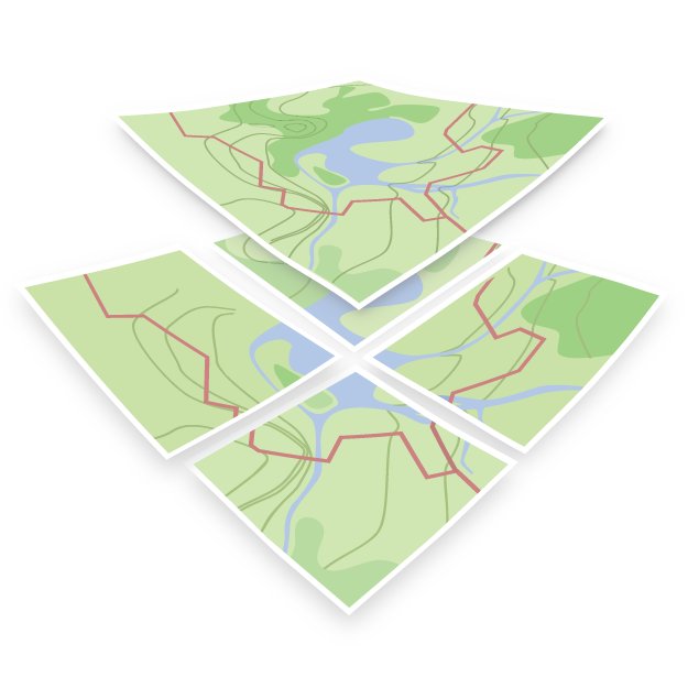
OpenMapTiles
@OpenMapTiles
#Opensource maps for self-hosting. Powered by #OpenStreetMap vector tiles. Made by @MapTiler team.
You might like


OpenMapTiles 3.15 is out! The main changes include * Big improvements to the road network * More water features * Integration of Aboriginal lands * Extra functionality for adding the most requested data & improving cartography Read more at bit.ly/44k6640

We've added some extra features to @OpenMapTiles. You can now use the following when making your maps: - Parcel lockers - Shrubberies - Bus guideways - Quarries Read more: maptiler.link/omt_314

We have a new style inspired by @OpenStreetMap Carto that shows all the features. Now you can have vector maps in a familiar design that will rotate and look good in 3D. We’ve even proposed that it is available on the OSM website! Find out more: maptiler.com/news/2023/05/o…


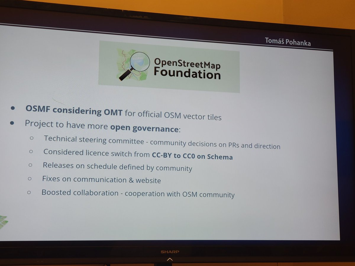
#openmaptiles announced plans for open governance and CC0 licensing! #foss4g2022 @foss4g

Hearing so many people talk about @OpenMapTiles at #FOSS4G2022. This is going to be a must see talk!
Don’t forget! @TomPohanka is speaking about the latest release of @OpenMapTiles @FOSS4G at 11:30: ow.ly/fm6F50Kp4o0 #FOSS4G2022 #OpenSource #OpenData

Just Announced📢 OpenMapTiles makes steps towards Open Governance and considers CC0 licence! OpenMapTiles may also become the Official #OSM #VectorTiles!! #FOSS4G2022 @openstreetmap @foss4g


@TomPohanka rolling at #foss4g2022 in the @maptiler colors
Don’t forget! @TomPohanka is speaking about the latest release of @OpenMapTiles @FOSS4G at 11:30: ow.ly/fm6F50Kp4o0 #FOSS4G2022 #OpenSource #OpenData

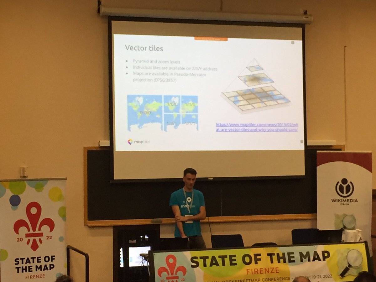
Vector tiles, @maptiler cloud and styling, @maplibre @OpenMapTiles @sotm #SotM2022

The latest release of @OpenMapTiles greatly enhanced its cartography and map styling options! Find out what’s new in @TomPohanka’s talk @FOSS4G 2022, 26th Aug. - 11:30. Find out more: maptiler.link/FOSS4G22-OpenM… #FOSS4G2022 #OpenSource #OpenData

Friday 22 July is Black Friday for #FOSS4G2022 online registration! From 00:00 to 23:59 CEST you can get your ticket discounted half price! Hurry up: the promotion will only be available for a limited time! ‼🗯 💻 2022.foss4g.org/registration_i… #OSGeo @OSGeo


(Re)découvrez la carte #OpenStreetMap sur @MapTiler Cloud! maptiler.link/openstreetmap - une adaptation du style osm-carto pour les tuiles vectorielles @OpenMapTiles

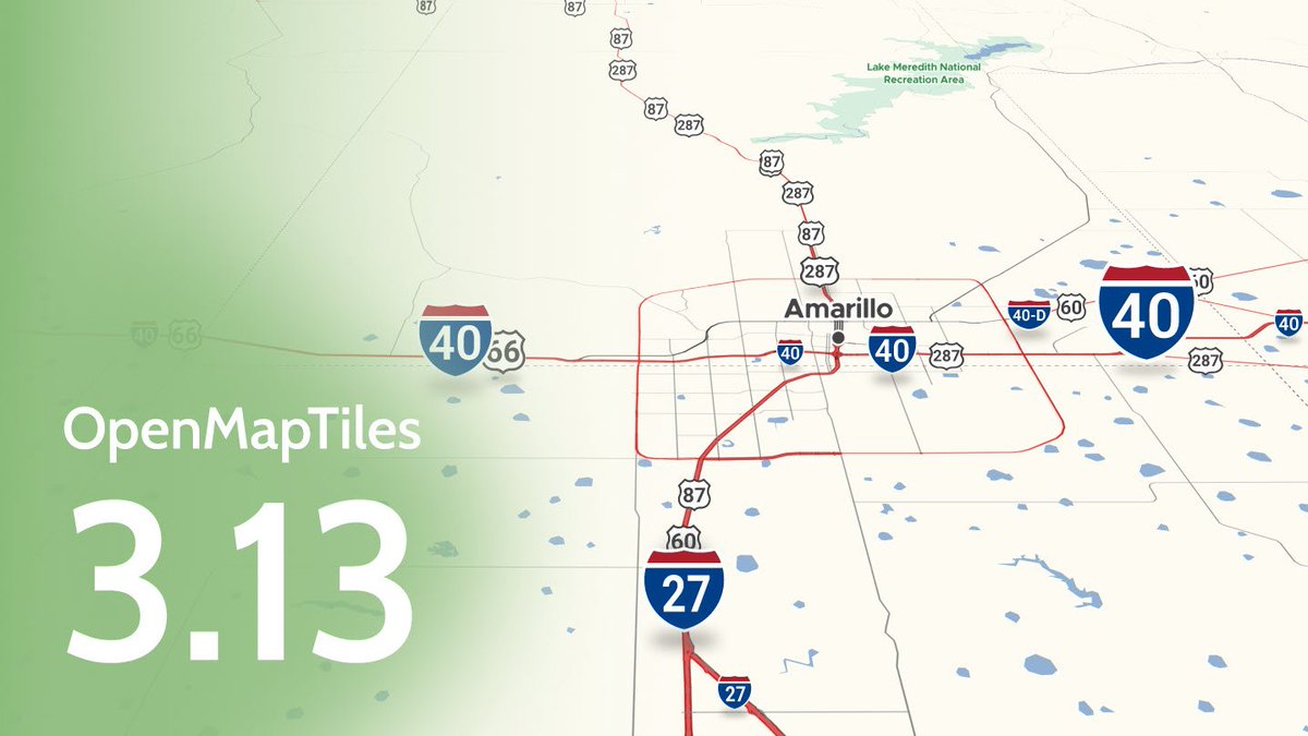
Don't forget to catch up with all improvements for showing routes on your map that came in with @OpenMapTiles 3.13. Highlight toll roads, use multiple labels for highways, mark out private roads with no access, and much more. See all the improvements here: maptiler.link/3wc6MJJ
#OpenMapTiles 3.13 gives you the option to label mountains in feet or meters, you can even use a combination of both for when your map shows both Canada and the USA like this one. Find out more here: maptiler.link/3sTxJjy @OpenMapTiles

There are some new data layers in @OpenMapTiles 3.13 including cable car names and ferry route labels like the ones shown here. Learn all about the improvements in the latest release here: maptiler.link/3h2mj6k #osm #maps #OpenMapTiles

#OpenMapTiles version 3.13 has been released with improvements for showing routes on your maps. You can highlight toll roads, use multiple labels for highways, mark out private roads with no access, and much more. Check out what has been improved here: maptiler.link/3BkPDy2.

OpenMapTiles 3.13 released: github.com/openmaptiles/o… Big thanks to all who contributed! #OpenMapTiles
github.com
Release v3.13 · openmaptiles/openmaptiles
RELEASE 3.13 Big thanks to all contributors, especially @ZeLonewolf, @zstadler, @Falke-Design, @nyurik, @eva-j or @frodrigo to name a few. There are 107 merged pull requests! Schema related Adding...
Our first pre-release version of BSD-licensed maplibre-gl is out, a drop-in replacement for mapbox-gl. Big thanks to Seth Nickell! github.com/maplibre/mapli…

Mapbox GL JS 2.0 software is no longer open-source! We remain on 1.13 and are keen to ensure an BSD licensed open-source fork remains to be available and maintained by the community or a well known foundation. Star & follow github.com/openmaptiles/g… for updates. Discussion going on
github.com
GitHub - maplibre/maplibre-gl-js: MapLibre GL JS - Interactive vector tile maps in the browser
MapLibre GL JS - Interactive vector tile maps in the browser - maplibre/maplibre-gl-js
A new feature - vector tiles support - makes it so easy to print high-res maps in @qgis 3.14 Pi! 🖨️🗺️ Learn how to add a very detailed vector map from anywhere in the world into #qgis at bit.ly/2V3PcUM Big thanks to @lutraconsulting @kanahiro_iguchi


United States Trends
- 1. Veterans Day 309K posts
- 2. Luka 78.7K posts
- 3. Nico 132K posts
- 4. Mavs 30.7K posts
- 5. Gambit 35.2K posts
- 6. Sabonis 2,969 posts
- 7. Kyrie 7,148 posts
- 8. Wike 89.4K posts
- 9. Pat McAfee 3,318 posts
- 10. Payne 9,806 posts
- 11. #csm220 8,249 posts
- 12. Vets 27.3K posts
- 13. Bond 70K posts
- 14. Tomas 19.4K posts
- 15. Toy Story 5 1,029 posts
- 16. Wanda 24.7K posts
- 17. Jay Rock 2,999 posts
- 18. #MarvelRivals 32.7K posts
- 19. Dumont 24.8K posts
- 20. Rogue 45.9K posts
You might like
-
 MapLibre
@maplibre -
 MapTiler
@MapTiler -
 OPENGIS.ch
@OPENGISch -
 Organic Maps: Explore, Hike, Bike, Drive Offline
@OrganicMapsApp -
 Python Maps
@PythonMaps -
 MicroPython
@micropython -
 Appwrite
@appwrite -
 Esri State & Local Gov
@EsriSLGov -
 State of the Map
@sotm -
 Esri GIS Education
@GISEd -
 ArcGIS Online
@ArcGISOnline -
 Tom Patterson
@MtnMapper
Something went wrong.
Something went wrong.