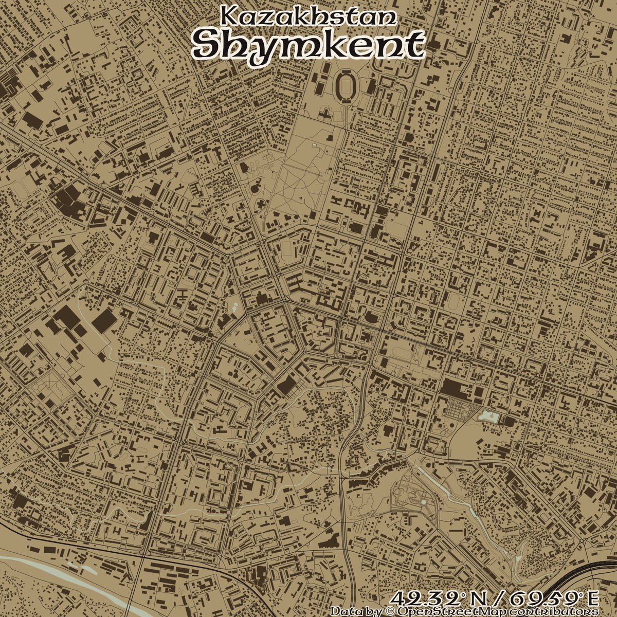
#openstreetmap kết quả tìm kiếm

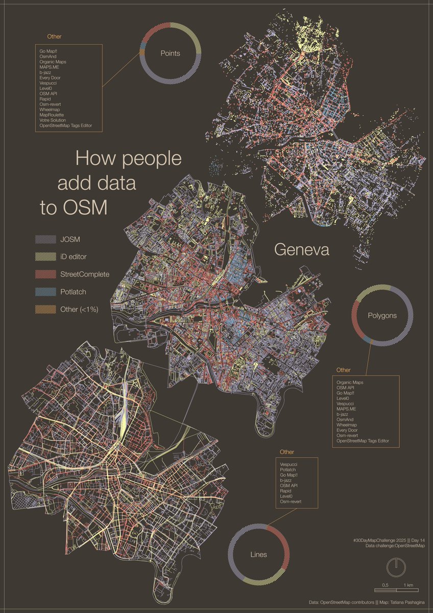
#30DayMapChallenge Day 14 – Data challenge: #OpenStreetMap A #map showing how people add data to OSM, using Geneva as an example. #JOSM, #iDeditor and #StreetComplete create visible patterns on the map🖌️🎨 And there are plenty of other apps to choose from😉📱💻🤖🗺️

¡Comunidad OSM Latam y del mundo entero, Ciudad de México y su Día de Muertos, les espera con muchísimo cariño y ansias por compartir y mapear juntos en comunidad! ¡Nos vemos en CDMX! #OSMLatam #SotMLatam2026 #OpenStreetMap #Mexico


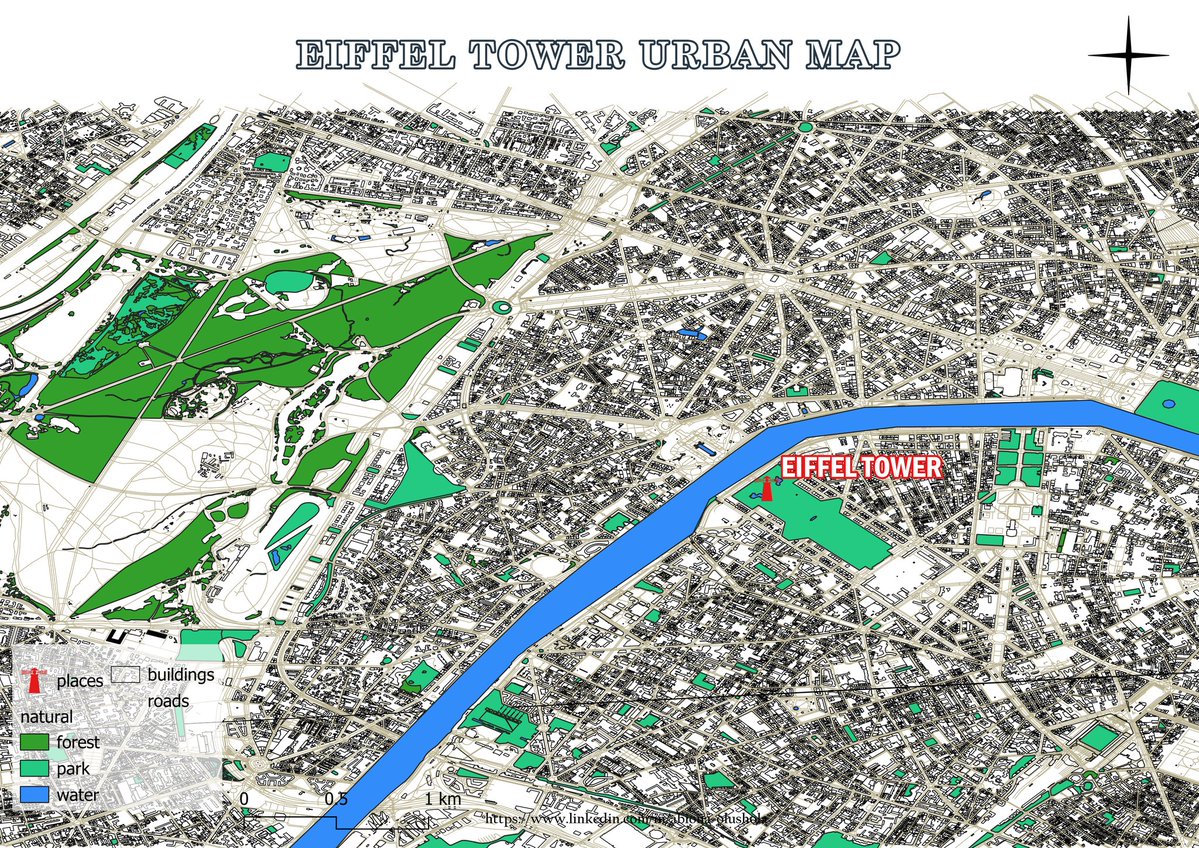
🌇 Day 14 Theme: OpenStreetmap The map presented today illustrates the urban landscape of Paris, renowned as the city of love, with the iconic Eiffel Tower situated at its center. 🖥️ Tool used: QGIS 📍 Data: Openstreetmap #30DayMapChallenge #Day14 #Openstreetmap

Creando mapas con 𝙘𝙖𝙧𝙩𝙤𝙜𝙧𝙖𝙥𝙝𝙧 en #R 𝙘𝙖𝙧𝙩𝙤𝙜𝙧𝙖𝙥𝙝𝙧 facilita enormemente la creación de mapas atractivos y funcionales en R, evitando la necesidad de realizar consultas complejas a #OpenStreetMap mappinggis.com/2025/10/creand…


と言う訳で、万博の大規模マッピングはこれで最後。 ドイツとルクセンブルク館の形状を修正、大屋根リングの通路を整えて正確性を向上。まだまだ描ける所は山積みだけど、この半年間頑張ったと思う。誰か褒めてください(笑) #OpenStreetMap #EXPO2025 #大阪・関西万博


🗺️A Minimalistic 3D Map of Central Park 🏞️ in Manhattan, New York City 🇺🇸 made using the Highest Hit DSM (2017) from the New York GIS Clearinghouse, overlaid with #OpenStreetMap #centralpark #nyc #USA #America #gischat #Cartography #dataviz #b3d #blender #NYCOpenData


#30DayMapChallenge 🗺️, jour 14 : #OpenStreetMap. Avec parfois des données insoupçonnées. Voici le parcours du Transcorrézien, un ancien tramway à vapeur rural (en Corrèze, donc), dont il reste quelques vestiges... 🚂


¿Qué tanto es tantito? #OpenStreetMap es una increíble herramienta donde miles de mapeadores voluntarios alrededor de mundo plasman cada detalle. Aquí un excelente ejemplo en la #CDMX. Hospital General de México: ⬅️Mayo 2025 ➡️Octubre 2025


地域を歩きながらウィキペディア記事を確認できるマップアプリ「WikiWalk」を作成しました! ウィキペディアタウンの役に立てばと思って作りました。 ↓から利用できます。 wiki-walk.vercel.app 足りていないことも多いと思うので指摘いただけると助かります #wikipediatown #OpenStreetMap
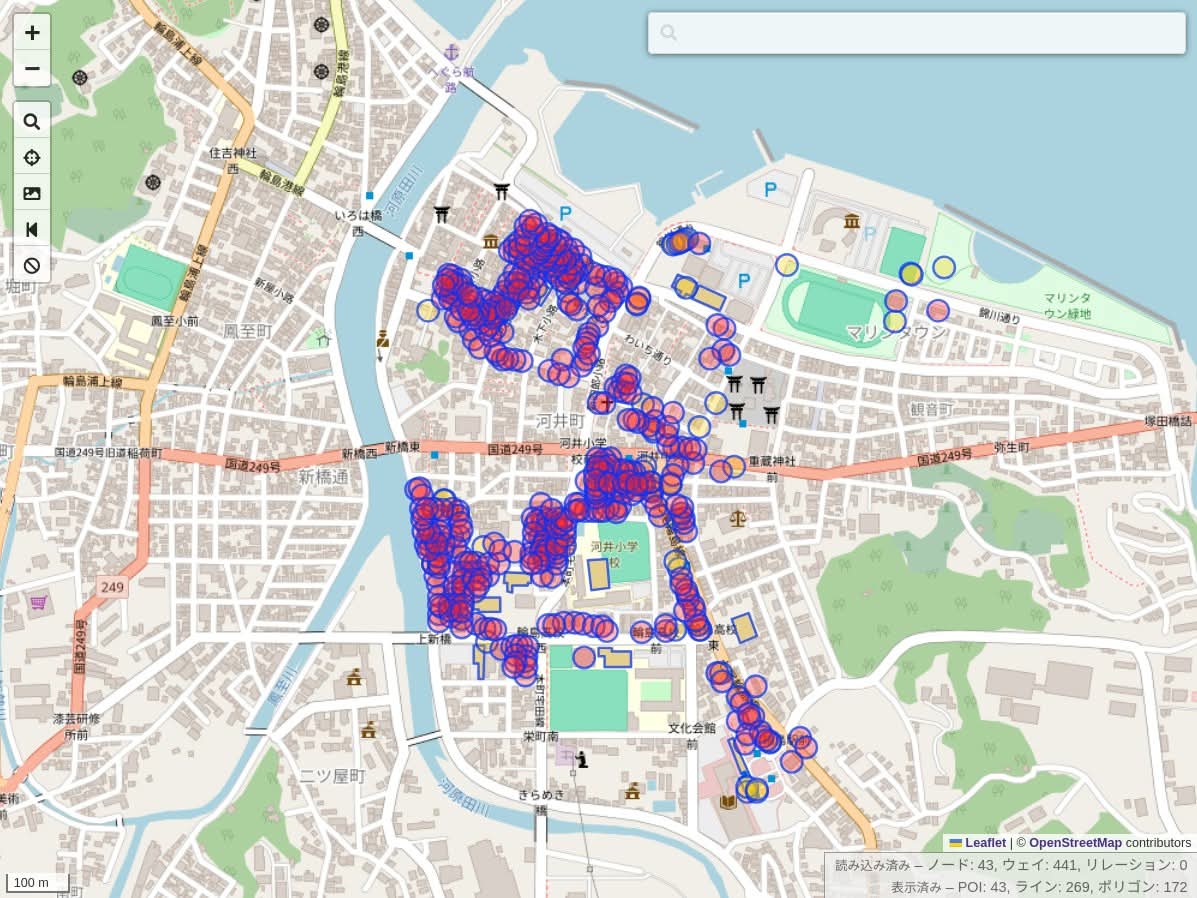
今日は能登半島の輪島市へ。レンタサイクルで回りつつ、建物の倒壊状況を記録。3時間みっちり作業して、朝市は1/3ほど更新したけど、まだまだ不十分。 来年の春にも行こうと思いつつ、誰かに頼まれた訳でも、仕事でも無いのに、何故行くんだろう。自分でも少し不思議な気持ち。 #OpenStreetMap

Now I started crafting 3D city maps and my first one is from Caracas🇻🇪. Thanks to @openstreetmap for the buildings, roads, parks, and water layers. Which city should I do next? #OpenStreetMap🗺 #CityMaps🏙 #R📊 #RStudio💻


Lo que pienso cuando alguien me pregunta "¿cómo se hace para que Google muestre el nombre correcto de mi calle?" Usen mapas buenos, usen #OpenStreetMap


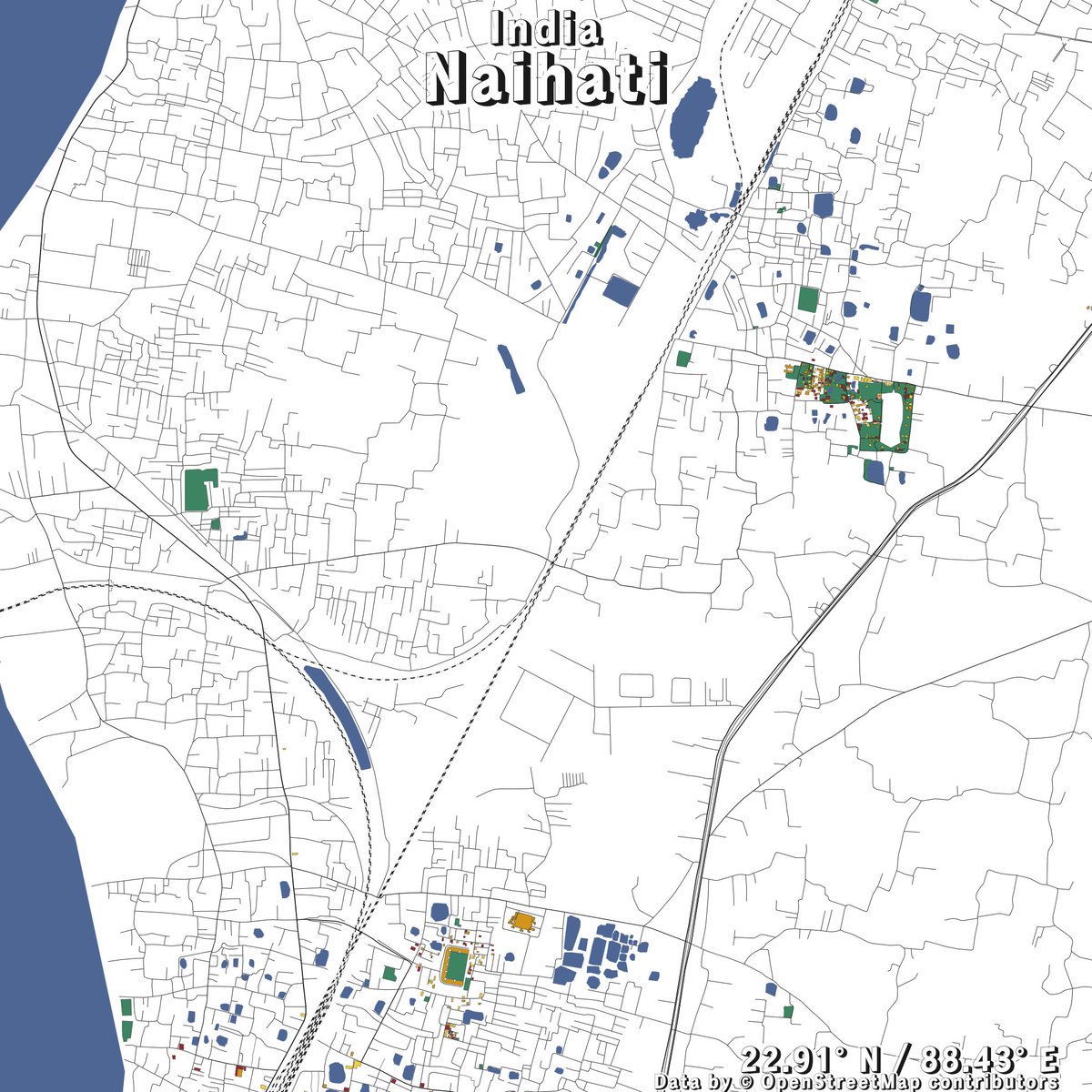
Trials maps of my local town using the new #openstreetmap vector tiles shortbread-tiles.org/schema/1.0/ in #qgis. It's possible to generate this for any other location. Feel free to request. © OpenStreetMap Contributors. Contours using NASADEM


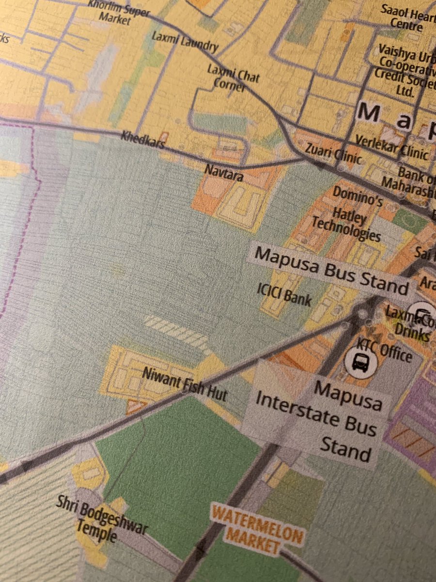
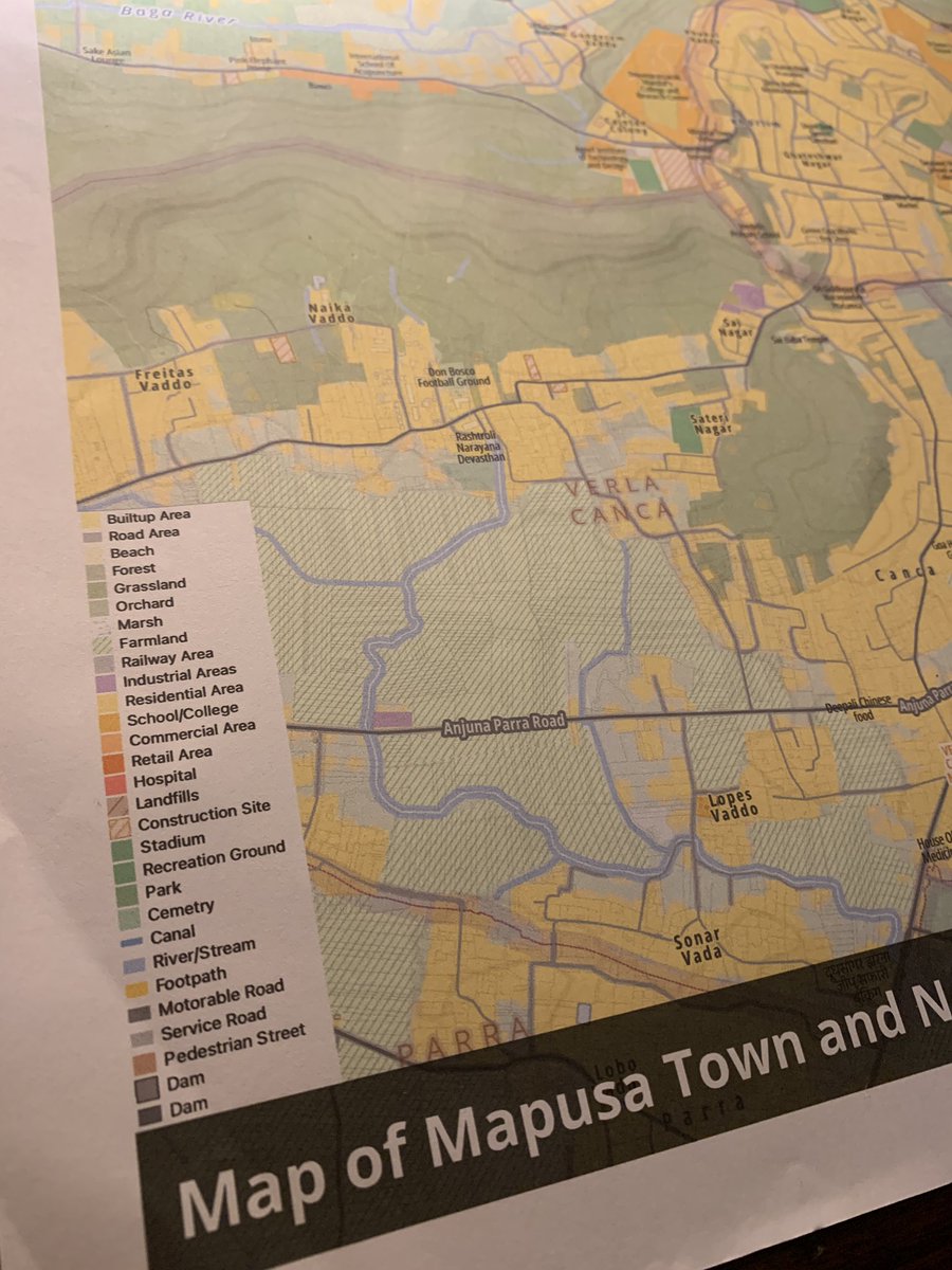
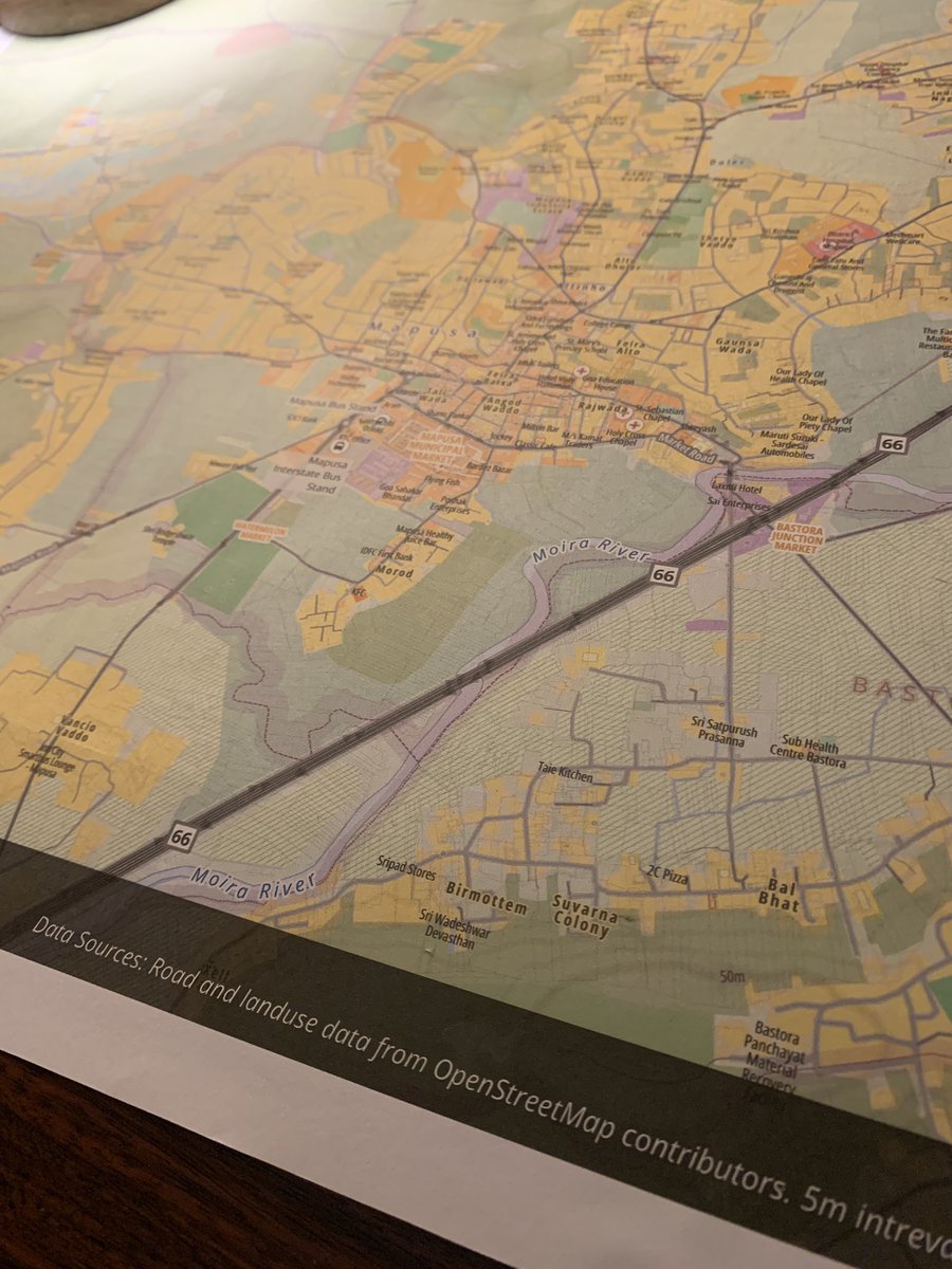
Being next door to a good printer has been fun. First trial of an A2 size color print. Costed Rs150 ($2) at Mapusa, #Goa. Tried including individual parcel boundaries with 0.1mm width and it printed fine 🤯 Map designed in #qgis using #openstreetmap data.


無料の商業アプリがユーザー情報を集めたいのはビジネスとして理解できる。自分もGoogleMapをめちゃ頼ってます。一方でこの点でユーザーには選択肢があるってことを知っておくのも良いと思う。OSMというものがあることも含めて #OpenStreetMap

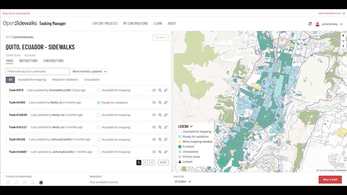
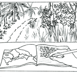
#OpenStreetMap es una tecnología de datos abiertos que permite iniciativas maravillosas como OpenSidewalks wiki.openstreetmap.org/wiki/OpenSidew… espero poder sumar data de accesibilidad universal para #PCD #a11y #dlscreativa
Fuentes: Natural Earth: naturalearthdata.com Conicet: mendoza.conicet.gov.ar/hora-oficial-h… Base: #OpenStreetMap

記事を投稿しました! Automating GIS Processes 2024 写経 Lesson 6 Network analysis in Python(2) qiita.com/t_t_japan/item… #Qiita #openstreetmap #GIS

Fuente: geonode.pergamino.gob.ar/catalogue/#/da… Base: #OpenStreetMap
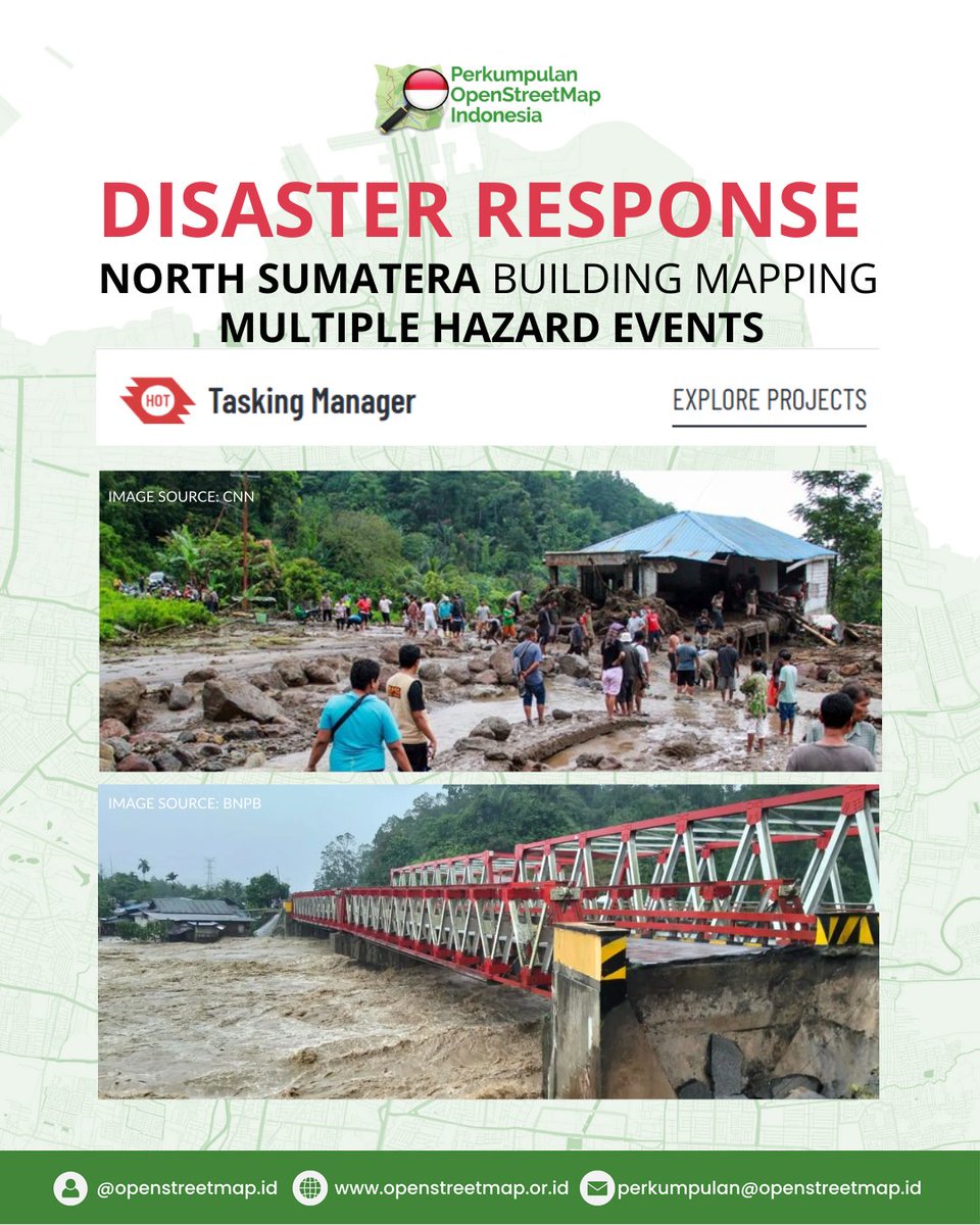
Bencana banjir, longsor, dan angin puting beliung pada Rabu, 26 Nov 2025 melanda 12 wilayah di Sumut. Yuk bantu pemetaan bangunan terdampak melalui OpenStreetMap. 🔗 task.hotosm.org 🔍 Project: #36537 & #36538 #SumutBersama #DisasterResponse #OpenStreetMap #HOTOSM

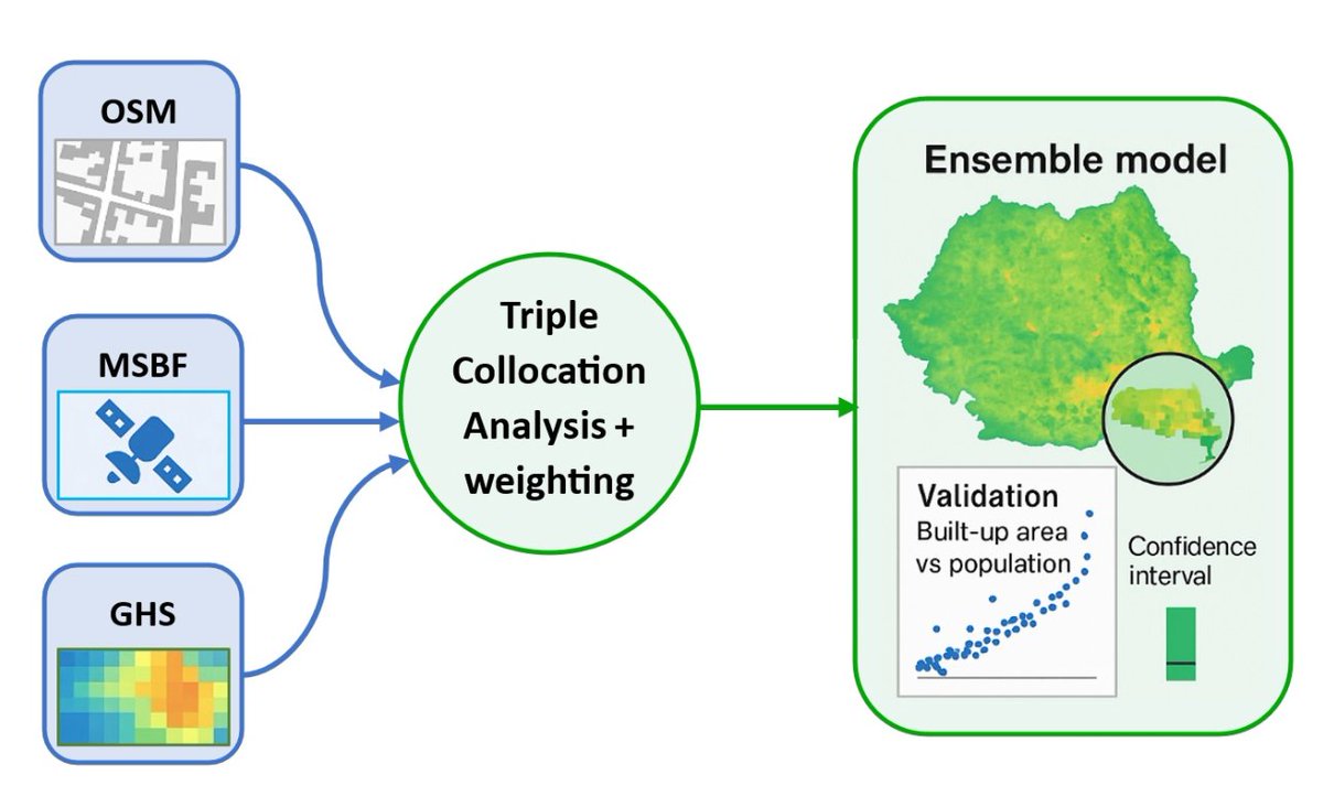
📢New Publication Built-Up Surface Ensemble Model for Romania Based on #OpenStreetMap, Microsoft Building Footprints, and Global Human Settlement Layer Data Sources Using Triple Collocation Analysis By Zsolt Magyari-Sáska and Ionel Haidu 👉mdpi.com/2220-9964/14/1…

OSM Daily Stats 📊 Users: 10,049,098 👥 Users that... edited nodes: 5,693 ✏️ uploaded GPX: 184 🗺️ Top 3 editors: 1. Wilmer - 40,398 🥇 2. FajrAl - 29,311 🥈 3. jptolosa - 27,752 🥉 Report run at 2025-11-27 00:00:16 UTC #OSMstats #OSM #OpenStreetMap

#MostCited Residential Micro-Segregation and Social Capital in Lima, Peru ✍️ by Fernando Calderón-Figueroa 👉 brnw.ch/21wXRPc #urban #OpenStreetMap
OSM Daily Stats 📊 Users: 10,048,147 👥 Users that... edited nodes: 5,720 ✏️ uploaded GPX: 152 🗺️ Top 3 editors: 1. dmich9 - 1,183,137 🥇 2. LuxuryCoop - 59,544 🥈 3. Vonter - 51,802 🥉 Report run at 2025-11-26 00:00:17 UTC #OSMstats #OSM #OpenStreetMap


Aunque parezca mentira la foto, son calles reales de #Zaragoza, las puedes ver en #OpenStreetMap openstreetmap.org/?mlat=41.63885…

OSM Daily Stats 📊 Users: 10,046,789 👥 Users that... edited nodes: 5,832 ✏️ uploaded GPX: 194 🗺️ Top 3 editors: 1. romik80 - 72,528 🥇 2. Wilmer - 59,566 🥈 3. w_djatmiko - 45,568 🥉 Report run at 2025-11-25 00:00:15 UTC #OSMstats #OSM #OpenStreetMap


#30DayMapChallenge Day 14 – Data challenge: #OpenStreetMap A #map showing how people add data to OSM, using Geneva as an example. #JOSM, #iDeditor and #StreetComplete create visible patterns on the map🖌️🎨 And there are plenty of other apps to choose from😉📱💻🤖🗺️

#30DayMapChallenge Day.1 - Points お題の'Point'に岬という意味があるらしいので、 岬に関連する地名(岬・崎/埼)を地図上で色分けしてみました。 データ元は #OpenStreetMap です。


Hace un rato en el @flisol_bogota hablando de mapeo abierto, proyectos colaborativos, el valor de la comunidad #OpenStreetMap y la importancia del mapa como herramienta de transformación social.


と言う訳で、万博の大規模マッピングはこれで最後。 ドイツとルクセンブルク館の形状を修正、大屋根リングの通路を整えて正確性を向上。まだまだ描ける所は山積みだけど、この半年間頑張ったと思う。誰か褒めてください(笑) #OpenStreetMap #EXPO2025 #大阪・関西万博
今日は能登半島の輪島市へ。レンタサイクルで回りつつ、建物の倒壊状況を記録。3時間みっちり作業して、朝市は1/3ほど更新したけど、まだまだ不十分。 来年の春にも行こうと思いつつ、誰かに頼まれた訳でも、仕事でも無いのに、何故行くんだろう。自分でも少し不思議な気持ち。 #OpenStreetMap
Creando mapas con 𝙘𝙖𝙧𝙩𝙤𝙜𝙧𝙖𝙥𝙝𝙧 en #R 𝙘𝙖𝙧𝙩𝙤𝙜𝙧𝙖𝙥𝙝𝙧 facilita enormemente la creación de mapas atractivos y funcionales en R, evitando la necesidad de realizar consultas complejas a #OpenStreetMap mappinggis.com/2025/10/creand…
🌇 Day 14 Theme: OpenStreetmap The map presented today illustrates the urban landscape of Paris, renowned as the city of love, with the iconic Eiffel Tower situated at its center. 🖥️ Tool used: QGIS 📍 Data: Openstreetmap #30DayMapChallenge #Day14 #Openstreetmap
#30DayMapChallenge 🗺️, jour 14 : #OpenStreetMap. Avec parfois des données insoupçonnées. Voici le parcours du Transcorrézien, un ancien tramway à vapeur rural (en Corrèze, donc), dont il reste quelques vestiges... 🚂
🗺️A Minimalistic 3D Map of Central Park 🏞️ in Manhattan, New York City 🇺🇸 made using the Highest Hit DSM (2017) from the New York GIS Clearinghouse, overlaid with #OpenStreetMap #centralpark #nyc #USA #America #gischat #Cartography #dataviz #b3d #blender #NYCOpenData
満場で万博入れないからOSMの万博マッピング中。今でもそこそこ精度はあるけど、将来に渡って活用されるので、もう一段階精度を上げたり情報追加を行っておきたい所。まぁ、体力と気力的に限界あるので、無理しない範囲で頑張ろうー。 #OpenStreetMap

Lo que pienso cuando alguien me pregunta "¿cómo se hace para que Google muestre el nombre correcto de mi calle?" Usen mapas buenos, usen #OpenStreetMap
¿Qué tanto es tantito? #OpenStreetMap es una increíble herramienta donde miles de mapeadores voluntarios alrededor de mundo plasman cada detalle. Aquí un excelente ejemplo en la #CDMX. Hospital General de México: ⬅️Mayo 2025 ➡️Octubre 2025
Now I started crafting 3D city maps and my first one is from Caracas🇻🇪. Thanks to @openstreetmap for the buildings, roads, parks, and water layers. Which city should I do next? #OpenStreetMap🗺 #CityMaps🏙 #R📊 #RStudio💻
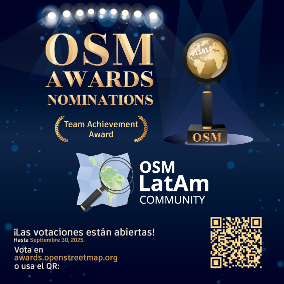
¡Estamos honrados y emocionados! Un agradecimiento enorme a todos los que contribuyen día a día. ¡Esta nominación es de tod@s y para tod@s! Vota: awards.openstreetmap.org ¡Sigamos mapeando en comunidad! 🌎💚 #OpenStreetMap #OSMLatam #OSMAwards2025


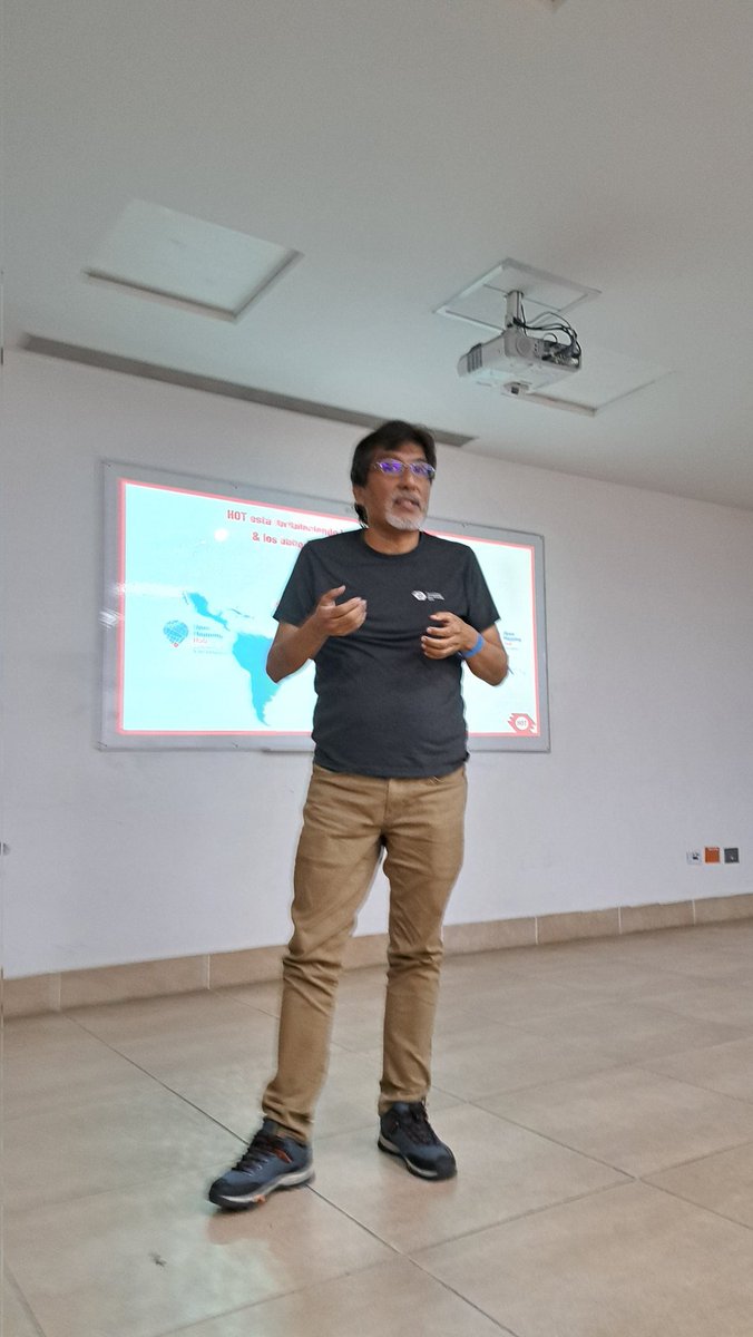
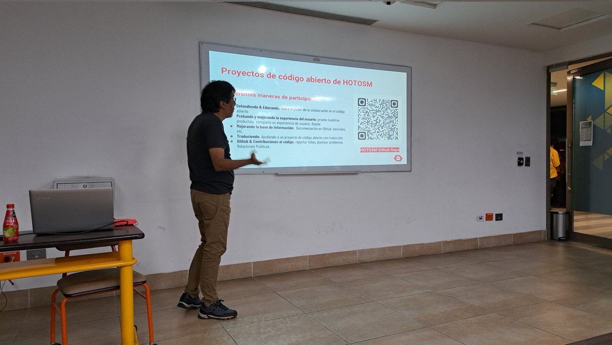
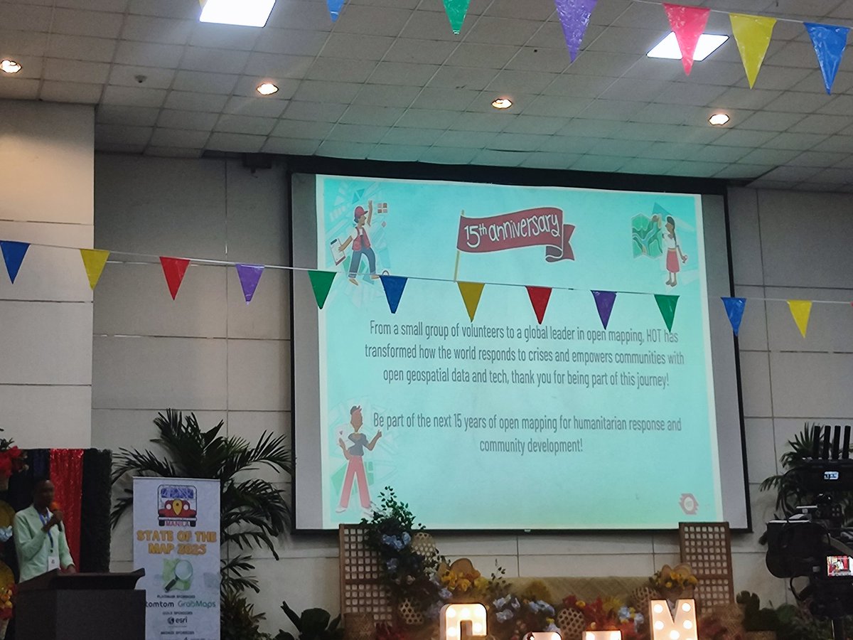
CELEBRATING 15 YEARS OF MAPPING A BETTER WORLD! 🎉🎉🎉 @kateregga1 takes the stage to share an exciting overview of Humanitarian OpenStreetMap Team's (HOT) remarkable 15-year journey and impactful activities! 🌎💻 #sotm2025 #OpenStreetMap #SOTM #sotmManila


Something went wrong.
Something went wrong.
United States Trends
- 1. Lamar 25.8K posts
- 2. Thanksgiving 1.79M posts
- 3. Ravens 32.8K posts
- 4. Chiefs 95.9K posts
- 5. Zac Taylor 2,046 posts
- 6. Cam Boozer N/A
- 7. Mahomes 30.2K posts
- 8. Tanner Hudson N/A
- 9. Joe Burrow 10.1K posts
- 10. Pickens 30.4K posts
- 11. Sarah Beckstrom 158K posts
- 12. Derrick Henry 3,061 posts
- 13. Tinsley 1,162 posts
- 14. #AEWCollision 8,394 posts
- 15. Duke 18.4K posts
- 16. Jason Garrett N/A
- 17. Caleb Foster N/A
- 18. Kyle Hamilton N/A
- 19. Chase Brown 2,086 posts
- 20. #CINvsBAL 1,242 posts