
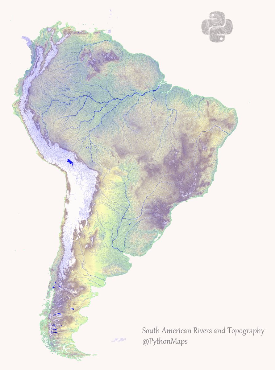
This is a map combining rivers and topography in the South America. Hopefully it shows the cool link between mountain ranges and waterways. This map was made with #Python using #geopandas and #matplotlib. #DataScience #Data #DataVisualization #SouthAmerica.
I am really enjoying combining different datasets into single images. These maps are getting more and more complex and I love it!


I wonder how different this would look when compared to a topo map created in GIS? 🤔 Might not even need separate datasets 🤔


Great tweet! Thank you for putting this out for all of us to see! 💯 Check out our account, you might find some interesting tips for you & your business! 😉


Great one. Continue creating and sharing these detailed topographical maps.


United States Trends
- 1. Megyn Kelly 19.7K posts
- 2. CarPlay 3,583 posts
- 3. Senator Fetterman 11.8K posts
- 4. Osimhen 81.2K posts
- 5. Cynthia 103K posts
- 6. Vine 19.9K posts
- 7. Padres 28.9K posts
- 8. Black Mirror 4,450 posts
- 9. Katie Couric 7,718 posts
- 10. #WorldKindnessDay 15.5K posts
- 11. Woody Johnson 1,125 posts
- 12. Gabon 114K posts
- 13. Sheel N/A
- 14. Massie 101K posts
- 15. V-fib N/A
- 16. Bonhoeffer 4,143 posts
- 17. #LoveDesignEP7 217K posts
- 18. #NGAGAB 15.5K posts
- 19. RIN AOKBAB BEGIN AGAIN 216K posts
- 20. Ariana 88K posts
Something went wrong.
Something went wrong.