你可能會喜歡


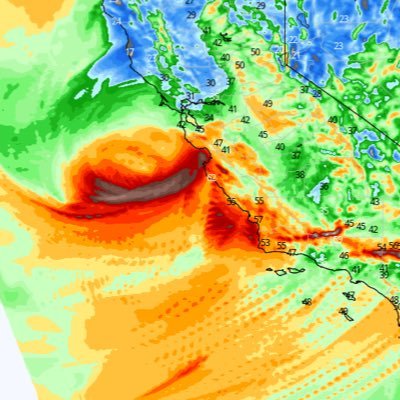
A look at today's latest Model Guidance for the first Pacific Storm of the season - Periods of heavy Rain and scattered Thunderstorms across #SoCal overnight through tomorrow. Heaviest rain from Orange County Northward, lesser amounts in SD County and Low Deserts. Potential…


Looking like a good early season Pacific Storm with meaningful precipitation for many locations across #SoCal.

Latest info for #SoCal storm: * Rain totals still significant * Thunderstorms chances higher - Heavy rain, hail, gusty winds main threats - Waterspout/weak tornado possible * Resort level snow * Possible higher rain rates - Minor debris flows possible #CAwx


HRRR Simulated Radar through Friday PM - Moisture from Tropical Storm Priscilla will continue to drift overhead through tomorrow, bringing Showers and isolated Thunderstorms to Southern and Eastern portions of #SoCal.
Radar Loop (Valid 1250 PM): - Showers/thunderstorms continue just east of LA county - Showers/thunderstorms could drift into the eastern San Gabriel Mtns this afternoon - Rain amounts, if any, are expected to be light - Rain threat will continue across LA county thru Fri #CAwx
Looking ahead to next week - There's currently good agreement among the various Operational Model Runs that an early season Trough & Cold Front will move through #SoCal next Tuesday/Wednesday bringing much cooler temperatures. #CAwx
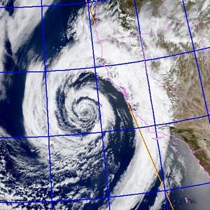
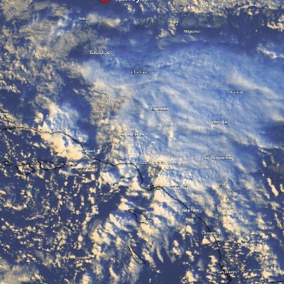
GOES West Satellite 10/09/25 - Tropical Storm Priscilla spins West of Baja California Sur with sustained winds of 45mph, but continues to weaken. Its moisture is being pulled Northward into the Southwest US with the help of an approaching Trough, bringing a chance for scattered…

Priscilla nears Baja California Sur as it weakens to a tropical storm. Moisture from the system is expected to bring a flash flood risk to the Four Corners region later this week.
HRRR Simulated Radar Depiction Thursday AM through Friday AM - Mid/upper level moisture from the remnants of Tropical Storm Priscilla will spread Northward across #SoCal Tomorrow through Friday. Best chances for Rain and Thunderstorms will be focused South and East of LA County.…
Chances for showers and isolated thunderstorms will be greatest across southern and eastern areas as the system moves closer.
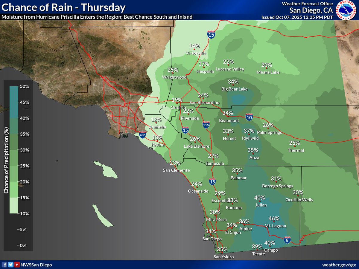
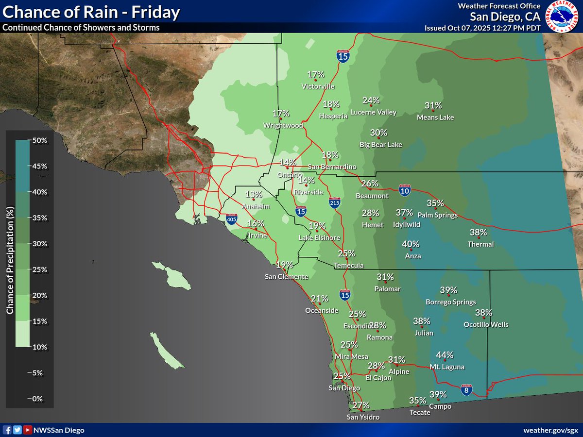
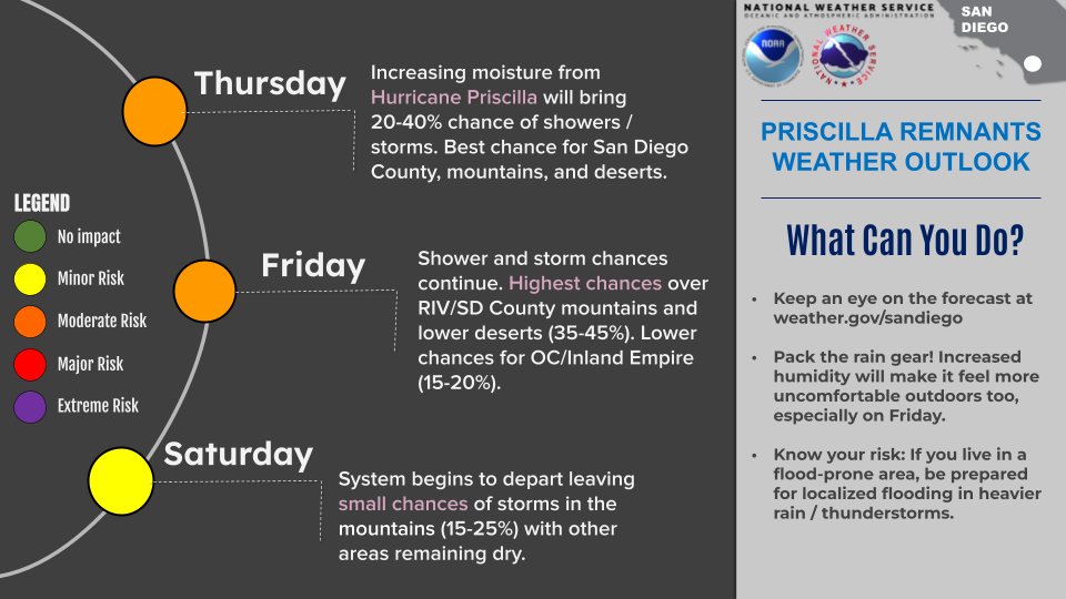
Remnant showers and thunderstorms from Hurricane Priscilla will make their way to the region Thursday through Saturday 🌀 ⛈️ Take a look below on our thoughts on the forecast and what you can do ☑️ #CAwx
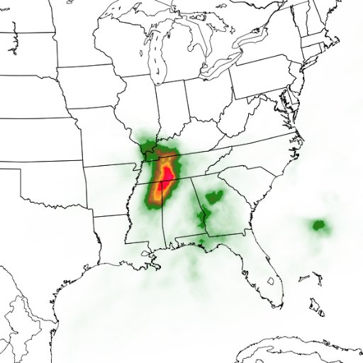
There's still a fair amount of disagreement among Model Guidance regarding rainfall chances across #SoCal from the remnant moisture from Tropical Storm Priscilla late this week. It currently looks like rainfall chances will be focused on Southern and Eastern portions of the…


Still watching the potential for some early-season rainfall for #SoCal late next week. A lot will depend on how an approaching trough interacts with the remnants from a Tropical System off of Baja. Model Guidance still struggling with it for now. #CAwx

Nothing of note on the horizon for #SoCal until later next week, when there will be an interesting setup with a trough approaching the West Coast as a Tropical System moves up from Baja. It is far from certain how these two features will interact, but the ingredients & potential…
A Trough will bring an early season Cold Front and Rain to Northern and Central CA, and will produce onshore flow and moderate temperatures across #SoCal this week. A West Coast Trough pattern is expected to continue through first full week of October. #CAwx
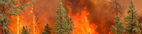
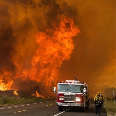
Isolated strong thunderstorms today across LA/Ventura/eastern Santa Barbara counties (including coasts/valleys), capable of localized flooding, strong wind gusts to 50 mph, hail, and dangerous cloud-ground lightning. When thunder roars, go indoors! #LAWeather Photo-Rick Dickert

Here's a look at a likely stormy scenario this afternoon 🌩️ Showers and thunderstorms will become more widespread across the mountains and deserts this afternoon, with localized flash flooding possible. #CAwx
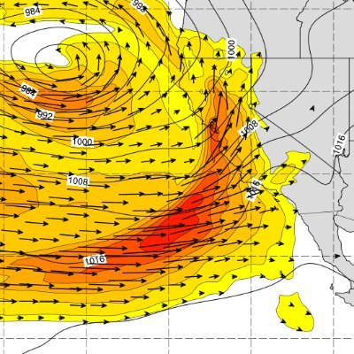
GOES West Satellite loop - Low clouds are in place across #SoCal Coastal and Valley locations as an Upper Low spins over the Eastern Mojave Desert. This Low will trigger development of Thunderstorms over the Mts/Deserts. The Northeasterly flow around the backside of the Low may…
There is a 20 to 30% chc for thunderstorms Sat, focused on southern areas and southern interior. Storms will be capable of causing frequent lightning, strong winds, isolated flooding, and travel delays, but widespread impacts are not expected. #socal #cawx #carain
HRRR Simulated Radar Depiction Friday afternoon through Saturday PM - The Upper Low that has been meandering to our North will return to #SoCal, bringing isolated Showers and Thunderstorms to local Mts/Deserts with the possibility that some of these could reach Inland and Coastal…


United States 趨勢
- 1. Columbus 151K posts
- 2. President Trump 1.07M posts
- 3. Middle East 252K posts
- 4. Brian Callahan 8,307 posts
- 5. #IndigenousPeoplesDay 10.8K posts
- 6. Titans 39.3K posts
- 7. Vrabel 7,079 posts
- 8. Thanksgiving 54.8K posts
- 9. Seth 48.3K posts
- 10. Macron 211K posts
- 11. Marc 49K posts
- 12. #WWERaw 54K posts
- 13. Cape Verde 8,473 posts
- 14. HAZBINTOOZ 4,705 posts
- 15. Apple TV 5,372 posts
- 16. Shildt 2,661 posts
- 17. Darius Smith 3,740 posts
- 18. Egypt 259K posts
- 19. Sarah Strong 1,673 posts
- 20. #Isles 1,229 posts
你可能會喜歡
-
 SoCalWeather.net
@SoCalweathernet -
 NWS Los Angeles
@NWSLosAngeles -
 San Bernardino National Forest
@SanBernardinoNF -
 NWS San Diego
@NWSSanDiego -
 Dr. Daniel Swain
@Weather_West -
 LAC/VNC Scanner🚒🔥
@SCscanner1 -
 FirePhotoGirl
@FirePhotoGirl -
 CW3E Scripps
@CW3E_Scripps -
 Firewatch Photography
@Firewatch_OC -
 415FirePhoto
@415FirePhoto -
 Southern California Weather Force
@SCWeatherForce -
 Neil Lareau
@nplareau -
 Robert Garcia
@firechiefanf -
 Wildfire Incidents
@CodeRed001Blue -
SoCalFirePhoto
@SoCalFirePhoto
Something went wrong.
Something went wrong.