
Spatial Fusion
@SpatialFusionNZ
Geospatial Architects & Storytellers. We hang out in those spaces between conventional wisdom. We love to mix, mash, & create. Tweets by @mashmatix.
You might like


Great excitement here today with the launch of LINZ's new Basemap service. This is #opendata at its finest. Check out the Aerial Imagery Basemap and get mapping!! bit.ly/31YyIQM

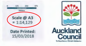
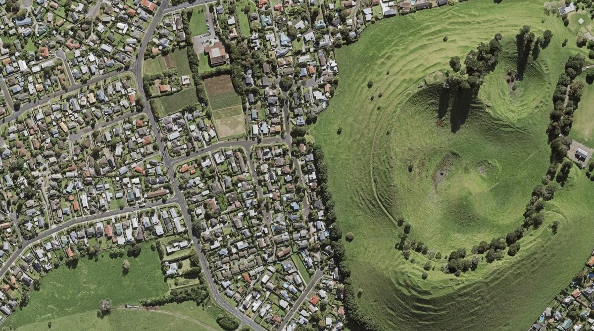
Check out our new Aerial Imagery basemap from the free LINZ Basemaps service at bit.ly/31YyIQM Media release -->bit.ly/3iNVJMW #basemap #opendata #geospatialdata #aerialimagery #satelliteimagery 📷Te Ara Pueru in Māngere Bridge, Auckland.Source: LINZ Basemaps
The latest NZ Building Outlines update is worth celebrating. First up, Tasman building outlines have been updated from 2015 to 2019, adding new subdivisions, e.g. in Richmond below. All existing outlines also now align to new aerial imagery data.linz.govt.nz/layer/101290 #opendata
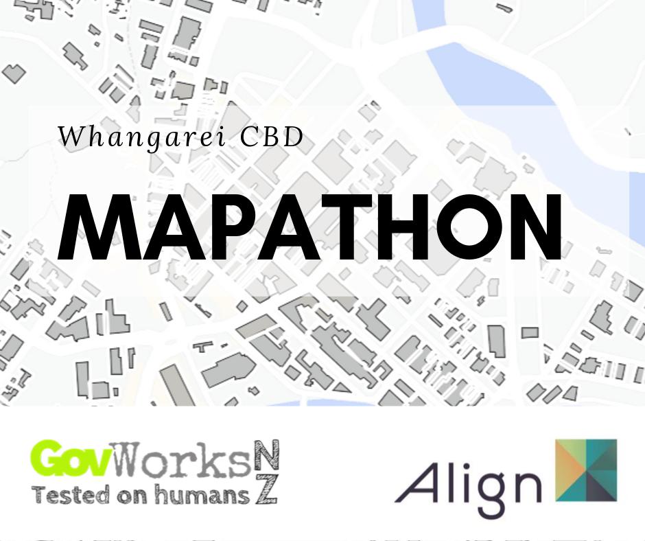
Epic. @openstreetmap @govworksnz @ALIGN_NZ ftw! ^5 @WhangareiDC library!

It's happening tomorrow - @whangareiNZ CBD #mapathon. At the Central Library (upstairs archive section) from 9am-1pm. Using @openstreetmap to map #allthethings! #GIS #opendata #spatialplanning #localgov #accessibility #parking #planning #community

Did you know you can search datasets using our spatial location map? Great for solving local problems at @GovHackNZ ow.ly/fQSq30dLMvX

Join us & @danrandow in Auck & Welly next week for an update on #opendata program & to share #opendata case studies ow.ly/SO3W30dnsmF


And we're back in #whangarei again this year for #govhacknz thanks to @TheOrchardNZ. Register NOW!

Ping @SpatialFusionNZ

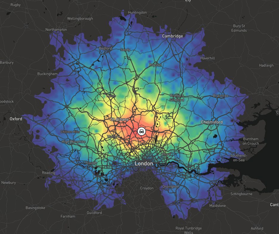
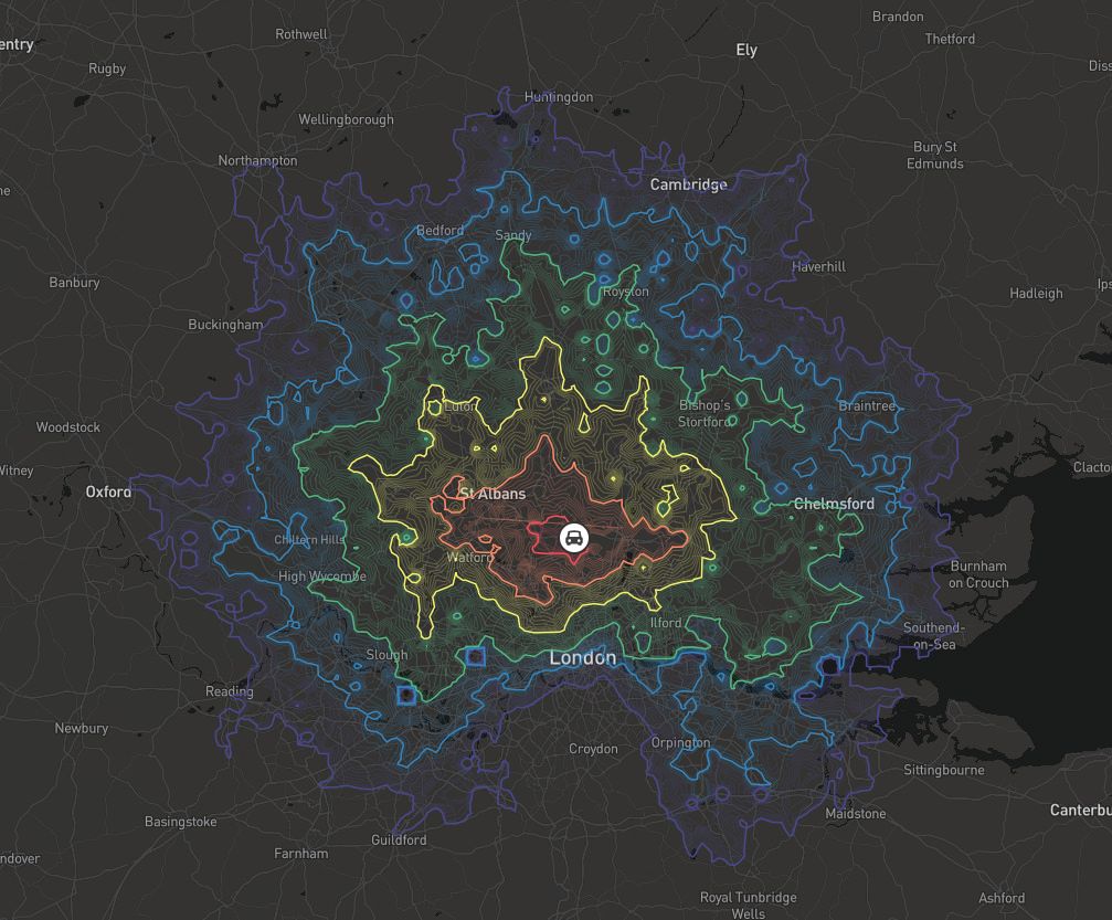
add drag and drop drive time analytics to your retail, finance, or urban planning app with isochrones buff.ly/2sPKyNX
Super excited to have @here as a major supporter of #govhacknz this year! Very cool stuff happening => here.com/en

Government’s #opendata gets $7.2 million boost beehive.govt.nz/release/govern… - come along and play with #data at @govhacknz!
We are sooooo grateful for our awesome #govhacknz sponsors! ^5s everyone for @InternetNZ!

Civic Tech for the people, by the people, of the people! Govhack '17 is on the horizon. Thanks 2 all taking + sharing the #diversity survey!
2017 #Rural Connectivity Symposium linkedin.com/pulse/2017-rur…
Ladies! We think #diversity is NB, & we're piloting some lead-in events around that. What would work for you? goo.gl/forms/KvX4HCCR…

Want some cool Koordinates swag!? Help us do some user testing and your feedback can improve the product. Win, win! koordinates.com/blog/were-look…
Looking forward to be able to play with some new #data #projecttrilogy #localgov #DigitalTransformation

#shoutout to @ACJMcInt0sh & the team at @WhangareiDC working on #DigitalTransformation #projecttrilogy initiative!! 👌🏼

Our #DigitalTransformation is evolving and this is our very calm prog manager #projecttrilogy 3 projects 1 big bang

New tool that will provide a map-based visualization of permits, licenses and inspections in the city buff.ly/2e7bqTE
#civictech is evolving to include new ways for cities to collaborate with community partners buff.ly/2etgxJz
“If you have urban design that creates spaces that people like and want to go to, the other pieces fall into place” buff.ly/2ejZwkO


United States Trends
- 1. Bill Mazeroski N/A
- 2. Good Saturday N/A
- 3. Tucker N/A
- 4. #Caturday N/A
- 5. Senior Day N/A
- 6. Dr Pepper N/A
- 7. RIP Maz N/A
- 8. #SaturdayVibes N/A
- 9. Caicedo N/A
- 10. Huckabee N/A
- 11. Plumb N/A
- 12. Burnley N/A
- 13. Joao Pedro N/A
- 14. #CHEBUR N/A
- 15. #screenshotsaturday N/A
- 16. Boebert N/A
- 17. GAMEDAY N/A
- 18. #ATSD N/A
- 19. Somalia N/A
- 20. DANCE KING JIMIN N/A
You might like

Something went wrong.
Something went wrong.