#geospatialdata kết quả tìm kiếm

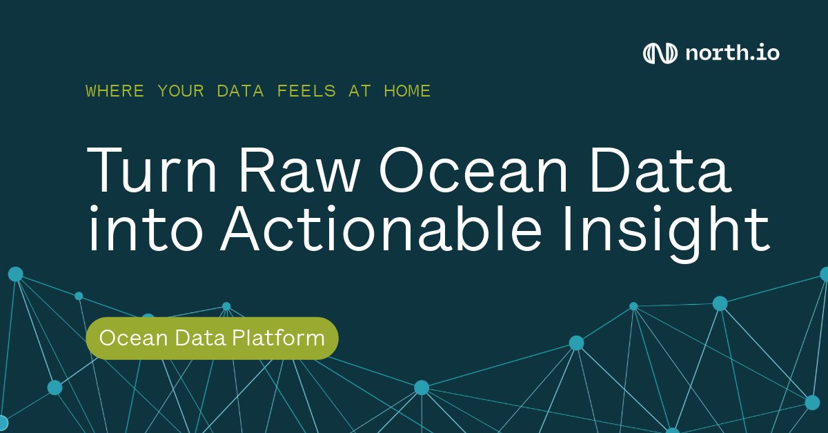
⚙️ North.io is redefining #OceanBigData with their Ocean Data Platform — keeping marine & geospatial data connected, collaborative & dynamic. Learn more: north.io/en/dataplatform #DataPlatform #GeospatialData #DigitalTransformation

Get started with geospatial data for developers! 🌐💡 Understand the differences between discrete and continuous data, and learn how to optimize performance. #GeospatialData #DeveloperTips Read the blog article ➡️ow.ly/F2me30sQoP0


Discover the secrets to maximizing your geospatial data with ArcGIS hosted services! 🚀📈 This blog series covers the differences between hosted feature services, vector tile services, and map tile services. #GeospatialData #ArcGIS Dive in ➡️ ow.ly/TCQA50X0Xqe


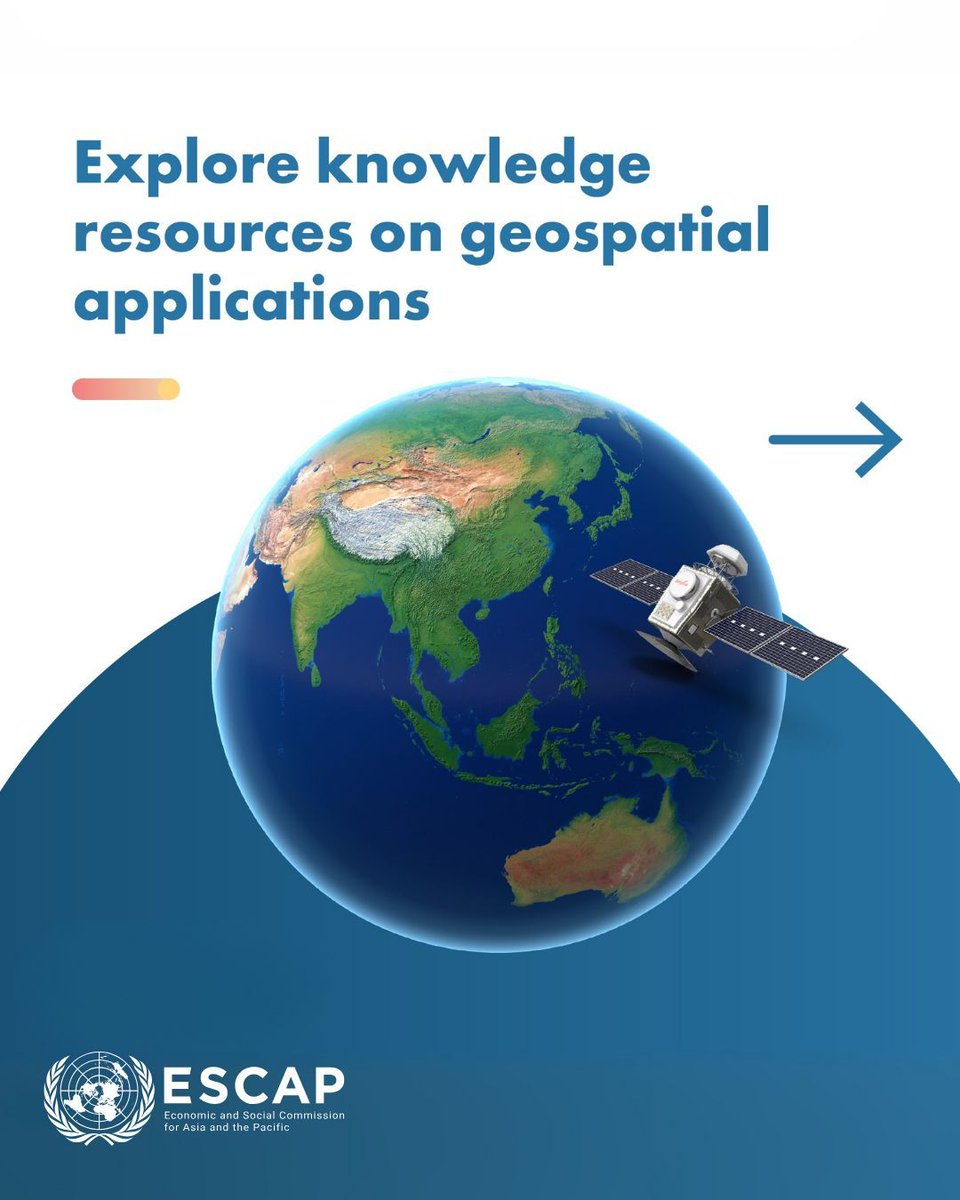
🛰️ How can space technology drive sustainable development? This #WorldSpaceWeek, @UNESCAP spotlights geospatial tools driving sustainable development: 📊 Dashboards & databases 📘 Regional compendiums 🤖 AI-powered tools Learn more 👉 buff.ly/C9b5ji4 #GeospatialData


DE Africa & @NASRDA trained staff on crop monitoring, flood mapping, urban growth & coastal change using DE Africa platforms, turning EO data into practical insights for sustainable development. Read the full story: digitalearthafrica.org/en_za/strength… #EarthObservation #GeospatialData

Flooding is rising, insurers need faster insights. Join our webinar Fighting the Rising Tide with FloodCast to see how rapid modelling transforms flood response. 5 Nov, 11am (GMT) Don’t miss it, register now: bit.ly/47jurc2 #GeospatialData #InsuranceTech


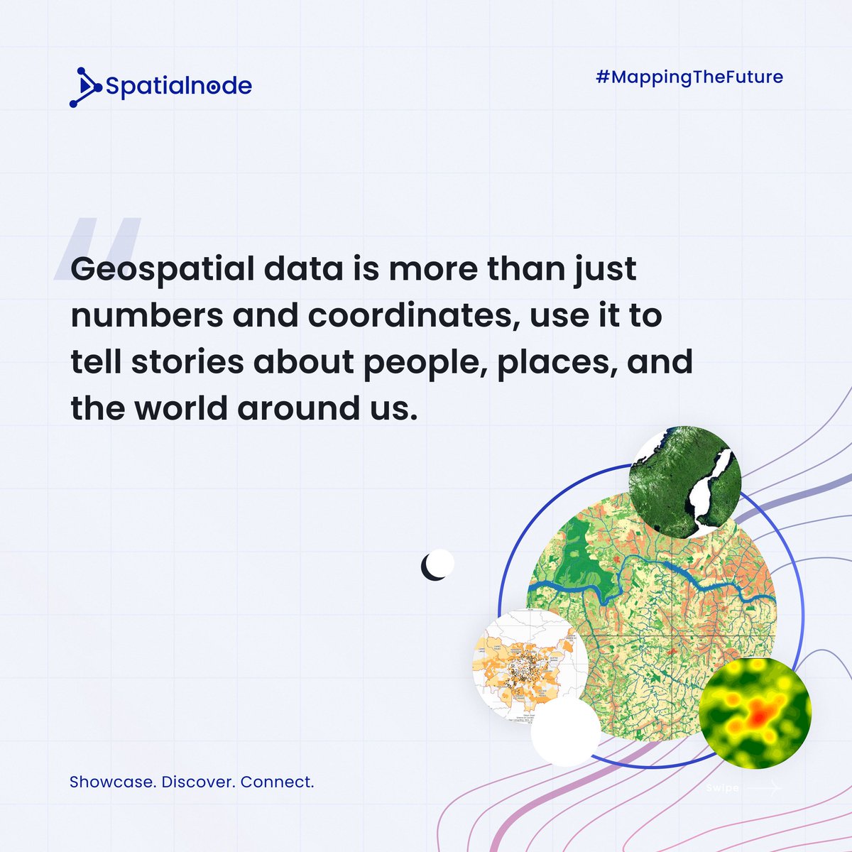
Geospatial data isn't just for techies! The power of #GeospatialData transcends tech! It's the backbone of impactful storytelling. Today, storytelling is in everyone's pockets. With just a phone with a camera, you can; - Document your journey - Share moments - Share local…


📣Call for Proposals! ISA is looking for a consultancy organization to provide geospatial mapping. If you have expertise in GIS tools, this is your chance to contribute to sustainable ocean governance! Apply by 13 October 👉 bit.ly/4e336gz #GIS #GeospatialData


#India's Digital Personal Data Protection Act (#DPDPA) and associated Rules do not explicitly address #geospatialdata, highlighting a need for specific consideration of sensitive #personal information: @Shravishtha_ajaykumar or-f.org/35082


💡In the complex world of geospatial data, analytics, and AI, it’s easy to feel overwhelmed. 🤔 How can you stay informed and navigate these buzzwords? Let’s unpack some key concepts and FAQ's to clarify their meanings. 🌍💡 #GeospatialData #AI #Analytics #IndustryInsights

Data-driven infrastructure is key to tackling climate risks, urban growth and system failures before they happen, says Alan Browne, co-founder of @SoarvoHQ. #geospatialdata theengineer.co.uk/content/opinio…

It's the first ever @OrdnanceSurvey Innovation Festival today,are ready to talk big ideas and geospatial solutions with everyone who's attending! They can't wait to get stuck in to show how we can help solve big challenges through the use of #geospatialdata!


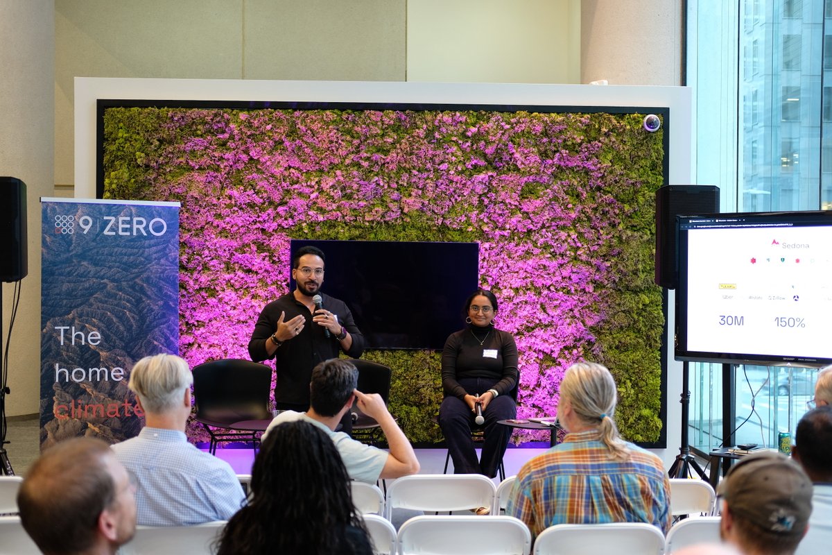
🎉 We had a blast at the Apache Sedona meetup yesterday! Big thanks to everyone who joined us. Today is the last day at #FOSS4GNA. Swing by table 34 to chat about #GeospatialData, #ApacheSeona, Wherobots, or just say hello! 👋


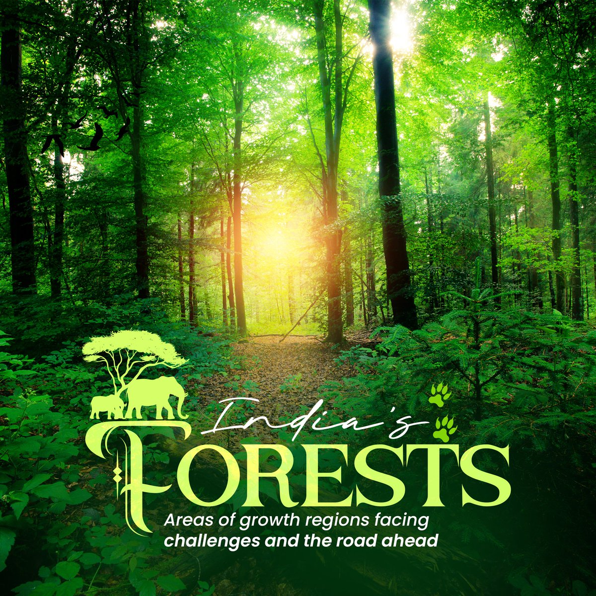
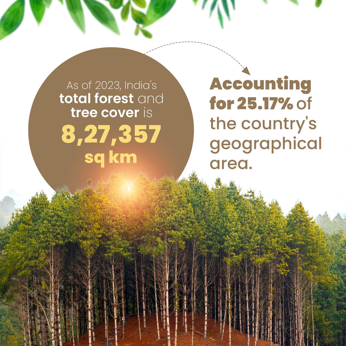
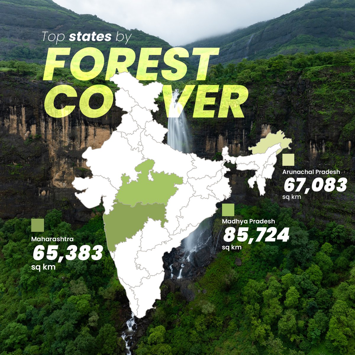
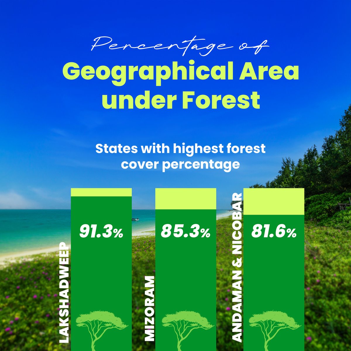
🌳 India’s Forest Cover: Growth vs Loss! In 2023, India has 25.17% of its area covered by forests, but tree cover loss is a growing challenge. Check out which states are making progress and which are losing out. 👇 #ForestCover #LatlongAI #GeospatialData #Sustainability

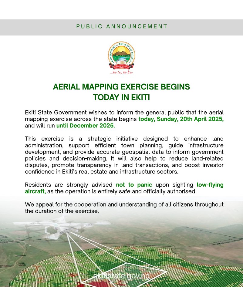
Aerial Mapping Begins in Ekiti Today! Residents are advised not to panic at the sight of low-flying aircraft, as it is a planned and harmless operation. The exercise runs till December 2025. #AerialMapping #EkitiDevelopment #GeospatialData #TownPlanning #BAOGovernance…

🌍 Geospatial Data Support for East African Humanitarians! 🛰 Caribou Space and UKHIH offer #support to integrate geospatial data into your operations. 📅 Deadline: 4 Sep 2024 🔗 Visit: shorturl.at/XCno5 #HumanitarianSupport #GeospatialData #EastAfrica #CrisisPreparedness

✨ A huge thanks to everyone who attended our meetup yesterday! Special thanks to @Hivemapper for joining us and Silas Toms for revitalizing the GeoMeetup group. See you at the next event! #Meetup #GeospatialAI #GeospatialData


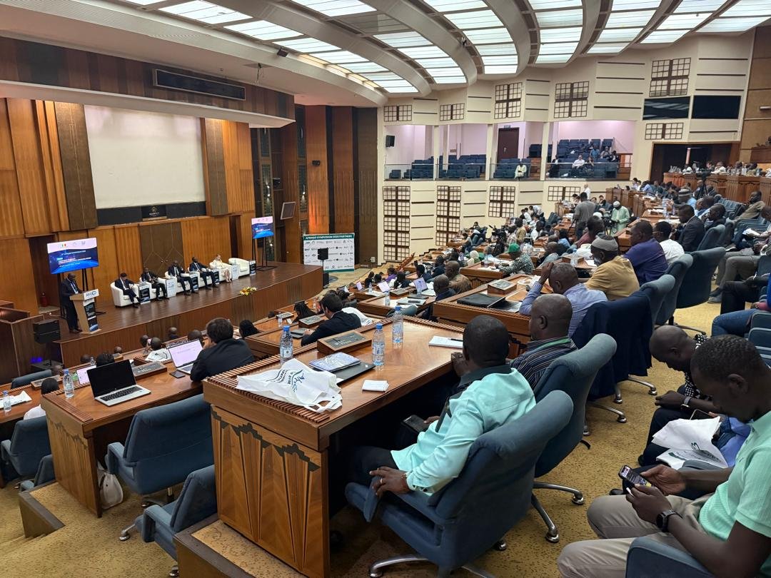
9th AfriGEO Symposium in Dakar (Oct 7–9, 2025), Experts and innovators explore how #GeospatialData can drive Africa’s sustainable future and the @OSS_Comms presents tools turning data into action for a resilient continent. #AfriGEO2025 #EarthObservation #Innovation #SDGs


⚙️ North.io is redefining #OceanBigData with their Ocean Data Platform — keeping marine & geospatial data connected, collaborative & dynamic. Learn more: north.io/en/dataplatform #DataPlatform #GeospatialData #DigitalTransformation
#India's Digital Personal Data Protection Act (#DPDPA) and associated Rules do not explicitly address #geospatialdata, highlighting a need for specific consideration of sensitive #personal information: @Shravishtha_ajaykumar or-f.org/35082

🗺️ Connect your maps, imagery, and documents with Knowvation GS—the platform that fuses powerful search with spatial intelligence. 📡 ptfs.com/knowvation-gs/ #GeospatialData #GISIntegration #SpatialSearch #PTFS


Hello TopoDOT Community! 👋 Join us for TUC 26 this May in Orlando! Celebrate a decade of innovation, education and collaboration! 🎉 Register before the New Year for early bird discounts! #TUC26 #GeospatialData #PointClouds #CivilInfrastructure

Happy National #GISDay from your friends at Timmons Group! Check out what our GIS team has been up to this year >> mailchi.mp/b657bf602624/h… #GIS #GeospatialData #UtilityNetwork #TrimbleUnity #AssetManagement #EmergencyPreparedness
#India's Digital Personal Data Protection Act (#DPDPA) and associated Rules do not explicitly address #geospatialdata, highlighting a need for specific consideration of sensitive #personal information: @Shravishtha_ajaykumar or-f.org/35082

Messy data slows everything down. Bad maps make it worse. Here’s how top field teams are speeding up GIS work — while making the data cleaner, smarter, and easier to use. 👇 tinyurl.com/2tfwsh3e #GIS #FieldOps #GeospatialData 🛰️

DE Africa & @NASRDA trained staff on crop monitoring, flood mapping, urban growth & coastal change using DE Africa platforms, turning EO data into practical insights for sustainable development. Read the full story: digitalearthafrica.org/en_za/strength… #EarthObservation #GeospatialData

Precision starts with the right training. Gain the skills to plan, execute & deliver professional drone surveys with confidence. Pre-register for Volatus Academy’s Drone Mapping Fundamentals (Photogrammetry & LiDAR): bit.ly/4gMO40z #GeospatialData #VolatusAcademy

#India's Digital Personal Data Protection Act (#DPDPA) and associated Rules do not explicitly address #geospatialdata, highlighting a need for specific consideration of sensitive #personal information: @Shravishtha_ajaykumar or-f.org/35082

Discover how BASF Digital Farming leverages AWS to build a scalable geospatial data platform for farmers worldwide! 🌱🛰️ #AWS #GeospatialData #DigitalFarming #STAC #OpenSource #Innovation aws.amazon.com/blogs/architec…

Discover the secrets to maximizing your geospatial data with ArcGIS hosted services! 🚀📈 This blog series covers the differences between hosted feature services, vector tile services, and map tile services. #GeospatialData #ArcGIS Dive in ➡️ow.ly/wxAf30sQXPR


Day 5 of the #30-Day Map Challenge: Exploring the Wildland-Urban Interface (WUI) from SILVIS Labs at UW-Madison. We're examining #geospatialdata showing where homes meet wildland vegetation across the U.S., a challenge for wildfire management, urban planning, and conservation.

Are you looking for accurate and reliable geospatial data? Look no further than KWGIS! Our team of experts is dedicated to delivering high-quality services to support development projects. #KWGIS #GeospatialSolutions #GeospatialData

The Game Changer in Geospatial Ecosystem!! #ViksitBharat #publicdata #GeospatialData #DataRegistry
Survey of India’s National Geo Platform – Spatially Enabling Digital India In a major initiative to strengthen India’s National Geospatial Ecosystem and implement the vision of the National Geospatial Policy, 2022, Survey of India (SoI), Government of India, has entered into an…

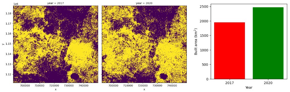
#Geospatialdata helps us understand how Nigeria’s land is changing and what it means for people and the planet. A continuation of my geospatial analysis on Nigeria’s land sector highlights two critical layers:
#India's Digital Personal Data Protection Act (#DPDPA) and associated Rules do not explicitly address #geospatialdata, highlighting a need for specific consideration of sensitive #personal information: @Shravishtha_ajaykumar or-f.org/35082

⚙️ North.io is redefining #OceanBigData with their Ocean Data Platform — keeping marine & geospatial data connected, collaborative & dynamic. Learn more: north.io/en/dataplatform #DataPlatform #GeospatialData #DigitalTransformation

Education being a necessity in urban development, it makes access to schools a vital aspect. Using geospatial data, we were able to map the distribution of schools in Jinja City, providing valuable insights for education planning and accessibility. #GeospatialData #DataCitiesUg


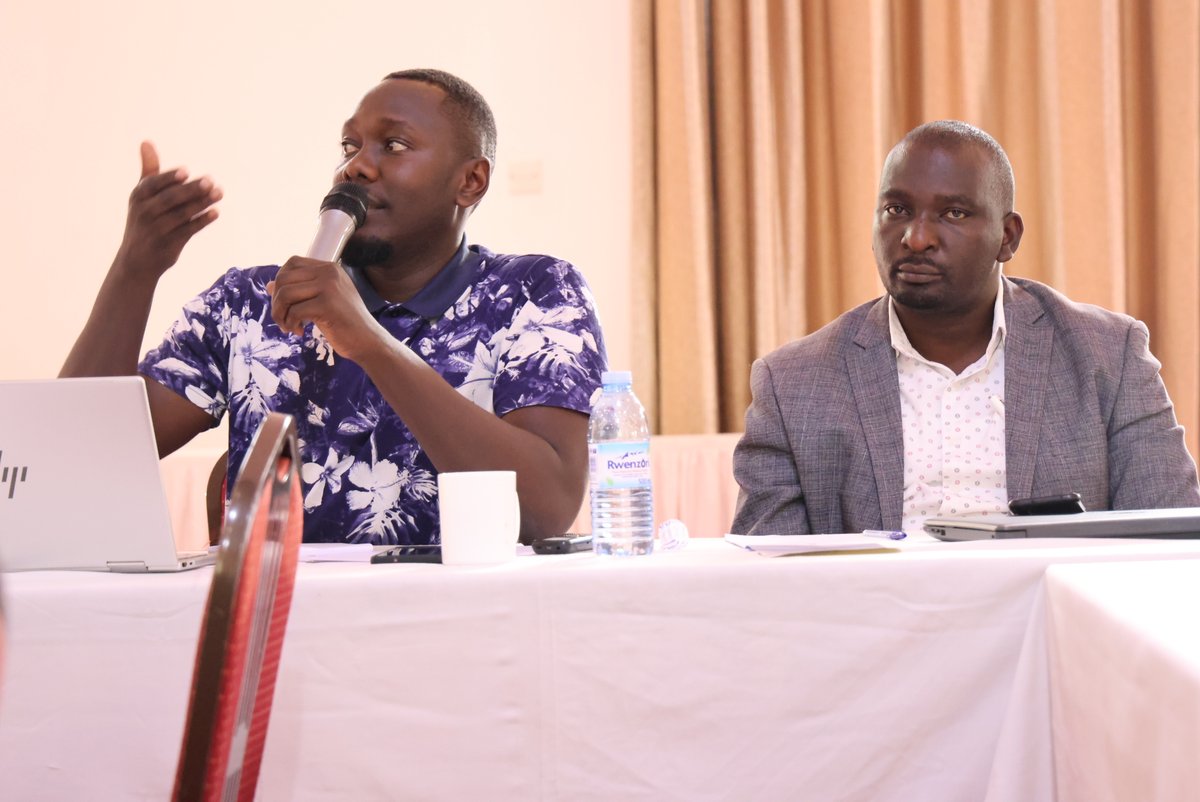
It was an honor to showcase some of our projects, including community mobilization initiatives, bootcamps, mapathons, women in geospatial, our geospatial innovation space at #geospatialdata and #digitaltechnologies 2024. @studio19tz @ResilienceAcad @UniTurku @TurkuAMK


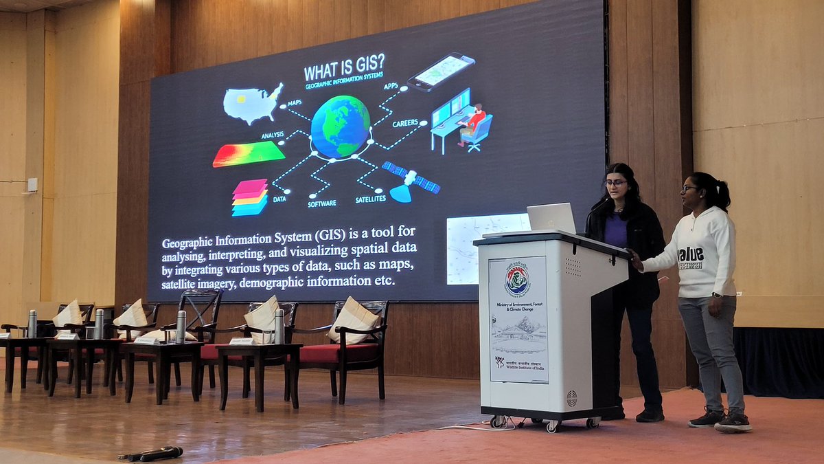
Accessible and rich datasets for Remote Sensing and GIS are transforming how we understand and interact with our environment. Here’s a glimpse of session on Data availability for RS and GIS Analysis #GeospatialData #RS #Gisday2023 @wii_india @himani_khati @harithajagannivasan
Geospatial data isn't just for techies! The power of #GeospatialData transcends tech! It's the backbone of impactful storytelling. Today, storytelling is in everyone's pockets. With just a phone with a camera, you can; - Document your journey - Share moments - Share local…
📣Call for Proposals! ISA is looking for a consultancy organization to provide geospatial mapping. If you have expertise in GIS tools, this is your chance to contribute to sustainable ocean governance! Apply by 13 October 👉 bit.ly/4e336gz #GIS #GeospatialData

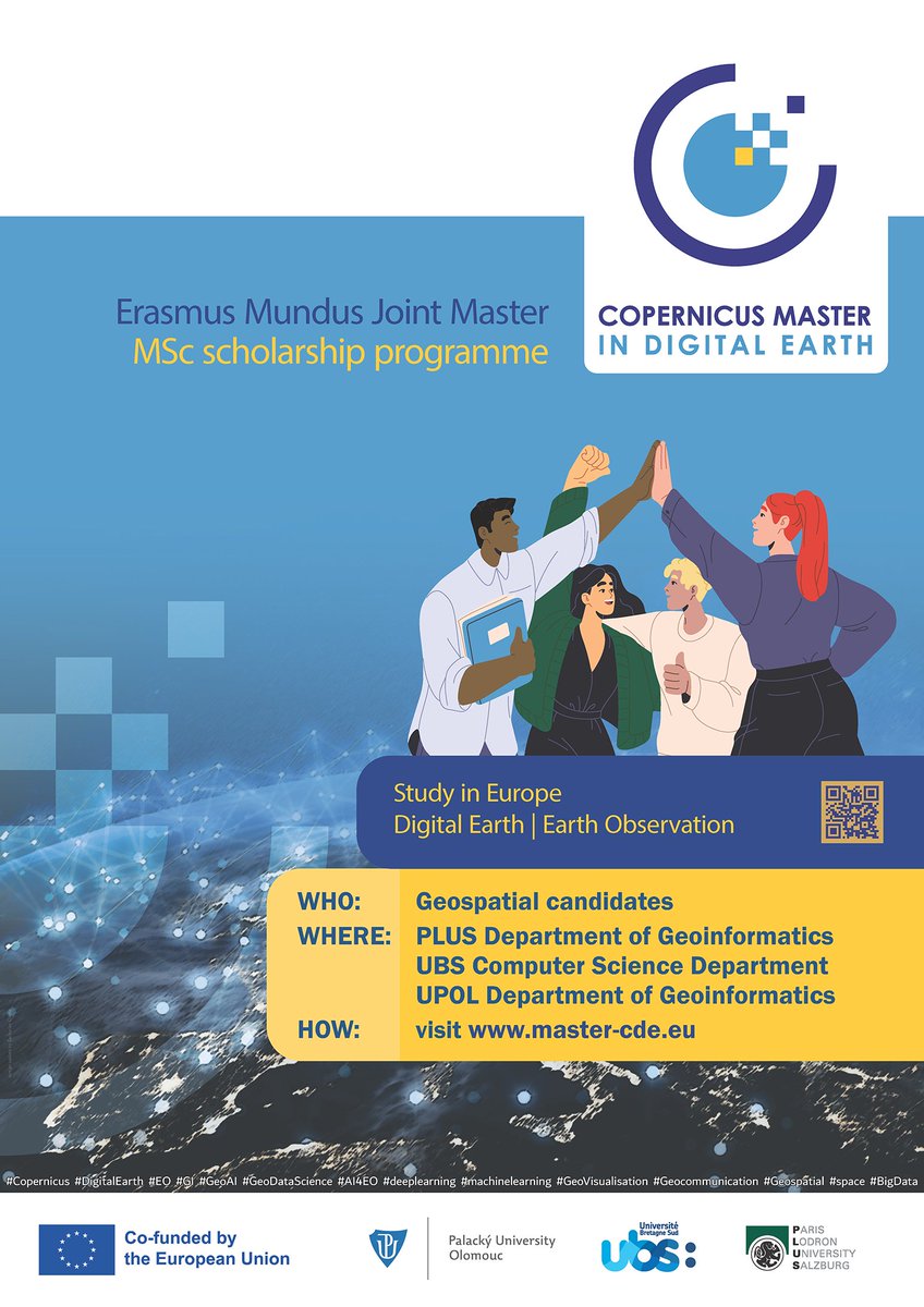
Are you #passionate about #GeospatialData? #ReadyToMove & study abroad #ApplyNow master-cde.eu postgrad #study #Europe #ErasmusPlus #EMJM #Copernicus #DigitalEarth #EO #GI #GeoDataScience #AI4EO #Geovisualisation #Geocommunication @PLUS_1622 @UPOlomouc @UBS_universite

Dr. @mmubangizi15, our head of office, is presenting on the power of #GeospatialData. He illustrates how tracking physical locations with satellite imagery reveals urban expansion and informs urban planning, environmental management, and more. 👉Follow @DataCitiesUg for updates


This #satepicoftheweek showcases New Orleans, Lousiana, which sits at, and in some areas below, sea level with mostly flat terrain and is prone to flooding. #geospatialdata helps governments and emergency responders identify high-risk areas and support recovery.


Meet members of the #K12 group @OAGEEOntarioGeo on Friday @YorkUEUC. Check out our workshops on how to navigate the world of #geospatialdata, #webmapping, field #datacollection, +#geographicanalysis w/#ArcGISOnline! Visit us at the @esricanada booth! @GIS4Teachers

🌳 India’s Forest Cover: Growth vs Loss! In 2023, India has 25.17% of its area covered by forests, but tree cover loss is a growing challenge. Check out which states are making progress and which are losing out. 👇 #ForestCover #LatlongAI #GeospatialData #Sustainability
🌍 Geospatial Data Support for East African Humanitarians! 🛰 Caribou Space and UKHIH offer #support to integrate geospatial data into your operations. 📅 Deadline: 4 Sep 2024 🔗 Visit: shorturl.at/XCno5 #HumanitarianSupport #GeospatialData #EastAfrica #CrisisPreparedness

Vice Mayor of Rotterdam Vincent Karremans shares the innovative strategies to make cities more climate-resilient and attractive for its citizens.🌇 Find out how he leverages #geospatialdata and intercity collaborations for better outcomes. buff.ly/3KHJscM #smartcities

Aerial Mapping Begins in Ekiti Today! Residents are advised not to panic at the sight of low-flying aircraft, as it is a planned and harmless operation. The exercise runs till December 2025. #AerialMapping #EkitiDevelopment #GeospatialData #TownPlanning #BAOGovernance…

🚀 We’ve updated our datasets page! To make it easier for you to find the data you need, we’ve added categories on kontur.io/datasets 🔍 You can also download the full list of datasets as a table for easier browsing and planning. #GeospatialData #Kontur #OpenData


Don't miss out this Thursday at #GraphQLConf, as author William Lyon explore how to work with #geospatialdata in #GraphQL: mng.bz/QRq1 @lyonwj Read his book: manning.com/books/fullstac… #ManningBooks #LearnWithManning #GraphQL @thegraphqlconf

Learn how to use layer renderers to define rules and symbols within your geospatial structured data! 🌏 🧮This will allow you to build powerful geospatial data exploration apps. #EsriDeveloper #geospatialdata Learn More ➡️ ow.ly/yhaZ50V7mTj


It's a new day, a new week, and a new month. Use geospatial data to create stunning maps that tell stories this month! #geospatial #geospatialtips #geospatialdata #MondayMotivation
🛰️ How can space technology drive sustainable development? This #WorldSpaceWeek, @UNESCAP spotlights geospatial tools driving sustainable development: 📊 Dashboards & databases 📘 Regional compendiums 🤖 AI-powered tools Learn more 👉 buff.ly/C9b5ji4 #GeospatialData
🎉 We had a blast at the Apache Sedona meetup yesterday! Big thanks to everyone who joined us. Today is the last day at #FOSS4GNA. Swing by table 34 to chat about #GeospatialData, #ApacheSeona, Wherobots, or just say hello! 👋
Something went wrong.
Something went wrong.
United States Trends
- 1. Happy Thanksgiving 356K posts
- 2. #StrangerThings5 351K posts
- 3. Afghan 406K posts
- 4. Turkey Day 18.5K posts
- 5. #DareYouToDeath 293K posts
- 6. DYTD TRAILER 216K posts
- 7. Good Thursday 24K posts
- 8. Feliz Día de Acción de Gracias 1,051 posts
- 9. BYERS 80.7K posts
- 10. robin 119K posts
- 11. #Thankful 4,827 posts
- 12. Taliban 51.4K posts
- 13. Vecna 81.6K posts
- 14. Rahmanullah Lakanwal 155K posts
- 15. Dustin 56K posts
- 16. Tini 13.7K posts
- 17. AI Alert 9,711 posts
- 18. #Grateful 2,690 posts
- 19. TOP CALL 11.4K posts
- 20. Nancy 74.3K posts