
Washington County Storm Chasers
@WashingtonCSW
Chasing is our passion, keeping you informed is our mission.
You might like


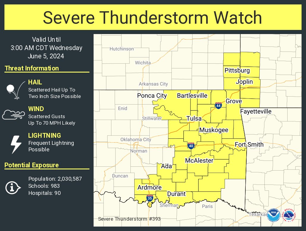
A severe thunderstorm watch has been issued for parts of Kansas, Missouri and Oklahoma until 3 AM CDT

If you haven't read the @NWStulsa survey's from last weekends tornado outbreak, here you go storymaps.arcgis.com/stories/4b42e5… At least four of the tornadoes were over a mile wide, with two nearly two miles wide. #okwx #arwx
storymaps.arcgis.com
2024 Tornado Events in Eastern Oklahoma Northwest Arkansas
Information about the tornadoes that affected the National Weather Service Tulsa area of responsibility during 2024.

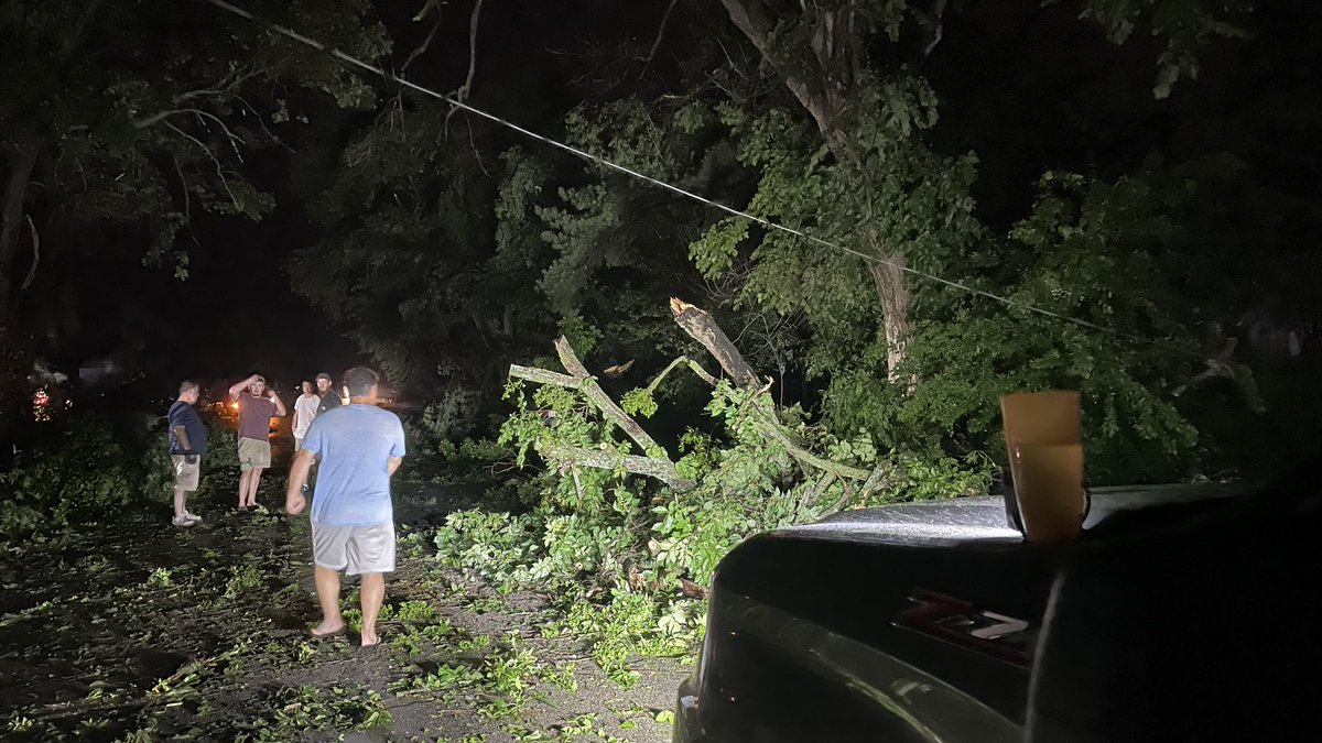
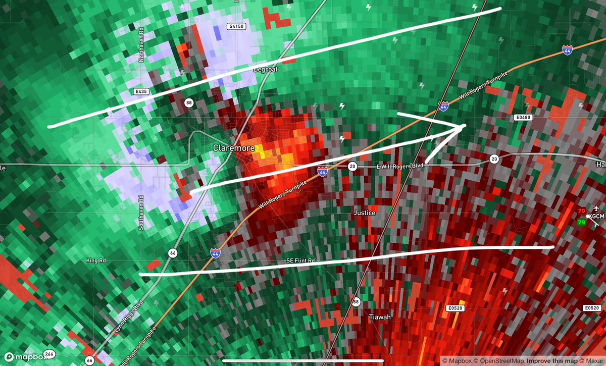
Cleanup ongoing in Claremore, OK. A ton of tree damage. #okwx @WxZachary @NWStulsa

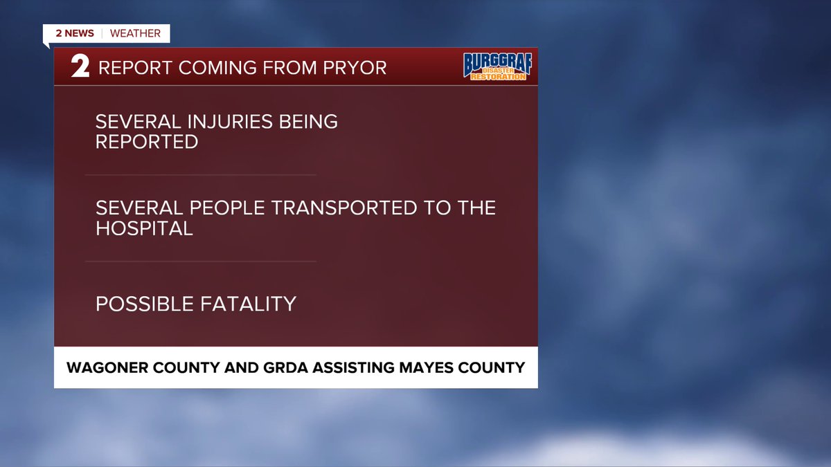
Information coming across our newsroom at this hour. Such a heartbreaking night for many in the path of the tornado earlier. #2NewsOk #OkWx

More than 15,000 power outages are reported after Oklahoma storms, including 6,122 in Rogers, 3,724 in Mayes, 1,171 in Delaware and 219 in Osage county. #okwx

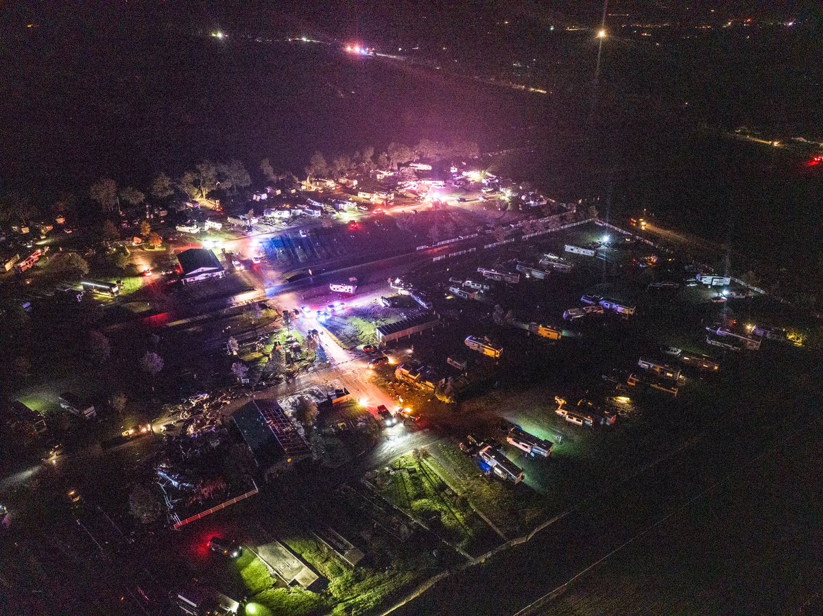
Horrible situation as Memorial Day campers at the KOA campground east of Claremore was hit by a tornado. Multiple entrapments and rescues ongoing. #okwx

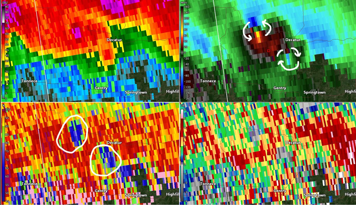
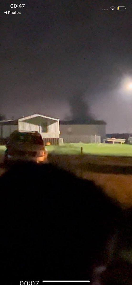
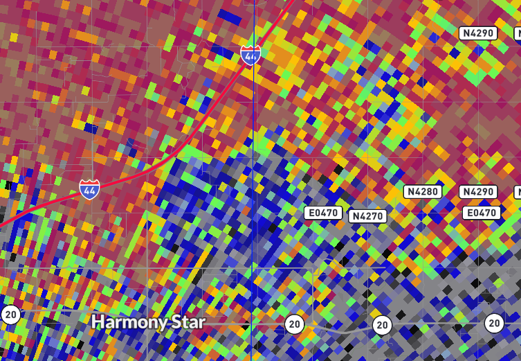
Just a bit earlier at 1:11am, twin tornadoes lofting debris near Decatur, AR, one cyclonic (swirling counter-clockwise), the other, anti-cyclonic (swirling clockwise). Both lofted debris into the radar signal #arwx #wxtwitter


ROGERS CO: SH-20 and SH-88 are closed east of SH-66 in Claremore due to storm damage. #okwx


A very violent tornado is ongoing just south of Lone Chapel OK! TAKE SHELTER NOW! #okwx #wxtwitter

🚨🌪️#PDSTornadoWarning #Oklahoma PARTICULARLY DANGEROUS SITUATION Damaging tornado on ground TAKE COVER NOW ⬇️ lowest floor interior space 🚫windows 🚫exterior walls Once in a safe space protect head⛑️ then ✅ other sources & contact others📱 #OKwx #tornado ⚠️EXPIRES 12:15 AM CDT

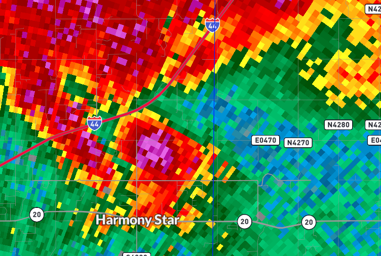
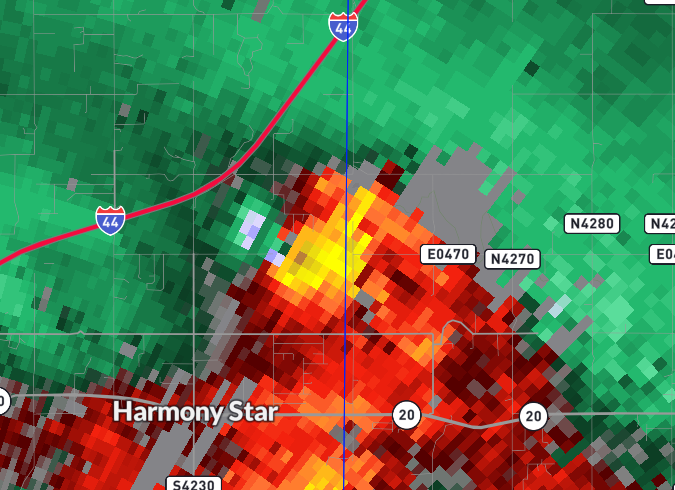
11:30CT: Tornado moving through Claremore, Oklahoma and is now approaching I-44 at E Will Rogers Blvd. This #tornado will continue along OK-20 toward Pryor Creek. Seek shelter throughout the warned area in the lowest level, interior room with a helmet and tennis shoes. #okwx
Dangerous circulation over Sperry will move across Owasso into southwest Rogers county near Verdigris by 1130 pm. #okwx

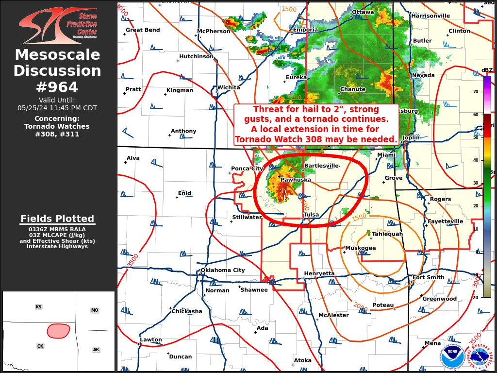
10:42pm CDT #SPC_MD 0964 , #okwx, spc.noaa.gov/products/md/md…
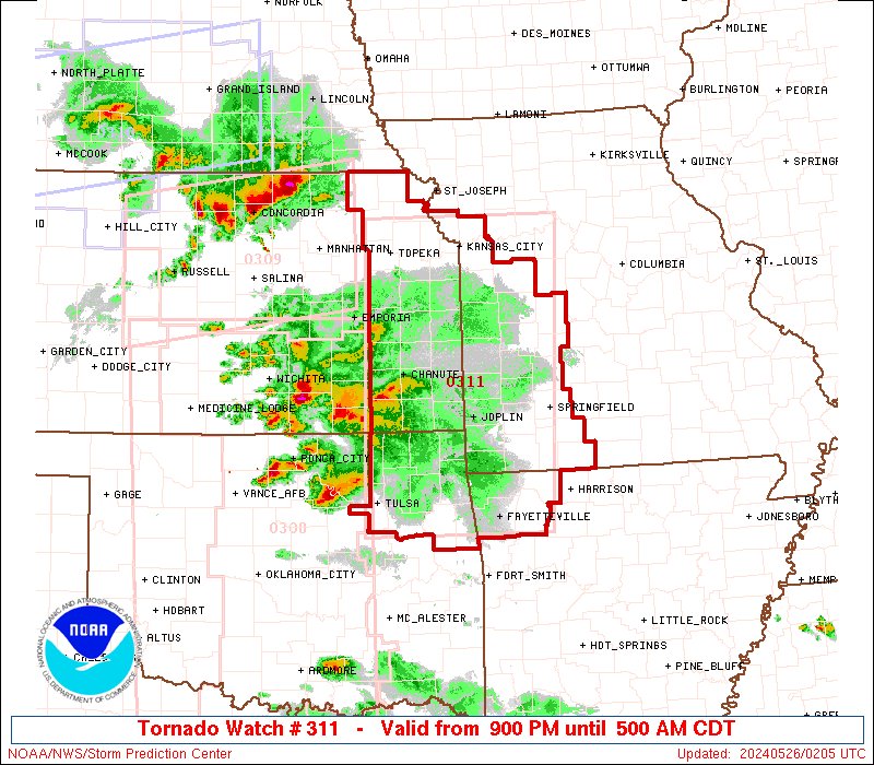
9:06pm CDT #SPC_Watch WW 311 TORNADO AR KS MO OK 260200Z - 261000Z, #arwx #kswx #mowx #okwx, spc.noaa.gov/products/watch…
[Update: 7:30 pm 5/25/24] Severe Weather threat rapidly INCREASING across NE and SE #OKwx. Severe T-Storms approaching the area with all hazards possible including tornadoes and large hail.
[8:15 AM 5/25/24] Severe weather is forecast to spread into portions of E OK this evening with severe potential continuing eastward into the overnight hours. Reminder to have multiple ways to receive weather information especially any severe weather watches and warnings.
![NWStulsa's tweet image. [8:15 AM 5/25/24] Severe weather is forecast to spread into portions of E OK this evening with severe potential continuing eastward into the overnight hours. Reminder to have multiple ways to receive weather information especially any severe weather watches and warnings.](https://pbs.twimg.com/media/GObVy6xaAAAsW53.jpg)
![NWStulsa's tweet image. [8:15 AM 5/25/24] Severe weather is forecast to spread into portions of E OK this evening with severe potential continuing eastward into the overnight hours. Reminder to have multiple ways to receive weather information especially any severe weather watches and warnings.](https://pbs.twimg.com/media/GObV_bxbMAAlwK_.jpg)
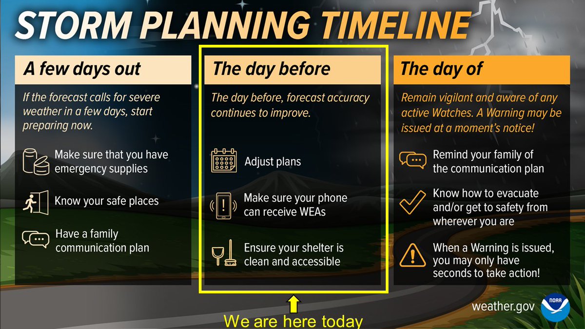
We are now the day before a significant severe weather event. If you haven't done so already, have emergency supplies, safe place, family plan. Before today ends: - strongly consider adjusting plans for late afternoon and evening - Activate WEA on cell phone #okwx #texomawx


United States Trends
- 1. FINALLY DID IT N/A
- 2. The REKT N/A
- 3. Sinners N/A
- 4. Oscar N/A
- 5. Jack Smith N/A
- 6. The ONDO N/A
- 7. #fancymedia N/A
- 8. Delroy Lindo N/A
- 9. Kate Hudson N/A
- 10. Best Picture N/A
- 11. No Other Choice N/A
- 12. The SPX6900 N/A
- 13. Chase Infiniti N/A
- 14. Jared Leto N/A
- 15. Wicked N/A
- 16. He-Man N/A
- 17. Nekima Levy Armstrong N/A
- 18. #MountainOfBusch N/A
- 19. Frankenstein N/A
- 20. Academy N/A


Something went wrong.
Something went wrong.