
Nathaniel Tabor
@WeatherCast3
Nathaniel Tabor / Meteorologist / father and husband / lover of all things weather
You might like


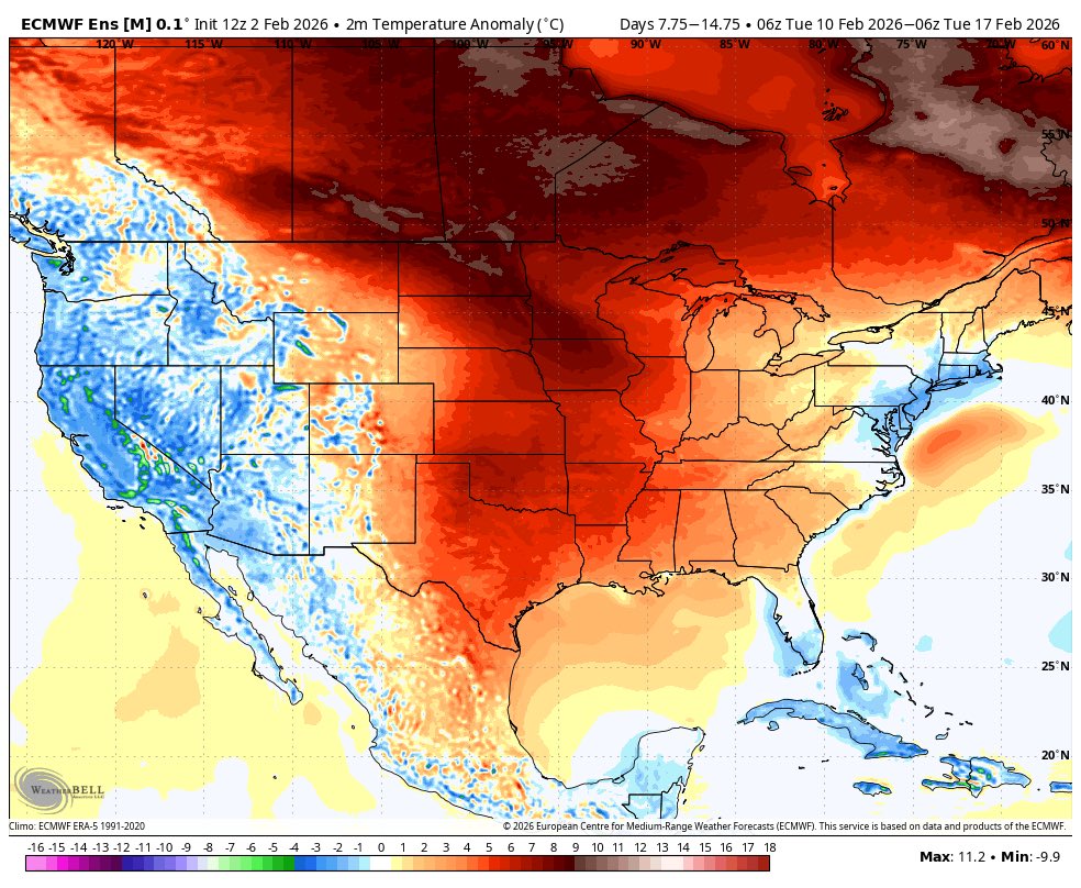
Looks like warmer weather for most of the month in Texas, most east of the Rockies should warm up as well if they haven’t already. With this signal looking persistent as we approach March the window is quickly closing on any chances for hard freeze threats in the southern plains,…
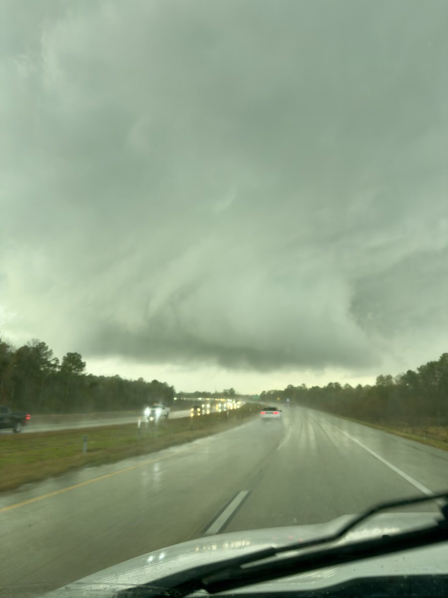
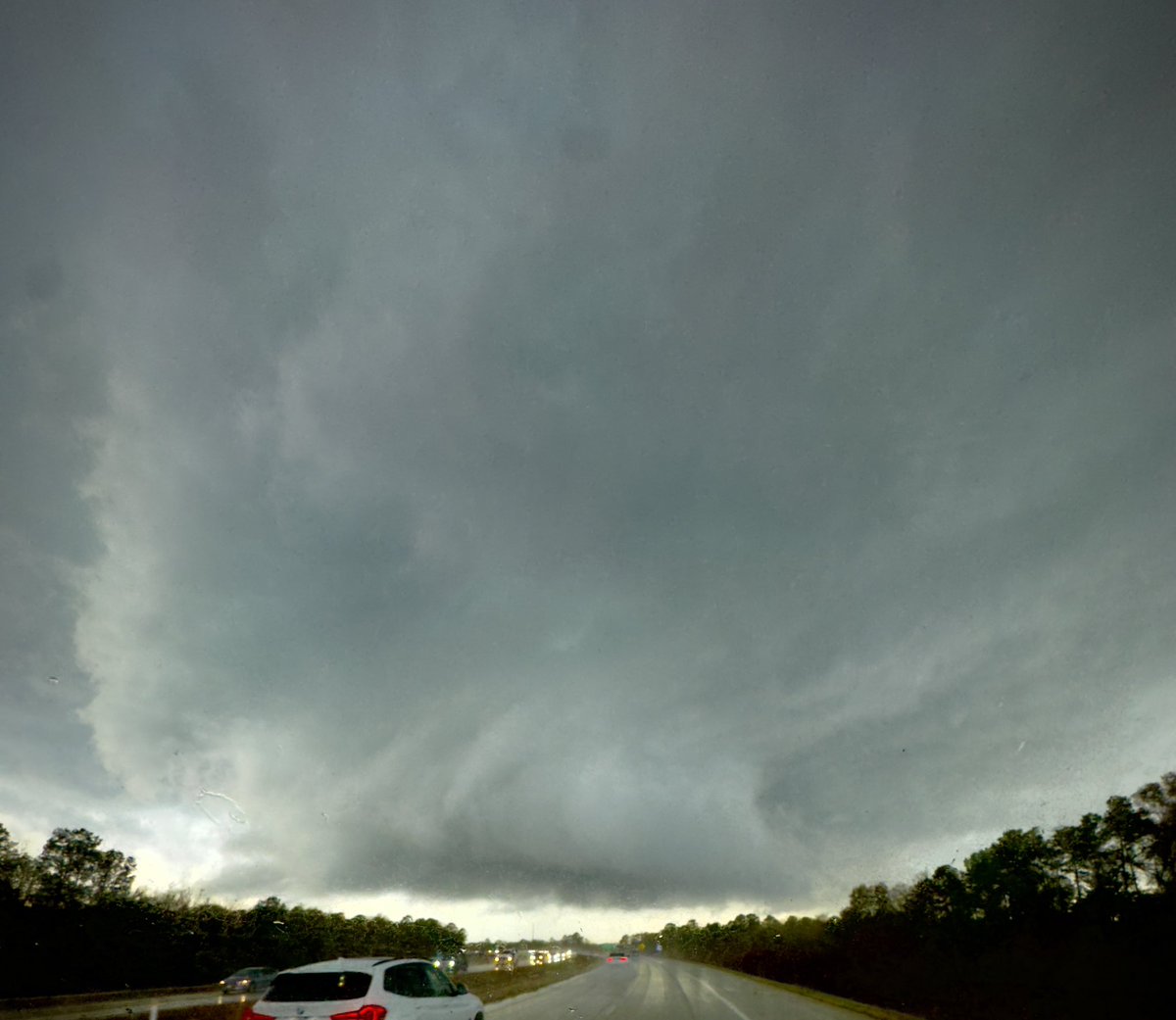
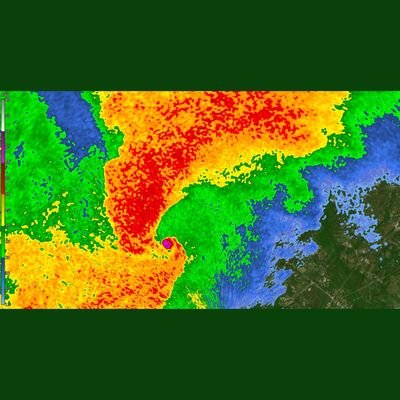
WOW! On 99 near humble not long ago. Greenage/structure was something I wasn’t expecting to see today
This is a pretty awesome view of a tornadic waterspout. Wish we had more footage like this as you can somewhat see the wind field reflected on the surface of the water surrounding the vortex.

The video captures an impressive waterspout seen today from the deck of a container ship in the Bermuda Triangle.
Not going to warm up much for long it seems

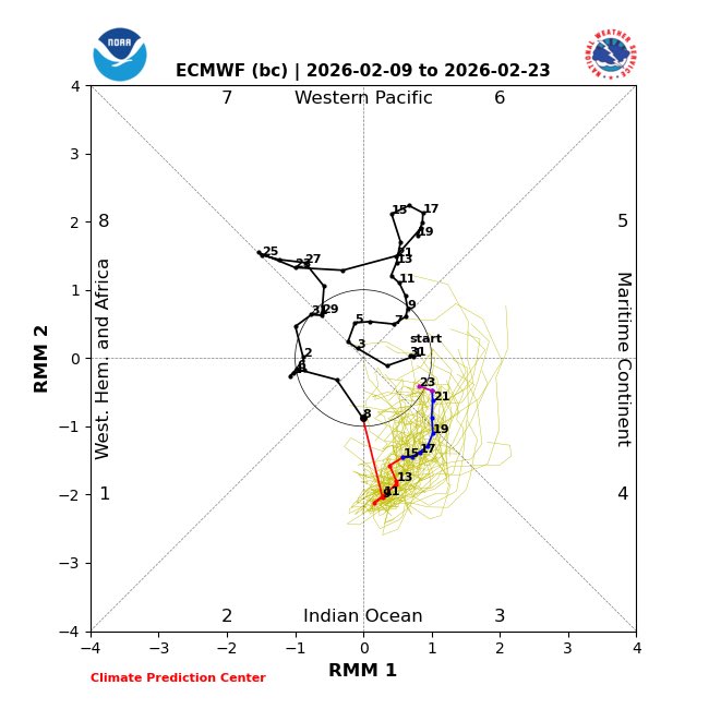
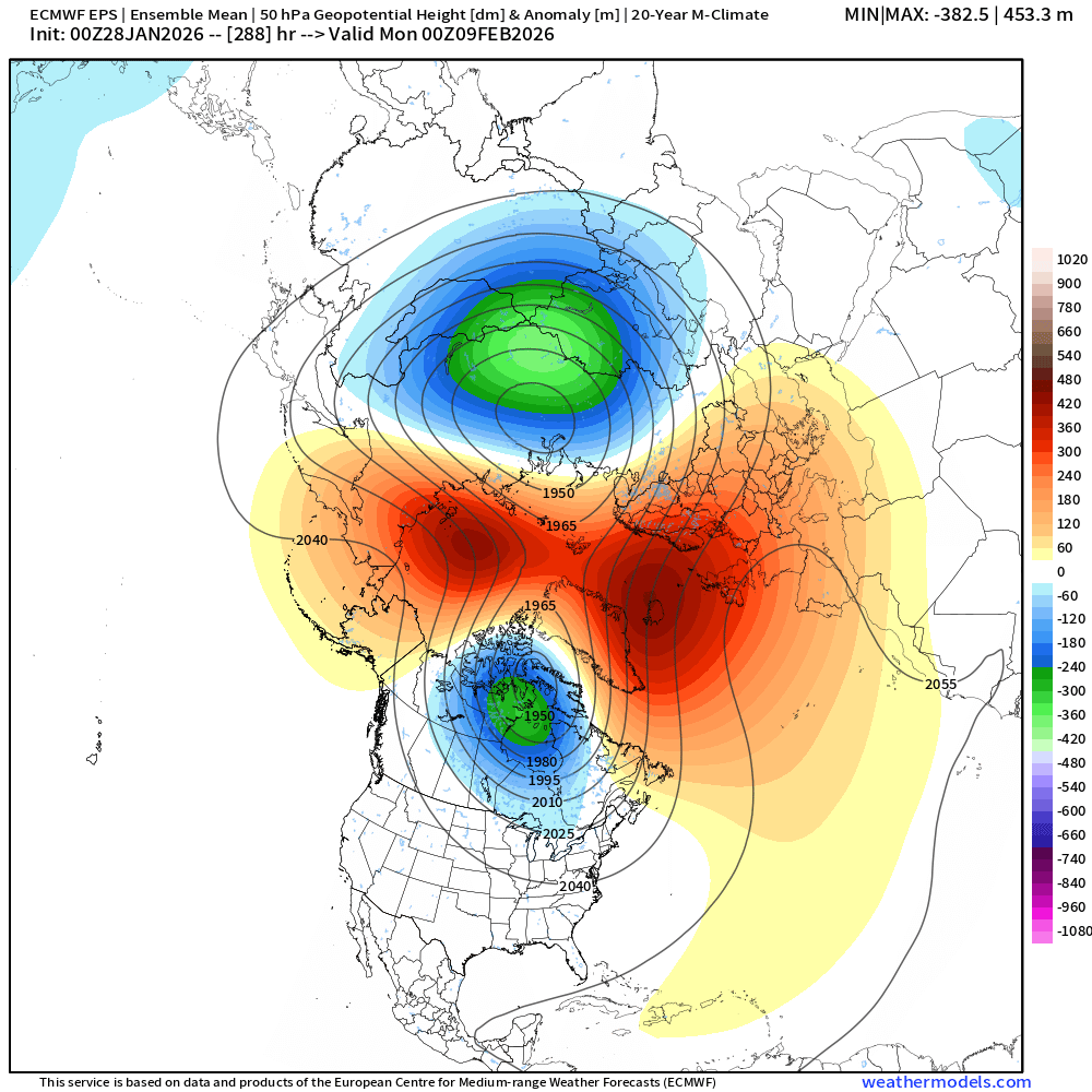
🧵We need to keep a very close eye on the stratosphere ahead for implications not only throughout February - but for early Spring as well.
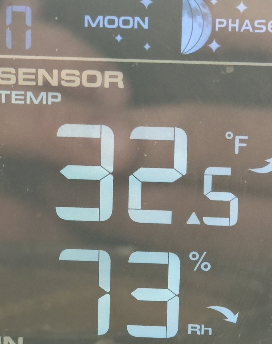
Finally cracked the freezing mark after almost 38 hours here near Katy. We’ve been below 35°F for almost 3 days, impressive cold airmass.
Colder pattern east of the Rockies continues to reload on guidance. Looks like another potentially potent storm at the end of this week as well. Fun times are here for winter weather fans.

Here's another video of a large "steamnado" on Lake Lewisville shared to us by Alex Abbe via Facebook. Scary looking but thankfully harmless! #dfwwx #txwx
Precip tapering off this morning as some light snow here near Katy. Several hours of freezing rain and sleet before this.
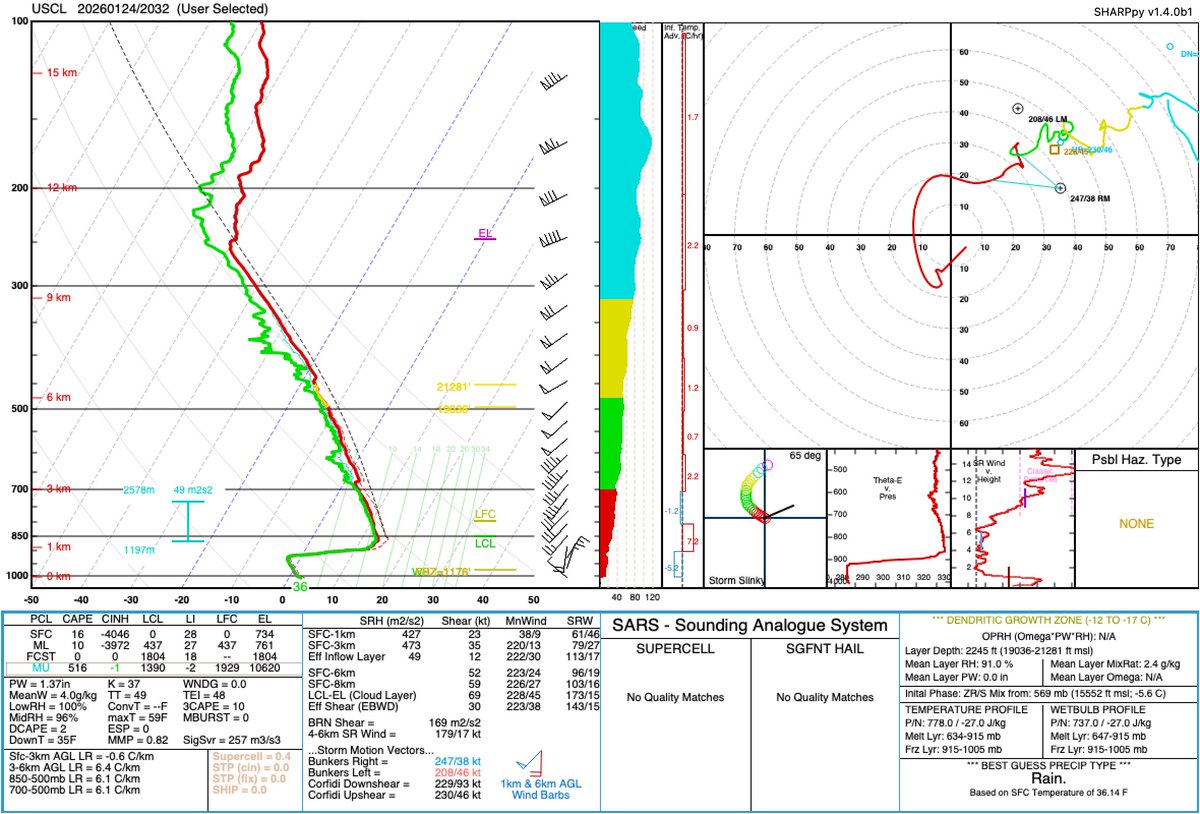
Here is the 21z sounding from College Station provided by @TAMU. Observations show ample moisture and a deep warm layer between 900-700mb. This warm layer and above freezing surface temps are currently staving off winter precipitation. #TXwx #HOUwx #Houston
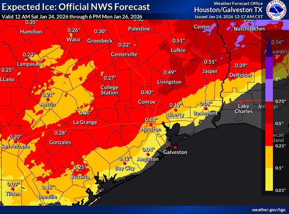

Pretty clear trend south in the Sleet/Freezing Rain threat. This is mostly important for the Houston Metro and I-10 corridor. Sunday and Monday will be un-drivable most likely.
Man who could have seen that coming!? I’m so shocked

HRRR Hi Res Model trend has the front speeding up, which could mean impacts shifting earlier Friday than previously expected. DFW Freezing Rain ETA is still around 11pm-3am, but this could still shift up an hour or two. School and evening activities should remain unaffected
Shallow cold air always wins
Want a more crazy comparison? Tonight’s 00z HRRR (left) vs yesterday’s 00z HRRR (right). 24 hours apart valid at the same time (6PM Friday). #txwx
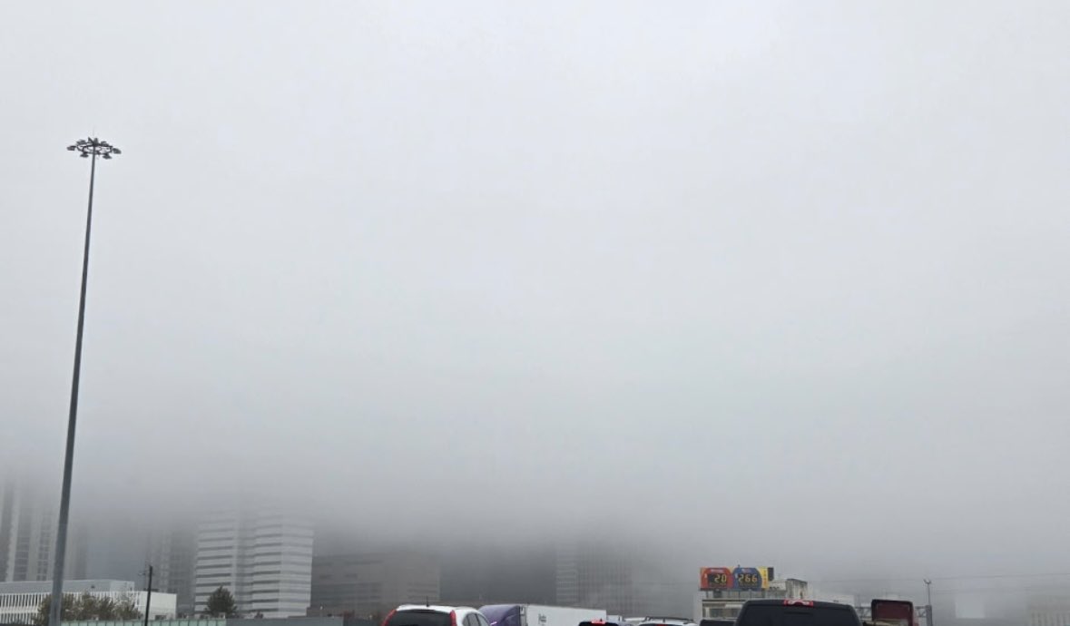
Busting fairly cool today around SE Texas and this soupy grey mess is the reason. On a gentle N/NE breeze as well. Textbook pre cold surge, and another reason I’m still cautioning people around SE/TX to expect colder conditions to arrive sooner than advertised and why there is…
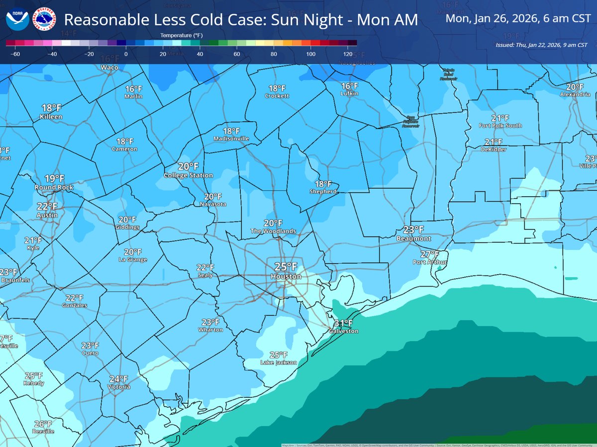
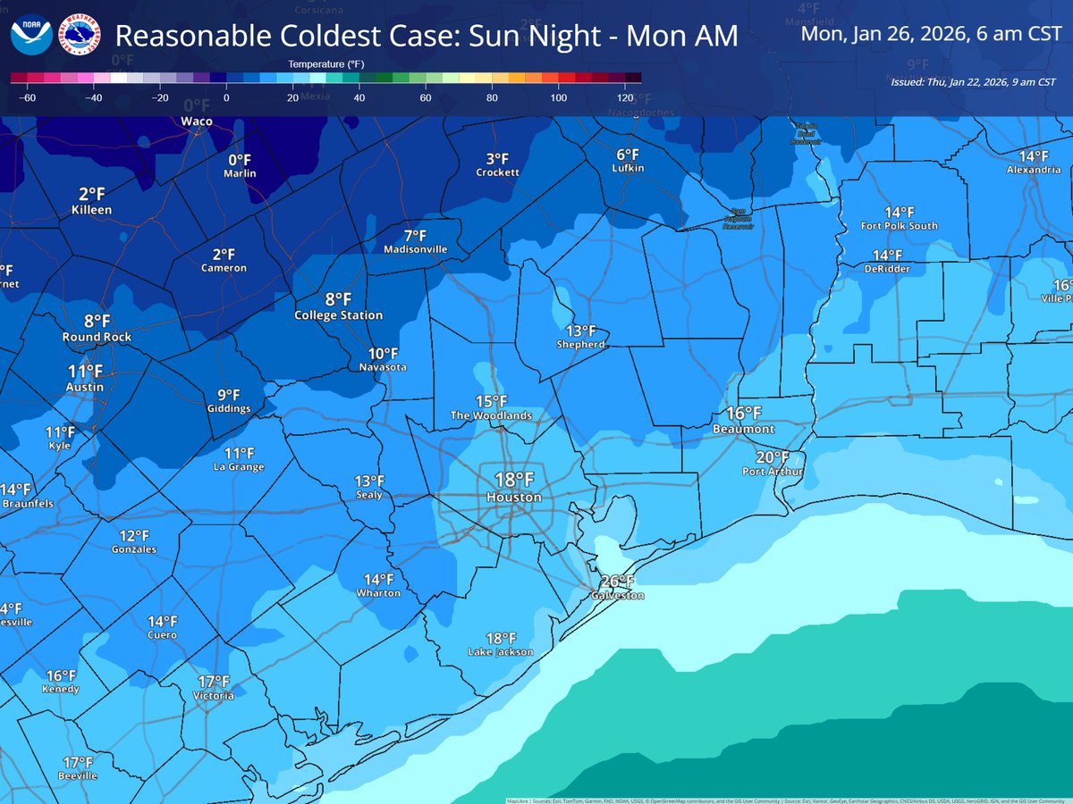
Reasonable best/worst case scenarios for Sun night–Mon AM low temperatures. Less-cold scenario still results in a hard freeze away from the coast and outside the urban heat island. Higher uncertainty in our northern zones as indicated by the very large temperatures range.
When making forecast changes or decisions based off of the new data assimilated into the GFS and ECMWF keep in mind it will take several runs to fully resolve this new data and to proceed with caution in that regard. In reality we will still likely be waiting until just before…
Specifically for the southern plains what I’m gathering from this is there is going to be a lot of lift ahead of this. Banding precipitation may also set up in spots. Southern stream looks healthy. I’m really interested to see how this translates into guidance at 0z.


United States Trends
- 1. #WWERaw N/A
- 2. Isaiah Stewart N/A
- 3. Pistons N/A
- 4. Miles Bridges N/A
- 5. Duren N/A
- 6. Darryn Peterson N/A
- 7. Nattie N/A
- 8. Paul Reed N/A
- 9. AJ Lee N/A
- 10. Moussa N/A
- 11. Becky N/A
- 12. Kansas N/A
- 13. Charles Lee N/A
- 14. #RawOnNetflix N/A
- 15. Duncan Robinson N/A
- 16. Elimination Chamber N/A
- 17. Lyra N/A
- 18. #kubball N/A
- 19. #TheRookie N/A
- 20. Rhea N/A
You might like
-
 Deven
Deven
@USAWX2022 -
 And☈ew G☈iffiths
@Central_IL_Wx -
 Spot On Weather
@eulermatthew4 -
 Dewclaw Truther
@jodginkel -
 Ryan Kane
@ryankanerWX -
 Dr. Jonathan Wall
@_jwall -
 Weathertob
@aweweather -
 A ☈ mando ϟalvadore
@KaptMands -
 Joshua Wx
@joshuawx_ -
 Sami
Sami
@sami733777 -
 Joe
Joe
@Joeweather3 -
 Jason Ludwig
@JasonLud1198 -
 FirstinWeather - Rohan Shroff
@FirstinWeather -
 Ramie Hensley
@RamieHensley -
 Landon Barley
@BarleyLandon
Something went wrong.
Something went wrong.