
Cartocode
@carto_code
Empowering firms with cutting-edge GIS & web development solutions. Transforming data into actionable insights and creating seamless digital experiences. #GIS

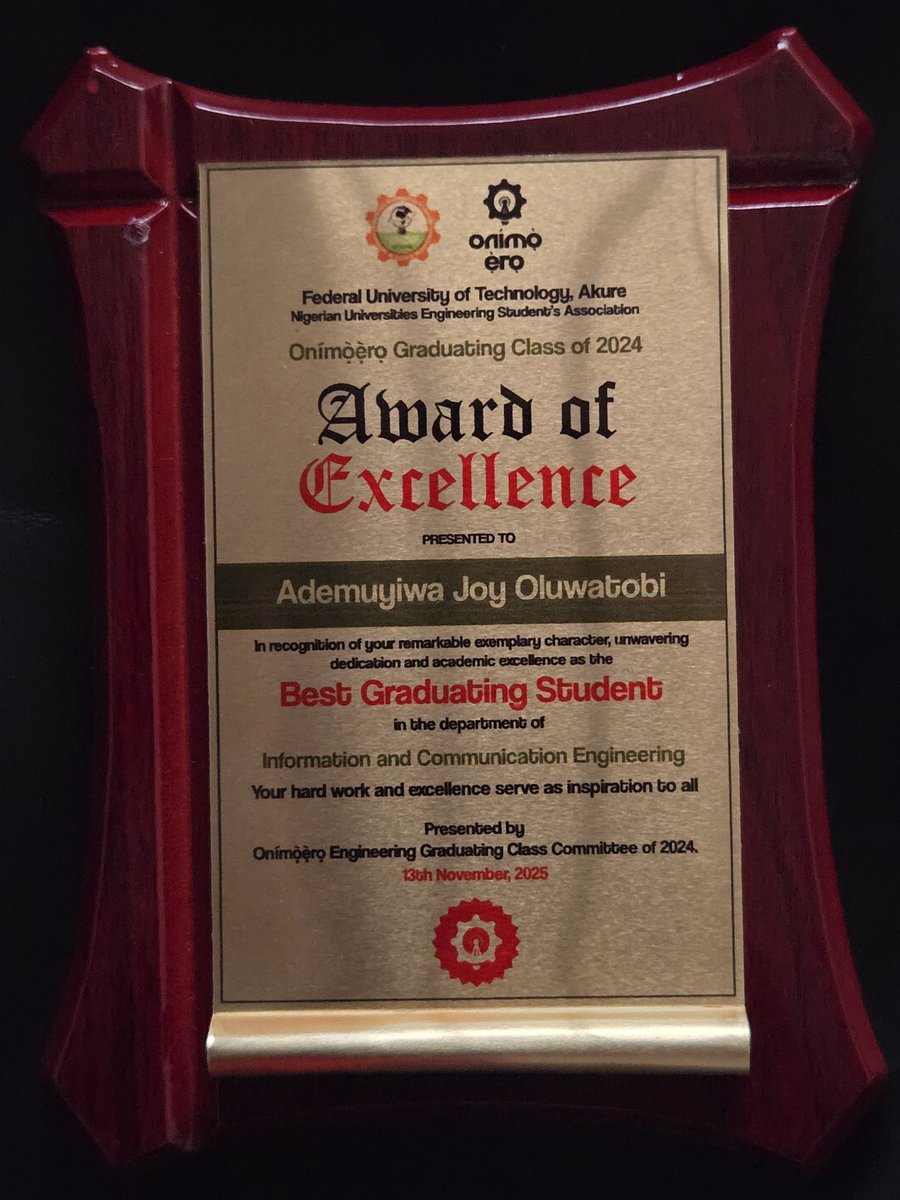
From “just aiming for a first class” to 𝗕𝗲𝘀𝘁 𝗚𝗿𝗮𝗱𝘂𝗮𝘁𝗶𝗻𝗴 𝗦𝘁𝘂𝗱𝗲𝗻𝘁, Information and Communication Engineering, Federal University of Technology Akure 🙃🎓 𝟰.𝟴𝟬/𝟱.𝟬𝟬 𝗖𝗚𝗣𝗔


A geospatially accurate 3D Globe is available in QGIS as part of QGIS 3.44. This work is the result of a Cesium Ecosystem Grant supporting the partnership of @lutraconsulting and @northroadgeo. Learn more and get started: hubs.li/Q03NwpzN0


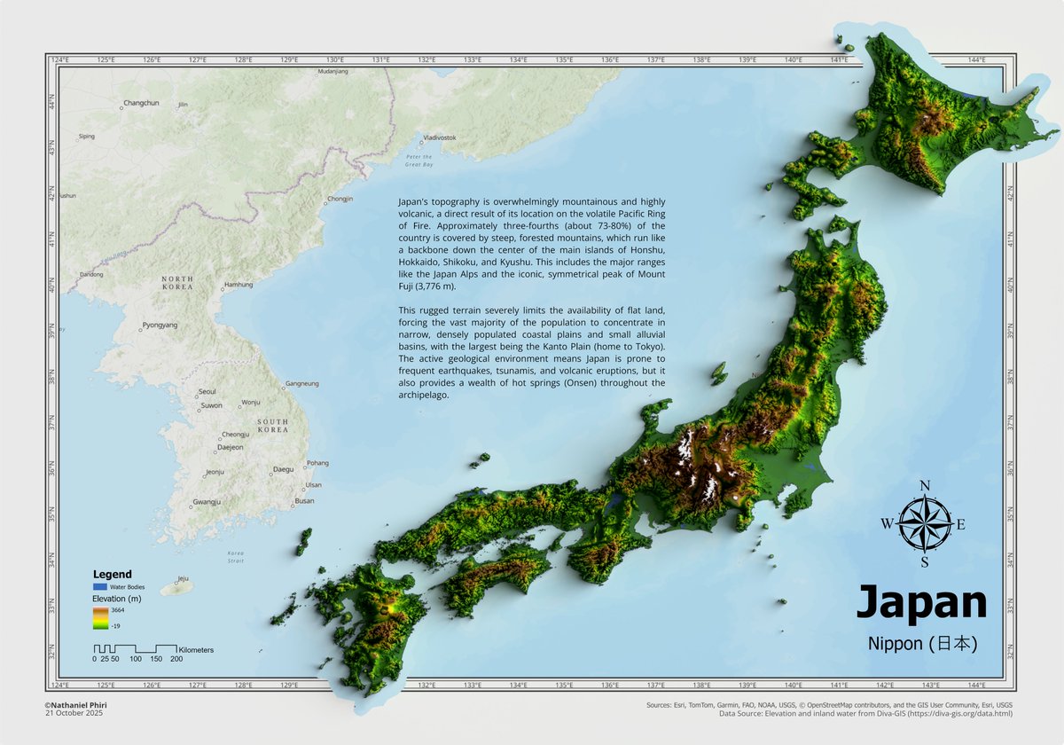
Been a while, but here is a 3D elevation map of Japan, made using @ArcGISPro and @Blender with datasets sourced from Diva-GIS diva-gis.org/data.html. Special shoutout to John Nelson for the tutorial on "Smashing Neatlines" youtu.be/KbXO0viT0gk?si… for the spillover map style.


United States الاتجاهات
- 1. Black Friday 403K posts
- 2. Egg Bowl 5,588 posts
- 3. Mississippi State 3,171 posts
- 4. Emmett Johnson N/A
- 5. Kamario Taylor N/A
- 6. Sumrall 1,519 posts
- 7. Scott Stricklin N/A
- 8. #SkylineSweeps N/A
- 9. NextNRG Inc 1,799 posts
- 10. Chambliss 1,298 posts
- 11. Wetjen N/A
- 12. #Huskers N/A
- 13. #HMxCODSweepstakes N/A
- 14. #Rashmer 24.5K posts
- 15. Carson Soucy N/A
- 16. Solo Ball N/A
- 17. Black Ops 7 XP 2,605 posts
- 18. Porsha N/A
- 19. #FanCashDropPromotion 1,832 posts
- 20. Fisch 1,190 posts
Something went wrong.
Something went wrong.