#butlerfire Suchergebnisse

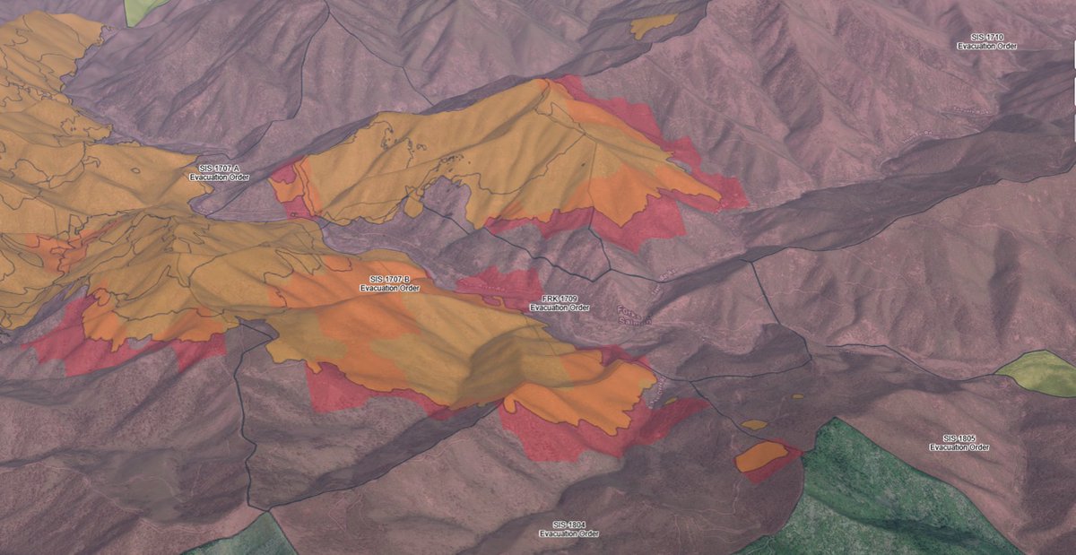
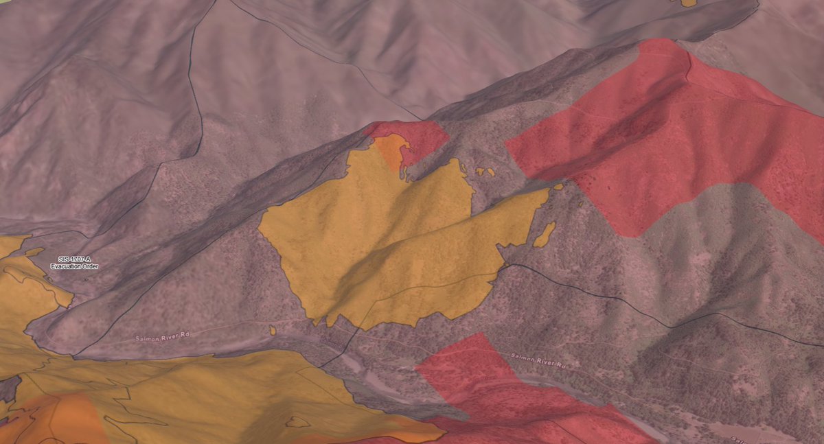
UPDATE (#ButlerFire): the fire is 8,156 acres. Evacuations remain the same. Here is a refresher on the evacuation zones: Evacuation Order - Level 3 - Go (MANDATORY) SIS-1703 SIS-1704 SIS-1707-A SIS-1803-A Evacuation Warning - Level 2 - Set (VOLUNTARY) FRK-1709 SIS-1705


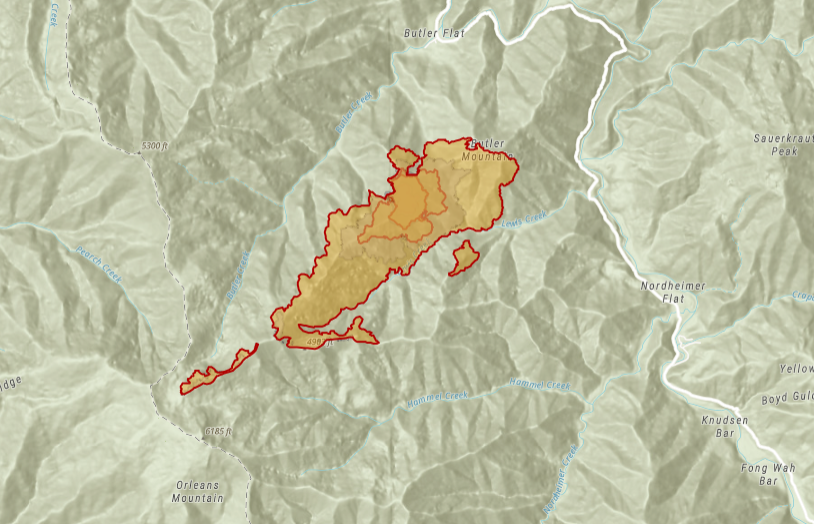
#OrleansComplex: Fire crews successfully carried out low-intensity firing operations on the #ButlerFire to protect Butler Flat and Salmon River Road, with monitoring and potential operations in nearby drainages planned. krcrtv.com/weather/wildfi…
krcrtv.com
Orleans Complex remains active amid weekend heat wave
The Red Fire, burning about 1.5 miles north of Nickowitz Peak near Blue Creek, remains uncontained after burning over a hundred acres, according to the...

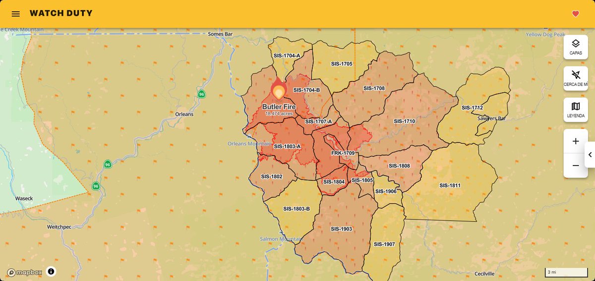
New #ButlerFire mapping shows the fire at 14,676.6 acres per a CAL FIRE flight. The fire has not crossed Sawyers Bar Rd on the east side of the Salmon River as of now. The west side has spotted across McNeal Creek in 4 spots, seen on the bottom right of the map. #cafire
Our 7/13 intel summary for the #GreenFire, #ButlerFire, and #SummitFire is live on YouTube. We also talk about the Forest Service's use/misuse of language around the term 'Full Suppression', and their unwillingness to message AT ALL about 'Resource Benefits' from fires.

youtube.com
YouTube
Northern California Fire Report - 7/13/2025
Shasta County: #GreenFire 19,022 acres 99% contained Siskiyou County: #ButlerFire 21,058 acres 96% contained #BigCliffFire 962.5 acres 41% contained Ventura County: #CanyonFire 5,370 acres 97% contained Yuba County: #PonderosaFire 87.2 acres 67% contained
Tonight's Lookout Livestream will catch you up on today's major growth on the #GreenFire, NE of Redding, the steep and wild #ButlerFire, near Somes Bar, and the not-much growth on the #SummitFire, near Etna. the-lookout.org/2025/07/11/gre…


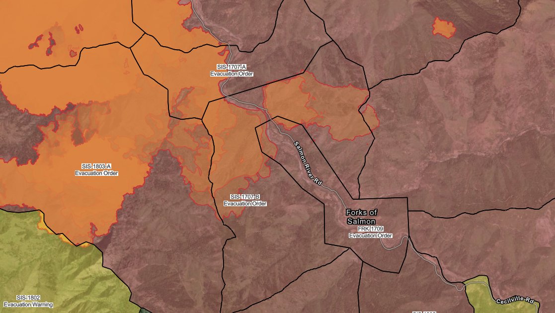
Butler Fire Surges Across Salmon River, Threatens Forks of Salmon #ButlerFire, #OrleansComplex kymkemp.com/2025/07/18/but…
kymkemp.com
Butler Fire Surges Across Salmon River, Threatens Forks of Salmon
A 700-acre spot fire crossed the Salmon River Thursday, pushing toward Forks of Salmon and triggering a surge in firefighting efforts as the #ButlerFire in the #OrleansComplex grew to 11,759 acres.
Here is our 7/8/2025 intel summary for the current situation on the #GreenFire, #ButlerFire, #SummitFire, and new emerging fires in Southern Oregon. the-lookout.org/2025/07/08/nor…
the-lookout.org
NorCal and SW Oregon Wildfire Report - 7/8/2025 - The Lookout
Zeke Lunder provided a detailed update on the Green Fire, Butler Fire, and Summit Fire in Northern California and southwestern Oregon. The Green Fire, between Redding and Burney, showed significant...
As fire activity picks up later today, look for smoke to be pushed east-northeast off of the #GreenFire and #ButlerFire. This will likely lead to poor air quality in places like Burney, Fall River Mills, & Alturas tonight. Read more on what's ahead >>> krcrtv.com/weather

Siskiyou County: #SummitFire 700 acres 90% contained #ButlerFire 18,855 acres 10% contained

More downgrades to Evacuation Orders for the #ButlerFire have been issued this afternoon. More details can be found on KDRV.com
The #ButlerFire, burning 10 miles east of Orleans near Butler Mountain, has grown to 15,663 acres with 2% containment, triggering new evacuation orders from the Siskiyou County Sheriff's Office. krcrtv.com/weather/wildfi…
krcrtv.com
Containment challenges continue as Butler Fire rages on
SISKIYOU COUNTY, Calif. — The U.S. Forest Service reported Monday that the Butler Fire reached the outer edges of the Butler Flats and Nordheimer communities on

⚡️🔥So the #ButlerFire in Siskiyou County was caused by a thunderstorm, yet a thunderstorm yesterday helped put most of the fire out. You can't make this stuff up 😂

#Butlerfire 14,226 acres 2 % containment Siskiyou county #cafire #wildfire
#Butlerfire Siskiyou County Sheriffs Office has issued an EVACUATION ORDER for Zones SIS - 1703 near Butler Mountain. Anyone in this area is ordered to leave now. They have also issued an EVACUATION WARNING for Zones SIS-1704 and SIS-1803-A. Anyone in these areas should be
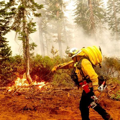
Today, as the #ButlerFire spreads freely across the mountain above his neighborhood, Will Harling and friends will be conducting a prescribed burn to protect their homes. Check out the backstory, here, in one of the more important videos we have made this year:


#butlerfire has now been mapped at 18,430.5 acres by Intel aircraft. #Cafire #wildfire Humboldt & Siskiyou Counties

To the north, the 7000 acre #ButlerFire is burning east of Eureka, and the 11,000 acre #GreenFire is burning less than 20 miles north of Redding. (4/x)
Shasta County: #GreenFire 19,022 acres 99% contained Siskiyou County: #ButlerFire 21,058 acres 96% contained #BigCliffFire 962.5 acres 41% contained Ventura County: #CanyonFire 5,370 acres 97% contained Yuba County: #PonderosaFire 87.2 acres 67% contained
Crews Hold the Line as Big Cliff Fire Slowly Advances Near Orleans kymkemp.com/2025/08/06/cre… #OrleansComplex #BigCliffFire #ButlerFire #SixRiversNF #KlamathNF #WildfireUpdate #PacificCrestTrail #HumboldtCounty #SiskiyouCounty

Crews Gain Ground on Big Cliff Fire as Heat Returns to Orleans Complex kymkemp.com/2025/08/05/cre… #BigCliffFire #ButlerFire #OrleansComplex #SixRiversNF #KlamathNF #WildfireUpdate

Big Cliff Fire Grows to 530 Acres Near Idlewild; Butler Fire Holds Steady at 93% Containment kymkemp.com/2025/08/04/big… #BigCliffFire #ButlerFire #OrleansComplex #SixRiversNF #KlamathNF #WildfireUpdate

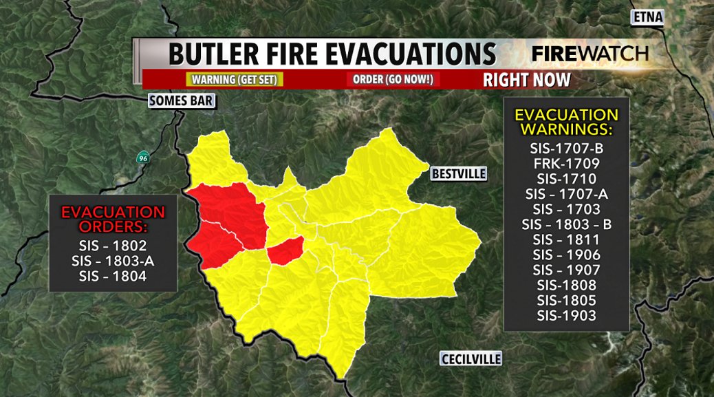
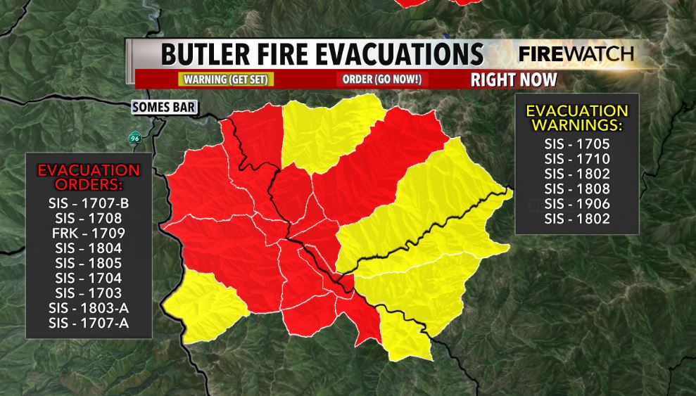
UPDATE (#ButlerFire): the fire is holding at 21,057 with 89% containment. Mostly evacuation warnings (Yellow) in place. They are the following: FRK-1709 SIS-1707-A SIS-1707-B SIS-1802 SIS-1803-A SIS-1804 SIS-1805 SIS-1906 They are shown in the Genasys Project map below (This

#OrleansComplexFires #OrleansComplex #ButlerFire: Size: 21,058 Percent Contained: 76% #BigCliffFire: Size: 247 Percent Contained: 0% #RedFire: Size: 116 Percent Contained: 100% 📸 U.S. Forest Service - Klamath National Forest / Big Cliff Fire
UPDATE (#ButlerFire): the fire is 21,057 acres with 83% containment. Evacuation warnings and orders have been reduced. Here are the updated zones: Evacuation Order - Level 3 - Go (MANDATORY) [RED] SIS-1802 SIS-1803-A SIS-1804 Evacuation Warning - Level 2 - Set (VOLUNTARY)
![InfernoWatch24's tweet image. UPDATE (#ButlerFire): the fire is 21,057 acres with 83% containment. Evacuation warnings and orders have been reduced. Here are the updated zones:
Evacuation Order - Level 3 - Go (MANDATORY) [RED]
SIS-1802
SIS-1803-A
SIS-1804
Evacuation Warning - Level 2 - Set (VOLUNTARY)](https://pbs.twimg.com/media/GxN1-48bEAAS0IU.jpg)
Crews Hold Butler Fire in Steep Terrain as Lightning Sparks New Blazes on Klamath kymkemp.com/2025/07/31/cre… #ButlerFire #SixRiversNF #KlamathFires #LightningFires #RedFlagWarning #WildfireUpdate #HumboldtCounty #SiskiyouCounty
kymkemp.com
Crews Hold Butler Fire in Steep Terrain as Lightning Sparks New Blazes on Klamath
Firefighters continued suppression efforts on the Butler Fire Wednesday while lightning ignited new fires across the Klamath National Forest, including the Big Cliff Fire near Idlewild Campground.
More downgrades to Evacuation Orders for the #ButlerFire have been issued this afternoon. More details can be found on KDRV.com
Firefighters on the Butler Fire face steep terrain, dry fuels, and lightning threats today as suppression and repair efforts continue near the 2020 Red Salmon Fire scar. kymkemp.com/2025/07/30/cre… #OrleansComplex #ButlerFire #USFS


We've seen some downgrades to Evacuation Orders and some Evacuation Warnings lifted on the #ButlerFire. More details can be found on KDRV.com

REVISION (#ButlerFire): the acreage and the containment updated after I published the above update. The acreage is 20,940 and the containment value is 34%.
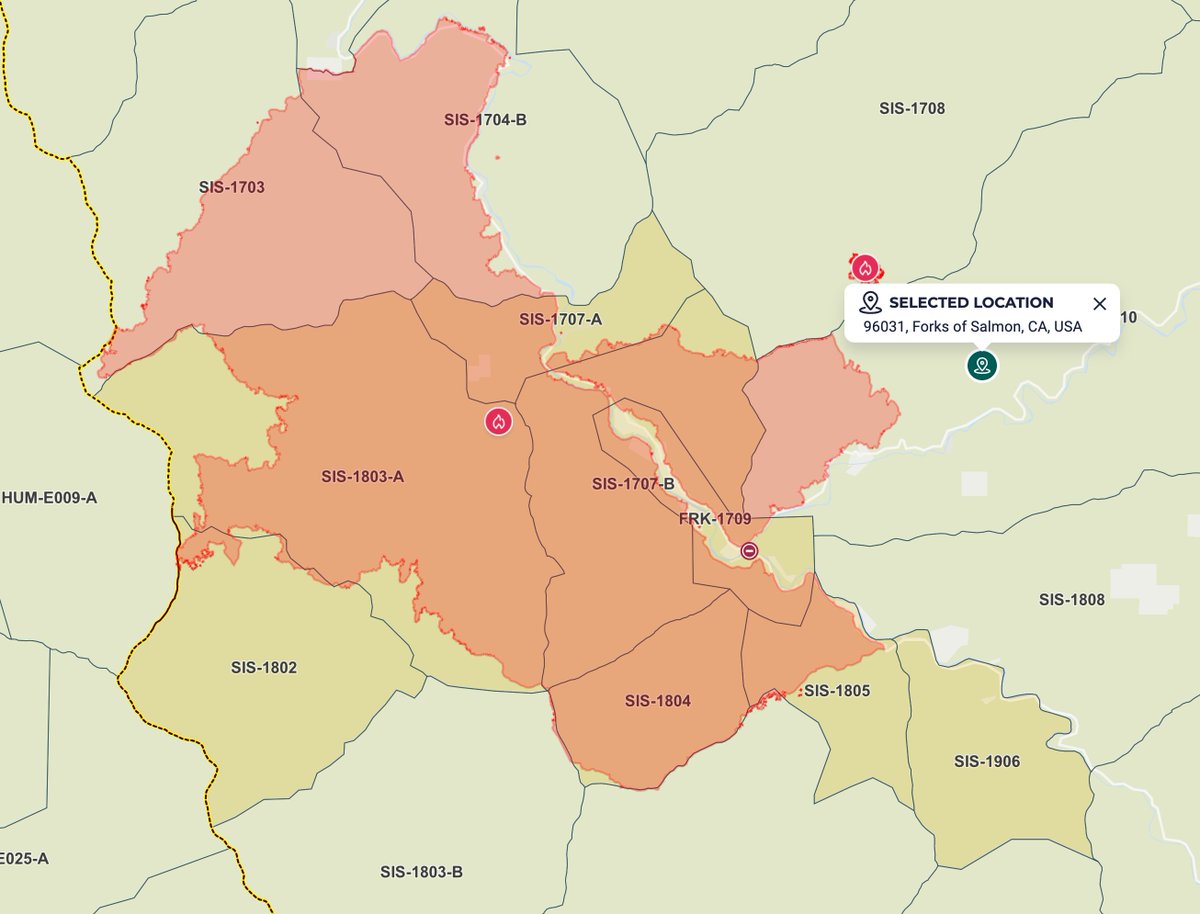
UPDATE (#ButlerFire): the Butler Fire now stands at 20,362 acres with 22% containment. Evacuations have expanded and below are the current plus the new evacuation zones with the Gensys Project evacuation map: Evacuation Order - Level 3 - Go [MANDATORY - RED] FRK-1709
![InfernoWatch24's tweet image. UPDATE (#ButlerFire): the Butler Fire now stands at 20,362 acres with 22% containment. Evacuations have expanded and below are the current plus the new evacuation zones with the Gensys Project evacuation map:
Evacuation Order - Level 3 - Go [MANDATORY - RED]
FRK-1709](https://pbs.twimg.com/media/Gw6UT-DaQAAVFed.jpg)

🔥 USFS Fire Chief Tom Schultz is shifting gears in 2025 🔥 The new US Forest Service chief is all-in on aggressive initial attack—putting fires out FAST before they explode. Below from CDF BC (ret) #Butlerfire

⚡️🔥So the #ButlerFire in Siskiyou County was caused by a thunderstorm, yet a thunderstorm yesterday helped put most of the fire out. You can't make this stuff up 😂
Siskiyou County: #SummitFire 700 acres 90% contained #ButlerFire 18,855 acres 10% contained


#butlerfire has now been mapped at 18,430.5 acres by Intel aircraft. #Cafire #wildfire Humboldt & Siskiyou Counties
Spot fires, rollouts, and rugged terrain challenged crews overnight on the Butler Fire, part of the Orleans Complex, now at 17,116 acres with 6% containment. kymkemp.com/2025/07/21/but… #ButlerFire #SiskiyouCounty #FireEvacuations


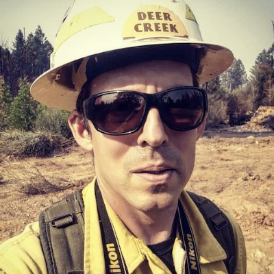
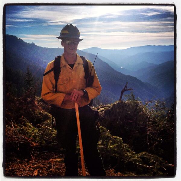
Back home @LandBtwnLakes after a long 20 day #wildfire detail to #california #butlerfire @CalFireNews @R5_Fire_News
UPDATE (#ButlerFire): the fire is 8,156 acres. Evacuations remain the same. Here is a refresher on the evacuation zones: Evacuation Order - Level 3 - Go (MANDATORY) SIS-1703 SIS-1704 SIS-1707-A SIS-1803-A Evacuation Warning - Level 2 - Set (VOLUNTARY) FRK-1709 SIS-1705
New #ButlerFire mapping shows the fire at 14,676.6 acres per a CAL FIRE flight. The fire has not crossed Sawyers Bar Rd on the east side of the Salmon River as of now. The west side has spotted across McNeal Creek in 4 spots, seen on the bottom right of the map. #cafire

GID - #ButlerFire Update: Fire est. 150-200 acres, crews almost completed burn out on west side of fire and working on east side. Additional resources ordered to help hold for predicted winds today.

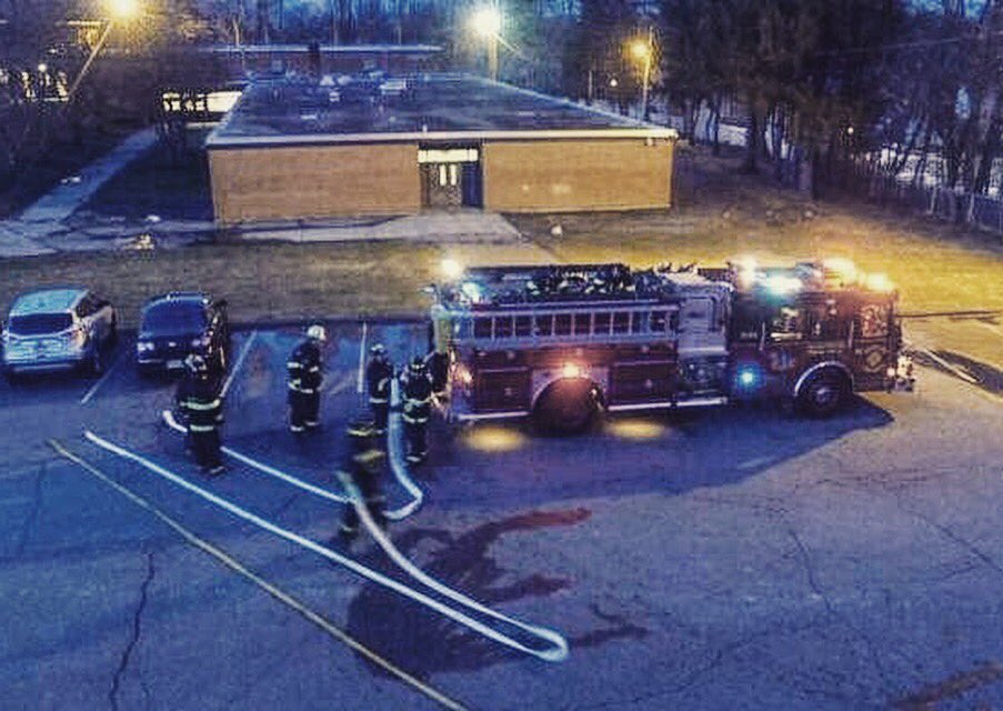
Found this cool photo, not mine Thanks @minecraft_gamer_5 ! #butlerfire #flagdetail #njfiretrucks #brotherhood #e...

Thanks @bsneill ! #butlerfire #njfiretrucks #brotherhood #engine #tower #tanker #ladder #rescue #squad #pumper #f...

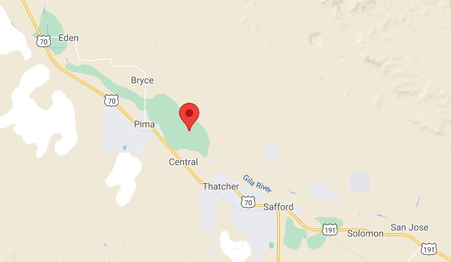
GID - New start, #ButlerFire: Approx. 2 miles northeast of Central, resources responding, estimated at 150-200 acres.

Yesterday; the #ButlerFire spotted over the Salmon River, growing to about 300 acres during the day. Later that night, the fire jumped a contingency line completed the day before. The spot fire now sits at around 700 acres and growing. #cafire
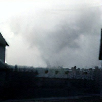
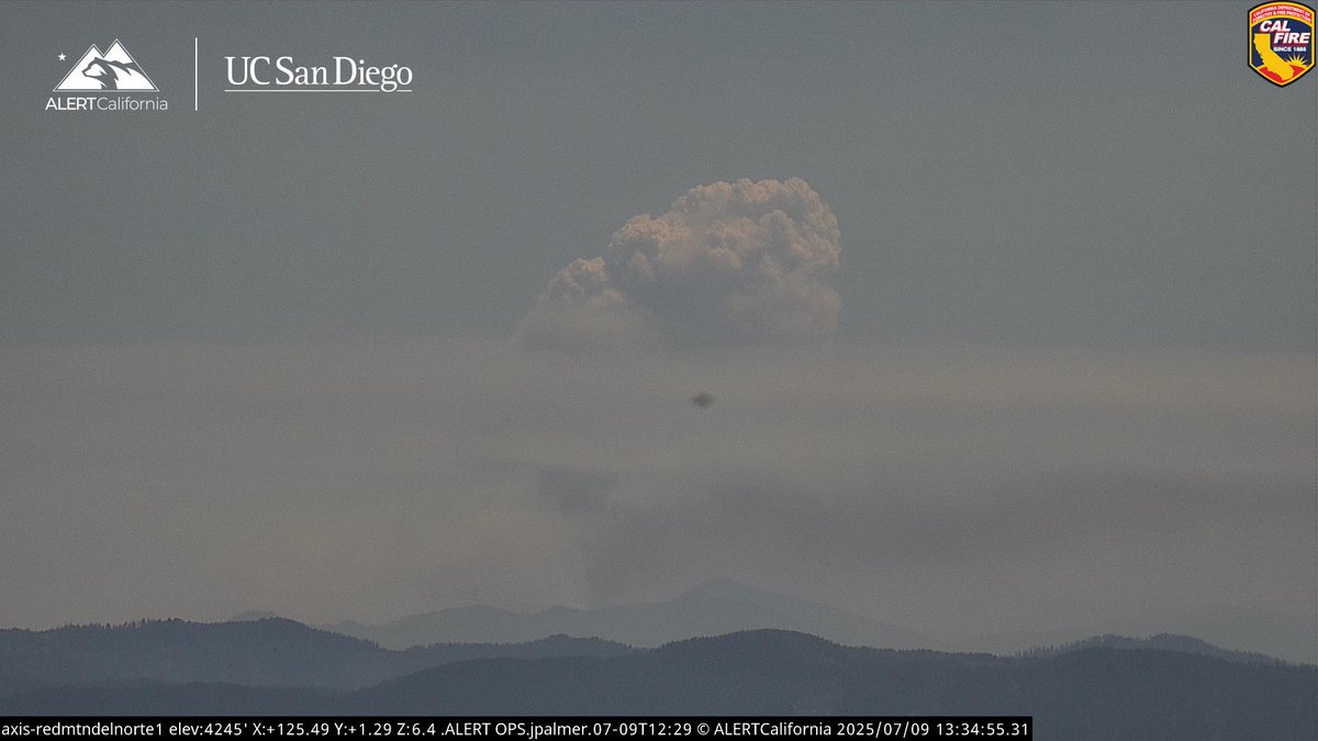
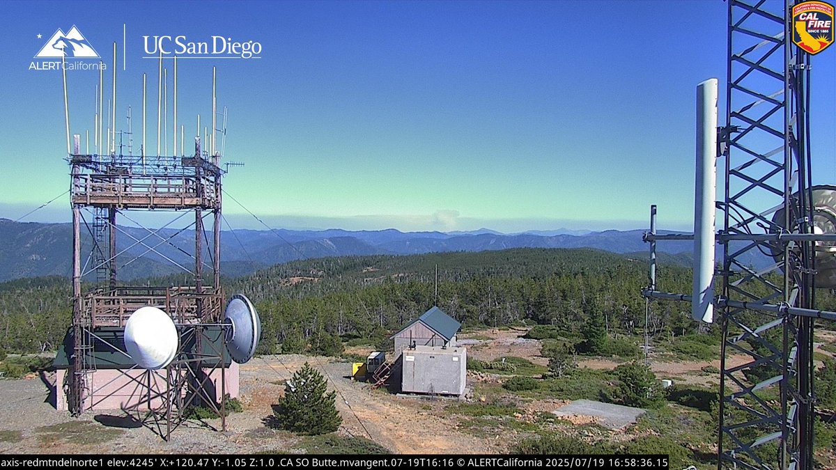
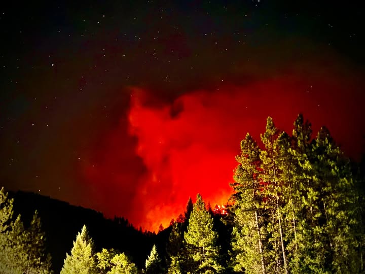
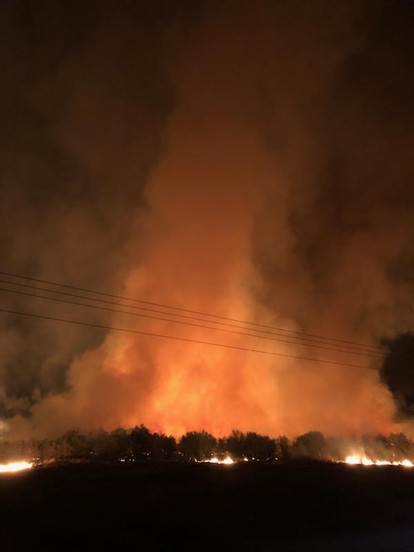
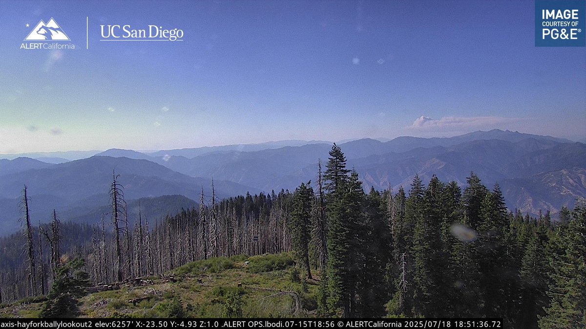
You can see the #ButlerFire on the Hayfork Bally Lookout 2 camera. Its visible on the right side of the image. The fire has a defining pyrocu white top, which is a bad sign. Not much more info right now. #cafire
New #ButlerFire mapping shows the spot fire and the main fire burning SE towards the general area of Forks of Salmon and Sawyers Bar Rd. The fire on the East side of the Salmon river is actively spotting. The fire is now 12,273.9 acres. Structure protection is in place. #cafire
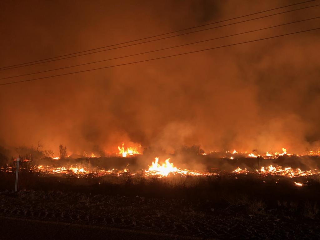
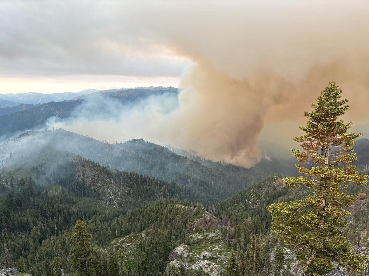
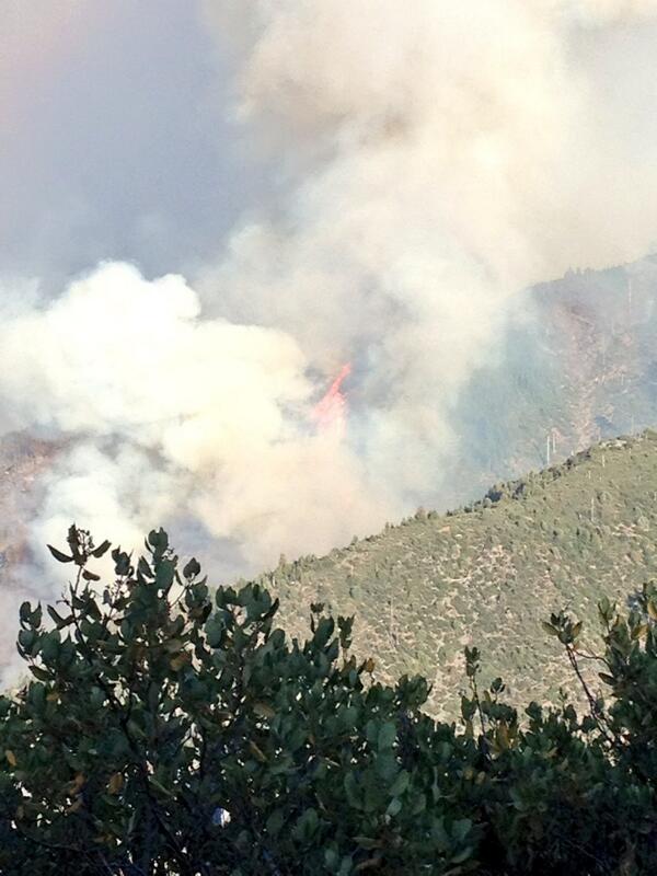
Short strip crown run with 50 foot flame lengths from afar on the #butlerfire @CalFireNews @R5_Fire_News #CaFire
More downgrades to Evacuation Orders for the #ButlerFire have been issued this afternoon. More details can be found on KDRV.com
Thanks @wmeier2337 ! #butlerfire #federalq #njfiretrucks #brotherhood #engine #tower #tanker #ladder #rescue #squ...


GID - #ButlerFire Update: Fire approx, 2 miles northeast of Central mapped today at 272 acres. Perimeter map now available on Inciweb at inciweb.nwcg.gov/incident/7496/.
An EVACUATION ORDER has been issued for the community of Forks of Salmon in Siskiyou County due to the #ButlerFire. The fire has crossed the river. People need to evacuate with the evacuation route through Cecilville. kdrv.com/news/top-stori…
New #ButlerFire mapping shows the spot fire and the main fire burning SE towards the general area of Forks of Salmon and Sawyers Bar Rd. The fire on the East side of the Salmon river is actively spotting. The fire is now 12,273.9 acres. Structure protection is in place. #cafire
Yesterday; the #ButlerFire spotted over the Salmon River, growing to about 300 acres during the day. Later that night, the fire jumped a contingency line completed the day before. The spot fire now sits at around 700 acres and growing. #cafire
🔥 USFS Fire Chief Tom Schultz is shifting gears in 2025 🔥 The new US Forest Service chief is all-in on aggressive initial attack—putting fires out FAST before they explode. Below from CDF BC (ret) #Butlerfire

Something went wrong.
Something went wrong.
United States Trends
- 1. UConn N/A
- 2. Wrexham N/A
- 3. Marquette N/A
- 4. Dan Hurley N/A
- 5. Carville N/A
- 6. Tosin N/A
- 7. Mizzou N/A
- 8. Jordan Davis N/A
- 9. Ozzie Albies N/A
- 10. #AMPERSANDONETOUR N/A
- 11. #mubb N/A
- 12. Missouri N/A
- 13. Mark Mitchell N/A
- 14. Win Again N/A
- 15. Ewin N/A
- 16. Jeter Downs N/A
- 17. Nicaragua N/A
- 18. Delap N/A
- 19. #ด้วงกับเธอEP6 N/A
- 20. Brazile N/A