#firstalertwx search results

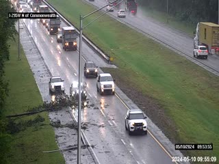
USE CAUTION: Branches on road in Duval County on I-295 W South, between Pritchard and Commonwealth. Right lane blocked @MikeFirstAlert @CSimmaWX #FirstAlertWx
USE CAUTION: Crash with injuries -- A truck is on its side on the Dames Point Bridge on NB I-295, blocking two lanes @CSimmaWX @MikeFirstAlert #FirstAlertWx


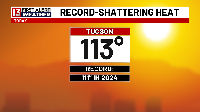
It's official! You've made it through record-setting heat in Tucson today. Extreme Heat Warning in place until 8:00 PM. It's a @KOLDNews #FirstAlertWX Day. Use extreme caution.


Flooded streets can be found throughout Yuma. Alex was just live to give you a look. azfamily.tv/3Oi5QvB #AZFamily #AZNews #FirstAlertWX #FirstAlertWeather #FirstAlert
April has your updated weather forecast for the weekend. azfamily.tv/4cCOzHU @aprilwarnecke #AZFamily #AZNews #FirstAlertWX #FirstAlertWeather

Pipes can freeze in temperatures as low as 20 degrees. Royal gives you some tips to help prevent issues. Submit your own weather questions: azfamily.tv/3Hq0aMp @RoyalNorman #FirstAlertWX #AZFamily #AZNews #FirstAlertWeatherFacts #FirstAlertWeather

Power outage risk is higher in the afternoon/evening on Tuesday. With saturated ground and wind gusts 30-50mph, trees will come down. #FirstAlertWx


FIRST ALERT | Severe Thunderstorm Warning in effect for Putnam, Marion until 3/15 7:15PM. #FirstAlertWX

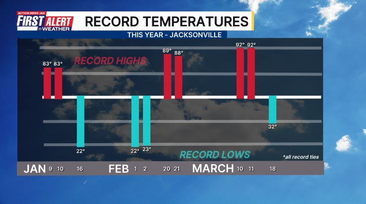
#firstalertwx "If you don't like the weather, just wait a minute" - 10 record temps. in just the first 3 month for Jacksonville, Florida @ActionNewsJax @WOKVNews


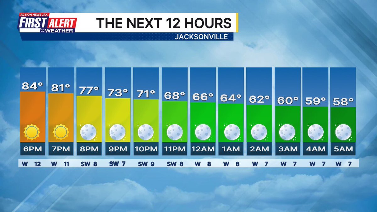
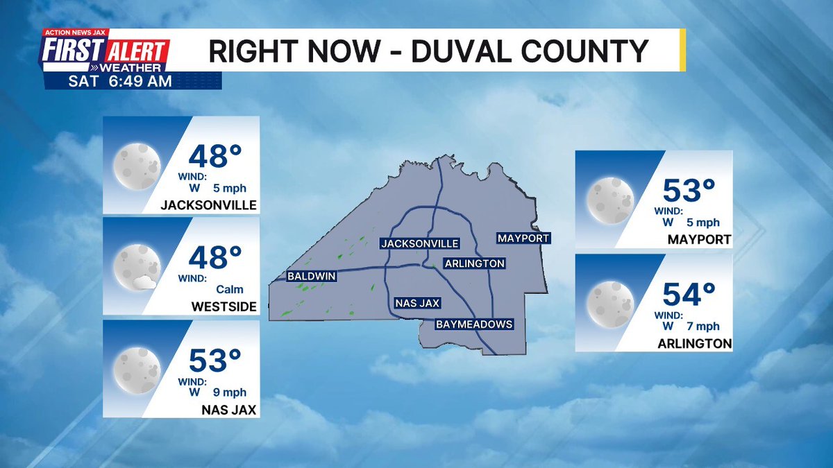
Morning! Here is how the next 12 hours in Jacksonville will shape up. #FirstAlertWX wjaxweatherapp.com


5:45am EST RADAR Check. Some of the light showers in a few of our areas well ahead of the main line of showers/storms that's coming our way in a few hours. #STORMScoming #COLDcoming #FirstAlertWX


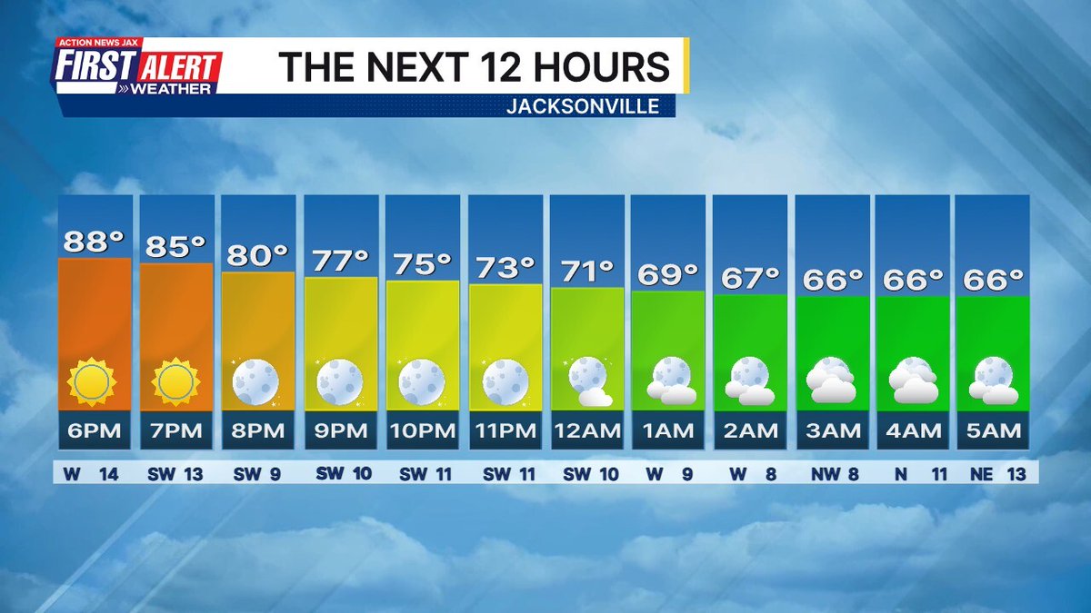


Morning! Here is how the next 12 hours in Jacksonville will shape up. #FirstAlertWX wjaxweatherapp.com
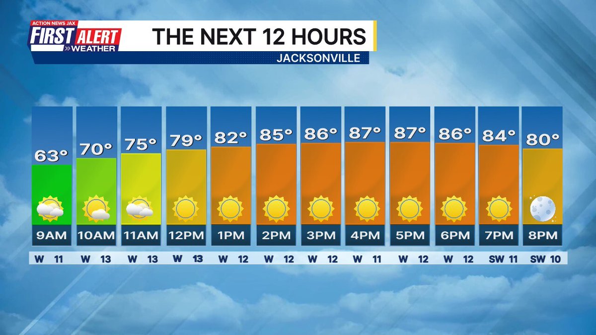
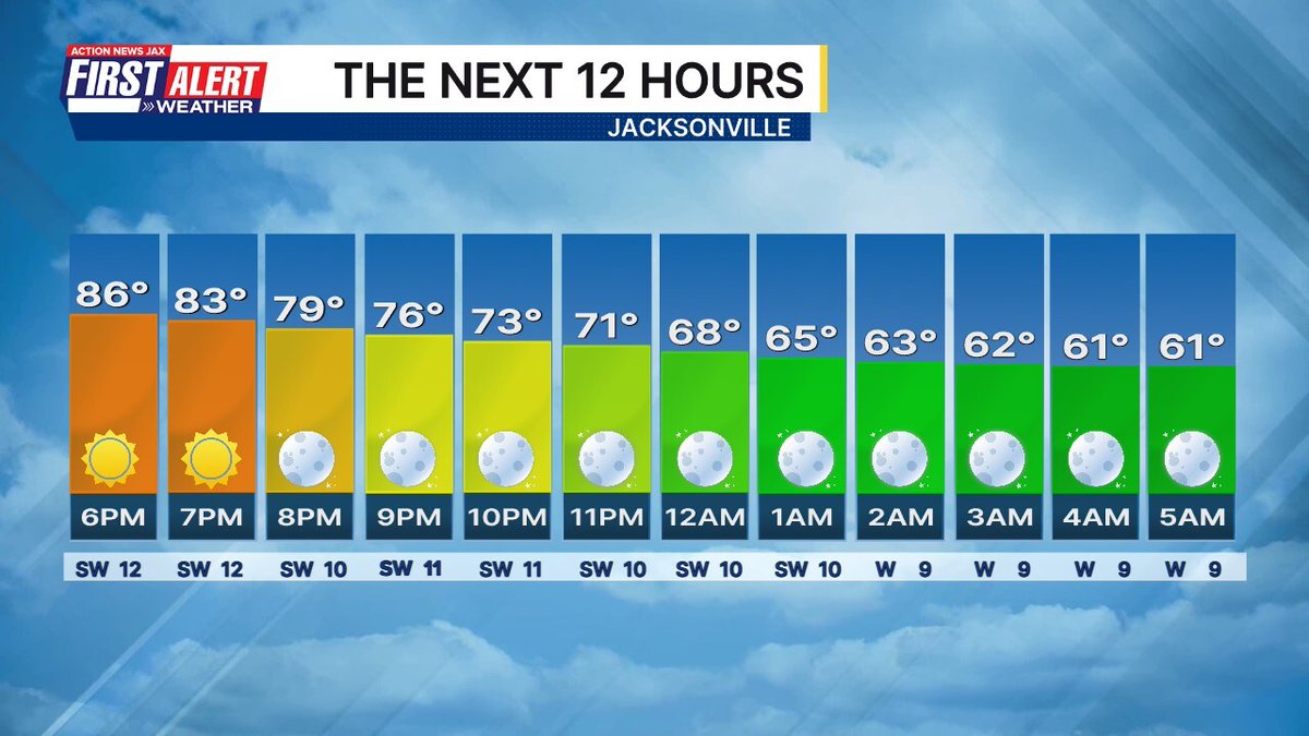


Morning! Here is how the next 12 hours in Jacksonville will shape up. #FirstAlertWX wjaxweatherapp.com


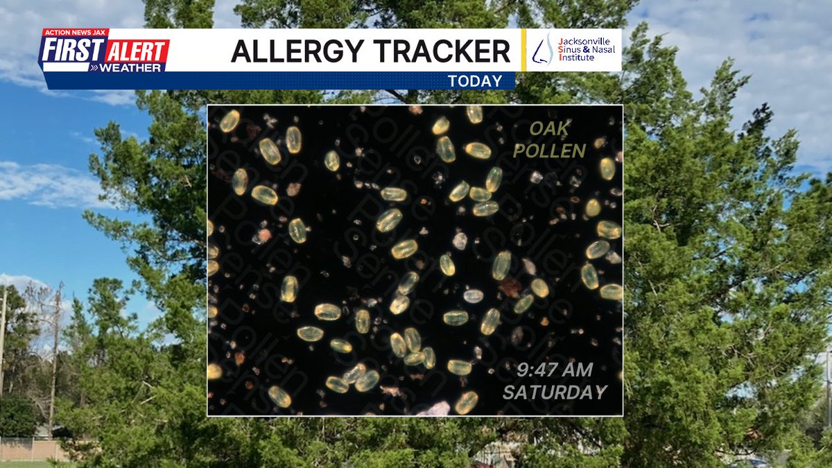
The oak pollen hit a new high for the year (so far) on Saturday - 15k particles. We had an appointment this morning and even just being outside for a grand total of 2-3 minutes in-and-out of the car had me FEELING it #FirstAlertWX @PollenSense

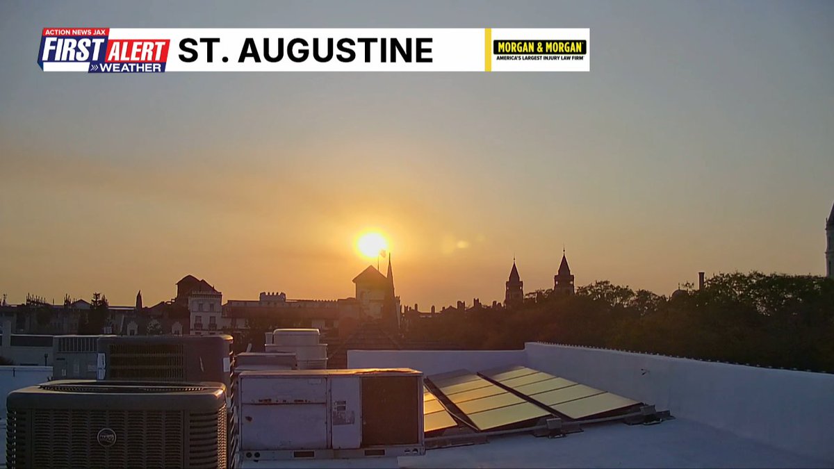
It's a hazy sunset Saturday evening thanks to nearby wildfires...the Bondarenko Ct. fire in Clay County near the Belmore State Forest is more than 300 acres and that's likely the smoke we see over St. Aug even though the fire is 30+ miles away #FirstAlertWX @ActionNewsJax


USE CAUTION: Branches on road in Duval County on I-295 W South, between Pritchard and Commonwealth. Right lane blocked @MikeFirstAlert @CSimmaWX #FirstAlertWx


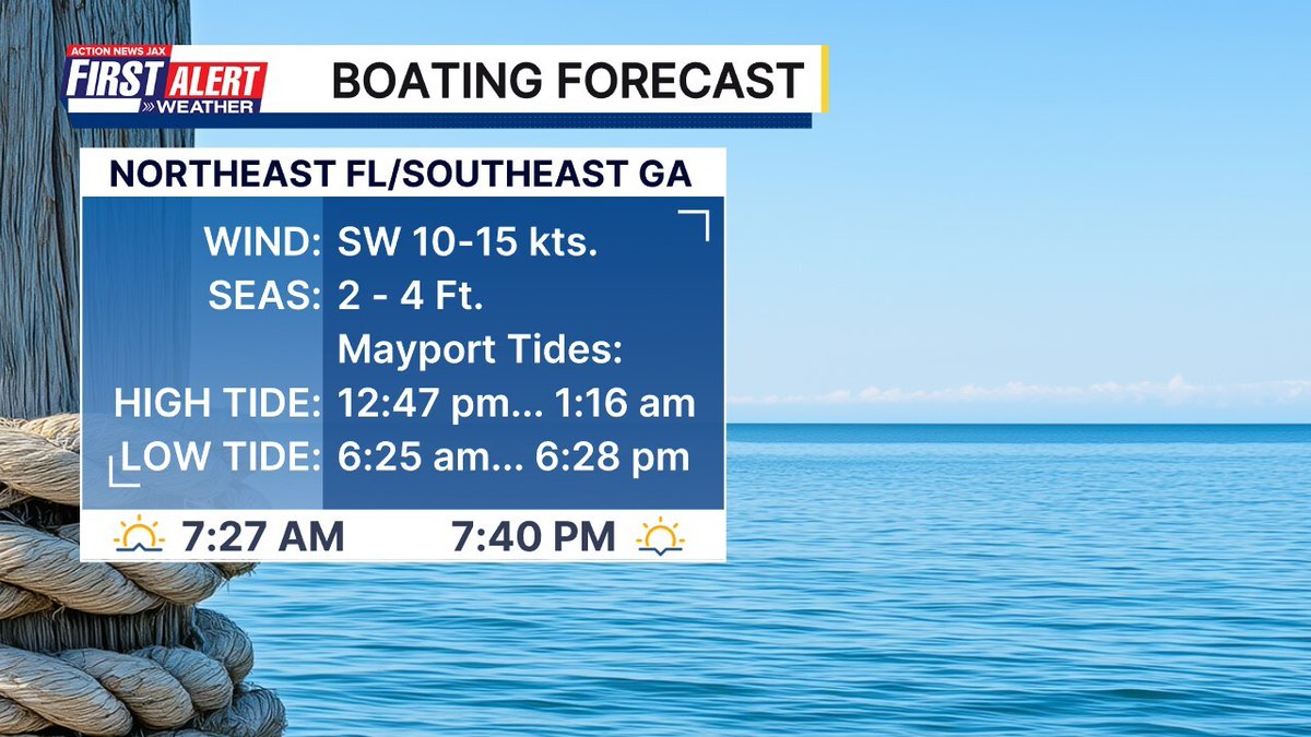
Talking the tropics at the Riverwood Men’s Club in Del Webb Nocatee. Thanks for having me! @ActionNewsJax @MikeFirstAlert #firstalertwx

USE CAUTION: Crash with injuries -- A truck is on its side on the Dames Point Bridge on NB I-295, blocking two lanes @CSimmaWX @MikeFirstAlert #FirstAlertWx

Got the #firstalertwx from @ActionNewsJax weather app. Made it to truck just in time! App is free. Timing is priceless. @MikeFirstAlert #shamelessplug #truethough

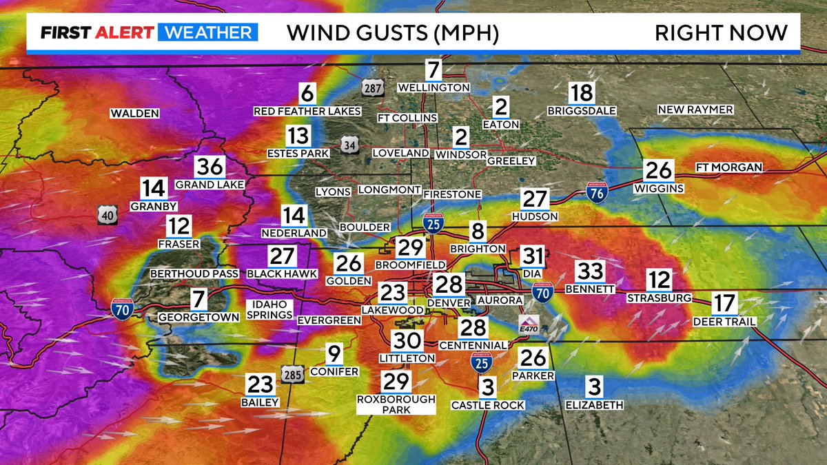
Here comes FIRE AND ICE now through early next week! Sunday Fire Danger is high for Denver metro area and I-25 corridor. In the mountains, Monday and Tuesday we may see 1 to 2 feet of snow! #cowx #FirstAlertWX @CBSNewsColorado @AlexLCBS4 @LaurenCBS4 @CallieZTV @AshtonCBS4


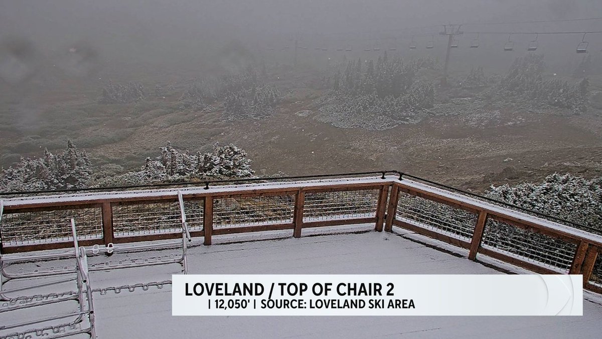
First Alert: Snow on some of our Colorado peaks! Loveland and A-basin with a dusting! #cowx #4wx #FirstAlertwx #FirstAlert @LaurenCBS4 @AshtonCBS4 @CallieZTV @CBSNEWSCOLORADO
#firstalertwx "Buresh Blog": bit.ly/4brPgEh - Early start to 90 degree days for Jacksonville... Despite recent rainfall, drought continues... Spring arrives Friday @ActionNewsJax @WOKVNews

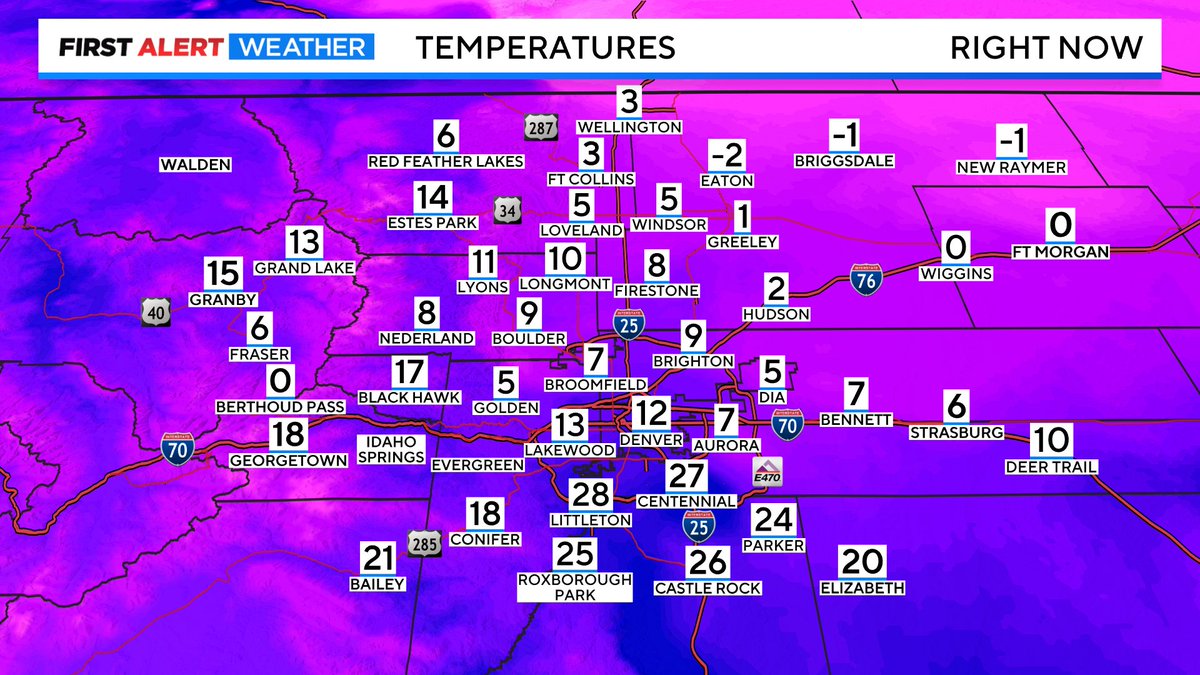
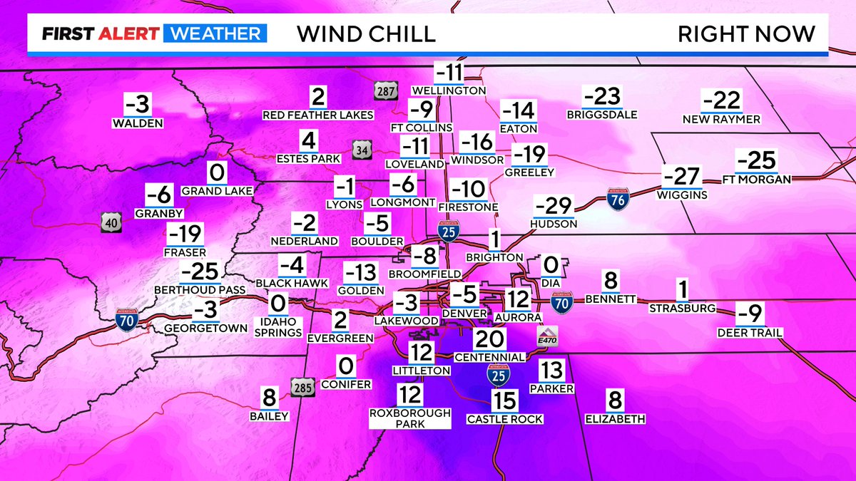
Arctic surge is blasting through the Denver Metro Area! DIA temperature dropped from 30° at 7:05pm to 5° at 9:05pm and is dropping like a rock! Wind Chill temps already below zero and counting! Bring the pets in. #cowx #FirstAlertWX @CBSNewsColorado
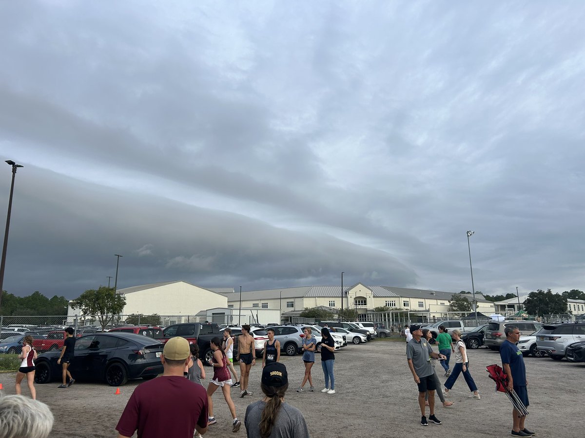
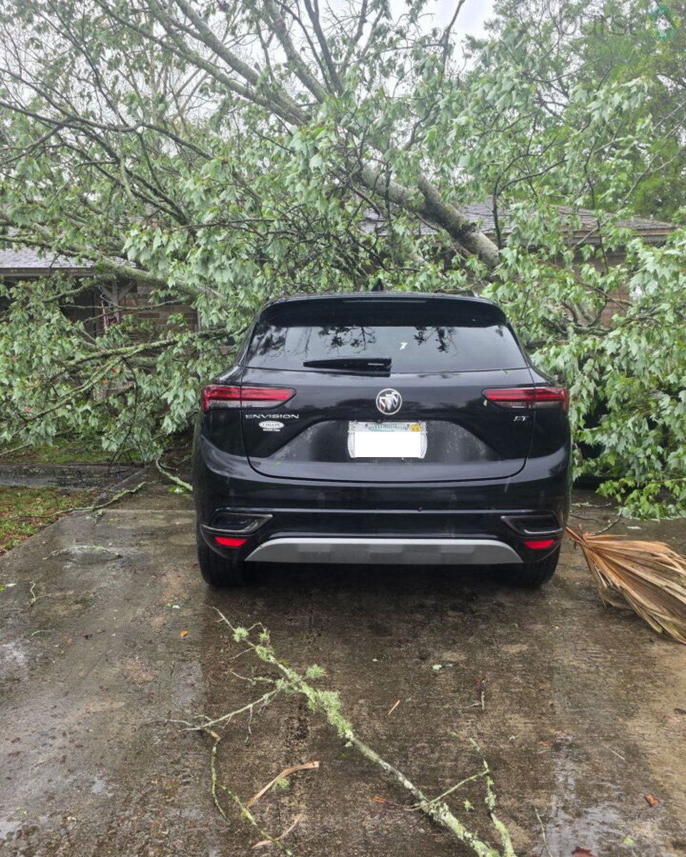
#firstalertwx tree on a car in Orange Park from this (Mon. 03/16) afternoon’s storms @ActionNewsJax @WOKVNews @NWSJacksonville


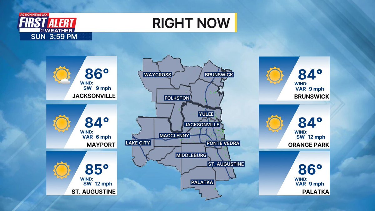
Jax hit 80° today, and pine pollen soared. Measured right on our rooftop @ActionNewsJax #flwx #firstalertwx


Wet & icy roads this morning at I-25 & 58th. @justinadamsTV & I in @CBSNewsColorado #FirstAlertWX Tracker all morning. #cowx #4wx


70s... we'll take it! We've reached 73 degrees so far in #Phoenix today. Happy Saturday! More weather ➡️ azfamily.com/weather/ @azfamily #azwx #firstalertwx


It's official! You've made it through record-setting heat in Tucson today. Extreme Heat Warning in place until 8:00 PM. It's a @KOLDNews #FirstAlertWX Day. Use extreme caution.
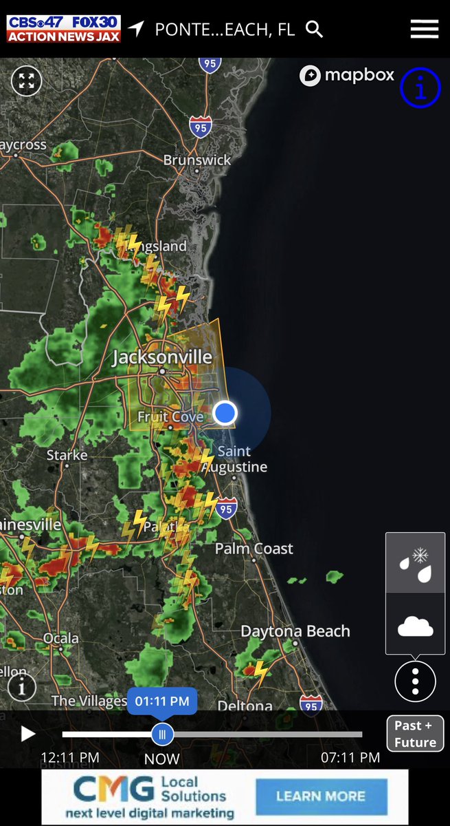
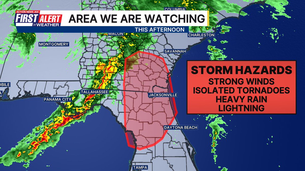
Likely to see a #tornado watch across our entire viewing area soon. Forecast remains unchanged. Expect a period of heavy rain, lightning, wind, and a severe storm or two this afternoon/evening. @ActionNewsJax #firstalertwx #flwx #gawx
Something went wrong.
Something went wrong.
United States Trends
- 1. Azzi N/A
- 2. Elvis N/A
- 3. UConn N/A
- 4. Syracuse N/A
- 5. Graceland N/A
- 6. #ENHYPEN_ALWAYS_7 N/A
- 7. Election Day N/A
- 8. Star Trek N/A
- 9. Solange N/A
- 10. Hannah Hidalgo N/A
- 11. Jared McCain N/A
- 12. #HEESEUNG_Belongs_With_ENHYPEN N/A
- 13. Tommie N/A
- 14. The ACA N/A
- 15. Moana N/A
- 16. Obamacare N/A
- 17. Elmo N/A
- 18. #BOYCOTT_HYBE_and_BELIFT N/A
- 19. #JeopardyBlindGuess N/A
- 20. Homeward Bound N/A