#gisandmapping 搜尋結果

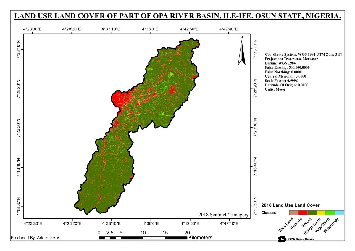
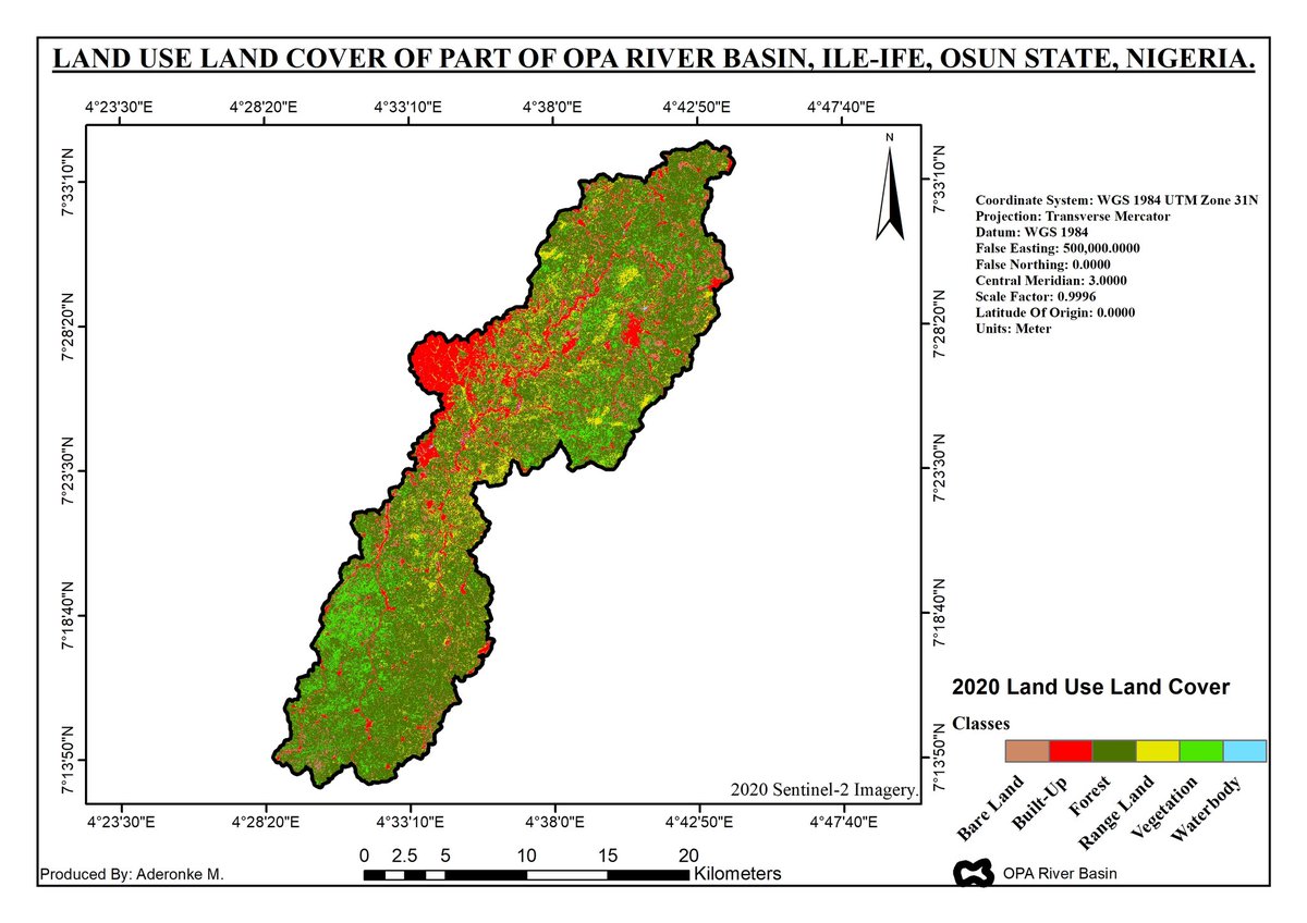
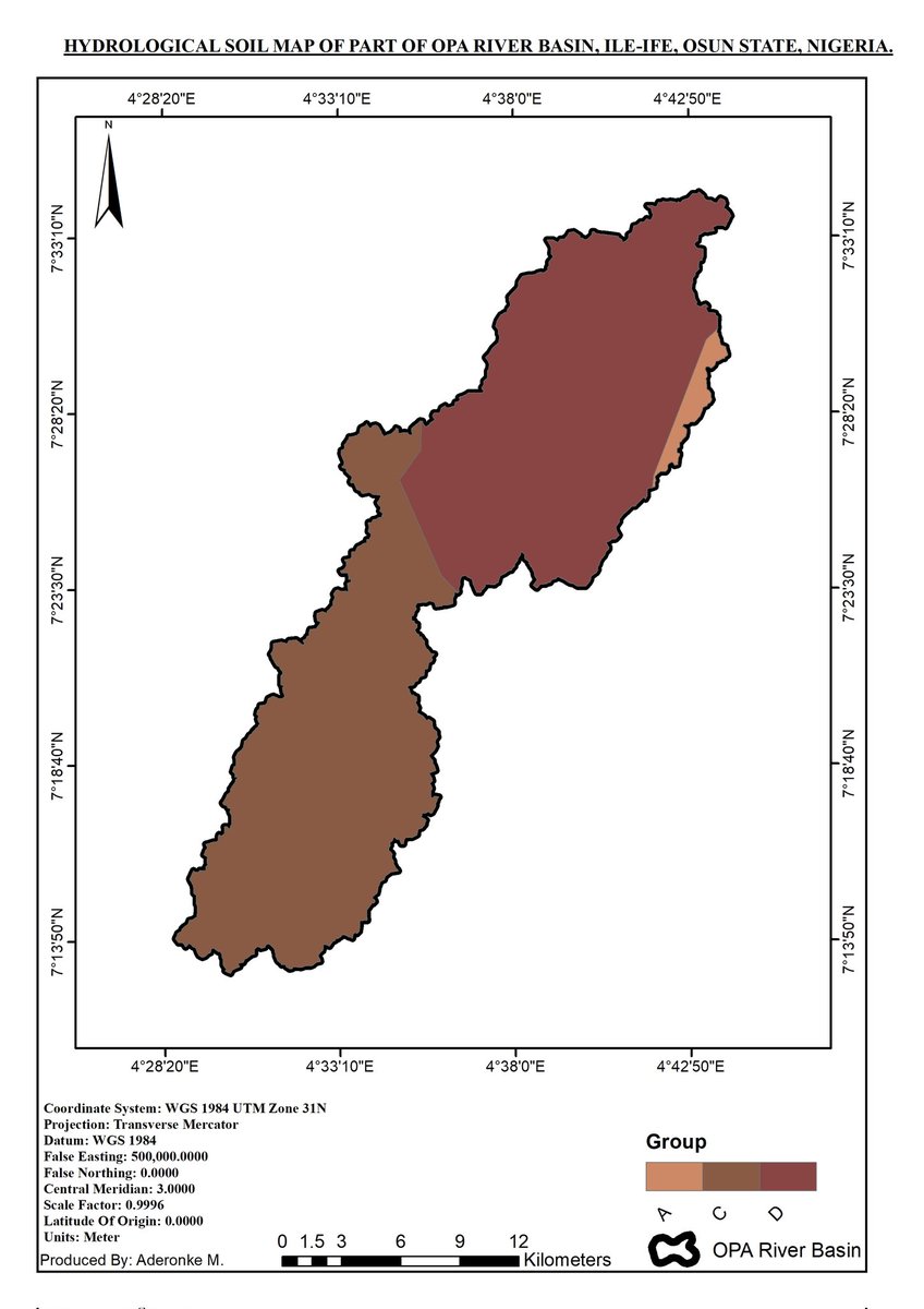
The Thematic layers overlayed to get the Runoff coefficients, using some blocks of codes made up of conditions derived from the curve numbers of Soil conservation service and processed in Raster Calculator on ArcMap #gischat #RemoteSensing #Gisandmapping #gisanalysis #geospatial


City of Boulder Flood Zones pearltrees.com/p/IU6NC #GISandMapping
GIS Manual: Elements of Cartographic Style pearltrees.com/p/ISK_C #GISandMapping

is there any way to convert TINs into Grids without having to convert them to Raster? #GIS #GISConversion #GISandMapping #GISHelp
The Thematic layers overlayed to get the Runoff coefficients, using some blocks of codes made up of conditions derived from the curve numbers of Soil conservation service and processed in Raster Calculator on ArcMap #gischat #RemoteSensing #Gisandmapping #gisanalysis #geospatial
City of Boulder Flood Zones pearltrees.com/p/IU6NC #GISandMapping
GIS Manual: Elements of Cartographic Style pearltrees.com/p/ISK_C #GISandMapping
is there any way to convert TINs into Grids without having to convert them to Raster? #GIS #GISConversion #GISandMapping #GISHelp
The Thematic layers overlayed to get the Runoff coefficients, using some blocks of codes made up of conditions derived from the curve numbers of Soil conservation service and processed in Raster Calculator on ArcMap #gischat #RemoteSensing #Gisandmapping #gisanalysis #geospatial
Something went wrong.
Something went wrong.
United States Trends
- 1. Cheney 72.1K posts
- 2. Sedition 137K posts
- 3. Treason 82K posts
- 4. First Take 45.1K posts
- 5. Mark Walter 1,089 posts
- 6. Jeanie 1,439 posts
- 7. Cam Newton 3,784 posts
- 8. Seditious 71.6K posts
- 9. Trump and Vance 34.9K posts
- 10. Commander in Chief 44.6K posts
- 11. #WeekndTourLeaks 1,443 posts
- 12. Constitution 101K posts
- 13. Coast Guard 17K posts
- 14. Shayy 11.5K posts
- 15. Nano Banana Pro 21.4K posts
- 16. #ExpediaChat 1,179 posts
- 17. Dameon Pierce N/A
- 18. #Geeksgiving25 N/A
- 19. Congratulations Bill N/A
- 20. UNLAWFUL 68.2K posts