#gishttps kết quả tìm kiếm
Advanced lessons for #JavaScript #API: Learn how to add a tool for drawing features on #online #maps. #GIShttps://goo.gl/SPdWrv
Converting #geodata between formats would be simple and fast with SuperGIS DataConvertor. #GIShttps://goo.gl/GA1G6L

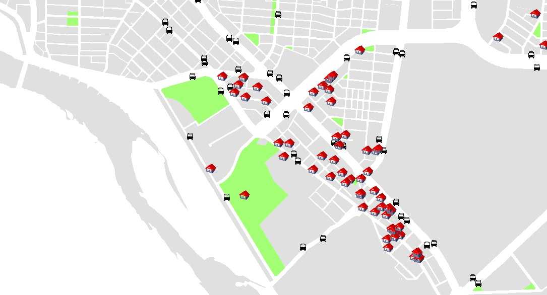
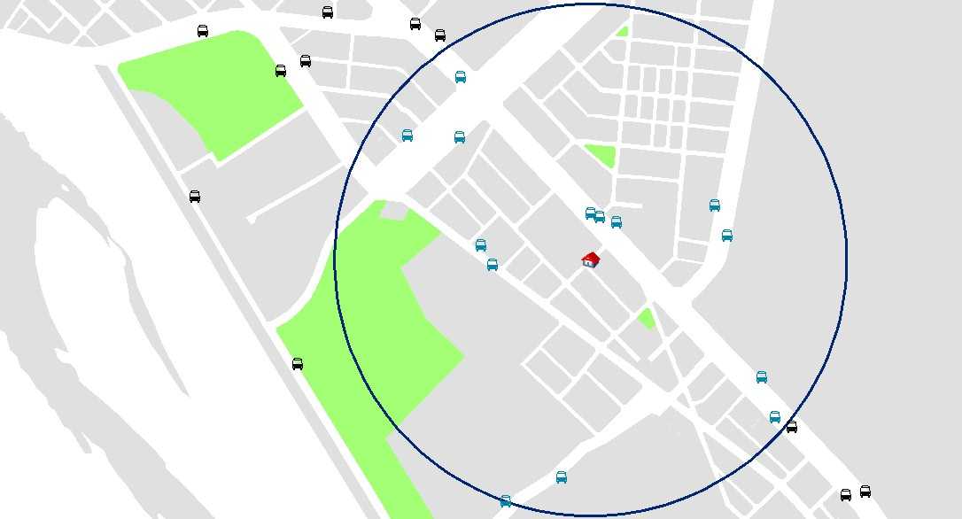
How to use SuperGIS Desktop to conduct an analysis for house #renting? A study in #Taipei. #GIShttps://goo.gl/J1KbrG
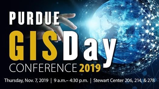
Are you attending #GISDay @LifeAtPurdue? Don't miss today's keynote speaker, Carly Sakumura, Research Scientist at Maxar, in the Stewart Center (STEW 206) at 10:00 am. #GISDay2019 #GIShttps://www.lib.purdue.edu/gis/gisday/gisday_2019_college_program
Bij de KlicConverter #Enterprise upload je alle #orientatieverzoeken en wij zorgen voor de #samenvoeging, #ontdubbeling en #conversie naar één #GeoPackage-bestand. Zo kun je de informatie snel ontsluiten voor derden. #GIShttps://klicconverter.nl/enterprise/

Join me @OAGEEOntarioGeo this Friday @YorkUEUC for #MapViewer Mastery! Navigate authoritative #data in #ArcGISOnline. Looking forward to presenting in person!!! #mappingfun #GIShttps://sites.google.com/view/2023oageeaegeo/home?authuser=0 @esricanada @GIS4Teachers @SIG_a_lecole

Datech Solutions proporciona al Canal Autodesk acceso al #softwareGISdeEsri tras firmar un acuerdo con Esri, líder global en inteligencia de localización; oferta conjunta de Autodesk y Esri destinada a apoyar la colaboración en Cloud para #BIM y #GIShttps://bit.ly/3vZVB5i

“ Building footprint data regularly provides more accurate answers when you are #geotargeting, #geofencing and connecting trace locations to the real world.” #GIShttps://buff.ly/2t1XldE

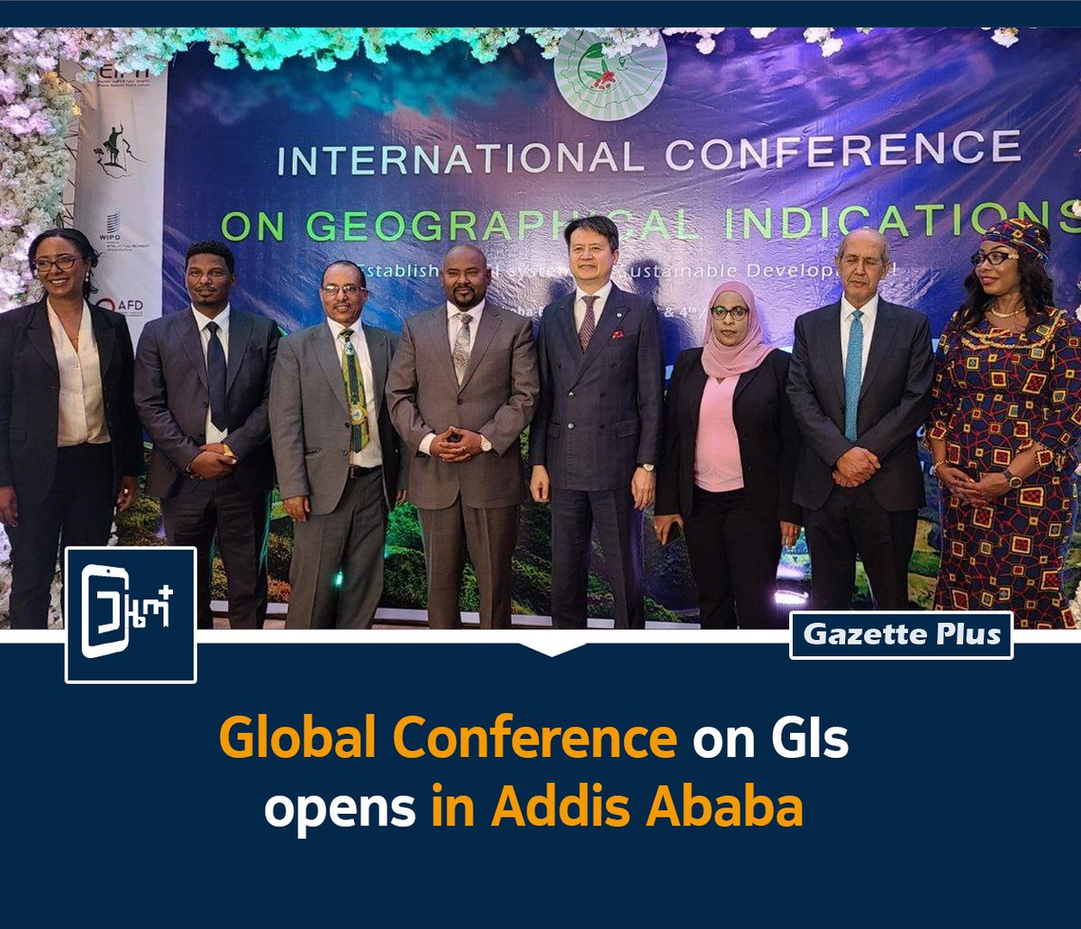
🌍 Ethiopia hosts global experts to discuss #GeographicalIndications (GIs) & their role in sustainable development, rural empowerment, and cultural preservation #GIshttps://www.facebook.com/share/p/1Bhsh4fJbF/ #Ethiopia #IntellectualProperty #WIPO #Innovation #Culture #trade
It's hard not to like free apps and content! See a wide range feature-rich apps and content at no cost. #esriuk #GIShttps://lnkd.in/dGgyKES
MCA & Stacy Deming met the wonderful 5th graders of Parkville Community School and talked GIS. #educationmatters #GIShttps://lnkd.in/e8D_cGs
elevation: an #opensource python library for easy access to 30m #SRTM elevation data. #gishttps://github.com/bopen/elevation
🌍 Ethiopia hosts global experts to discuss #GeographicalIndications (GIs) & their role in sustainable development, rural empowerment, and cultural preservation #GIshttps://www.facebook.com/share/p/1Bhsh4fJbF/ #Ethiopia #IntellectualProperty #WIPO #Innovation #Culture #trade

Join me @OAGEEOntarioGeo this Friday @YorkUEUC for #MapViewer Mastery! Navigate authoritative #data in #ArcGISOnline. Looking forward to presenting in person!!! #mappingfun #GIShttps://sites.google.com/view/2023oageeaegeo/home?authuser=0 @esricanada @GIS4Teachers @SIG_a_lecole

Datech Solutions proporciona al Canal Autodesk acceso al #softwareGISdeEsri tras firmar un acuerdo con Esri, líder global en inteligencia de localización; oferta conjunta de Autodesk y Esri destinada a apoyar la colaboración en Cloud para #BIM y #GIShttps://bit.ly/3vZVB5i

Bij de KlicConverter #Enterprise upload je alle #orientatieverzoeken en wij zorgen voor de #samenvoeging, #ontdubbeling en #conversie naar één #GeoPackage-bestand. Zo kun je de informatie snel ontsluiten voor derden. #GIShttps://klicconverter.nl/enterprise/

Bij de KlicConverter #Enterprise upload je alle #orientatieverzoeken en wij zorgen voor de #samenvoeging, #ontdubbeling en #conversie naar één #GeoPackage-bestand. Zo kun je de informatie snel ontsluiten voor derden. #GIShttps://klicconverter.nl/enterprise/

Powerful GIS-based visualization makes impactful decision-making easier than ever with Gensuite Mapper. #Gensuite #COVID19 #GIShttps://www.gensuite.com/mapper-heatmap-visualization-application/
Are you attending #GISDay @LifeAtPurdue? Don't miss today's keynote speaker, Carly Sakumura, Research Scientist at Maxar, in the Stewart Center (STEW 206) at 10:00 am. #GISDay2019 #GIShttps://www.lib.purdue.edu/gis/gisday/gisday_2019_college_program

“ Building footprint data regularly provides more accurate answers when you are #geotargeting, #geofencing and connecting trace locations to the real world.” #GIShttps://buff.ly/2t1XldE

Converting #geodata between formats would be simple and fast with SuperGIS DataConvertor. #GIShttps://goo.gl/GA1G6L

Advanced lessons for #JavaScript #API: Learn how to add a tool for drawing features on #online #maps. #GIShttps://goo.gl/SPdWrv
Advanced lessons for #JavaScript #API: Learn how to add a tool for drawing features on #online #maps. #GIShttps://goo.gl/SPdWrv
It's hard not to like free apps and content! See a wide range feature-rich apps and content at no cost. #esriuk #GIShttps://lnkd.in/dGgyKES
How to use SuperGIS Desktop to conduct an analysis for house #renting? A study in #Taipei. #GIShttps://goo.gl/J1KbrG


Advanced lessons for #JavaScript #API: Learn how to add a tool for drawing features on #online #maps. #GIShttps://goo.gl/SPdWrv
Converting #geodata between formats would be simple and fast with SuperGIS DataConvertor. #GIShttps://goo.gl/GA1G6L

Advanced lessons for #JavaScript #API: Learn how to add a tool for drawing features on #online #maps. #GIShttps://goo.gl/SPdWrv
elevation: an #opensource python library for easy access to 30m #SRTM elevation data. #gishttps://github.com/bopen/elevation
MCA & Stacy Deming met the wonderful 5th graders of Parkville Community School and talked GIS. #educationmatters #GIShttps://lnkd.in/e8D_cGs
Advanced lessons for #JavaScript #API: Learn how to add a tool for drawing features on #online #maps. #GIShttps://goo.gl/SPdWrv
Converting #geodata between formats would be simple and fast with SuperGIS DataConvertor. #GIShttps://goo.gl/GA1G6L

How to use SuperGIS Desktop to conduct an analysis for house #renting? A study in #Taipei. #GIShttps://goo.gl/J1KbrG


Are you attending #GISDay @LifeAtPurdue? Don't miss today's keynote speaker, Carly Sakumura, Research Scientist at Maxar, in the Stewart Center (STEW 206) at 10:00 am. #GISDay2019 #GIShttps://www.lib.purdue.edu/gis/gisday/gisday_2019_college_program

Join me @OAGEEOntarioGeo this Friday @YorkUEUC for #MapViewer Mastery! Navigate authoritative #data in #ArcGISOnline. Looking forward to presenting in person!!! #mappingfun #GIShttps://sites.google.com/view/2023oageeaegeo/home?authuser=0 @esricanada @GIS4Teachers @SIG_a_lecole

Bij de KlicConverter #Enterprise upload je alle #orientatieverzoeken en wij zorgen voor de #samenvoeging, #ontdubbeling en #conversie naar één #GeoPackage-bestand. Zo kun je de informatie snel ontsluiten voor derden. #GIShttps://klicconverter.nl/enterprise/

“ Building footprint data regularly provides more accurate answers when you are #geotargeting, #geofencing and connecting trace locations to the real world.” #GIShttps://buff.ly/2t1XldE

Datech Solutions proporciona al Canal Autodesk acceso al #softwareGISdeEsri tras firmar un acuerdo con Esri, líder global en inteligencia de localización; oferta conjunta de Autodesk y Esri destinada a apoyar la colaboración en Cloud para #BIM y #GIShttps://bit.ly/3vZVB5i

🌍 Ethiopia hosts global experts to discuss #GeographicalIndications (GIs) & their role in sustainable development, rural empowerment, and cultural preservation #GIshttps://www.facebook.com/share/p/1Bhsh4fJbF/ #Ethiopia #IntellectualProperty #WIPO #Innovation #Culture #trade

Something went wrong.
Something went wrong.
United States Trends
- 1. #AEWWrestleDream 60.7K posts
- 2. #sabrinanightlive 4,827 posts
- 3. Darby 9,321 posts
- 4. Lincoln Riley 2,578 posts
- 5. Mizzou 5,758 posts
- 6. Hugh Freeze 2,628 posts
- 7. Kentucky 25.2K posts
- 8. Bama 15.6K posts
- 9. Stoops 4,874 posts
- 10. Arch 26K posts
- 11. #RollTide 8,493 posts
- 12. Utah 30.1K posts
- 13. Stanford 6,665 posts
- 14. Tennessee 54.4K posts
- 15. Sark 4,458 posts
- 16. Notre Dame 16.1K posts
- 17. Jackson Arnold 1,023 posts
- 18. Texas 174K posts
- 19. #StreamFighters4 84.3K posts
- 20. #BYUFOOTBALL 1,060 posts


