#geodata search results

Think of Amanda Iglesias Moreno's article as a fundamental foundation for the use and applications of APIs for obtaining large-scale geographic data, so that you can later delve deeper into all the tools they offer 🌎 #GeoData #Python towardsdatascience.com/top-5-geospati…
towardsdatascience.com
Top 5 Geospatial Data APIs for Advanced Analysis | Towards Data Science
Explore Overpass, Geoapify, Distancematrix.ai, Amadeus, and Mapillary for Advanced Mapping and Location Data

#México | ✨ (Posa)Datos y Mezcales es MAÑANA ✨ 🗺️ Conoce proyectos de #geodata presentados por: 🌎 @crisisreadiness 🌎 @DirectRelief 🌎 INEGI Data Science Lab 🌎 @hotosm 🌎 Data for Good META 🗓️ 11.12.24 | 🕖 7 p.m. | 📍 @adecoac, #CDMX 📋 Únete ➡️ bit.ly/PosaDatosyMezc…


Great to see an amazing panel on #geodata for #humanrights at Winter School, with @PAXforpeace presenting on #remotesensing of environmental damage, with case studies from Yemen and Syria, among a great line-up of experts. geographie.nat.fau.de/geodata-for-hu…

🗺️ Geographic data can make or break a project. In Amanda Iglesias Moreno's article, dive into 5 must-know APIs that facilitate large-scale information acquisition. #GeoData #DataScience towardsdatascience.com/top-5-geospati…
towardsdatascience.com
Top 5 Geospatial Data APIs for Advanced Analysis | Towards Data Science
Explore Overpass, Geoapify, Distancematrix.ai, Amadeus, and Mapillary for Advanced Mapping and Location Data
#México | 🗺️📍📊 En términos de #geodata... 🤔📊🥃 ¿Qué podemos destacar del #DatosyMezcales, realizado en el marco del taller de @CopernicusLAC? ¡Abrimos 🧵! 🤓👇

#EirGrid has awarded #Fugro a framework agreement for delivery of #geodata surveys for a project that will develop #offshore #electricity substations & export cable routes, connecting future #windfarms along Ireland’s south coast to the nation’s grid. bit.ly/4eUHqVd


#GeoData🌍 Seguimos avanzando hacia el desarrollo con innovación y tecnología que transforman realidades. ¡La cuarta edición de Revista Geodata está cada vez más cerca! 📊📡


Kartverket: Sjømåler på Svalbard i sommer #svalbard #sikkerseilas #geodata kommunikasjon.ntb.no/pressemelding/…
kommunikasjon.ntb.no
Sjømåler på Svalbard i sommer | Kartverket
Det er fortsatt store områder på Svalbard med dårlige dybdedata og «hvite områder» som ikke er kartlagt i det hele tatt. Kartverket prioriterer å bruke hele sommersesongen til å sjømåle på Svalbard –...
Kartverket: Bekymret for finansiering av fellesløsningene #geodata #norge kommunikasjon.ntb.no/pressemelding/…
Kartverket: Stor kraft i kart og kartdata for samfunnet #geodata #digitalisering kommunikasjon.ntb.no/pressemelding/…
kommunikasjon.ntb.no
Stor kraft i kart og kartdata for samfunnet | Kartverket
Store nasjonale satsinger på effektivisering og digitalisering av Norge skjer fra Hønefoss, også data som er av samfunnskritisk betydning for nasjonal kontroll og sikkerhet og beredskap.

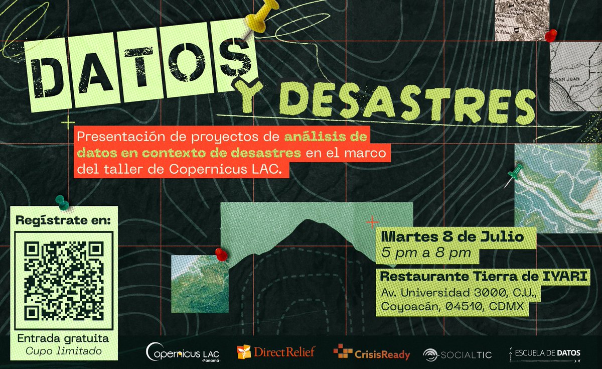
🚨Porque ustedes lo pidieron... ¡tenemos nueva edición de #DatosyDesastres! (y mezcales🥃) 🗺️Acompáñenos a conocer proyectos de #GeoData para entender mejor los impactos de los desastres en la región🌎 📅8/7/25 ⏰5 pm 📌#TierraDeIyari Registro previo 👇 socialtic.org/events/datos-y…


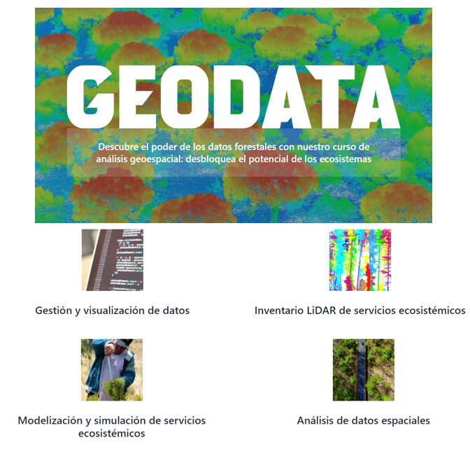
Curso #GEODATA 👉datos forestales y análisis geoespacial👈 geodata.uva.es 🗓️inicio: septiembre 2023 ⏰ duración: 2 semestres Organiza: @UVa_es Colabora: @agrestascoop

We’ve signed a 7-year framework agreement with @EirGrid to deliver a full suite of #GeoData surveys for the “Powering Up Offshore – South Coast” project. Our work will support the development of offshore substations and cable routes that connect future wind farms to Ireland’s
Work is underway on Ireland’s planned first commercial-scale offshore wind farm, the 375 MW Oriel project, being jointly developed by JERA Nex bp and ESB. We’re delivering a detailed geotechnical site investigation to acquire the high-quality #GeoData needed to inform safe,

Next week the leading international event for forward-looking geo applications will kick off in Berlin. Don't forget to register for INTERGEO! 👉 cities-today.com/event/intergeo… @InsideIntergeo #intergeo2023 #geodata #BIM #geospatial

📢¡No lo olviden, hoy es el último #DatosyMezcales del año! Cáiganle a @adecoac a las 7:00 pm para conocer proyectos de #geodata presentados por: 💥@crisisreadiness 💥@hotosm 💥Data for Good #META 💥#INEGI Data Science Lab 💥@DirectRelief Registro 👇 docs.google.com/forms/d/e/1FAI…


🚀 Struggling with outdated, scattered data? Meet #DataHubio’s Global Data Solutions: 🌍 Global #GeoData: 30+ detailed data points per region—ISO codes, holidays, boundaries & more. 📮 #PostalCode Database: Accurate, up-to-date logistics & e-commerce data. ✅ Global Reach ✅

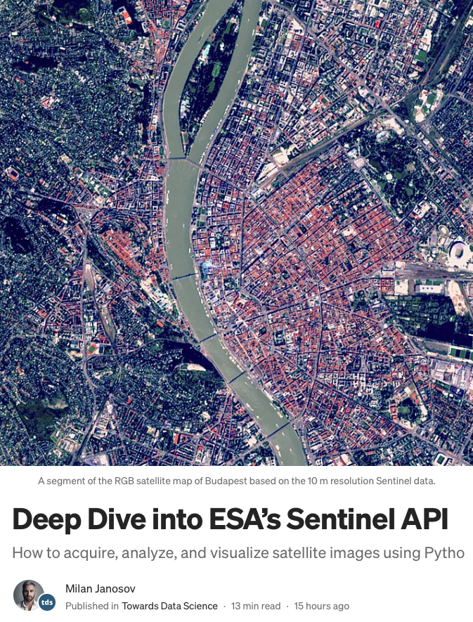
My latest geospatial data science tutorial, 𝐃𝐞𝐞𝐩 𝐃𝐢𝐯𝐞 𝐢𝐧𝐭𝐨 𝐄𝐒𝐀’𝐬 𝐒𝐞𝐧𝐭𝐢𝐧𝐞𝐥 𝐀𝐏𝐈, is online on @TDataScience - check it out here: towardsdatascience.com/deep-dive-into… #geospatialdata #geodata #spatialanalytics #datascience #remotesensing #datavisualization

(Open Access Online) Geocomputation with R: freecomputerbooks.com/Geocomputation… Look for "Read and Download Links" section to download. Follow me if you like this post. #Geocomputation #GeoData #GeoAnalysis #SpatialData #SpatialAnalysis #GIS #LLMs #GenAI #GenerativeAI

🌊 Tackling geological challenges at Dunkerque offshore wind farm! Our multi-method approach delivered precision data for foundation design 🔍 Driving #OffshoreWind success 🌱⚡ 👉 fugro.com/expertise/case… #GeoData #RenewableEnergy #Innovation

(Open Access Online) Geocomputation with R: freecomputerbooks.com/Geocomputation… Look for "Read and Download Links" section to download. Follow me if you like this post. #Geocomputation #GeoData #GeoAnalysis #SpatialData #SpatialAnalysis #GIS #LLMs #GenAI #GenerativeAI

🚢 arx iT prend le large avec l’IFREMER ! 🌊 Fiers de cette 1ère collaboration autour du développement & maintien de SI scientifiques. Au programme : data marine, SIG, bathymétrie & logiciels complexes. 👉 ArcGIS, FME, Python, C++ #SIG #GeoData #Esri #QGIS #Ifremer #Ocean


Turned satellite imagery into my name 🌍 “ARYAN” — created using real Earth patterns from NASA Landsat 🚀 Geospatial data is more creative than we think. #NASA #Landsat #GeoData #DataViz

What excites me most as a builder: the use cases are now highly practical. Flood detection, crop classification, burn scar mapping, geolocation, surface water detection. That’s real-world utility, not just benchmarks. #GeoAI #ComputerVision #GeoData #AppliedAI

🌍 ¿Sabías que el Shapefile es uno de los formatos más usados en GIS, pero también uno de los más controversiales? Si trabajas con datos espaciales, entender qué es y cuándo usarlo puede cambiar tu flujo de trabajo. 🧵👇 #GIS #Shapefile #GeoData

Strengthen local market focus using GEO data services in Houston for better targeting, mapping, and customer engagement performance. myaicampaigns.com #Houston #GEOData #LocalMarket #SEO #BusinessGrowth #Analytics #Marketing #MyAiCampaigns


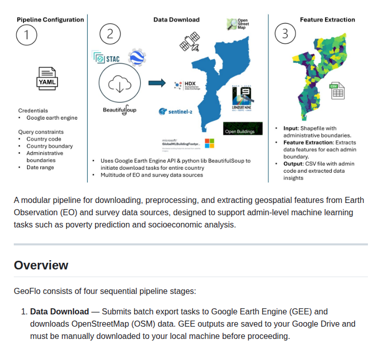
🚀 Novo: GeoFlo, o pipeline que transforma imagens geoespaciais em features de alta qualidade em segundos! Curioso? Teste agora: github.com/Data-Science-U… #GeoData #MachineLearning

📍 Tu GPS puede mentirte y eso afecta apps, IA y ciudades inteligentes 😲 Markus Levin de XYO explica cómo solucionarlo en BlockworksDAS 2026 NYC 🗽 🎥 Mira el video aquí: x.com/OfficialXYO/st… #Blockchain #GeoData

📍 Tu GPS puede mentirte y eso afecta apps, IA y ciudades inteligentes 😲 Markus Levin de XYO explica cómo solucionarlo en BlockworksDAS 2026 NYC 🗽 🎥 Mira el video aquí: x.com/OfficialXYO/st… #Blockchain #GeoData
📍 Tu GPS puede mentirte y eso afecta apps, IA y ciudades inteligentes 😲 Markus Levin de XYO explica cómo solucionarlo en BlockworksDAS 2026 NYC 🗽 🎥 Mira el video aquí: x.com/OfficialXYO/st… #Blockchain #GeoData
📍 Tu GPS puede mentirte y eso afecta apps, IA y ciudades inteligentes 😲 Markus Levin de XYO explica cómo solucionarlo en BlockworksDAS 2026 NYC 🗽 🎥 Mira el video aquí: x.com/OfficialXYO/st… #Blockchain #GeoData
📍 Tu GPS puede mentirte y eso afecta apps, IA y ciudades inteligentes 😲 Markus Levin de XYO explica cómo solucionarlo en BlockworksDAS 2026 NYC 🗽 🎥 Mira el video aquí: x.com/OfficialXYO/st… #Blockchain #GeoData

Try Gazemap. It tracks everywhere you explore on Google Maps and builds a personal heatmap. See where you've really been looking gazemap.com #maps #geodata #buildinpublic #sideproject #webdev

Spent 5 minutes turning scattered reports into something you can actually see Plot it on a map → patterns start to emerge. Sometimes It takes one clear question to turn chaos into insight. science4data.com #DataViz #Mapping #GeoData #DataStorytelling #Insights #NoCode

📊Turning news into data Question: Which type of infrastructure has been affected in each location? Each location becomes a data point → easy to map, compare, and visualize patterns. From raw reports → clear geographic insights. #Mapping #DataAnalytics #GeoData
🌊 Tackling geological challenges at Dunkerque offshore wind farm! Our multi-method approach delivered precision data for foundation design 🔍 Driving #OffshoreWind success 🌱⚡ 👉 fugro.com/expertise/case… #GeoData #RenewableEnergy #Innovation

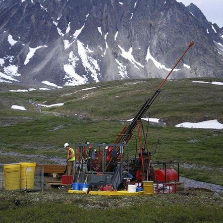
mountain views are where the patterns get interesting #geodata

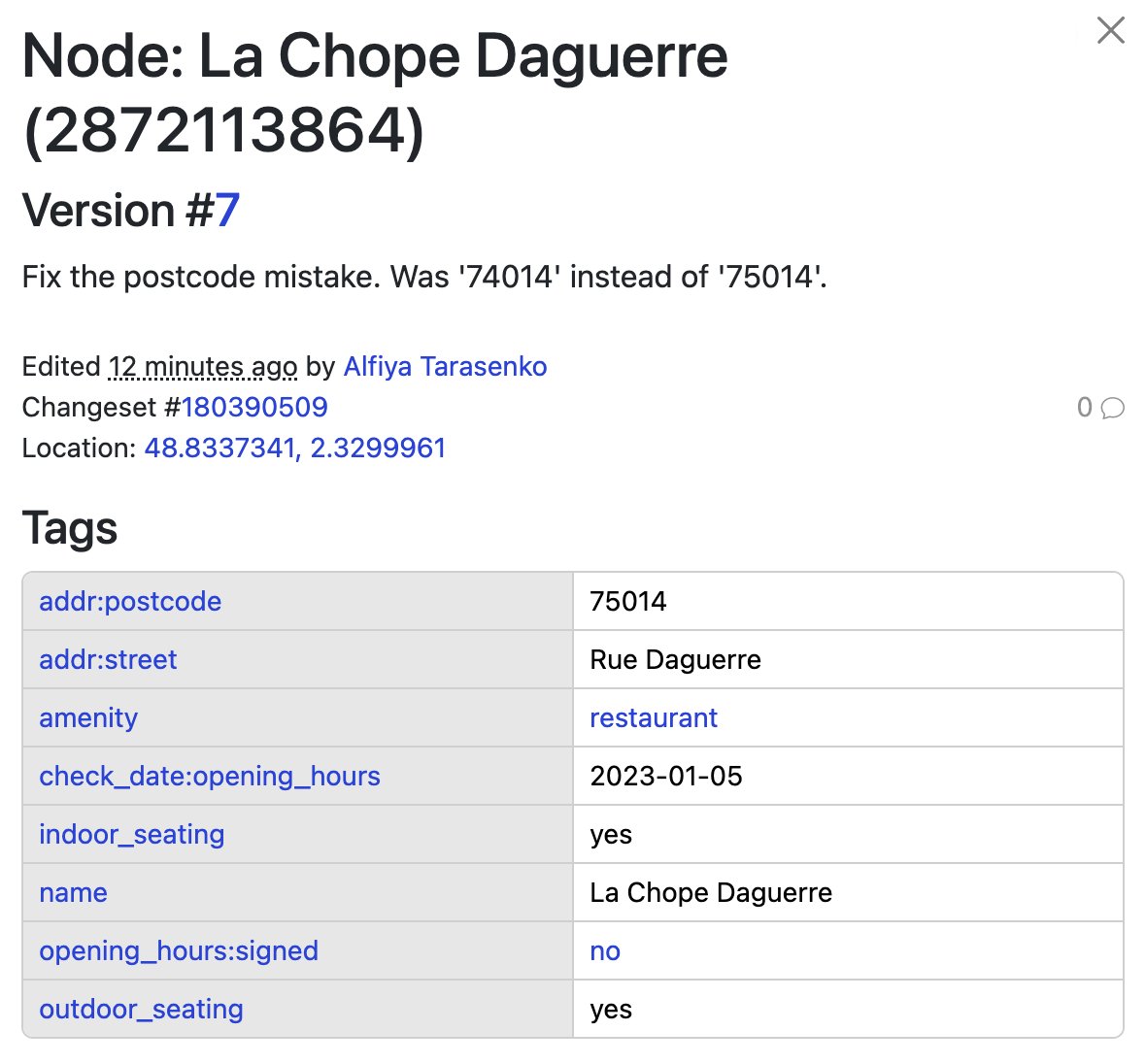
We investigated incorrect postal codes for French cities 🇫🇷 Examples: Marseille → 10013 Paris → 65011, 74014, 70007 🔍 Cause: incorrect postcode tags in @openstreetmap 🛠 Fix: corrected most directly in OSM Open data = fixable 👍 #OpenStreetMap #GeoData #GIS #Geocoding

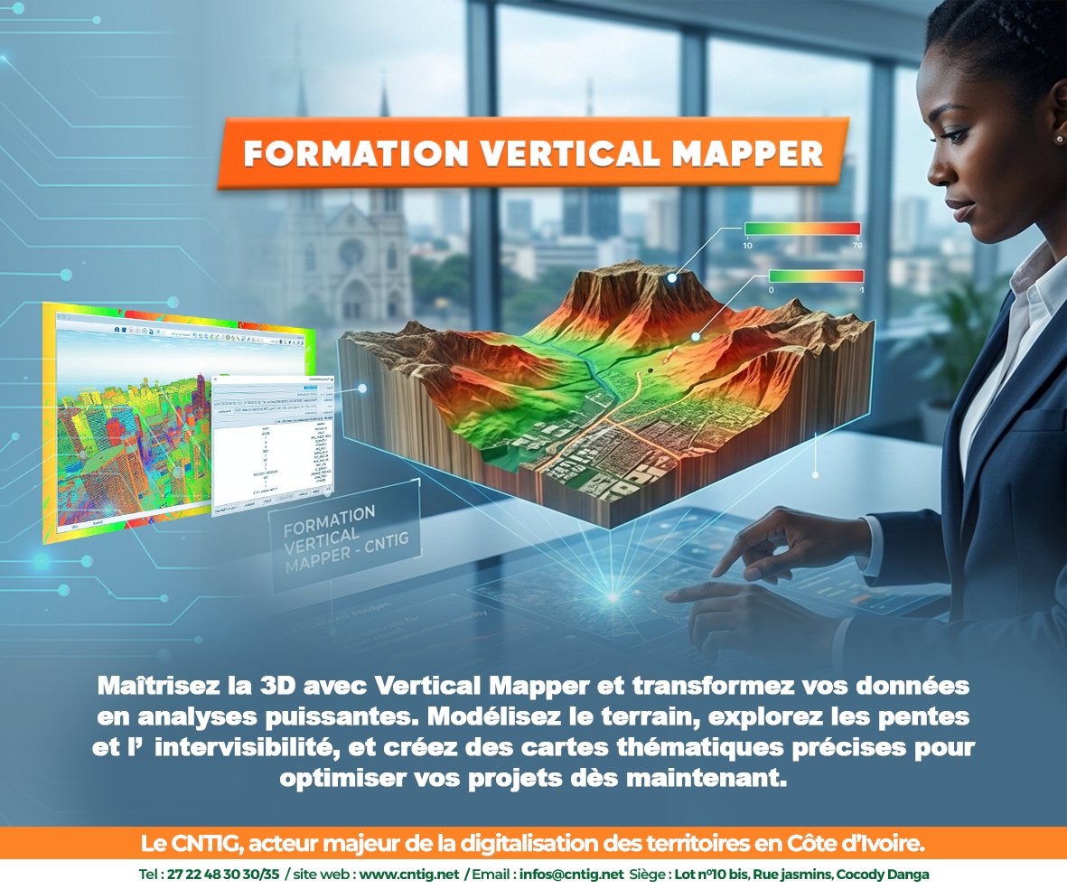
Testez votre culture Géospatiale avec le 𝐂𝐍𝐓𝐈𝐆 ! Dans 𝐯𝐞𝐫𝐭𝐢𝐜𝐚𝐥 𝐦𝐚𝐩𝐩𝐞𝐫, comment appelle-t-on une grille de données rectangulaires représentant une surface continue (comme l'altitude) ? A vos claviers ! #cntig #VerticalMapper #Geodata #AuServiceDuDéveloppement

𝐌𝐚𝐢̂𝐭𝐫𝐢𝐬𝐞𝐳 𝐥𝐚 𝐩𝐮𝐢𝐬𝐬𝐚𝐧𝐜𝐞 𝐝𝐞 𝐕𝐞𝐫𝐭𝐢𝐜𝐚𝐥 𝐌𝐚𝐩𝐩𝐞𝐫 ! De l'exploitation des données raster à la création de modèles numériques de surface. Le 𝐂𝐍𝐓𝐈𝐆 vous accompagne. #cntig #VerticalMapper #Geodata #AuServiceDuDéveloppement


Certification Spotlight🔎 Put your enterprise #geodata management skills to the test. Ideal candidates include #GIS data administrators, analysts, and managers who typically have 4+ years of experience. esri.social/ofpA50MvBSJ

A nice collection of free #GIS data sources by @GISGeography in their article "10 𝐅𝐫𝐞𝐞 𝐆𝐈𝐒 𝐃𝐚𝐭𝐚 𝐒𝐨𝐮𝐫𝐜𝐞𝐬: 𝐁𝐞𝐬𝐭 𝐆𝐥𝐨𝐛𝐚𝐥 𝐑𝐚𝐬𝐭𝐞𝐫 𝐚𝐧𝐝 𝐕𝐞𝐜𝐭𝐨𝐫 𝐃𝐚𝐭𝐚𝐬𝐞𝐭𝐬": linkedin.com/feed/update/ur… #geodata #geospatialdata #spatialanalytics #datascience

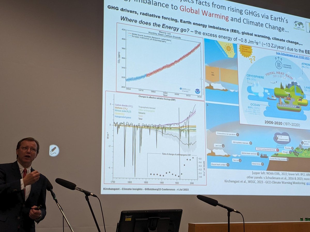
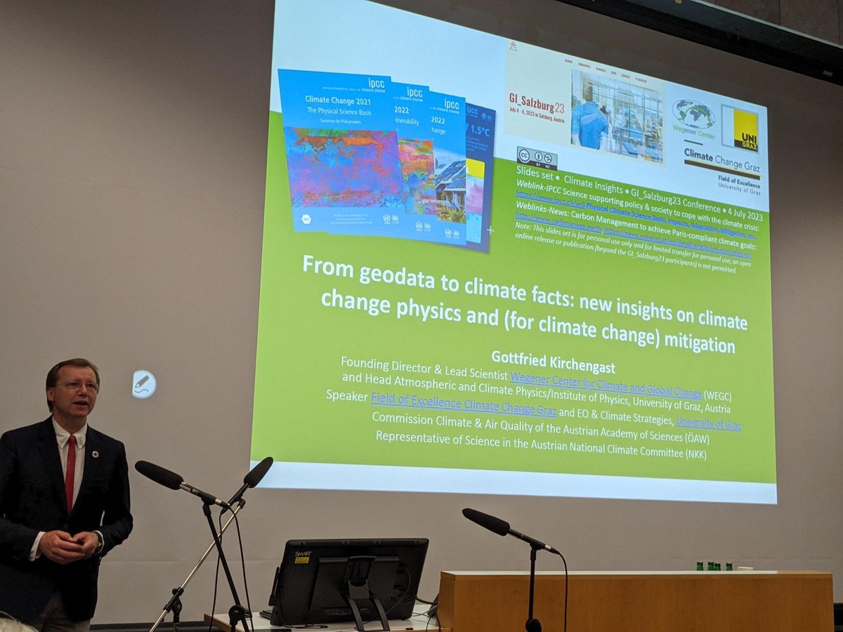
From what-is-where, when and why to the 'why do we care?' - #geodata as foundations for climate change evidence and insights! #GISalzburg23 gcci.earth/global/cwm/


Many of our #geovisualisation features were built on #opendata - meaning you too can access and use the publicly-available #geodata to make your own visualisations. See some examples here: orlo.uk/LQYRA
My latest geospatial data science tutorial, 𝐃𝐞𝐞𝐩 𝐃𝐢𝐯𝐞 𝐢𝐧𝐭𝐨 𝐄𝐒𝐀’𝐬 𝐒𝐞𝐧𝐭𝐢𝐧𝐞𝐥 𝐀𝐏𝐈, is online on @TDataScience - check it out here: towardsdatascience.com/deep-dive-into… #geospatialdata #geodata #spatialanalytics #datascience #remotesensing #datavisualization
My latest article, 𝐄𝐱𝐩𝐥𝐨𝐫𝐢𝐧𝐠 𝐋𝐚𝐫𝐠𝐞-𝐬𝐜𝐚𝐥𝐞 𝐑𝐚𝐬𝐭𝐞𝐫 𝐏𝐨𝐩𝐮𝐥𝐚𝐭𝐢𝐨𝐧 𝐃𝐚𝐭𝐚, is out on @TDataScience: towardsdatascience.com/exploring-larg… #geosptaialdata #geodata #spatialdata #datavisualization #datascience #data #datafam #visualization #gis #geography


Does your app need to handle #geodata like latitude, longitude, or distance between geographic locations? We got you: supabase.com/blog/geo-queri…

My recent article, 𝐄𝐱𝐩𝐥𝐨𝐫𝐢𝐧𝐠 𝐋𝐚𝐫𝐠𝐞-𝐬𝐜𝐚𝐥𝐞 𝐑𝐚𝐬𝐭𝐞𝐫 𝐏𝐨𝐩𝐮𝐥𝐚𝐭𝐢𝐨𝐧 𝐃𝐚𝐭𝐚, published on @TDataScience: towardsdatascience.com/exploring-larg… @WorldPopProject #geosptaialdata #geodata #spatialdata #gis #geography #datascience #datavisualizatiom #ai


With the Missing Maps initiative, @MSF teams are leveraging spatial data to better evaluate the extent of #displacement in the hard-to-reach camps around Goma, DR Congo. Read how #geodata is helping #humanitarianaid efforts. reliefweb.int/node/3987685 📷 UNHCR/Hélène Caux

Curso #GEODATA 👉datos forestales y análisis geoespacial👈 geodata.uva.es 🗓️inicio: septiembre 2023 ⏰ duración: 2 semestres Organiza: @UVa_es Colabora: @agrestascoop
#México | ✨ (Posa)Datos y Mezcales es MAÑANA ✨ 🗺️ Conoce proyectos de #geodata presentados por: 🌎 @crisisreadiness 🌎 @DirectRelief 🌎 INEGI Data Science Lab 🌎 @hotosm 🌎 Data for Good META 🗓️ 11.12.24 | 🕖 7 p.m. | 📍 @adecoac, #CDMX 📋 Únete ➡️ bit.ly/PosaDatosyMezc…

Seabed insights = better calls. Fugro’s Aaron Broughton details how high-resolution geo-data drives smarter offshore decisions. Stream on demand → go.otcnet.org/EEE_Fugro #OTC2025 #OffshoreEnergy #GeoData #DecisionMaking

#México | 🗺️📍📊 En términos de #geodata... 🤔📊🥃 ¿Qué podemos destacar del #DatosyMezcales, realizado en el marco del taller de @CopernicusLAC? ¡Abrimos 🧵! 🤓👇
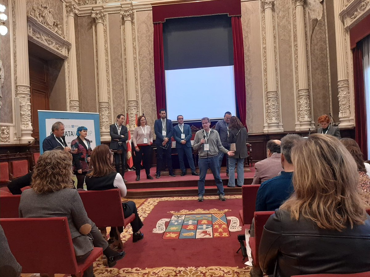
Nuestro compañero @quecoak presentando a AGRESTA en #Geodata MeetUp #SmartGlobalEcosystems 👉 networking de empresas y actores interesados en la aplicación de la Inteligencia Artificial #IA

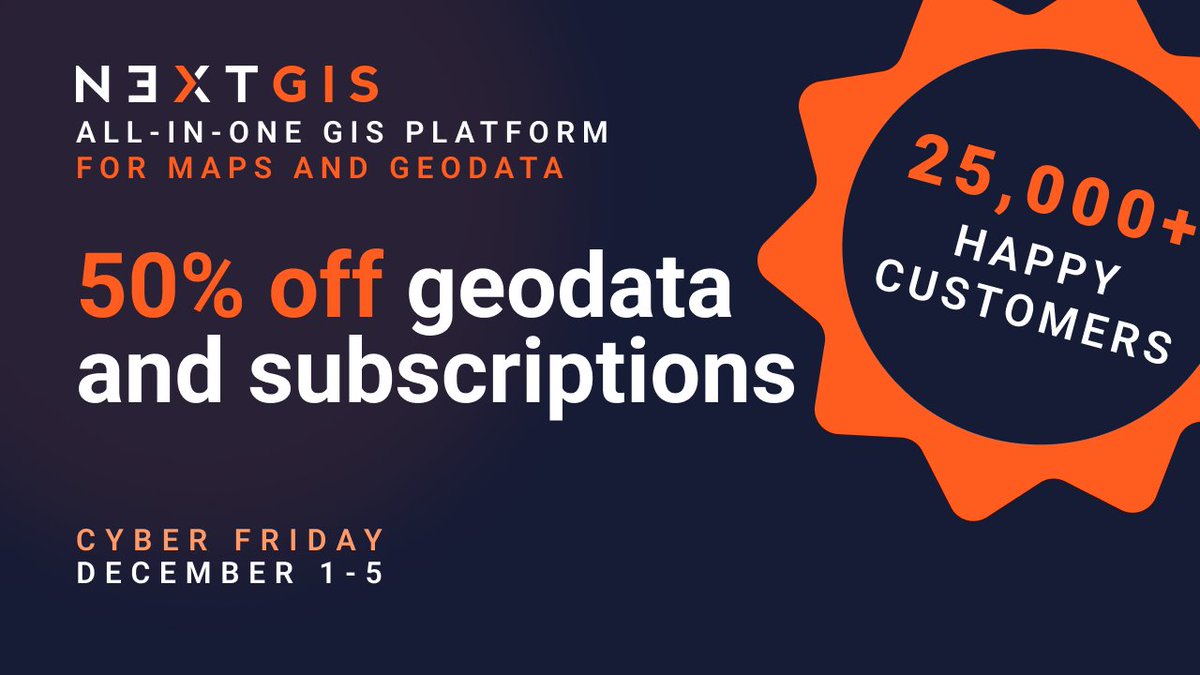
Data prep shouldn't take longer than the actual analysis. @nextgis geodata: pre-validated, pre-styled, ready to use. Basemaps, buildings, elevation, satellite imagery, landcover, POIs. 50% off Dec 1-5 | Works in any GIS tool linkly.link/2Rlit⚡ #Geodata #GIS #SpatialData
🚨Porque ustedes lo pidieron... ¡tenemos nueva edición de #DatosyDesastres! (y mezcales🥃) 🗺️Acompáñenos a conocer proyectos de #GeoData para entender mejor los impactos de los desastres en la región🌎 📅8/7/25 ⏰5 pm 📌#TierraDeIyari Registro previo 👇 socialtic.org/events/datos-y…

💡 Ever wondered how to visualize #geodata in a unique and engaging way? Learn how to create a #SkyscraperMap with #AzureMaps in #PowerBI! It's like a bar chart on a map where each bar is a skyscraper. Perfect for displaying data along values. ➡️ Dive in: alexloth.com/how-to-create-…


Géodonnées et vision du monde commercial à travers Internet (#Geodata et #BlancsDesCartes) Le projet All The Places extrait les données concernant les « emplacements de magasins » à partir de sites web du monde entier alltheplaces.xyz 1/
#México | 🗺️📍📊 En términos de #geodata... 🤔📊🥃🪅 ¿Qué podemos destacar del último (Posa)#DatosyMezcales, realizado en el marco de Novel Data, AI and Disasters From Data to Public Policy? ¡Abrimos 🧵! 🤓👇
Fugro’s Aaron Broughton reveals how geo-data can boost decision-making and strategic advantage in offshore programs. 📍 Energy Evolution Exchange Theater 🕒 1100–1130 CDT | 6 May | #OTC2025 🔗 go.spe.org/E_Evolution #GeoData #OffshoreEnergy #DecisionMaking
Something went wrong.
Something went wrong.
United States Trends
- 1. #euphoria N/A
- 2. #GoAvsGo N/A
- 3. #GoAvsGo N/A
- 4. Jarrett Allen N/A
- 5. BEST OF ME N/A
- 6. #mnwild N/A
- 7. Rudy N/A
- 8. #LetEmKnow N/A
- 9. Cale Makar N/A
- 10. Quinn Hughes N/A
- 11. Wallstedt N/A
- 12. Raptors N/A
- 13. Wally N/A
- 14. Edmond N/A
- 15. Habs N/A
- 16. Max Strus N/A
- 17. Lou Ann N/A
- 18. Pistons in 6 N/A
- 19. Montreal N/A
- 20. Avalanche N/A