#hurricaneerin search results

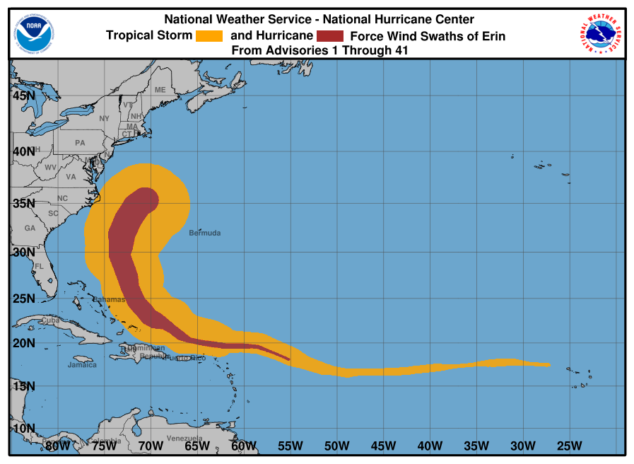
.@NOAA's #GOESEast satellite continues to closely track #HurricaneErin this morning as it pushes away from the Eastern Seaboard. #GOES19 Follow #Erin's path with our Hurricane Tracker: nesdis.noaa.gov/imagery/hurric…

Hurricane #Erin Advisory 40A: Coastal Flooding Continues Along Portions of the North Carolina And Mid-Atlantic Coasts. Beachgoers Are Cautioned Against Swimming At Most U. S. East Coast Beaches Due to Life-Threatening Surf and Rip Currents. hurricanes.gov

STORM WATCH: Hurricane Erin is impacting parts of Babylon Village Park and the Town of Babylon, causing high water levels in residential areas. Stay with News12 for the latest update. #News12 #LongIsland #HurricaneErin #BabylonVillagePark #Weather #Thunderbolt12 #StormWatch

Hurricane Erin has consistently produced powerful winds and major waves along the U.S. East Coast this week. Structures close to beaches are at risk from ocean overwash. #eastcoast #hurricaneerin #hurricane #extremeweather #beaches #ocean #FoxWeather
#HurricaneErin became the Atlantic’s first #hurricane of the season and strengthened into a Category 5 storm just one day later—one of the fastest intensifications on record. Learn how @NOAA satellites monitored and tracked #Erin in this week's #EarthFromOrbit video:
Hurricane Erin has caused some not-so-ideal conditions for pet owners in North Carolina this week. One resident experienced a bit of difficulty while walking her dog on Wednesday during high tide. #NorthCarolina #hurricaneerin #flood #hurricaneseason #FoxWeather

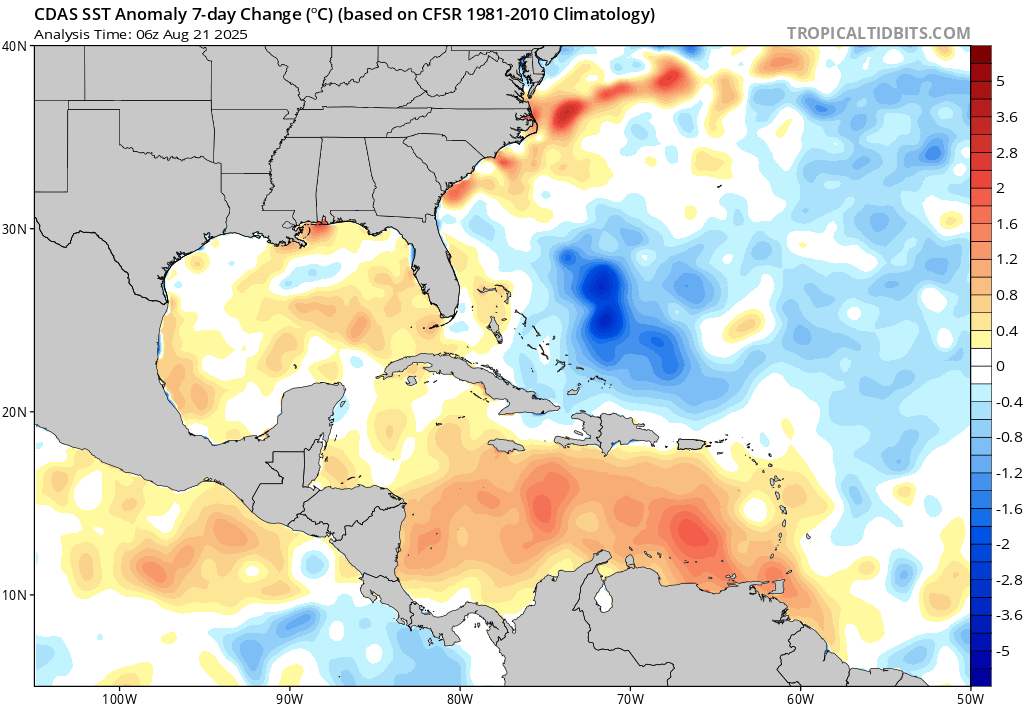
A significant drop in SST in parts of the tropical Atlantic last 7 days The churning effect of #HurricaneErin a likely contributor as cold sub surface waters are forced to upwell

Large waves crashing at Ballyheigue Pier this evening! Remnants of #HurricaneErin making herself known! vm.tiktok.com/ZNd4MW8Ww/
TRACKING THE STORM: Satellite imagery of Hurricane Erin over the past few days shows the progression of the powerful storm, which reached a Category 5 rating on Saturday. #hurricaneerin #hurricane #extremeweather #beach #ocean #FoxWeather

With #HurricaneErin in the rearview mirror, forecasters are to looking to an incoming bout of notable, beneficial rainfall for parts of the dry Atlantic provinces this week. #NSwx #NLwx ow.ly/V3xX50WL1Fe

The Weather Network meteorologist @MurphTWN talks to @NateTWN live from Peggy's Cove, Nova Scotia as #HurricaneErin makes waves. ow.ly/JMIL50WKgg7

The life cycle of #Erin burning through ocean heat along the way. Through powering its heat engine and churning up the ocean waters below, upwelling cooler water from deep, #HurricaneErin managed to cool the surface water by ~5 degrees F

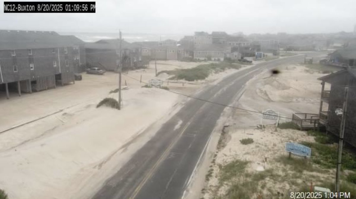
August 20, 2025, high tide in Buxton, NC. 🌀Erin OuterBanks 📹epicshutterphotography #HurricaneErin #northcarolina #buxton

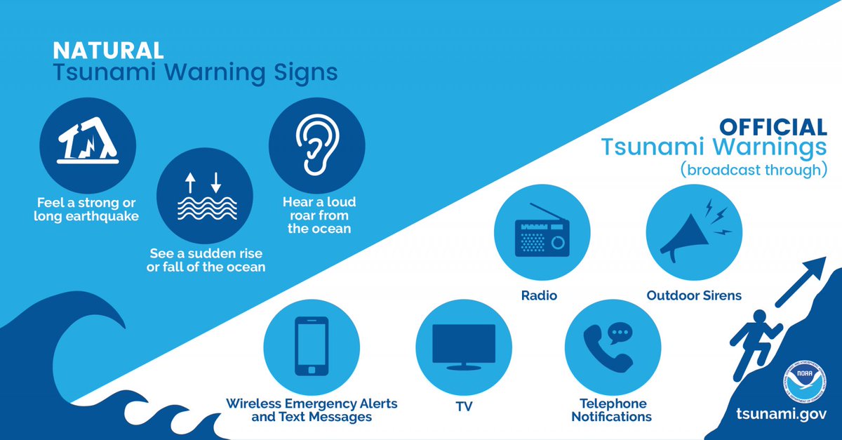
NTWC has ruled out any tsunami threat to the U.S. Atlantic Coast. That said, it's a good reminder that a tsunami can happen anytime- even if there's a hurricane. Plan for it so you're prepared for it. #HurricaneErin @NWS

Beaches along France’s Atlantic coast remain closed as powerful swells from former Hurricane Erin send waves of four to five meters crashing ashore, posing risks to visitors and local maritime activity. #France #HurricaneErin #AtlanticCoast

#HurricaneErin is really making some waves over here in Wildwood. Still several hours from high tide as well.

"NOAA’s #NationalGeodeticSurvey is collecting aerial damage assessment images following #HurricaneErin. Imagery is collected by NOAA aircraft in specific areas identified by NOAA in coordination with federal and state partners." oceanservice.noaa.gov/news/aug25/ngs…

#HurricaneErin’s sprint to Cat 5 shows how #climatechange is supercharging storms. Even in Wisconsin, we’re not insulated - floods, storms & heat are hitting harder. I break it down in my latest Substack...open to everyone, because this issue is too important:

The rough and intense waves continue to persist along the U.S. East Coast. Although there are no direct impacts from Hurricane Erin, various areas are preparing for ocean overwash from the storm. #eastcoast #hurricaneerin #extremeweather #beaches #ocean #FoxWeather

Ex Hurricane Erin created some big waves in the northwest yesterday evening. This was Creevy, Donegal where some took risky chances with big waves over toppling the pier. Images by Kevin Shields Photography #weather #ireland #hurricaneerin


COLD FUSION AND COLD FRICTION. THE TWO FORCES RESPONSIBLE FOR DARK MATTER AND DARK ENERGY. #DEW #HurricaneErin #DarkMatter #DarkEnergy substack.com/@trickylasoul/…
#HurricaneErin? Directed Energy Weapons(#DEW) like PYROKINESIS? Blackholes are Nature's Stealth Technology. They Bend&Reflect the light via Magnetism (Solid Metal Core left over). Thats Redirect TELEKINESIS into Light Repulsion. You better call 9-1-1. You invented it, remember?
#HurricaneErin didn't unless you count Weapons Contractors. Cold Fusion still hasn't been commericalised yet. I guess DEW is hard, huh?
HIRE ME. @BoeingDefense @Boeing @LMSpace @NASA @BAESystemsplc I am a GOD, literally. #FreeEnergy I can create a better #hurricaneErin, baby.
THIS IS HOW SPEED OF LIGHT WORKS AND ITS MANIPULATION INTO TO FASTER THAN LIGHT TRAVEL. #physics #Science #fasterthanlight #SpaceTech #Space #scifi substack.com/@trickylasoul/…

Five homes in Buxton, North Carolina, collapsed into the ocean 40 days after #HurricaneErin events following high surf and waves from #HurricaneImelda and #HurricaneHumberto. A total of 17 homes on the NC Outer Banks were lost to the ocean since 2020.
Tidal surges caught on cameras in Buxton township, located on NC highway 12 as #HurricanErin moves north. Floods #geoposted at: ∿ Ocean Drive 35.26423,-75.51905 ∿ Cottage Av. 35.26351,-75.51917 ∿ Highway 12 north of Buxton 35.26725,-75.51896 next to Cape Hatteras Motel

Gabrielle is now a Category 4 Hurricane with maximum sustained winds of 140 mph. It is the 2nd (Major) hurricane of the season, behind Category 5 Hurricane Erin back in August. #HurricaneGabrielle #Gabrielle #HurricaneErin #Erin #2025HurricaneSeason #Tropics #AtlanticOcean

Tropical Storm Narda has formed in the Pacific Ocean. Maximum sustained winds of 60 mph. It is the 16th named storm of the season. #TropicalStormNarda #Narda #2025HurricaneSeason #Tropics #PacificOcean


#HurricaneErin never made landfall in the U.S., but its impacts spread far from the storm's center. In my latest article for @NOAA, we highlight support provided to partners on land and in the ocean by @NWS scientists. Read it here: noaa.gov/stories/hurric… #WeatherReadyNation
noaa.gov
Hurricane Erin: When distant storms pose a danger to America’s coastal communities
Although the eye of Hurricane Erin was never closer than about 200 miles from the U.S. East Coast and its center never made landfall, Erin’s effects were still seen along the shoreline and felt by...

The Cooperative Institute for Meteorological Satellite Studies (@UWCIMSS) - a @NOAA partner - assembled a visualization of #HurricaneErin using @tomorrowio_'s microwave observations and their state-of-the-art ML algorithm for intensity estimation. Across multiple overpasses,


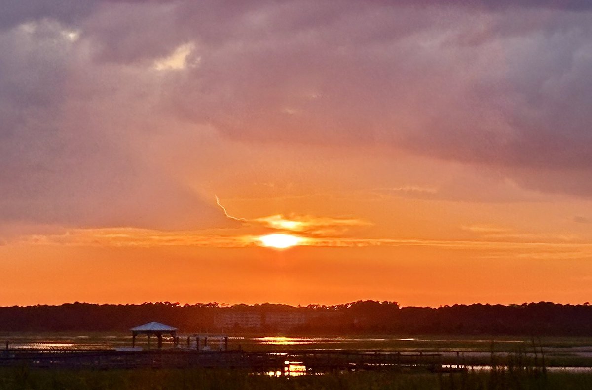
Last Hatteras Village Sunrise before heading home. Although delayed for two days by #HurricaneErin this was a wonderful trip Relaxing Thank You #OBX


From strategy to setup, I’ll build your online community (Skool, Circle, Kajabi, Podia, Mighty Networks) tailored to your brand. fiverr.com/s/R76bvm5 #hurricaneerin #CollegeColorsDay #Vrabel #baylorbears #ViceGanda

The numbers are in! The Virgin Islands had an average 8.7 inches of rain, with mean wind gusts of 42.3 miles per hour when #HurricaneErin made its pass near the Territory August 16-17.


NC Medicaid has enacted temporary flexibilities from Aug. 19-Sept. 2 following Gov. Stein’s state of emergency for Hurricane Erin. Patients can receive early refills and access medications without prior authorization. Details: bit.ly/4nbtcSR #NCMedicaid #HurricaneErin
medicaid.ncdhhs.gov
NC Medicaid Temporary Flexibilities Due to Hurricane Erin
NC Medicaid Temporary Flexibilities Due to Hurricane Erin

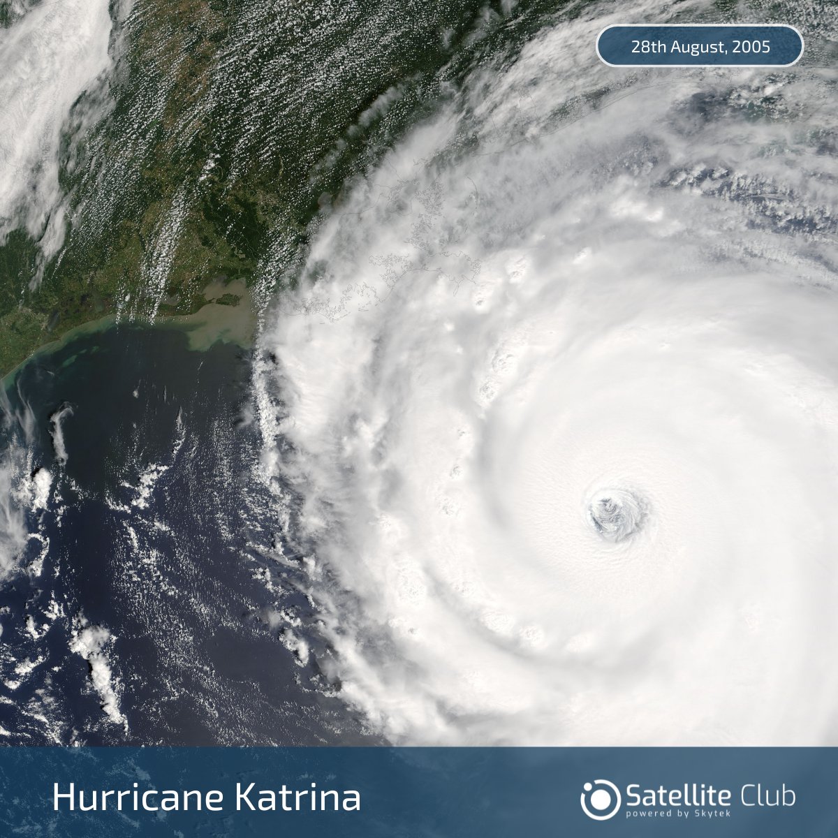
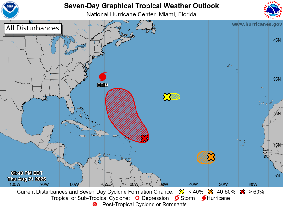
Is America Ready for Another Hurricane Katrina? 20 yrs on, New Orleans still remembers. Katrina killed 1,800+, displaced hundreds of thousands, & exposed deep failures. With storms like Cat-5 #HurricaneErin & TS #Fernand brewing, are we prepared? satellite-club.skytek.com

Our Top 10 is LIVE! Incredible waves from Jack Robinson, Koa Rothman, Ben Gravy, Rio Waida and more 🤙 #HurricaneErin #FijiPro


A yellow weather warning for rain has been put in place in parts of the UK in the wake of Hurricane Erin crossing the Atlantic ⚠️ farmersguide.co.uk/rural/environm… #WeatherWarning #HurricaneErin #UKWeather #RainAlert #StormyWeather #WeatherUpdate #FarmingForecast #UKFarming @metoffice


Europe Weather Alert: Ex-Hurricane Erin Brings Severe Storm System #EuropeWeather #HurricaneErin #SevereWeather #WeatherAlert #Flooding #Italy #Alps #Thunderstorms #WeatherForecast #StormWatch #ExtremeWeather #EuropeanWeather #MeteoAlert #WeatherWarning #WeatherUpdate

⚠️ #HurricaneErin insights from @CDIPBuoys Peak periods were longer than usual for tropical storms in the Atlantic Ocean due to Erin’s extraordinary size, which added to the power of the waves that impacted the shoreline. Complete data set available here: bit.ly/4muaKES


Here's a three hour difference between the NC12 Traffic Cam in Buxton, #NorthCarolina - two hours before High Tide as #HurricaneErin inches closer. #ncwx #Erin @NWSMoreheadCity

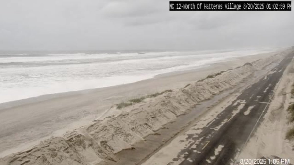
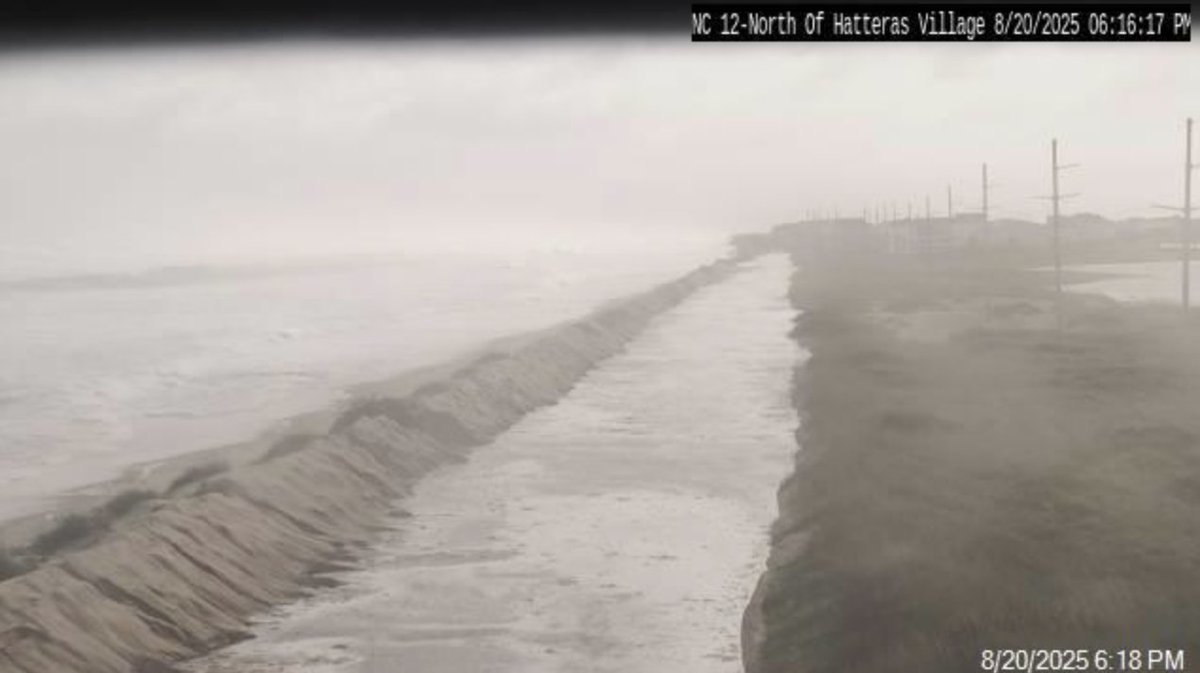
Wow! Here's a 5hr difference from the NC12 Traffic Cam in Hatteras, #NorthCarolina today as #HurricaneErin and High Tide cover the highway. 😯 #ncwx #erin @NWSMoreheadCity
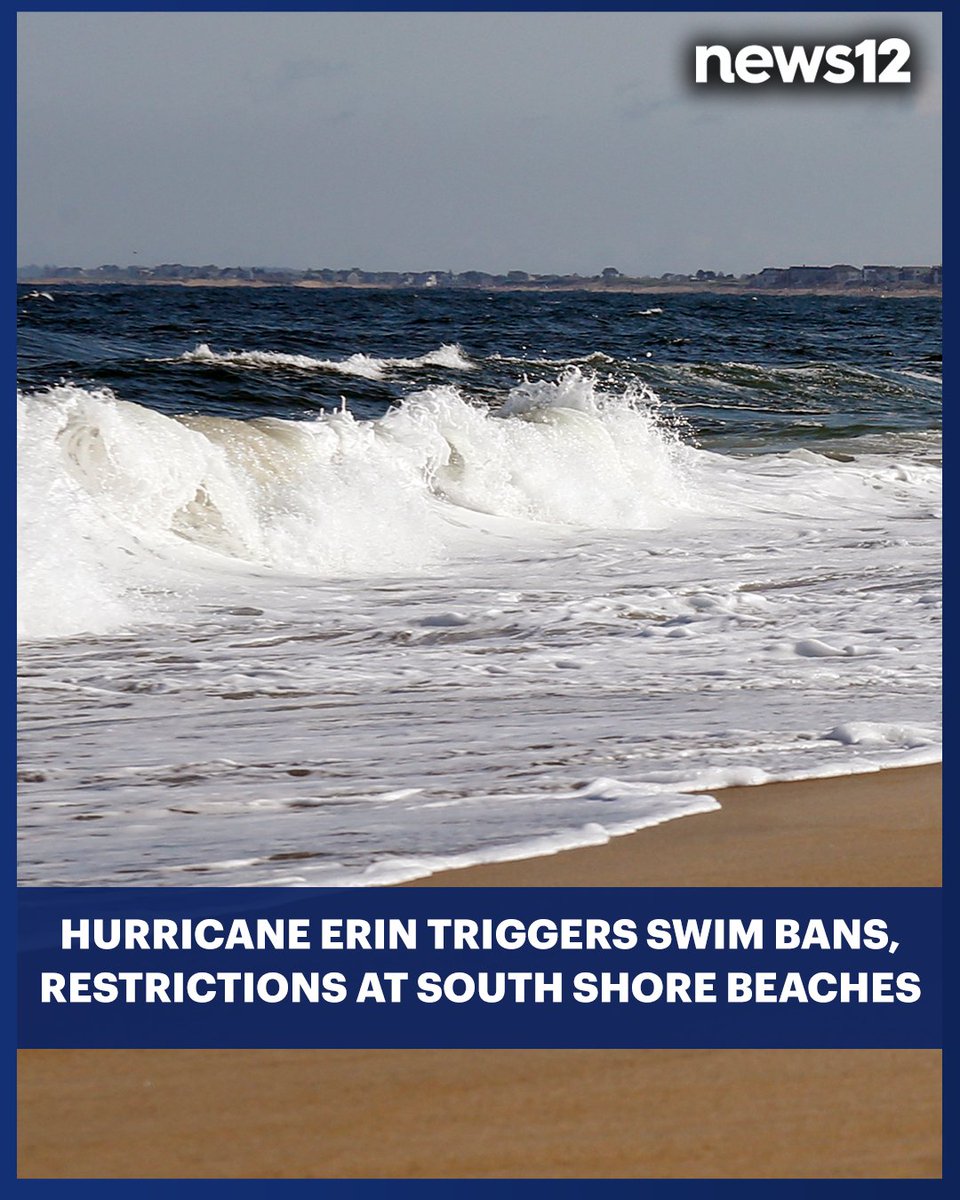
#StormWatch: Crews are closely watching conditions as #HurricaneErin passes offshore #LongIsland today. One of their top concerns is what this storm could mean for the region's vulnerable coastline. - bit.ly/461piG4

BEACH SWIMMING BANS: Restrictions are going into effect at beaches all across #LongIsland's South Shore in preparation for #HurricaneErin to pass. - bit.ly/4mNcsAT
A significant drop in SST in parts of the tropical Atlantic last 7 days The churning effect of #HurricaneErin a likely contributor as cold sub surface waters are forced to upwell

That same buoy now experiencing hurricane-force gusts as of 3:15 PM. #HurricaneErin

Buoy 41047 will be the one to watch in the Atlantic for getting the dirty side of #Erin today. Here's a recent image of the wave action while gusting between 50 - 60 mph already. You can follow here: ndbc.noaa.gov/station_page.p…


#hurricaneerin may cause increased rip currents all along the East Coast over the next few days, including in Maryland. Be careful; rip currents can be deadly. #ripcurrent Learn more: noaa.gov/jetstream/ocea…

Ex Hurricane Erin created some big waves in the northwest yesterday evening. This was Creevy, Donegal where some took risky chances with big waves over toppling the pier. Images by Kevin Shields Photography #weather #ireland #hurricaneerin


High level clouds from the outflow of #HurricaneErin can be seen from the summit today. Erin will continue its northeastward movement as it parallels the Northeast coastline. The storm will stay well offshore, generating only high level clouds on the horizon today and tomorrow.


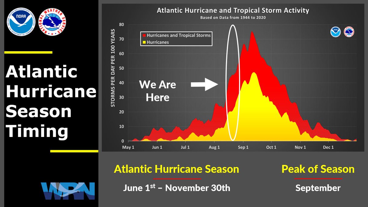
As we edge closer to the end of August and #HurricaneErin moves away, it's a reminder that we are going into peak season. The Atlantic is active, but so far things are staying away. This is the time to make sure you have an emergency kit and plan in place. #scwx #ncwx #gawx

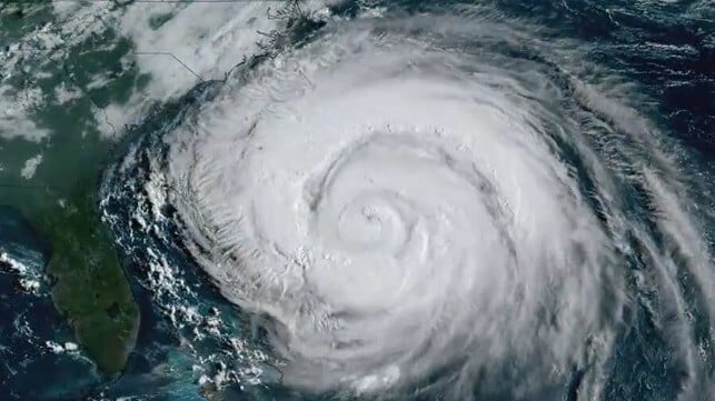
Hurricane Erin!! Just magnificent with its wing spread all around. Can watch this all day!! Sat image shows sign of intensification again. #HurricaneErin

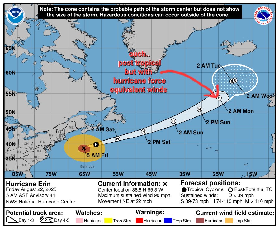
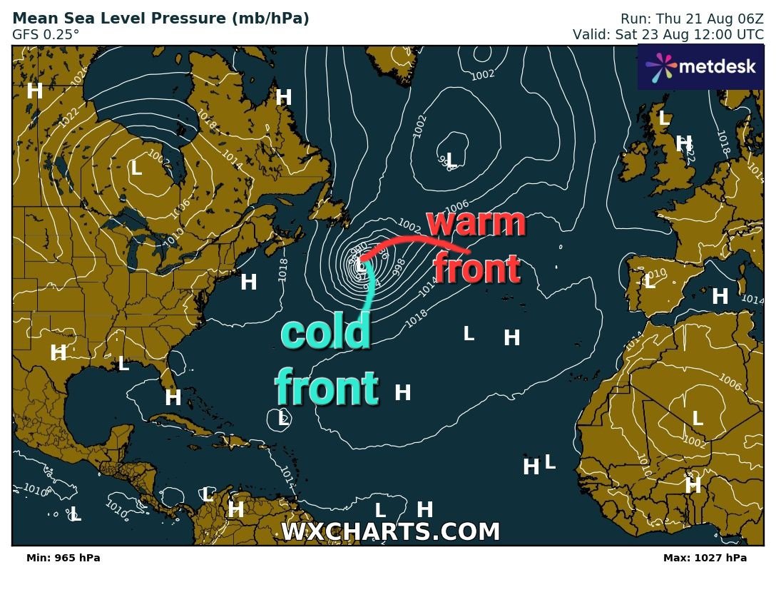
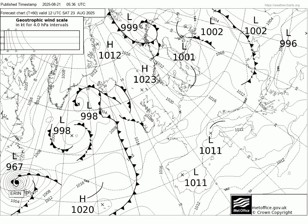
Hurricane evolution is fascinating @NHC_Atlantic expecting #HurricaneErin to undergo extratropical transition Saturday morning As shown by GFS by then the storm has started interacting with the jetstream..cold air from the N mixes into the system, & it forms weather fronts


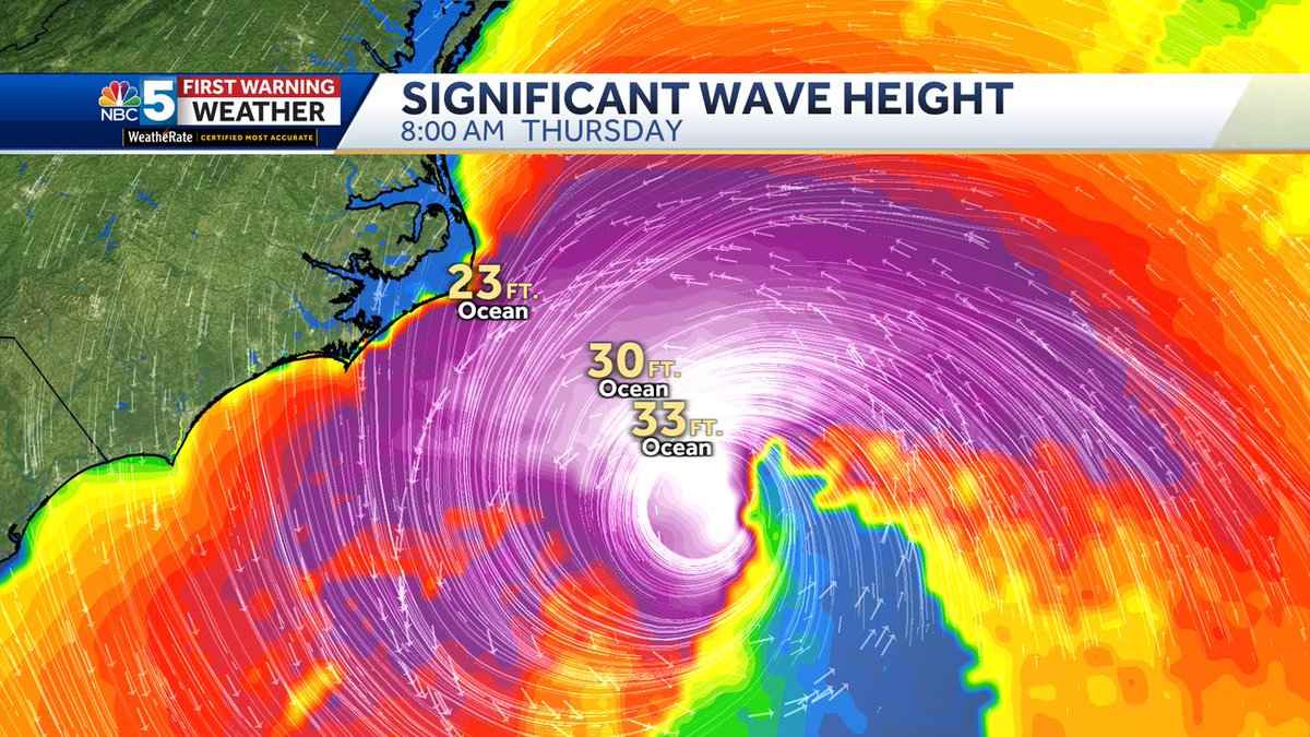
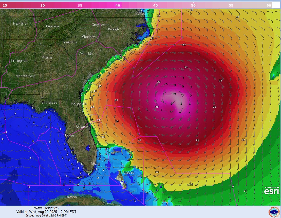
8/20/2025: #HurricaneErin continues to produce a very large area of extremely large and hazardous seas in the SW Atlantic, with seas over 12 feet extending over 400 nm E of the center and waves near 50 feet closer to the center. See hurricanes.gov/marine for forecast details.

Hurricane Erin Creates Risk for Shipping off U.S. East Coast #HurricaneErin #EastCoastShipping #WeatherAlert #MaritimeSafety maritime-executive.com/article/hurric…
NTWC has ruled out any tsunami threat to the U.S. Atlantic Coast. That said, it's a good reminder that a tsunami can happen anytime- even if there's a hurricane. Plan for it so you're prepared for it. #HurricaneErin @NWS
🚨 HURRICANE HQ: FOX Weather is your Hurricane HQ. We're continuing to bring you LIVE coverage tracking Hurricane Erin’s life-threatening impacts. Stay with us 24/7. #foxweather #hurricaneerin #hurricane #erin #live


71st St in Ocean City MD According to Lisa Haker Bowman: Some of the waves are already coming up to the path. The waves just keep getting bigger and BIGGER!!! #HurricaneErin


Something went wrong.
Something went wrong.
United States Trends
- 1. May the 4th N/A
- 2. John Sterling N/A
- 3. #StarWarsDay N/A
- 4. Good Monday N/A
- 5. #اصنع_في_الامارات N/A
- 6. #MondayMotivation N/A
- 7. #PorApátridaNoVolverás N/A
- 8. #May4th N/A
- 9. Mike Lee N/A
- 10. Whale - Buy N/A
- 11. QUICK TRADE N/A
- 12. Smart Money - Buy N/A
- 13. RIP Legend N/A
- 14. TOP CALL N/A
- 15. Project Freedom N/A
- 16. Suzyn N/A
- 17. Jedi N/A
- 18. New York Yankees N/A
- 19. NovaRed Mining N/A
- 20. FDV Alert N/A