#ncwx search results

As I was saying yesterday… 🤷🏾♂️ #ncwx
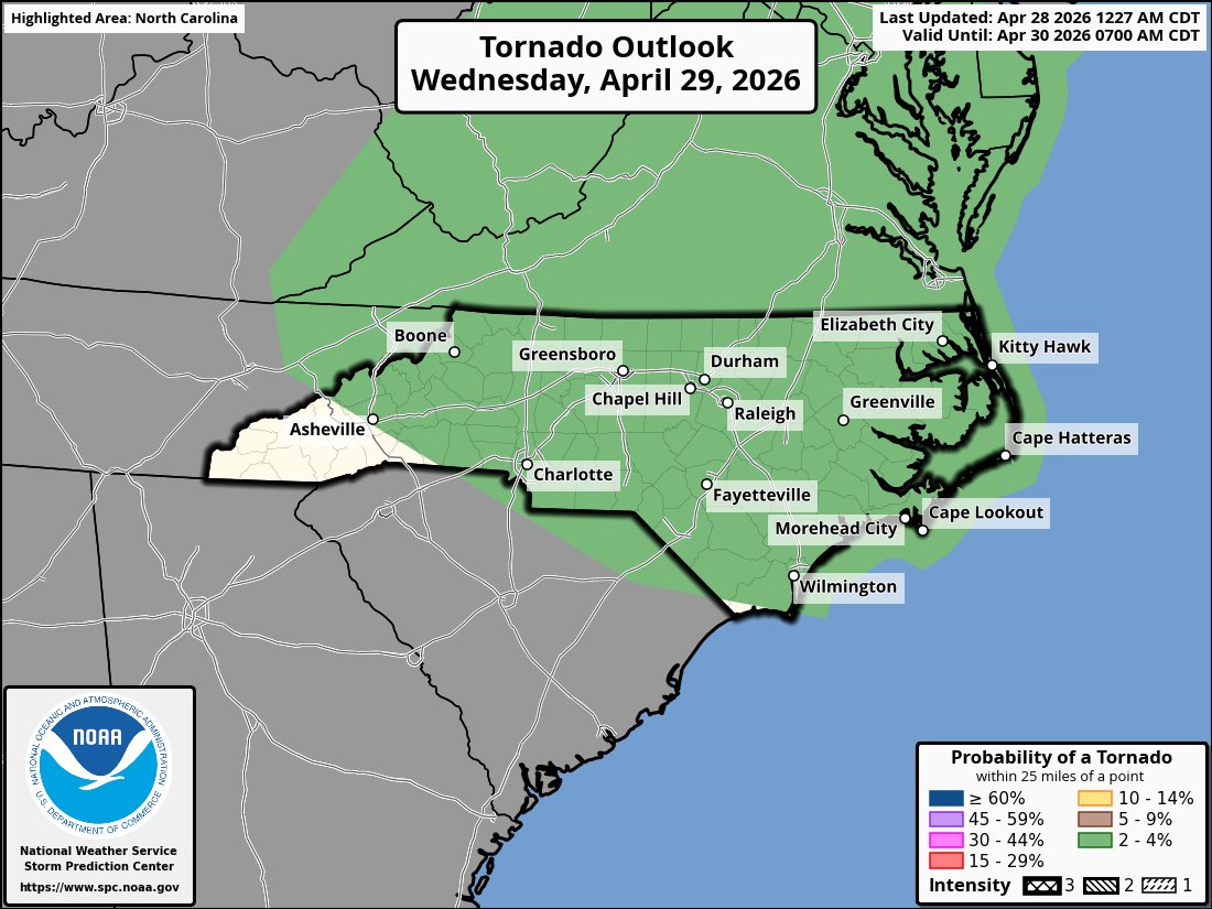
⚠️Weather Update: Wouldn’t be surprised to see a 2% tornado risk added for portions of NC on Wednesday afternoon/evening. NAM 3km has been consistent with this in previous model runs as well. We shall see. #ncwx


We're looking ahead to two additional chances for rain with the ongoing drought. Wednesday is our next best chance for showers. #scwx #ncwx #myrwx @wmbfnews wmbfnews.com/2026/04/28/fir…

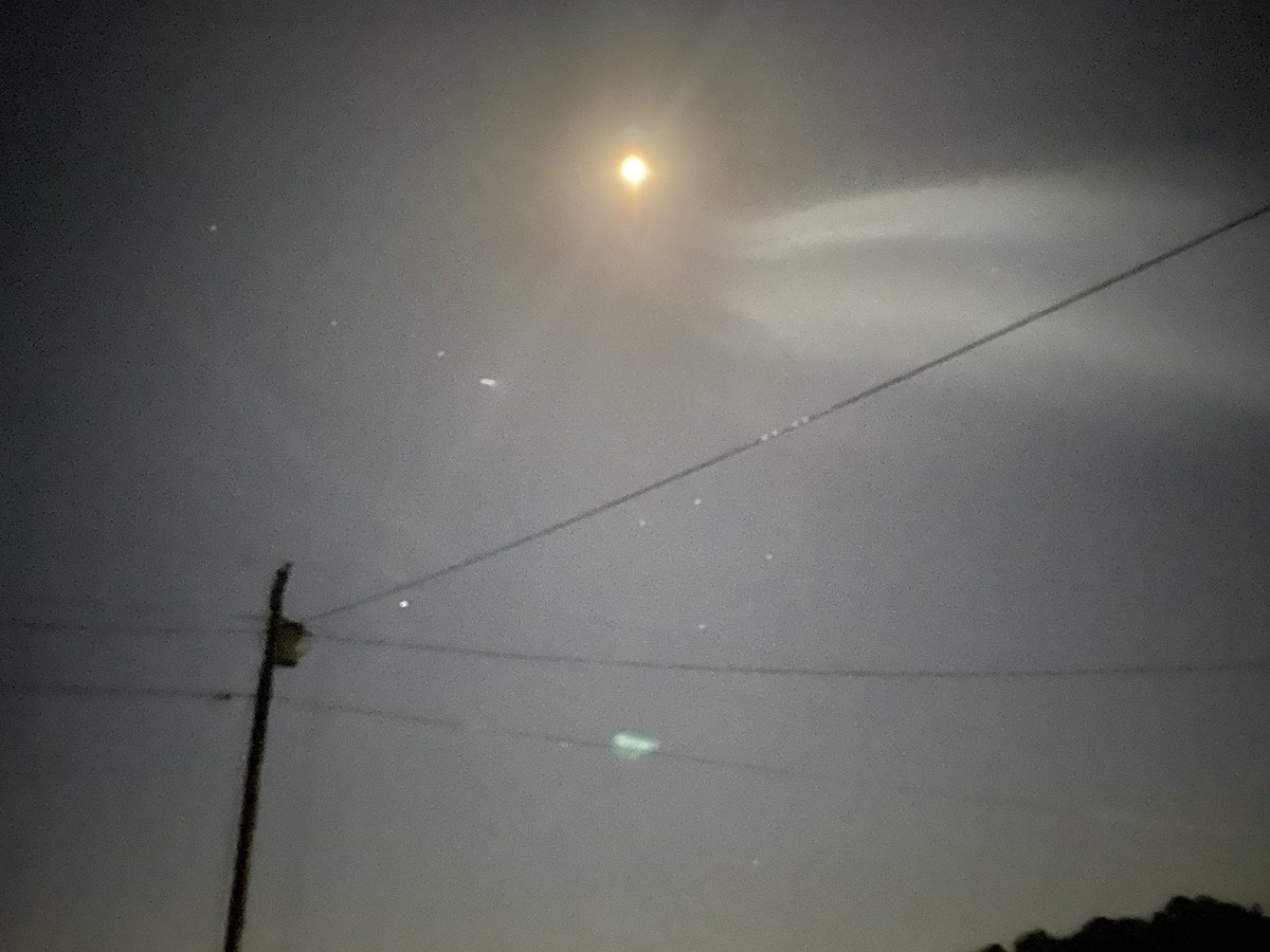
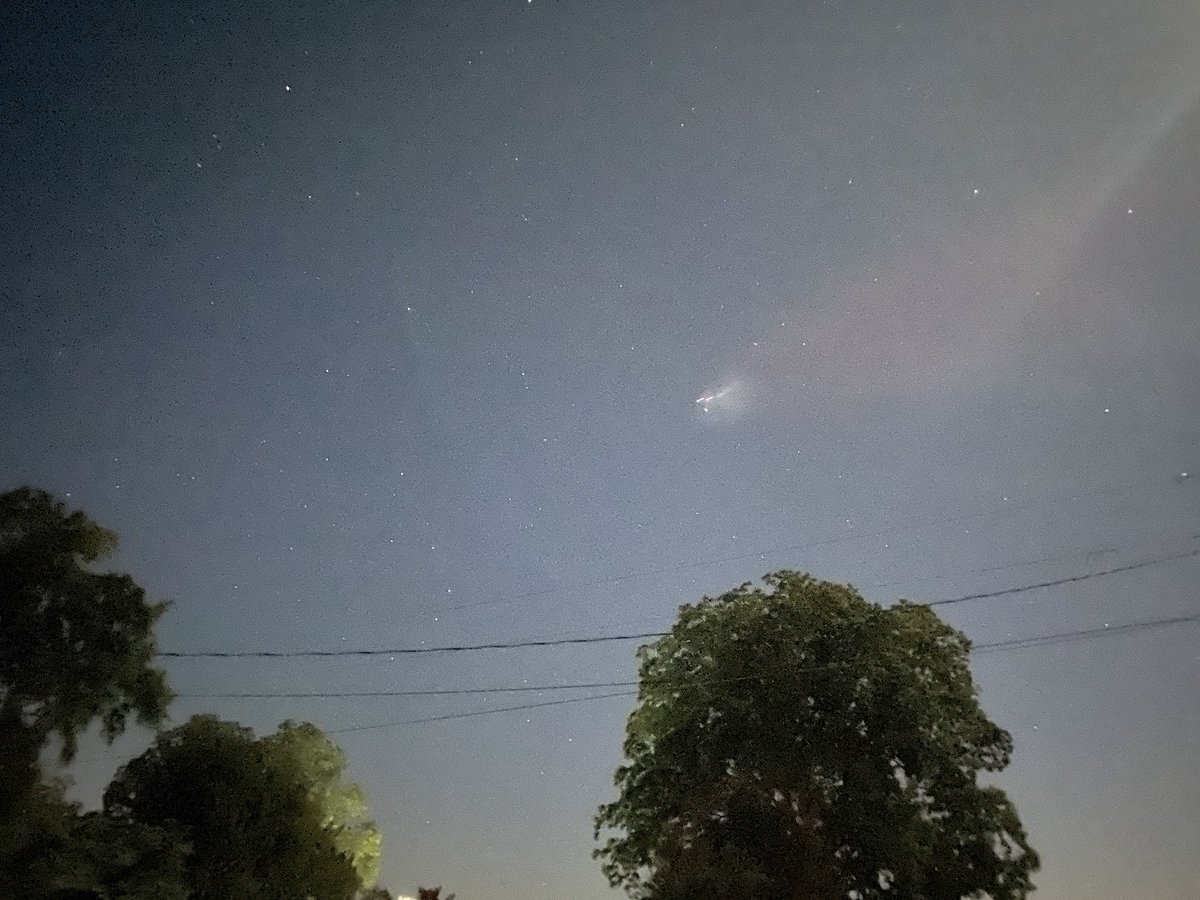
A light jacket wouldn't hurt this morning. Temperatures are sitting in the mid-upper 40s inland under mostly clear skies. #scwx #ncwx #myrwx @wmbfnews


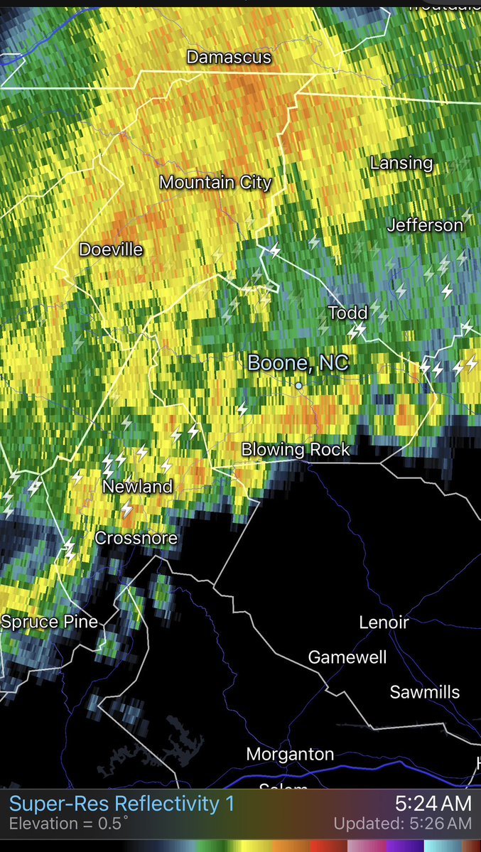
📡 5:26 AM radar: Rain and embedded thunderstorms moving through the High Country. Heavier cells and lightning near Mountain City, Newland, and Blowing Rock. Allow extra time if heading out. #NCWx #HighCountryNC #Boone
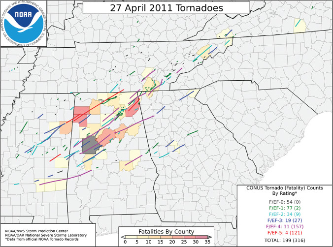
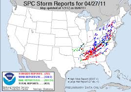
ON THIS DATE, 15 YEARS AGO: An outbreak of tornadoes tore across the southeastern United States with numerous long-track violent tornadoes. The supercell responsible for the tornado that devastated Tuscaloosa, AL. #scwx #gawx #ncwx


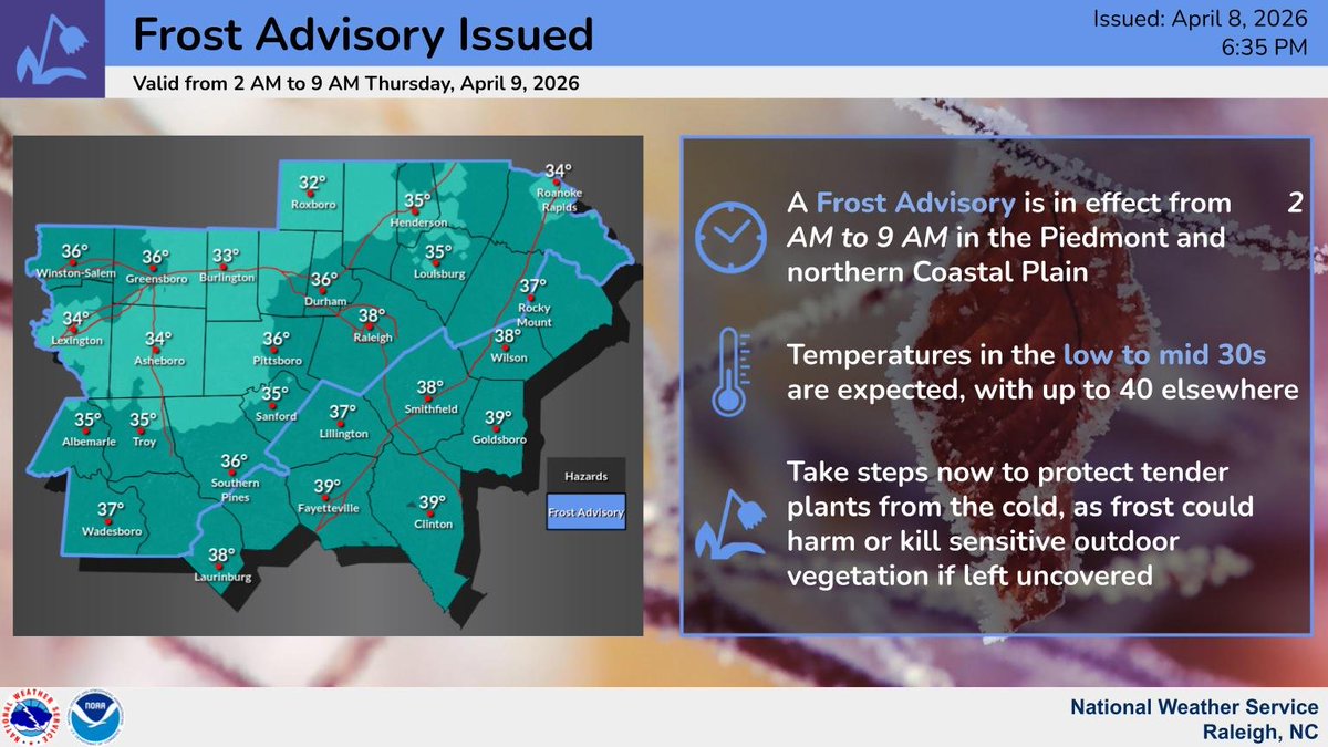
⚠️🥶 A Frost Advisory has been issued for portions of central North Carolina, including the Piedmont and northern Coastal Plain, valid from from 2 AM to 9 AM tonight into tomorrow morning. 🪴 Take time today to protect your tender plants and bring any potted plants inside. #NCwx

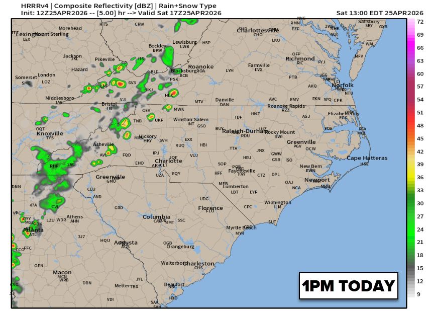
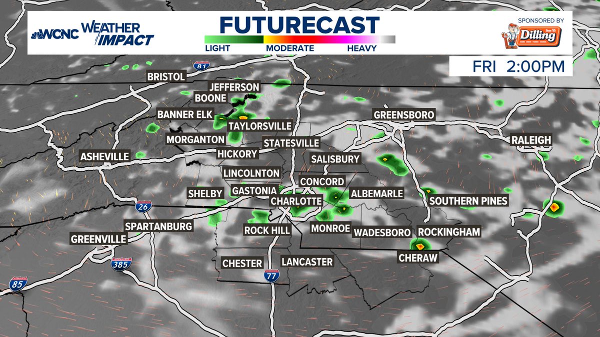
Here's a look at the timing of the scattered showers and storms today. Not everyone will see good rain, and even those who do will not amount to a lot. #cltwx #ncwx #scwx #wcnc


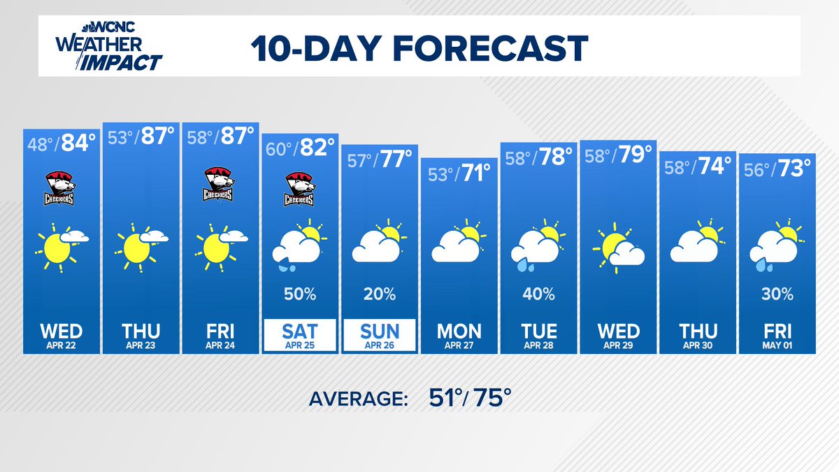
10-Day Forecast: Hot and dry the next 3 days, but signs of a normal pattern for mid to upper 70s and rain chanecs every 2-3 days starting this weekend. #cltwx #ncwx #scwx #wcnc
The pine pollen is down, but still lots of other tree pollen out. The # drought and lack of rain have allowed this pollen to blow around and stick around. The good news is that we are past the peak, and things get better quickly in May. #cltwx #ncwx #scwx #wcnc


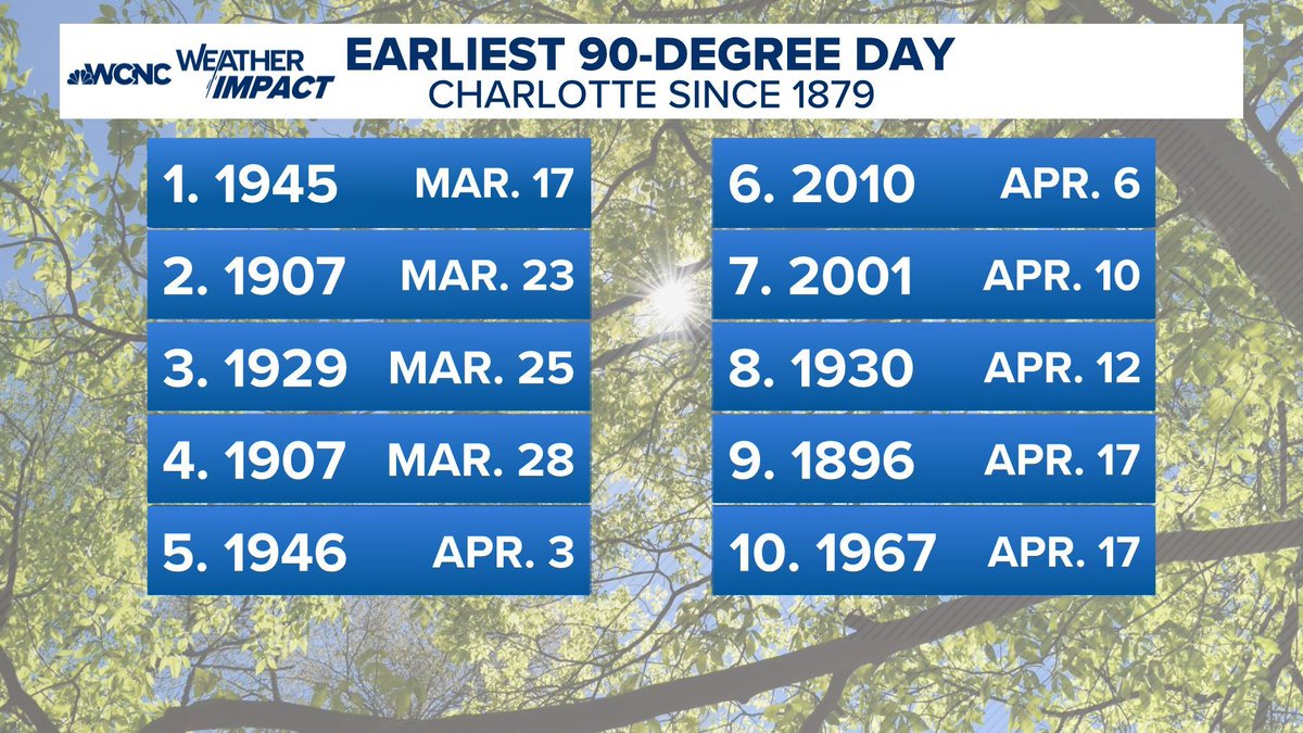
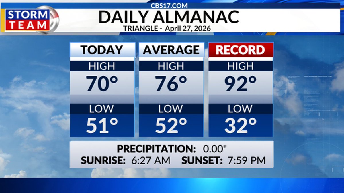
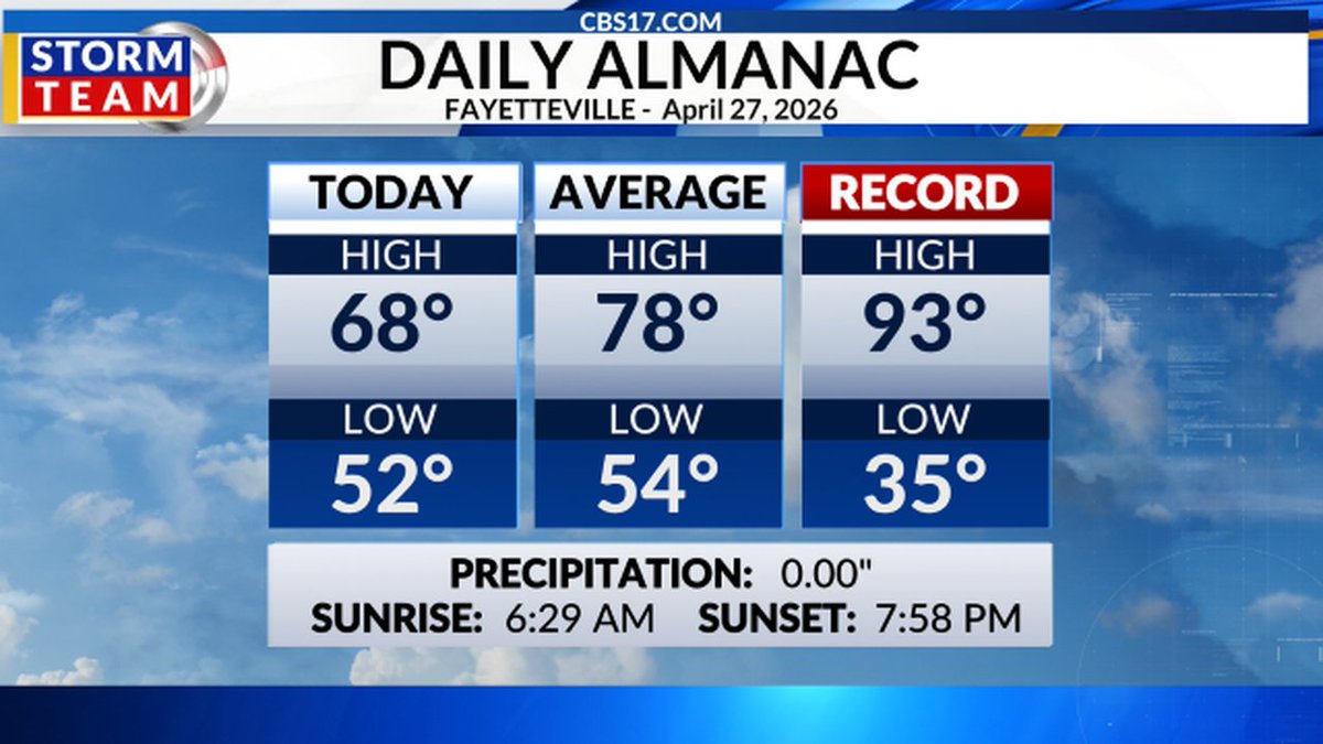
We haven't had a 90° in April since 2010, and this week we could do it 4-5 times, with record highs and the top-ten earliest 90° on record. #cltwx #ncwx #scwx #wcnc


It was nice to get some rain finally, but boy, were the amounts small. We have more chances ahead, but yesterday didn't do anything for the #drought; it did help to address the wildfire danger in the short term. #cltwx #ncwx #scwx #wcnc

Beneficial rainfall returns Saturday ahead of a cold front. However, rainfall amounts will be light and will have a very little impact on the ongoing drought. #ncwx #scwx #gawx

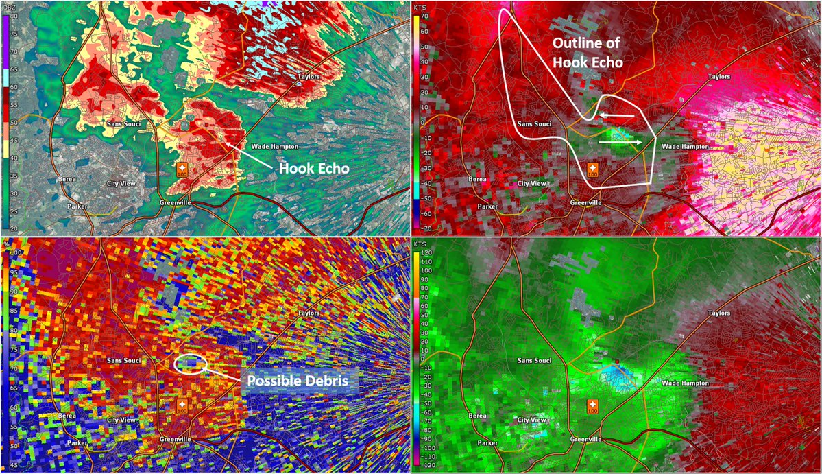
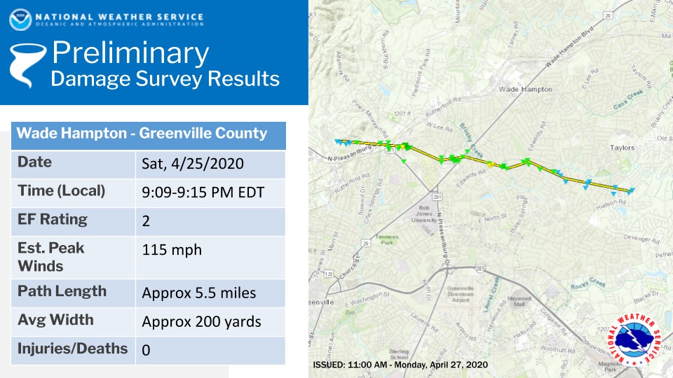
ON THIS DATE, 6 YEARS AGO: Several supercells developed along I-85 from Upstate SC and metro Charlotte, producing widespread large hail and an EF2 tornado near Greenville, SC. Numerous businesses were damaged and trees down onto home and vehicles. #scwx #ncwx

Increasing mid clouds over our office ahead of showers moving in from the west. It still looks like most locations our forecast area will see at least some measurable rain today. We'll take what we can get! #scwx #ncwx #gawx


If you like warm weather, you'll enjoy the weather today as temperatures will feel like early summer with plenty of sunshine. #scwx #ncwx #gawx

Hot and well above normal temperatures are expected much of this week, especially Wednesday through Saturday. Chance of highs reaching the lower 90s east of the mountains will steadily increase through Saturday. #ncwx #scwx #gawx


📡 5:26 AM radar: Rain and embedded thunderstorms moving through the High Country. Heavier cells and lightning near Mountain City, Newland, and Blowing Rock. Allow extra time if heading out. #NCWx #HighCountryNC #Boone
A light jacket wouldn't hurt this morning. Temperatures are sitting in the mid-upper 40s inland under mostly clear skies. #scwx #ncwx #myrwx @wmbfnews
As I was saying yesterday… 🤷🏾♂️ #ncwx
⚠️Weather Update: Wouldn’t be surprised to see a 2% tornado risk added for portions of NC on Wednesday afternoon/evening. NAM 3km has been consistent with this in previous model runs as well. We shall see. #ncwx
We're looking ahead to two additional chances for rain with the ongoing drought. Wednesday is our next best chance for showers. #scwx #ncwx #myrwx @wmbfnews wmbfnews.com/2026/04/28/fir…
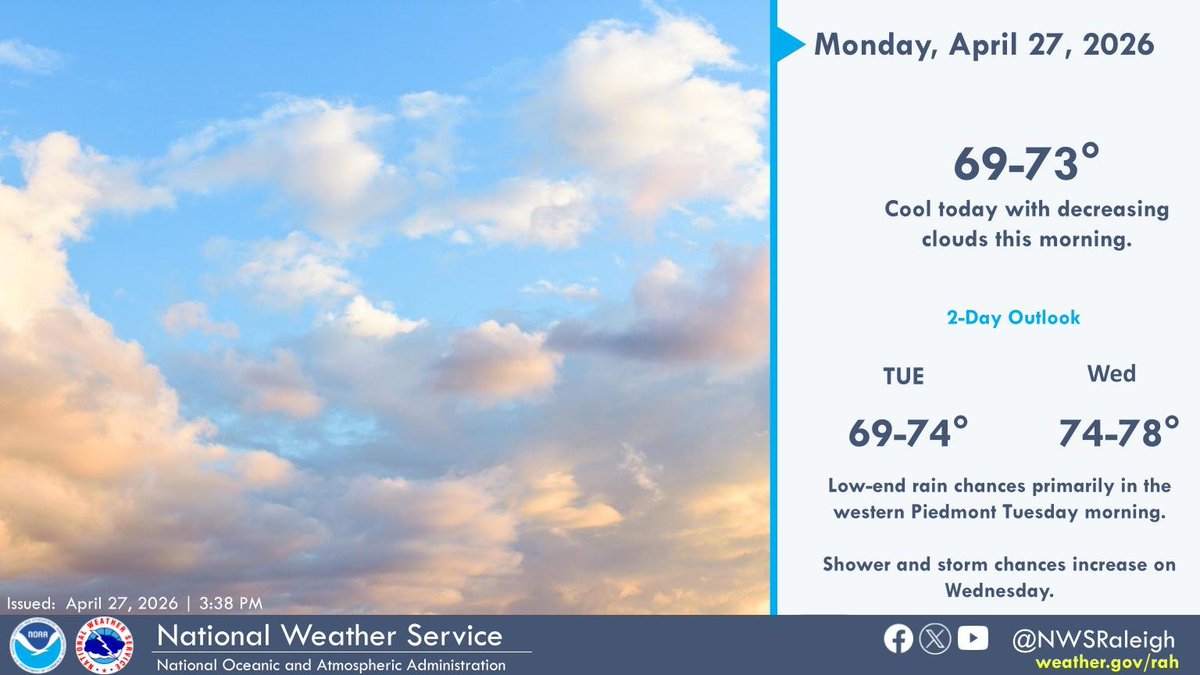
Increasing clouds today with a few showers possible in the Triad this morning. Highs will be in the low 70s. #NCwx
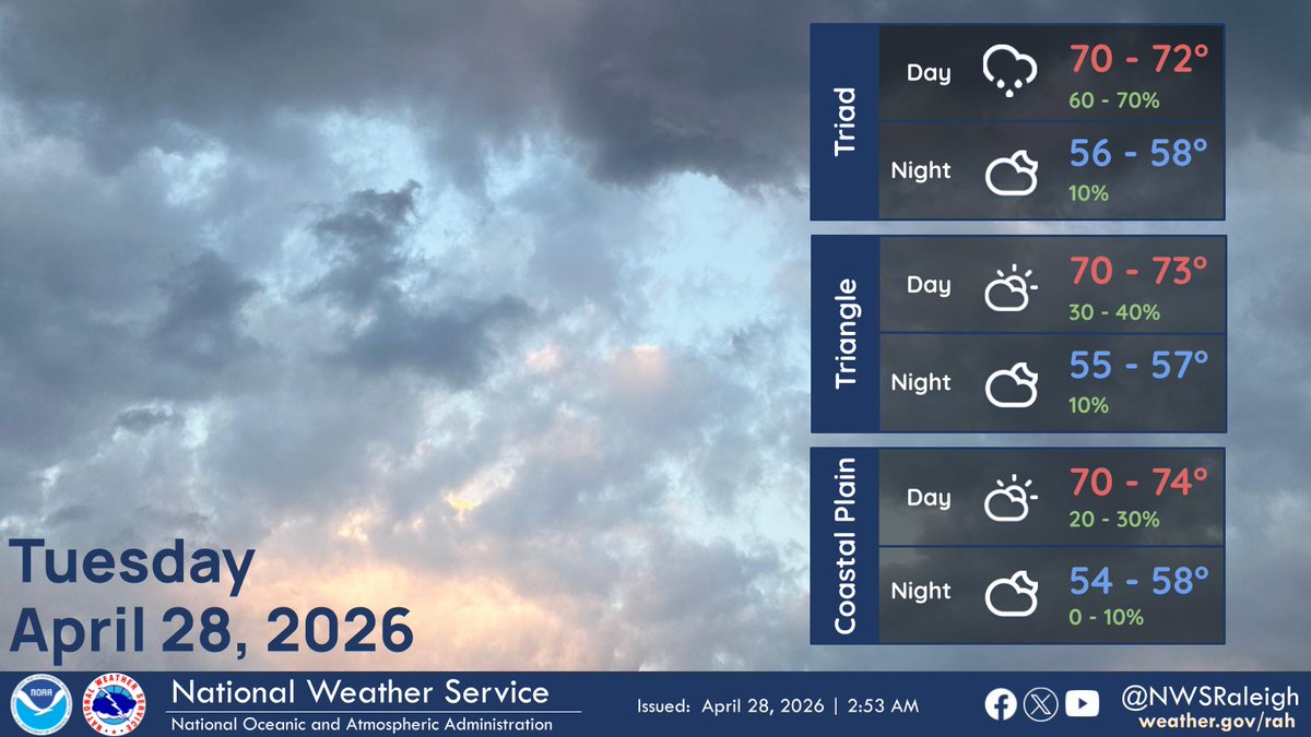


Light rain is possible tomorrow morning, especially across the northern Piedmont. Most areas will see less than 0.1", but keep the umbrella handy just in case! #NCwx

Good evening ENC! Another cool night is in store for the area, with lows getting down into the 40s inland and 50s along the OBX and immediate coast tonight. We are in for a treat tomorrow with slightly warmer temps and much lighter winds! #NCwx


Another day in the books! Here's a look at current temperatures this evening. Have a great night! #ncwx


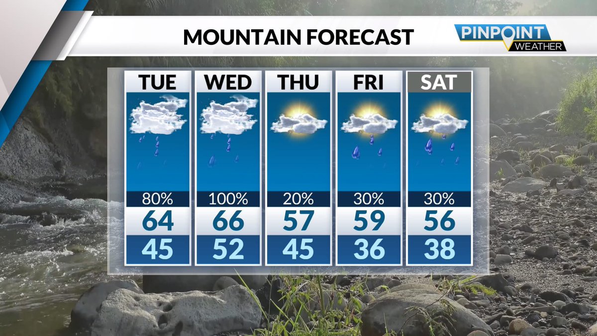
-An active 5 days ahead for the western Carolinas! -Multiple rounds of rain are expected through Saturday. -Some of these rounds could be significant. -Some data shows many getting well over 1" total. -A new drought monitor will come out Thursday. @WLOS_13 #wncwx #avlwx #ncwx

Rain chances return Tuesday morning. The North Carolina mountains will have the best chance to see rain hold together as well as the best chance to see the highest rainfall amounts. #ncwx #scwx #gawx


Low-impact showers Tuesday morning, then more significant rain arrives Wednesday morning. Expecting 0.25"-0.5" of rain along & east of I-77, a little more to the west. Outside chance (threat level 1 out of 5) of severe thunderstorm wind gusts. #NCwx #SCwx @WBTV_News


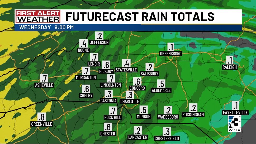

THIS WEEK: More rain chances! Over the next 7 days, most areas could pick up an inch or more of rain. First round comes tomorrow morning; the next one Wednesday AM. More rain/storms possible this weekend, too. 🌧 @Queen_City_News #droughthelp #cltwx #ncwx #scwx


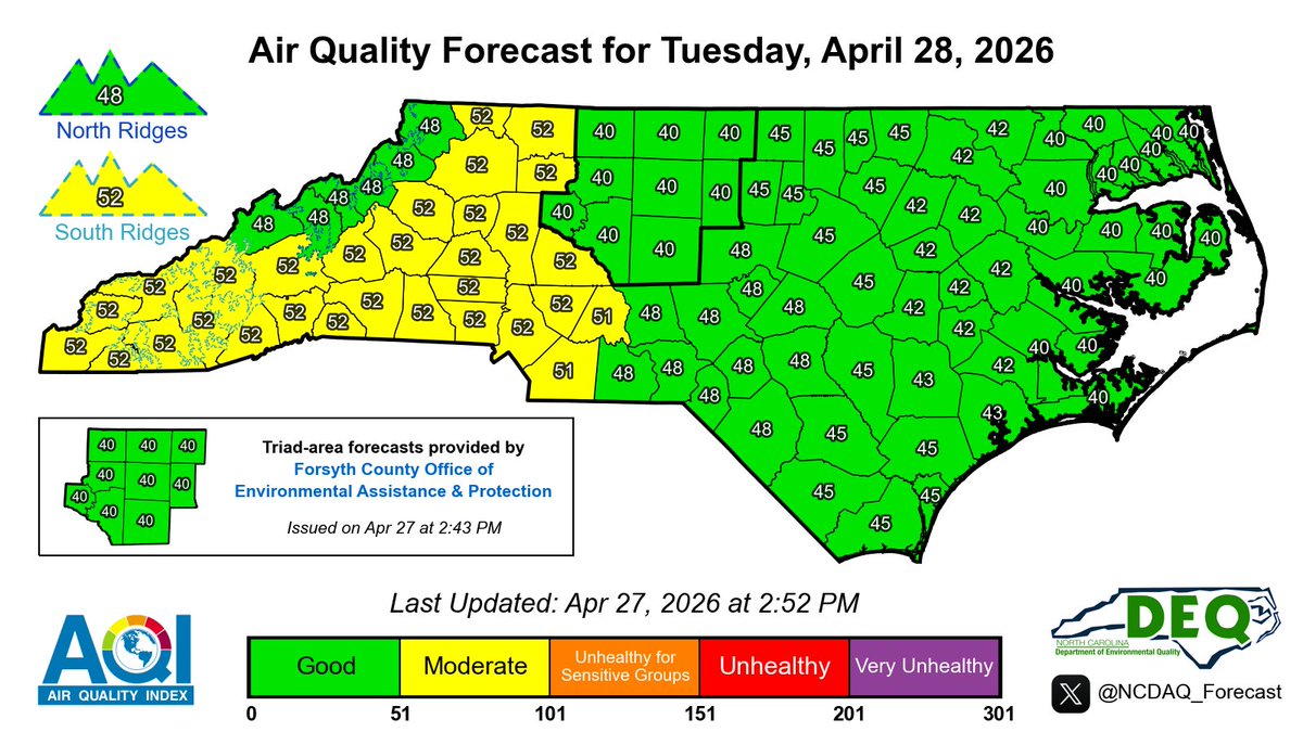
Here is the latest NC Air Quality Forecast for Tuesday, 4/28/2026 #ncwx #airquality #AQI For our discussion & KML files: airquality.climate.ncsu.edu/discussion/?is…
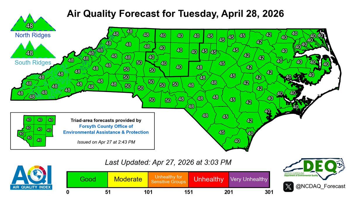
Here is the latest NC Air Quality Forecast for Tuesday, 4/28/2026 #ncwx #airquality #AQI For our discussion & KML files: airquality.climate.ncsu.edu/discussion/?is…
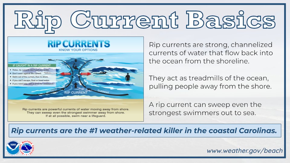
It’s Carolinas Rip Current Awareness Week! Rip currents are the #1 weather related killer in the coastal Carolinas. Follow us throughout the week for rip current and beach safety tips to keep you & your family safe at the beach. Link: weather.gov/ilm/ripcurrents #scwx #ncwx


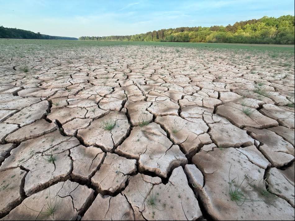
I don't think people understand how bad the drought has gotten here in North Carolina. One of WRAL reporters took this picture at Falls Lake, which is the main drinking water source for the city of Raleigh. #ncwx
That's a lot of very low streamflow; some are at record lows for this time of year. #drought #cltwx #ncwx #scwx


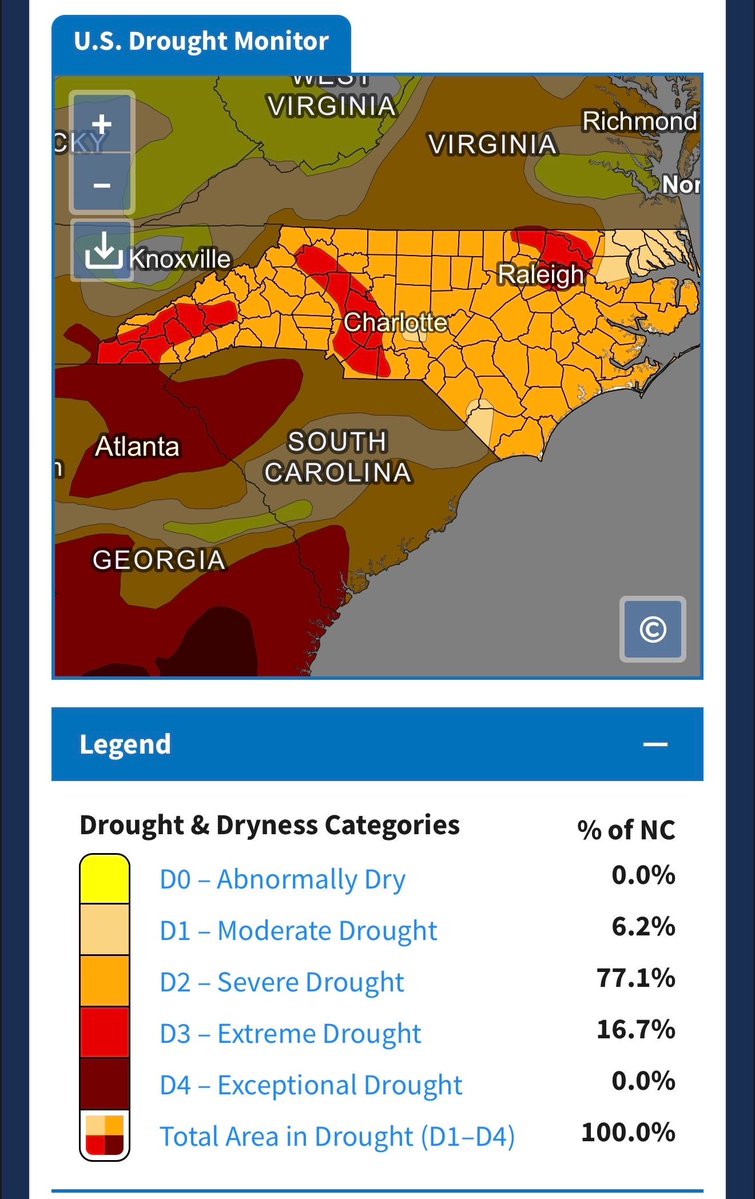
The latest report from the US Drought Monitor just dropped and IT IS UGLY! EXTREME DROUGHT - the second worst category - has expanded across the state including into parts of the Pee Dee. SEVERE DROUGHT now covers 93% of the state - a large jump in just one week. #SCwx #NCwx


It was nice to get some rain finally, but boy, were the amounts small. We have more chances ahead, but yesterday didn't do anything for the #drought; it did help to address the wildfire danger in the short term. #cltwx #ncwx #scwx #wcnc
10-Day Forecast: Hot and dry the next 3 days, but signs of a normal pattern for mid to upper 70s and rain chanecs every 2-3 days starting this weekend. #cltwx #ncwx #scwx #wcnc
Trying not to get too excited, and certainly nothing too widespread. But scattered showers or even a thunderstorm are possible late Saturday afternoon and evening. 🤞 #raindance #cltwx #ncwx #scwx #wcnc

We haven't had a 90° in April since 2010, and this week we could do it 4-5 times, with record highs and the top-ten earliest 90° on record. #cltwx #ncwx #scwx #wcnc
10-Day Forecast: Cooler and chances of rain over the next 10 days. It looks like we might finally see some average April weather. #cltwx #ncwx #scwx #wcnc

We need rain so bad, the #drought just keeps getting worse and now we are fully in the growing season. #cltwx #ncwx #scwx #wcnc
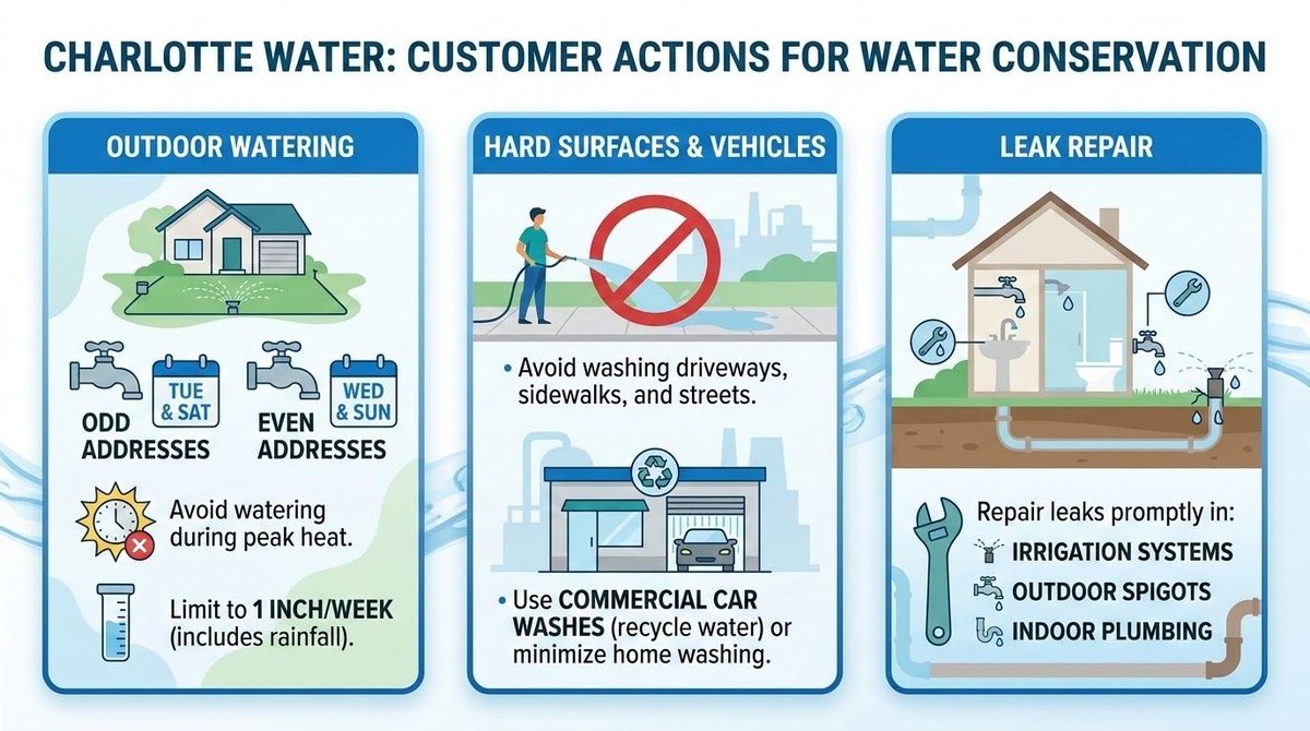
#Charlotte Water has begun asking for voluntary water restrictions due to the drought. If conditions worsen or people don't do enough voluntarily, these could become mandatory. Full story here-->buff.ly/Hr31GPb #cltwx #ncwx #scwx #wcnc #drought
This week's #drought monitor shows that ~40% of the Carolinas are now in extreme drought conditions. #cltwx #ncwx #scwx #wcnc

Hot, dry, and very summer-like this week with several records within reach. Our average high is 73° right now and the average low is 48°. #cltwx #ncwx #scwx #wcnc


Rapidly developing wildfire in Avery County near the Mitchell County line. Aerial assets are on the way to help a Chinook firefighting helicopter in route. 20 acres and spreading quickly. #wncwx #widlfire #ncwx

It's not much, but just maybe a few very isolated showers are possible on Friday afternoon. A disturbance over in Tennessee moves over us with maybe just enough to kick off a stray shower or storm, just need some low-level moisture. #cltwx #ncwx #scwx #wcnc
Cool stacked lenticular clouds today from near West Jefferson. Thanks to Lori Howard Myers for the picture. #wncwx #ncwx

The South Carolina burn ban comes back into effect starting Friday. North Carolina has never lifted their burn ban for the past 3 weeks. #cltwx #ncwx #scwx #drought #wcnc #wildfire

5:36pm The county line wildfire in Avery County has grown to 50 acres, and they are sending fixed-wing air tankers in now. #wildfire #wncwx #ncwx


The pine pollen is down, but still lots of other tree pollen out. The # drought and lack of rain have allowed this pollen to blow around and stick around. The good news is that we are past the peak, and things get better quickly in May. #cltwx #ncwx #scwx #wcnc

Something went wrong.
Something went wrong.
United States Trends
- 1. Good Tuesday N/A
- 2. Kyle Tucker N/A
- 3. Cade N/A
- 4. Pistons N/A
- 5. Spencer Jones N/A
- 6. Duren N/A
- 7. #WWERaw N/A
- 8. #BCSpoilers N/A
- 9. Devin Booker N/A
- 10. #ForgedInGold N/A
- 11. #TusksUp N/A
- 12. Magic N/A
- 13. World War Eleven N/A
- 14. Tabata N/A
- 15. Roseanne N/A
- 16. Orlando N/A
- 17. Kid Rock N/A
- 18. Naz Reid N/A
- 19. Runner N/A
- 20. Asta N/A