#landmapping 検索結果

Goa to conduct a comprehensive land survey after over 50 years to update its records. The survey will identify unoccupied vacant plots and land parcels that are not claimed by any person. #Goa #landsurvey #landmapping #goaproperty #goaliving #trending #realtor #realtynews

📐 Step 2: New Survey Plan Our licensed surveyors prepare a precise plan merging all parcels into one legal property. Accuracy and compliance guaranteed. #LandMapping #SurveyExperts #GiblandSurveys

DILRMP: ज़मीन विवादों का सरल समाधान!भूमि संसाधन विभाग, भारत सरकार की DILRMP पहल के तहत ज़मीन की डिजिटल मैपिंग से पारदर्शिता बढ़ रही है और विवाद कम हो रहे हैं।देखें भूमिजा संवाद का यह वीडियो और जानें ज़मीन से जुड़े विवादों का तेज़ और आसान समाधान! #DILRMP #LandMapping…

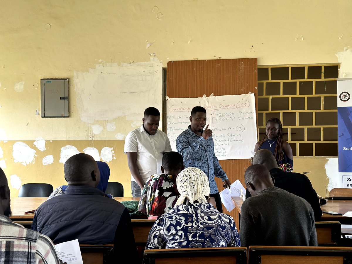
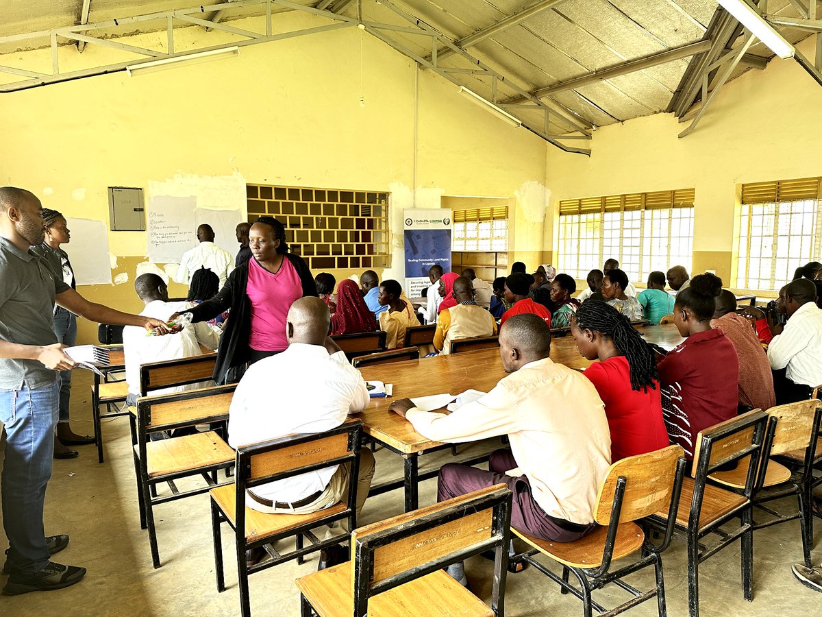
Day 2 of creating awareness unfolds with enthusiasm in Namutumba District! We're unraveling the significance of land mapping—a key to unlocking prosperity for generations to come. #LandMapping #SustainableDevelopment


Precision is our specialty! D.C. Gohn Associates offers top-notch surveying services, ensuring your project starts on the right path. Trust us for accurate land data. #Surveying #LandMapping
You can now access and view the digitized map for your specific area by clicking the link below: Click Here to see your Area: lis.pulse.gop.pk #DigitalPunjab #LandMapping

Our SAEE project team went to Moremi High School to teach students about valuable land mapping skills. Hands-on learning in action! #SAEEProject #landmapping #christianfoodaid #Empoweringyouth #SustainableFuture


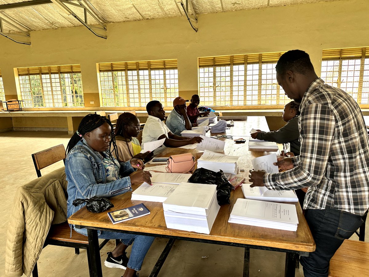
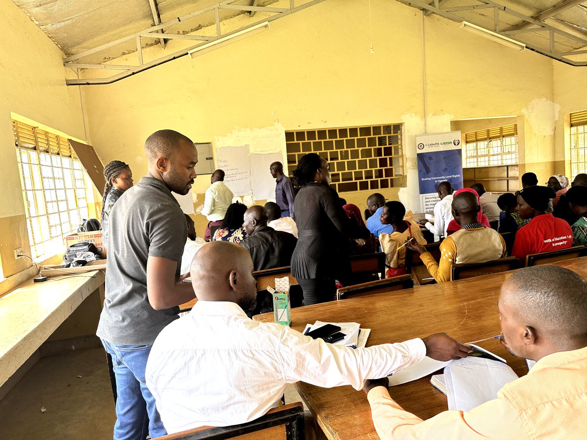
Excited to lead a sensitization session in Namutumba District on land mapping and customary land ownership. Empowering communities with knowledge for sustainable development. The citizens are excited to know about their land rights! #LandMapping #CommunityEmpowerment


Get a chance to be a part of TeckZy's workshops to learn the art of drone photography. #droneshots #drones #landmapping #landsurveying #aerialimagery #uav #aerialvideography


"Precision meets possibility with our topography surveys. 🌐 Explore the terrain, shape the future. #TopographySurvey #LandMapping #PrecisionMeetsPossibility #PragatiKaHighway #BuildingTheNation #GatiShakti"
"Unveiling the hidden landscape with our topography surveys. 🗺️ Let's sculpt the future together. #TopographySurvey #LandMapping #SculptingTheFuture #PragatiKaHighway #BuildingTheNation #GatiShakti"

NIT Rourkela develops India’s first autonomous drone system for real-time land mapping, secures patent for BHU-MANACHITRA @nitrourkela @bhupro #Research #LandMapping #Remotesensing #AI #drone educationtimes.com/article/campus…
"Unveiling the intricate tapestry of the land through our topography surveys. 🗺️ Let us guide your path to progress. #TopographySurvey #LandMapping #NavigateTheTerrain #PragatiKaHighway #BuildingTheNation #GatiShakti"
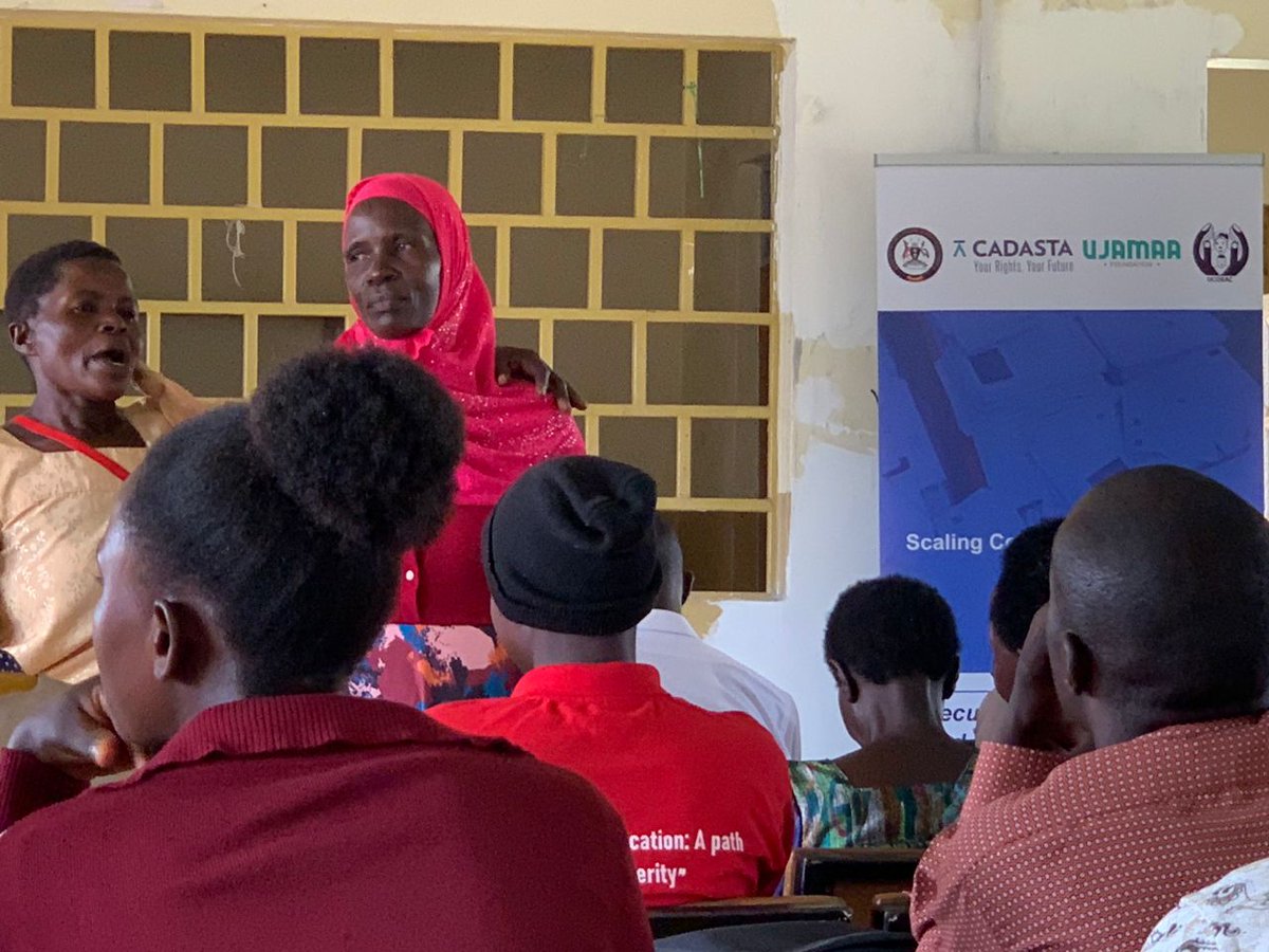
Exciting times at Ujamaa Foundation as our dedicated team gears up for a crucial training session! 🌍 Today, we're preparing to embark on the transformative journey of land mapping for customary ownership in Namutumba district. Ready to make a positive impact! #LandMapping


"Discovering the beauty in every contour. 🏞️ Our topography surveys capture the essence of the land, guiding your journey towards success. #TopographySurvey #LandMapping #ExploreTheContours #PragatiKaHighway #BuildingTheNation #GatiShakti"
Do you have experience in #EarthObservation or #LandMapping? 🌍 The EPA is #recruiting for the role of Scientific Officer, Land Evidence. The #job will be based in EPA Headquarters in Wexford, working in the Office of Evidence and Assessment. 📅Apply by 4pm on January 8.

"Charting the unseen, revealing the potential. 🌄 Our topography surveys pave the way for progress. #TopographySurvey #LandMapping #UnlockPotential #PragatiKaHighway #BuildingTheNation #GatiShakti"


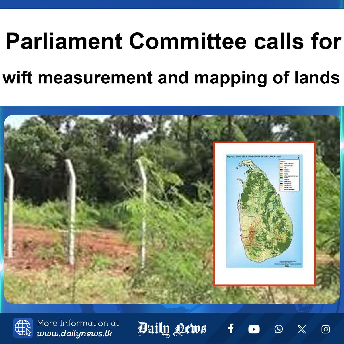
Parliament Committee calls for swift measurement and mapping of lands More Info >>> dailynews.lk/?p=898493 #lka #SriLankaLand #LandMapping #SurveyDepartment #LandReforms #ParliamentUpdates #ResourceSustainability #LandManagement #SriLankaNews #TaxRecovery 𝗙𝗢𝗟𝗟𝗢𝗪 𝗨𝗦…
You can now access and view the digitized map for your specific area by clicking the link below: Click Here to see your Area: lis.pulse.gop.pk #DigitalPunjab #LandMapping
📐 Step 2: New Survey Plan Our licensed surveyors prepare a precise plan merging all parcels into one legal property. Accuracy and compliance guaranteed. #LandMapping #SurveyExperts #GiblandSurveys

#SaveYalaSwamp4Community @orengo_james Step 2: Undertake Beneficiary/Community Mapping & Registration! Identify & document community land owners & users. Accurate data is key to securing our land rights! #CommunityLandRegistration #LandMapping. @ActionAid_Kenya, @KituoSheria
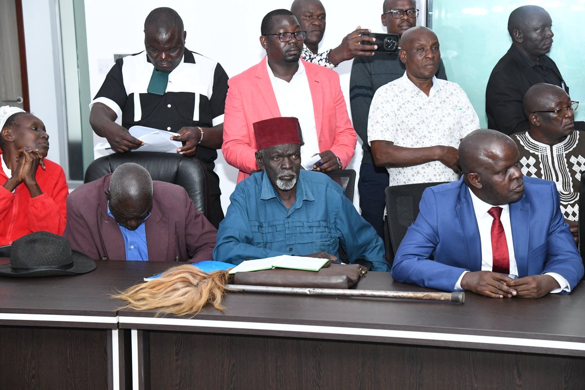

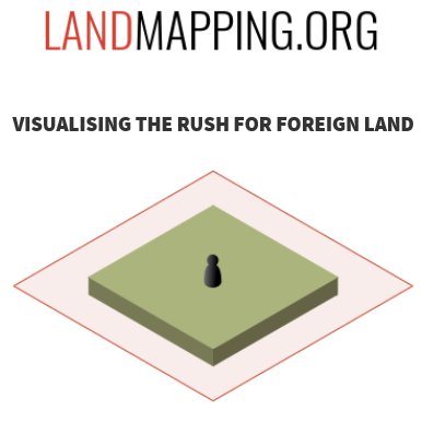
Maha orders mapping of religious encroachments on forest land Forest minister assures House that information would be collected #Maharashtra #ForestLand #LandMapping #Environment Read: epaper.lokmat.com/articlepage.ph… Story by: Vijay Pinjarkar

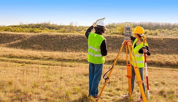
Ever wondered how land boundaries are set in Nairobi? Cadastral surveys map property lines for ownership & development. We’re surveying in Nairobi, Central, Narok & Kajiado! Know your land’s value today. 📲 0723054542 #KenyaSurveys #LandMapping #LandSurveyingKenya

📐 Step 2: New Survey Plan Our licensed surveyors prepare a precise plan merging all parcels into one legal property. Accuracy and compliance guaranteed. #LandMapping #SurveyExperts #GiblandSurveys
Get a chance to be a part of TeckZy's workshops to learn the art of drone photography. #droneshots #drones #landmapping #landsurveying #aerialimagery #uav #aerialvideography
Our SAEE project team went to Moremi High School to teach students about valuable land mapping skills. Hands-on learning in action! #SAEEProject #landmapping #christianfoodaid #Empoweringyouth #SustainableFuture
Precision is our specialty! D.C. Gohn Associates offers top-notch surveying services, ensuring your project starts on the right path. Trust us for accurate land data. #Surveying #LandMapping

We’re a leading mining engineering firm specializing in surface and underground mine design, surveying, permitting, and project management. We focus on meeting client needs with cost-effective solutions that deliver results. #LotLineAdjustments #SurveyingServices #LandMapping

Excited to lead a sensitization session in Namutumba District on land mapping and customary land ownership. Empowering communities with knowledge for sustainable development. The citizens are excited to know about their land rights! #LandMapping #CommunityEmpowerment
"Charting the unseen, revealing the potential. 🌄 Our topography surveys pave the way for progress. #TopographySurvey #LandMapping #UnlockPotential #PragatiKaHighway #BuildingTheNation #GatiShakti"

A big shoutout to the unsung heroes behind the maps and land measurements. Land surveyors play a vital role in building our communities & infrastructure. Your precision and dedication make the world a more structured and navigable place. Cheers to you! #SurveyorsWeek #LandMapping

Exciting times at Ujamaa Foundation as our dedicated team gears up for a crucial training session! 🌍 Today, we're preparing to embark on the transformative journey of land mapping for customary ownership in Namutumba district. Ready to make a positive impact! #LandMapping
Since 1993 Hillwig-Goodrow Land Surveying & Mapping has been providing top-notch land surveying and mapping services. Our team of experts uses state-of-the-art equipment to ensure accuracy and efficiency in every project. #expertise #stateoftheart #landmapping
Day 2 of creating awareness unfolds with enthusiasm in Namutumba District! We're unraveling the significance of land mapping—a key to unlocking prosperity for generations to come. #LandMapping #SustainableDevelopment
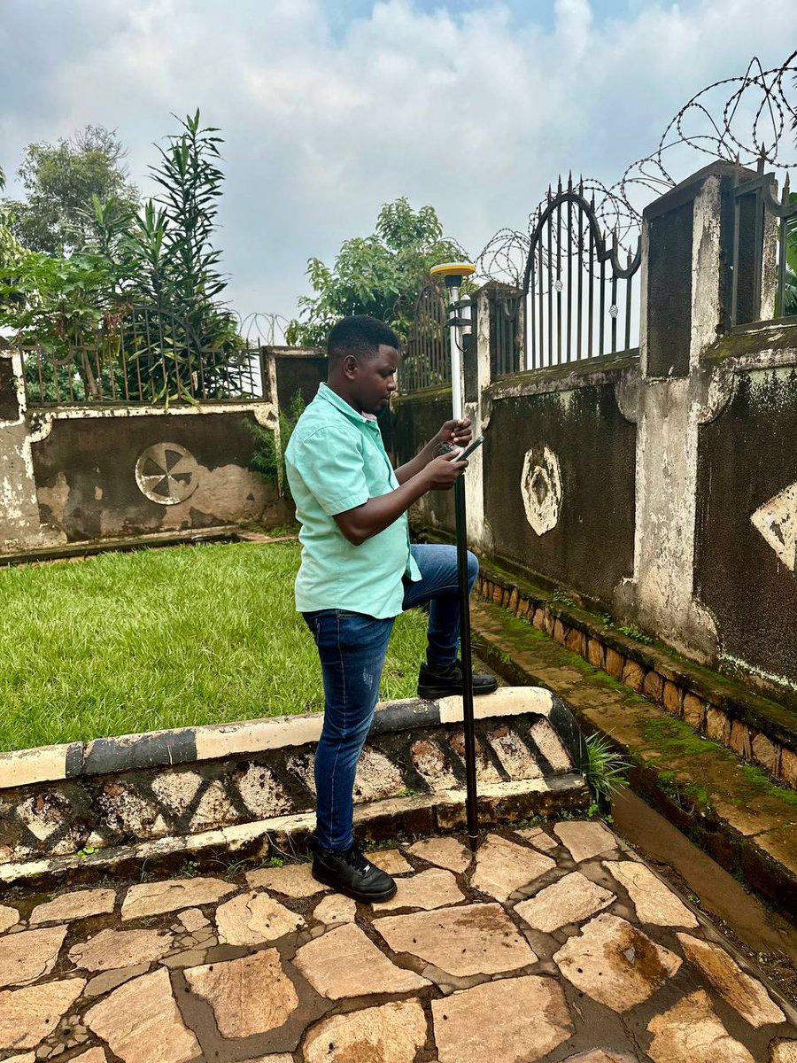
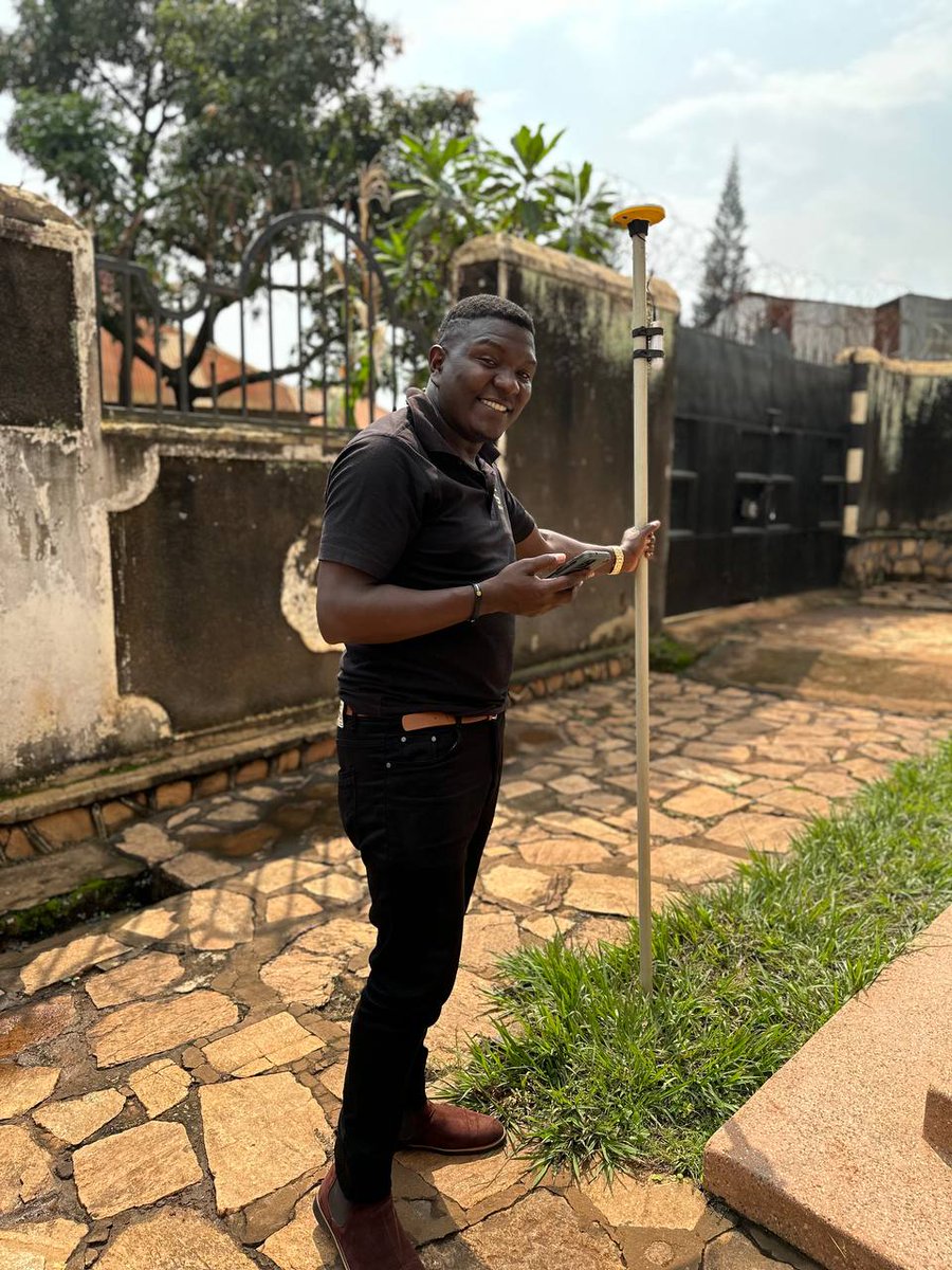
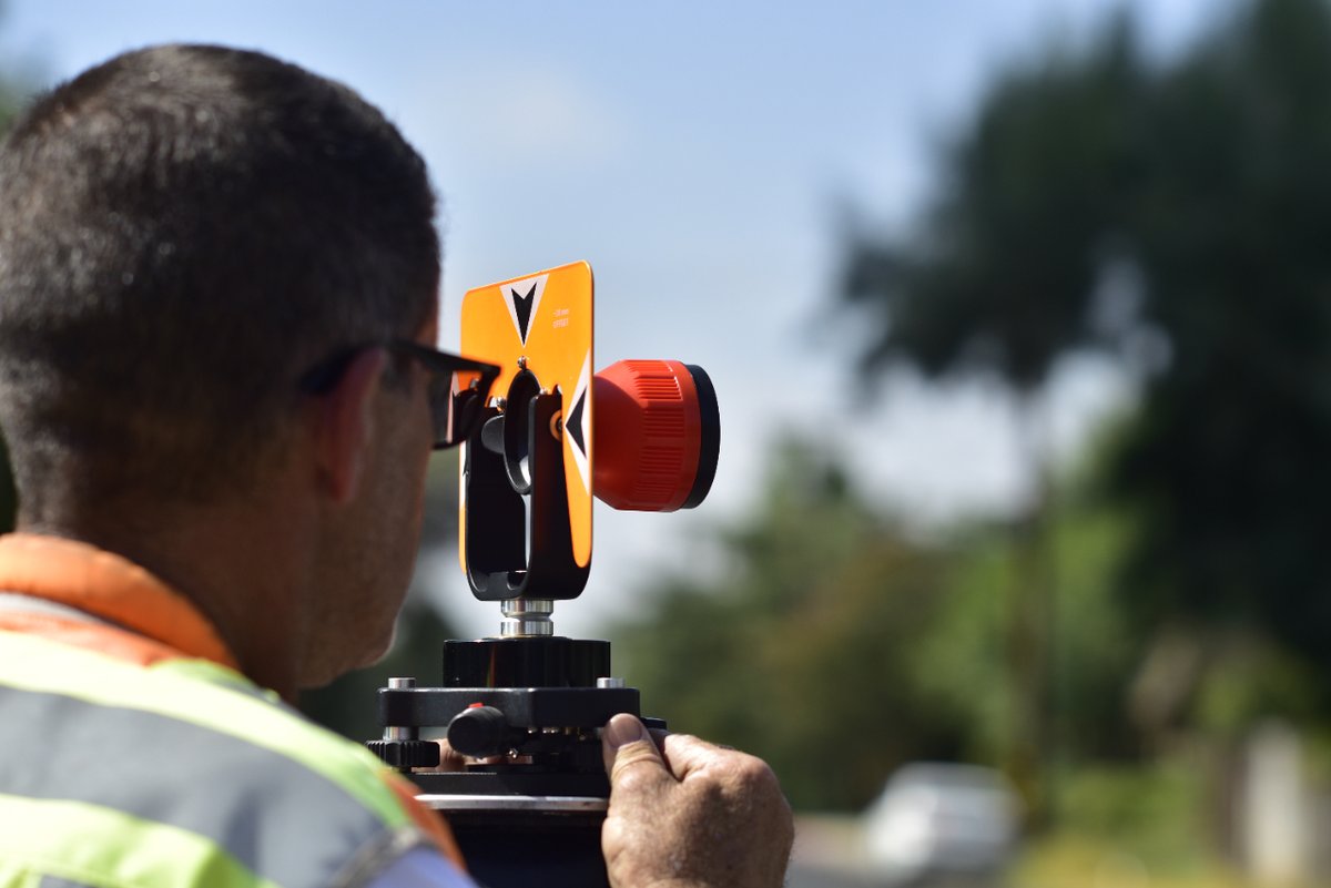
Surveying the terrain with precision – mastering the plan in hand! #Surveying #LandMapping #PrecisionWork


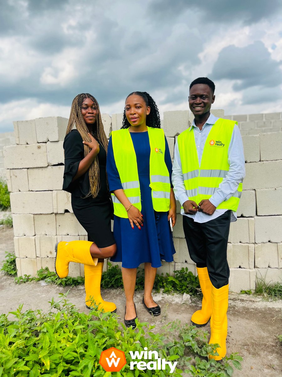
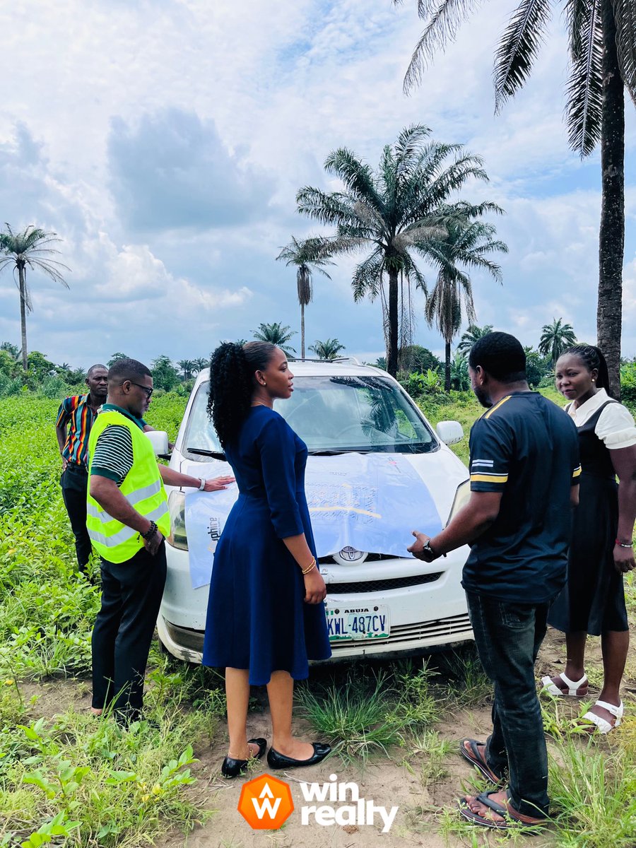
Site Visit Highlights | Win Realty Team in Action Our team was on site for a comprehensive inspection and land mapping session with a prospective client. #WinRealty #SiteInspection #LandMapping #RealEstateNigeria #SecureYourFuture #TeamOnGround


Punjab Government Initiates 3D Mapping of Land! Read the Entire Article: bit.ly/44UJiXh . . #Constructionworld #LandMapping #LandUsePlanning #GeospatialTechnology #PunjabDevelopment #InnovationInLandManagement #GIS #ConstructionTechnology

Something went wrong.
Something went wrong.
United States Trends
- 1. #AEWFullGear 47.4K posts
- 2. Benavidez 13.5K posts
- 3. Haney 25.4K posts
- 4. LJ Martin N/A
- 5. Mark Briscoe 3,273 posts
- 6. Georgia Tech 6,335 posts
- 7. Terry Smith 2,551 posts
- 8. #AlianzasAAA 2,503 posts
- 9. Klay 6,842 posts
- 10. #LasVegasGP 133K posts
- 11. Kyle Fletcher 1,765 posts
- 12. Narduzzi 1,491 posts
- 13. Utah 21.7K posts
- 14. #OPLive 2,246 posts
- 15. Nebraska 24.5K posts
- 16. #LAFC N/A
- 17. Rhule 2,032 posts
- 18. Lando 81.9K posts
- 19. Raleek Brown N/A
- 20. The Elite 35.7K posts