#geospatialtechnology نتائج البحث


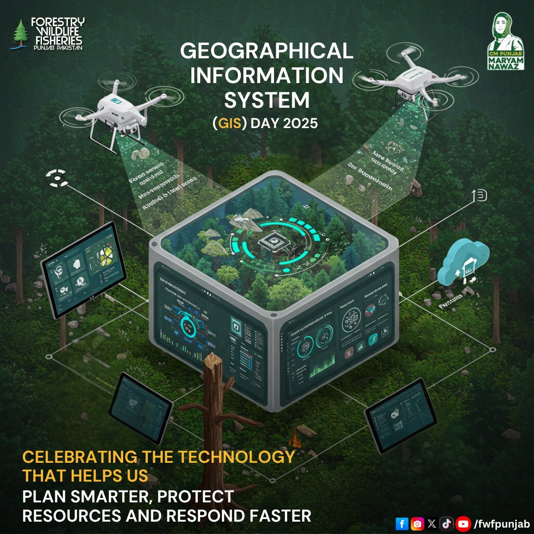
Celebrating the Technology that Helps us. . . . #GISDay #geospatialtechnology #GIS #technology #fwfpunjab #GovtOfPunjab

Geospatial opportunities, As you keep it #GIS #GeospatialTechnology #remotesensing , here are a few opportunities. · @UNICEF - Consultation internationale (6 mois) - Etude du suivi de la température lors du transport des vaccins et de la cartographie des chambres froides,…


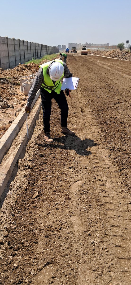
150 mm thick cement treated, Graded crushed stone, stabilized, laid, rolled and compacted to specifications. More watering to cure before laying tarmac. #Highwaygeometry #Engineeringsurvey #Geospatialtechnology


Exciting news! Esri Rwanda, in collaboration with Rwanda Space Agency, is thrilled to announce our GIS Day 2023 celebration with University students and Lecturers at UR, AUCA, and Ines Ruhengeli! #GISDay2023 #GIS #geospatialtechnology


Introducing the Gap Analyser tool, crafted by BISAG-N for @TribalAffairsIn under the Particularly Vulnerable Tribal Groups Scheme. This tool meticulously measures gaps in essential parameters outlined by the ministry. 📊✨ #GeospatialTechnology #DigitalIndia


🌐 The future of geospatial technology is here, and it's built by Foursquare. The power of location data can define how your consumers interact with the world around them. Learn more 👉 location.foursquare.com/?utm_source=tw… #Foursquare #geospatialtechnology


🐠 As environmental and climate threats intensify and become more frequent, The Nature Conservancy’s work in the Caribbean offers a compelling blueprint for global conservation. hubs.ly/Q03PNJsm0 #ClimateResilience #GeospatialTechnology #ENVI #GIS @nature_org
environmentenergyleader.com
High-Tech Conservation in the Caribbean: A Blueprint for Global Impact - Environment+Energy Leader
Advanced mapping tools like AI, drones, and GIS are helping safeguard Caribbean ecosystems, setting a new global standard for conservation and climate resilience.

We joined the “From Data to Decisions” workshop on #GeospatialTechnology, AI, and Risk Assessment in Southeast Asia. During the session, we shared lessons from Lao PDR on using Earth Observation for climate #resilience & facilitated a session on UN-ASIGN and decision tools.


Convened meeting of officials of National Institute of GeoInformatics Science&Technology #NIGST,only one of its kind in India,along with team of Capacity Building Commission at #Hyderabad.Online courses in #GeospatialTechnology to be made available through iGoT Karmayogi platform


#MGISS, one of the UK’s leading technology firms, supports @FMConwayltd to reduce on-site risks using augmented reality. cpnonline.co.uk/features/mgiss… @mgissuk #geospatialtechnology


Introducing the Gap Analyser tool, crafted by BISAG-N for @TribalAffairsIn under the Particularly Vulnerable Tribal Groups Scheme. This tool meticulously measures gaps in essential parameters outlined by the ministry. 📊✨ #GeospatialTechnology #DigitalIndia


Thursday Top with ⭐ APGLOS Survey Wizard ⭐ 🌍 🌎 🌏 🌍 🌎 🌏 🌍 🌎 🌏 🌍 🌎 🌏 GWF GEOSPATIAL WORLD FORUM 2-5 May 2023 Rotterdam, The Netherlands. #geospatial #geospatialtechnology #geography #gnss #education #geodesy #geospatialintelligence #mapping #landsurveying


Geospatial World Forum 2023 Heads to Rotterdam this May buff.ly/3oOtVQQ #geospatial #geospatialtechnology #mapping


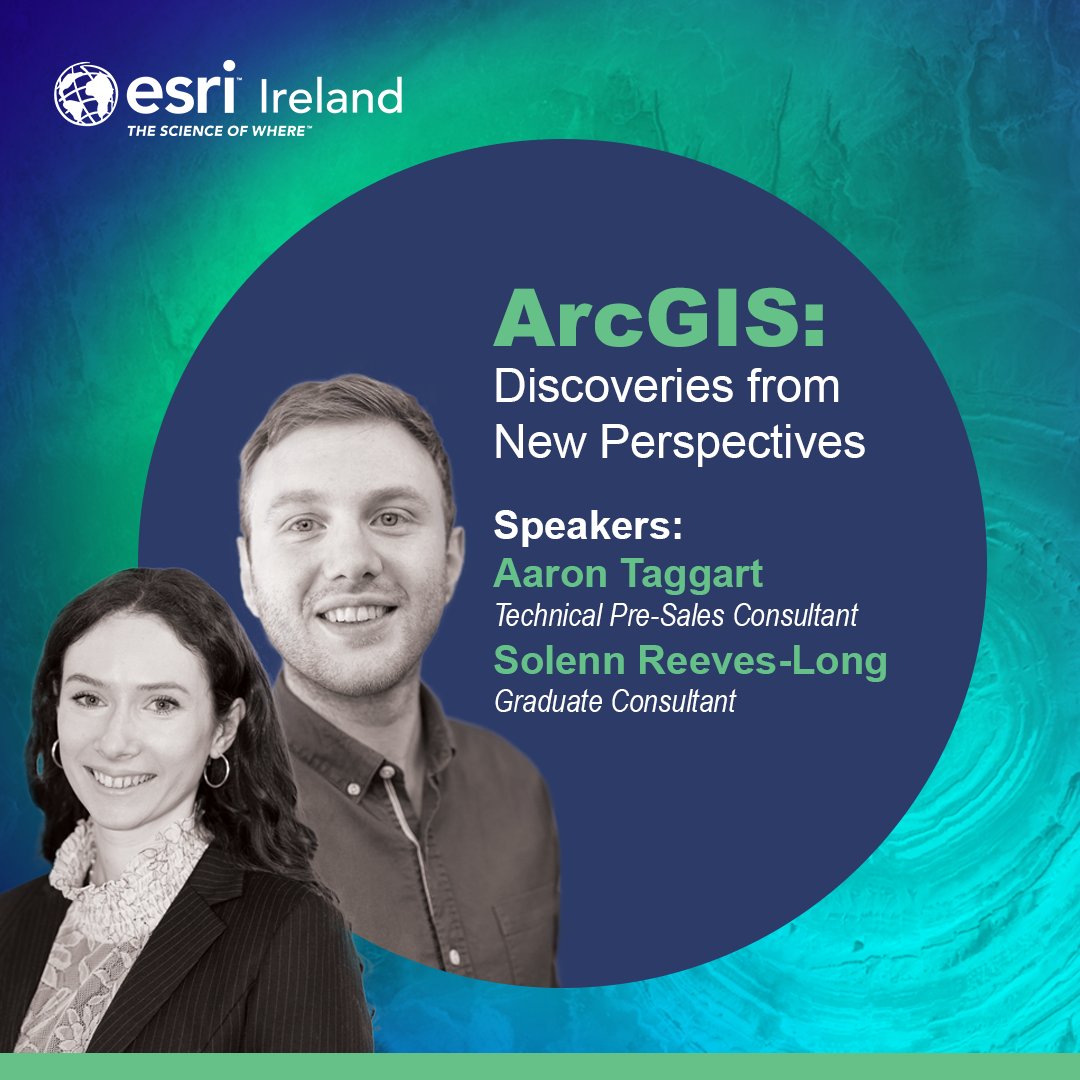
We are a Platinum Sponsor at the upcoming AGI NI Conference on June 28th. Our team members will present some interesting topics for this year’s theme, “GI and Spatial for the Future – Here and Now.” @GeoCommunity #geospatialdata #geospatialtechnology #teamesriireland


📍At #INTERGEO2024, WGIC hosted its board and member meeting. #INTERGEO #GeospatialTechnology #GeospatialIndustry #GIS #RemoteSensing #EarthObservation @InsideIntergeo


Watch all the groundbreaking sessions and keynotes from @Google Public Sector's #GeoforGov event. Dive into the latest innovations in #geospatialtechnology: carah.io/GeoForGovOnDem…

A new publication from START researcher Megan Rutter examines how geospatial technologies can be used by terrorists and violent extremists to target critical infrastructure and crowded areas. go.umd.edu/1smm @NCITE_COE #TerrorismResearch #GeospatialTechnology

New Applications on Teledyne CARIS Cloud Platform Support S-100 Production buff.ly/40ZgWsR #geospatial #geospatialtechnology #hydrospatial #technology #cloud


GeoSmart India 2025 Celebrates Living Legends Who Shaped India’s Geospatial and Space Legacy #TycoonWorld #GeoSmartIndia2025 #GeospatialTechnology #SpaceTechnologyIndia #LivingLegendsAwards #GeospatialWorld #BharatMandapam tycoonworld.in/geosmart-india…

Matrix Geo Secures Southern Africa Drone-Based Survey & GIS Project Worth USD 9.25 Lakhs #TycoonWorld #MatrixGeoSolutions #GeospatialTechnology #DroneSurvey #DAAS tycoonworld.in/matrix-geo-sec…


science, technology, and applications in India. IIT Roorkee takes pride in this achievement, which reflects the institute’s commitment to advancing excellence in geospatial research and innovation in water resources. #IITRoorkee #WRDM #GeospatialTechnology #RemoteSensing #ISRS
#SPARCIndia #GISDay2025 #GeospatialTechnology #MiningInnovation #SustainableMining #RegulatoryCompliance #DigitalMining #SpatialIntelligence

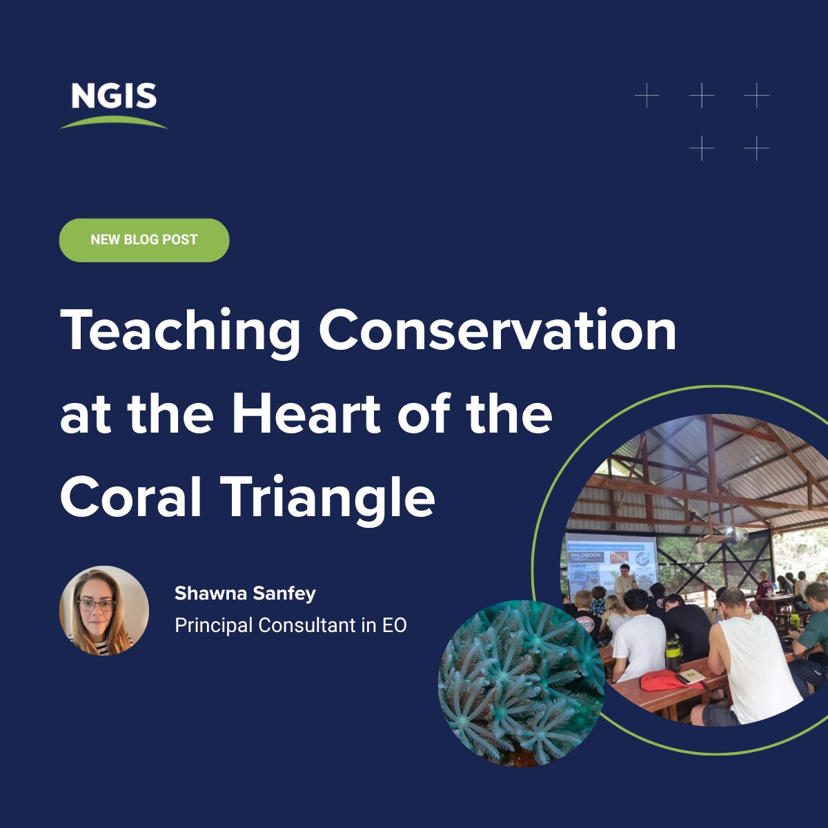
🐠🌿When a classroom becomes a coral reef Our Principal Consultant travelled to Wakatobi Marine National Park to teach future scientists in the heart of the Coral Triangle. 👉 Read more: hubs.ly/Q03THtKw0 #Conservation #GeospatialTechnology #MarineScience #Sustainability
Celebrating the Technology that Helps us. . . . #GISDay #geospatialtechnology #GIS #technology #fwfpunjab #GovtOfPunjab

At AABSyS IT, we celebrate #GISDay2025 by turning geospatial data into powerful digital solutions that drive global impact. Honoring all GIS pros and enthusiasts making real-world change. Happy GIS Day! #AABSySIT #GeospatialTechnology #GeoData #SpatialData

The excitement is building! The team is hard at work, setting up for an incredible event, ensuring every detail is perfect to showcase the power of GIS. Stay tuned for more updates! #GISWeek #GeospatialTechnology #EventPrep


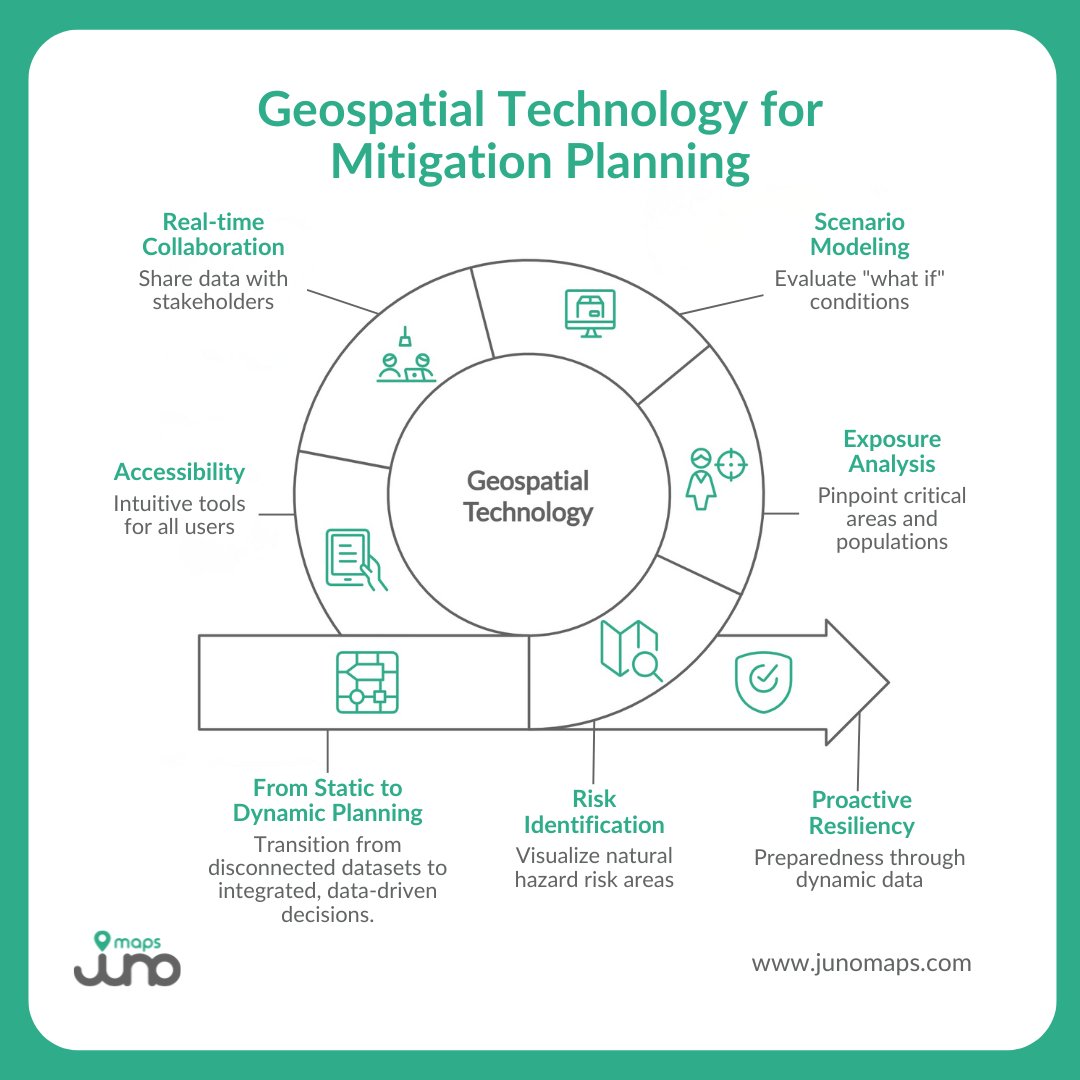
Modern hazards demand more than static maps. Geospatial technology connects data across agencies, enabling risk identification, exposure analysis, and scenario modeling for proactive resiliency. #JunoMaps #SmartSitePlan #GeospatialTechnology

In less than 2 weeks, GeoWorld will open its doors, bringing together the entire geospatial community. Don’t miss your chance to be at the MEASA region’s only geospatial event. Get your FREE TICKET now: bit.ly/3VUKEiD #GeoWorld #GeospatialTechnology #asddconcept
Celebrating the Technology that Helps us. . . . #GISDay #geospatialtechnology #GIS #technology #fwfpunjab #GovtOfPunjab
Geospatial opportunities, As you keep it #GIS #GeospatialTechnology #remotesensing , here are a few opportunities. · @UNICEF - Consultation internationale (6 mois) - Etude du suivi de la température lors du transport des vaccins et de la cartographie des chambres froides,…
150 mm thick cement treated, Graded crushed stone, stabilized, laid, rolled and compacted to specifications. More watering to cure before laying tarmac. #Highwaygeometry #Engineeringsurvey #Geospatialtechnology
Exciting news! Esri Rwanda, in collaboration with Rwanda Space Agency, is thrilled to announce our GIS Day 2023 celebration with University students and Lecturers at UR, AUCA, and Ines Ruhengeli! #GISDay2023 #GIS #geospatialtechnology
#MGISS, one of the UK’s leading technology firms, supports @FMConwayltd to reduce on-site risks using augmented reality. cpnonline.co.uk/features/mgiss… @mgissuk #geospatialtechnology
Geospatial World Forum 2023 Heads to Rotterdam this May buff.ly/3oOtVQQ #geospatial #geospatialtechnology #mapping
We recently laid out our expectations for spatial technology trends in 2023, and it's incredible to see how quickly the technology is evolving. Learn more about our updated predictions. Read on👇 location.foursquare.com/resources/blog… #geospatialtechnology #locationtechnology

🌐 The future of geospatial technology is here, and it's built by Foursquare. The power of location data can define how your consumers interact with the world around them. Learn more 👉 location.foursquare.com/?utm_source=tw… #Foursquare #geospatialtechnology
Introducing the Gap Analyser tool, crafted by BISAG-N for @TribalAffairsIn under the Particularly Vulnerable Tribal Groups Scheme. This tool meticulously measures gaps in essential parameters outlined by the ministry. 📊✨ #GeospatialTechnology #DigitalIndia
New Applications on Teledyne CARIS Cloud Platform Support S-100 Production buff.ly/40ZgWsR #geospatial #geospatialtechnology #hydrospatial #technology #cloud

It's landed! This year's #GeospatialEngineering should be through your letterbox imminently 📬 Digital version coming soon, or grab a copy from us @GEOBusinessShow! 🤝 #geospatial #GeospatialTechnology #GeospatialSurveying #GeospatialData #GeoBusiness #engineering


Convened meeting of officials of National Institute of GeoInformatics Science&Technology #NIGST,only one of its kind in India,along with team of Capacity Building Commission at #Hyderabad.Online courses in #GeospatialTechnology to be made available through iGoT Karmayogi platform

Introducing the Gap Analyser tool, crafted by BISAG-N for @TribalAffairsIn under the Particularly Vulnerable Tribal Groups Scheme. This tool meticulously measures gaps in essential parameters outlined by the ministry. 📊✨ #GeospatialTechnology #DigitalIndia

Introducing the Gap Analyser tool, crafted by BISAG-N for @TribalAffairsIn under the Particularly Vulnerable Tribal Groups Scheme. This tool meticulously measures gaps in essential parameters outlined by the ministry. 📊✨ #GeospatialTechnology #DigitalIndia

The National Geospatial Policy, 2022 was notified on December 28, 2022. However, what does the policy mean and what implications does it hold for us? Find your answers here. #cprgindia #geospatialtechnology #geospatial #india #publicpolicy #policy @RamanandDelhi


Version 24.1 of the Global Mapper SDKs Include New Features & Updates buff.ly/40NDhu4 #geospatial #geospatialtechnology #gis #mapping #software


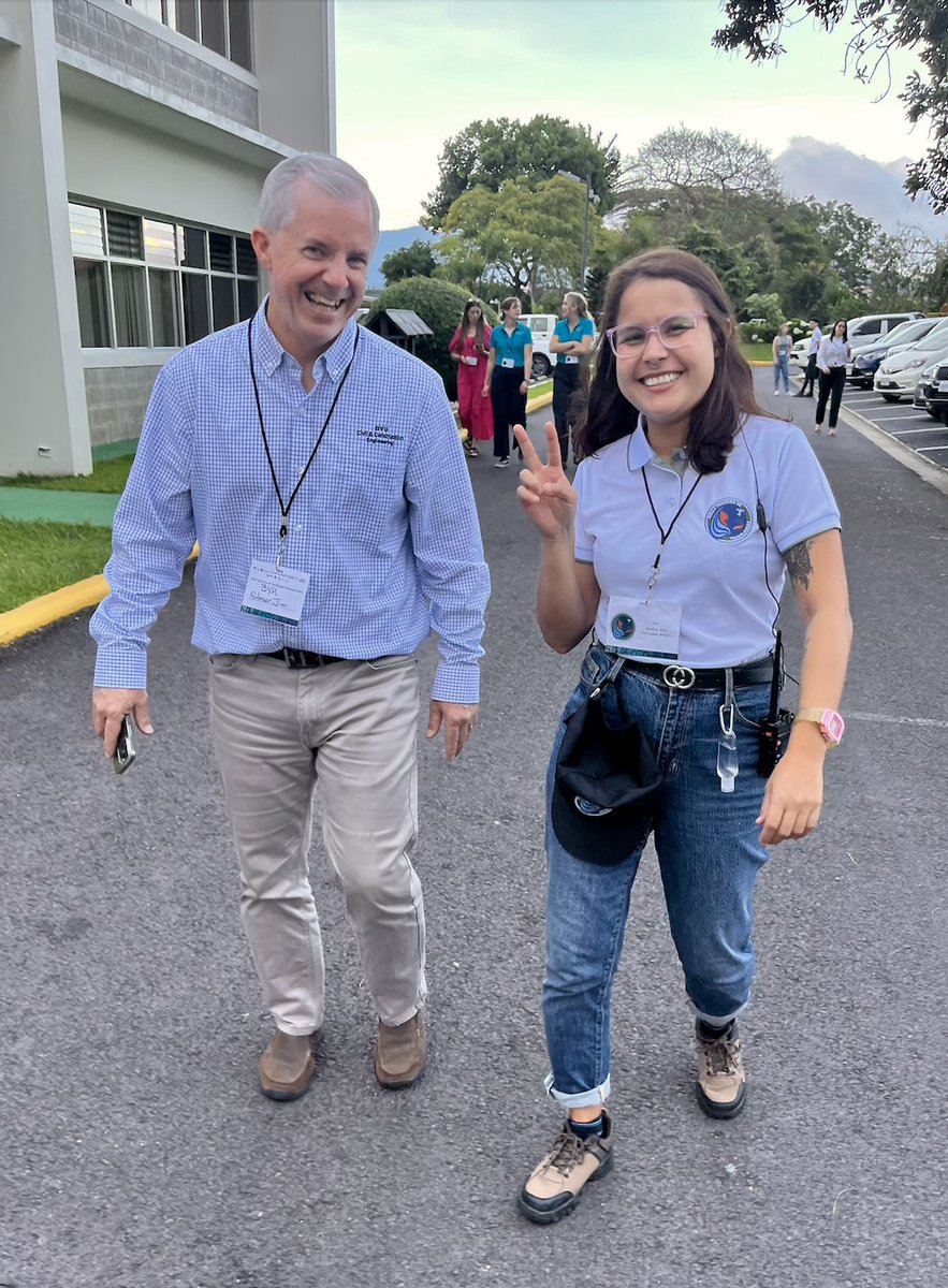
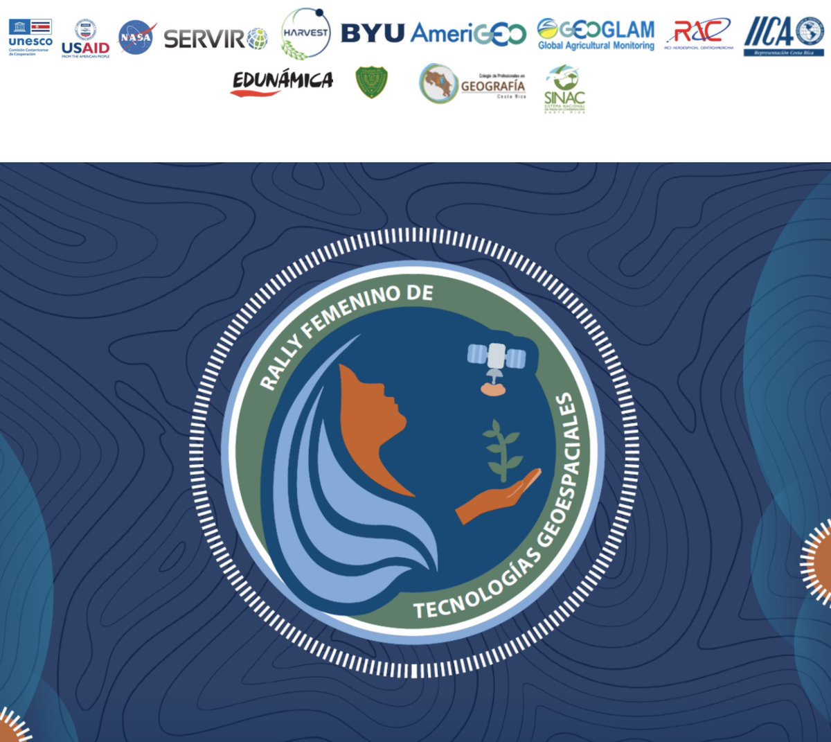
Honored to support the 3-day #RallyFemenino #GeospatialTechnology workshop in CR 🇨🇷. Over 100 women will explore using geospatial tech to support their communities. Thanks to collaborators @iicanoticias, @HarvestProgram, @G20_GEOGLAM, @GeoGlows, @BallardCenter, @USAIDES & more.

What are the latest trends and innovations in #geospatialtechnology and how will they impact the future? Find out on 4/30 during FedGeoDay, an interactive and immersive experience you won’t want to miss: carah.io/f651ac

Something went wrong.
Something went wrong.
United States Trends
- 1. Chris Paul 7,326 posts
- 2. Pat Spencer 2,658 posts
- 3. Kerr 5,565 posts
- 4. Podz 3,291 posts
- 5. Shai 15.6K posts
- 6. Jimmy Butler 2,644 posts
- 7. Seth Curry 4,903 posts
- 8. The Clippers 10.2K posts
- 9. Hield 1,580 posts
- 10. Carter Hart 4,099 posts
- 11. #DubNation 1,428 posts
- 12. Mark Pope 1,967 posts
- 13. #SeanCombsTheReckoning 5,090 posts
- 14. Lawrence Frank N/A
- 15. #AreYouSure2 132K posts
- 16. Kuminga 1,488 posts
- 17. Derek Dixon 1,307 posts
- 18. Brandy 8,276 posts
- 19. Elden Campbell N/A
- 20. Connor Bedard 2,443 posts