#radarsat search results

DYK #RADARSAT data improves railway safety in Canada? This product was developed from RADARSAT-2 data and shows ground movement in Thompson Canyon, B.C., over a 16-month time lapse. 📷 CSA, RADARSAT-2 data, processed by TRE Altamira

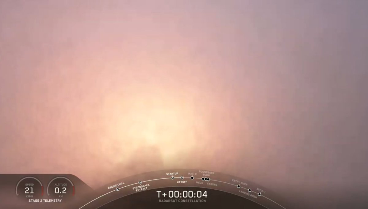
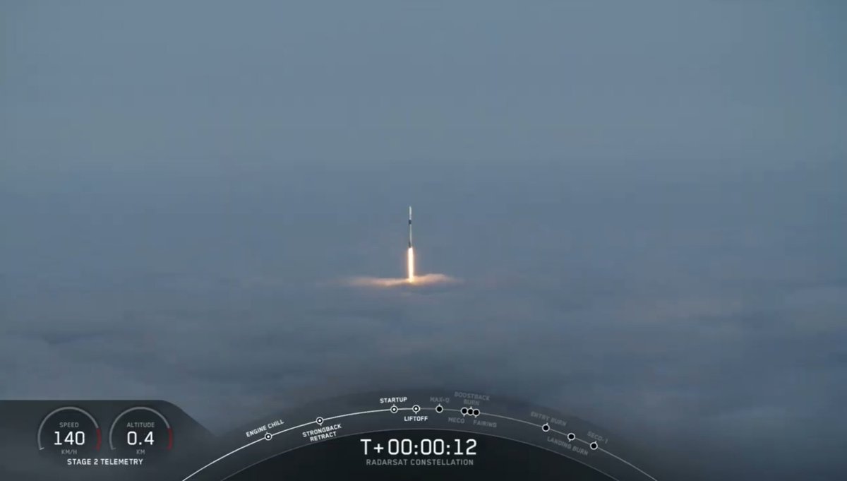
Join me tomorrow morning at 6:45 a.m. PDT (13:45 UTC) for @SpaceX's launch of the #RADARSAT constellation for @csa_asc !!! This will be a fun one to watch with a beautiful dawn launch and landing at LZ-4! - youtube.com/watch?v=pAcD8a…
youtube.com
YouTube
Watch SpaceX launch their most expensive payload ever! (RadarSat)
For more than 25 years, Canada’s RADARSAT satellites have provided images to help scientists better understand ice sheet changes and icebergs in Antarctica. 🇨🇦 #RADARSAT #SatellitesForEarth

Did you know that @csa_asc and @NASA used radar images taken by the Canadian Satellite RADARSAT-1 to create the first complete map of #Antarctica? This map provided scientists with vital information to help study ice and monitor coastlines. Check it out: asc-csa.gc.ca/eng/satellites…

Celebrating 30 years of RADARSAT data: Canada’s legacy in Earth observation 🛰️✨ 🔗 Learn more: asc-csa.gc.ca/eng/news/artic… #RADARSAT #EarthObservation #Canada

This RADARSAT-2 image of the coast of Vancouver on August 1, 2024, provides specific information on ship location. 🛰️ Learn how #RADARSAT data improves illegal fishing response in Canada: asc-csa.gc.ca/eng/multimedia… #OnOurRadar #SpaceBenefits

Major investment just announced! The CSA will initiate projects to ensure continued access to satellite EO data beyond the RCM’s design life for the provision of critical services to Canadians. More info: canada.ca/en/space-agenc… #SpaceBound2023 #RADARSAT #EarthObservation

This RCM imagery animation shows the route of an iceberg on the coast of Labrador, from June 18 to July 9, 2023. Learn how #RADARSAT data supports safe and efficient goods transportation in Northern communities: asc-csa.gc.ca/eng/satellites… #OnOurRadar #SpaceBenefits
The @DisastersChart celebrates its 20th anniversary today! Canada supported relief efforts in 538 disasters worldwide in the last 20 years by providing #RADARSAT satellite images. This thread shows some disaster images captured by 🇨🇦 satellites.

This animation shows ice evolution and ships on Lac Saint-Pierre, St. Lawrence River, from February 2024 to February 2025. 🛰️ Learn how #RADARSAT data improve ship navigation in ice-covered waters in Canada: asc-csa.gc.ca/eng/satellites… #OnOurRadar #SpaceBenefits
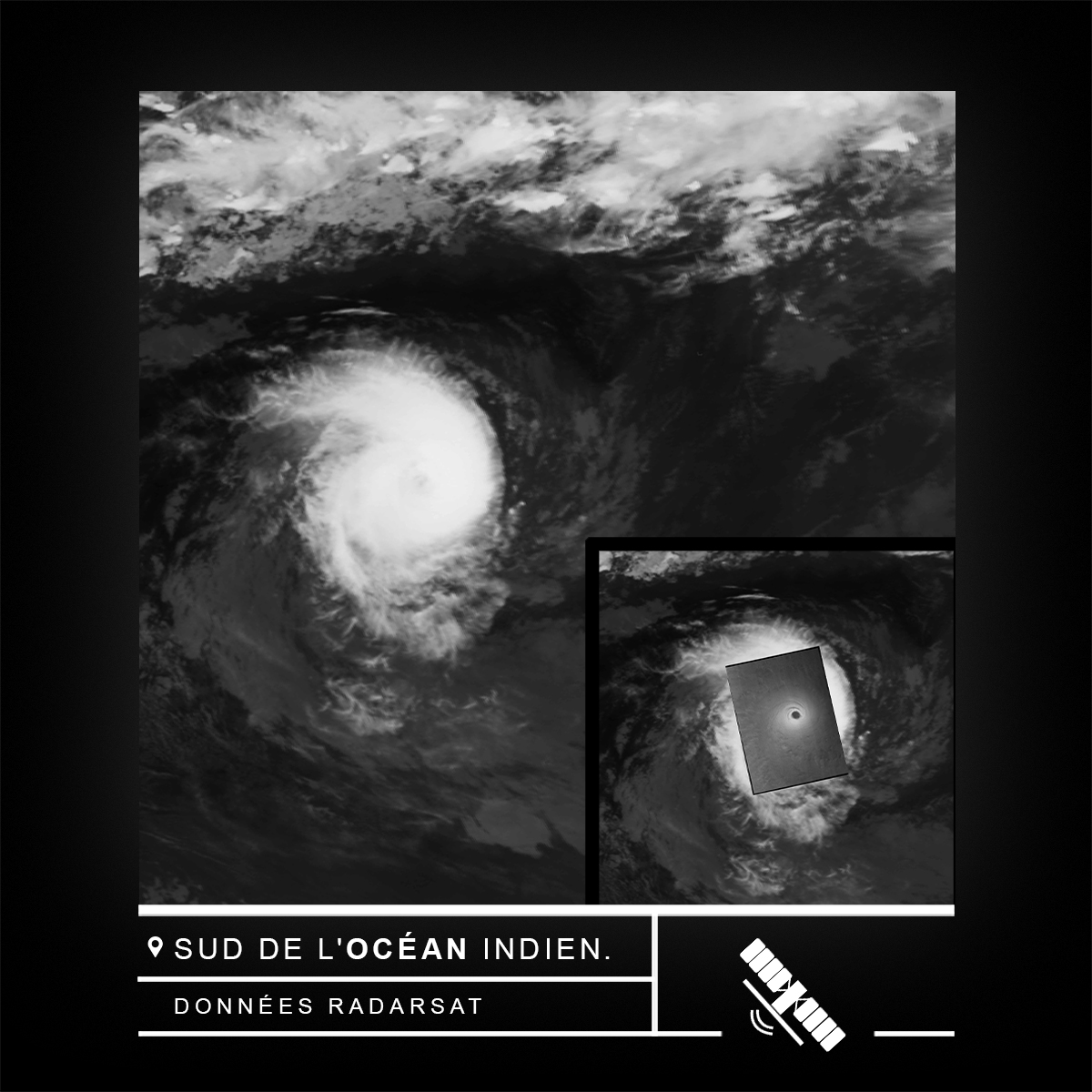
The rectangle in the middle of this image of Tropical Cyclone Freddy in the South Indian Ocean shows how RCM data can be used to see through the clouds. Learn how #RADARSAT data helps communities prepare for hurricanes: asc-csa.gc.ca/eng/satellites… #OnOurRadar #SpaceBenefits

For nearly 60 years now, Canada has made key contributions to space science and technology: from pioneering satellite communications technologies, to building the #Canadarm and space-based radar systems #RADARSAT. #SpaceInOurLives #CDNSpace

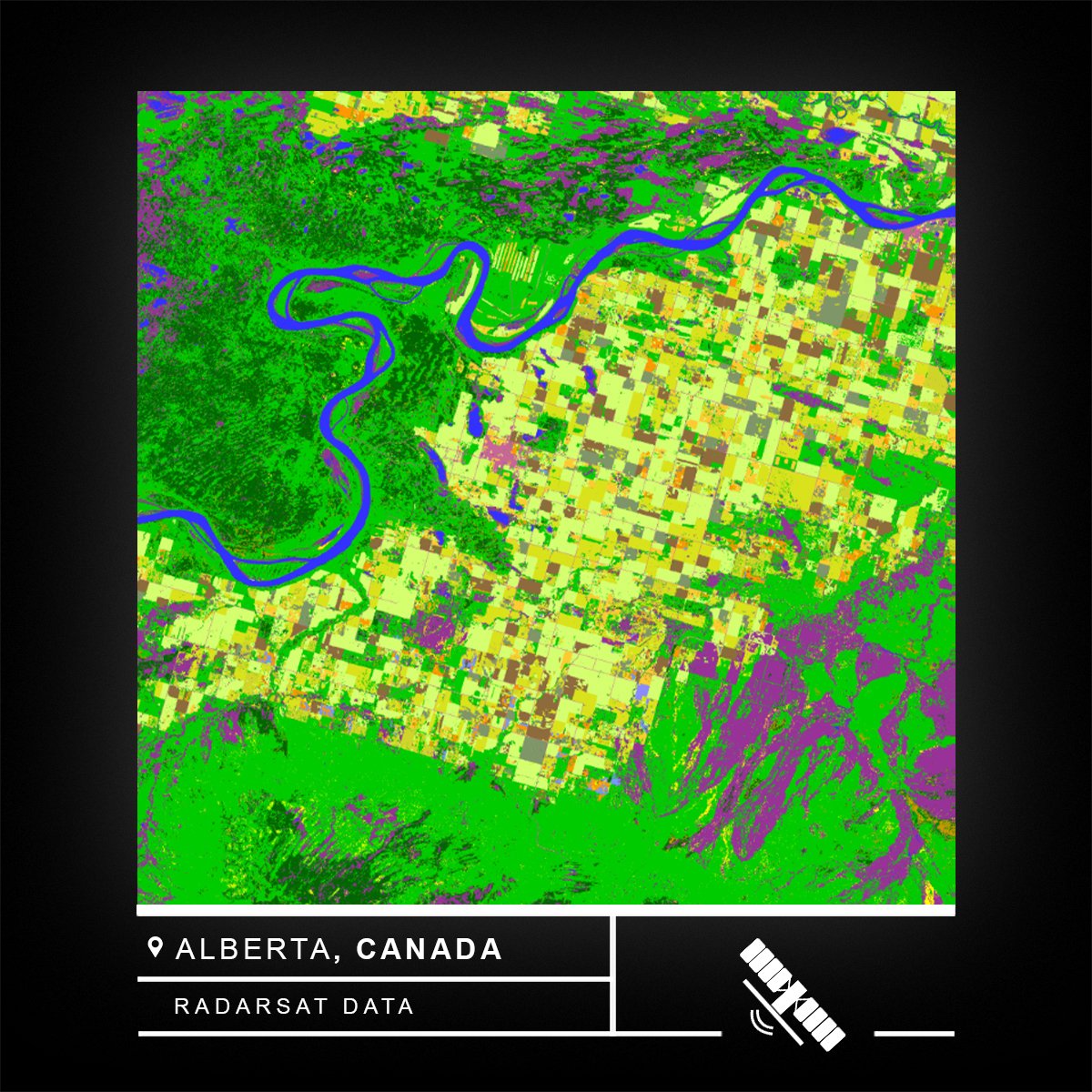
This RCM image of an agricultural area features different types of crops in Alberta, Canada. Learn how #RADARSAT data help farmers grow crops to their full potential: asc-csa.gc.ca/eng/satellites… #OnOurRadar #SpaceBenefits

Oh man. What a view. #SpaceX’s Falcon 9 first stage descends through the fog and lands at Landing Zone 4 at Vandenberg Air Force Base this morning. #RADARSAT
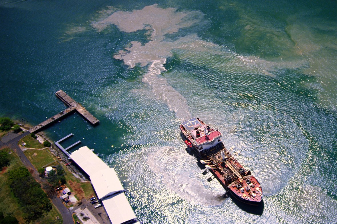
This RADARSAT-2 image illustrates the possible extent of an oil spill in Manila Bay, Philippines, on July 27, 2024. Learn how #RADARSAT data enables authorities to quickly respond to an oil spill in the ocean: asc-csa.gc.ca/eng/satellites… #OnOurRadar #SpaceBenefits


Some pretty unique views of Falcon 9 #radarsat launching from Vandenburg courtesy of the @SpaceX webcast.


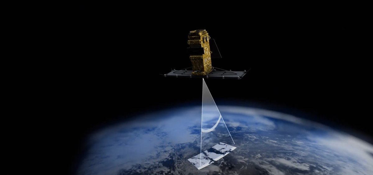
Canada has the longest coastline in the world. Since #RADARSAT data is available in near real time, it is one of the best sources of information to use for coastal monitoring. Learn about how we monitor and protect our ecosystems from #space asc-csa.gc.ca/eng/satellites… @csa_asc #EO


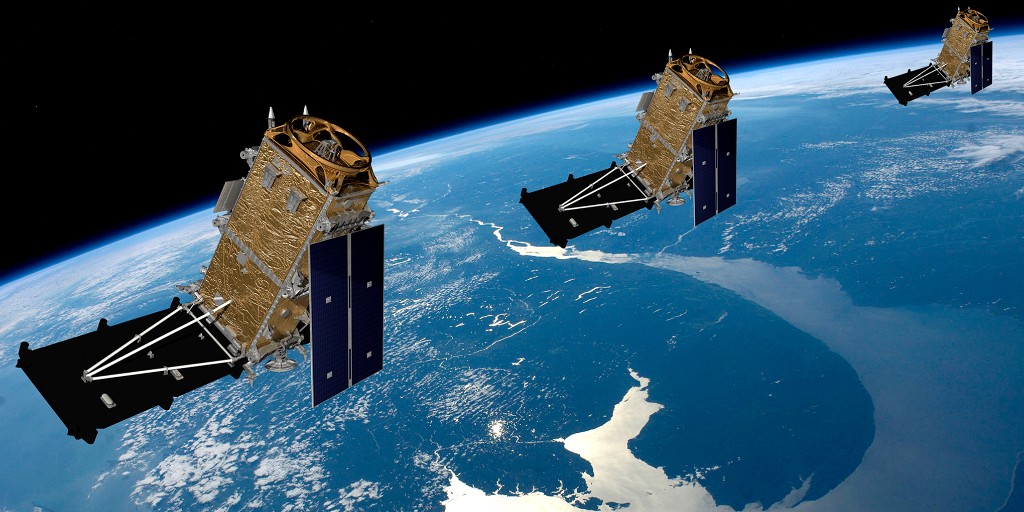
Happy 5th launchiversary to the #RADARSAT Constellation Mission (RCM)! Designed and built by MDA Space, #RCM consists of 3 satellites working together to provide critical information on maritime surveillance, disaster management, and ecosystem monitoring. @csa_asc #MissionMDA
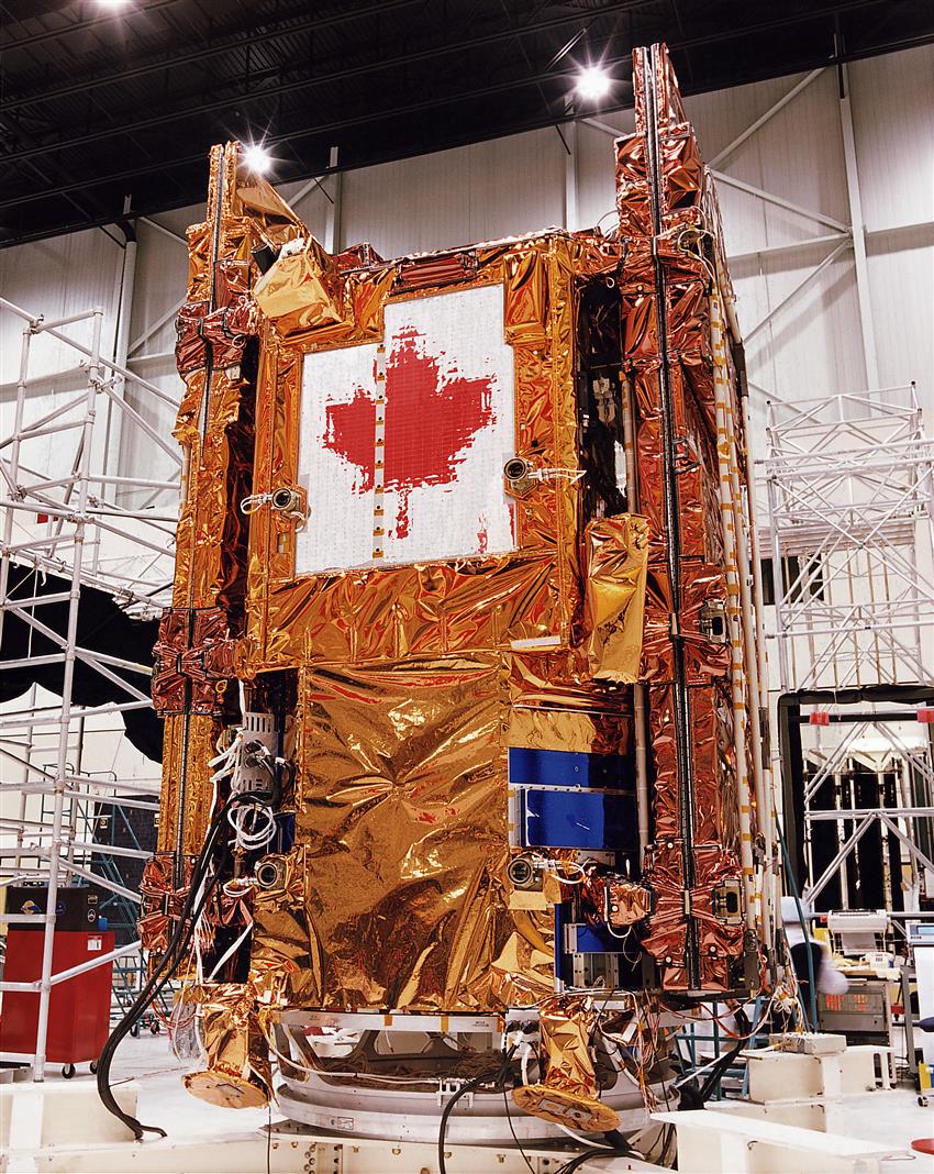
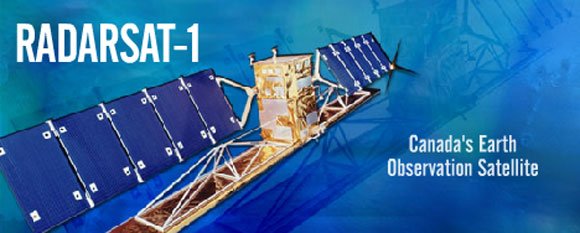
#RADARSAT-1 was Canada's first commercial #EarthObservation satellite and its images were used internationally to monitor climate change and Earth's resources. #SAR #EO @csa_asc

#RADARSAT Program Turns 30 #EarthObservation data supports disaster management, climate monitoring & maritime navigation. In 2025, marking the program's 30th anniv, a major investment was announced to ensure uninterrupted #SatelliteData access & develop next-gen #satellites.

Government of Canada invests $47 million to secure access to essential Canadian Earth observation data @csa_asc #satellitedata #earthobservation #radarsat canada.ca/en/space-agenc…

MDA Space (TSX: MDA) secures key Canadian government contract for RADARSAT replenishment as Earth observation demand surges business-news-today.com/mda-space-tsx-… #MDASpace #RADARSAT #EarthObservation #SatelliteImaging #CanadianSpaceAgency #TSX #CHORUSsatellite #SpaceTech #Aerospace

MDA Space awarded initial contract by @csa_asc for RADARSAT+ Replenishment Satellite. brnw.ch/21wY4W2 #MDASpace #RADARSAT #RCM

30 years of RADARSAT data: Canada's legacy in Earth observation @csa_asc #satellitedata #earthobservation #radarsat asc-csa.gc.ca/eng/news/artic…
Celebrating 30 years of RADARSAT data: Canada’s legacy in Earth observation 🛰️✨ 🔗 Learn more: asc-csa.gc.ca/eng/news/artic… #RADARSAT #EarthObservation #Canada

Célébrons 30 ans de données RADARSAT : l’héritage du Canada en observation de la Terre 🛰️✨ 🔗 Pour en savoir plus: asc-csa.gc.ca/fra/actualites… #RADARSAT #ObservationDeLaTerre #Canada

The rectangle in the middle of this image of Tropical Cyclone Freddy in the South Indian Ocean shows how RCM data can be used to see through the clouds. Learn how #RADARSAT data helps communities prepare for hurricanes: asc-csa.gc.ca/eng/satellites… #OnOurRadar #SpaceBenefits
Le rectangle dans cette image du cyclone Freddy dans le sud de l’océan Indien montre comment les données #RADARSAT permettent de voir à travers les nuages et donc d’aider la population à se préparer aux ouragans : asc-csa.gc.ca/fra/satellites… #SurNotreRadar #BénéficesEspace
This RADARSAT-2 image of the coast of Vancouver on August 1, 2024, provides specific information on ship location. 🛰️ Learn how #RADARSAT data improves illegal fishing response in Canada: asc-csa.gc.ca/eng/multimedia… #OnOurRadar #SpaceBenefits
Cette image de RADARSAT-2 fournit des informations précises sur la position des navires près de Vancouver. 🛰️ Découvrez comment les données #RADARSAT aident dans la lutte contre la pêche illégale au Canada : asc-csa.gc.ca/fra/multimedia… #SurNotreRadar #BénéficesEspace


Découvrez comment les données #RADARSAT permettent aux autorités d'intervenir rapidement lors d'un déversement d'hydrocarbures dans l'océan : asc-csa.gc.ca/fra/satellites… #SurNotreRadar #BénéficesEspace 📸: ASC, données de RADARSAT-2, Maxar Technologies Ltd., traitées par MDA Space.
asc-csa.gc.ca
La mission de la Constellation RADARSAT : surveillance maritime efficace
La mission de la Constellation RADARSAT joue un rôle crucial dans la surveillance efficace des eaux canadiennes et pour assurer une navigation sûre.
This RADARSAT-2 image illustrates the possible extent of an oil spill in Manila Bay, Philippines, on July 27, 2024. Learn how #RADARSAT data enables authorities to quickly respond to an oil spill in the ocean: asc-csa.gc.ca/eng/satellites… #OnOurRadar #SpaceBenefits

ASI’s COSMO-SkyMed 2 constellation expanded to six X-band SAR satellites, delivering hourly radar imagery for agriculture, defense, and disaster monitoring. #RadarSat #COSMOSkyMed2
ASI’s COSMO-SkyMed Nebula radar satellites launch scheduled for 2026, doubling radar revisit rates for disaster monitoring and security surveillance. #COSMOSkyMed #RadarSat


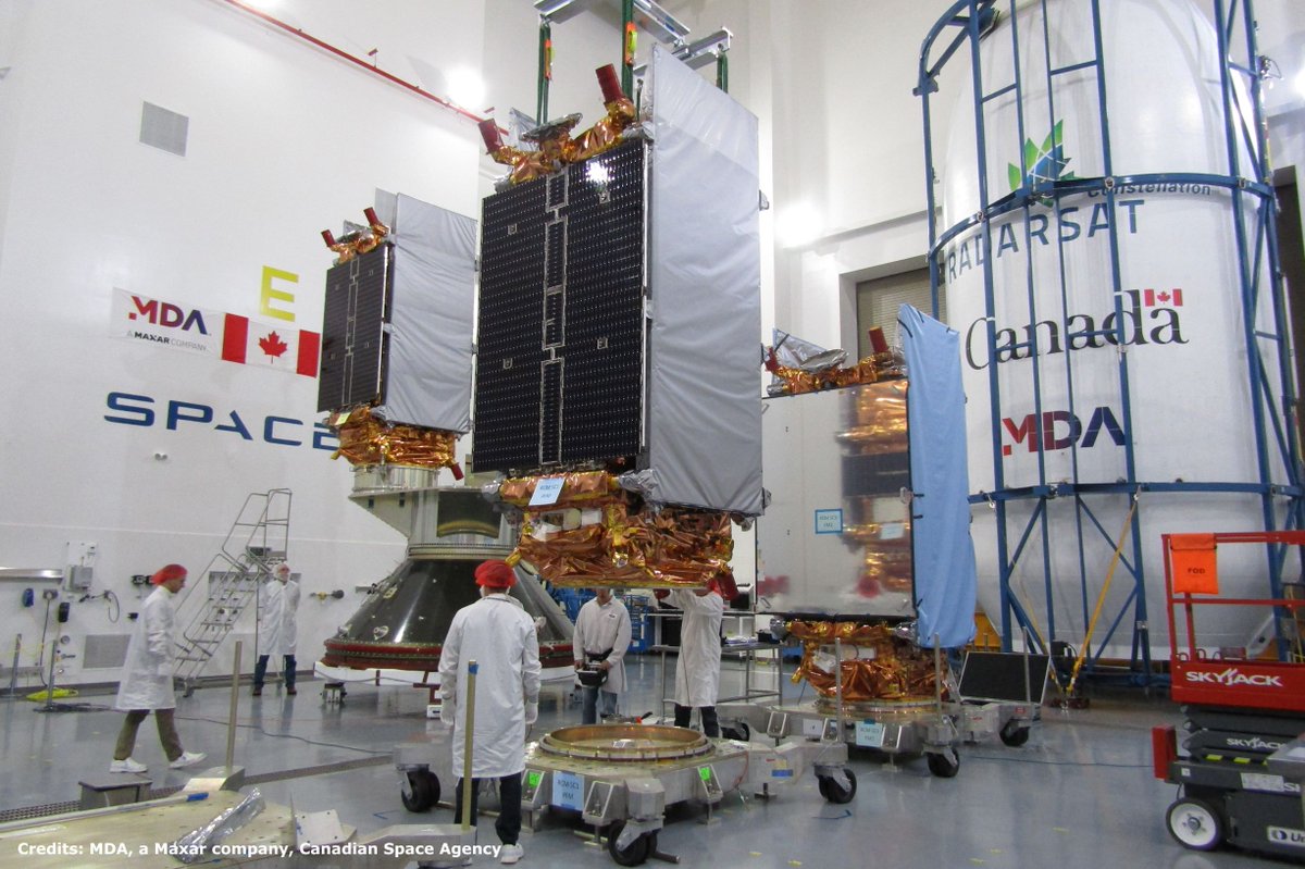
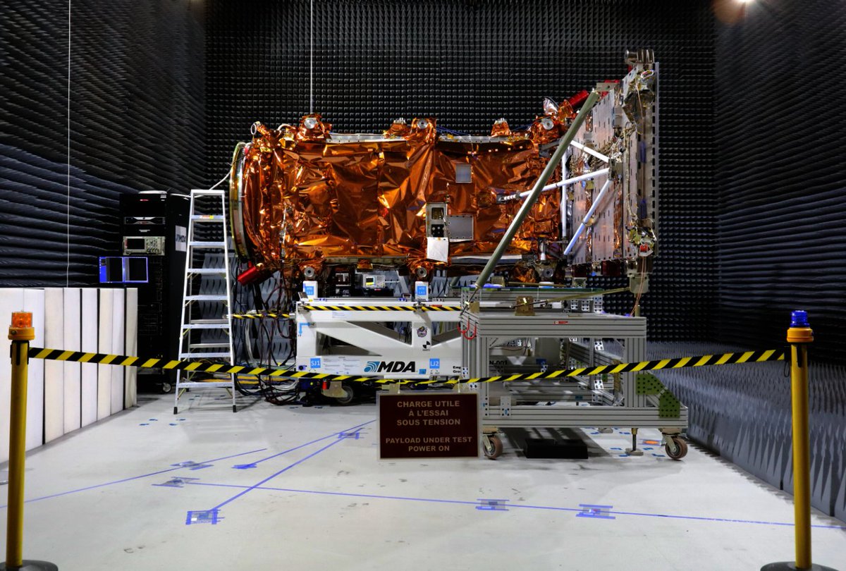
Milestone alert! @MDA_maxar delivered the 3rd and final #RADARSAT Constellation spacecraft to California. Launch will take place in the week of Feb. 18, 2019. To learn more: ow.ly/X0Cu30mfKLB.

Currently under testing, the 3 satellites of the #RADARSAT Constellation Mission will launch later this year to provide a wealth of data to help the #GoC deliver services and meet Canadian needs: ow.ly/Amij30is5Os. Credit: MDA
DYK #RADARSAT data improves railway safety in Canada? This product was developed from RADARSAT-2 data and shows ground movement in Thompson Canyon, B.C., over a 16-month time lapse. 📷 CSA, RADARSAT-2 data, processed by TRE Altamira
For nearly 60 years now, Canada has made key contributions to space science and technology: from pioneering satellite communications technologies, to building the #Canadarm and space-based radar systems #RADARSAT. #SpaceInOurLives #CDNSpace
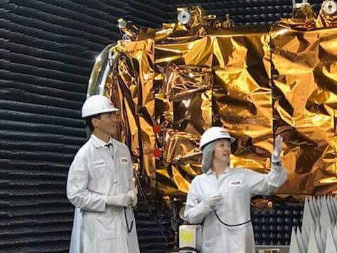
.@CanadianPM was @MDA_maxar today to visit their facilities. The 3 satellites of the #RADARSAT Constellation Mission, launching in the next few months, will support #GoC data-driven decision making: ow.ly/qEcJ30llk2j.
This RADARSAT-2 image of the coast of Vancouver on August 1, 2024, provides specific information on ship location. 🛰️ Learn how #RADARSAT data improves illegal fishing response in Canada: asc-csa.gc.ca/eng/multimedia… #OnOurRadar #SpaceBenefits
The rectangle in the middle of this image of Tropical Cyclone Freddy in the South Indian Ocean shows how RCM data can be used to see through the clouds. Learn how #RADARSAT data helps communities prepare for hurricanes: asc-csa.gc.ca/eng/satellites… #OnOurRadar #SpaceBenefits
Did you know that over 36,000 historical #RADARSAT-1 satellite images of the Earth now available to the public? #EarthObservation #OpenData #ClimateChange eodms-sgdot.nrcan-rncan.gc.ca/index_en.jsp

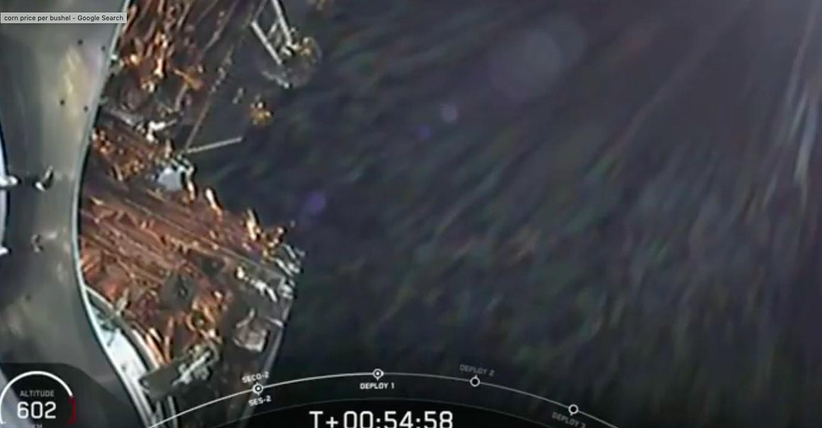
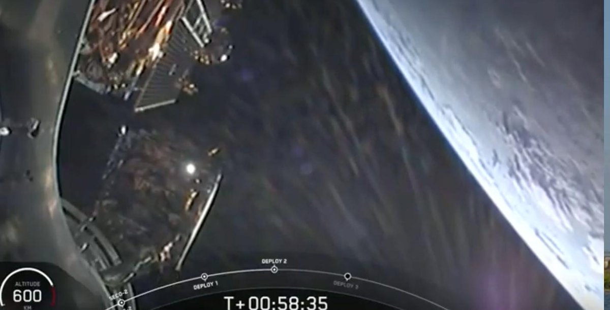
Congratulations @SpaceX, @csa_asc and @MDA_maxar on successful launch and deployment of #RADARSAT trio of #RCMSatellites, to a sun-synchronous orbit, monitoring maritime surveillance, disaster management and ecosystem across Canada 🛰️🇨🇦🛰️🇨🇦🛰️

This RCM image of an agricultural area features different types of crops in Alberta, Canada. Learn how #RADARSAT data help farmers grow crops to their full potential: asc-csa.gc.ca/eng/satellites… #OnOurRadar #SpaceBenefits
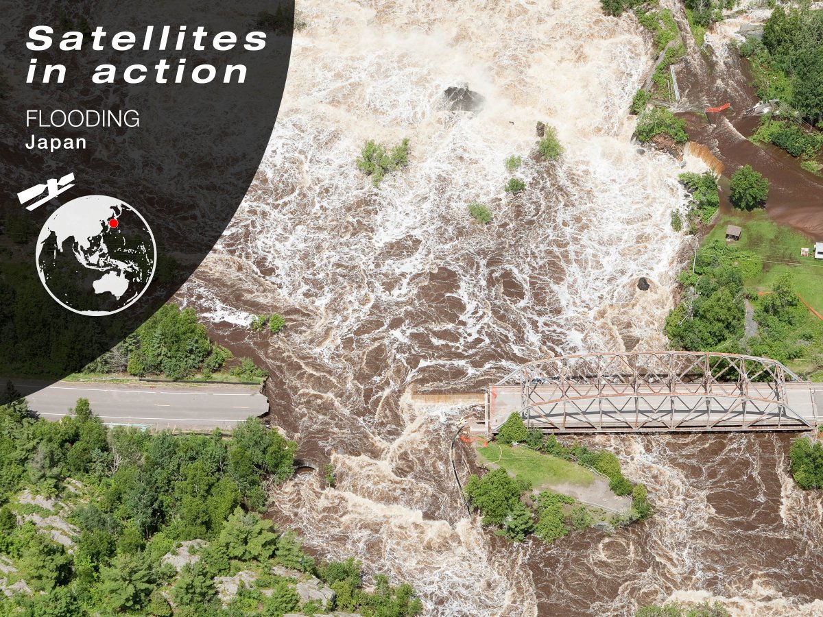
#RADARSAT-2 images were provided to assist relief efforts in #Japan as part of @DisastersChart. Record rainfall struck central and southwestern Japan, continuing for several days and causing #floods and landslides. Learn more: ow.ly/z4Ol30kUjW3.
Celebrating 30 years of RADARSAT data: Canada’s legacy in Earth observation 🛰️✨ 🔗 Learn more: asc-csa.gc.ca/eng/news/artic… #RADARSAT #EarthObservation #Canada
This RADARSAT-2 image illustrates the possible extent of an oil spill in Manila Bay, Philippines, on July 27, 2024. Learn how #RADARSAT data enables authorities to quickly respond to an oil spill in the ocean: asc-csa.gc.ca/eng/satellites… #OnOurRadar #SpaceBenefits

Two of my four remote cameras set to capture some stills of tomorrow’s RADARSAT launch. The one on the right is aimed at the landing pad. 😃 #spacex #falcon9 #radarsat


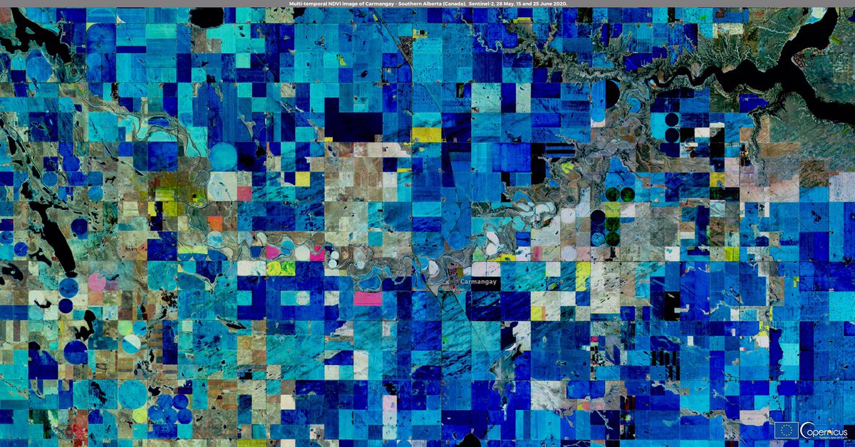
Happy #CanadaDay to our friends and colleagues from 🇨🇦 #EUSpace is happy to count #Radarsat as a @CopernicusEU Contributing Mission and that there are so may use cases of our #OpenData in Canada! ⬇️ Area in Southern Alberta - Multi-Temporal NDVI obtained from #Sentinel2🇪🇺🛰️ data
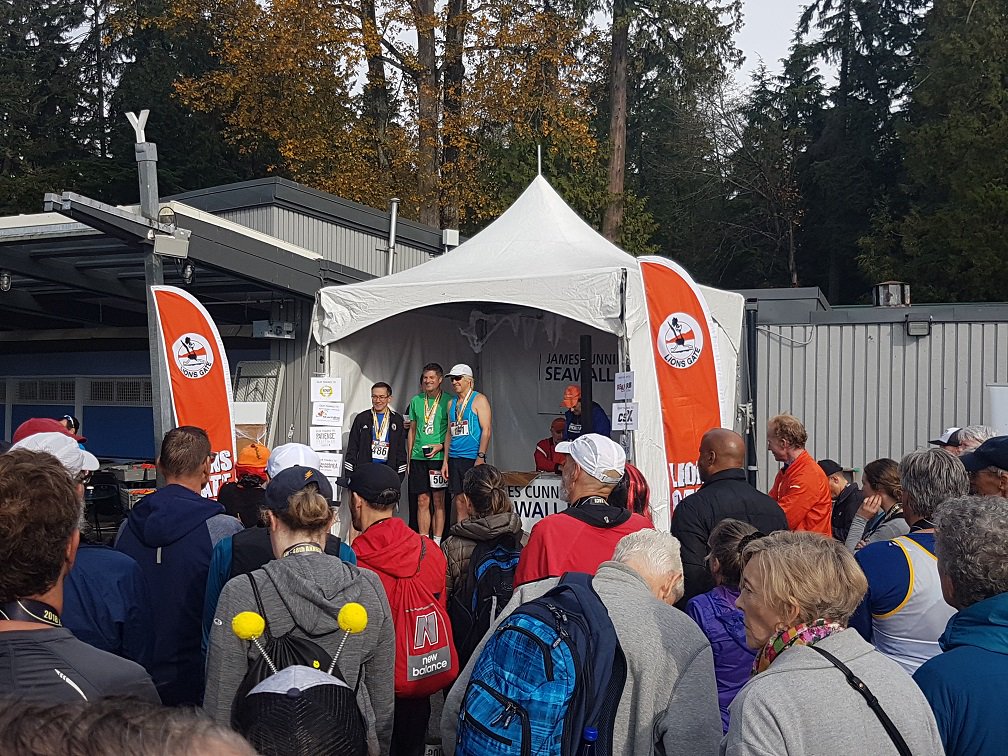
Proud to share that Alan Thompson, @MDA_maxar's Chief Systems #Engineer for the #RADARSAT Constellation Mission, won his age category today in #Vancouver's 9.6K @SeawallRace. Congratulations Alan! @StanleyParkVan

The California fog making it a little hard to see but, yes, SpaceX has landed this Falcon 9 rocket booster for the second time. cnb.cx/2X63SVO #RADARSAT

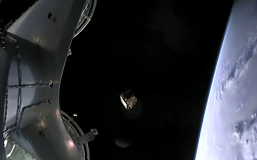
"All payloads deployed": An hour after launch, three #Radarsat satellites are on their own in orbit, finishing up @SpaceX #Falcon9's part of the job. Story updated: geekwire.com/2019/spacex-la…

Major investment just announced! The CSA will initiate projects to ensure continued access to satellite EO data beyond the RCM’s design life for the provision of critical services to Canadians. More info: canada.ca/en/space-agenc… #SpaceBound2023 #RADARSAT #EarthObservation
Something went wrong.
Something went wrong.
United States Trends
- 1. Good Friday N/A
- 2. Good Friday N/A
- 3. $LOL N/A
- 4. F-15 N/A
- 5. $ROCKET N/A
- 6. #FursuitFriday N/A
- 7. Theo N/A
- 8. CSAR N/A
- 9. Viernes Santo N/A
- 10. Holostars N/A
- 11. Memphis N/A
- 12. #Boycott_HYBE_BELIFTLAB N/A
- 13. #OnlyFriendsDreamOnEP6 N/A
- 14. #LastFourWatched N/A
- 15. Mike Evans N/A
- 16. CENTCOM N/A
- 17. Grandma and Grandpa N/A
- 18. #FanCashDropPromotion N/A
- 19. Ryan Clark N/A
- 20. Matt Ryan N/A