#satellitedata 搜尋結果

Discover tangible ways to make a difference as @planet CEO @Will4Planet highlights the life-saving impact of satellite data. If you are looking to truly make a difference in the world, we can help you find the role that's right for you. #planetlabs #satellitedata

Ya pensó en desarrollar actividades de investigación durante la carrera universitaria? 🤔💭 Tienes interés de trabajar en áreas #EarthObservations #EarthSciences #SatelliteData #MachineLearning #DeepLearning #RemoteSensing #GIS #Mapping? Ven y colabora con nosotros… abro 🧵1/6


Turning-#RealTime-#SatelliteData into a Competitive Advantage: @HarvardBiz "The number of #ActiveSatellites could reach 60K by 2030, fueling a booming space economy. Modern satellites are equipped with #AI & #EdgeComputing, making them smart tools for: - #PredictiveLogistics…
hbr.org
Turning Real-Time Satellite Data into a Competitive Advantage
Businesses across industries are using real-time satellite data to gain an edge. The number of active satellites has tripled in five years and could reach 60,000 by 2030, fueling a booming space...

📡 #Satellitedata is now accessible to all businesses and offers incredible opportunities. From managing infrastructure risk to improving sustainability. Learn more about the power of #EOdata and seize the opportunity for your business. tinyurl.com/ycyjs48d


That’s alarming - unencrypted satellite data is an open invitation to espionage. If researchers can intercept it, so can hostile actors. In space or cyberspace, security can’t be optional. 🛰️🕵️♂️ #CyberSecurity #SatelliteData #EspionageRisks msn.com/en-us/news/tec…

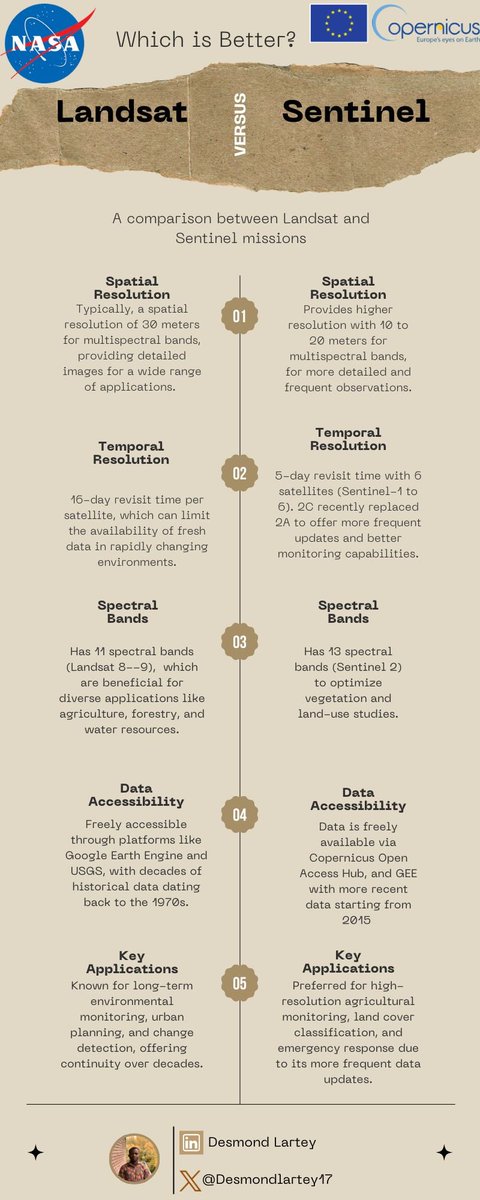
🌐 As a researcher with a focus on remote sensing and environmental monitoring, I often get asked: which satellite data source is better for various applications – Landsat or Sentinel? Here's a quick comparison to help you decide! 👇 #GIS #SatelliteData
SpaceChain's Decentralized Satellite Applications Platform simplifies #SatelliteData access & analysis. Discover why #DSA is the optimal interface for acquiring satellite data here: tinyurl.com/59y7px5m Revolutionizing the Space Economy. spacechain.com

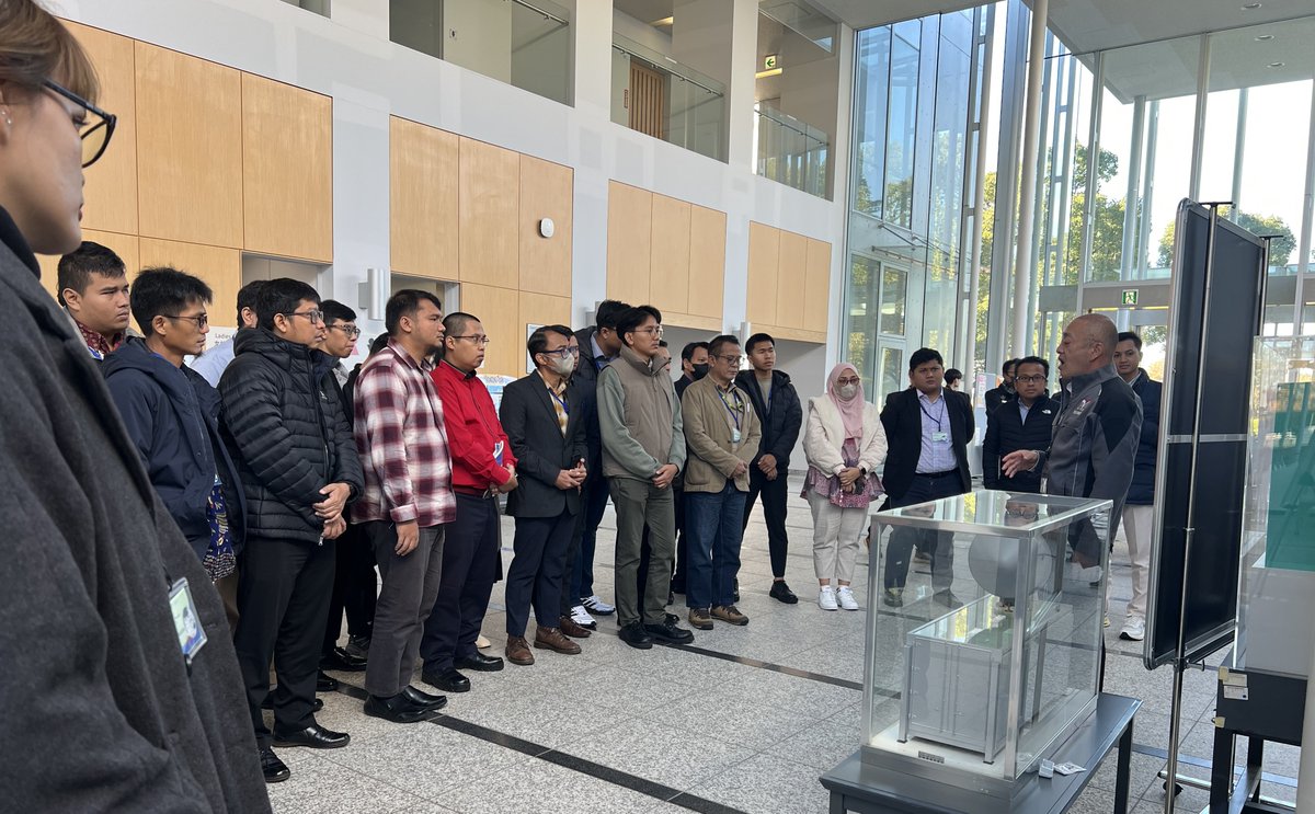
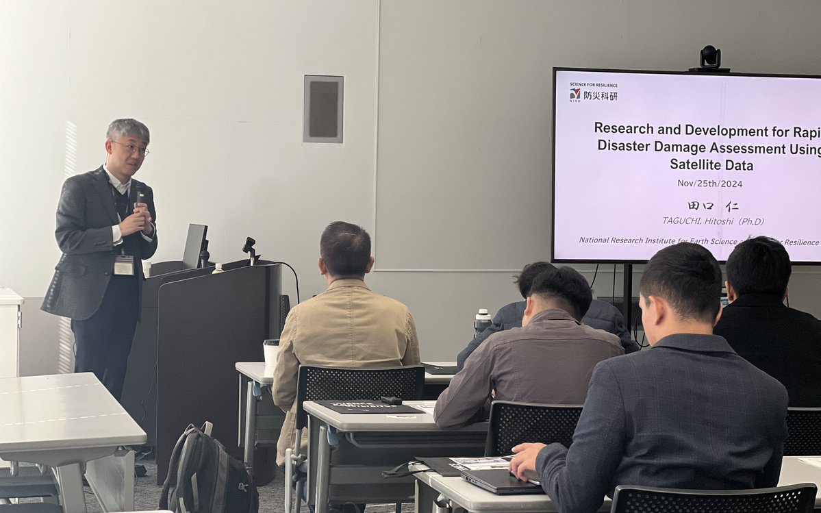
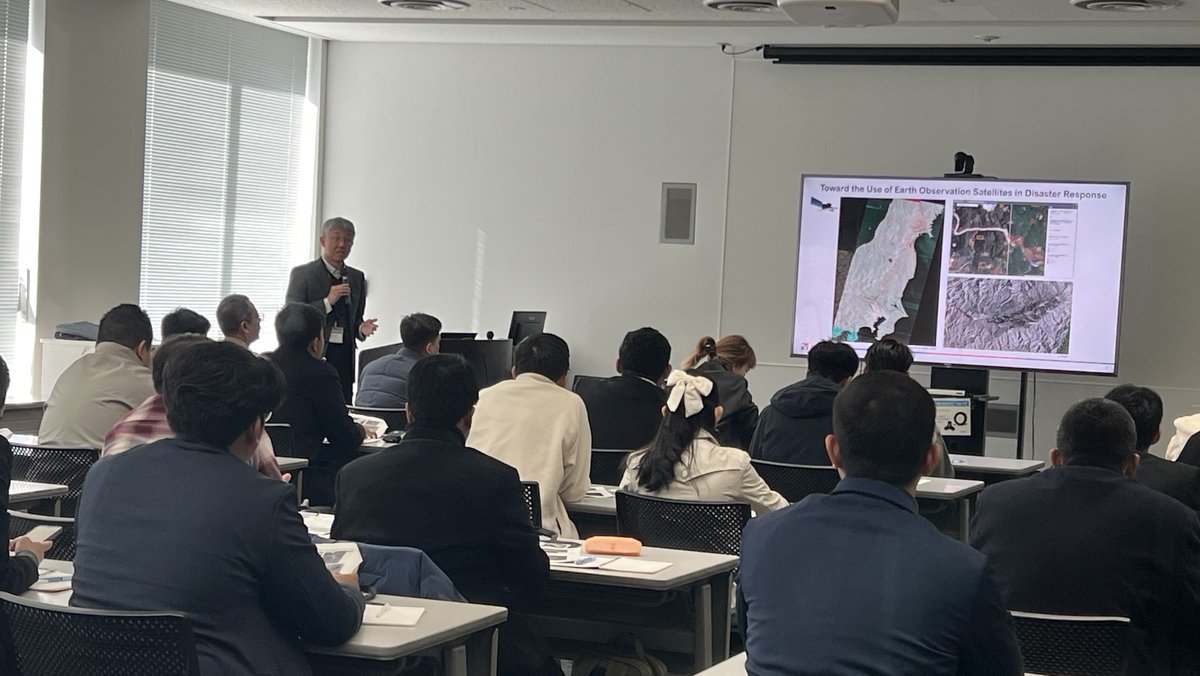
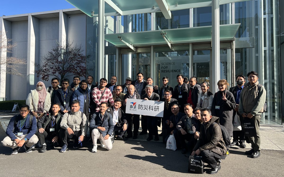
As part of a capacity building training program learning Japan's EEW system, organized by ADRC, the Indonesian @infoBMKG officials visited #NIED on Nov 25 and received a lecture from NIED’s Dr. Hitoshi Taguchi on early disaster damage assessment using #SatelliteData.

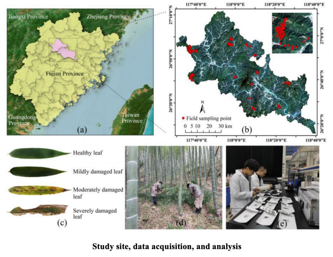
Scientists uses satellite data to improve the model for tracking pest damage in Moso bamboo forests. This helps measure chlorophyll and water levels more accurately, boosting ecosystem health monitoring. #satellitedata @Forestecosyst sciencedirect.com/science/articl…
📡 With very low barriers to entry, I-Sat democratizes access to satellite applications so that anyone seeking #satellitedata or applications can use the platform without prior expertise. 💡 Learn more here: tinyurl.com/yn6bytyk #SpaceChain #EO #AI #ISAT


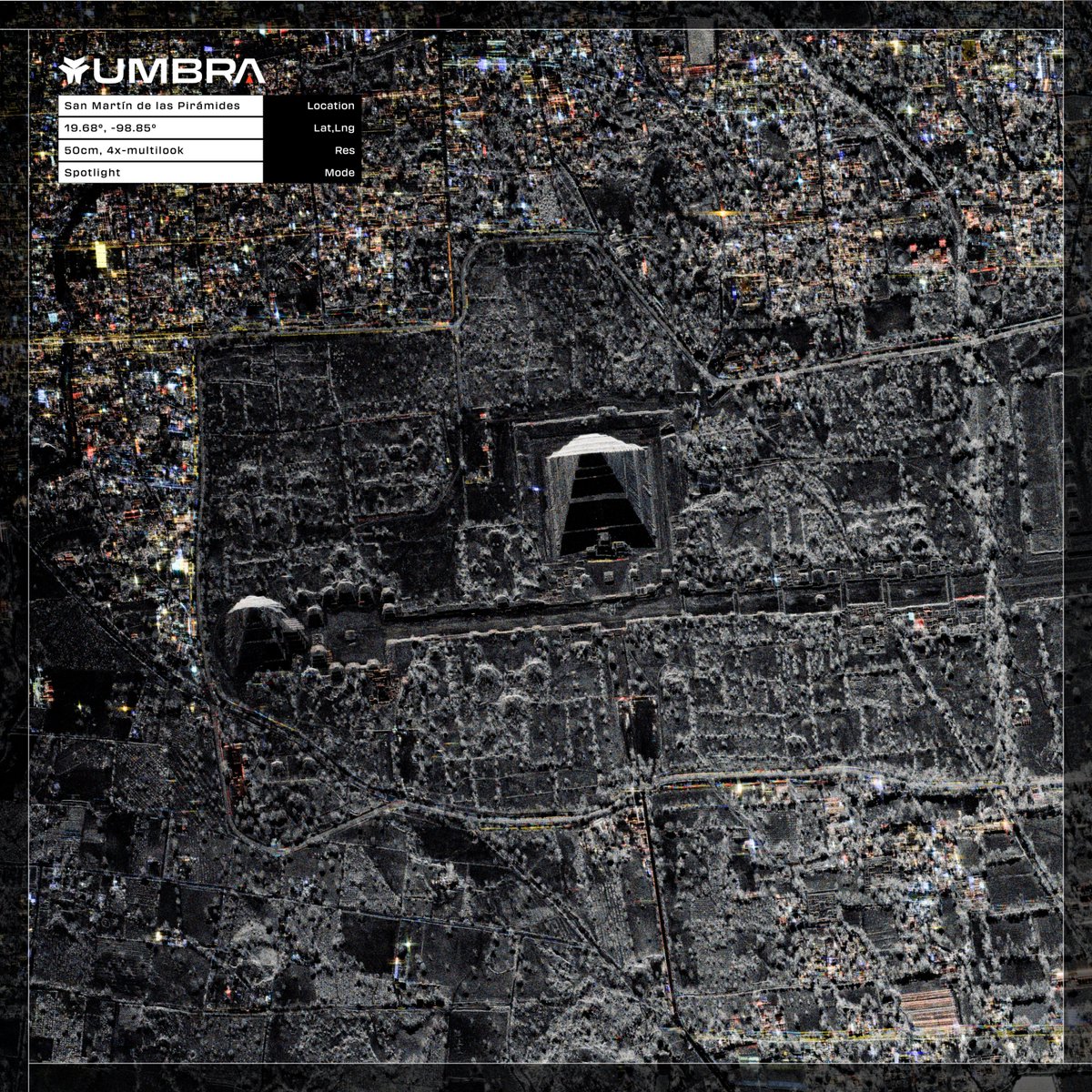
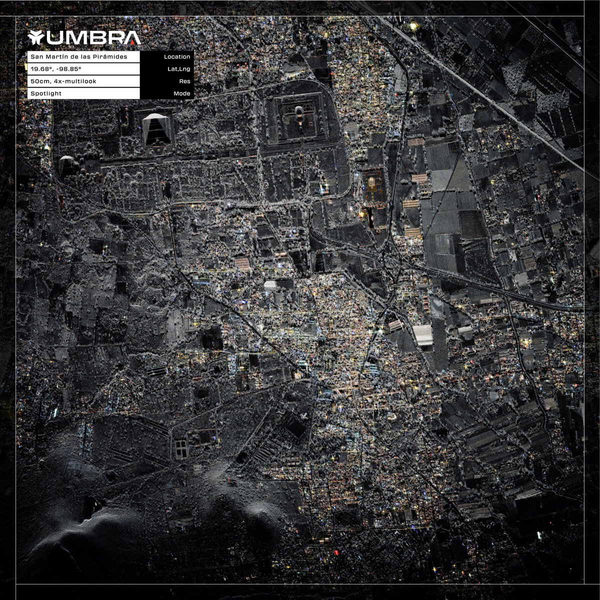
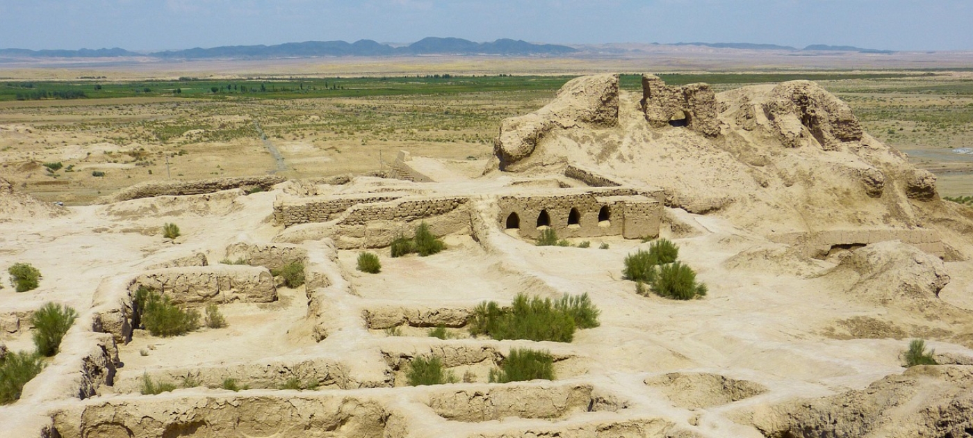
San Martín de las Pirámides, Mexico | 50cm | 4x-Multilook Now available to download from the Umbra Open Data Program. #SatelliteData #Mexico

Did you know? Satellite data is changing the way people trade goods because it gives them real-time information about oil storage, crops, and supply chains. Learn more in our Geoawesome article: geoawesome.com/eo-hub/how-sat… #Geoawesome #SatelliteData #CommodityTrading #RemoteSensing
🚀🌌 Satellite data has evolved since Sputnik 1! With huge volumes of data now available, how do we manage it all? How are platforms making data analysis simpler and more impactful? geoawesome.com/eo-hub/making-… Full video: youtu.be/mbf0IrSmeuY #SatelliteData #Geoawesome

Satellite technology is helping researchers at the @UniStrathclyde understand how climate change is forcing people to leave their homes – and how communities can build resilience before disasters strike. #ClimateChange #SatelliteData #EarthObservation theengineer.co.uk/content/news/s…

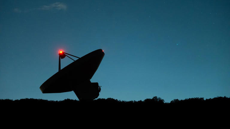
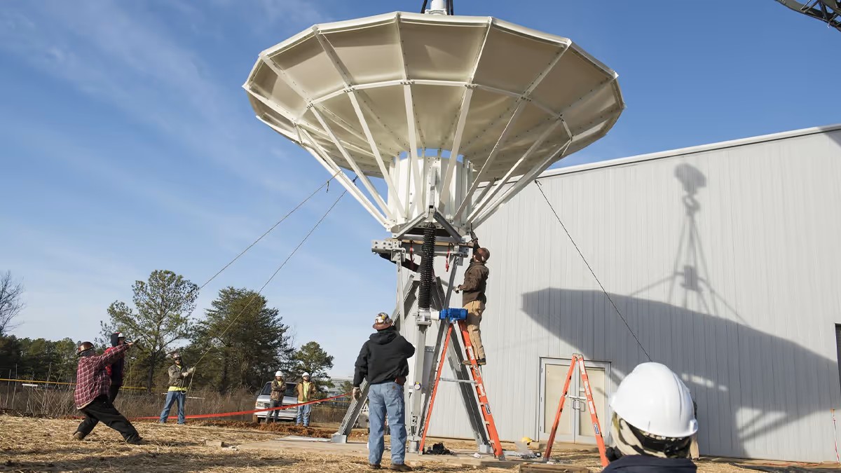
📡Final move. The satellite dish is in place — the Data Acquisition Station is coming to life. Stay tuned #EarthObservation #SatelliteData #Cyprus #ERATOSTHENESCoE @CyUniTechof @DLR_en @beyond_center

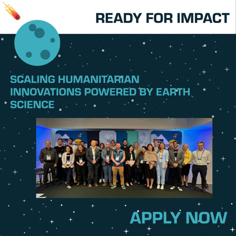
🌍 Are you a humanitarian or scientist ready to scale your satellite data-powered innovations? ✨ Expert guidance 🤝 Humanitarian partnerships 💡 Pitch training & stipend 📅 Apply by Jan 21, 2025: wp.me/p23f03-cq5 #ReadyForImpact #SatelliteData #InnovationForGood
✨Geoawesome Fact ✨Satellites like Sentinel-1 can detect sea surface changes from undersea earthquakes? Learn how satellite tech is making coasts safer in our full article: shorturl.at/t0r44 Full video on YT: youtu.be/rkAegn0gBtA #Tsunami #SatelliteData #Geoawesome
UNOSAT met with Professor Yutaka Matsuo from the Matsuo-Iwasawa Laboratory, University of Tokyo, to share our AI work on flood monitoring, damage assessment, and shelter mapping and explore synergies between our organizations. ➡️unosat.org/services #AI #SatelliteData


We’re connecting #SatelliteData & finance in our new project with @ScotDevInt!🛰️ In March, Scottish space companies will meet Danish #Finance leaders in Copenhagen. 👀 Learn more: sdi.co.uk/news/how-scott…

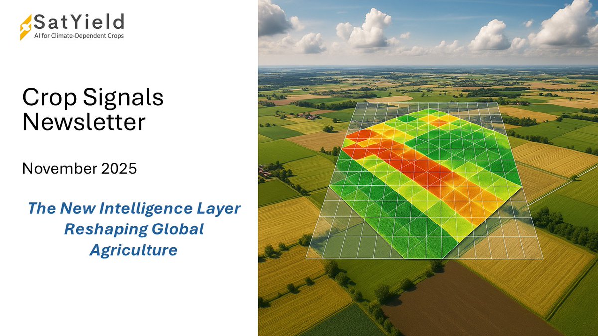
🌾 New: Crop Signals Edition 11 Reporting gaps are widening. Frontier regions are rising. Digital twins are reshaping ESG finance. See how SatYield brings clarity to chaotic markets → linkedin.com/pulse/from-rep… #AgTech #SatelliteData #AltData #Commodities

Over half of global coastal settlements are retreating inland due to intensifying climate risks @UCPH_Research #satellitedata #earthobservation #climatehazards #coastaldevelopment news.ku.dk/all_news/2025/…
Climate change drives rising temperatures and severe drought in Uzbekistan, shows new UNEP Atlas @UNEP #satellitedata #earthobservation #climatechange #drought unep.org/news-and-stori…
ESA’s HydroGNSS mission launched to ‘scout’ for water @esa #satellitedata #earthobservation #hydrognss #water esa.int/Applications/O…

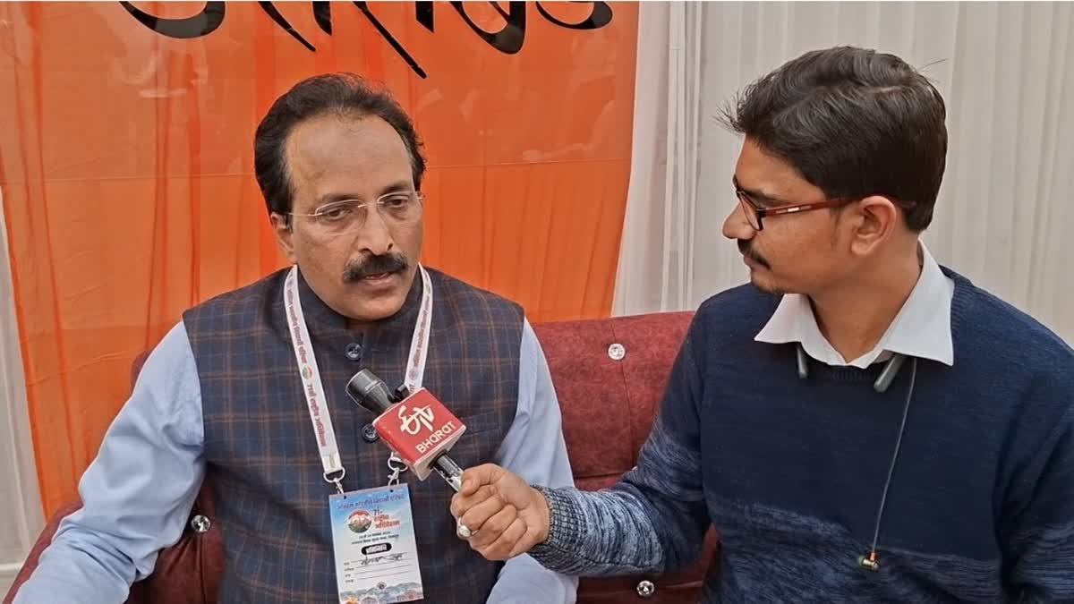
శాటిలైట్ల సమాచారానికి ఏఐ- ప్రకృతి వైపరీత్యాలపైనా భవిష్య వాణి : ఇస్రో మాజీ ఛైర్మన్ ఎస్.సోమనాథ్ #formerisrochairman #somnath #satellitedata #ETVBharat #TeluguNews #etvbharatandhrapradesh etvbharat.com/te/bharat/sate…
🌍Do you use #Copernicus Sentinel data? If so - it's v. important to do know.space's independent evaluation of UK participation by Dec 9 To receive the full survey, email [email protected] or fill in your contact details: lnkd.in/eZippDNK #SatelliteData
This study uses #GoogleEarthEngine and #MachineLearning to analyze 2014–2023 #SatelliteData, predicting future #LandParcel changes and aiding #UrbanPlanning, #agriculture, and #EnvironmentalManagement. #RandomForest Read more: doi.org/10.1016/j.geog…

curiouscats.ai/breaking-news/… PM Modi- "Just invented the 'G20 Open Satellite Data Partnership'—because sharing is caring, especially when you can see your neighbors from space!" #Modi #G20 #SatelliteData #TechForGood #GlobalSouth ✅ NDTV

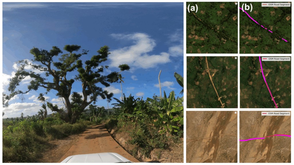
🛰️ New global satellite dataset released! Designed to support humanitarian routing and #infrastructure tracking, it’s set to improve crisis response and field logistics worldwide. 🌍 #HumanitarianAid #SatelliteData #CrisisMapping #GIS @GIScienceHD bit.ly/3K86zR6

Forecasting the future of forests with AI: From counting losses to predicting risk @GoogleResearch #satellitedata #earthobservation #artificialintelligence #deforestation #forecasting research.google/blog/forecasti…
Timely decisions to fight human capital shocks: fusing survey and satellite data for nowcasting food security in Malawi @WorldBank #satellitedata #earthobservation #geospatial #foodinsecurity blogs.worldbank.org/en/opendata/ti…
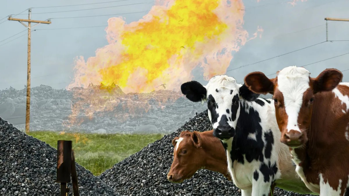
How satellites can help us find and clean up methane super-polluters #satellitedata #remotesensing #methane yaleclimateconnections.org/2025/11/how-sa…
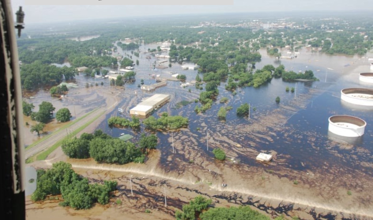
Researchers at KU launch new Kansas Flood Mapping Dashboard @UnivOfKansas #satellitedata #earthobservation #flooding #emergencymanagement news.ku.edu/news/article/r…
New Global Satellite Dataset for Humanitarian Routing and Tracking Infrastructure Change #satellitedata #earthobservation #infrastructure #opendata heigit.org/heigit-release…
Duke-Invented Satellite Tech Moving Closer from Lab to Orbit @DukeU #satellitedata #earthobservation #syntheticapertureradar today.duke.edu/2025/11/duke-i…

amitsinha1964.blogspot.com/2025/11/lights… Autocrats' GDP is inflated, according to Luis R. Martinez (UChicago) using satellite Nighttime Lights (NTL). While democracies like India show lights & growth matching, autocracies like China over-report #GDP #Economics #SatelliteData #Autocracy
Turning Real-Time Satellite Data into a Competitive Advantage @HarvardBiz #satellitedata #earthobservation #competitiveadvantage hbr.org/2025/11/turnin…


📡 #Satellitedata is now accessible to all businesses and offers incredible opportunities. From managing infrastructure risk to improving sustainability. Learn more about the power of #EOdata and seize the opportunity for your business. tinyurl.com/ycyjs48d

Scientists from the University of Washington and Bangladesh's Ministry of Agriculture are using NASA satellite data to help Bangladeshi farmers save water with the IRAS irrigation system #satellitedata #climatechange #innovation #watersaving #globalagriculture @NASA

San Martín de las Pirámides, Mexico | 50cm | 4x-Multilook Now available to download from the Umbra Open Data Program. #SatelliteData #Mexico
SpaceChain's Decentralized Satellite Applications Platform simplifies #SatelliteData access & analysis. Discover why #DSA is the optimal interface for acquiring satellite data here: tinyurl.com/59y7px5m Revolutionizing the Space Economy. spacechain.com
Ya pensó en desarrollar actividades de investigación durante la carrera universitaria? 🤔💭 Tienes interés de trabajar en áreas #EarthObservations #EarthSciences #SatelliteData #MachineLearning #DeepLearning #RemoteSensing #GIS #Mapping? Ven y colabora con nosotros… abro 🧵1/6

🚀 Private leaderboard for Aerosol Optical Depth Estimation competition is open! 👇 Check out the final standings & make late subs. Publish your solution write-ups and other topics too! solafune.com/competitions/c… #Solafune #Competition #SatelliteData #MachineLearning #DataScience


The 74th @Iac2023 in Baku is underway. Swing by our booth #515 and chat about #GroundStation services, future #SubOrbitalExpress missions, #SatelliteData analytics and #SatLaunch – all part of our offering 🚀🛰️📡 @iafastro #IAC2023 #SmallSatExpress #Orbital #SSCconnect #SatCom


Despite growing interest in commercial #satellite data, industry faces uncertainty - buff.ly/43Knoq1 #space #satellitedata #satelliteimagery
🛰️ Get ready to access & analyze #SatelliteData with ease! #SpaceChain's Decentralized Satellite Applications Platform makes it simple. Learn why #DSA is the best interface for acquiring satellite data in our video. bit.ly/418W5V3 #DecentralizedTechnology #Blockc ...

📡 With very low barriers to entry, I-Sat democratizes access to satellite applications so that anyone seeking #satellitedata or applications can use the platform without prior expertise. 💡 Learn more here: tinyurl.com/yn6bytyk #SpaceChain #EO #AI #ISAT
As part of a capacity building training program learning Japan's EEW system, organized by ADRC, the Indonesian @infoBMKG officials visited #NIED on Nov 25 and received a lecture from NIED’s Dr. Hitoshi Taguchi on early disaster damage assessment using #SatelliteData.

Decades of Satellite Data Unveil Alarming Sea Level Rise Trends 🛰️ 🌊 Long-term records reveal a doubling in the rate of sea level rise since 1993, driven by global warming and exacerbated by El Niño events. More 👉 bit.ly/GRSS-eNewslett… #SatelliteData #ClimateTrends


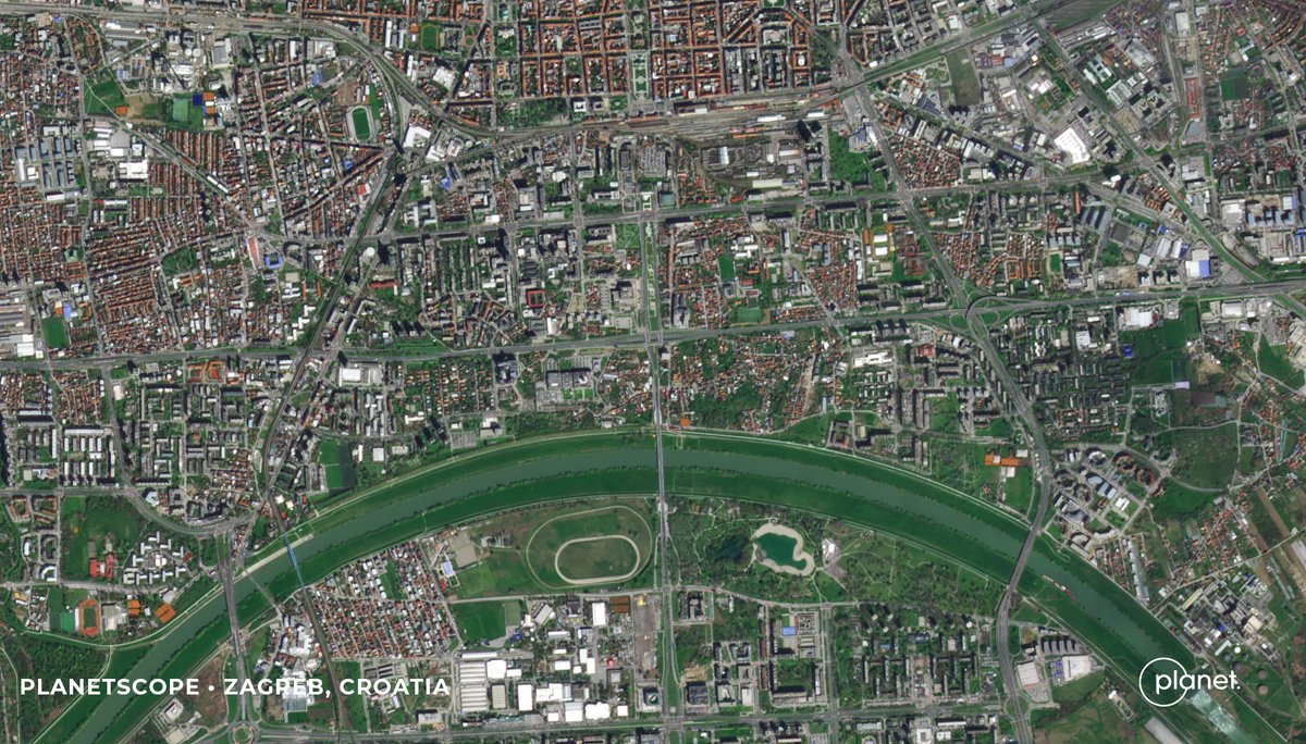
Can satellites cure allergies?🤧 Maybe not. But researchers from the University of Zagreb and @suminsCFRI used @Planet #satellitedata + #ML techniques to map & identify allergenic tree species Zagreb, Croatia for better informed city planning. Read on: go.planet.com/allergies

Using #MultiResolution #SatelliteData to Quantify Land Dynamics: Applications of #PlanetScope Imagery for #Cropland and Tree-Cover Loss Area Estimation by Jeffrey Pickering, Alexandra Tyukavina, Ahmad Khan, Peter Potapov, et all. @UofMaryland 👉mdpi.com/2072-4292/13/1
Using advanced #AI computer vision models, @Royce_Geo leveraged @Planet #satellitedata to identify & track “dark” vessels & uncover Russia’s illicit oil supply route. Learn how: go.planet.com/roycegeo

🌍 Are you a humanitarian or scientist ready to scale your satellite data-powered innovations? ✨ Expert guidance 🤝 Humanitarian partnerships 💡 Pitch training & stipend 📅 Apply by Jan 21, 2025: wp.me/p23f03-cq5 #ReadyForImpact #SatelliteData #InnovationForGood

NEW PAPER📢 Characterizing annual #LeafAreaIndex changes & volume growing using #ALS and #SatelliteData in #ForestPlantations 🔓#OpenAccess: bit.ly/4dY7i12 ✍️Gavilán-Acuna, Coops, @PiotrTompalski Mena-Quijada, Varhola, Roeser, Olmedo 🙏 Forestal Arauco for ALS data

2,500 acres of high alpine adventure anyone? Copper Mountain, Colorado, USA | 35cm Resolution Now available to download from the Umbra Open Data Program. #sar #satellitedata #satelliteimagery #colorado

The world's sea level keeps rising. #SatelliteData are critical to monitoring it globally. Here is an overview of leading technologies and projects focused on that topic. #EO #EOHub s.bulk.ly/3g4b


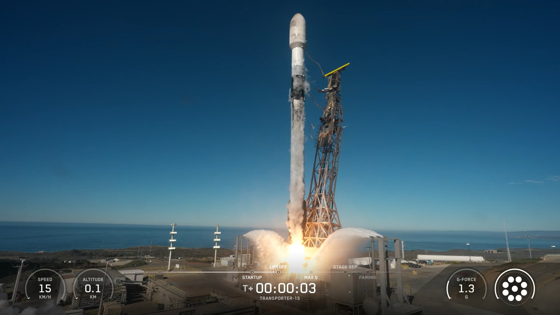
📡 Throwback to Q2 FY2024: 725 spacecraft launched, with 84% dedicated to communications. Learn more: brycetech.com/briefing #BryceBriefing #SatelliteData #SpaceIndustry

Something went wrong.
Something went wrong.
United States Trends
- 1. #ALLOCATION 253K posts
- 2. #JUPITER 254K posts
- 3. #GivingTuesday 11.7K posts
- 4. The BIGGЕST 447K posts
- 5. Good Tuesday 33.9K posts
- 6. #GMMTVxTPDA2025 787K posts
- 7. rUSD N/A
- 8. Susan Dell N/A
- 9. Michael Dell 1,126 posts
- 10. Kanata 26.7K posts
- 11. Taco Tuesday 11.7K posts
- 12. Costco 33.2K posts
- 13. #tuesdayvibe 1,962 posts
- 14. Dart 40.9K posts
- 15. JOSSGAWIN AT TPDA2025 119K posts
- 16. Trump Accounts 4,284 posts
- 17. King Von N/A
- 18. JIMMYSEA TPDA AWARD 2025 79.5K posts
- 19. Pentagon 60.9K posts
- 20. Snow Day 8,020 posts