#satellitedata search results

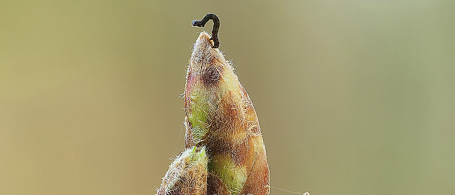
How oak trees outwit their predators #satellitedata #earthobservation #forest #herbivore #resilience uni-wuerzburg.de/en/news-and-ev…
Puerto Rico’s forests recovered in unexpected ways post-Hurricane Maria, VCU research finds @VCUnews #satellitedata #earthobservation #forests #hurricanerecovery news.vcu.edu/article/puerto…

Snow cover on Greek mountains has more than halved in four decades, study finds @Cambridge_Uni #satellitedata #earthobservation #snowcover #hydrology #climatechange cam.ac.uk/research/news/…

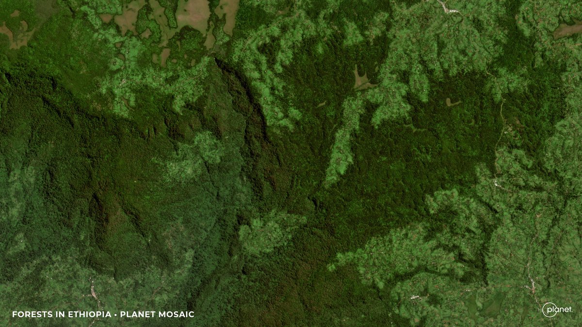
Stunning images from Biomass mark its one year in orbit @esa #satellitedata #earthobservation #forests #carboncycle esa.int/Applications/O…

A search engine for the planet opens to the public @mongabay #satellitedata #earthobservation #geospatial #artificialintelligence news.mongabay.com/short-article/…
New Study Finds Urban Parks in Less Privileged Neighborhoods Are Smaller, Hotter and More Polluted @GWpublichealth #satellitedata #urbanparks #environmentalinequity #publichealth publichealth.gwu.edu/new-study-find…

Apply for Earth Observation Satellite Systems Design Training #satellitedata #earthobservation esa.int/Education/ESA_…

Turning-#RealTime-#SatelliteData into a Competitive Advantage: @HarvardBiz "The number of #ActiveSatellites could reach 60K by 2030, fueling a booming space economy. Modern satellites are equipped with #AI & #EdgeComputing, making them smart tools for: - #PredictiveLogistics
hbr.org
Turning Real-Time Satellite Data into a Competitive Advantage
Businesses across industries are using real-time satellite data to gain an edge. The number of active satellites has tripled in five years and could reach 60,000 by 2030, fueling a booming space...

Registration for Planet “On The Road” in Berlin is open!🛰️ Join us May 22 for a day full of keynotes, in-person networking, & interactive sessions on how #satellitedata is leveraged across industries from policy to business innovation: planet.com/on-the-road/be… #planetontheroad

Nighttime Imaging Grows Landsat’s Science Value #satellitedata #earthobservation #landsat #nighttime science.nasa.gov/missions/lands…


IO datasets have multiple commercial uses and can be leveraged by organisations for their benefits. Find the article link in the comments 🔗 @isro #isro #data #satellitedata #agriculture

#DidYouKnow In the Nordic regions often linked to Santa in folklore, real reindeer migrate hundreds of kilometres each year. And their movements have been tracked with #GPS collars and #satellitedata since the late 1990s. That long record shows how quickly things are changing:

Our next stop on Planet’s “On The Road” tour: the Washington DC area! Join us June 12th for a day full of in-person keynotes, networking, & sessions on how #satellitedata is leveraged across industries from D&I to natural disaster risk mitigation: planet.com/on-the-road/dc…

NOAA’s Satellites Detect Blowing Dust Events that Impact Human Health and Safety @NOAASatellites #satellitedata #airquality #humanhealth nesdis.noaa.gov/news/noaas-sat…

Satellites + AI = real-time greenhouse gas tracking 🌿Organizations like Climate TRACE & GHGSat are enabling transparency & smarter climate action. Discover how space tech fights emissions! geoawesome.com/eo-hub/how-org… #SatelliteData #GHG #EarthObservation #Climate #Geoawesome
🚀 Satellite data is transforming agriculture! From precision farming to carbon credit estimation, EO helps farmers: ✅Monitor crops ✅Predict yields ✅Optimize resources Read more on Geoawesome! geoawesome.com/eo-hub/how-sat… #SatelliteData #Farming #EarthObservation #Geoawesome

Get to know the #startup Hula Earth, which uses #satellitedata and #birdcalls to determine #biodiversity. More than 80 small high-tech boxes are installed in the outdoors, collecting data and transmitting it to the company headquarters: go.tum.de/230329 📷A. Heddergott
Great to see @EarthDailyA's Dave Gebhardt featured in a #FiresideChat with CropLife @croplifemag Editor Eric Sfiligoj at Tech Hub LIVE 2025 in Des Moines, IA. Dave shared how #satellitedata and #analytics are becoming central to agronomic decision-making. Full feature here:


Explore the future of Earth Observation and large AI models in Satellogic's CEO, @earlkman, first blog of the series. Get ready for the "ChatGPT 3.5 moment" in EO! #earthobservation #satellites #satellitedata #AI satellogic.com/2024/04/24/the…

Hurricanes devastated Florida’s East Coast – then seagrass made an unexpected comeback @ConversationUS #satellitedata #earthobservation #landsat #seagrass #hurricanes theconversation.com/hurricanes-dev…

Snow cover on Greek mountains has more than halved in four decades, study finds @Cambridge_Uni #satellitedata #earthobservation #snowcover #hydrology #climatechange cam.ac.uk/research/news/…
How oak trees outwit their predators #satellitedata #earthobservation #forest #herbivore #resilience uni-wuerzburg.de/en/news-and-ev…
New Study Finds Urban Parks in Less Privileged Neighborhoods Are Smaller, Hotter and More Polluted @GWpublichealth #satellitedata #urbanparks #environmentalinequity #publichealth publichealth.gwu.edu/new-study-find…
Apply for Earth Observation Satellite Systems Design Training #satellitedata #earthobservation esa.int/Education/ESA_…
Stunning images from Biomass mark its one year in orbit @esa #satellitedata #earthobservation #forests #carboncycle esa.int/Applications/O…
Puerto Rico’s forests recovered in unexpected ways post-Hurricane Maria, VCU research finds @VCUnews #satellitedata #earthobservation #forests #hurricanerecovery news.vcu.edu/article/puerto…
Hurricanes devastated Florida’s East Coast – then seagrass made an unexpected comeback @ConversationUS #satellitedata #earthobservation #landsat #seagrass #hurricanes theconversation.com/hurricanes-dev…
Nighttime Imaging Grows Landsat’s Science Value #satellitedata #earthobservation #landsat #nighttime science.nasa.gov/missions/lands…
A search engine for the planet opens to the public @mongabay #satellitedata #earthobservation #geospatial #artificialintelligence news.mongabay.com/short-article/…
NOAA’s Satellites Detect Blowing Dust Events that Impact Human Health and Safety @NOAASatellites #satellitedata #airquality #humanhealth nesdis.noaa.gov/news/noaas-sat…
Braving the Arctic for upcoming polar-focused satellites @esa #satellitedata #earthobservation #seaice #climatechange esa.int/Applications/O…


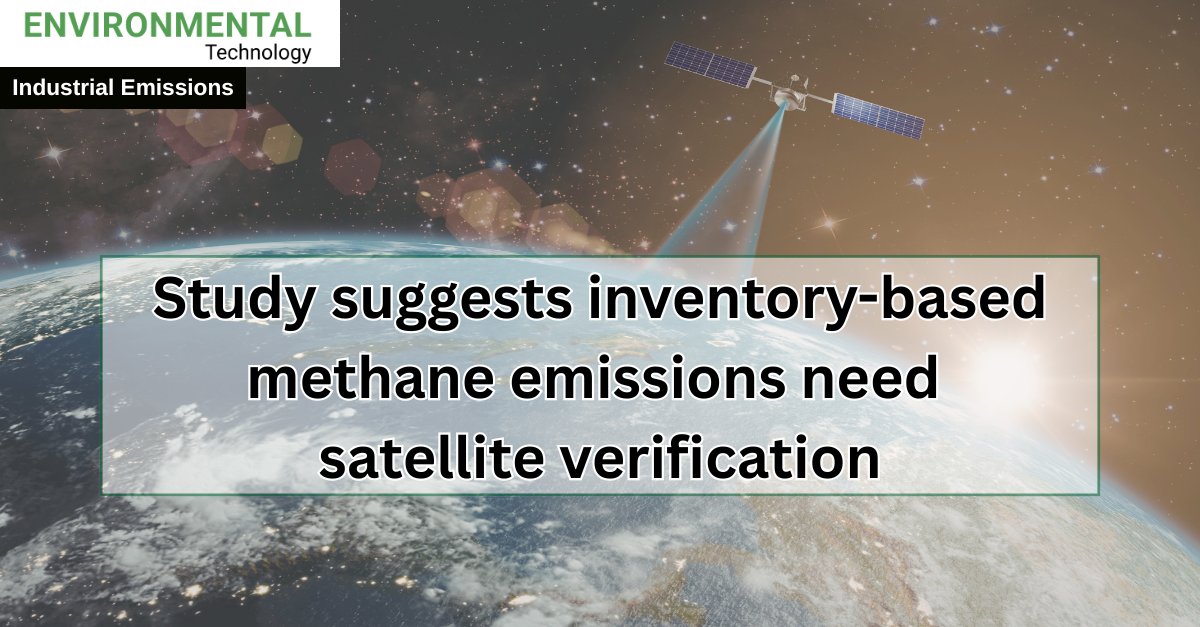
A study led by researchers at @UMich suggests that urban #MethaneEmissions are rising faster than official estimates indicate, raising questions for city climate plans & for the monitoring systems used to support them 👉 ilmt.co/TL/0qj9 #MethaneMonitoring #SatelliteData
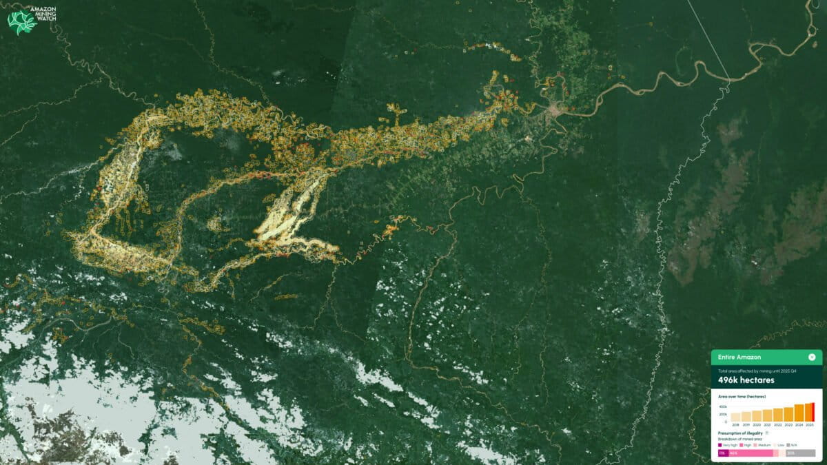
Geospatial AI is reinventing the rainforest beat @NiemanLab #satellitedata #earthobservation #machinelearning #journalism niemanlab.org/2026/04/geospa…

Why Earth Observation is Drowning in Data but Starving for Decision- Ready Intelligence @geoawesome_dgtl #satellitedata #earthobservation #decisionreadyintelligence geoawesome.com/why-earth-obse…

Kicking off Development of New Earth Observation Solutions #satellitedata #earthobservation earthdata.nasa.gov/news/feature-a…

@spcsft Transforms Satellite Analytics to API Model 𝙍𝙚𝙖𝙙 𝙈𝙤𝙧𝙚: itbusinesstoday.com/tech/ai/spaces… #AI #SateAIs #Satellitedata #spacebusiness #SpaceShift

HawkEye IPO Space data demand is rising fast and HawkEye is targeting a $2.4B IPO valuation. A big signal for the future of satellite intelligence. Read more: chapterninty.com/space-data-boo… #IPO #SpaceTech #SatelliteData #Investing

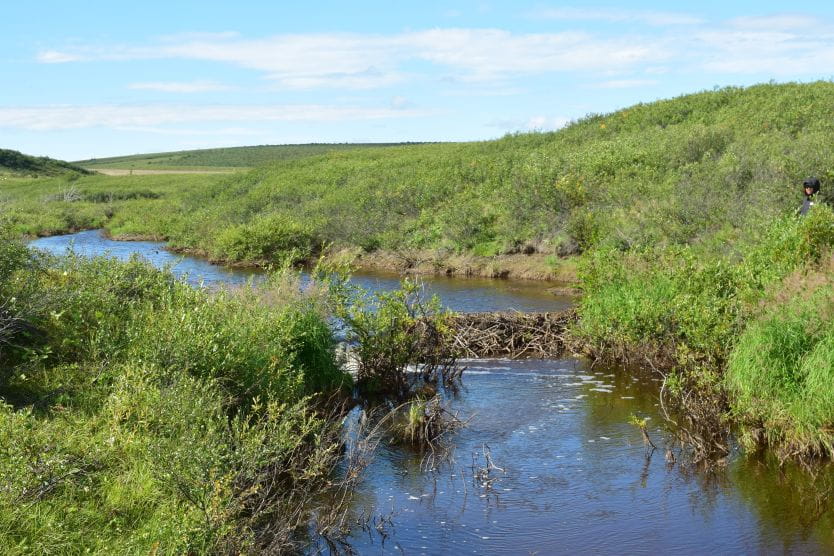
Beavers leave a trail as they head into the Arctic #satellitedata #earthobservation #beavers #climatechange aru.ac.uk/news/beavers-l…
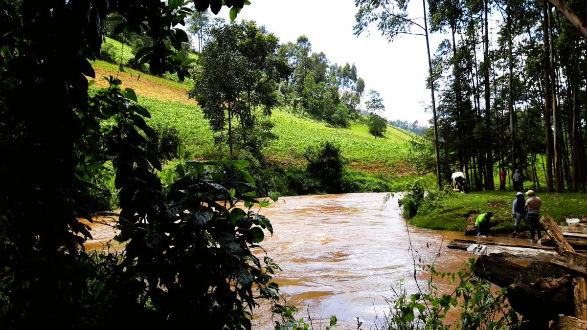
The Underestimated Role of Rivers as a Source of Greenhouse Gases #satellitedata #earthobservation #rivers #greenhousegases kit.edu/kit/english/pi…
Snow Is Scarce in the Upper Colorado Basin #satellitedata #earthobservation #snowpack #waterresources science.nasa.gov/earth/earth-ob…


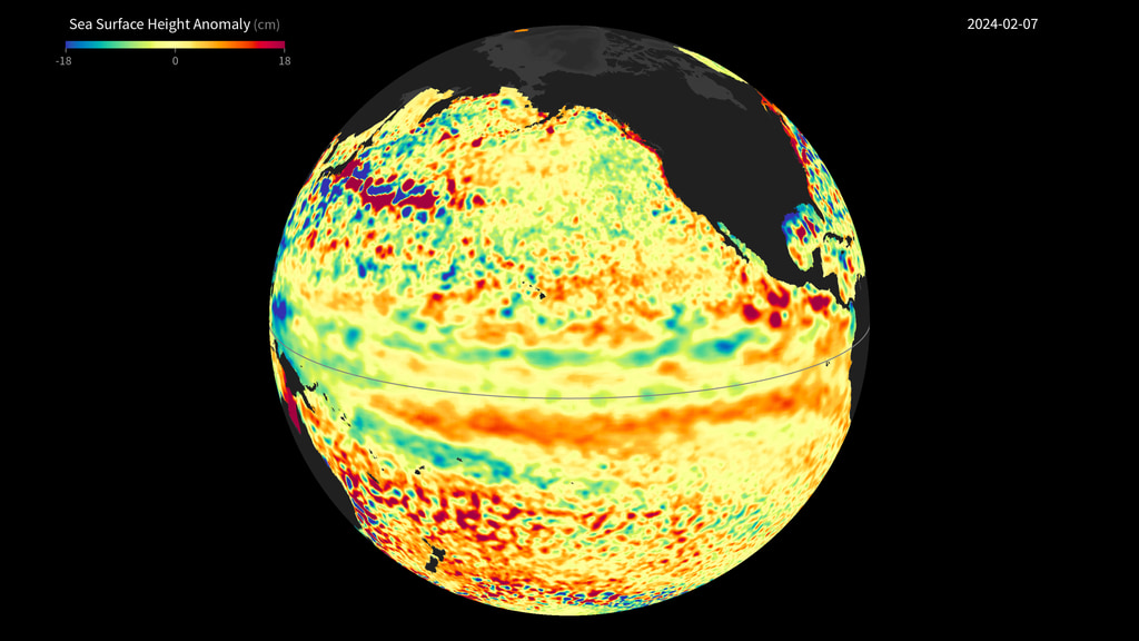
Decades of Satellite Data Unveil Alarming Sea Level Rise Trends 🛰️ 🌊 Long-term records reveal a doubling in the rate of sea level rise since 1993, driven by global warming and exacerbated by El Niño events. More 👉 bit.ly/GRSS-eNewslett… #SatelliteData #ClimateTrends

.@LiumResearch uses @planet #satellitedata for accurate & timely reporting on the status of #renewableenergy projects for energy investors, enabling new market opportunities & supporting a renewable energy transition. Find out how: go.planet.com/lium

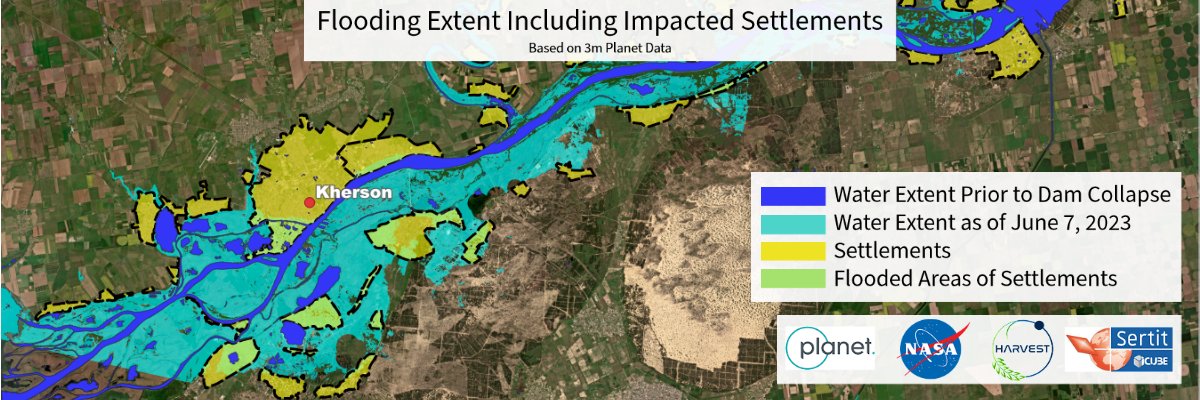
The Nova Kakhovka dam provided water across agricultural lands in Ukraine. Following the dam's destruction, @NASA @HarvestProgram via #satellitedata found that three farm irrigation canals are already disconnected, with a fourth dangerously close. More: go.planet.com/harvest-dam
Today at @usgif #GEOINT2023 we announced new strategic partnerships with #ai analytics providers, @synthetaic and @SIAnalytics_AI. These advanced tools + our #satellitedata can help customers better understand change to make critical decisions faster: go.planet.com/geointai

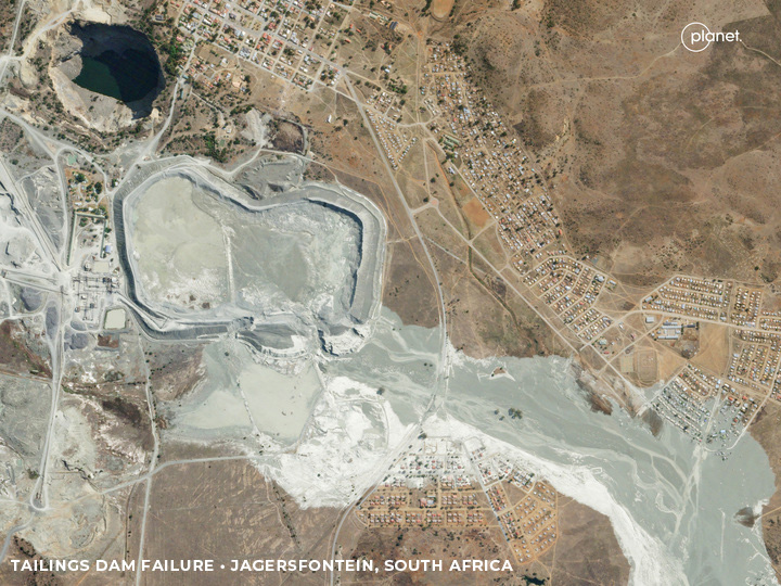
Tailings dams hold back waste from mines, but when those dams fail, it could be hazardous. To prevent such hazards, researchers used our #satellitedata to study the failure of a tailings dam in Jagersfontein, South Africa. Read what they found: go.planet.com/tailingsdams
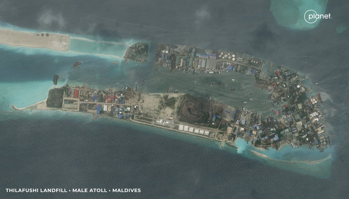
Burning trash stinks! 🗑️ But seriously, trash burning in landfills can be hazardous to health, and in many countries, illegal. Researchers from @DukeU are using our #satellitedata + #ML to identify illegal waste burning. Learn more: go.planet.com/trash
The @NICFISATdata program provides access to @Planet’s high-res #satellitedata to help reduce & reverse tropical forest loss, improve #biodiversity and combat #climatechange. Learn more about the NICFI program’s powerful user stories and events: go.planet.com/nicfisatdata
IO datasets have multiple commercial uses and can be leveraged by organisations for their benefits. Find the article link in the comments 🔗 @isro #isro #data #satellitedata #agriculture
From strengthening geopolitical security to combating bushfires, there’s a lot happening with Planet data in the Asia-Pacific region. Curious about what the future could hold for #satellitedata in the area? Learn more: go.planet.com/apj-sat-future

📣 The latest agenda and speakers for Planet’s On The Road - Berlin have been announced! 📣 Join us in-person on May 22 to learn how #satellitedata is being leveraged in industries ranging from agriculture to carbon markets. See who will be there: planet.com/on-the-road/be…

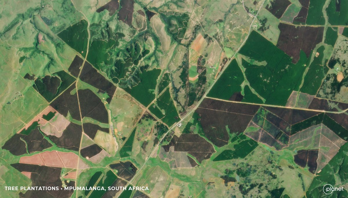
Baboons, just being baboons. But when they damage and kill timber commodities, early intervention can protect the trees.🌳 Learn how researchers from @MandelaUni and @UKZN use #ai and our #satellitedata to monitor and identify the damage to timber: go.planet.com/baboons

See this article about my inspiring and informative visit to the @SES_Satellites Global Operations Center, where I learned all about the SES global connectivity system: rocketdatascience.org/?p=1989 ————— #SatelliteData #BigData #Cloud #DigitalTransformation #DigitalConnectivity
Using advanced #AI computer vision models, @Royce_Geo leveraged @Planet #satellitedata to identify & track “dark” vessels & uncover Russia’s illicit oil supply route. Learn how: go.planet.com/roycegeo

Missed GeoawesomeMeetup? Catch the recording see how satellite data is transforming mapping! 🌍Insights from @TomTom + @Maxar - perfect for geospatial pros & enthusiasts. Watch it here: youtu.be/dWZrR1XKrno?si… #Geospatial #SatelliteData #Mapping #Geoawesome #FutureOfNavigation

Registration for Planet “On The Road” in Berlin is open!🛰️ Join us May 22 for a day full of keynotes, in-person networking, & interactive sessions on how #satellitedata is leveraged across industries from policy to business innovation: planet.com/on-the-road/be… #planetontheroad

The 74th @Iac2023 in Baku is underway. Swing by our booth #515 and chat about #GroundStation services, future #SubOrbitalExpress missions, #SatelliteData analytics and #SatLaunch – all part of our offering 🚀🛰️📡 @iafastro #IAC2023 #SmallSatExpress #Orbital #SSCconnect #SatCom

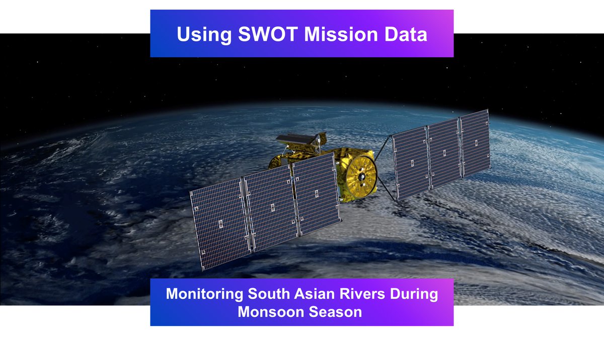
🛰️ The SWOT mission is revolutionizing water monitoring with high-resolution satellite data! How is it helping us track rivers and oceans? Read the full article on Geoawesome! 🌍 geoawesome.com/using-swot-mis… #SWOTMission #EO #SatelliteData #Water #Geoawesome
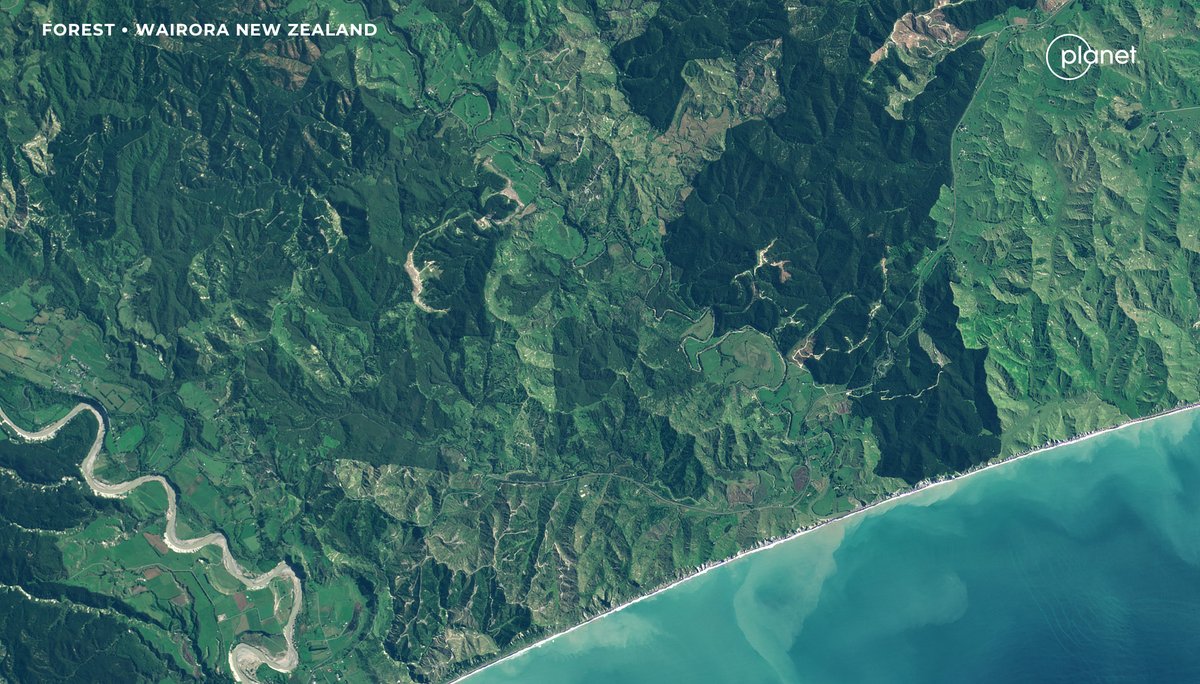
In this week's #GroundTruthInAsia, learn how our partners are using our #satellitedata to monitor tree harvest and growth, for better #forestmanagement & rehabilitation in NZ and PH. 🌳 👉🏽 go.planet.com/apj2 Spotlight on @interpine_Nz & @JukenNewZealand & Geospectrum
While seagrass meadows may not be ideal for picnics, they're critical habitats for marine #biodiversity, and serve as carbon sinks. Learn how researchers combined our #satellitedata with #ML to map & measure these ecosystems off the coast of New Zealand: go.planet.com/seagrass

#DidYouKnow In the Nordic regions often linked to Santa in folklore, real reindeer migrate hundreds of kilometres each year. And their movements have been tracked with #GPS collars and #satellitedata since the late 1990s. That long record shows how quickly things are changing:
Something went wrong.
Something went wrong.
United States Trends
- 1. #SmackDown N/A
- 2. eBay N/A
- 3. Ricky Saints N/A
- 4. Jacy Jayne N/A
- 5. Always a Runner N/A
- 6. Charlotte Flair N/A
- 7. Spirit N/A
- 8. May Day N/A
- 9. Dr. Phil N/A
- 10. Oaks N/A
- 11. JB Bickerstaff N/A
- 12. Portable N/A
- 13. #SteinerMathDay N/A
- 14. Will Warren N/A
- 15. Jack Flaherty N/A
- 16. #GCWExpress N/A
- 17. Volpe N/A
- 18. Jacob Misiorowski N/A
- 19. Duncan Robinson N/A
- 20. Paul Reed N/A