#statemap resultados de búsqueda

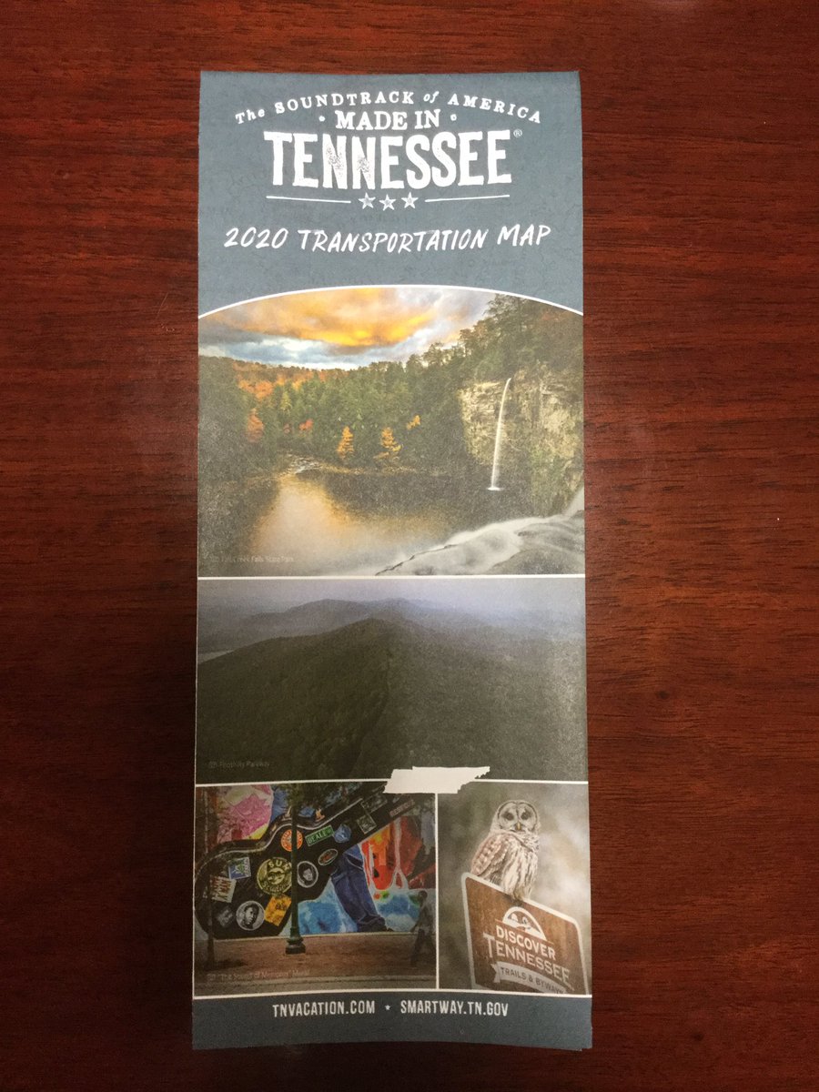
Need a state map? We’ve got new 2020 state maps! Order one here: tn.gov/tdot/driver-ho…. #Map #StateMap #Tennessee #Transportation
IT'S HERE – NCDOT staff are pumped about the BRAND NEW #StateMap. Get yours today at any rest stop across the state.🗺️
Excellent! #STATEMAP
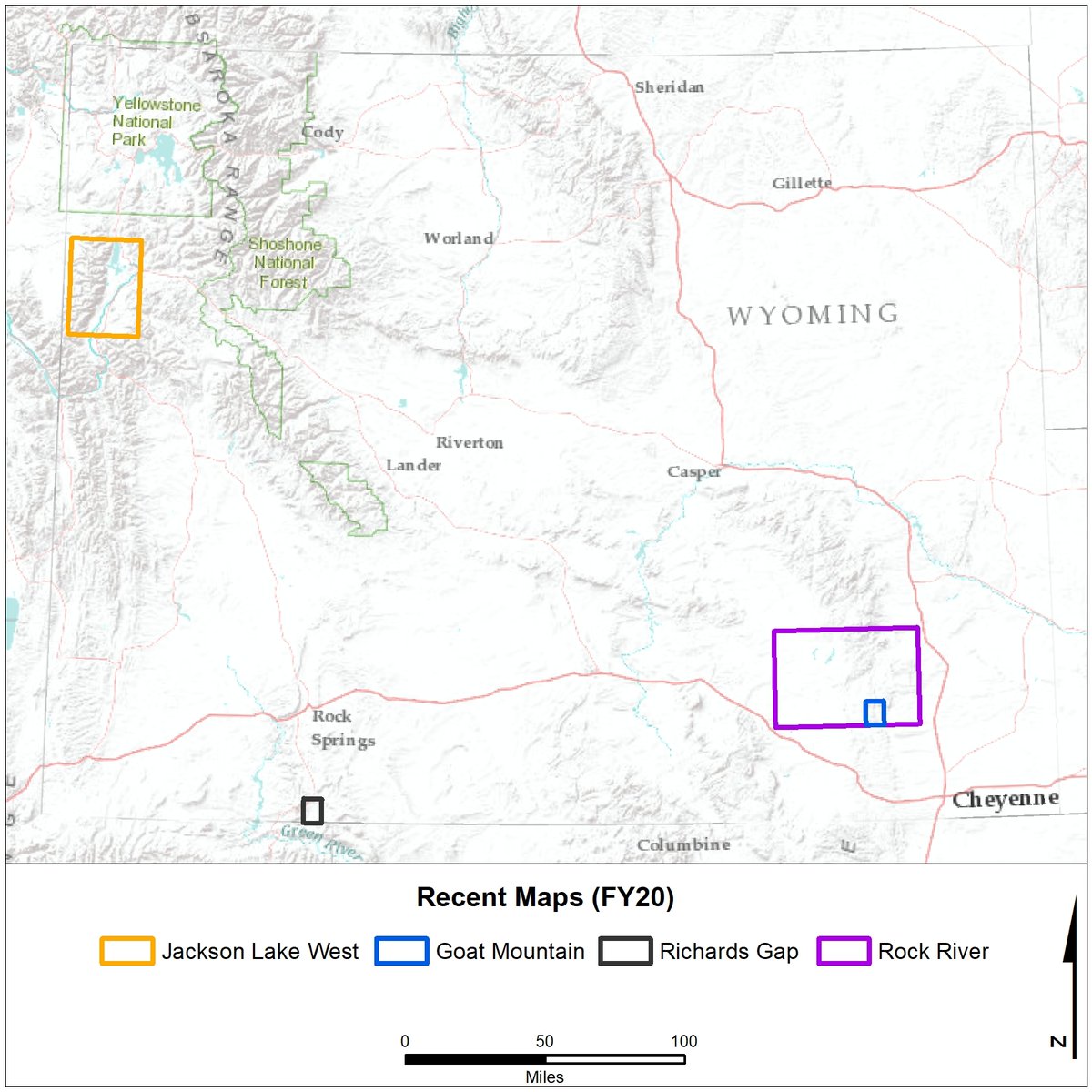
NEW map alert! The WSGS published 4 new #geologic #maps under its STATEMAP program. Look for daily posts starting today highlighting each #map. In the meantime, learn about the projects in the news release: content.govdelivery.com/accounts/WYSGS…. #Wyoming #geology #geologicmap #mapping

📍 Hey Georgia! The 2023-2024 State Highway and Transportation Map is now available. Add this to your travel kit before your begin your next trip. Download your copy today by visiting bit.ly/3FHMNHz. 🗺️ #StateMap #ArriveAliveGA
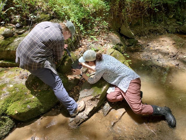
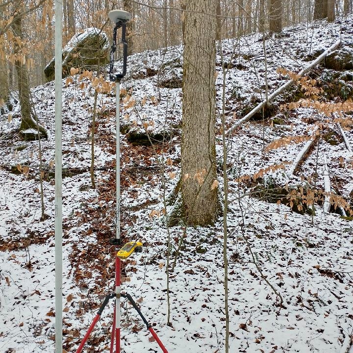
It is currently field season for our geologists! Here DGMR geologists examine and measure the Dover High Strain Zone in Goochland County. This mapping is supported by a #USGS #STATEMAP grant. Learn more here: tinyurl.com/pp3bpa4


Jellystone if it was a state + Transparent versions [#jellystone #hannabarbera #statemap #countymap #digitalart #ArtistOnX #ArtistonTwitter]
![geko_is's tweet image. Jellystone if it was a state + Transparent versions
[#jellystone #hannabarbera #statemap #countymap #digitalart #ArtistOnX #ArtistonTwitter]](https://pbs.twimg.com/media/Ga_zr32XAAE5zxW.jpg)
![geko_is's tweet image. Jellystone if it was a state + Transparent versions
[#jellystone #hannabarbera #statemap #countymap #digitalart #ArtistOnX #ArtistonTwitter]](https://pbs.twimg.com/media/Ga_zr38WcAAxFse.jpg)
![geko_is's tweet image. Jellystone if it was a state + Transparent versions
[#jellystone #hannabarbera #statemap #countymap #digitalart #ArtistOnX #ArtistonTwitter]](https://pbs.twimg.com/media/Ga_zr35XEAAB9iI.jpg)
![geko_is's tweet image. Jellystone if it was a state + Transparent versions
[#jellystone #hannabarbera #statemap #countymap #digitalart #ArtistOnX #ArtistonTwitter]](https://pbs.twimg.com/media/Ga_zr34XwAAEUw3.jpg)


AZGS NewsLetter Winter 2020-2021. Catch up on geologic projects and Survey objectives going forward in 2021. AZ State Geologist Phil A. Pearthree shares his vision for the AZGS. tinyurl.com/AZGSNewsLetter #Geohazards #Mapping #STATEMAP @USGSAZ @AGI_Updates @AEGweb @NESTA_US


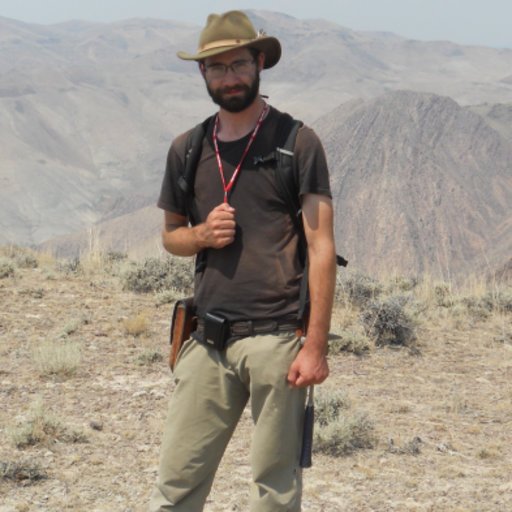
Coming soon to a geological survey near you. Dr. Eric Stewart. #WGNHSresearch #mapping #StateMap #newfacesatthesurvey
Two days per week for the next six weeks - look for Eric Carson and a geoprobe rig in the driftless area. #DriftlessArea #StateMap arcg.is/1aCrXG #outstandinginourfield


Do like shre and subscribe to my yt channel will be posting all of aerial slam results t @here only #slam #vio #statemap
youtu.be/WHfJz8Ed6ck Did visual intertial state estimator few months back
youtube.com
YouTube
Real-Time Visual SLAM | Feature Tracking + 3D Trajectory
Jellystone if it was a state + Transparent versions [#jellystone #hannabarbera #statemap #countymap #digitalart #ArtistOnX #ArtistonTwitter]
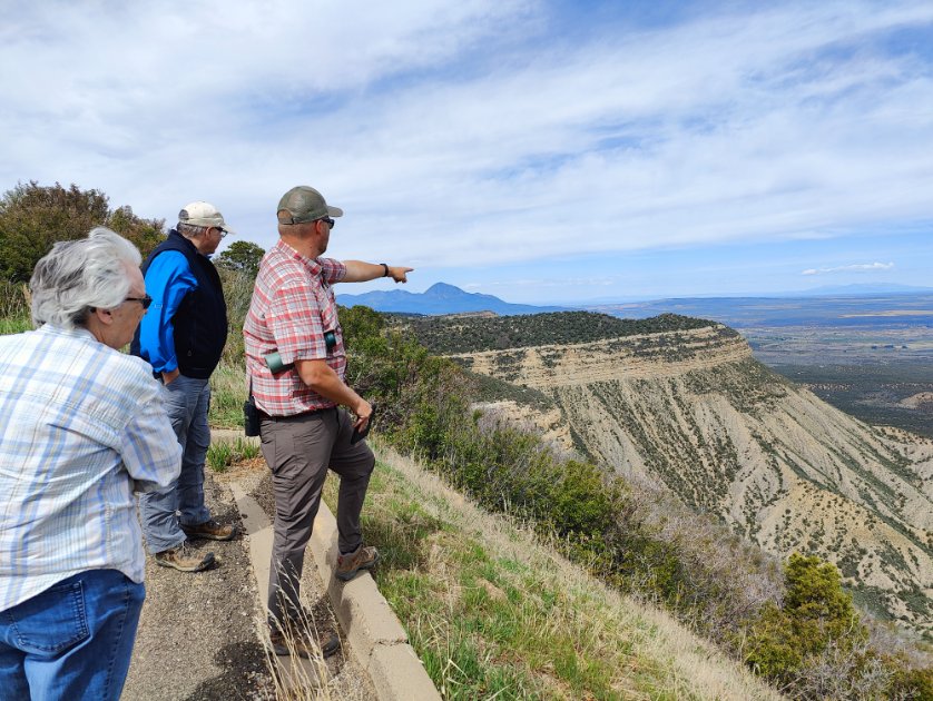
A team of our geologists spent the past week in the Four Corners region to map the Cortez quadrangle as part of the #STATEMAP program!


Excited to share my #laserengraved #statemap #woodsign livesaygrafix.etsy.com/listing/148121…

A land of folklore, music and brave warriors, Nagaland represents unimaginable beauty, moulded perfectly for a breath-taking experience. #StateMap #Nagaland #NorthEast #KnowYourIndia


Need a state map? We’ve got new 2020 state maps! Order one here: tn.gov/tdot/driver-ho…. #Map #StateMap #Tennessee #Transportation
Jellystone if it was a state + Transparent versions [#jellystone #hannabarbera #statemap #countymap #digitalart #ArtistOnX #ArtistonTwitter]

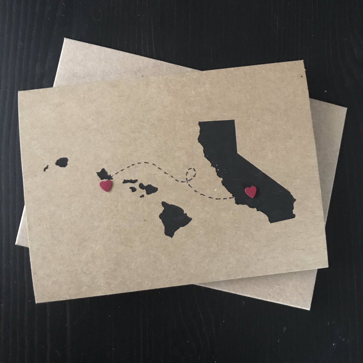
It makes me so happy to custom make these lovely #statemap #notecards for people! 🥰 . . Get your cards made today with YOUR state(s) and text of choice! Link in bio.📱

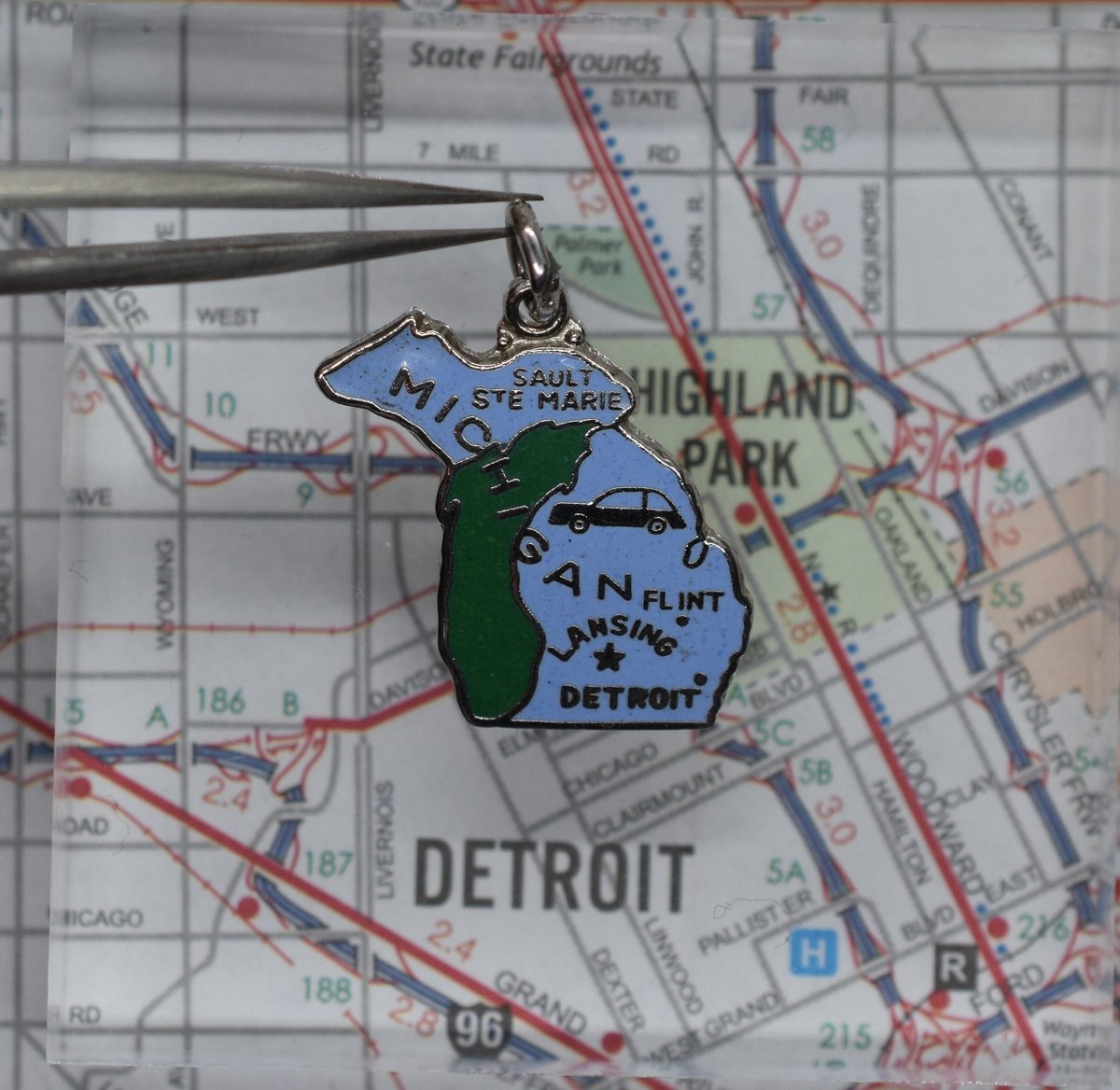
Excited to share the latest addition to my #etsy shop: Vintage Michigan Silver Tone and Enamel State Map Charm For Bracelet Featuring Sault Ste. Marie, Flint, Lansing and Detroit with a Car etsy.me/2zmWLOy#travel #statemap #charm #detroit #michigan #motorcity
Fossil root cast in coal unearthed during last week's #GeologicDrilling in Greene County. This sample will be characterized as part of ongoing #STATEmap project & later stored in our core library for future research. #IGWScollections

Coming soon to a geological survey near you. Dr. Eric Stewart. #WGNHSresearch #mapping #StateMap #newfacesatthesurvey
#IGWSgeologists described core from Morgan County this week as part of #STATEMAP program. Bedrock cores are cut & described using the IGWS corebook procedure to produce fast, accurate, & consistent observations. Download a free copy of the corebook at igws.indiana.edu/bookstore/deta….

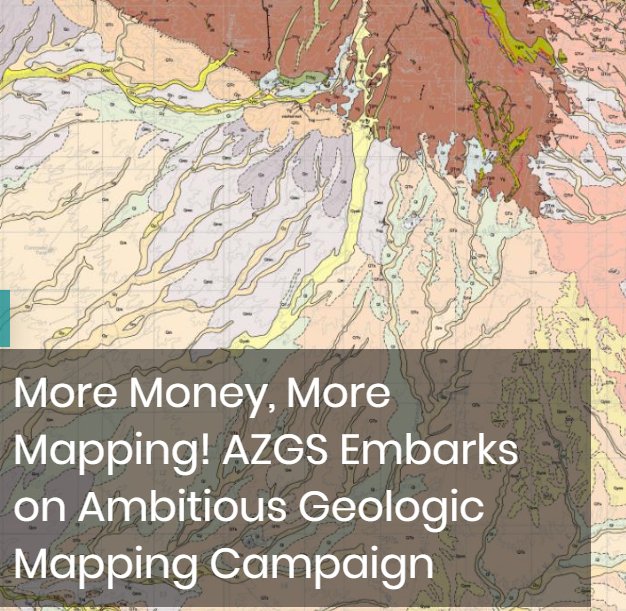
AZGS #STATEMAP award in Fiscal Year 20-21 is $324k – a 2-fold increase from our current level of funding. See today's, 'More Money, More Mapping! AZGS Embarks on Ambitious Geologic Mapping Campaign', for details and map strategy for 2020-21. @USGSAZ blog.azgs.arizona.edu/blog/2020-06/m…
#IGWSgeologists are busy splitting and describing geologic core for the #STATEMAP project. Rock cores provide an invaluable look at the subsurface of Indiana, and allow geologists to create geologic maps, identify aquifers, and trace mineral and energy resources.

A team of our geologists spent the past week in the Four Corners region to map the Cortez quadrangle as part of the #STATEMAP program!
Coring near Martinsville this week as part of the @USGS State Geologic Survey #STATEMAP project. #IGWSgeologists will use unconsolidated sediment & bedrock cores to create detailed maps that can help planners address water & mineral resource issues in Morgan County.


Icy cold or muggy & hot...What's your favorite season for field work? #IGWSgeologists continue to map around Crane NSWC for the #STATEmap project. The map will show geologic formations, identify potential aquifers, & improve our understanding of groundwater flow in the region.
AZGS NewsLetter Winter 2020-2021. Catch up on geologic projects and Survey objectives going forward in 2021. AZ State Geologist Phil A. Pearthree shares his vision for the AZGS. tinyurl.com/AZGSNewsLetter #Geohazards #Mapping #STATEMAP @USGSAZ @AGI_Updates @AEGweb @NESTA_US
Something went wrong.
Something went wrong.
United States Trends
- 1. #RHOA N/A
- 2. Cooper Flagg N/A
- 3. Luke Kennard N/A
- 4. UCLA N/A
- 5. #90DayFiance N/A
- 6. Porsha N/A
- 7. Bezos N/A
- 8. Escarra N/A
- 9. #BELIFT_Treat_ENHYPEN_Fairly N/A
- 10. Shamea N/A
- 11. Jake Laravia N/A
- 12. #scottywiththebaby N/A
- 13. Ben Brown N/A
- 14. Tulsa N/A
- 15. K Michelle N/A
- 16. Abreu N/A
- 17. #RHORI N/A
- 18. South Carolina N/A
- 19. Lindgren N/A
- 20. Jaxson Hayes N/A