#geologicmap search results

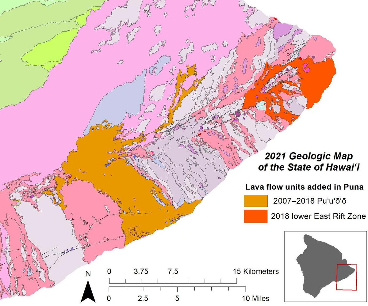
Something old, something new, something borrowed, something.....researched! The newest #geologicmap of the State of #Hawaii has it all. #VolcanoWatch #HVO ow.ly/XMu850HYJt0

First ever digital geologic map of Alaska published. #geologicmap #alaska #resources #tectonicplates sulc.us/6q3g5
New Release: Geology of Cactus Forest quad, Pinal County, AZ , at AZGS Doc. Repository. 1.usa.gov/U2fjUo #GeologicMap

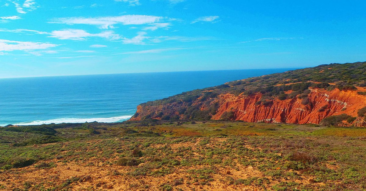
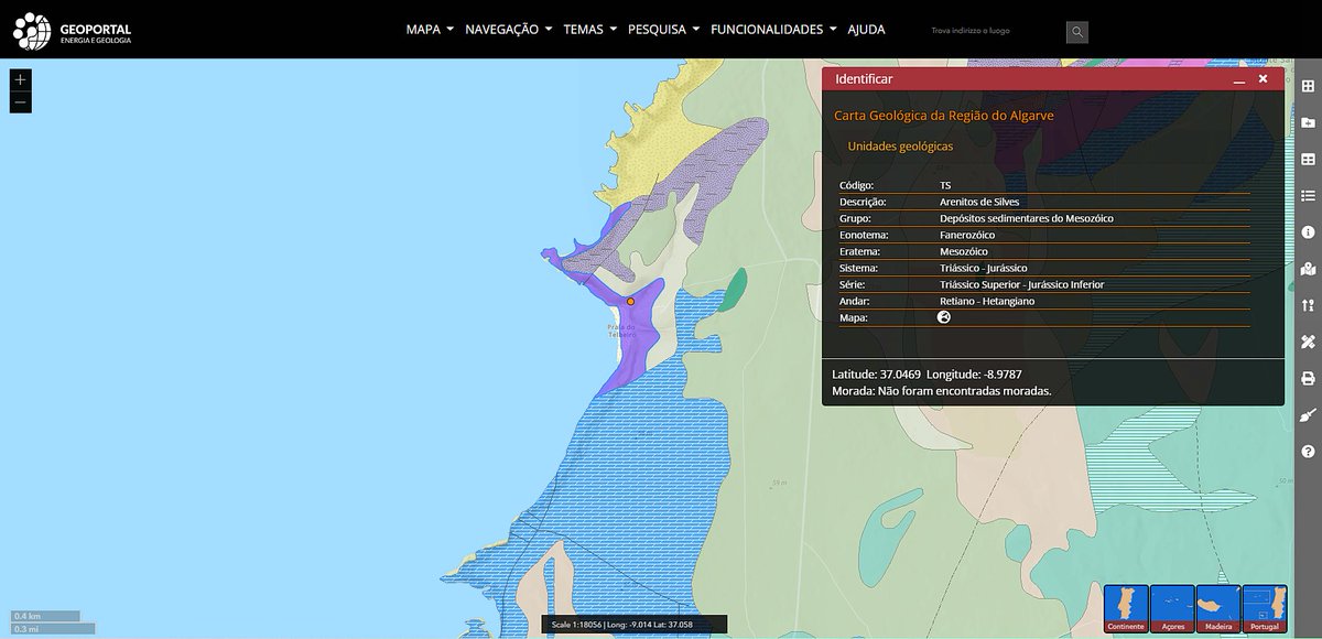
What are those red #rocks in #Algarve? The pictured #geologicmap gives the answer... they formed between the #Triassic and #Jurassic in a semi-arid terrestrial environment! --- #TuesdayThoughts #tuesdayvibes #geology #naturephotography #geotourism #traveltuesday
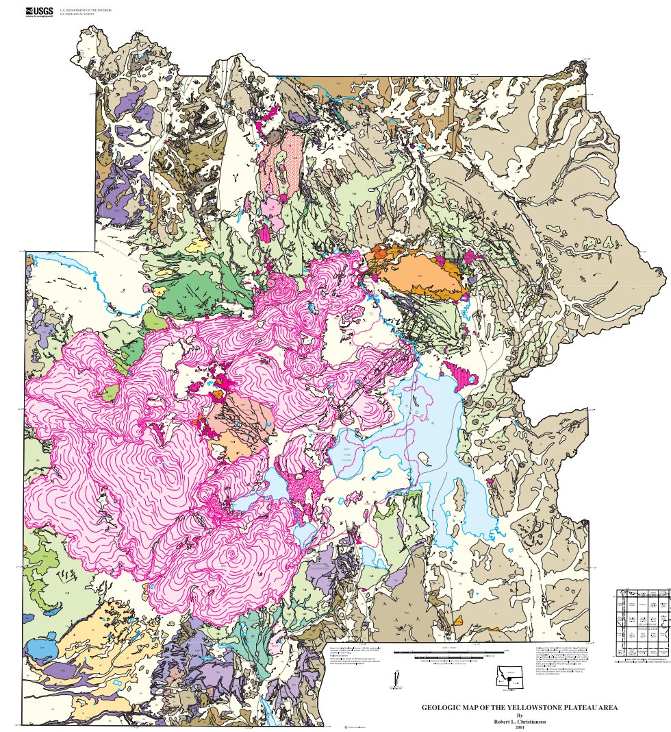
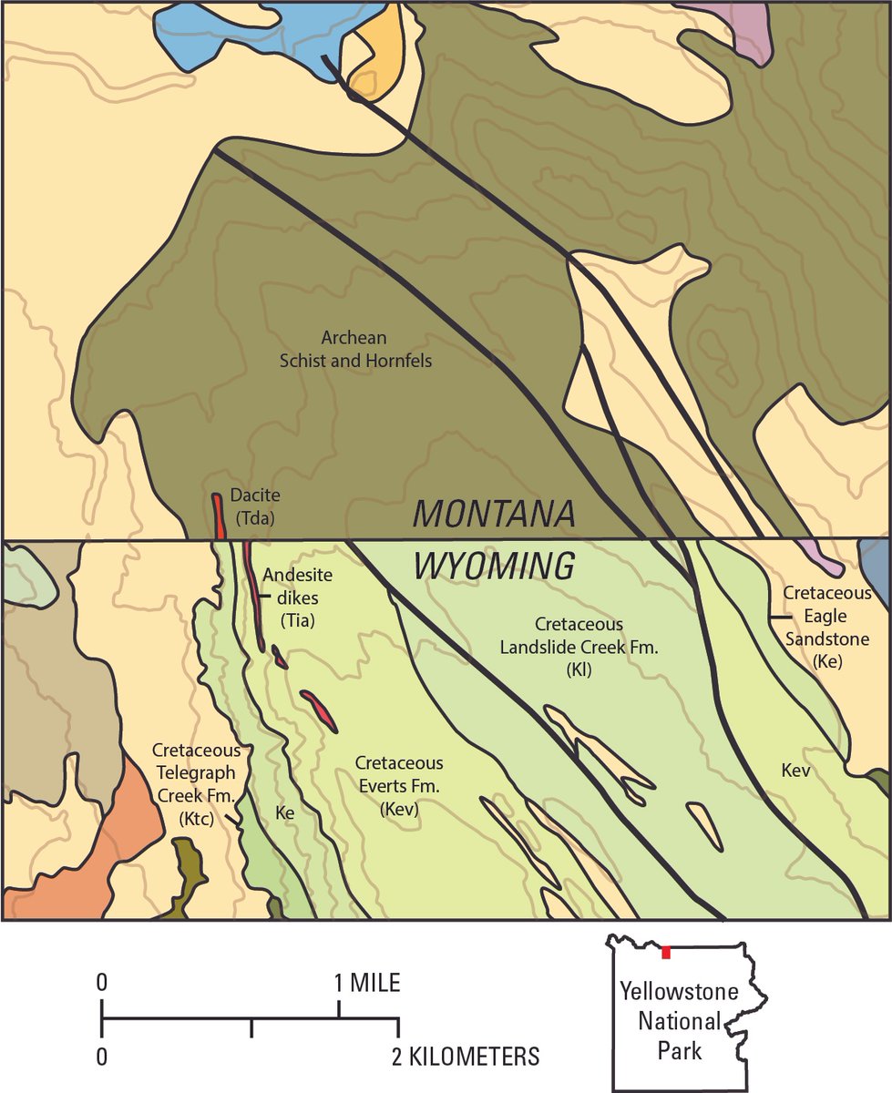
@YellowstoneNPS celebrates 145 years today! The 2001 #geologicmap includes #volcanic #rocks older than 2 mil years. pubs.usgs.gov/pp/pp729g/

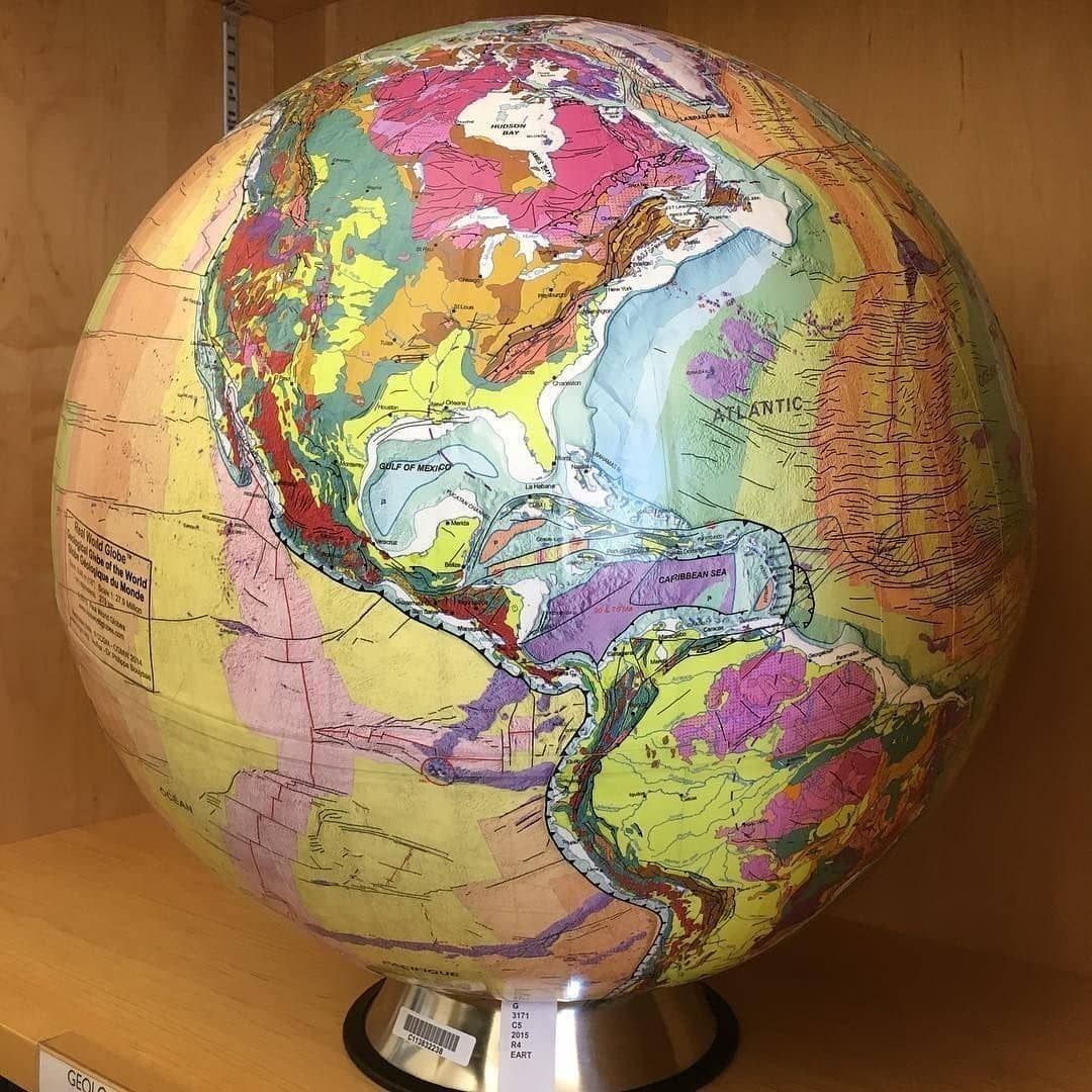
A geologic globe! not something you see everyday #geology #geologicmap #globe #berkeley #geologicalmap #geologicalmapping #map #maps #cartography #geography #topography #mapping #mappe #carte #mapa #karta #cable #cables #globe #worldmap #geography


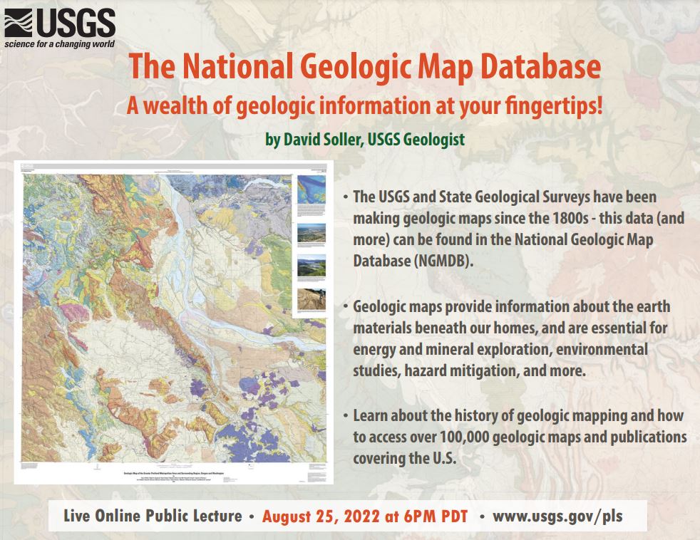
Tune in TONIGHT! August 25, 2022 at 6:00 PM (PT) for the August USGS Virtual Public Lecture The National Geologic Map Database - A wealth of geologic information at your fingertips! by David Soller, USGS Geologist ow.ly/pSxT50Krscn #GeologicMap #Geology
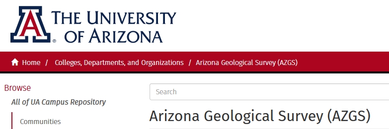
DYK that holdings of the AZGS's Document Repository are now mirrored at UArizona Library? Well, they are. #GeologicMap #Reports #OFR #Bulletins #DGM repository.arizona.edu/handle/10150/6…
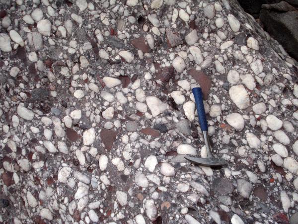
Quartz pebble Del Rio Quartzite (1.63-1.7 Ga) Chino Valley, AZ. #GeologicMap repository.azgs.az.gov/uri_gin/azgs/d…

#toVIEW RT UWMacrostrat: The #geologicmap in RockdApp is available in your browser, nearly 2 million polygons from…

RT @UWMacrostrat: The #geologicmap in @RockdApp is available in your browser, nearly 2 million polygons from 75 sources! #geology #map http…
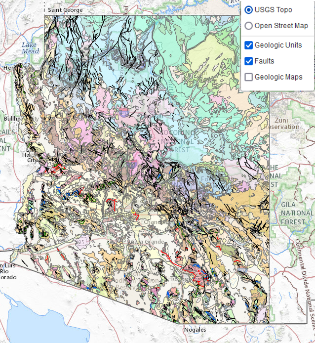
Our enhanced, online 'Geologic Map of Arizona'. Note the layer choices in upper right corner. geomapaz.azgs.arizona.edu #GeologicMap
A geologic globe, not something you see everyday #geology #geologicmap #globe #geologicalmap #geologicalmapping #map
Fresh, 1:100k compilation of the geology of the Little Horn Mountains 30' X 60' Quadrangle, West-Central Arizona. The publication includes: map plate PDF, report, GIS data, Google Earth KMZ, and open-source version of GIS data. #GeologicMap @USGSAZ repository.azgs.az.gov/uri_gin/azgs/d…

[PUB] #OTD in 1908, Teddy Roosevelt proclaimed the @GrandCanyonNPS a national monument. Check out this geologic map of the area and order a hard copy or download a PDF through the USGS Store: ow.ly/ikSs50Qq6xi 🗺️ #TBT #GeologicMap #GrandCanyon
![USGS's tweet image. [PUB] #OTD in 1908, Teddy Roosevelt proclaimed the @GrandCanyonNPS a national monument. Check out this geologic map of the area and order a hard copy or download a PDF through the USGS Store: ow.ly/ikSs50Qq6xi 🗺️
#TBT #GeologicMap #GrandCanyon](https://pbs.twimg.com/media/GDmNHMgXYAAkaM5.jpg)

The #geologicmap in @RockdApp is available in your browser, nearly 2 million polygons from 75 sources! #geology #map macrostrat.org/burwell/

SAVE THE DATE. Thursday August 25, 2022 at 6:00 PM (PT) USGS Virtual Public Lecture The National Geologic Map Database - A wealth of geologic information at your fingertips! by David Soller, USGS Geologist bit.ly/3Jn4DPY #GeologicMap #Geology bit.ly/3cP405u

Monday morning digitizing of the bedrock-alluvium contact in the La Liebre Ranch quadrangle (southern CA) using newest LA County lidar. Working on brand new compilation geologic map for release in July 2019. #geologicmap #arcgis


What goes into making a geologic map? Follow along as geologists investigate a perplexing incongruity in adjoining geologic maps in the north part of Yellowstone National Park. usgs.gov/observatories/… #GIS #geologicmap #yellowstone #mapping
NEW Quaternary (surficial) map of the Safford Basin, SE AZ, online. #GeologicMap 1.usa.gov/18dcTsa

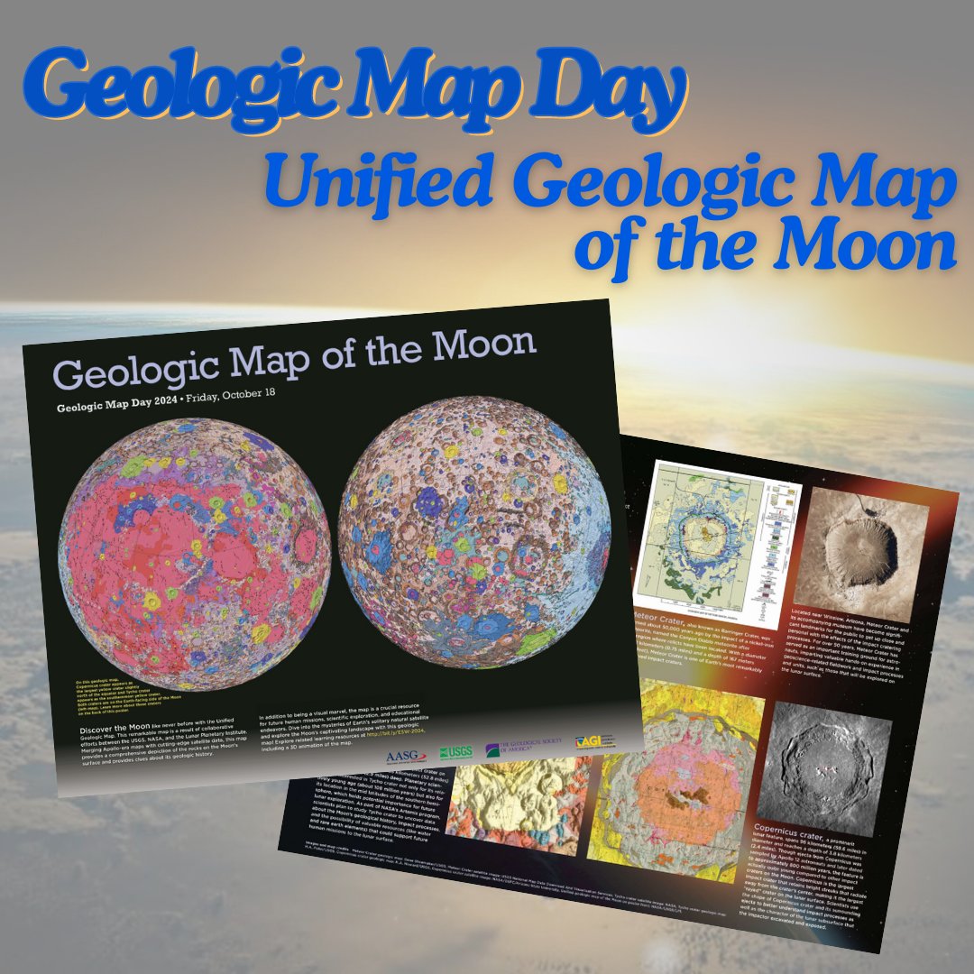
The Moon isn’t just grey dust… 🌓 This detailed #GeologicMap by the United States Geological Survey reveals billions of years of impact & volcanic history: 👇 👇 astrogeology.usgs.gov/search/map/uni…

Publication of first comprehensive geologic map of Saipan and Tinian guided urban planners and emergency managers in zoning and hazard mitigation. #GeologicMap #Planning

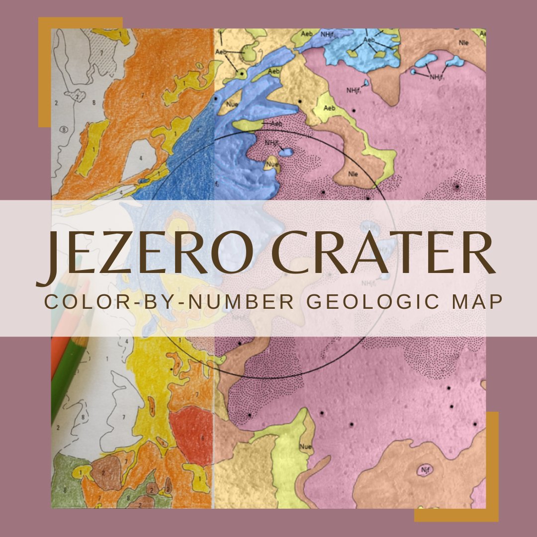
Hey #Teachers! Looking for a fun, easy way to teach about the #Mars2020 Perseverance rover? Check out this #GeologicMap coloring sheet activity! Students color their own geologic map and learn about the geology of #Mars! usgs.gov/news/coloring-…


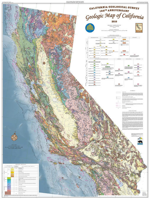
On the last day of #EarthScienceWeek, @CaGeoSurvey shares the #GeologicMap of California with a special feature where users can ID different rock types! 🪨⛏️😎 Check it out below ⬇️⬇️⬇️ @earthsciweek @AGI_Updates #GeologicMapDay

It's #GeologicMapDay! Do you love maps? California Geological Survey has an interactive geological map of California that allows users to identify the different rock types across the state! ⛏️🪨 Click➡️maps.conservation.ca.gov/cgs/gmc/ @CalConservation #EarthScienceWeek
Happy #GeologicMapDay! Enjoy this downloadable poster for the Unified #GeologicMap of the Moon! americangeosciences.org/static/files/e… Find more Earth Science Week resources and a back page to the poster on the Earth Science Week webpage: earthsciweek.org/resources/2024… #EarthScienceWeek

I think this would be a GREAT Adult Coloring Book! #jezero #geologicmap #mars #USGS_AstroGeo! Thanks for sharing...
Hey #Teachers! Looking for a fun, easy way to teach about the #Mars2020 Perseverance rover? Check out this #GeologicMap coloring sheet activity! Students color their own geologic map and learn about the geology of #Mars! usgs.gov/news/coloring-…
Hey #Teachers! Looking for a fun, easy way to teach about the #Mars2020 Perseverance rover? Check out this #GeologicMap coloring sheet activity! Students color their own geologic map and learn about the geology of #Mars! usgs.gov/news/coloring-…
This annotated photograph is of the Mowry Shale and the Frontier Formation (Belle Fourche Member, Emigrant Gap Member & Wall Creek Member), Oil Mountain quadrangle in Natrona County. 2022 geologic map report: wsgs.wyo.gov/wyoming-geolog… #Wyoming #geology #geologicmap #map

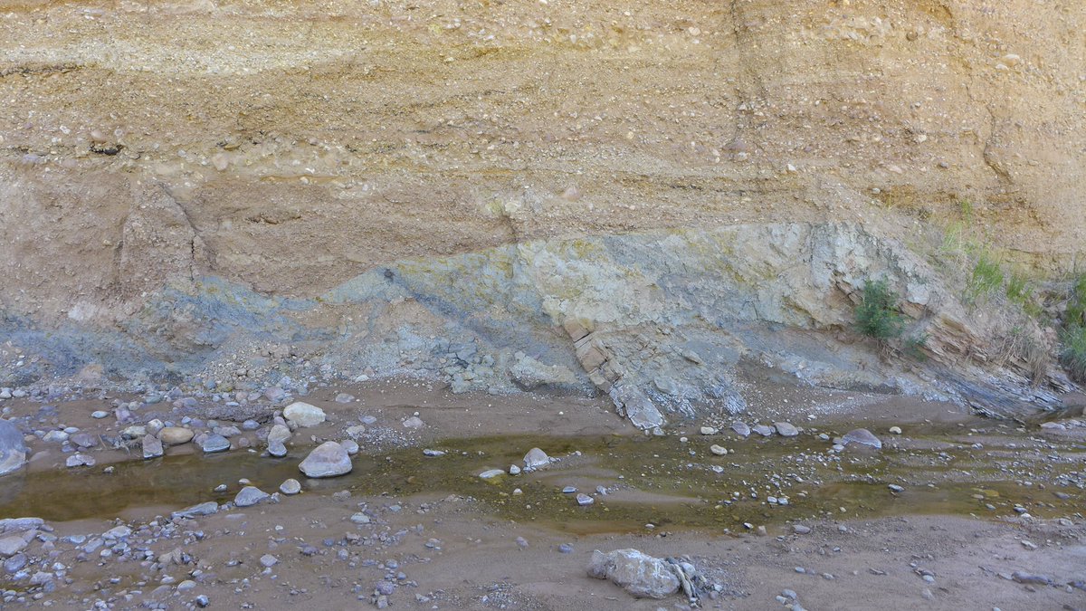
This cut bank exposure is in an active channel of Red Creek revealing older alluvial deposits overlying Fort Union Formation bedrock, Richards Gap quadrangle in southern Wyoming. Preliminary geologic map of the quad➡️ wsgs.wyo.gov/wyoming-geolog…. #Wyoming #geology #geologicmap #map
[PUB] #OTD in 1908, Teddy Roosevelt proclaimed the @GrandCanyonNPS a national monument. Check out this geologic map of the area and order a hard copy or download a PDF through the USGS Store: ow.ly/ikSs50Qq6xi 🗺️ #TBT #GeologicMap #GrandCanyon
Link to the Oil Mountain quadrangle geologic map: wsgs.wyo.gov/wyoming-geolog… #Wyoming #geology #geologicmap #map 3/3
Geo-Note! A rusty yellow and orange conglomerate layer of the White River Formation and underlying Pierre Shale, Goat Mountain quadrangle in southeast Wyoming. A minor slump can be seen just right of center. #geologicmap: wsgs.wyo.gov/wyoming-geolog… #Wyoming #geology

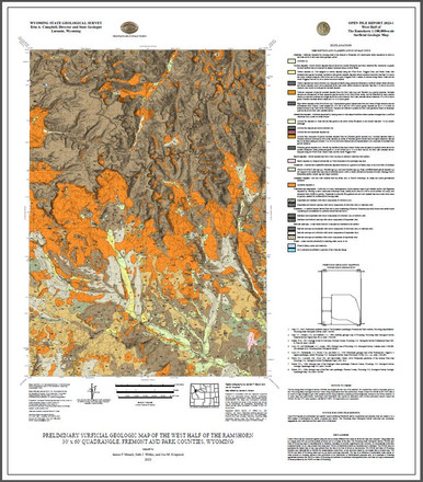
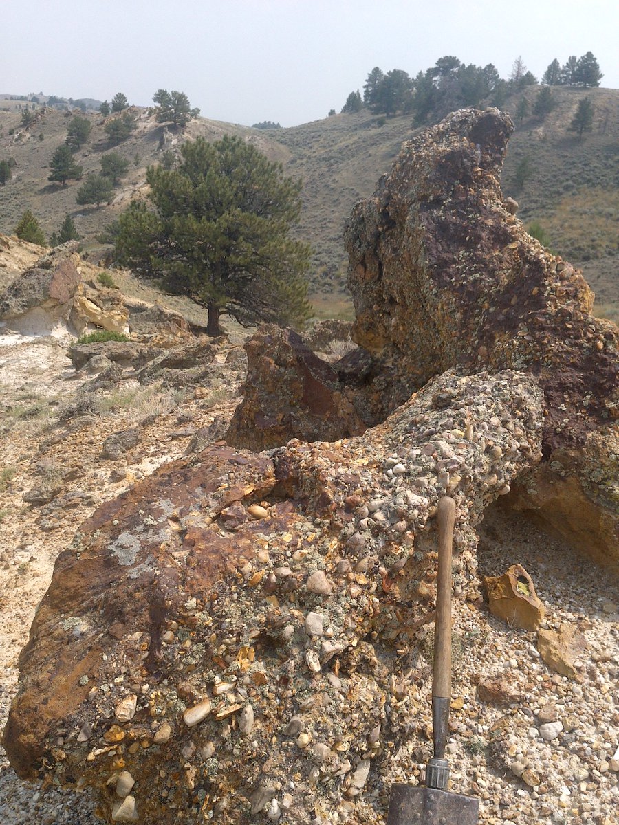
Earlier this year, we published a surficial #geologicmap of the west half of The Ramshorn 30' x 60' quad, Fremont & Park counties. A report w/the #map includes this📸of basalt boulders that are up to 1.5 m in diameter & rest directly on claystone of the Tepee Trail Formation. 1/2

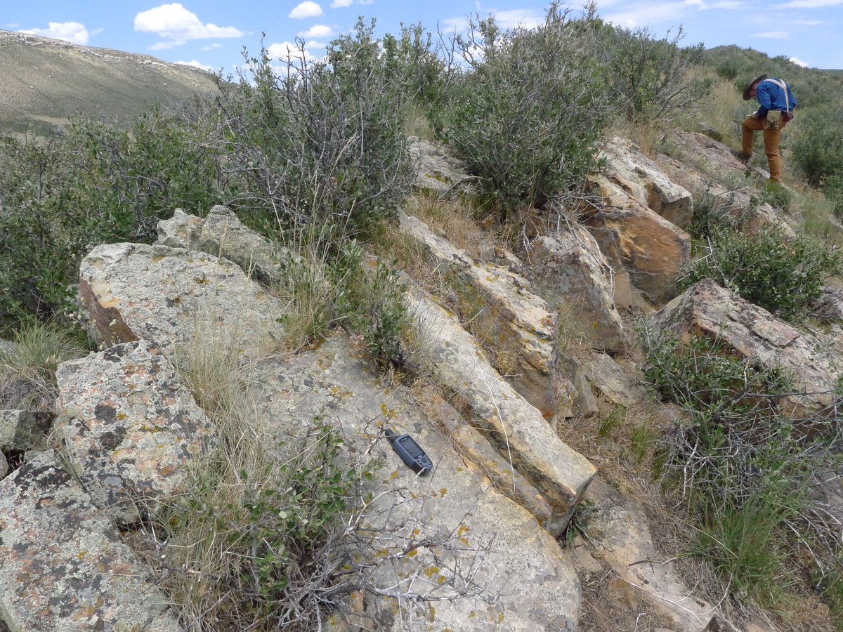
Geo-Note! The Cloverly Formation on the Goat Mountain quadrangle in southeast #Wyoming forms prominent ridges like this sandstone ridge in the northwestern Iron Mountain syncline area of the quadrangle. Goat Mountain #geologicmap: sales.wsgs.wyo.gov/preliminary-ge… #geology #geologic #map
Bridger Pass quadrangle geologic map mentioned in previous post can be found here: sales.wsgs.wyo.gov/preliminary-ge… #Wyoming #geology #geologicmap #map
Find the geologic map of the King Mountain quadrangle (mentioned in the previous post) at: sales.wsgs.wyo.gov/geologic-map-o… #Wyoming #geology #geologicmap #map
Cliffs in the Wiggins Formation (above) & underlying slope in the Tepee Formation (below) on the south ridge of Ramshorn Peak on The Ramshorn quadrangle, NW #Wyoming. The @WyGeoSurvey recently mapped the west half of the quad: sales.wsgs.wyo.gov/preliminary-su… #geology #geologicmap #map

Upper Fort Union Formation ferruginous pebble conglomerate #outcrop, on the Oil Mountain quadrangle in central #Wyoming. The Oil Mountain quadrangle #geologicmap can be found here: sales.wsgs.wyo.gov/preliminary-ge…. #geology #map
The cliffs in the photograph are part of the Wiggins Formation, which is prone to multiple types of mass wasting along the steep valley sides and headwalls of the Absaroka Range. NEW surficial #geologicmap of the west half of the quad ➡️ sales.wsgs.wyo.gov/preliminary-su… 1/2
Hey #Teachers! Looking for a fun, easy way to teach about the #Mars2020 Perseverance rover? Check out this #GeologicMap coloring sheet activity! Students color their own geologic map and learn about the geology of #Mars! usgs.gov/news/coloring-…


Kīlauea’s past holds clues to today’s summit activity🌋 Analyses of tephra deposits show that high lava fountains—like those in Halemaʻumaʻu today—also erupted 500 years ago, around 1650, and in the early 1800s. Learn more: usgs.gov/observatories/… #VolcanoWatch #Kilauea #Tephra
Something old, something new, something borrowed, something.....researched! The newest #geologicmap of the State of #Hawaii has it all. #VolcanoWatch #HVO ow.ly/XMu850HYJt0


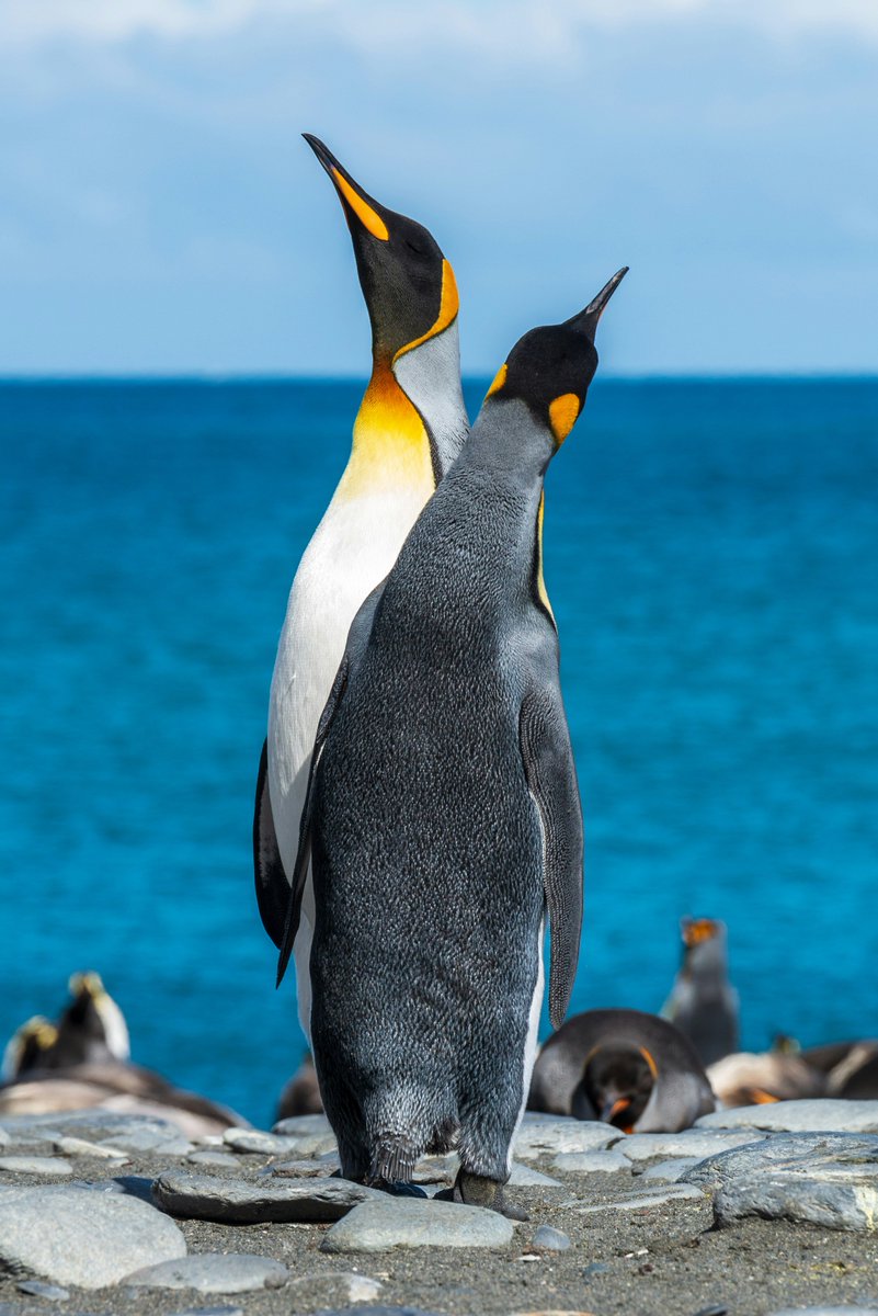
🚨Emperor penguins are now officially listed as Endangered. The International Union for Conservation of Nature (IUCN) has upgraded their status from Near Threatened to Endangered, citing the accelerating impacts of climate change.

A geologic globe, not something you see everyday⠀ ⠀ #geology #geologicmap #globe #geologicalmap #geologicalmapping #cartography #geography #topography #geomorphology #geospatial

A geologic globe, not something you see everyday #geology #geologicmap #globe #geologicalmap #geologicalmapping #map

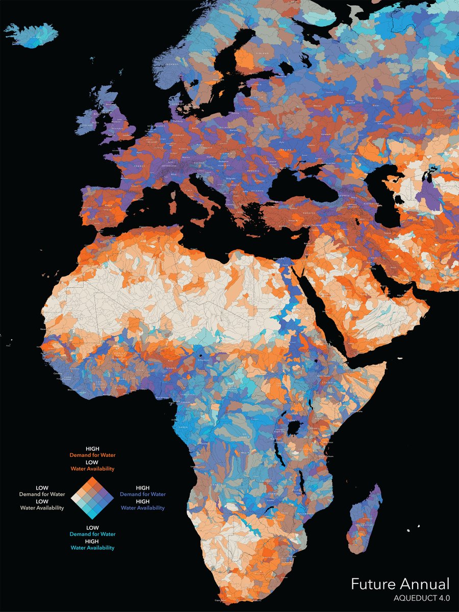
How will freshwater availability change in 50 years? 💧 The Aqueduct 4.0 Global Water Risk dataset from @WorldResources helps us prepare for future needs. Available in ArcGIS Living Atlas: bit.ly/4spzq3o #hydrology #conservation


@YellowstoneNPS celebrates 145 years today! The 2001 #geologicmap includes #volcanic #rocks older than 2 mil years. pubs.usgs.gov/pp/pp729g/


A geologic globe! not something you see everyday #geology #geologicmap #globe #berkeley #geologicalmap #geologicalmapping #map #maps #cartography #geography #topography #mapping #mappe #carte #mapa #karta #cable #cables #globe #worldmap #geography

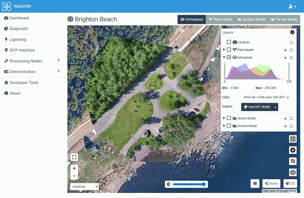
📢 WebODM se separa de OpenDroneMap: nueva etapa, mejoras y descarga gratis mappinggis.com/2026/04/webodm…

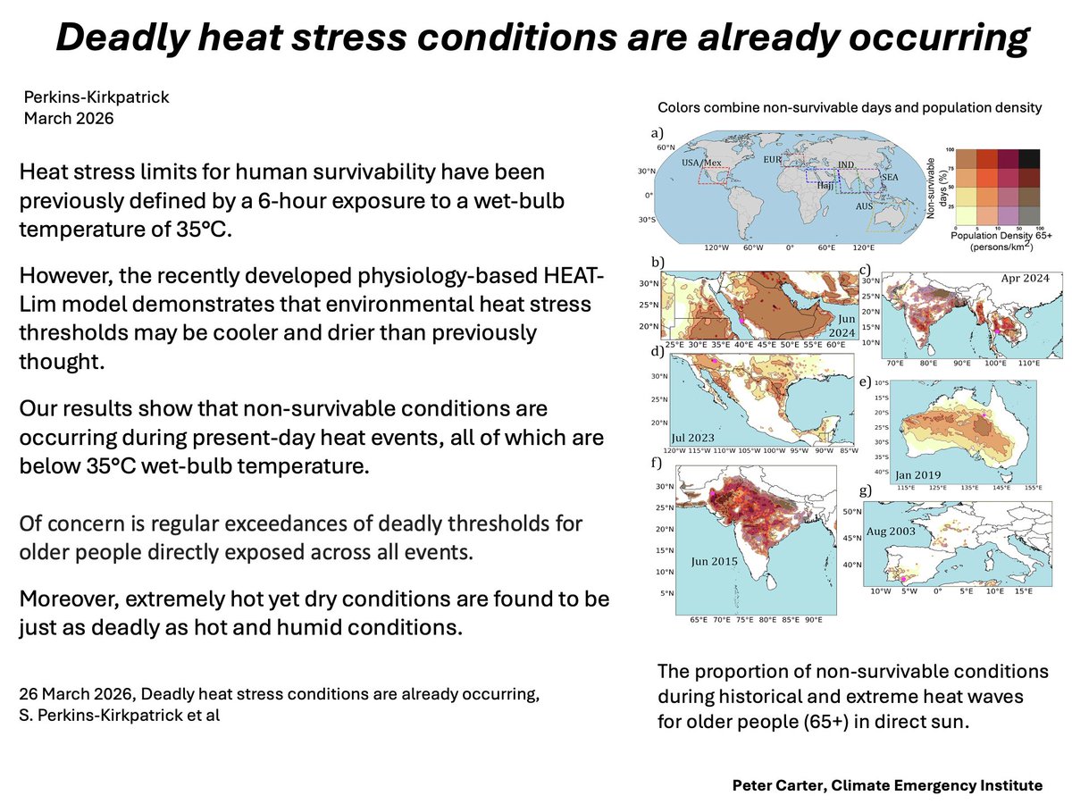
DEADLY HEAT STRESS IS ALREADY OCCURRING Adds human physiology to the wet-bulb temperature heat limit (35°C). Especially for elderly, temperature tolerance to deadly heat is found to be lower. nature.com/articles/s4146… #climatechange #globalwarming

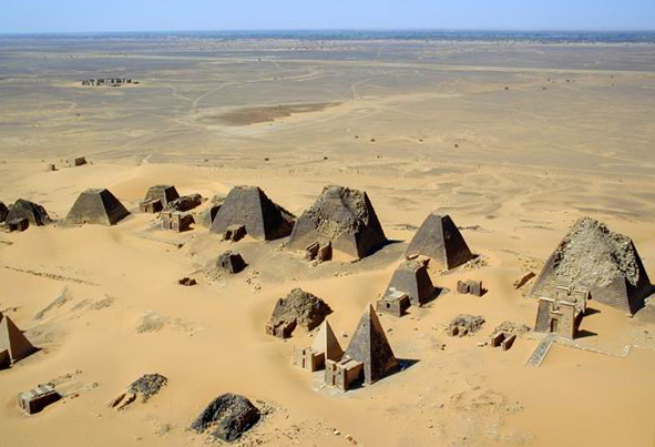
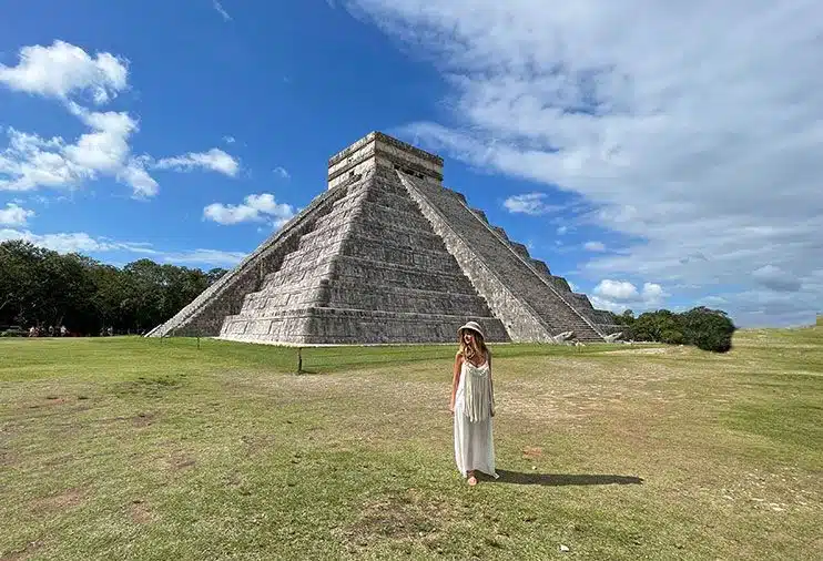
🚨 A pyramid is the simplest shape to build. Any culture would arrive at it. That's the argument. Here's why it falls apart. If pyramids were just piles of stone tapering to a point, the explanation would hold. But the structures themselves tell a different story. The Great


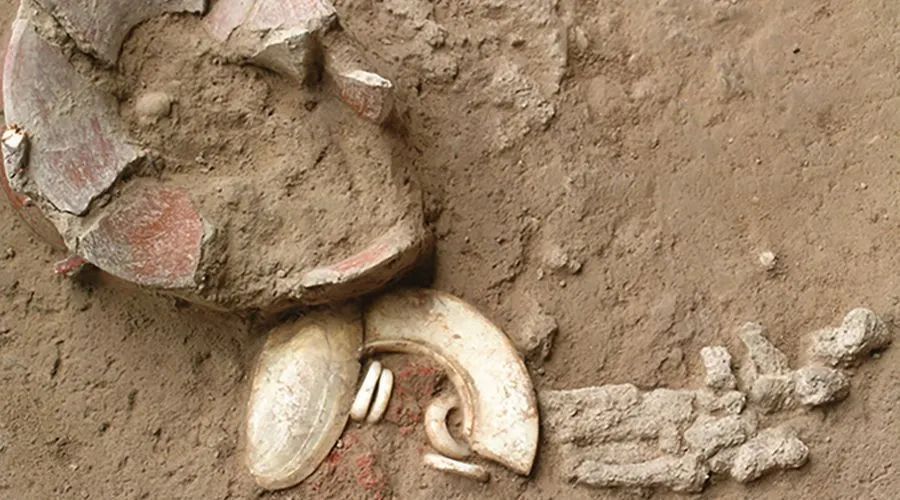
From the Neolithic to the Iron Age, ochre acted as a powerful marker of identity and belief in prehistoric Thailand. Examination of how its use in elaborate funerary rituals changed over time reveals over three millennia of shifting culture. 🆓 doi.org/10.15184/aqy.2…

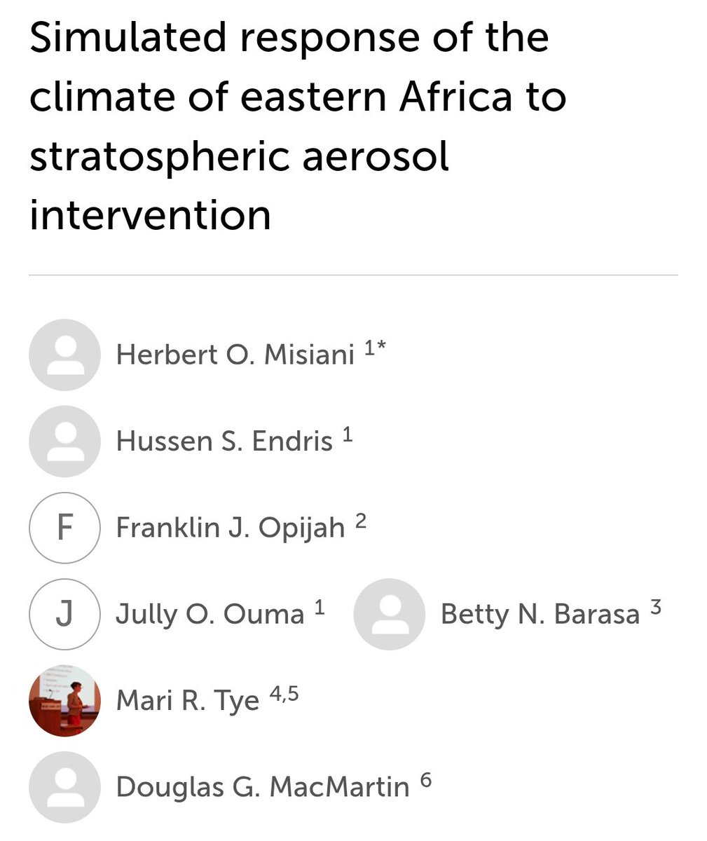
Recent study assesses how solar radiation management (#SRM) via stratospheric aerosol injection (#SAI) could shape future climate in Eastern Africa. Using CESM2-WACCM6 simulations, results show SAI can significantly reduce projected warming in both near- and mid-term periods.


#Tectónicadeplacas | sismos a nivel mundial durante las últimas 24 horas: se dieron eventos en Puerto Rico, las Islas Vírgenes, Texas, New Mexico, Perú, Bolivia, el paso de Drake, Irán, China, Malasia, Indonesia, Japón, Papua Nueva Guinea, Fiji, el noreste de Rusia, Hawaii y las

Something went wrong.
Something went wrong.
United States Trends
- 1. #sabchella N/A
- 2. #LeeCronin N/A
- 3. #Coachella N/A
- 4. Max Muncy N/A
- 5. Swalwell N/A
- 6. #SmackDown N/A
- 7. Will Ferrell N/A
- 8. HOLY SHEETS N/A
- 9. Fang Fang N/A
- 10. Susan Sarandon N/A
- 11. Artemis II N/A
- 12. SUGAR TALKING N/A
- 13. SUCH A FUNNY WAY N/A
- 14. Edwin Diaz N/A
- 15. Podz 30 N/A
- 16. #Go_Big_With_SevEN N/A
- 17. Roger Stone N/A
- 18. Swae Lee N/A
- 19. Al Franken N/A
- 20. BED CHEM N/A