#map 搜尋結果

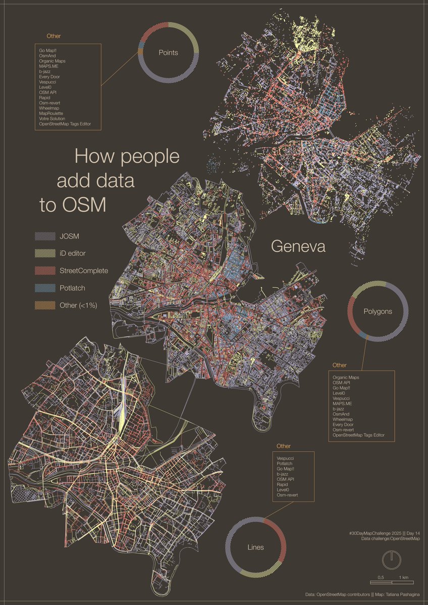
#30DayMapChallenge Day 14 – Data challenge: #OpenStreetMap A #map showing how people add data to OSM, using Geneva as an example. #JOSM, #iDeditor and #StreetComplete create visible patterns on the map🖌️🎨 And there are plenty of other apps to choose from😉📱💻🤖🗺️
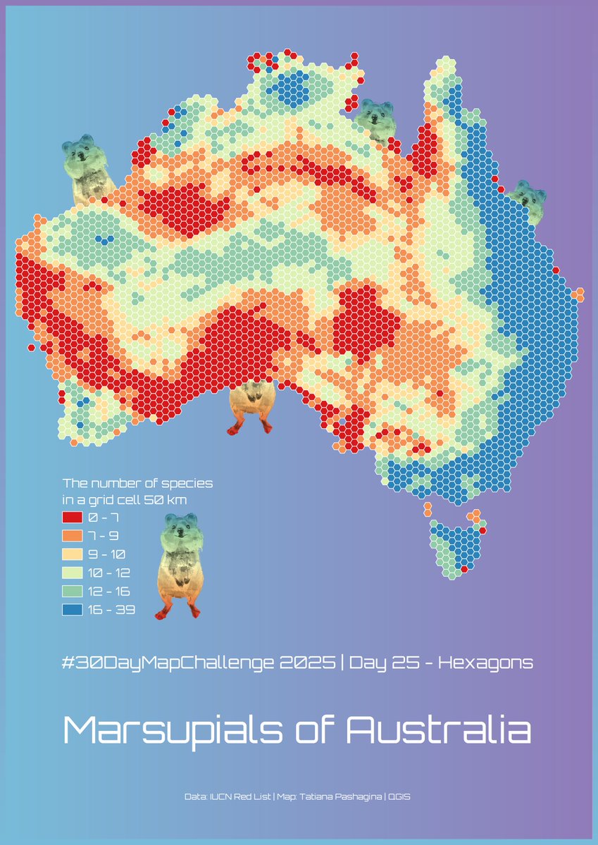
#30DayMapChallenge Day 25 – Hexagons. Marsupials of Australia🤷♀️☺️🦘🐨🌏🇦🇺 ❤️🧡💛💚💙💜🤍 #map #dataviz #QGIS

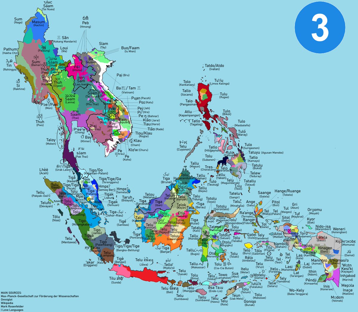
How to say the number Three (3) in various languages of Southeast Asia #southeastasia #language #map


#Map Animation shows satellite observed sulphur di oxide plume from the #volcano Hayli Gubbi in Ethiopia that travelled all the way to Northern India in the last 3 days. It caused some disruption to air traffic as well

🍼 Aller à la maternité dans le Finistère #30DayMapChallenge - J7 : Accessibilité Qu'est ce qui collerait mieux au thème du jour qu'une carte isochrone ? 🌍 Projection conique conforme de Lambert, réalisée avec QGIS et Adobe Illustrator 🕰️ 3h30 (merci les 3 crash QGIS) #map


Wanderlust rule #1 :If there's a #map in sight, it's coming home in my camera roll😄🗺. #Maps in the wild #gischat

🏴☠️ Piraterie en Asie du Sud-Est (1993-2020) #30DayMapChallenge - J13 : Carte en 10 minutes 🌍 Système géodésique WGS84, réalisé avec QGIS et Illustrator, données du Journal of Open Humanities Data (JOHD), Natural Earth et Marine Traffic 🕰️ 10' sur QGIS, 10' sur AI #map #30DMC

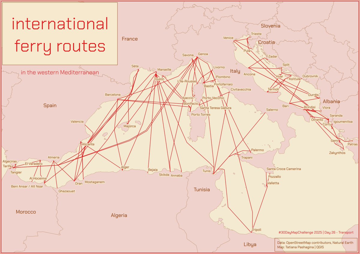
#30DayMapChallenge Day 26 – Transport. A map showing ferry routes in the western Mediterranean Sea⛴️⤴️⤵️🔁 #map #gis #qgis #dataviz

![mapdoctor7's tweet image. New Map!
Tree Portal [20x40]
▫️Patreon- for just 1$ get 1000+ battlemaps!
#DnD #map #battlemap](https://pbs.twimg.com/media/G6nRzNpXsAAKULl.jpg)
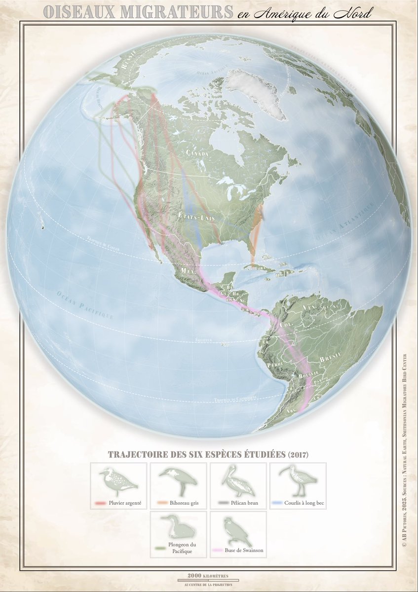
🪶 Oiseaux migrateurs en Amérique du Nord #30DayMapChallenge - J10 Air Je sors vraiment de ma zone de confort ici 😅 🌍 Projection orthographique, réalisée avec des données Natural Earth et du SMBC, avec QGIS et Adobe Illustrator 🕰️ 3h30 #map #30DMC
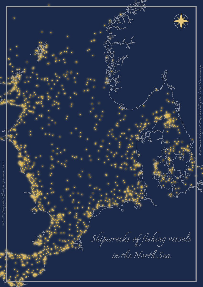
#30DayMapChallenge Day 13 – 10 minute map. A #map showing shipwrecks of fishing vessels in the North Sea. #gis #qgis
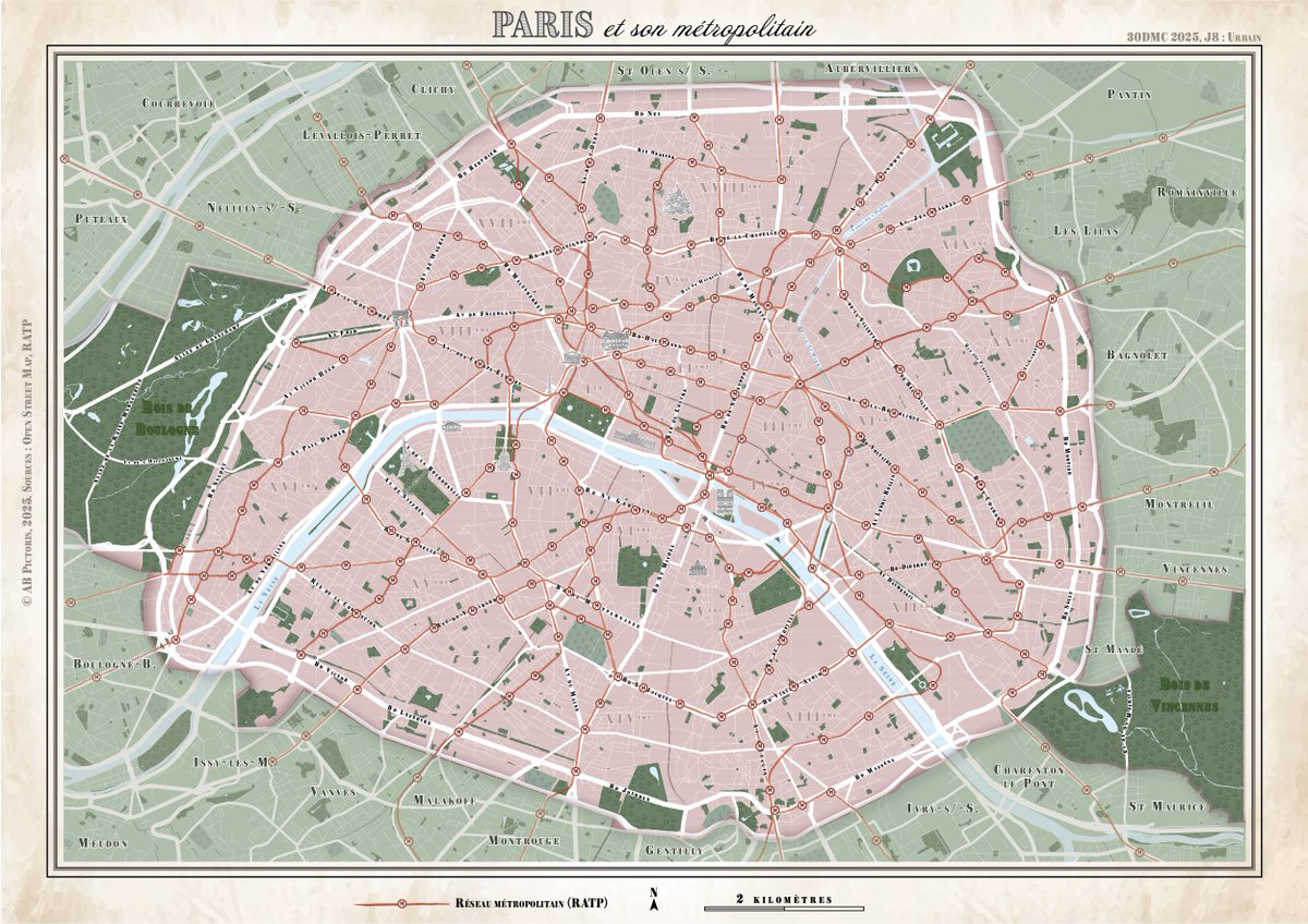
🥐Ⓜ️ Paris et son métropolitain #30DayMapChallenge - J8 Urbain 🌍 Projection conique conforme de Lambert, carte faite avec des données OSM et RATP avec QGIS et Illustrator 🕰️ 4h de réalisation #map #paris #30DMC

🚨 ISRO chief V. Narayanan says India needs private players in navigation tech to boost self-reliance and lower import costs. 🇮🇳 #mapindia #mapmyindia #map @MapmyIndia @_rohanverma


mitadDsemana sigamossumando #horas #twitch sigamostryhardeando #map #loot catarreros #arcraiders #gamer #art esREAL💟 #hornetsparta

The Board got a FaceTime Video Call 📱 from Ms. Allie Quinn with a Message for the #map faithful and a unique opportunity, a Unique Suggestion…. #MAPMania #pro #season #strangerthings #art MAPMANIA: 10 Year Anniversary Holiday Inn Express & Suites Sioux Falls-Brandon

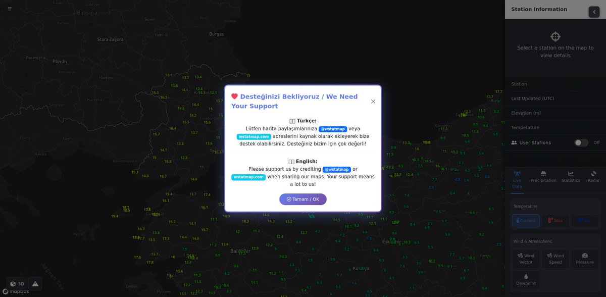
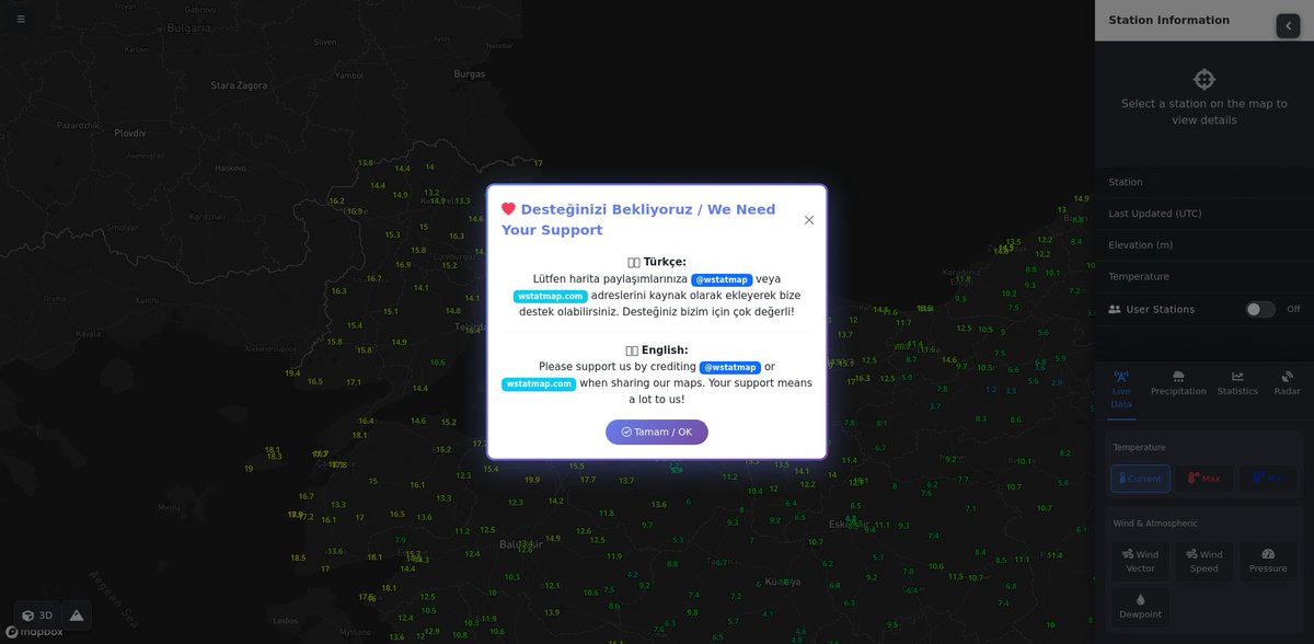
🌡 Türkiye Güncel Sıcaklık Haritası 2025-11-27 02:30 İşte ülke genelindeki son sıcaklık dağılımı! 📊 🔍 Detaylar ve daha fazlası için: wstatmap.com #weather #map
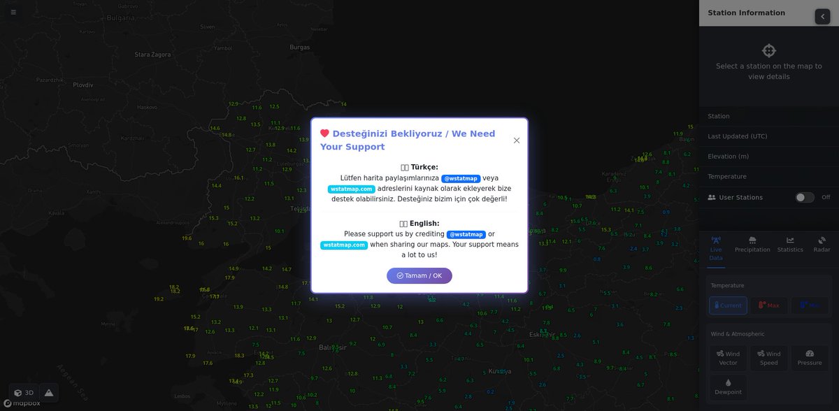
🌡 Türkiye Güncel Sıcaklık Haritası 2025-11-27 00:30 İşte ülke genelindeki son sıcaklık dağılımı! 📊 🔍 Detaylar ve daha fazlası için: wstatmap.com #weather #map


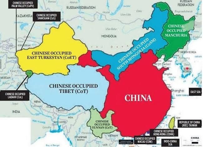
Map of actual #china #map #mapofchina #chinesemap @XHNews @ChinaDaily @PDChina @Echinanews @SCMPNews @GoogleDeepMind @deepseek_ai
#30DayMapChallenge Day 26 – Transport. A map showing ferry routes in the western Mediterranean Sea⛴️⤴️⤵️🔁 #map #gis #qgis #dataviz
🌡 Türkiye Güncel Sıcaklık Haritası 2025-11-26 22:30 İşte ülke genelindeki son sıcaklık dağılımı! 📊 🔍 Detaylar ve daha fazlası için: wstatmap.com #weather #map


#30DayMapChallenge Day 14 – Data challenge: #OpenStreetMap A #map showing how people add data to OSM, using Geneva as an example. #JOSM, #iDeditor and #StreetComplete create visible patterns on the map🖌️🎨 And there are plenty of other apps to choose from😉📱💻🤖🗺️


Wanderlust rule #1 :If there's a #map in sight, it's coming home in my camera roll😄🗺. #Maps in the wild #gischat
#30DayMapChallenge Day 13 – 10 minute map. A #map showing shipwrecks of fishing vessels in the North Sea. #gis #qgis
🗺 L'Europe et ses villes #30DayMapChallenge - J14 OSM 🌍 Projection orthographique (encore une), réalisée avec QGIS et Adobe Illustrator avec des tuiles ESRI OSM Blueprint 🕰️ 1h45 (il y a quand même eu quelques retouches à faire sur DAO) #map #30DMC

🍼 Aller à la maternité dans le Finistère #30DayMapChallenge - J7 : Accessibilité Qu'est ce qui collerait mieux au thème du jour qu'une carte isochrone ? 🌍 Projection conique conforme de Lambert, réalisée avec QGIS et Adobe Illustrator 🕰️ 3h30 (merci les 3 crash QGIS) #map
🥐Ⓜ️ Paris et son métropolitain #30DayMapChallenge - J8 Urbain 🌍 Projection conique conforme de Lambert, carte faite avec des données OSM et RATP avec QGIS et Illustrator 🕰️ 4h de réalisation #map #paris #30DMC
#30DayMapChallenge Day 25 – Hexagons. Marsupials of Australia🤷♀️☺️🦘🐨🌏🇦🇺 ❤️🧡💛💚💙💜🤍 #map #dataviz #QGIS
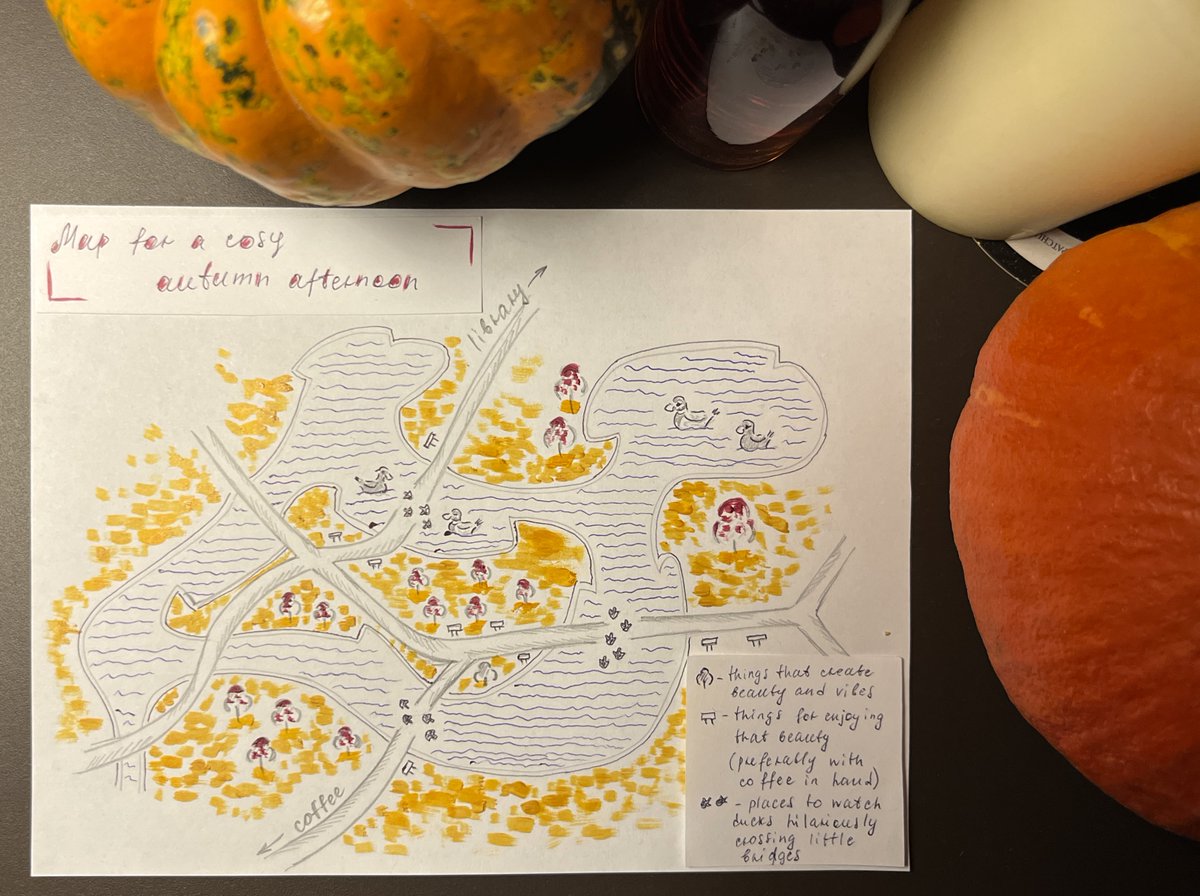
#30DayMapChallenge Day 9 – Analog. A #map for a cosy autumn afternoon 🍁🍂☕️📷🦆 This is a small part of my local park where I spent some cosy time with coffee, watching hilariously cute ducks.
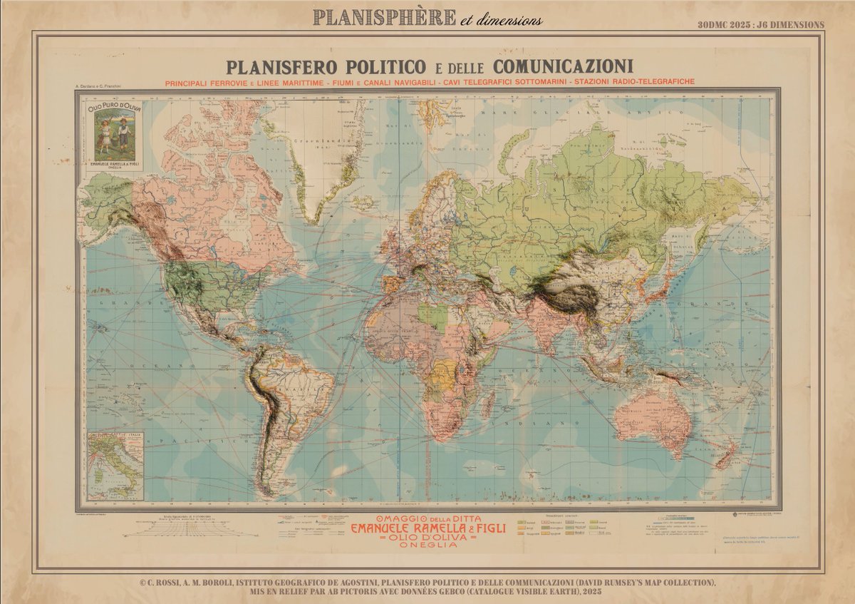
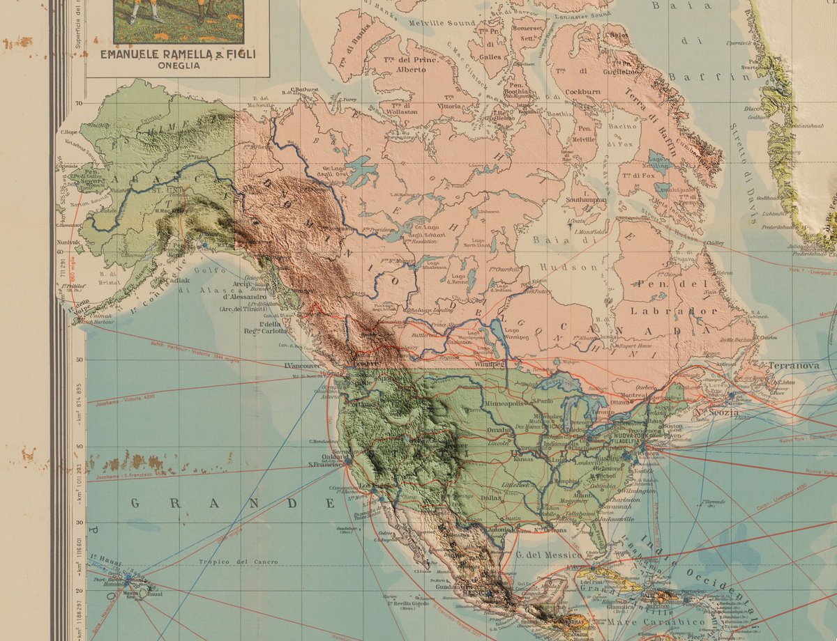
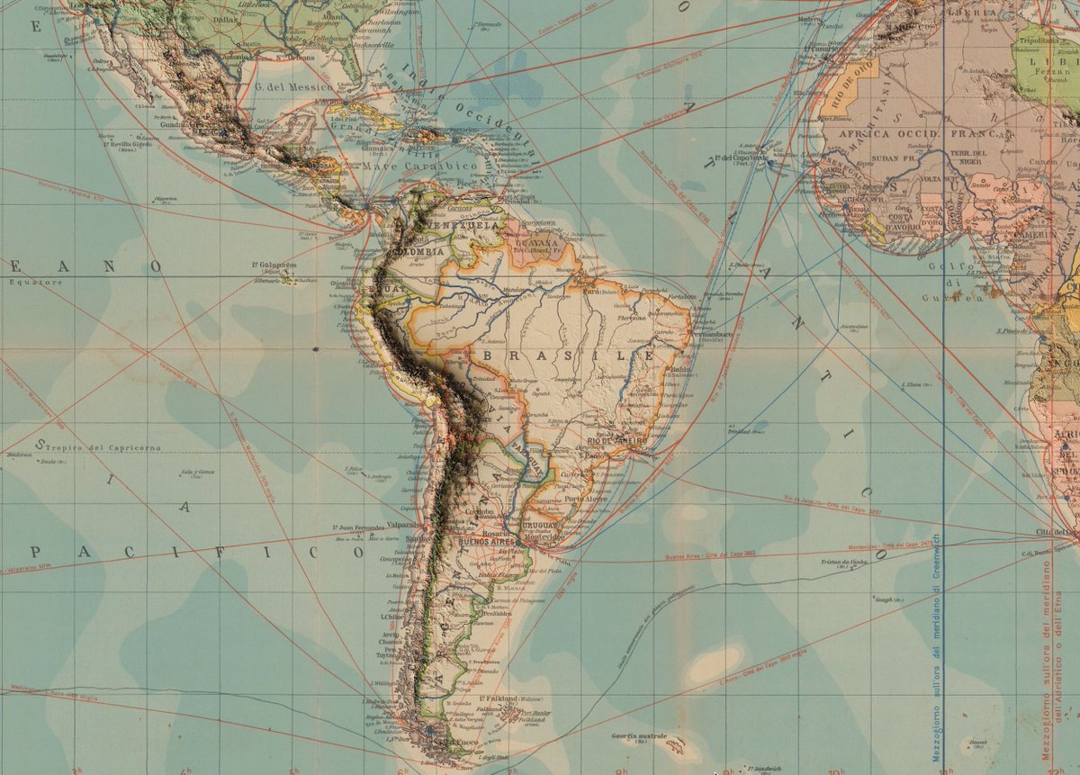
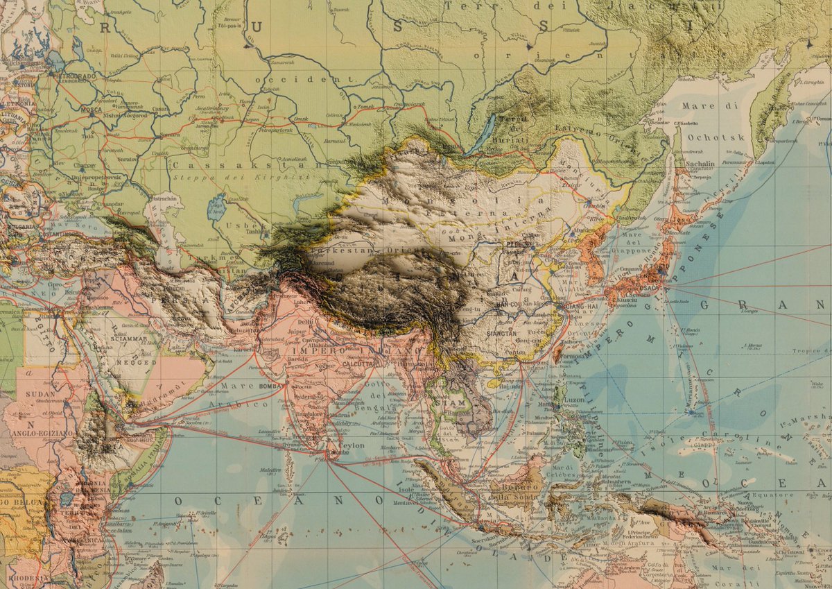
⛰️ Planisphère et dimensions #30DayMapChallenge - J6 : Dimensions Pour ce thème, j'ai réalisé une manip que j'ai tjs voulu faire : ajouter à une ancienne (et magnifique) carte du relief avec Blender ✨ (explications en 🧶) ⬇️ #map #30DMC
🌔 La Lune en 2125 #30DayMapChallenge - J12 : Carte de 2125 Carte imaginaire sur l'avenir de la Lune dans 100 ans : début concret du tourisme lunaire et de l'exploitation des ressources, exacerbation des rivalités... #map #30DMC #Moon

💮 Collection de souvenirs #30DayMapChallenge - J4 : Mes données J’ai voulu mettre en carte qq souvenirs, et surtout le plus beau qui arrive dans quelques semaines 🍼 🌍 Projection LCC (France), projection Mercator (Taipei), réalisée avec QGIS et Illustrator 🕰️ 4h #map


Day 1 – Points 🌱 The Trees Draw Valencia — each point represents a tree, together sketching the city’s green identity. #30DayMapChallenge #Points #Map #UrbanNature #cartography #Valencia #ArcGISPRO

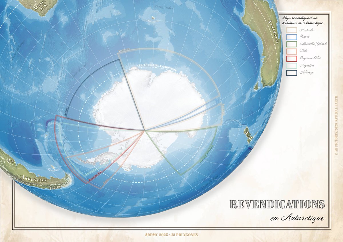
🐧 Revendications en Antarctique #30DayMapChallenge J3 : Polygones 🌍 Réalisée avec QGIS et Illustrator, avec des données Natural Earth Data et en projection orthographique (encore!) 🕰️ 3h de réalisation #map #30DMC #Antarctica
Something went wrong.
Something went wrong.
United States Trends
- 1. #StrangerThings5 153K posts
- 2. Thanksgiving 632K posts
- 3. Reed Sheppard 3,372 posts
- 4. Afghan 255K posts
- 5. Podz 3,116 posts
- 6. robin 71K posts
- 7. BYERS 28.3K posts
- 8. National Guard 628K posts
- 9. holly 51.5K posts
- 10. Gonzaga 8,014 posts
- 11. Dustin 84.5K posts
- 12. #AEWDynamite 21K posts
- 13. Michigan 76.6K posts
- 14. Amen Thompson 1,389 posts
- 15. Tini 8,092 posts
- 16. Erica 13.2K posts
- 17. Rahmanullah Lakanwal 96.5K posts
- 18. #Survivor49 3,032 posts
- 19. Will Richard 2,096 posts
- 20. Jardine 6,434 posts