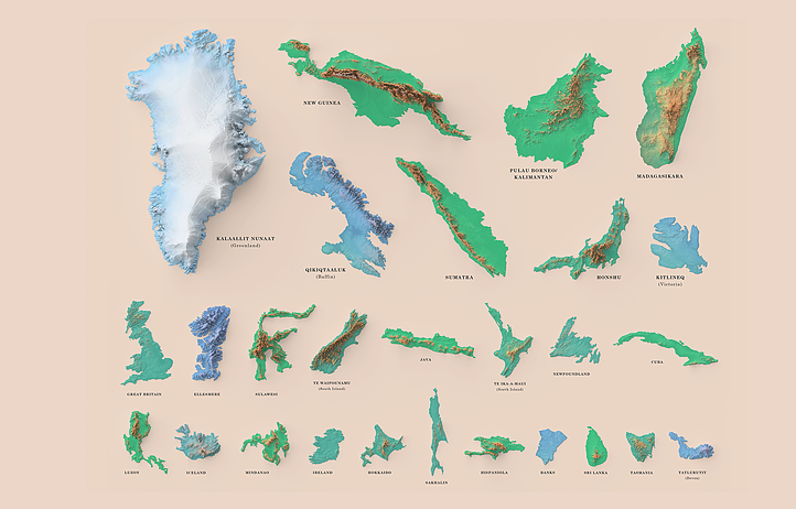
#indigenousmapping search results

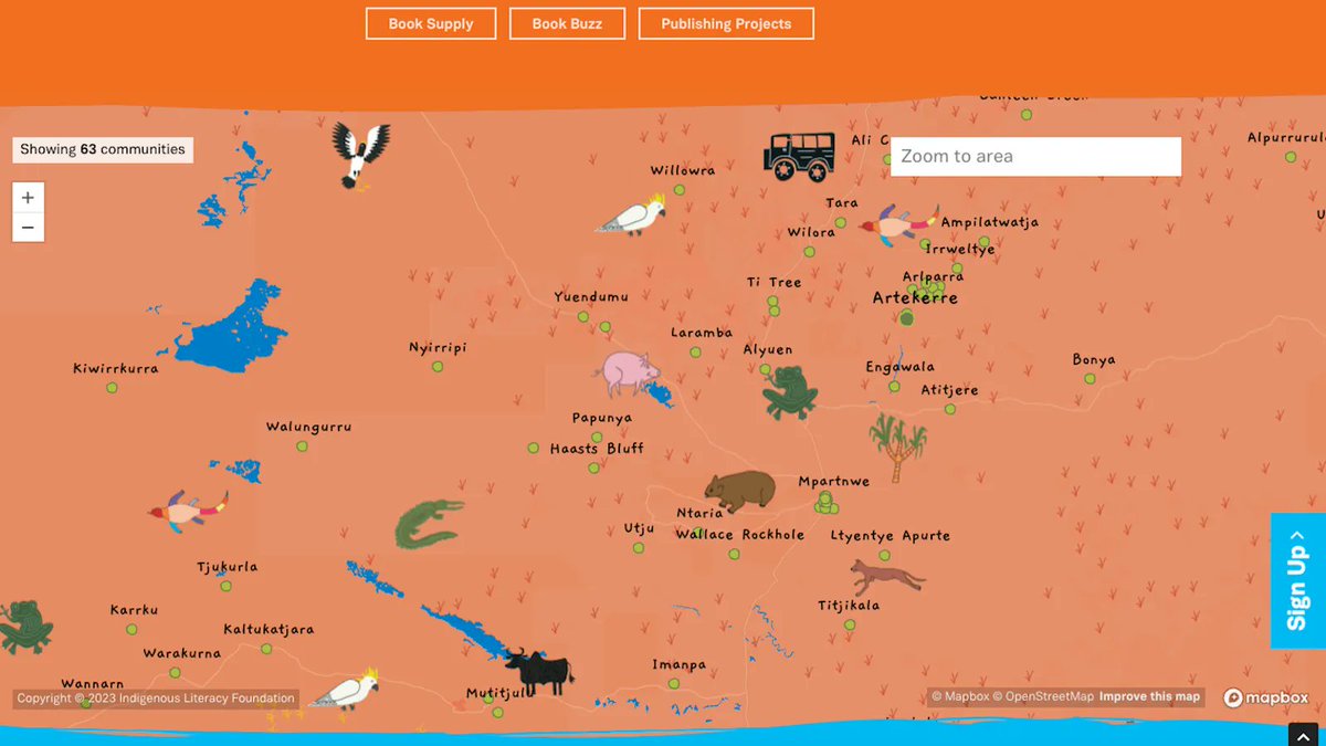
We love a super cute map on #mondaymapday! 😍 Check out how @indigenouslf uses a beautiful custom map style and icons in their map of where they operate: indigenousliteracyfoundation.org.au/where-we-work #indigenousmapping #mapdesign #BuiltWithMapbox

A @RoyalRoads student is mapping what is now known as Greater Victoria using lək̓ʷəŋən place names to reconnect people with Indigenous history. Listen as Melinda Quintero shares her work with CFAX 1070’s @JoshHylden 🎧iheart.com/podcast/962-af… #IndigenousMapping #yyj
Very pleased to announce the publication of a new article, "Mapping for Reconnection: Place Name Documentation and the Atlas of Kanyen'kehá:ka Space," by @geolinguistics and Kahente Horn-Miller: doi.org/10.18357/kula.…. #IndigenousPlaceNames #Indigenousmapping

Exploring Indigenous mapping practices: The Ziibiwing Center of Anishinabe Culture in Michigan uses GIS to preserve tribal culture and history, reaffirm treaty rights, and manage resources. #IndigenousMapping #GIS #CulturalPreservation

Read a CARTO 58.4 article by Matthew Kunkel (@usask) that discusses Indigenous maps and journal entries illuminating previously concealed Indigenous contributions of William Clark's master map of the West: bit.ly/carto584a #historyofcartography #Indigenousmapping
Exploring the power of indigenous cartography! Did you know that the Inuit have developed an intricate mapping system made from wood and bone, representing coastlines and important features for hunting, fishing and exploring? #IndigenousMapping #InuitNavigation.
Exploring the intersection of modern technology and Indigenous wisdom. An Australian Aboriginal tribe using Google Earth for preserving and sharing sacred sites, a fine example of harmonizing ancient and contemporary mapping practices. #IndigenousMapping #CulturalPreservation
Exploring the depths of our ancestors' wisdom, just discovered that indigenous tribes used constellations for mapping & navigation. How fascinating that stars guided their journeys before compasses existed! #IndigenousMapping #AncientWisdom

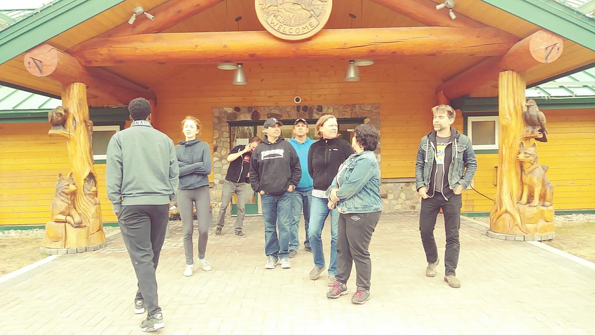
1/2 We love seeing apprehension turn into confidence with tech! Stephanie, Kerri, Romi, & Hayley joined IMW 2024 to prepare for a desert fire management project. Learn more about their experience: hubs.la/Q02YRKkt0 #IMWau #IndigenousMapping #FireManagement #TechforGood
We’re proud to have Dr Sam Holt presenting at this year’s National Indigenous Mapping Workshop in Meanjin. He’ll be sharing how airborne photogrammetry + remote sensing tech are helping communities map, manage & protect Country. bit.ly/3KZ1i1V #IndigenousMapping #spatial


@Esri User Conference begins in three weeks! Experience GIS technology's power to connect and transform. Get ready for a week of learning, innovation and community. 📅 Join us July 15-19, in San Diego or online esri.social/JkTP50SlkOn #EsriUC #GISCommunity #IndigenousMapping

Exploring the world from an indigenous perspective. The Yupik Eskimo community in Alaska uses their traditional mapping practices to navigate the fishing territories in the Yukon River. #IndigenousMapping #CulturalHeritage #YupikEskimo

When land disputes arise, oral history is consulted first .Land is not mapped on paper—but remembered through name, story, and walk .#LandMemory #IndigenousMapping
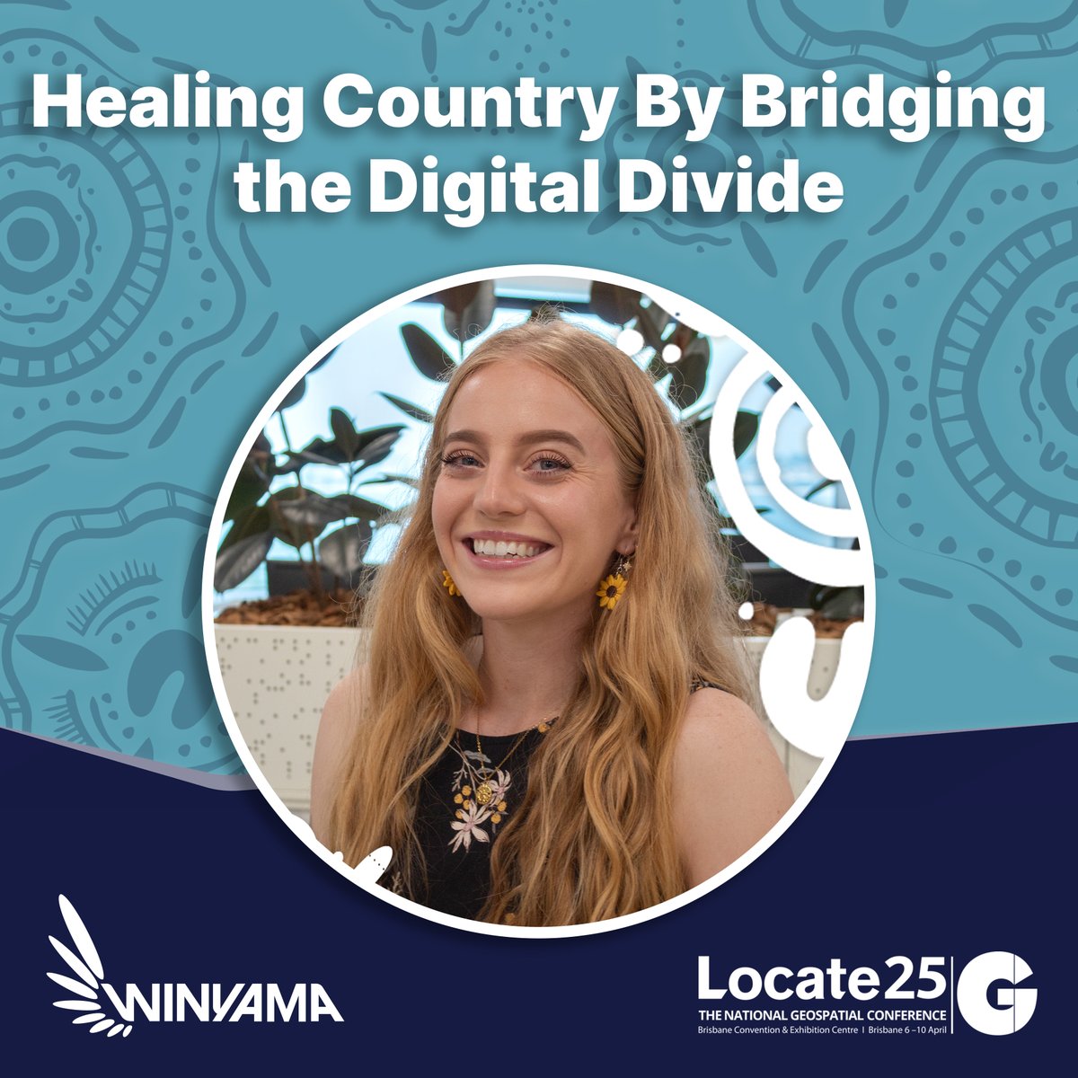
1/4 🔷What role does Mob-led mapping play in healing Country? 🔷How does bridging the digital divide empower First Nations communities? 🔷What’s next for Indigenous Data Sovereignty in geospatial tech? #Locate25 #IndigenousMapping #IMWau #Winyama #HealingCountry #NationalIMW
3/4 Register for Locate25 now and be part of the conversation 👉🏿 hubs.la/Q03dP8RD0 #Locate25 #IndigenousMapping #IMWau #Winyama #HealingCountry #NationalIMW2025
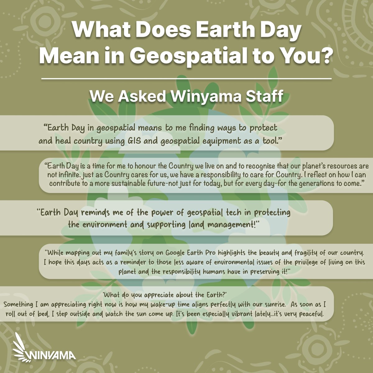
This Earth Day, we asked our team what this day means to them from a geospatial perspective, how mapping, data and technology can help protect Country. What does Earth Day mean to you? Share your thoughts in the comments below! #EarthDay #HealthyCountry #IndigenousMapping
2/2 Don't miss out on National IMW 2025! Sign up to our newsletter: hubs.la/Q02YRK-C0 #IMWau #IndigenousMapping #FireManagement #TechforGood
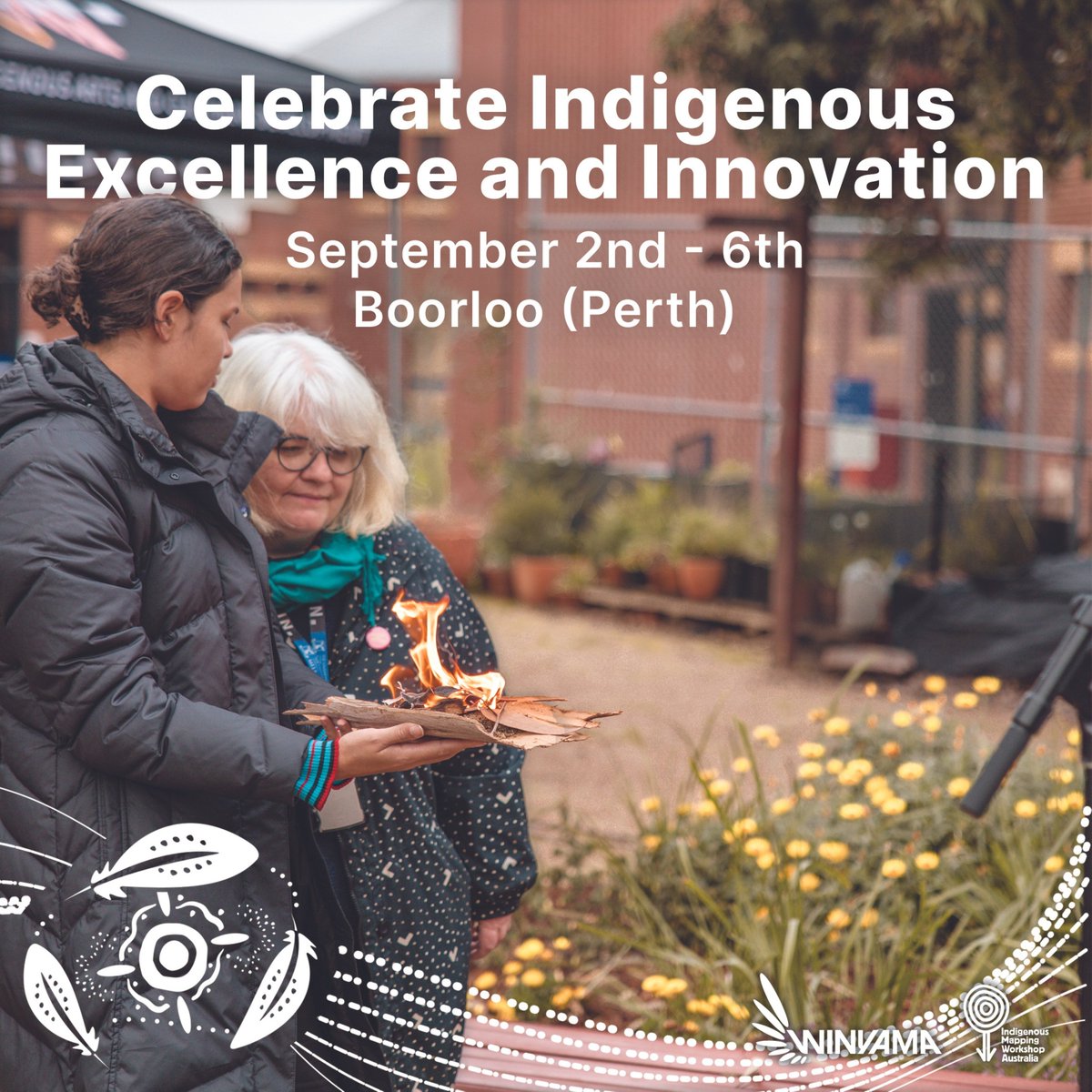
3/3 Secure your spot now and join a community dedicated to innovation and empowerment. Apply today! hubs.la/Q02KK_p60 #NationalIMW2024 #IndigenousMapping #GIS #IndigenousExcellence #Winyama #IMWau
4/4 And on the Apple Website: hubs.la/Q03dPXWS0 #IndigenousMapping #PlaceNames #IndigenousKnowledge #TruthTelling
apple.com
Apple deepens community initiatives in Australia and Aotearoa New Zealand
Apple’s new initiatives in Australia and New Zealand help strengthen communities, and advance tech’s role in preserving culture and enhancing education.
When land disputes arise, oral history is consulted first .Land is not mapped on paper—but remembered through name, story, and walk .#LandMemory #IndigenousMapping
We’re proud to have Dr Sam Holt presenting at this year’s National Indigenous Mapping Workshop in Meanjin. He’ll be sharing how airborne photogrammetry + remote sensing tech are helping communities map, manage & protect Country. bit.ly/3KZ1i1V #IndigenousMapping #spatial
This Earth Day, we asked our team what this day means to them from a geospatial perspective, how mapping, data and technology can help protect Country. What does Earth Day mean to you? Share your thoughts in the comments below! #EarthDay #HealthyCountry #IndigenousMapping
1/2 Our Indigenous Mapping Workshop Australia Program Manager, Kass, has had an exciting week at the Locate25 Conference! #Locate25 #IndigenousMapping #IMWau #Winyama #HealingCountry #NationalIMW2025

3/3 Want to bring a supported Indigenous Mapping Workshop to your ranger group or community? We tailor workshops to meet your needs and help build mapping skills on Country. Get in touch to learn more! 👉🏿 hubs.la/Q03fTmDd0 #IndigenousMapping #Training #Winyama #IMWau
4/4 And on the Apple Website: hubs.la/Q03dPXWS0 #IndigenousMapping #PlaceNames #IndigenousKnowledge #TruthTelling
apple.com
Apple deepens community initiatives in Australia and Aotearoa New Zealand
Apple’s new initiatives in Australia and New Zealand help strengthen communities, and advance tech’s role in preserving culture and enhancing education.
3/4 Register for Locate25 now and be part of the conversation 👉🏿 hubs.la/Q03dP8RD0 #Locate25 #IndigenousMapping #IMWau #Winyama #HealingCountry #NationalIMW2025
1/4 🔷What role does Mob-led mapping play in healing Country? 🔷How does bridging the digital divide empower First Nations communities? 🔷What’s next for Indigenous Data Sovereignty in geospatial tech? #Locate25 #IndigenousMapping #IMWau #Winyama #HealingCountry #NationalIMW
A @RoyalRoads student is mapping what is now known as Greater Victoria using lək̓ʷəŋən place names to reconnect people with Indigenous history. Listen as Melinda Quintero shares her work with CFAX 1070’s @JoshHylden 🎧iheart.com/podcast/962-af… #IndigenousMapping #yyj
Very pleased to announce the publication of a new article, "Mapping for Reconnection: Place Name Documentation and the Atlas of Kanyen'kehá:ka Space," by @geolinguistics and Kahente Horn-Miller: doi.org/10.18357/kula.…. #IndigenousPlaceNames #Indigenousmapping
2/2 Don't miss out on National IMW 2025! Sign up to our newsletter: hubs.la/Q02YRK-C0 #IMWau #IndigenousMapping #FireManagement #TechforGood
1/2 We love seeing apprehension turn into confidence with tech! Stephanie, Kerri, Romi, & Hayley joined IMW 2024 to prepare for a desert fire management project. Learn more about their experience: hubs.la/Q02YRKkt0 #IMWau #IndigenousMapping #FireManagement #TechforGood
4/4 If you are interested in partnering with Winyama or want to learn more about our sponsorship packages, we are eager to hear from you! Don’t hesitate to get in touch with us here: hubs.la/Q02VB4B30 #2024IMW #IndigenousMapping

We love a super cute map on #mondaymapday! 😍 Check out how @indigenouslf uses a beautiful custom map style and icons in their map of where they operate: indigenousliteracyfoundation.org.au/where-we-work #indigenousmapping #mapdesign #BuiltWithMapbox

another full village in Papua New Guinea mapped! #indigenousmapping @sotmus @emjacobi #sotmus Thanks @DigitalGlobe for the imagery!


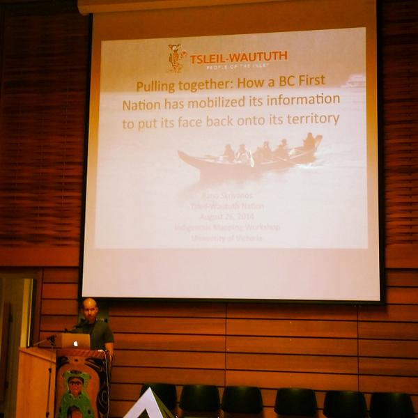
Panos Skrivanos, from Tsleil-Waututh FN, on importance of information mobilization in #indigenousmapping #IMW2014


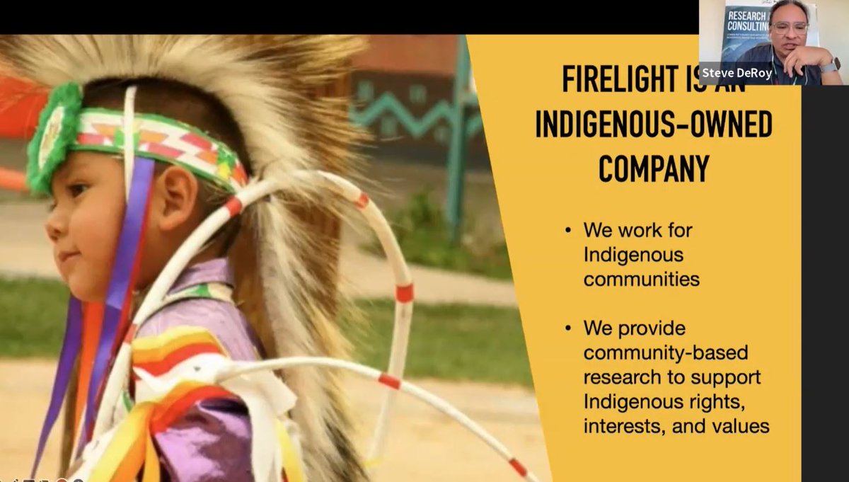
We learned how @thefirelightgp is using #ArcGIS to Build a Global #IndigenousMapping Community @esricanada's #GISDay virtual event keynote. #ArcGISStoryMaps #ArcGISSurvey123 #ArcGISHub #IndigenousKnowledge #geographyawarenessweek #giscareers @GIS4Teachers @GISAmbassador
October’s GIS Ambassador of the Month – Melissa Lavoie works with Indigenous youth to promote the use of spatial technology for traditional land-based learning. ow.ly/n5xb50wRDzU @GIS4Teachers #GISAmbassador @GISAmbassador #IndigenousMapping @CreeGeoEd #Mushkegowuk

@Esri User Conference begins in three weeks! Experience GIS technology's power to connect and transform. Get ready for a week of learning, innovation and community. 📅 Join us July 15-19, in San Diego or online esri.social/JkTP50SlkOn #EsriUC #GISCommunity #IndigenousMapping

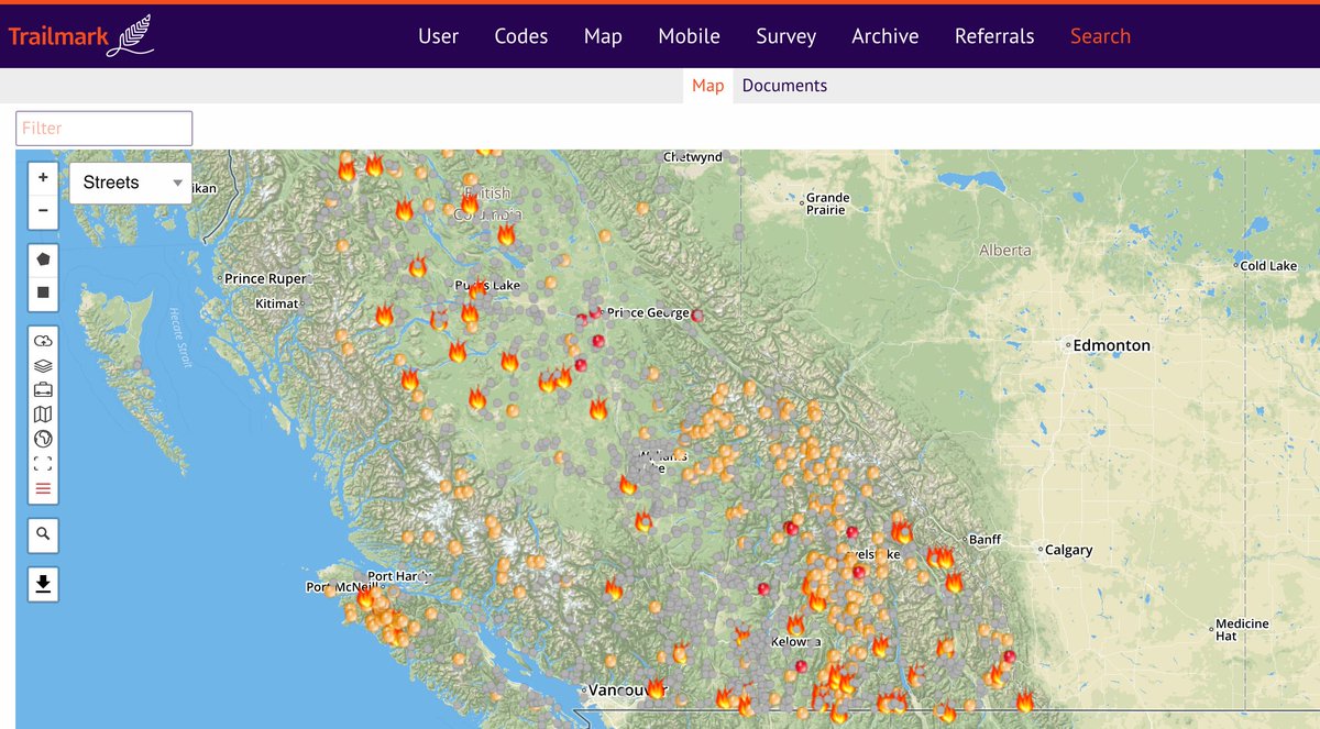
Hey BC Trailmark community partners: you can add the province of BC's active fires data into your map layers page as a WMS file. You can then view it against your entire digital archive. Stay safe everyone! #indigenousmapping

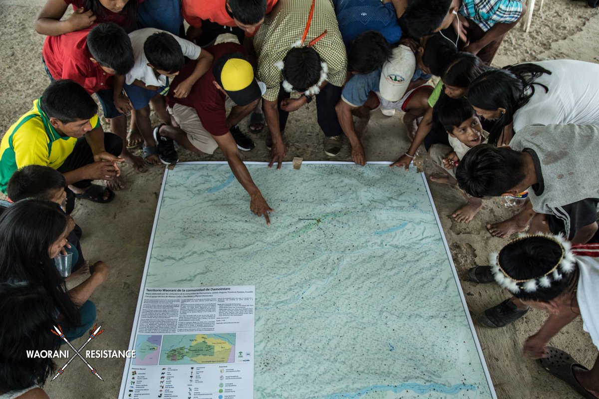
The community-led process of territorial mapping has been a powerful tool for resistance among the 18 Waorani communities threatened by Oil Block 22. Learn more at: buff.ly/2s82oJ5 #WaoraniResistance #ResistenciaWaorani #indigenousmapping
Matawa is a tribal council that looks after nine First Nations communities in northern Ontario. They taught themselves drone technology and mapped their communities at 1-cm accuracy—in only six months. Get the story from our podcast: ow.ly/5a3450KB5Ar! #IndigenousMapping


We are supporting the @imwaustralia and you can too! Get involved by visiting hubs.ly/H0hqL-T0. Contact us to be a part of building #geospatial capacity for Aboriginal and Torres Strait Islander community. #IMWau2019 #IndigenousMapping #WhyIMap @LocateConf @WinyamaDigital
#Zuni maps based on memories, ceremonies, songs, and a deep relationship to the land. They countering western notions of place and challenging the arbitrary borders imposed on their world emergencemagazine.org/story/counter-… via @emergence_zine #Countermapping #IndigenousMapping #NewMexico

October edition @Mapbox is out #LocationisPersonal! @LoBenichou talks mapping disasters and what makes leaving home so hard. Also spotlighting the amazing @mapmakerdavid 😍 🗺 Check out his amazing work #Indigenousmapping #decolonisemapping blog.mapbox.com/location-is-pe…
Read a CARTO 58.4 article by Matthew Kunkel (@usask) that discusses Indigenous maps and journal entries illuminating previously concealed Indigenous contributions of William Clark's master map of the West: bit.ly/carto584a #historyofcartography #Indigenousmapping

Winyama is proud to be organising the @imwaustralia with the support of @ngis_australia - you can be involved too. Get in touch via our website hubs.ly/H0hqLH10 to see how you can help build #geospatial capacity for the Indigenous community #IndigenousMapping #WhyIMap
What a pleasure it was to be in Mayo, Yukon this month working with Na Cho Nyak Dun First Nation, working together to set up maps, mobile data apps, and digital archives. Thanks for the hospitality. Here's a photo of us trying to take a photo #indigenousmapping
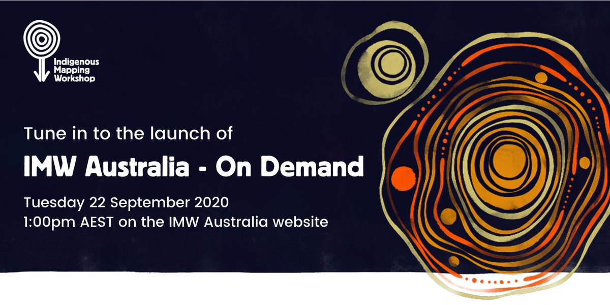
We are proud to support the @imwaustralia - On Demand. You can watch the official launch event tomorrow via this link: bit.ly/3hI91cY #IMWauOD #IndigenousMapping
We’re proud to have Dr Sam Holt presenting at this year’s National Indigenous Mapping Workshop in Meanjin. He’ll be sharing how airborne photogrammetry + remote sensing tech are helping communities map, manage & protect Country. bit.ly/3KZ1i1V #IndigenousMapping #spatial
Something went wrong.
Something went wrong.
United States Trends
- 1. Kharg Island N/A
- 2. Boasberg N/A
- 3. Vandy N/A
- 4. Friday the 13th N/A
- 5. Wisconsin N/A
- 6. Jake Brown N/A
- 7. Antifa N/A
- 8. Vanderbilt N/A
- 9. Duke Miles N/A
- 10. Vladdy N/A
- 11. Nick Boyd N/A
- 12. Pirro N/A
- 13. Kennedy Center N/A
- 14. Tulsa N/A
- 15. Powell N/A
- 16. Potomac TRACON N/A
- 17. Illini N/A
- 18. North Texas N/A
- 19. Underwood N/A
- 20. Boswell N/A