
26th Parallel North
@26thParallel
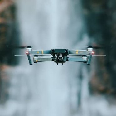
26th Parallel North is a Professional Drone Service company that serves the Agriculture, Construction, Surveying and Real Estate Industries.
You might like


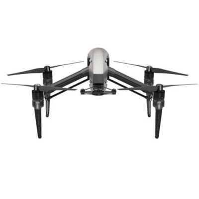
Working on some aerial photography on a beautiful day. Please reach out for any drone needs and check out our website parallel26.com #26pn #dronephotography #photogrammetry #lidar #surveyor #drone #aerialsurvey
Photogrammetry taken for a client in Central FL. GSD of under 3 centimeters. #26pn #dronephotography #photogrammetry #lidar #surveyor #drone #aerialsurvey


Real Estate Shoot in the afternoon setting the mood. #aerialphotography #realestate #drone #PhotographyIsArt #Florida #26PN


The FAA is working to restore its Notice to Air Missions System. We are performing final validation checks and reloading the system now. Operations across the National Airspace System are affected. We will provide frequent updates as we make progress.
This point cloud was created at a 1:1 densification from photogrammetry with a GSD of 2.2cm. Achieving a RMSE of less than 4cm on hard surfaces. Parallel26.com #26pn #photogrammetry #lLiDAR #drone #dronesurvey #surveying #remotesensing #aerialsurvey #fromabirdseyeview


Photogrammetry of Rock Slide. Photos taken after mitigation efforts. GSD of under 3 centimeters. Ground Truthing on Sigma 2 analysis averaged under 5 centimeters. #26pn #dronephotography #photogrammetry #lidar #surveyor #drone #aerialsurvey


South Florida Views! #26pn #photography #aerialphotography #drone #southflorida #Florida #FisherIsland #beachvibes #photogrammetry #LiDAR


Point cloud drafting! #26pn provides 80% line work deliverables as well! Contact us for your aerial surveying needs through our website Parallel26.com. #aerialsurveying #surveying #drones #LiDAR #photogrammetry #dronephotography

Just because the job ain’t close by, doesn’t mean we can’t reach your project. Our team is fully trained to tackle any environment. #traveling #surveylife #surveying #aerialsurvey #26pn
LiDAR Data Collection of a Townhouse Development. This is a preview point cloud still unprocessed. Visit our website to see our full suite of services catered to your project. #26pn #Drones #aerialsurvey #lidar #photogrammetry #surveying #aerialphotography

26th Parallel North also works with Real Estate Developers and Realtors to bring them amazing views of the landscape and developments. Check us out at Parallel26.com. #26pn #aerialphotography #photography #drones #southflorida #photogrammetry #lidar


Possible FAA LAANC outage from 10am EST to 3pm EST today December 5th, 2022. #FAA #Drone #LAANC #Lidar #photogrammetry #surveying #26pn
I love it when I flight plan goes perfectly! Feel free to DM us for more information on our services. #26pn #lidar #photogrammetry #drones #aerialsurvey #dronesurvey #surveying #survey #surveylife

Sometimes you have to stop and appreciate the sights. #26pn #26thparallelnorth #aerialphotography #dronephotography #drone #lidar #photogrammetry #sea #beach Parallel26.com #part107


Check us out at Parallel26.com and see our services and previous projects in the From a Bird’s Eye View section. #26pn #lidar #photogrammetry #drone #dronesurvey #surveying #remotesensing #aerialsurvey #fromabirdseyeview
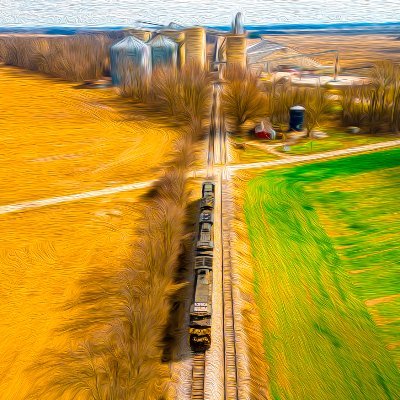
#Surveying a 700+ acre site that’s being developed for the installation of solar panels. Great day for #lidar ! #26pn #dronesurvey #dronephotography #drone #photogrammetry #surveylife

Processing LIDAR data for power lines and substation. Our team was able to obtain high accurate point clouds from multiple flights to create what you are seeing. This is ready for PLS-CADD with incredible precision. #26PN #26thParallelNorth #dronesurvey #drone #surveylife


Survey Drones allow for quick and accurate data collection in the field with the benefit of extending the reach to locations where field crews just can’t go. #26pn #dronephotography #photogrammetry #lidar #surveyor #drone #aerialsurvey


United States Trends
- 1. Lakers 71.7K posts
- 2. Luka 66.2K posts
- 3. Wemby 25.6K posts
- 4. #Talus_Labs N/A
- 5. Marcus Smart 5,682 posts
- 6. #LakeShow 5,505 posts
- 7. Blazers 8,087 posts
- 8. Russ 10.1K posts
- 9. Ayton 15.2K posts
- 10. Richard 44.9K posts
- 11. Horford 1,898 posts
- 12. #AmphoreusStamp 6,158 posts
- 13. #RipCity N/A
- 14. Podz 2,367 posts
- 15. #dispatch 61.8K posts
- 16. Champagnie 1,204 posts
- 17. Thunder 34.2K posts
- 18. Godzilla 32.7K posts
- 19. Nico Harrison 1,690 posts
- 20. Kuminga 3,313 posts


Something went wrong.
Something went wrong.