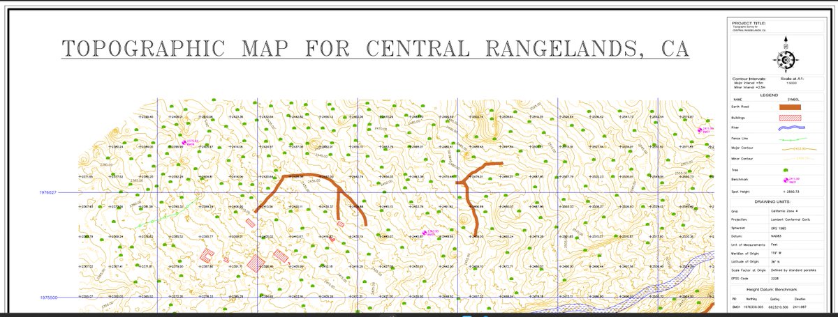
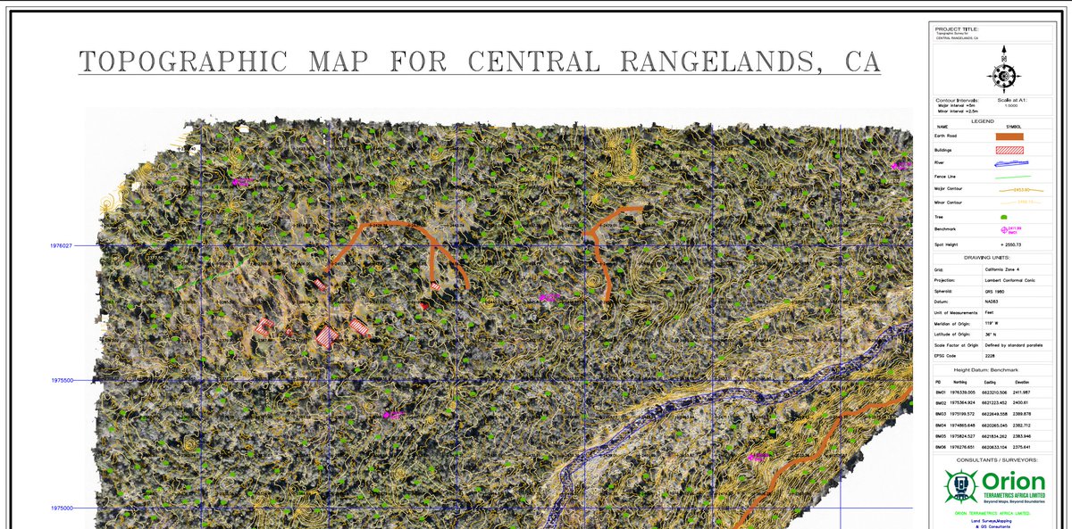
#lidar search results


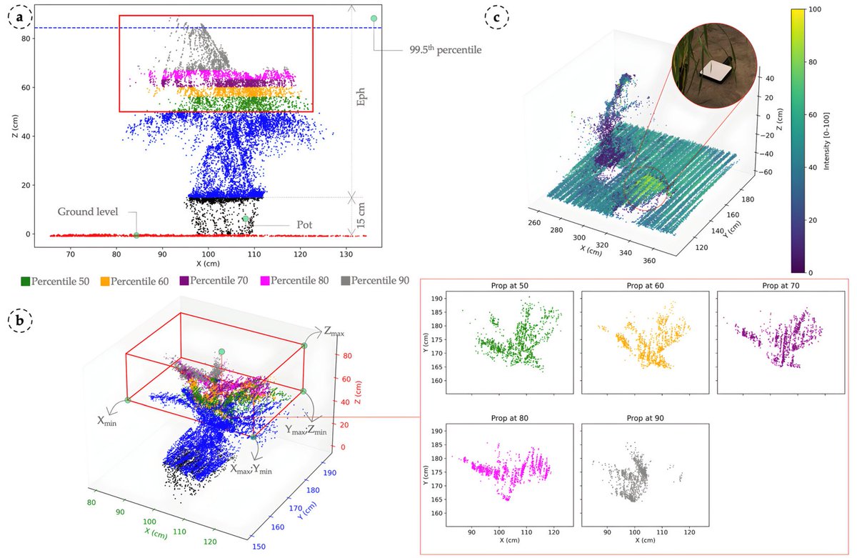
🌾🍂 Monitoring #Leaf Rust and Yellow Rust in #Wheat with 3D #LiDAR Sensing ✍️ Jaime Nolasco Rodríguez-Vázquez et al. 🔗 brnw.ch/21x0bqT
👉👉 Assessing #Lidar Ratio Impact on #CALIPSO Retrievals Utilized for the Estimation of #Aerosol SW #Radiative #Effects across North Africa, the Middle East, and Europe ✍️ Anna Moustaka et al. 🔗 brnw.ch/21x09Lu

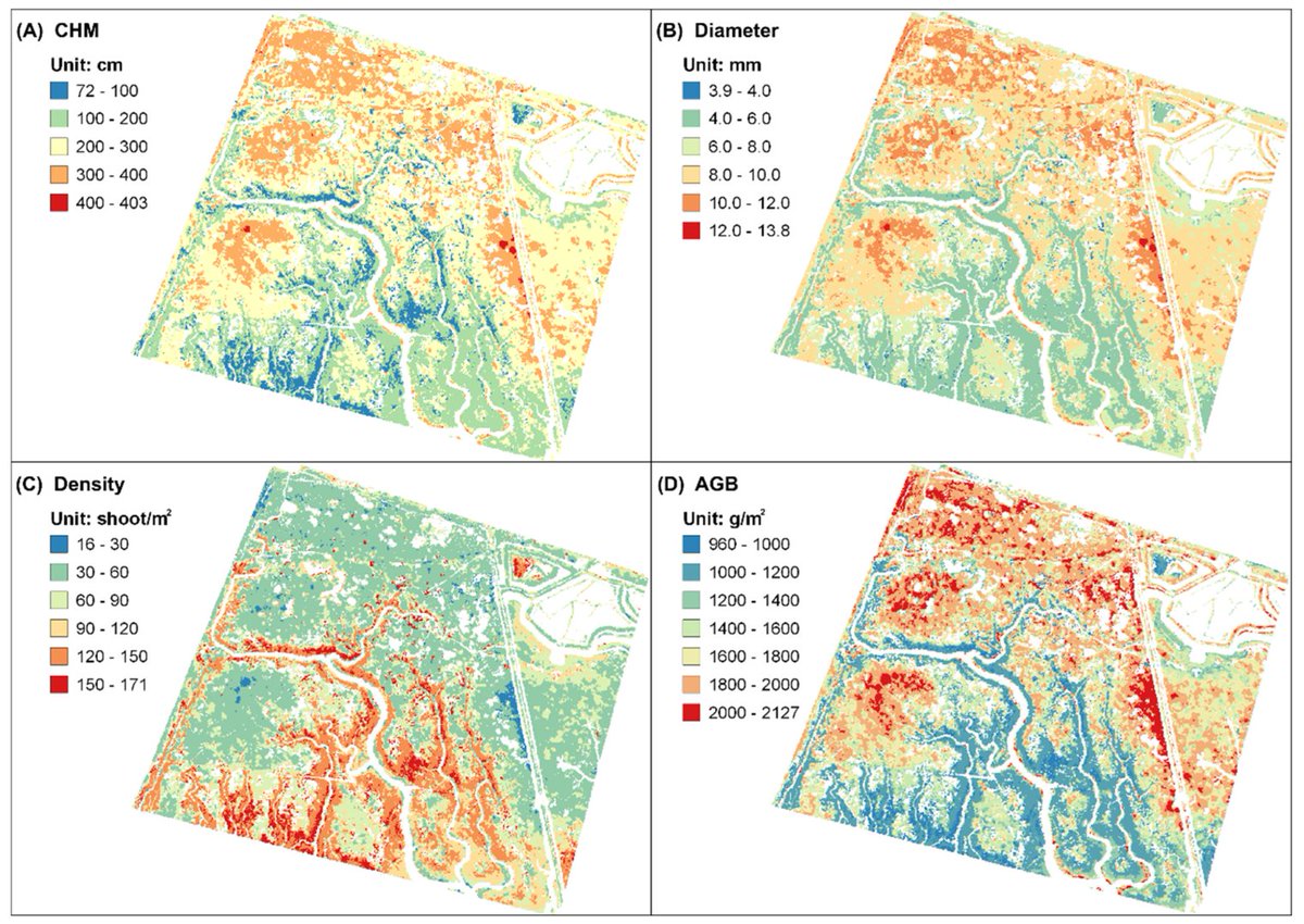
🌿💧 Synergy of #UAV- #LiDAR #Data and Multispectral #RemoteSensing Images for Allometric Estimation of Phragmites Australis Aboveground #Biomass in Coastal #Wetland ✍️ Chentian Ge et al. 🔗 brnw.ch/21x0Ifj

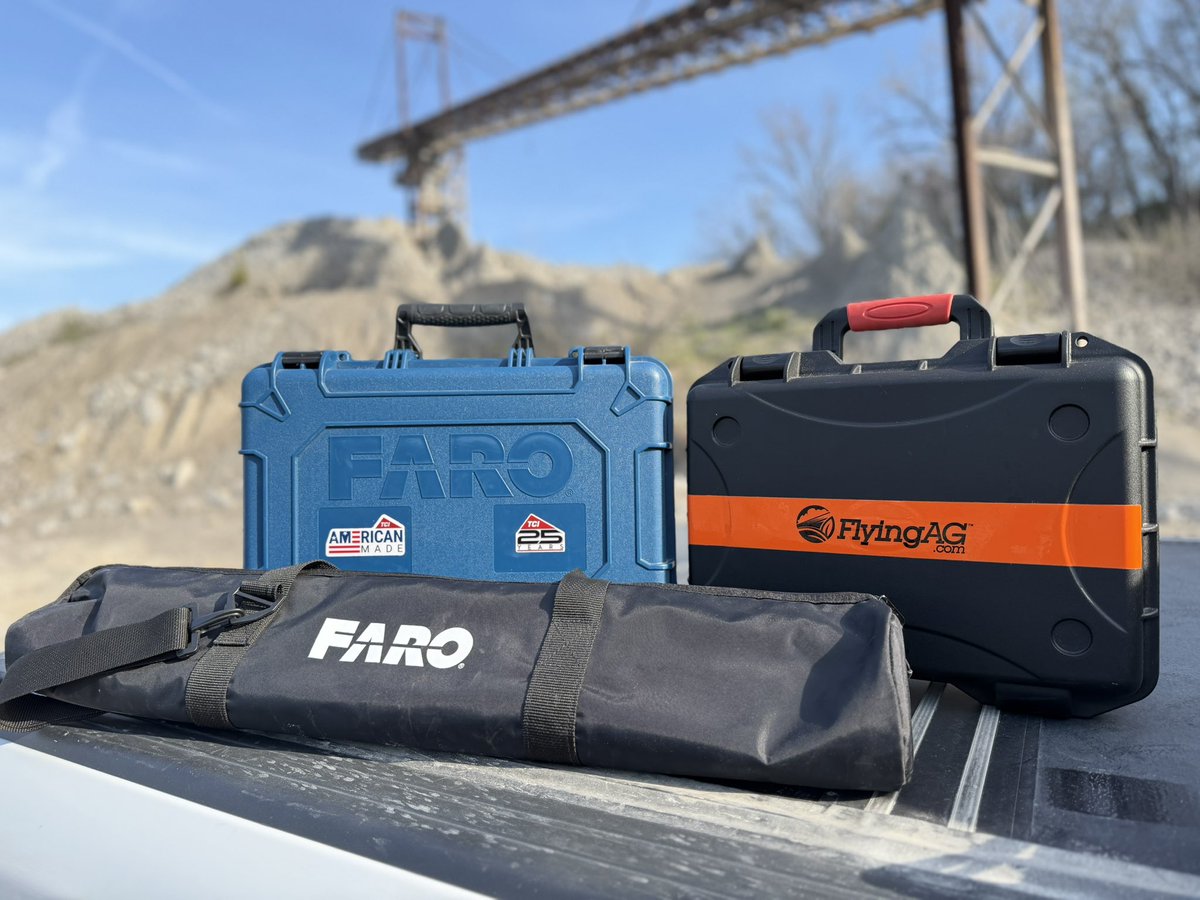
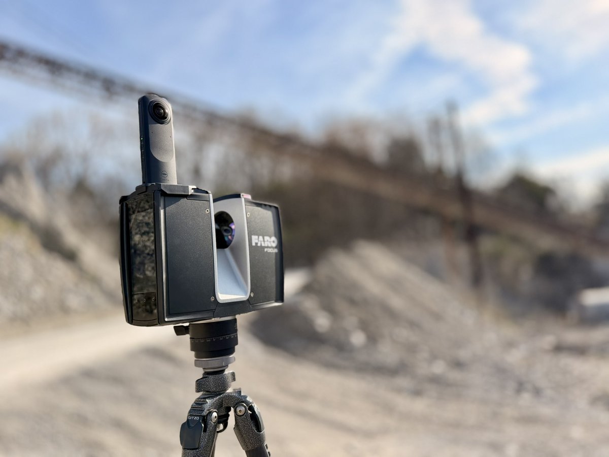
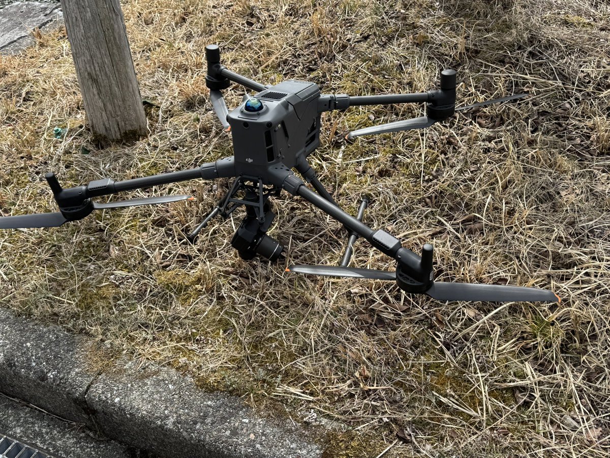
Last Saturday in Las Vegas with the team at @TCIMFG booth during @conexpoconagg 2026. This Saturday morning: @faro_building scanner on the ground @FlyingAGUAV @DJIGlobal drone in the air From trade show floor ➝ real world in one week. #LiDAR #Drones #FlyingAg


DJI Zenmuse L3 P1による計測業務を実施しました。 ・広範囲の高速測量 ・植生下の地形取得 ・高精度な3Dデータ化 これらをワンストップで対応可能です。 測量・調査・インフラ点検など、ドローンの活用をご検討の方はお気軽にご相談ください。 #ドローン業務 #LiDAR #空間データ #業務効率化
💧🌿 ANN-Based Filtering of #Drone #LiDAR in Coastal #SaltMarshes Using Spatial–Spectral #Features ✍️ Kunbo Liu et al. 🔗 brnw.ch/21x0OrT

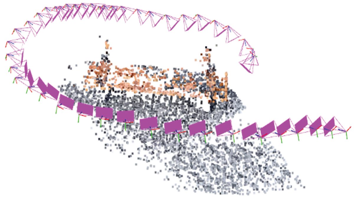
👉👉 Fusing #LiDAR and #Photogrammetry for Accurate #3D #Data: A Hybrid Approach ✍️ Rytis Maskeliūnas et al. 🔗 brnw.ch/21x1nYJ
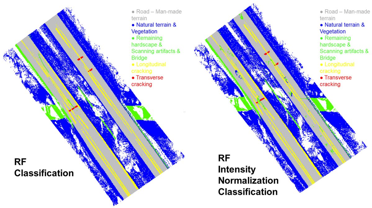
👉👉 #LiDAR-Based #Road Cracking Detection: #MachineLearning Comparison, Intensity Normalization, and Open-Source #WebGIS for #Infrastructure Maintenance ✍️ Nicole Pascucci et al. 🔗 brnw.ch/21x1GL7
🌳🏙️🌳 Comparison of #UAV-Based #LiDAR and #Photogrammetric Point Cloud for Individual #Tree Species Classification of #Urban Areas ✍️ Qixia Man et al. 🔗 brnw.ch/21x1TQs
🌳🌳 Modelling #LiDAR-Based #Vegetation Geometry for Computational Fluid Dynamics #Heat #Transfer Models ✍️ Pirunthan Keerthinathan et al. 🔗 brnw.ch/21x1N9G

👋👋 Experimental #Evaluation of the #Motion-Induced Effects for Turbulent Fluctuations Measurement on Floating #Lidar #Systems ✍️ Maxime Thiébaut et al. 🔗 brnw.ch/21x01a9

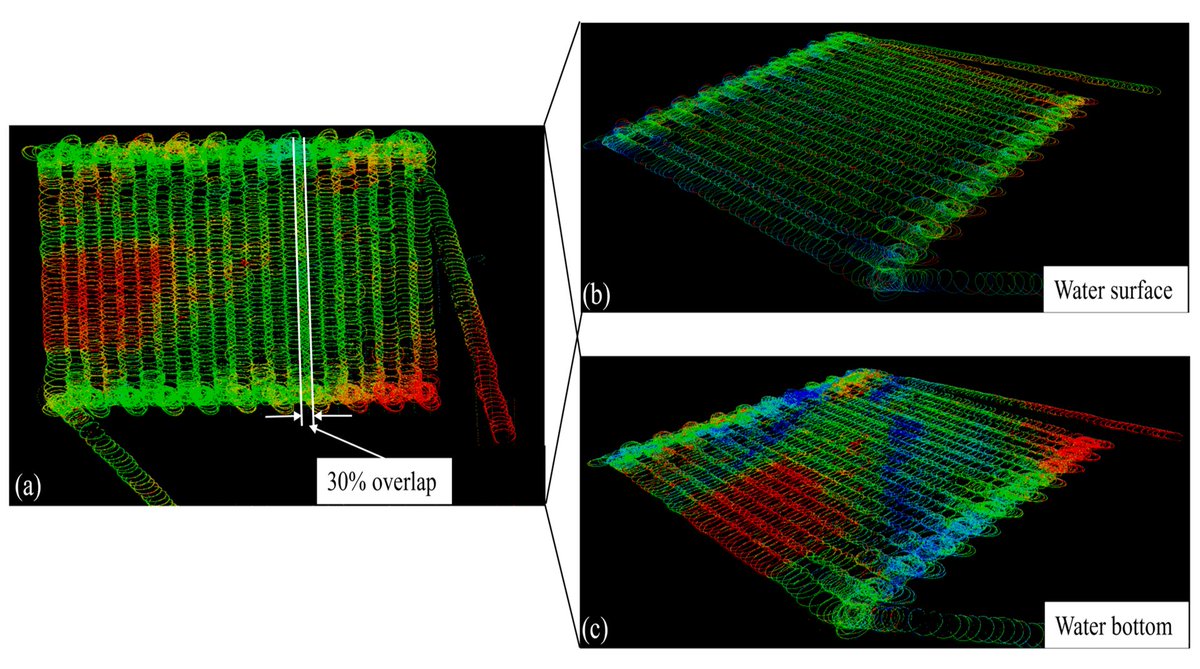
👋👋 #Development of an Adaptive Fuzzy Integral-Derivative Line-of-Sight Method for #Bathymetric #LiDAR Onboard Unmanned Surface Vessel ✍️ Guoqing Zhou et al. 🔗 brnw.ch/21x0ysd
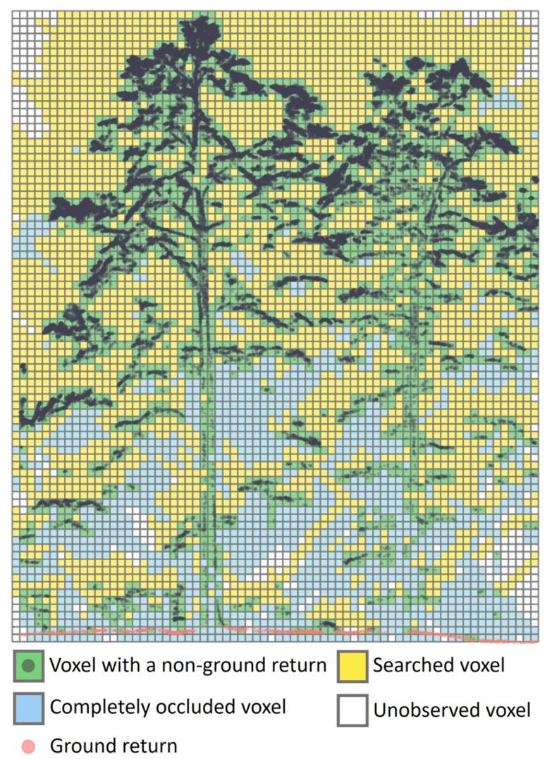
🌳🌳 Near-Complete Sampling of #Forest #Structure from High-Density Drone #Lidar Demonstrated by Ray Tracing ✍️ Dafeng Zhang et al. 🔗 brnw.ch/21x0Cfs

🚀 New Special Issue Alert! "Feature Papers in Radar and LiDAR Sensors 2026", led by Section Editor-in-Chief Prof. Dr. Guangcai Sun. We invite high-quality research on #Radar/#LiDAR tech, #SAR, signal processing, #AI applications. 📄mdpi.com/journal/sensor… #CallForPapers


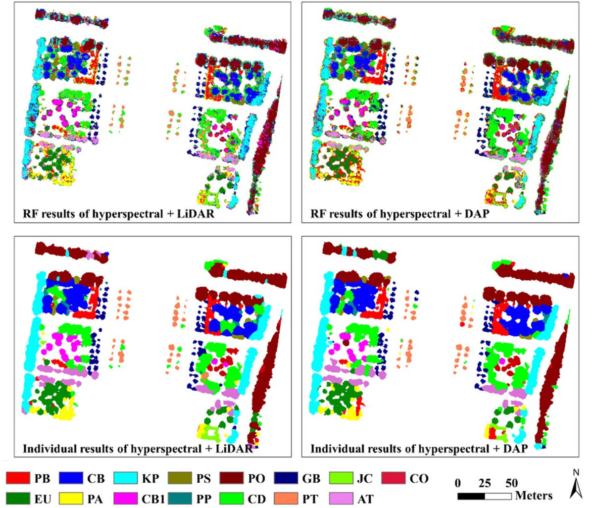
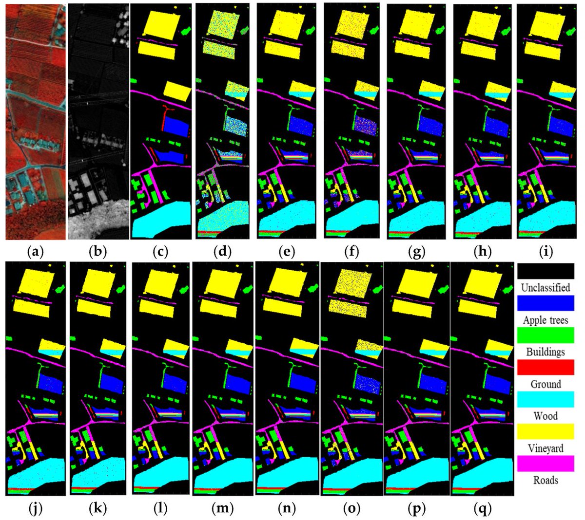
👋👋 Joint Classification of #Hyperspectral and #LiDAR #Data via Multiprobability Decision #Fusion Method ✍️ Tao Chen et al. 🔗 brnw.ch/21x14tW

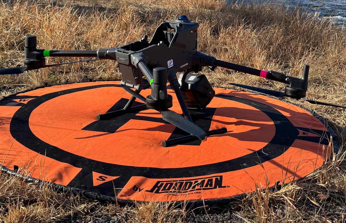
Done. What should we map next? Try our aerial LiDAR and #photogrammetry services today. Too much vegetation and undergrowth? No problem. Our #LiDAR sensors (Zenmuse L2 and L3) were designed exactly for that. The L3 payload features up to 16 laser returns, enabling it to penetrate


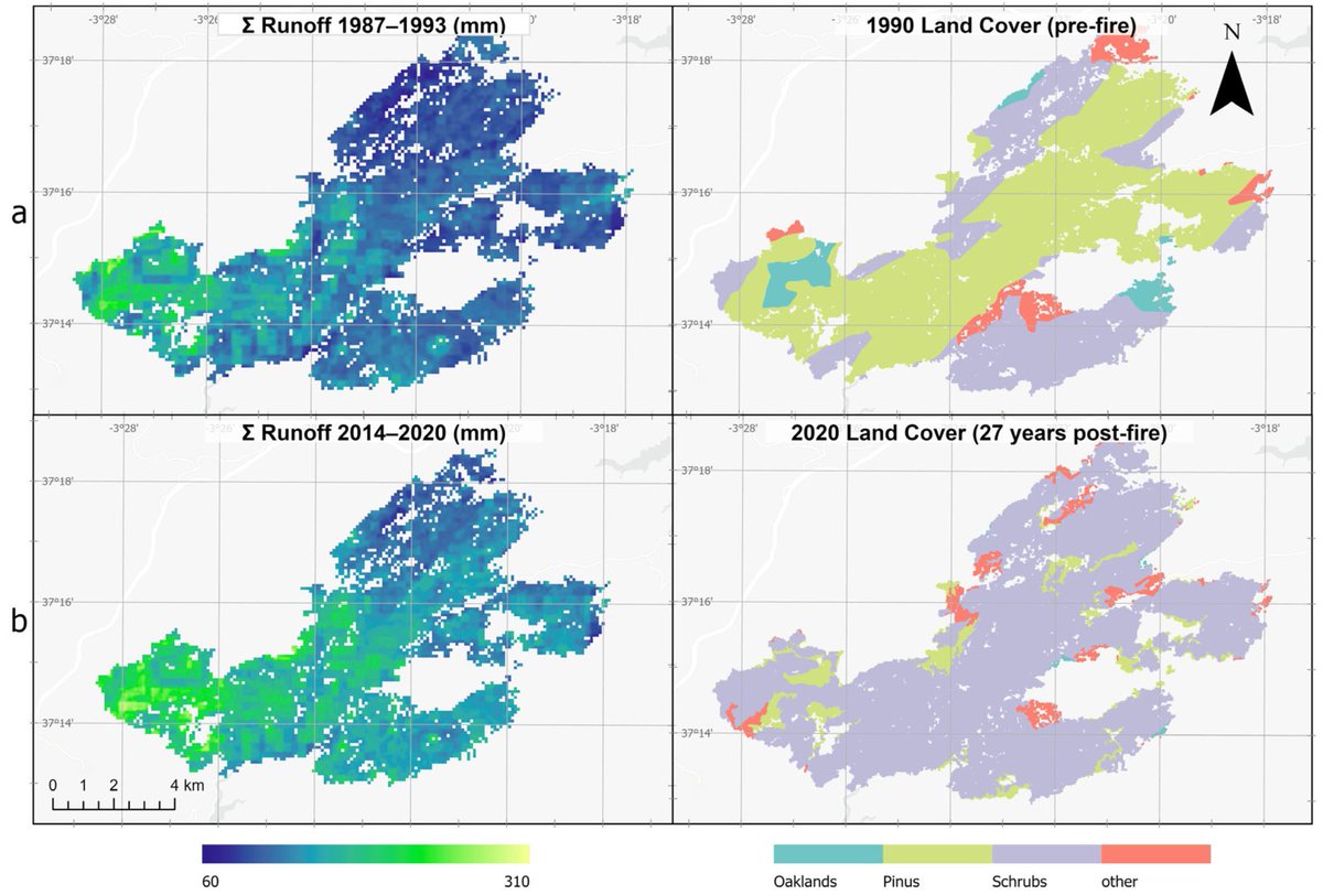
🌳🔥 #Post- #Fire Restauration in Mediterranean Watersheds: Coupling WiMMed Modeling with #LiDAR–#Landsat #Vegetation Recovery ✍️ Edward A. Velasco Pereira and Rafael Mª Navarro Cerrillo 🔗 brnw.ch/21wZYeA

Waymo made lidar famous this decade with spinning sensors that once cost around $50,000 mounted atop Jaguar robotaxis in San Francisco. Today, palm-sized $200 units are common on Chinese cars. #Lidar #China #Rivian #automotive #autoindustry


Something went wrong.
Something went wrong.
United States Trends
- 1. Wyatt Sicks N/A
- 2. Invited Users N/A
- 3. Gen V N/A
- 4. Bo Dallas N/A
- 5. Zoey Stark N/A
- 6. Nikki Cross N/A
- 7. Joe Gacy N/A
- 8. The Boys N/A
- 9. Kay Lee Ray N/A
- 10. Uncle Howdy N/A
- 11. Custom N/A
- 12. Alba Fyre N/A
- 13. Jayden Reed N/A
- 14. #LightningStrikes N/A
- 15. FFXIV N/A
- 16. Betis N/A
- 17. Ray J N/A
- 18. #TTStarFanConcert N/A
- 19. Lucha Underground N/A
- 20. Vought Rising N/A