
GIS Tutor
@GISTutor
A source of beginner, intermediate and advanced level Geographic Information Systems (GIS) tutorials. Numerous examples using open source software.
You might like


How to drop #GeoCoins for other people to collect by @GISTutor: gistutor.com/geocoin/27-beg… $GEO #geocaching #btc
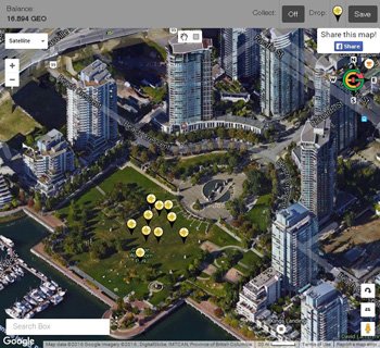
#GeoCoin Tutorial - How to collect GeoCoin #Cryptocurrency using a Smart Phone with GPS: gistutor.com/geocoin/27-beg… via @GISTutor
#GIS Tutorial: How to Georeference Images taken from GPS Enabled Cameras using Google Earth: gistutor.com/google-earth/2… via @GISTutor
#GIS Tutorial: Understanding #PostGIS Spatial Queries: gistutor.com/postgresqlpost… via @GISTutor
#GIS Tutorial: How to Join CSV Attribute Data to a Vector Layer using Fields in #QGIS: gistutor.com/quantum-gis/19…
#GIS Tutorial: How to record a 3D flyover animation using #ESRI #ArcScene: gistutor.com/esri-arcgis/1-…
#GIS Tutorial : Georeferencing Satellite Imagery from Google Earth using #QGIS: gistutor.com/quantum-gis/20…
#GIS Tutorial: How to Create a Shapefile from XY Data using #QGIS: gistutor.com/quantum-gis/19…
#PostGIS: Buffer lat/long and other projections using meters units, custom st_buffer_meters function: gistutor.com/postgresqlpost…
#GIS Concept Tutorial: Ecological Fallacy in GIS: gistutor.com/concepts/24-in…

QGis 1.7.0 is out! http://qgis.org/component/content/article/127-qgis-1-7-release.html #qgis
#GIS Tutorial: How to generate contours using raster data in Quantum GIS (#QGIS): gistutor.com/quantum-gis/19… via @GISTutor
#GIS Tutorial: How to generate contours using point data in Quantum GIS (#QGIS): gistutor.com/quantum-gis/19… via @GISTutor
#GIS Tutorial: How to sample raster datasets using points in Quantum GIS (#QGIS): gistutor.com/quantum-gis/19… via @GISTutor
#GIS Tutorial: Masking a Raster in #QGIS: gistutor.com/quantum-gis/19…
#GIS Tutorial: Using #QGIS Plugins: http://www.gistutor.com/quantum-gis/19-beginner-quantum-gis-tutorials/52-using-qgis-plugins.html
#GIS Tutorial: Inverse Distance Weighting ( #IDW ) Interpolation using #QGIS: gistutor.com/quantum-gis/20…
#GIS Tutorial: Single Band Raster Layer Symbology in #QGIS: gistutor.com/quantum-gis/19…
#GIS Tutorial: Importing an Image to Real World Coordinates in #AutoCAD: gistutor.com/autocad/23-int…


United States Trends
- 1. Giannis N/A
- 2. Sinner N/A
- 3. #SmackDown N/A
- 4. Trans N/A
- 5. Adam 22 N/A
- 6. Bucks N/A
- 7. #DragRace N/A
- 8. Gigi N/A
- 9. Jason Luv N/A
- 10. #OPLive N/A
- 11. Kuzma N/A
- 12. #PersonaLive N/A
- 13. Attitude Era N/A
- 14. Pacers N/A
- 15. Dabo N/A
- 16. Spizzirri N/A
- 17. Aaron Gordon N/A
- 18. Antarctica N/A
- 19. #ZuffaBoxing01 N/A
- 20. WILLIAMEST ECHO IN SG N/A


Something went wrong.
Something went wrong.