
Może Ci się spodobać


You can make $120/hr working at night, If you have: 1. A laptop 2. Internet 3. Free time Here're 12 Remote jobs you can do at night that pays $120/hr:↓

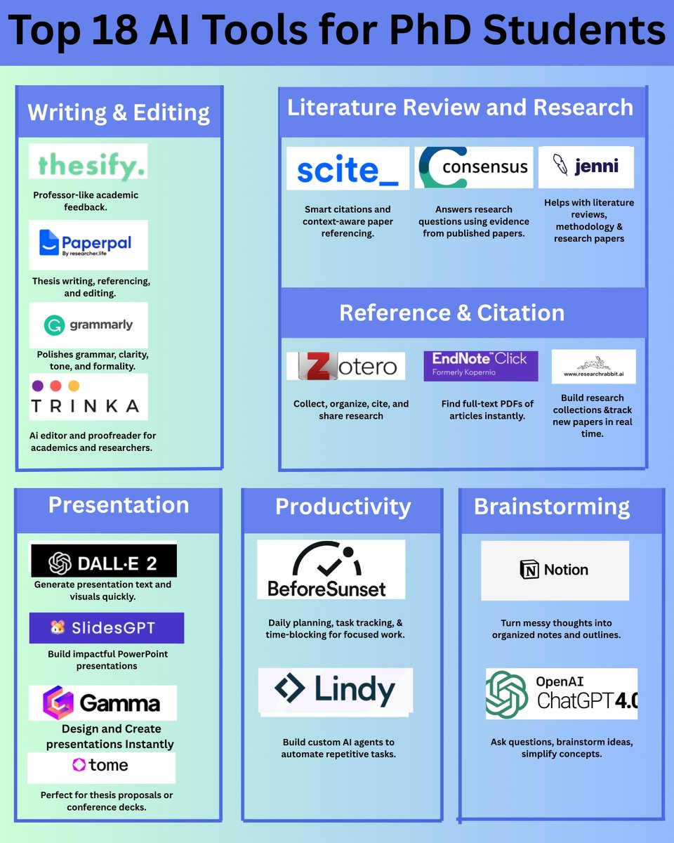
Top 18 AI Tools for PhD Students Writing & Editing 1. @thesify_ai 2. @teampaperpal 3. @Grammarly 4. @thetrinkaai Literature Review and Research 5. @Scite 6. @ConsensusNLP 7. @whoisjenniai Reference and Citation 8. @zotero 9. @EndNoteNews 10. @RsrchRabbit…
Starting a GIS development career? Consider these three areas (Most demanded skills): 1. Web GIS - Frontend web development: HTML, CSS, JavaScript, React, Angular, Vue.js - Backend web development: Python (Django, Flask), Node.js, Express.js - Web mapping libraries: Leaflet,…

Best ML Courses- mltut.com/best-coursera-… @KirkDBorne #MachineLearning #100DaysOfCode #100DaysOfMLCode #Python #javascript #womenwhocode #cybersecurity #CodeNewbie #DataScience #DEVCommunity #BigData #Analytics #pythonprogramming #PowerBI #SQL #GenAI #OpenAI #chatgpt4 #AI #GPT5

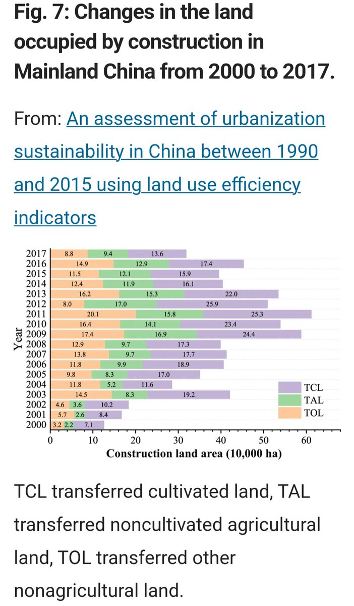
This paper integrated Earth observation and census data to estimate the relationship between land, population and economic domains of urbanization in 433 cities in China over 25 years using land use efficiency indicators.

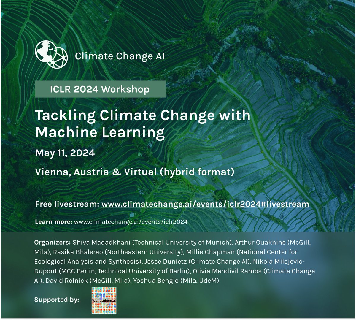
Can't make it to #ICLR2024? We've got you covered! We are excited to announce that our full workshop on May 11 will be livestreamed - for free! 🎉🤓 For more info on the program & the link to the livestream, check our website: climatechange.ai/events/iclr2024
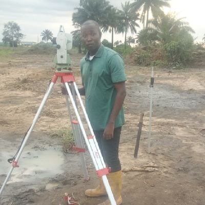
We are looking for 4 new PhD students! 👩🎓👩💻 Are you a talented MSc student passionate about unlocking the potential of geospatial data and remote sensing technologies? 🌍✨Apply before the 20th of March! More info: tinyurl.com/yy358ych #ERC #geospatial #phdposition


How to use satellite data to measure the quality of infrastructure PLUS • free geospatial datasets to proxy economic activity • identifying informal settlements through remote sensing • accessing historical GDP estimates, & more Here's everything I wrote about this week:

In a new #Jupyter Notebook developed at NASA's #PODAAC, learn the basics of #xarray and how to use the open-source #Python library, Dask, for parallel computing (data access and data analysis) in the cloud. #CloudComputing ➡️Check it out at: go.nasa.gov/3UFQa9m


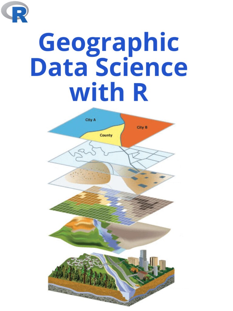
Geographic Data Science with R is a powerful tool for analyzing and visualizing spatial data. pyoflife.com/geographic-dat… #DataScience #rstats #DataAnalytics #DataScientists #Datavisualization #statistics #geospatial #database #r #programming #GeoEngineering #codinglife

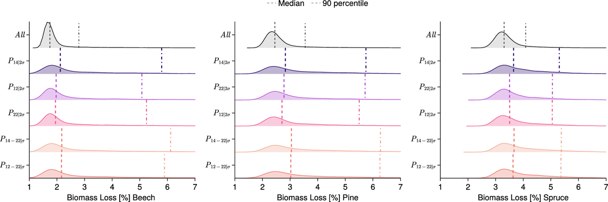
🌲🔍 #GenerativeAI meets forest biomass loss! Researchers here are using a modified variational autoencoder to tackle forest biomass loss. This #AI model separates weather variables in latent space, allowing the generation of weather prototypes associated with high biomass loss.…

📢More datasets in #IEEE DataPort Geoscience and Remote Sensing 🌍Aerial Image 🗓️2024 👥Rafi Ibn Sultan 🎓DOI: lnkd.in/ej3tNyKy 👉bit.ly/aerImg

35 Best Data Science Courses- mltut.com/best-coursera-… @KirkDBorne #MachineLearning #100DaysOfCode #100DaysOfMLCode #Python #javascript #Serverless #womenwhocode #cybersecurity #CodeNewbie #DataScience #DEVCommunity #BigData #Analytics #pythonprogramming #OpenAI #PowerBI #lGenAI

💻 E-LEARNING OPPORTUNITY This free online course aims to strengthen local government officials' capacity for: 🔸risk reduction; 🔸resilience planning; 🔸health threats management. The 3-module course is prepared and hosted by @UNDRR @WHO & @UNITAR ➡️ ow.ly/Ltke50QwpCX


Download these resources to learn how GIS can be leveraged to visualize a multitude of datasets to asses climate risk and its impact on communities and businesses ow.ly/2iBi30szzBa

If you are looking for passive income that pays in USD, open this:👇

Finally tested the global hydrological basins dataset that I created using the GeoParquet <-> GeoJSON converter planetlabs.github.io/gpq/ 🎉 Love the performance! btw, 290 MB GeoJSON -> 35MB GeoParquet

@felt now supports @GeoParquet! This was my first feature request for Felt - I'm psyched it's come through. It's great to see more and more web tools support the format. And I've heard the Felt team is embracing GeoParquet for more internal use as well.

Great news!🎓 Anna Mateo Sanchis just defended her PhD thesis "Crop yield estimation using remote sensing and machine learning" 👩🌾🌽🛰️🌍🤖 The advisors, colleagues, family & friends are super proud! Thanks @sbegueria @belenfranchgras @DChaparro_EO, for the great evaluation! 👇
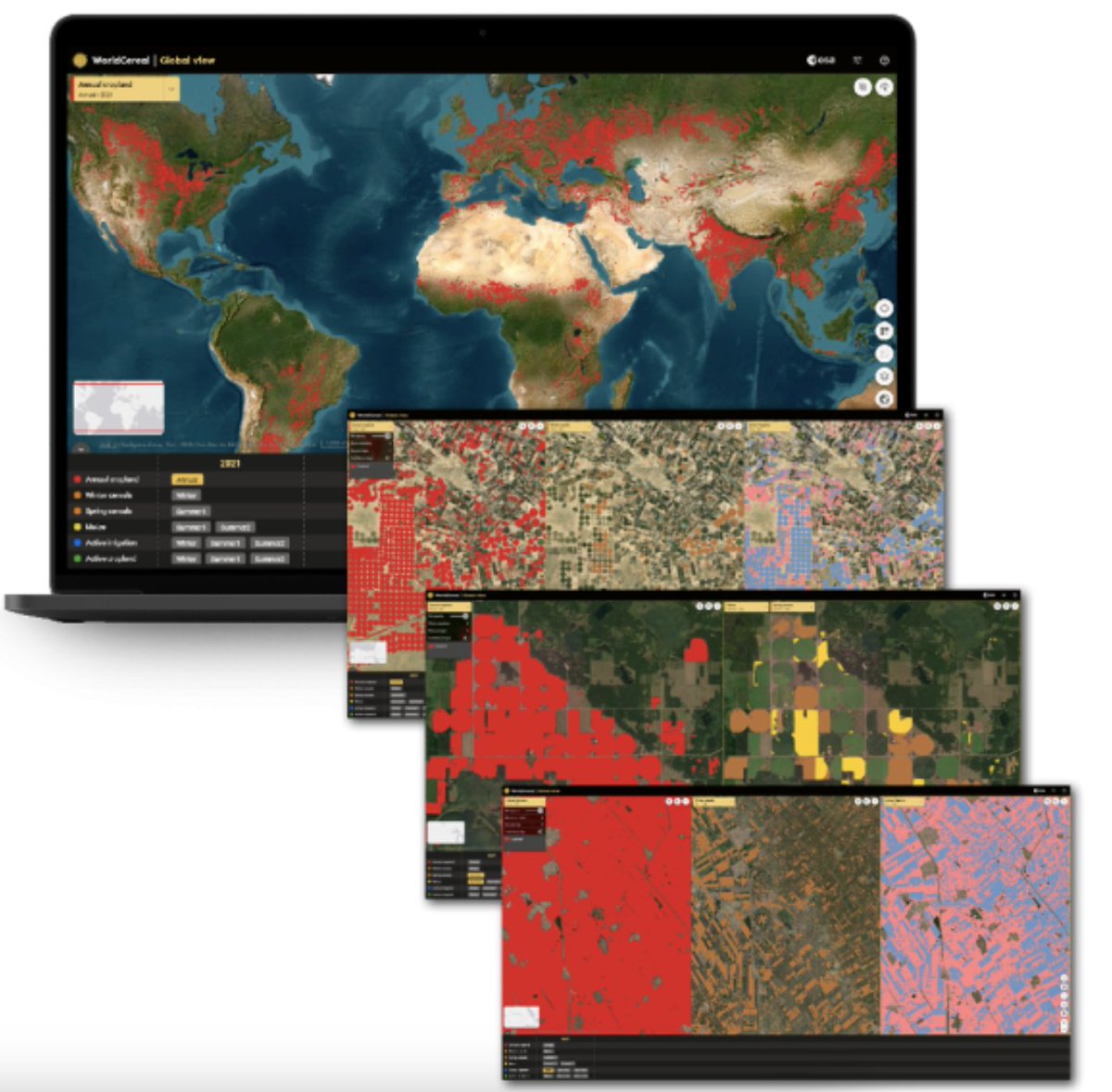
Measuring agricultural GDP at a pixel-level is notoriously challenging. It requires precise information on crop type and crop yield. Now, @esa has launched a (free) dataset that provides this information. Here's what you need to know about it:

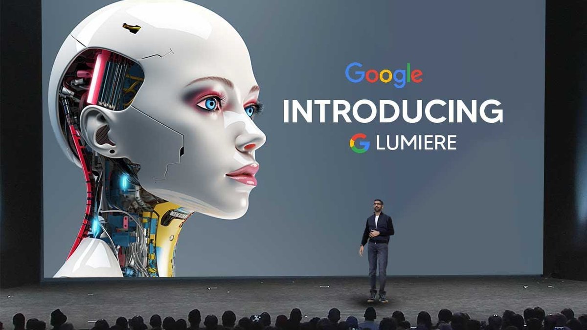
🚨 Breaking news: Google just launched LUMIERE, and it's crazy. This is going to transform the future of VIDEO forever Here are 5 stunning examples you can't miss out on: 🧵


United States Trendy
- 1. Brunson 6,637 posts
- 2. Knicks 12.1K posts
- 3. Celtics 12.5K posts
- 4. Jaylen Brown 5,645 posts
- 5. Duke 28.2K posts
- 6. Jordan Walsh N/A
- 7. #WWENXT 10.5K posts
- 8. Notre Dame 34K posts
- 9. Miami 95.9K posts
- 10. Bama 22.4K posts
- 11. Van Epps 123K posts
- 12. Mikal Bridges 1,404 posts
- 13. Tennessee 209K posts
- 14. Boogie Fland N/A
- 15. Isaiah Evans 1,296 posts
- 16. Nashville 32.3K posts
- 17. Behn 74.9K posts
- 18. Cam Boozer 1,053 posts
- 19. #RHOSLC 2,569 posts
- 20. Syracuse 8,506 posts


Something went wrong.
Something went wrong.