
PacIOOS
@PacIOOS
We empower ocean users & stakeholders throughout the Pacific Islands by providing accurate and reliable coastal and ocean information, tools, and services.
You might like


Scientists from @NOAAFish_PIFSC are using wave-powered 🌊 , autonomous surface vehicles called Wave Gliders to study ocean health and impacts of climate change on marine ecosystems and fisheries in Hawaiʻi: bit.ly/4a4s9y0 @NOAA_OMAO @LiquidRobotics #ClimateScience
NOAA National Weather Service (NWS) is looking for a Social Scientist to join their team based in Honolulu, Hawai'i. NWS provides timely watches, warnings, advisories, and forecasts for hazardous weather conditions. For more info, visit: usajobs.gov/job/694763200
The Pacific Islands Region Acoustic Telemetry Network is hiring a part-time Graduate Assistant that will assist with management of an acoustic telemetry database. To view the full job description, visit the UH Mānoa website (workatuh.hawaii.edu) and enter position #: 0000GA11

As part of the PacIOOS Water Quality Sensor Partnership Program, the Micronesia Conservation Trust deployed a nearshore sensor in Awak, U, Pohnpei to collect data on water temperature, salinity, turbidity, chlorophyll-a, and depth. Data will be made available on our website soon!

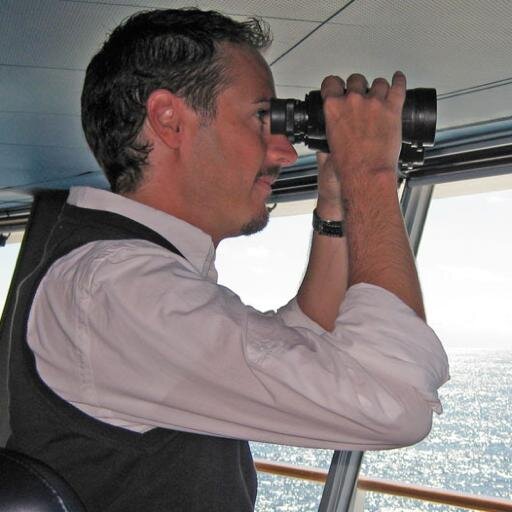
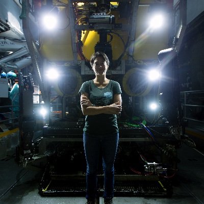
Ever wondered who is behind deploying and maintaining PacIOOS wave buoys in Hawai'i? Meet Olivia Hughes, one of our oceanographic technicians. Today Olivia talked about all things buoys, moorings, and wave measurements to 60 marine science students from Radford High School.

Coastal hazards aren’t one and done. So @PacIOOS has a tool to show wave-induced flooding WITH #SeaLevelRise for Maui. Check it out: pacioos.hawaii.edu/shoreline/slr-… #GISDay

PacIOOS is HIRING! The Web Data/Product Developer will design and develop visualizations and web-based interactive products of weather, ocean, climate, and coastal information to support decision-making across the Pacific Islands. Visit RCUH.com for more info.

As Co-Chair of the House Ocean Caucus, I joined @IOOSAssociation & @caricoos for the #IOOS2022 Fall Meeting in Puerto Rico. The IOOS network is the nation’s premier coastal observing program, and I’ve been proud to support their work in Congress.


PacIOOS is seeking applicants for a Web Data/Product Developer to work closely with the our data management group to design and develop visualizations and web-based interactive products of weather, ocean, climate, and coastal information. Apply now at rcuh.com!

Exciting news: Backyard Buoys was awarded $4.98M by the @NSF Convergence Accelerator program to empower Indigenous and other coastal communities to collect, steward, and use wave data that complements their existing knowledge to support their blue economy. backyardbuoys.org


New opportunity in the Republic of the Marshall Islands with UH Sea Grant and PacIOOS! For the full job description and application instructions, visit rcuh.com, click “Job Postings” and search for job #222595

We are excited to announce a new online tool designed to help West Maui community members, property owners, and state and county officials prepare for and respond to potential coastal flooding events! Check it out at pacioos.hawaii.edu/shoreline/slr-… Photo courtesy, Carol Tu‘ua

The PacIOOS Lānaʻi wave buoy is back online! pacioos.hawaii.edu/waves/buoy-lan… Located 2.5 miles southwest of Kaumalapau Harbor and 2.5 miles northeast of Palaua Point, the buoy provides updated data every half hour. #waves #wavebuoy #lanai #Hawaii

Join us starting TOMORROW to help document the #KingTides that affect our shorelines! Your photographs help coastal communities and decision makers better understand and prepare for sea-level rise. Check out our photo submission platform: pacioos.org/kt


The Tanapag wave buoy was recently redeployed off Saipan! To see wave height, period and direction data -- updated every 30 minutes-- visit pacioos.hawaii.edu/waves/buoy-tan…. The buoy also provides sea surface temperature available here: pacioos.hawaii.edu/water/buoy-tan…

PacIOOS sensors help improve predictions of Ala Wai Canal bacteria levels | PacIOOS pacioos.hawaii.edu/latest-news/al…


United States Trends
- 1. Packers 99.1K posts
- 2. Eagles 128K posts
- 3. Jordan Love 15.3K posts
- 4. Benítez 12.9K posts
- 5. #WWERaw 135K posts
- 6. LaFleur 14.6K posts
- 7. AJ Brown 7,077 posts
- 8. Sirianni 5,070 posts
- 9. Patullo 12.4K posts
- 10. Jaelan Phillips 8,053 posts
- 11. McManus 4,441 posts
- 12. Grayson Allen 4,106 posts
- 13. Jalen 24.1K posts
- 14. Veterans Day 30.4K posts
- 15. Smitty 5,592 posts
- 16. James Harden 1,953 posts
- 17. Berkeley 60.3K posts
- 18. #GoPackGo 7,957 posts
- 19. Cavs 12.2K posts
- 20. JOONGDUNK BRIGHT SKIN 185K posts
You might like
-
 U.S. IOOS Office
@usioosgov -
 Marine Technology Society
@MTSociety -
 NOAA Coastal Ocean Science
@noaacoastalsci -
 MARACOOS
@maracoos -
 The Global Ocean Observing System (GOOS)
@GOOSocean -
 ECO Magazine
@ecoMagNews -
 EuroGOOS
@EuroGOOS -
 NOAA Ocean Acidification Program
@OA_NOAA -
 Pacific Tourism Organisation
@PacTourismOrg -
 Ocean Observatories
@oceanobserv -
 SECOORA
@secoora -
 Hawai'i Conservation Alliance & Foundation
@HCAFriends -
 Alexander Matheou
@AJMatheou -
 IOOS Association
@IOOSAssociation -
 ILOAsiaPacific
@ILOAsiaPacific
Something went wrong.
Something went wrong.