
Pro-Alert Weather
@ProAlertWeather
Private-Sector meteorological agency in the Charlotte-Metro Area. Reliable forecasts for the Charlotte Metro and beyond. Our posts = our own
You might like


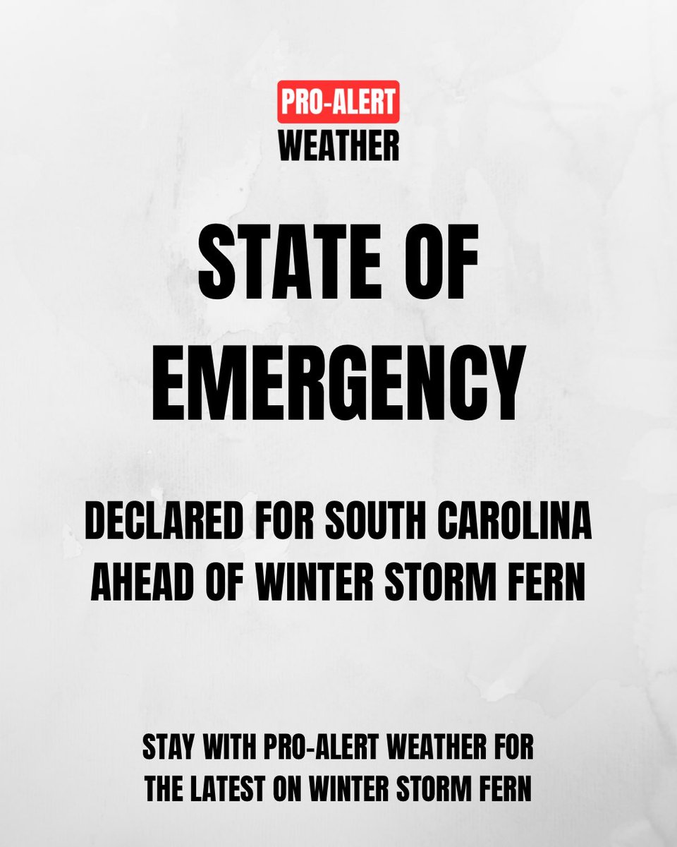
A State of Emergency has been declared for South Carolina ahead of the arrival of Winter Storm Fern. Stay with Pro-Alert Weather for continued coverage. #SouthCarolina #CLTWX #WinterStormFern #ProAlertWeatherNC #PAWWinter2526 #NCWX #SCWX #StateOfEmergency
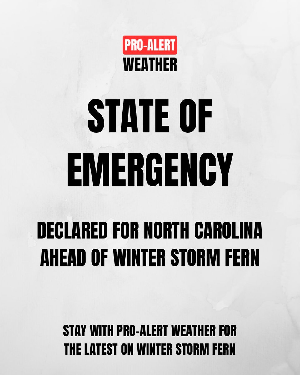
A State of Emergency has been declared for North Carolina ahead of the arrival of Winter Storm Fern. Stay with Pro-Alert Weather for continued coverage. #NorthCarolina #CLTWX #WinterStormFern #ProAlertWeatherNC #PAWWinter2526 #NCWX #SCWX #StateOfEmergency
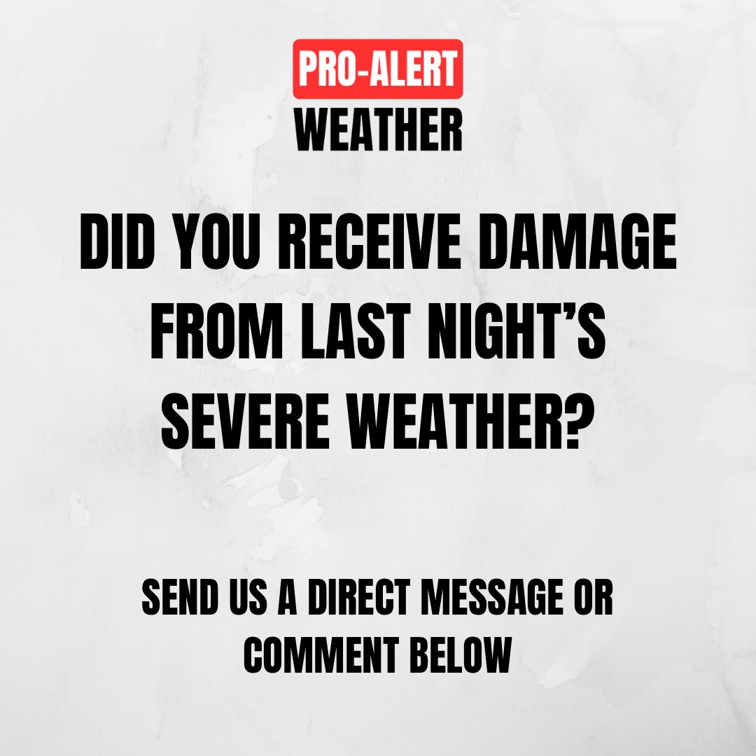
Got storm damage from Tuesday's storms? We're asking the public to send us any photos/videos of damage you experienced! Your reports help us understand the full impact. Please include the time, location, a brief description of the damage. #NCWX #SCWX #CLTWX #ProAlertWeatherNC
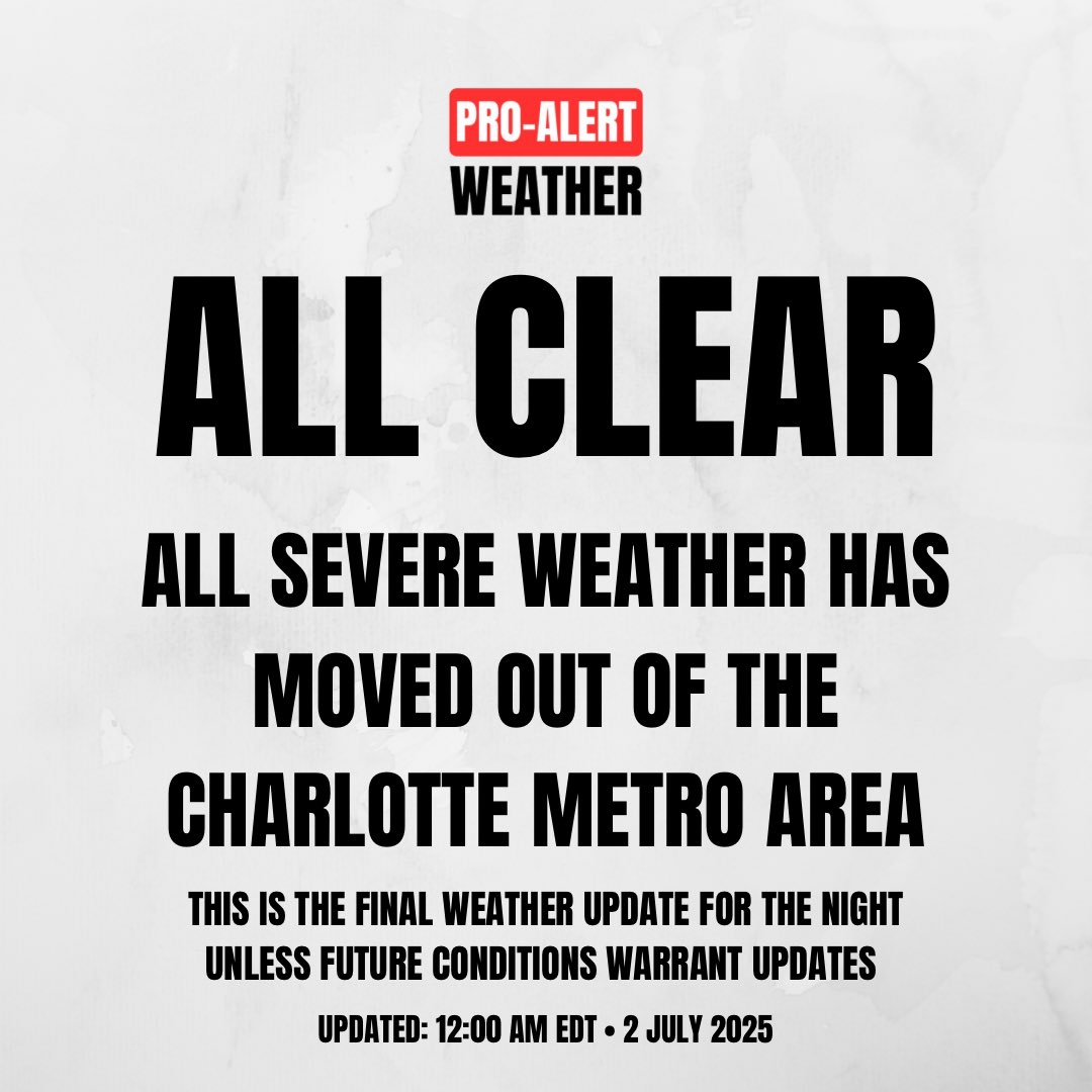
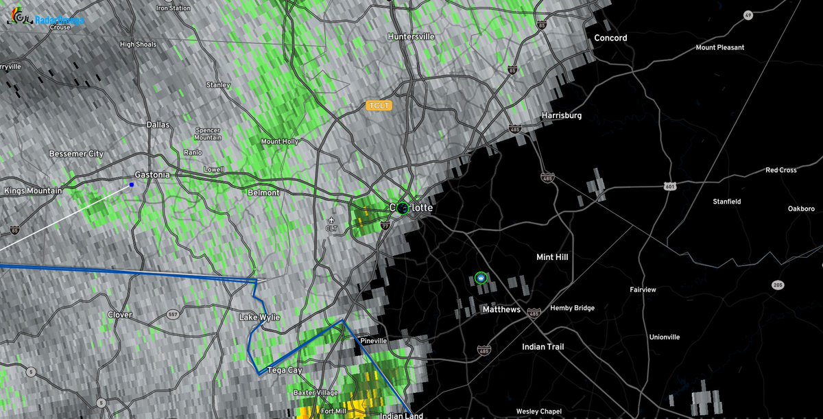
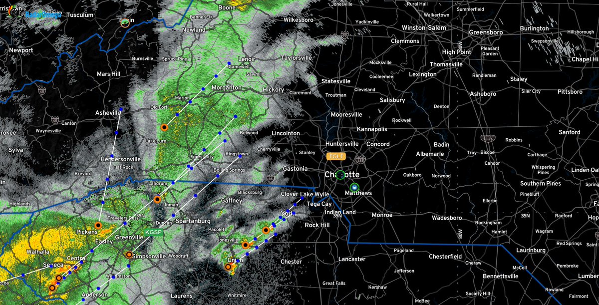
We are “All Clear” from the main #SevereWeather in the #Charlotte Metro Area. This is the final update for the night unless future conditions warrant updates. #NCWX #SCWX #CLTWX #PAWSevere25 #JDHuffmanPAW #ProAlertWeatherNC @JDHuffmanPAW
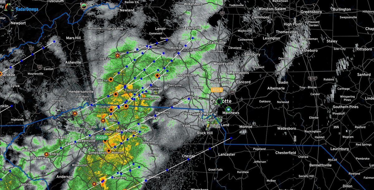
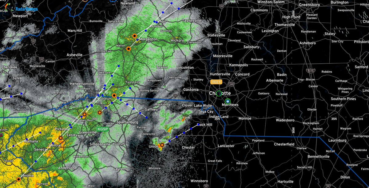
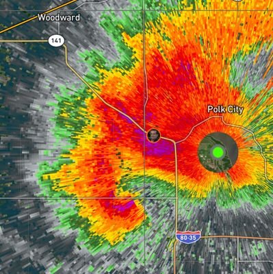
Doppler Radar Update 9:30 PM EDT • 1 July 2025 #NCWX #SCWX #CLTWX #PAWSevere25 #SevereWeather #ProAlertWeatherNC #JDHuffmanPAW
The #Charlotte Metro Area remains in a MARGINAL RISK area for #SevereWeather for Tuesday (1 July 2025). The severe threat is not over yet, so stay with us for continued coverage. #NCWX #SCWX #CLTWX #PAWSevere25 #ProAlertWeatherNC

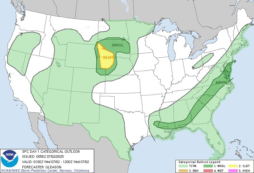
7:58pm CDT #SPC Day1 Outlook Slight Risk: across parts of the northern/central Plains spc.noaa.gov/products/outlo…
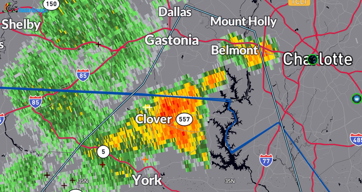
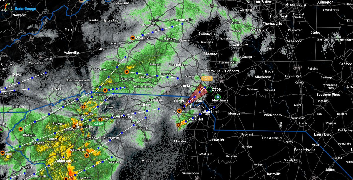
Current Doppler radar in Belmont (NC) and Clover (SC) is indicating heavy to torrential rain actively falling in your areas. Expect rapidly rising water on roads, potential for ponding, and reduced visibility. Drive with extreme caution! #NCWX #SCWX #CLTWX #PAWSevere25
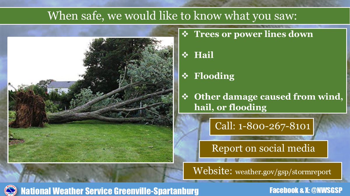
If you received damage from the storms overnight/early Saturday morning, the National Weather Service in Greenville-Spartanburg (SC) would like to know what you saw. Check out the graphic from @NWSGSP for more information. #NCWX #SCWX #CLTWX #ProAlertWeather #PAWSevere25 #NWSGSP
PRESS STATEMENT 17 May 2025 • 11:30 AM EDT Pro-Alert Weather Successfully Recovers Original YouTube Channel #ProAlertWeather #YouTube #Weather #NCWX #SCWX #CLTWX
Doppler Radar Update 9:00 PM EDT (April 6, 2025) Full update on Facebook. #NCWX #SCWX #CLTWX #ProAlertWeather #PAWSevere25 #SevereWeather #DopplerRadar
Doppler Radar Update 7:30 PM EDT (April 6, 2025) Showers are currently moving into Uptown #Charlotte at this time. Nothing severe, but stay with Pro-Alert Weather for the latest. #NCWX #SCWX #CLTWX #ProAlertWeather #JDHuffmanPAW
Doppler Radar Update 7:00 PM EDT (April 6, 2025) Showers are beginning to move into the Charlotte Metro area, with one cell forecasted to arrive in Uptown Charlotte within the next 10 to 15 minutes. Stay with Pro-Alert Weather for the latest #NCWX #SCWX #CLTWX #ProAlertWeather
Doppler Radar Update 6:30 PM EDT (April 6, 2025) Showers are getting closer and closer to #Charlotte. Still no severe alerts on the board, but that could change over the next few hours. Stay with Pro-Alert Weather for more. #NCWX #SCWX #CLTWX #ProAlertWeather #JDHuffmanPAW
Latest Doppler Radar as of 6:00 PM EDT (April 6, 2025). Next update at 6:30 PM EDT. #NCWX #SCWX #CLTWX #JDHuffmanPAW #ProAlertWeather #Charlotte #PAWSevere25 #DopplerRadar

Current Doppler Radar as of 6:00 PM EDT (April 6, 2025). No active severe alerts for the #Charlotte Metro area as of this time, but be ready to seek shelter if a warning is issued. #NCWX #SCWX #CLTWX #ProAlertWeather #JDHuffmanPAW #PAWSevere25 #DopplerRadar
A look at the unseasonably warm temperatures for today and Saturday, along with the next chance of rain starting Sunday. Full update on Facebook. #NCWX #SCWX #CLTWX #Charlotte #JDHuffmanPAW #ProAlertWeather #PAWSevere25
Unseasonably warm temperatures today and Saturday, and then our next weather system moves in on Sunday. Full update on the Pro-Alert Weather Facebook page. #NCWX #SCWX #CLTWX #JDHuffmanPAW #ProAlertWeather #Charlotte #PAWSevere25 @ProAlertWeather
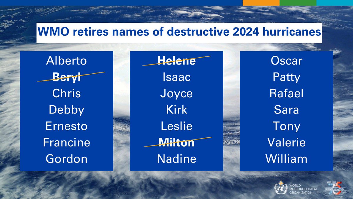
The @WMO has retired three Atlantic basin names: Beryl, Helene, and Milton, after a very active and destructive 2025 Atlantic hurricane season. #Helene #Beryl #Milton #AtlanticHurricaneSeason #HurricaneSeason #ProAlertWeather #NCWX #SCWX #CLTWX

The WMO Hurricane Committee has retired the names Beryl, Helene and Milton from its Atlantic basin name list and John from the eastern Pacific basin name list because of the death and destruction these storms caused in 2024. wmo.int/news/media-cen…
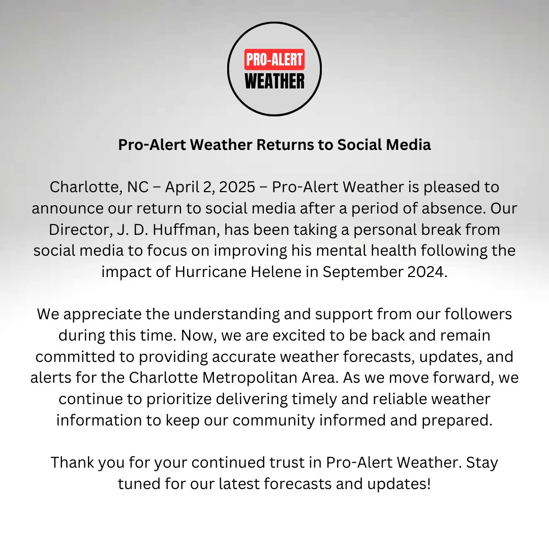
PRESS STATEMENT WEDNESDAY, APRIL 2, 2025 #ProAlertWeather #JDHuffmanPAW #NCWX #SCWX #CLTWX #Charlotte #PressStatement
Here is your #Halloween 2023 Forecast from #ProAlertWeather and J. D. Huffman (@JDHuffmanPAW). #NCWX #SCWX #CLTWX #JDHuffmanPAW #Weather #WeatherForecast
Cloudy conditions will continue into the evening with temperatures in the lower to mid 50s, so it might be a good idea to have a jacket on standby for the trick-or-treaters. #NCWX #SCWX #CLTWX #ProAlertWeather #JDHuffmanPAW #Halloween #WeatherForecast @ProAlertWeather
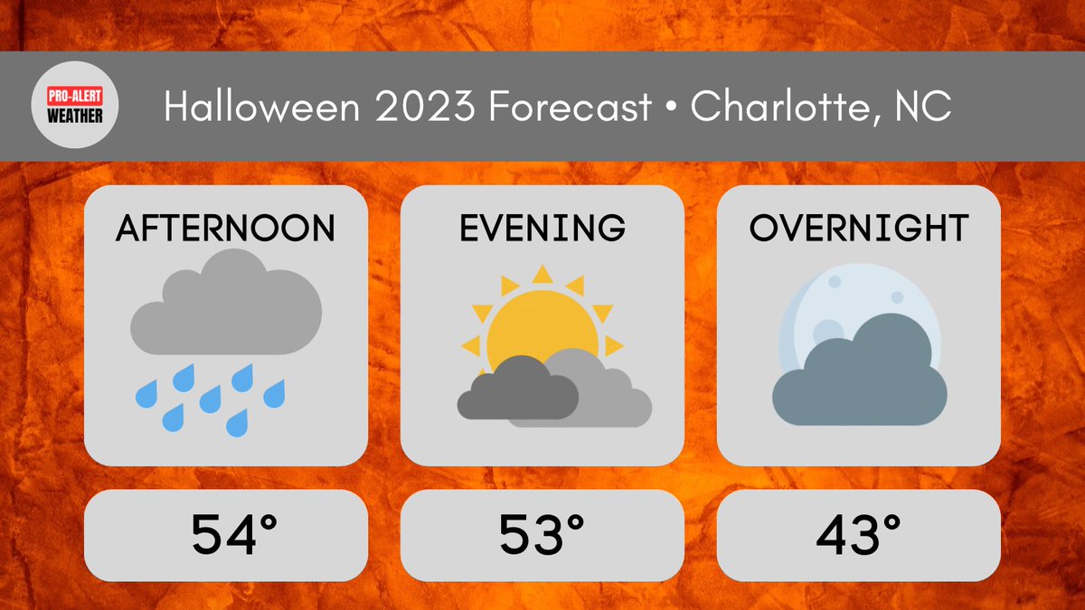
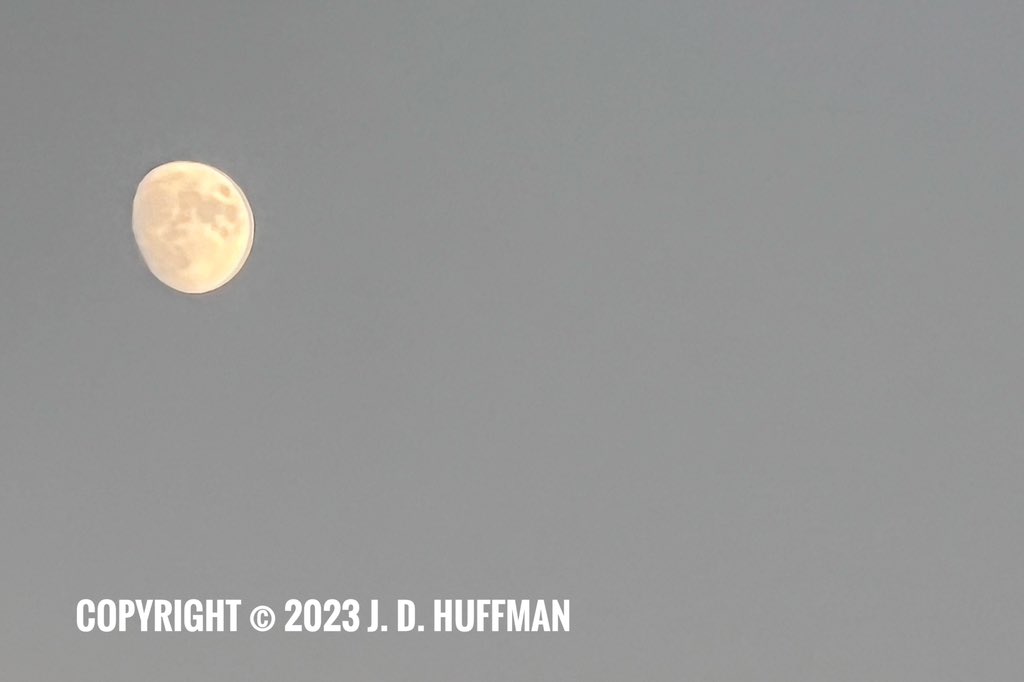
Photo of the #Moon in Gastonia, NC on Wednesday evening (10/25/2023). Photo courtesy of J. D. Huffman (@JDHuffmanPAW). #NCWX #CLTWX #JDHuffmanPAW #PAWFall23 #ProAlertWeather


United States Trends
- 1. Good Thursday N/A
- 2. #thursdayvibes N/A
- 3. #AgendaEnergética N/A
- 4. Happy Friday Eve N/A
- 5. #DareYouToDeathEP8 N/A
- 6. LINGORM EMDISTRICT CNY2026 N/A
- 7. #EMDISTRICTCNY2026xLingOrm N/A
- 8. JUNGKOOK N/A
- 9. Jessie Diggins N/A
- 10. #ThursdayThoughts N/A
- 11. Timo N/A
- 12. Día de la Juventud N/A
- 13. Richard Gere N/A
- 14. ICE Custody N/A
- 15. Scott Jennings N/A
- 16. Leon Black N/A
- 17. Latvia N/A
- 18. The IOC N/A
- 19. Vote YES N/A
- 20. $NBIS N/A
You might like
-
 Meteorologist Kailah Gordon
@KailahGordon -
 Riley Blackwell
@rblackwell_wx -
 Jackson Chastain
@jchastainwx -
 ℂ𝕙𝕝𝕠𝕖
ℂ𝕙𝕝𝕠𝕖
@wx_chloe4 -
 Miller Hyatt
@millerhyattwx -
 Alexis Swanson
@aswansonweather -
 Paul Austin
@diftone -
 Curt Yowell
@Storm11275 -
 Chris Denmark
@cdenmarkwx -
 Den
Den
@onefunden -
 Meteorologist Mark Baldwin
@meteo_mark -
 Cassie O
@cumuluscassie -
 Jake Lambright
@jakelambright -
 Peyton Campbell
@PeytonCampbelWX -
 Meteorologist Tori Alvarado
@torialvaradowx
Something went wrong.
Something went wrong.