SpatialExplorer
@SpatialExploler
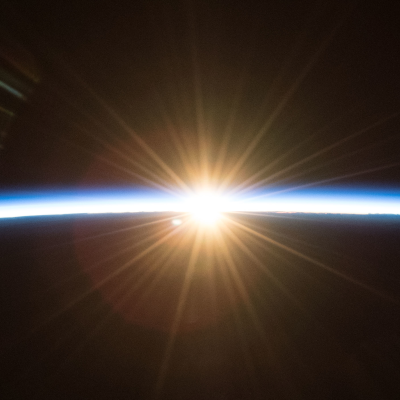
The Big Picture spectator ;)


CIA Built "12 Secret Spy Bases" In Ukraine & Waged Shadow War For Last Decade, Bombshell NYT Report Confirms zerohedge.com/geopolitical/c…
Ed Fairburn repurposes old maps, transforming them into beautiful, highly-detailed portraits, merging landscape and humanity, reminding us that we are a product of our environment & vice versa [📹 edfairburn]
A striking example of the usefulness of historical aerial/satellite photographs/images.⏱️🛩️🛰️

Gamalt kort af Grindavík frá 1957 á vefnum map.is sýnir gamla sprungu eða sigdal sem fer í gegnum allan bæinn. Við bárum þetta saman við drónamyndband sem Ragnar Visage tók í dag af sama svæði. Skemmdirnar á Austurvegi eru ofan á gömlu sprungunni.

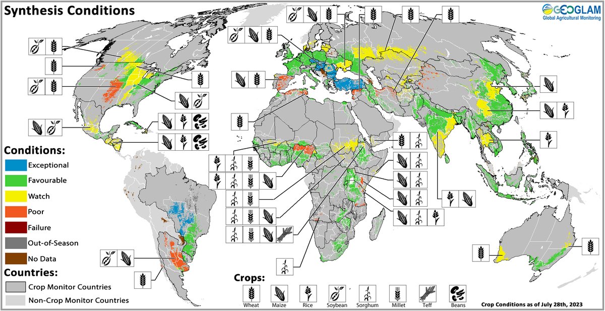
Out today: The #CropMonitor August reports. #CM4AMIS, #CM4EW, and the Global Crop Monitor showing crop conditions across the world. Full reports available at cropmonitor.org
Great tool for #stereoscopic observations 👏, although it needs some more tweaks! It reminded me Stereo GE Browser (for #GoogleEarth). Get 👓 and enjoy! #Photogrammetry #3D

I've revisited my Stereoscopic map to give the 3D a bit of a boost + a way to tweak the colour based on your monitor (better on more monitor / glasses combos). You can dig out some $1 anaglyph glasses ^🔴-🔵^ or put the map in crossview mode if yr brave! steveattewell.com/stereomap/#45.…

What is ignored or neglected by the media -- but will be studied by historians? Here's the full list of 25 examples:


A blog post by LinkedIn user Anass YARROUDH 👇 Introducing segment-lidar: Revolutionizing Unsupervised Instance Segmentation of Aerial LiDAR Data medium.com/@yarroudh/intr… #segmentanything #geospatial #lidar
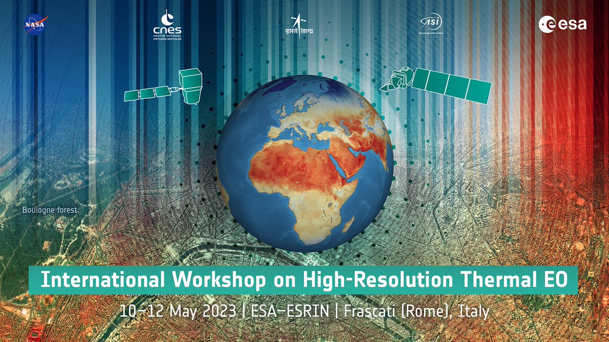
International Workshop on High-Resolution #Thermal #EO 🛰️- Day 2 NOW LIVE! youtube.com/live/7PoaeqqNY… / more info thermal2023.esa.int

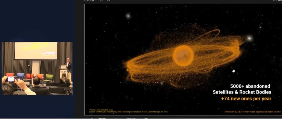
#GWF2023 | Kees Van Der Pols, @ClearspaceToday explains about 3 types of Space Debris: 1. We can see & know their position 2. We know exist but we don’t know their position 3. We don’t see but we know can cause severe problems #GWF #spacedebris #SpaceJunk #geospatial #Space
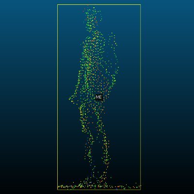
Excellent #uav #point_cloud collection animation

Have you ever wondered how the airborne lidar works? This is a great video from Bankole M -------------------- Join me in the Telegram group for full downloadable video/content - t(dot)me/michalgula #lidar #drone #technology #surveying #innovation
This is machine learning training on landscapes. StyleGAN3 is a generative adversarial network particurarly effective in generating photo-realistic faces [read more: buff.ly/3siB4Yl] [📹 Gene Kogan]

✨ Today we are ready to take AI Graphics to the next level: full volumetric photorealistic NeRF rendering on the web. All in realtime! What you see is what you get for photorealistic 3D is finally here! Starting with the the Fields Editor soon you’ll be able to reshoot in…

Determine which satellite bands you need for your research. The interactive Landsat Spectral Characteristics viewer helps researchers find the right combination. landsat.usgs.gov/spectral-chara…
Amazing analogue technique, now similar effects are created by algorithms...

Absolutely amazing perspective on rubbing Your 👀

This is what eye rubbing looks like through an MRI scanner. Credit: Damien Gatinel
Amazing explanatory video and channel. 👏How does #Starlink #Satellite #Internet Work?📡☄🖥 youtu.be/qs2QcycggWU via @YouTube

Welcome to space! First contact with #EnMAP has been established 📡. The satellite 🛰 will now be commissioned, its systems powered up & the target orbit adjusted.

"The Dirty Work Of Going Through Old Positions On Bank Balance Sheets Is Being Done Around The Clock As We Speak" zerohedge.com/markets/dirty-…


United States الاتجاهات
- 1. Delap 16.2K posts
- 2. Good Saturday 28.6K posts
- 3. Guiu 5,850 posts
- 4. Burnley 35.2K posts
- 5. Andrey Santos 3,564 posts
- 6. Gittens 8,663 posts
- 7. Chelsea 104K posts
- 8. #SaturdayVibes 4,054 posts
- 9. #Caturday 3,032 posts
- 10. #BURCHE 20K posts
- 11. Enzo 32.1K posts
- 12. Neto 22.5K posts
- 13. #askdave N/A
- 14. Maresca 18.7K posts
- 15. Joao Pedro 6,689 posts
- 16. Tosin 8,569 posts
- 17. The View 100K posts
- 18. #MeAndTheeSeriesEP2 580K posts
- 19. Chalobah 4,489 posts
- 20. Somali 87.2K posts


Something went wrong.
Something went wrong.