JG_RS_GIS
@jg_rs_gis
All things Remote Sensing and Geographic Information Science 🛰️📡🛩️🤖 Currently working with Remote Sensing @OrdnanceSurvey All views are my own.
You might like


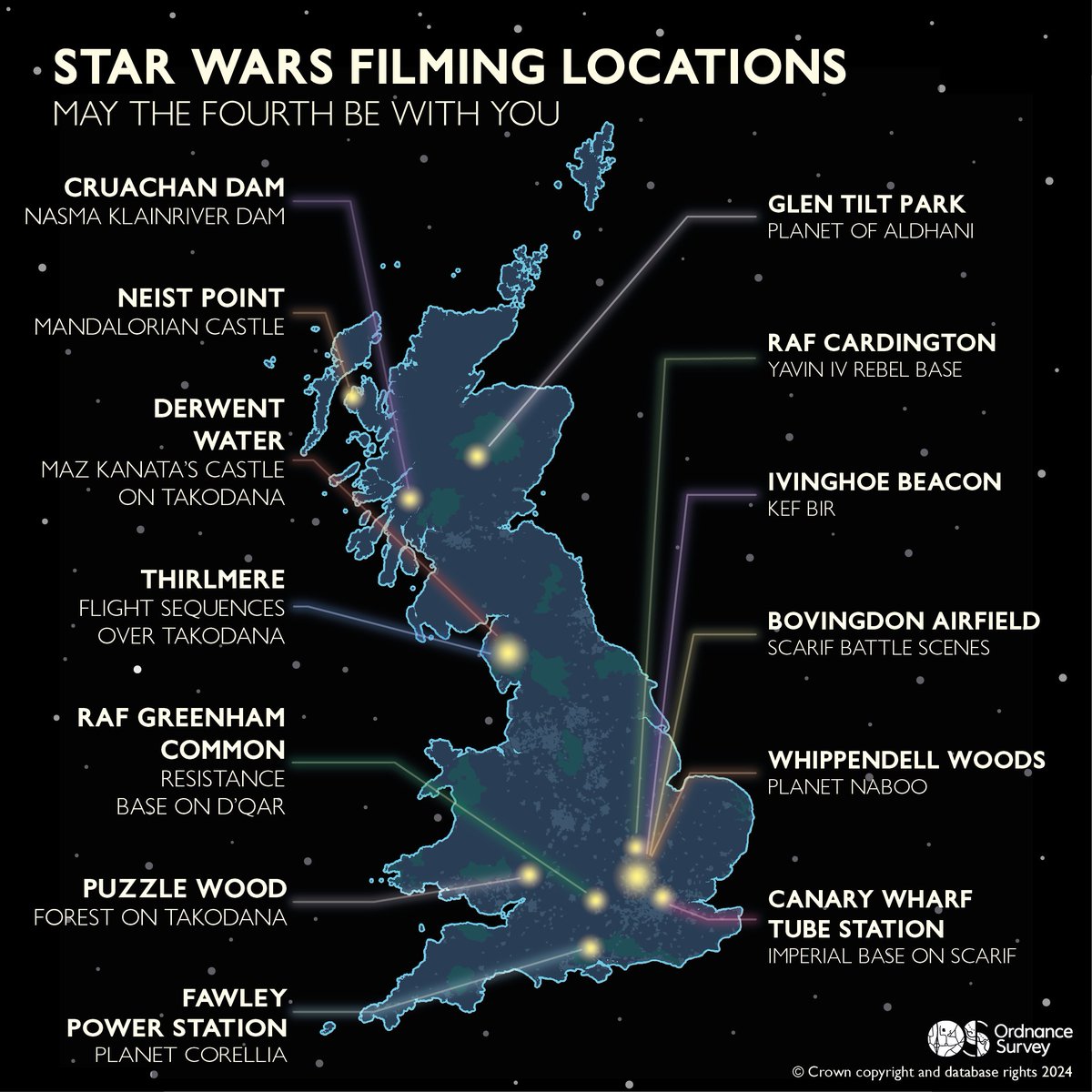
May the fourth be with you! 🌌 Have you visited any of these locations? #StarWarsDay #MayThe4th

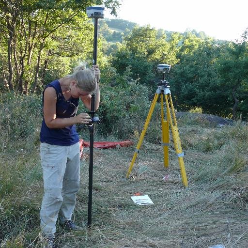
Bernhard Schachinger meets other participants of the successfully completed VOLTA (innoVation in geOspatiaL + 3D daTA) project in Italy! It was once again fantastic to exchange professional knowledge through presentations and discussions. @VOLTA_MSCA @3DOMFBK @FBK_research


Did you know BGS uses #Minecraft to help make geology more accessible? We've built 5 worlds to allow you to explore underground: we use real geological data to show what it's like under the surface. 🧵

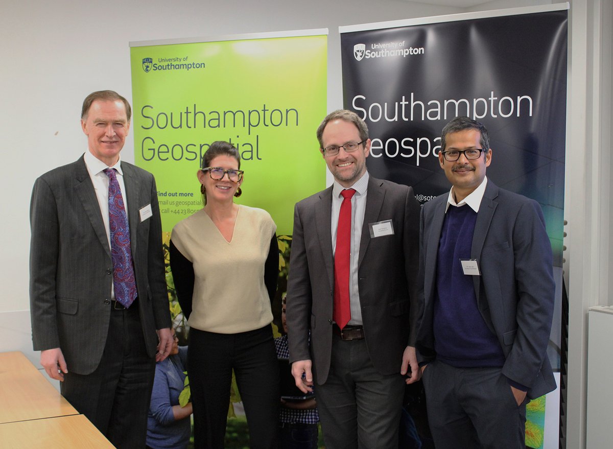
It's great to join forces through this new partnership to enable knowledge sharing and cutting-edge geospatial research to drive greater insights from location data. 👏

As a UK leader in geospatial innovation, we’re very proud to announce our collaboration with fellow leader @OrdnanceSurvey. Together, we aim to drive the nation forward, transforming location data and technologies to lead in innovation. Discover more 👉 brnw.ch/21wGbqy
Ordnance Survey’s Product Managers, Mark Stileman and Chris Heap, share how Britain’s national mapping agency could help customers see the world in more depth and detail. geobusinessshow.com/seeing-the-wor… #realitycapture #3dmodeling #photogrammetry #3dgis #3d #gis
We're excited to join #GITEXGLOBAL Dubai 16th - 20th October. Discover how we can accelerate your progress with our consulting services, unlocking unrivalled location intelligence to benefit people and the economy. @GITEX_GLOBAL
📣 PRODUCT LAUNCH: Introducing the NEW #UltraCamDragon 4.1 - a game-changing HYBRID imaging and LiDAR system. This camera kicks off our INTEGRATED LINE, featuring hybrid-source based aerial mapping systems. ➡️ Press: bit.ly/3ZMi8Rv ➡️ Details: bit.ly/3QkBZEt
📣 PRODUCT LAUNCH: Introducing the NEW UltraCam Merlin 4.1: Your strong base for professional aerial data collection! UltraCam Merlin 4.1: ✔️ available in 2 models ✔️ starts new FUNDAMENTAL LINE ➡️ Press release: bit.ly/3FcHP4m ➡️ More details: bit.ly/3QkBZEt
Exciting News: Unveiling NEW #UltraCam Product Lines! 📣 Vexcel CEO Alexander Wiechert reveals our new UltraCam product lineup, designed to meet all mapping applications. This year, we are introducing TWO remarkable systems! ➡️ FIND OUT WHAT'S NEW: bit.ly/3ZQRSp8
Have you ever spotted the OS plane? May was one of the busiest months for our Flying Team due to the good weather ☀️ This DataViz shows GPS tracks of two of our aircrafts making their way over GB!

#GIS job descriptions be like "Must be an expert in SQL, Python, R, Javascript, FME, every ESRI tool ever made, QGIS, a really niche remote sensing programme HR found on chatGPT, and... excel." You just know which of those you'll be using the most #gischat


Are you already familiar with Aerial Triangulation, one of the key features within UltraMap Studio? It is the process of calculating precise image orientations of an entire image block in a mapping frame. Learn more: bit.ly/3QMsQBa #vexcelimaging #ultramap


Well deserved @OrdnanceSurvey in winning the 2022 Enterprise GIS award at #EsriUC
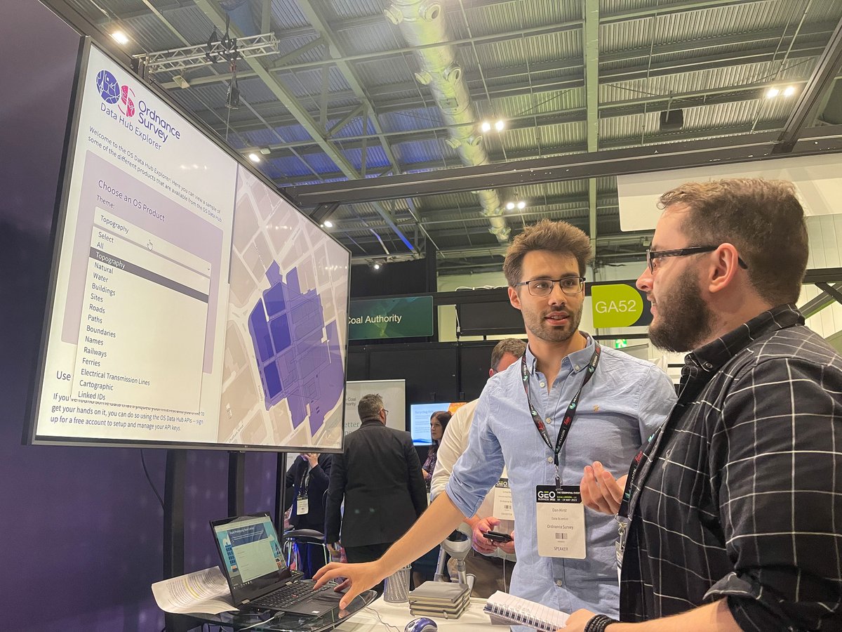
Did you know you can explore OS Data Hub capabilities yourself in our Explorer? Discover more about our open and premium options, and learn more: ow.ly/Bu3X50JjH4g

Excellent reporting.

As BP announced bumper profits of £9.5bn today, we can reveal that the company's North Sea oil operations have cost the UK taxpayer hundreds of millions of pounds. @heliaebrahimi reveals that in 2019 BP had an effective tax rate of minus 54%. channel4.com/news/huge-prof…

This meme that's been going around perfectly encapsulates why I avoid shapefiles as much as I can.


Electronic counter measures by Russia to hide military build up? Image from @EarthBlox shows border of #Ukraine in mid-Nov 2021. This is not your usual radio frequency interference on Sentinel1 - more like a saturating signal intended to obscure? #EOChat @wammezz @Steven_Ramage


I'm available for a full time permanent role in the New Year. If you are looking for someone who 'knows enough to be dangerous' please reach out (DM's are open).

The 2022 series of #elearning #courses from EuroSDR is now open for registration 💻📘 Check it out at eurosdr.net/education/cour… #Lidar #CrowdsourcedGeographicInformation #GeoBIM #3DCityModelling #3DPointCloud #EduServ20


United States Trends
- 1. Comey 53K posts
- 2. Thanksgiving 156K posts
- 3. Jimmy Cliff 28.4K posts
- 4. #WooSoxWishList 5,146 posts
- 5. #IDontWantToOverreactBUT 1,447 posts
- 6. Lindsey Halligan 9,067 posts
- 7. #NutramentHolidayPromotion N/A
- 8. DISMISSED 26.9K posts
- 9. Pentagon 10.5K posts
- 10. The Department of War 12.4K posts
- 11. Sen. Mark Kelly 17.1K posts
- 12. #MondayMotivation 14.5K posts
- 13. DOGE 242K posts
- 14. #stayselcaday 4,774 posts
- 15. TOP CALL 5,218 posts
- 16. Hal Steinbrenner N/A
- 17. Monad 182K posts
- 18. Victory Monday 5,261 posts
- 19. Justin Tucker N/A
- 20. Zach Bryan N/A


Something went wrong.
Something went wrong.