
WeatherDrops4567
@WeatherGamer45
I am a weather enthusiast and a Roller Coaster Maker in Ultimate Coaster 2 and Planet Coaster. 4567 is just a random # combination that I made up.
You might like


WOW! A potential G5 (Extreme) Geomagnetic Storm is inbound, with a chance for widespread aurora tonight! This could impact satellites and power grids. We're tracking the CME's arrival LIVE on YouTube & X right now! #spaceweather #aurora #NorthernLights

#BREAKING: Hurricane Melissa Fatality Total: 90+ {14+ Remain Missing} [Update as of 8:20 PM EST on November 4, 2025] ➼43+ in Haiti ➼35+ in Jamaica •32 Direct/3 Indirect ➼4 in the Dominican Republic ➼4 in Panama (Indirect) ➼2 in Cuba ➼2 in the United States (Indirect)…

🚨 Kick Time Set at Northwestern ⏰ Noon ET 📍 Wrigley Field 📺 Fox


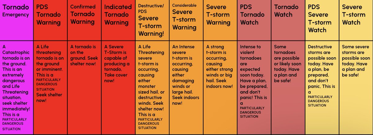
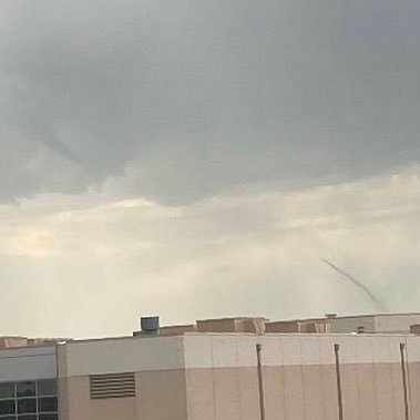
A tornado watch has been issued for parts of Louisiana and Texas until 10 PM CDT


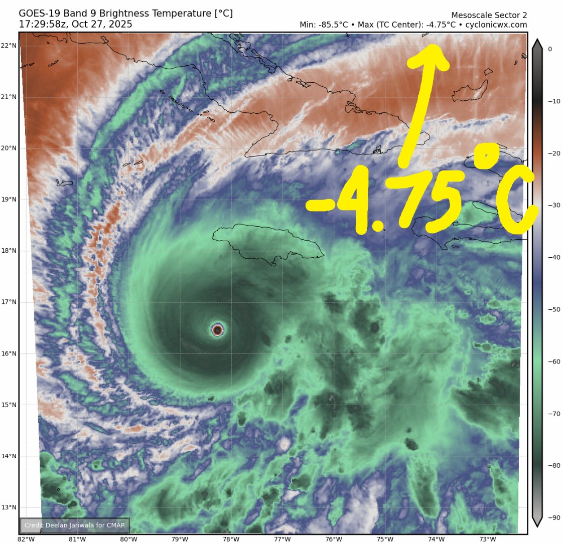
Within the modern satellite era, Hurricane Melissa now has the record driest eye measured on Earth

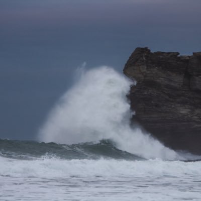
Unreal. If you’re anywhere near this thing, do everything you can to get to safety now.

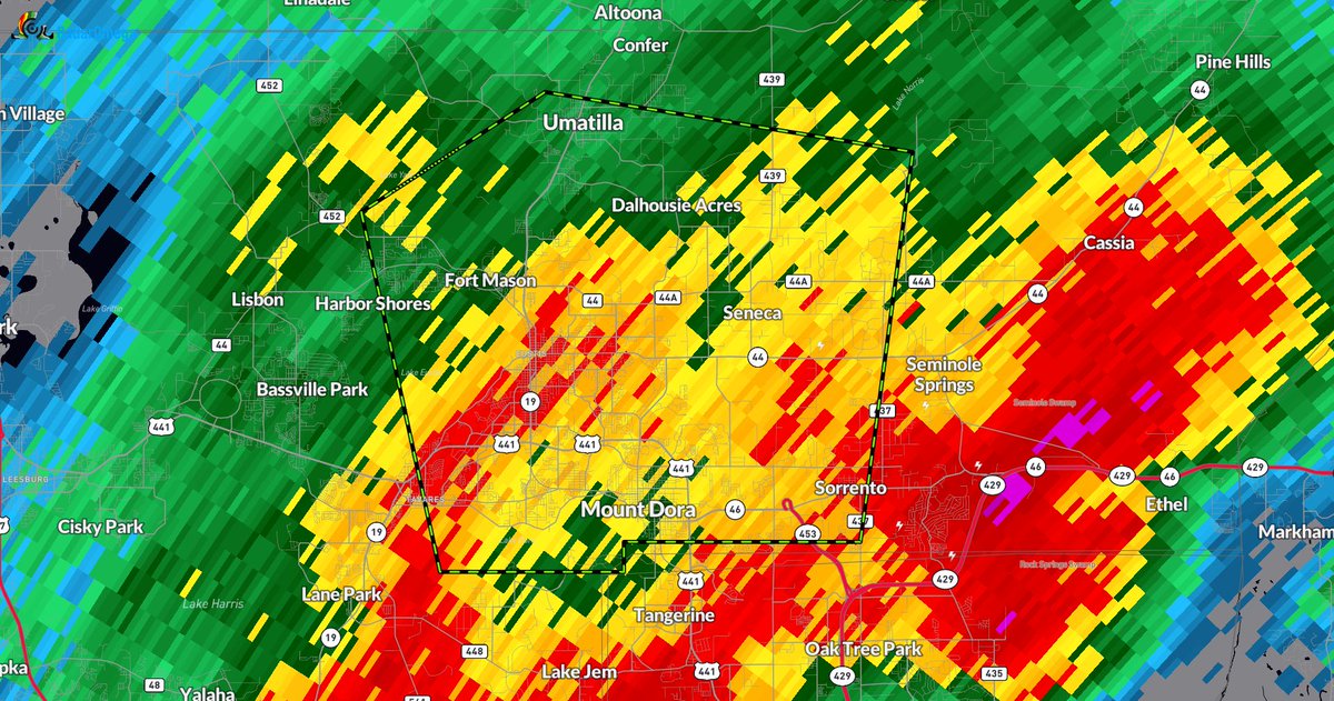
BREAKING: FLASH FLOOD EMERGENCY IN MOUNT DORA, FLORIDA! 15-18" of rain has fallen, 2-3"+ more rain is coming. Get to higher ground now!
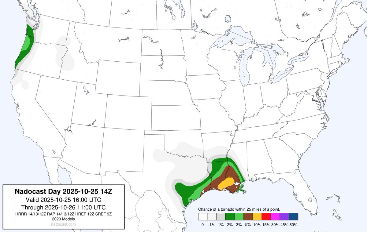
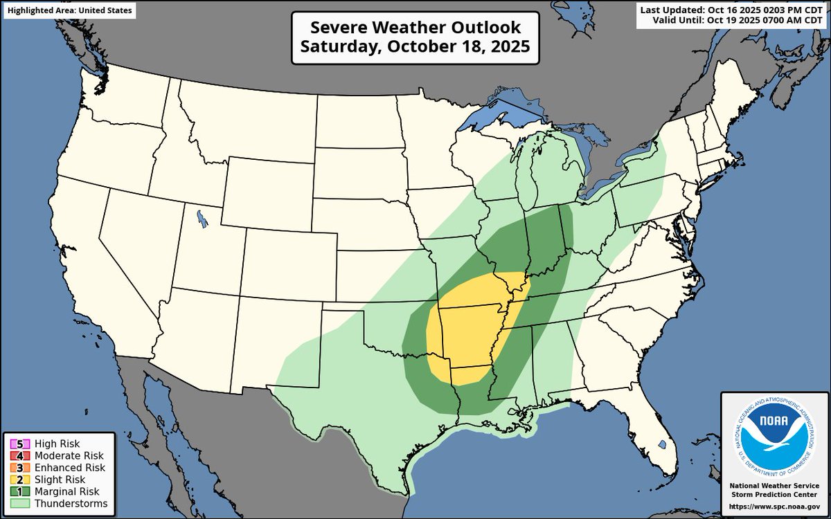
Today: A 5% tornado risk is in place for TX and LA, as a few brief tornadoes appear likely. In the early stages of the line of storms that will form, a few supercells may form, causing significant hail, damaging winds, and even a possibility for a brief strong tornado. #tornado
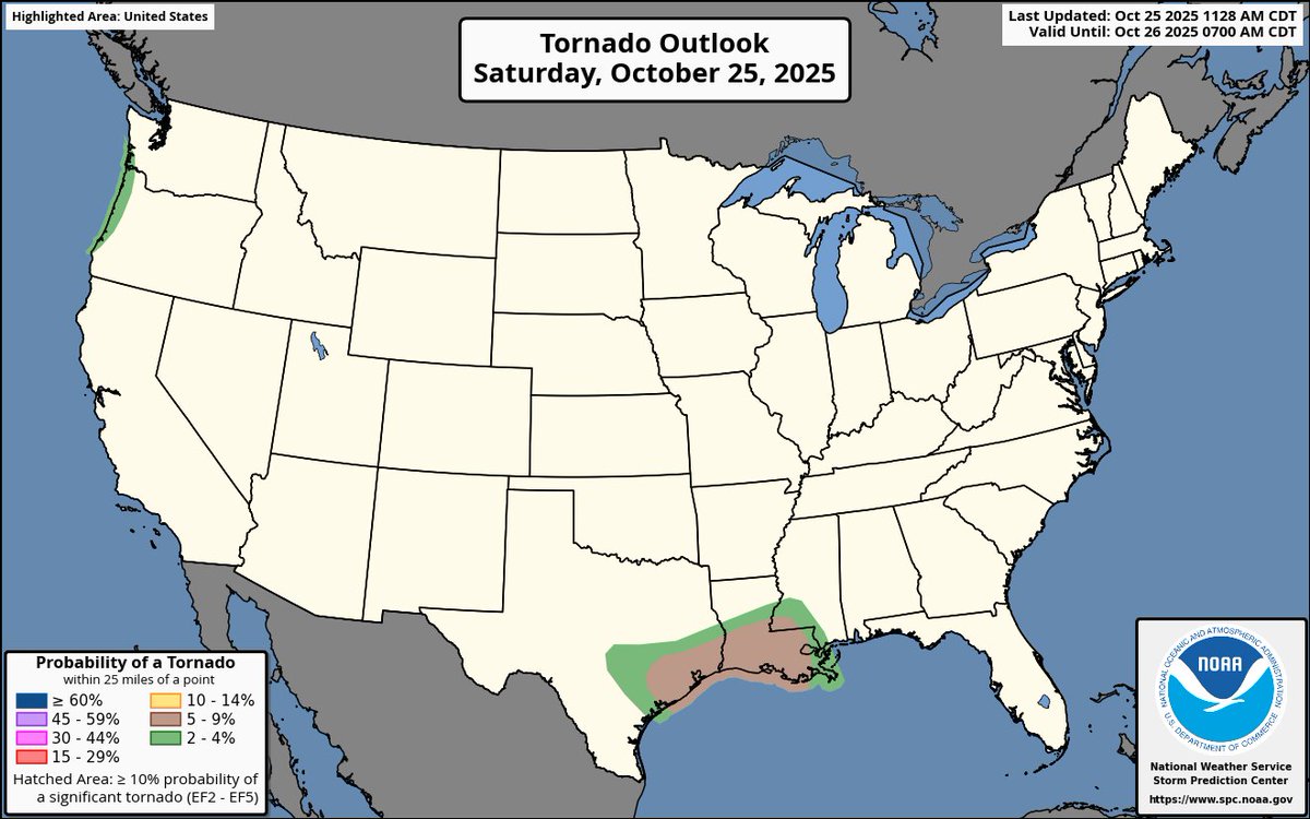
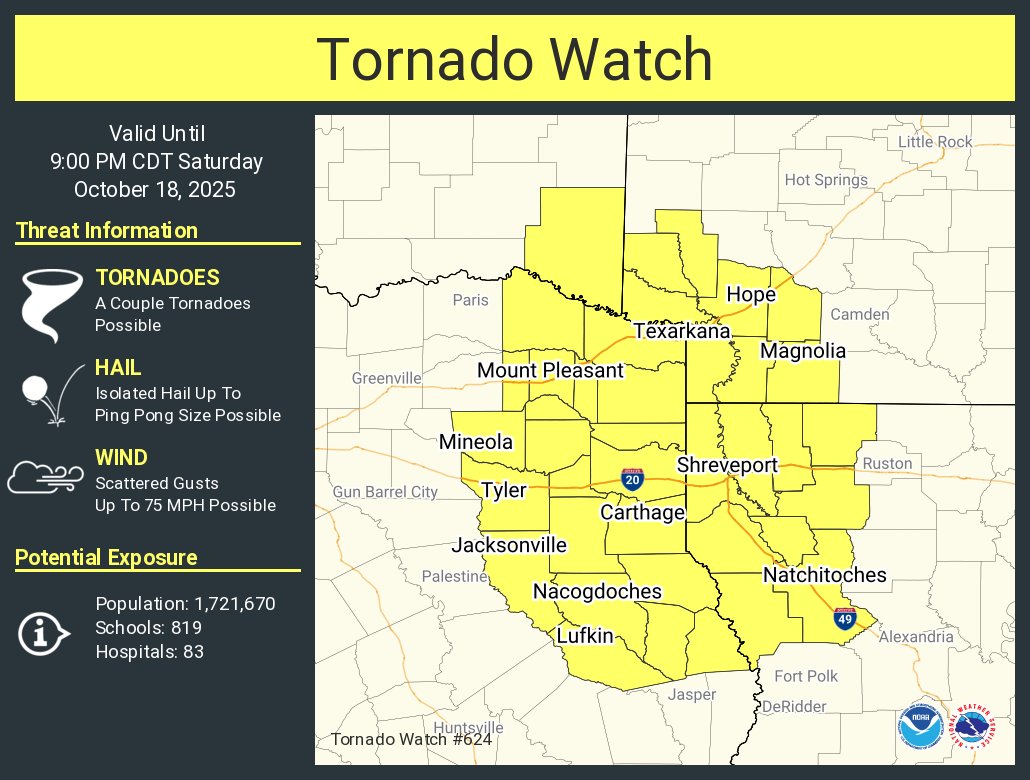
A tornado watch has been issued for parts of Arkansas, Louisiana, Oklahoma and Texas until 9 PM CDT
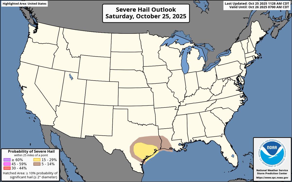
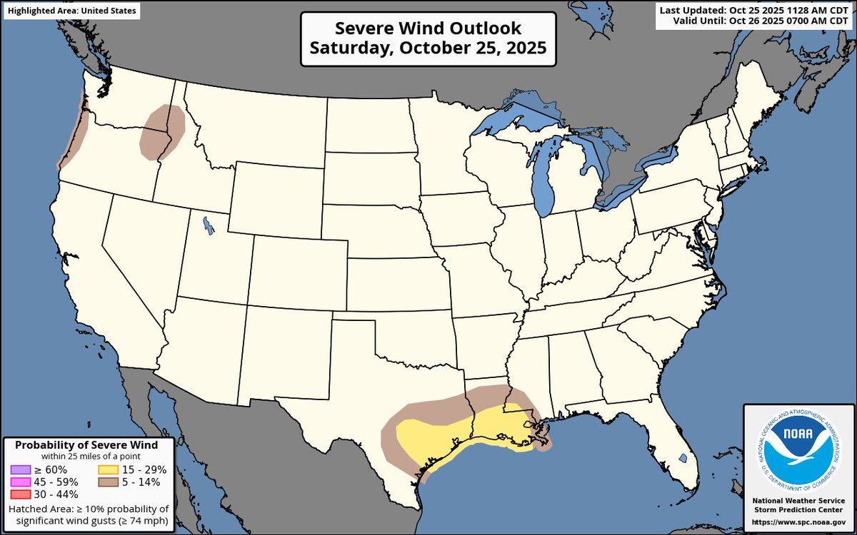
Saturday: A large severe weather event is possible this Saturday for several central-southern states. Damaging winds seem to be the main threat as of now, but large hail and a couple tornadoes appear possible as well. #tornado #severewx

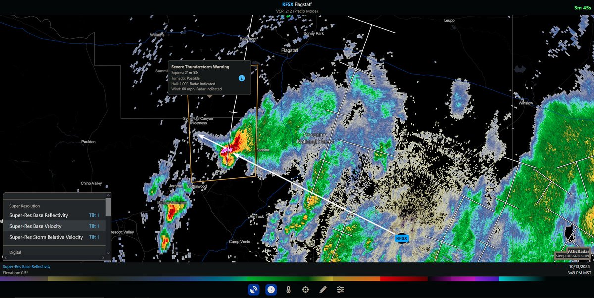
the storm west of sedona rn is exhibiting a three-body scatter spike & had this particularly impressive presentation on radar just a moment ago #azwx

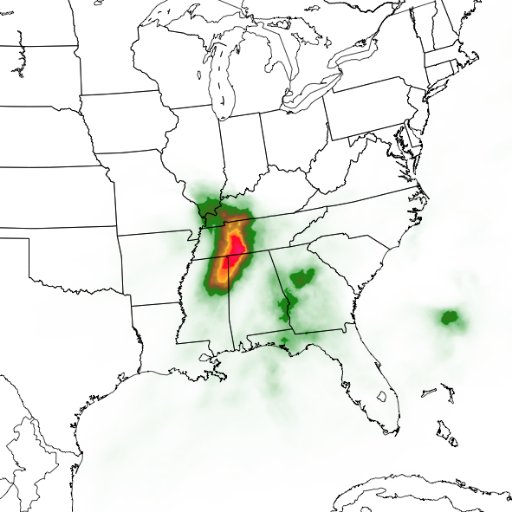
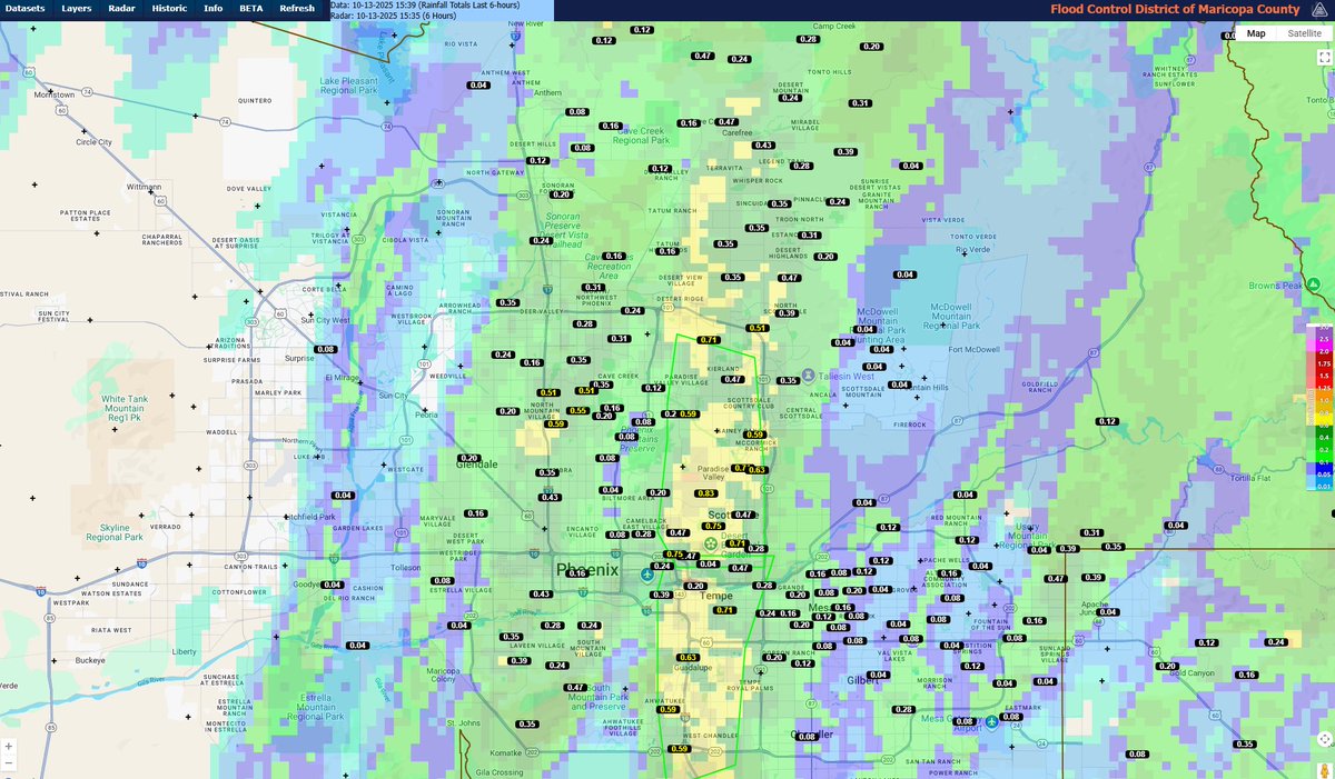
3:50pm - Here are the latest 6-hour rainfall amounts. This rain came down fast - with rainfall rates over half an inch in just 15 minutes in the Arcadia area! #azwx
Fall severe weather / tornado season is upon us.

I'm building 24/7 YallBot weather streams for EVERY SINGLE STATE in America! Each one locally focused, live, and running nonstop. Which state should we launch first? Can probably handle 1-2 new states per month while we scale up the backend.

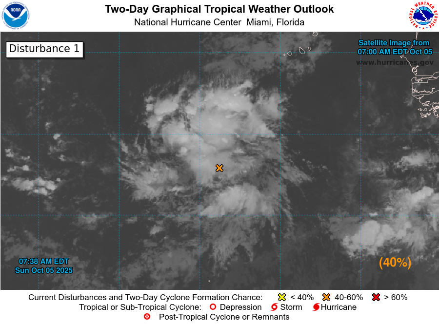
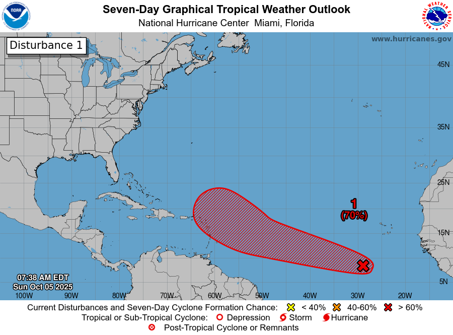
8am EDT Oct 5th -- NHC is monitoring an area of low pressure associated with a tropical wave (#AL95) which now has a high chance (70% 🔴) of formation over the next week. It is forecast to approach the Leeward Islands by late this week. Latest outlook: hurricanes.gov/gtwo.php?basin…
Humberto certainly looks like a CAT 5 to me! Insane presentation on the WeatherWise app!
A tornado watch has been issued for parts of Arkansas and Oklahoma until 10 PM CDT


A severe thunderstorm watch has been issued for parts of Colorado, Kansas and Oklahoma until 3 AM CDT


United States Trends
- 1. FINALLY DID IT 793 B posts
- 2. The BONK 242 B posts
- 3. The ORE 33 B posts
- 4. #DigitalBlackoutIran 186 B posts
- 5. #FanCashDropPromotion 1.878 posts
- 6. ICE Watch 175 B posts
- 7. #LawEnforcementAppreciationDay N/A
- 8. Algorhythm Holdings N/A
- 9. #FursuitFriday 7.020 posts
- 10. Ketel Marte N/A
- 11. Good Friday 75,7 B posts
- 12. The BULLISH 39,2 B posts
- 13. #FridayVibes 4.073 posts
- 14. The SEC 134 B posts
- 15. Jon-Eric Sullivan 3.743 posts
- 16. Blade 25,7 B posts
- 17. Hail Mary 7.773 posts
- 18. Publix 1.310 posts
- 19. The WHITEWHALE 14,5 B posts
- 20. National Law Enforcement Day 8.229 posts


Something went wrong.
Something went wrong.