
Jeremy Wright
@inertcatnip
Product Engineer, Esri -- opinions are my own, not my employer's.
Vous pourriez aimer


If you are planning your migration from ArcMap to ArcGIS Pro, this free one-hour training seminar can help: ow.ly/yMv830sNvQV Expert Esri presenters will discuss key ArcGIS Pro terminology and components and demonstrate how to migrate maps and other items to ArcGIS Pro.


Are you attending the #EsriUC? Did you know that you can sign up for a 1:1 meeting with a migration specialist? #EsriWater #ArcGIS ow.ly/y2U450Wh0ts
so...a cardinal gin?

Possibly my greatest contribution to #cartography - the gin and tonic compass rose. You're welcome #gischat

Possibly my greatest contribution to #cartography - the gin and tonic compass rose. You're welcome #gischat

Learn how to export your map from #ArcGISPro to Adobe Illustrator and Photoshop in the newest video in the #ArcGISProShorts series! Recorded by: Thomas Coughlin Watch the video: ow.ly/x5a550Vw0AH

After calculating flood simulation in @ArcGISPro you can turn on "other layers" to add a little spice... ...like, for example, some lidar. 🧐 LAS data courtesy of @VCGI
Worst part about coming back from vacation is all the software and driver updates that pounce when you start up your laptop again.
Looking at Civil War maps? Or playing with Civil War maps? Or... a little bit of both...😆
Check out the newest video in our #ArcGISProShorts series to learn how to visualize wind turbine data with animated symbols in #ArcGISPro! Recorded by: Craig McCabe Watch the video: ow.ly/JVje50UYXoR
Explore how ArcGIS Aviation helps manage and analyze obstacles around airfields. Check out our StoryMap for a comprehensive guide! See how GIS is being used to protect air traffic corridors. Learn more: ow.ly/tirs50UX4sN


Artist James Cook renders detailed landscapes and portraits by typing a careful assemblage of letters, numbers, and punctuation marks onto sheets of paper using old / unwanted typewriters. This is the Flatiron building. [📹 jamescookartwork]

Car crashes are a leading cause of death worldwide. The first step in preventing them is understanding where and why they occur. 🔍 This (free) ArcGIS lab uses ArcGIS Pro to identify dangerous roads + calculate rates for crash analysis. Get started → esri.social/BBwv50Ux2qy

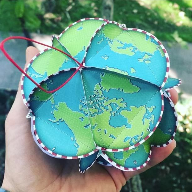
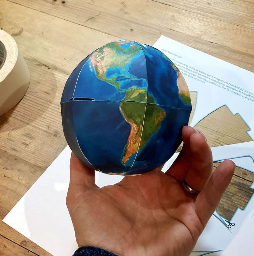
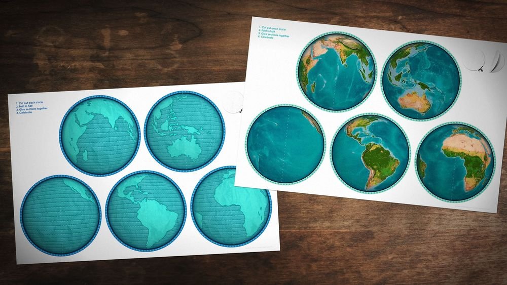
Here are 5 globe ornament crafts for you to consider for your work party or classroom project or just for funzies. esri.com/arcgis-blog/pr…

📣New functionality alert!📣 Check out the newest video in our #ArcGISProShorts series! In #ArcGISPro 3.4 you can now control the visibility of individual layers symbolized with Unique Values symbology. Recorded by: Grace Anderson Watch the video: esri.social/ow5b50Uj4WX
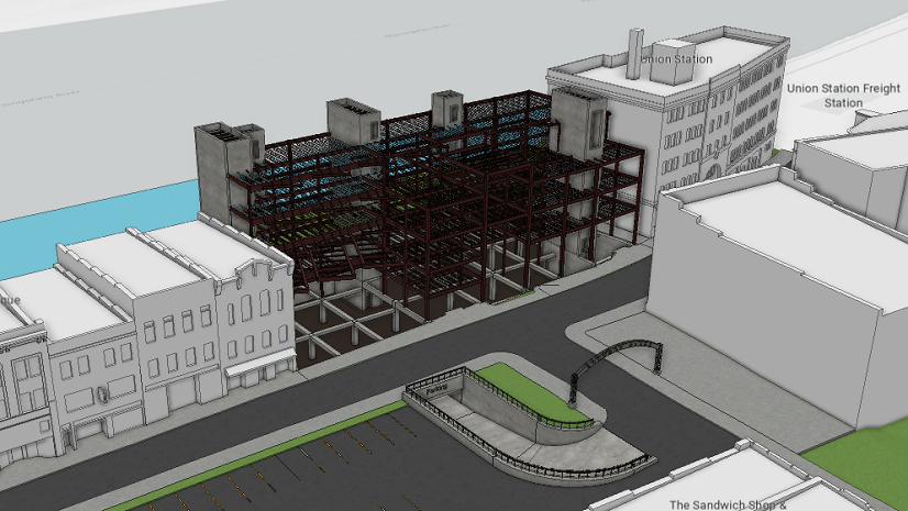
#ArcGISPro 3.4 introduces updates that boost workflows for GIS teams in AEC, transportation, and more! Check out the new features in this blog, including direct publishing of CAD datasets and updated support for BIM datasets. Learn more: esri.social/QtMu50Ug7He


United States Tendances
- 1. #VERZUZ 16.9K posts
- 2. Cash Money 19.6K posts
- 3. Mia X 563K posts
- 4. #HalloweenHavoc 31.1K posts
- 5. Wayne 29.6K posts
- 6. Birdman 2,928 posts
- 7. Tamar 6,138 posts
- 8. Master P 2,914 posts
- 9. Bama 14.6K posts
- 10. Mississippi State 5,893 posts
- 11. South Carolina 16.7K posts
- 12. Juvie 2,059 posts
- 13. Silkk 1,022 posts
- 14. Tatum 17.9K posts
- 15. Marcel Reed 1,631 posts
- 16. #HookEm 3,149 posts
- 17. Slow Motion 5,239 posts
- 18. Texas 139K posts
- 19. Harlem Berry N/A
- 20. Boo Carter N/A


Something went wrong.
Something went wrong.