#arcgisfieldmaps search results

Harness the power of location! Short video about Esri's easy to use mobile apps: #ArcGISWorkforce #ArcGISNavigator #ArcGISFieldMaps #ArcGISSurvey123 #ArcGISQuickCapture #ArcGISDrone2Map #ArcGISDashboards ow.ly/py6230sC8WY


Read this case study to learn all about how @CvilleFireDept modernized their field data collection workflow using #ArcGISFieldMaps. @GISPublicSafety Link ➡️ esri.social/mOuB50Pthi2


Ready to take your mobile mapping to the next level? Join Eos and Bolton & Menk on Oct. 22 for a hybrid webinar/workshop! See the Skadi Series in action with #ArcGISFieldMaps, explore real-world workflows, and learn from the experts! Register for free: buff.ly/PUH7VHQ


Discover how #ArcGISFieldMaps helped improve #ButterflyConservation efforts in Yamhill County, Oregon. esri.social/UlMz50Q59CA #GIS


Couldn't attend our hosted lunch session with Esri at #EsriUC2024? No worries! Watch the recording to catch up on the new Skadi Series #GNSS receivers, industry advancements, and updates for #ArcGISFieldMaps! Watch the session or read the transcript: ow.ly/MghF50SRuO2 #GPS


От новия брой на сп. Utilities можете да научите основните ползи, които ви дават #ArcGISWorkforce, #ArcGISSurvey123, #ArcGISFieldMaps, #ArcGISQuickCapture и други Есри ГИС приложения за оптимизиране на работата на терен. Прочетете сега 👉 bit.ly/3qRrZsp

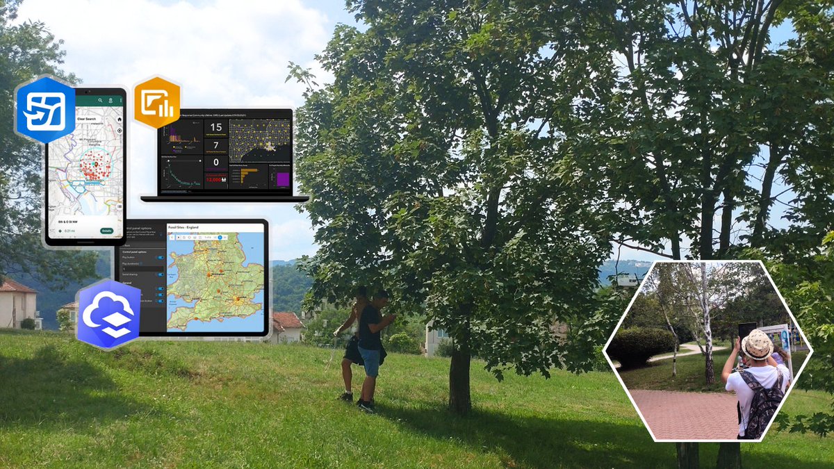
📱Само с таблет и📏метър 12 десетокласници от Велико Търново картотекираха 495 броя 🌳дървесна растителност в парк "Дружба", използвайки #ArcGISOnline, #ArcGISFieldMaps и #MapViewer за събиране и мониторинг на данните. #esri #MappingSkills #DataCollection #GISinSchool

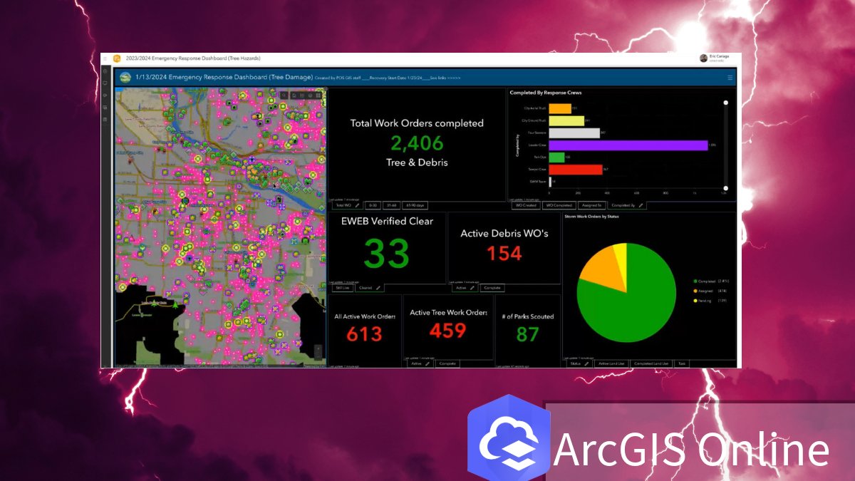
Streamline your storm response with #ArcGISOnline! Eugene's POS team uses #ArcGISFieldMaps for real-time data sharing and work order management. Learn more: esri.social/tYcs50TgXk0

🔍The next gen of ArcGIS Field Maps is here — and it’s in beta! Explore task coordination, offline utility networks, smarter forms, better indoor/outdoor data capture, and more. 📖 Learn more: geodatasystems.info/43q81Fn #ArcGISFieldMaps #WhatsNewWednesday
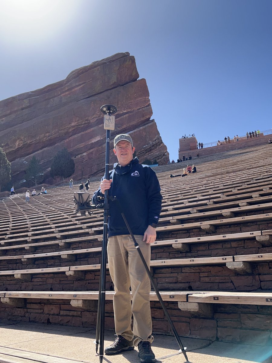
Check out the latest addition to our case study map! In this photo, Jim Casey collects data at Red Rocks Park and Amphitheatre in Colorado. He's using an Arrow Gold #GNSS receiver & #ArcGISFieldMaps to verify accuracy of previously captured drone imagery! eos-gnss.com/case-study-map

Harness the power of location! Short video about Esri's easy to use mobile apps: #ArcGISWorkforce #ArcGISNavigator #ArcGISFieldMaps #ArcGISSurvey123 #ArcGISQuickCapture #ArcGISDrone2Map #ArcGISDashboards ow.ly/Jvst30sCeIt

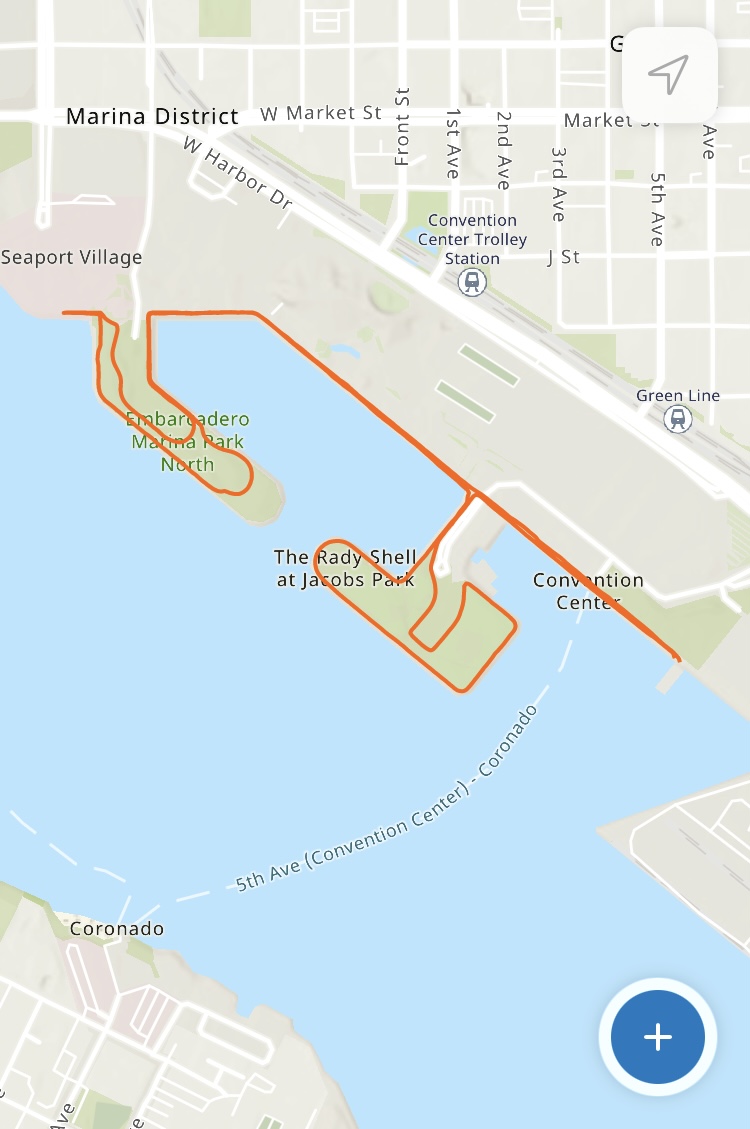
Skadi goes the distance! 🏃Manny Lopez of ASM Affiliates more than ran the #EsriUC 5K Fun Run — he mapped it! Using a Skadi 100 #GNSS receiver & #ArcGISFieldMaps, he captured his exact route in real time. 🛰️👟 Try Skadi for yourself in Booth 925: ow.ly/RnOb50WqTpK #EosGNSS


It’s been over 2 years since #ArcGISFieldMaps was first released and since then a number of updates have taken place. In our latest #GeoMarvelLive tutorial, we demo how to configure forms, create #geofences, and enable offline capabilities! Video & Blog: bit.ly/3H8fgp7


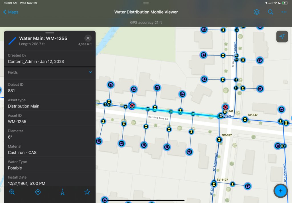
#ArcGISFieldMaps is Utility Network Aware! Users can view connectivity associations, structural attachments, and containment of assets. Tracing is also available within Field Maps! Learn more in this Industry Blog article: esri.social/Tllf50Qman2 #EsriWater #ArcGISUtilityNetwork

Harness the power of location! Short video about Esri's easy to use mobile apps: #ArcGISWorkforce #ArcGISNavigator #ArcGISFieldMaps #ArcGISSurvey123 #ArcGISQuickCapture #ArcGISDrone2Map #ArcGISDashboards ow.ly/ATew30sCar3


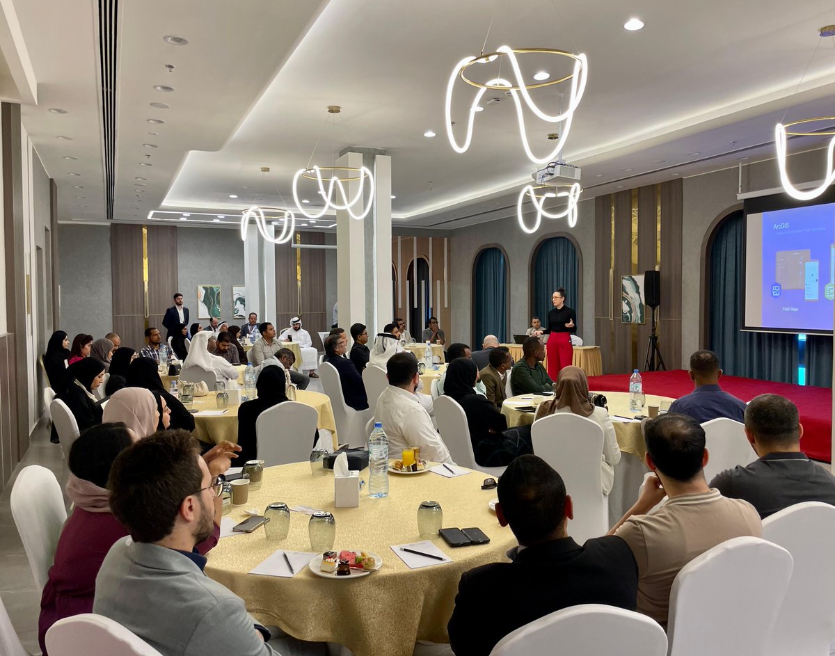
📍SHARJAH; Amazing insights are being shared on how #MobileGIS & #ArcGISFieldMaps are transforming field ops. Big thanks to our speaker Sarah Saint-Ruth and all the attendees! Explore more at esri.com/en-us/arcgis/p… #FieldOperations #ArcGIS #Esri #GIS #FieldDataCollection


A Colorado-based #RailwayManagement company is maximizing asset value by using #ArcGISFieldMaps and a custom #GIS app. esri.social/BBCu50Q59GE

See how Washington College’s Geospatial Innovation Program went from campus to canopy at Tuckahoe State Park! Using Arrow Gold #GNSS and #ArcGISFieldMaps, students mapped trails and gained hands-on experience by creating accurate maps for visitors. ow.ly/5LWW50TfCt9 #GIS

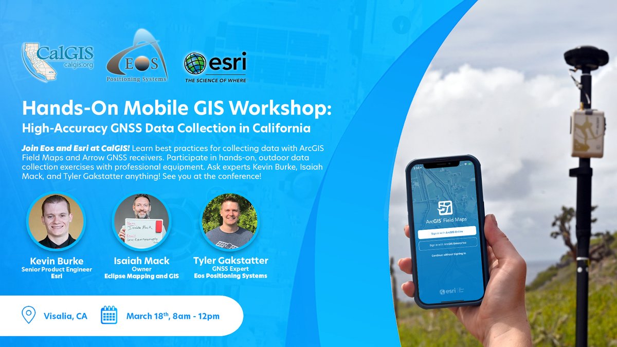
Unlock the power of high-accuracy data collection at this year’s #CalGIS! Attend this exciting hands-on workshop to delve into #GNSS fundamentals, best practices, and real-world mapping using #ArcGISFieldMaps. Elevate your #GIS skills! Register: ow.ly/ggjg50QIkRC @URISA
Want to learn more about the Invisible Range Pole? This video walks you through the setup & workflow for collecting a point using this innovative Skadi Smart Handle mode with #ArcGISFieldMaps! Watch the video or read the step-by-step transcript! ow.ly/wu5l50W1VRL #EosGNSS

Ready to take your mobile mapping to the next level? Join Eos and Bolton & Menk on Oct. 22 for a hybrid webinar/workshop! See the Skadi Series in action with #ArcGISFieldMaps, explore real-world workflows, and learn from the experts! Register for free: buff.ly/PUH7VHQ
Discover how Henry Hartnell combined his two passions — music & maps! Using Arrow #GNSS and #ArcGISFieldMaps, he brings high-accuracy mapping to festival stages, making construction faster, safer, & smarter. Full spotlight: eos-gnss.com/successes/cust… @LIBfestival @TheDoLaB #EosGNSS

Skadi goes the distance! 🏃Manny Lopez of ASM Affiliates more than ran the #EsriUC 5K Fun Run — he mapped it! Using a Skadi 100 #GNSS receiver & #ArcGISFieldMaps, he captured his exact route in real time. 🛰️👟 Try Skadi for yourself in Booth 925: ow.ly/RnOb50WqTpK #EosGNSS
Want to learn more about the Invisible Range Pole? This video walks you through the setup & workflow for collecting a point using this innovative Skadi Smart Handle mode with #ArcGISFieldMaps! Watch the video or read the step-by-step transcript! ow.ly/wu5l50W1VRL #EosGNSS
Want to see the Extensible Virtual Range Pole in action? Watch this new tutorial to learn the setup and workflow for collecting a point using this Skadi Smart Handle mode with #ArcGISFieldMaps! Watch the video or read the transcript: ow.ly/8IUa50W1U6G #EosGNSS #GIS
The Eos newsletter is out now! See how @spicergroupinc modernized St. Louis, MI's asset management using #EosGNSS and #ArcGISFieldMaps. Plus, explore the first all-Canadian Antarctic expedition, and dive into new Skadi Smart Handle tutorials and articles. eos-gnss.com/newsletters/20…
🔍The next gen of ArcGIS Field Maps is here — and it’s in beta! Explore task coordination, offline utility networks, smarter forms, better indoor/outdoor data capture, and more. 📖 Learn more: geodatasystems.info/43q81Fn #ArcGISFieldMaps #WhatsNewWednesday
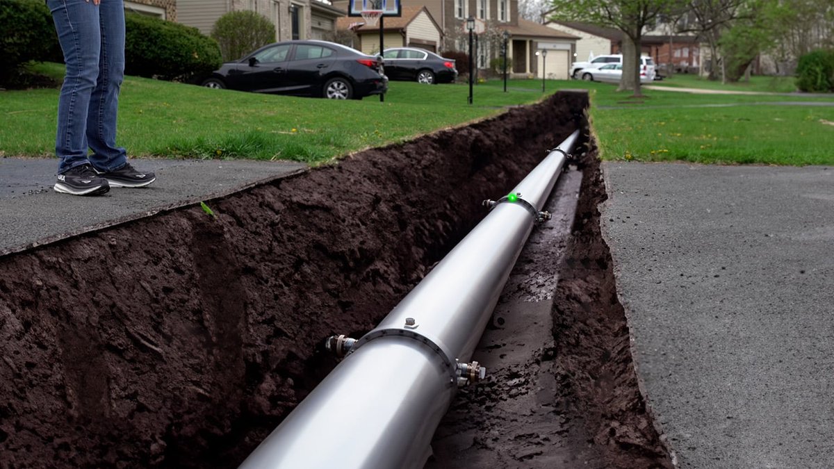
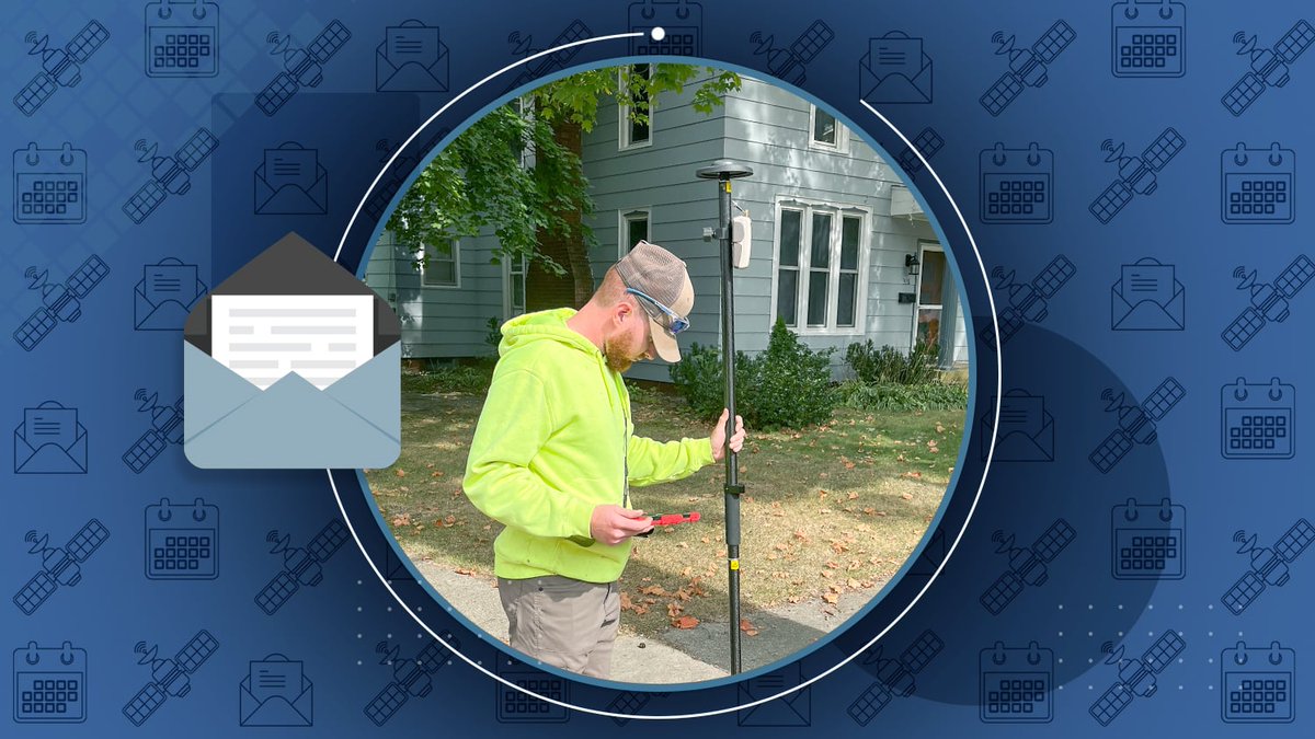
Learn how @spicergroupinc is enhancing St. Louis, MI’s infrastructure with high-accuracy #GNSS! By implementing Eos GNSS receivers & #ArcGISFieldMaps, they've worked to streamline asset management and ensure better infrastructure planning. 💧 ow.ly/X11150VcZbs #GIS #ArcGIS

The latest release of #ArcGISFieldMaps includes improvements to Designer; support for setting a coordinate system when creating a map from a template and offline improvements for maintaining and downloading true curves. ow.ly/i9nj50V8x0f #EsriWater
esri.com
What's new in ArcGIS Field Maps (February 2025)
What's new in ArcGIS Field Maps (February 2025)
📍SHARJAH; Amazing insights are being shared on how #MobileGIS & #ArcGISFieldMaps are transforming field ops. Big thanks to our speaker Sarah Saint-Ruth and all the attendees! Explore more at esri.com/en-us/arcgis/p… #FieldOperations #ArcGIS #Esri #GIS #FieldDataCollection
Tomorrow at #IMGIS! See how @socalgas uses #ArcGISFieldMaps & #EosGNSS to validate service information and update systems of record. Attend "Data Collection from Paper Records to ArcGIS Field Maps, My Forty Year Journey" at 4 PM in Mojave | Renaissance! ow.ly/7emc50TQ52c

Want to use your Eos #GNSS receiver with #ArcGISFieldMaps on iOS but not sure where to start? After pairing your Arrow via Bluetooth, the next step is to open Field Maps and set your location provider! Let's revisit the step-by-step article: ow.ly/kLQG50Q1hOI #tbt #ArcGIS

Streamline your storm response with #ArcGISOnline! Eugene's POS team uses #ArcGISFieldMaps for real-time data sharing and work order management. Learn more: esri.social/tYcs50TgXk0
When taking maps offline for use in #ArcGISFieldMaps, there are a number of things to consider that can cause issues with syncing your offline data. This #ArcGISBlog provides a list of items to consider before taking data offline. #EsriWater esri.social/QTgU50TkEmW

In the new issue of @ArcUser, learn how Littlerock Creek Irrigation District launched a #GIS program to meet state requirements & improve asset management. Using Arrow Gold #GNSS & #ArcGISFieldMaps, they both saved time and boosted operational efficiency! ow.ly/cW9w50TgA9V


See how Washington College’s Geospatial Innovation Program went from campus to canopy at Tuckahoe State Park! Using Arrow Gold #GNSS and #ArcGISFieldMaps, students mapped trails and gained hands-on experience by creating accurate maps for visitors. ow.ly/5LWW50TfCt9 #GIS
Curious about our new Skadi Series #GNSS receivers, industry advancements, & upcoming #ArcGISFieldMaps features? Tune into insights from Eos CTO Jean-Yves Lauture, Esri's Jeff Shaner, and DMG's Eric Gakstatter in our #EsriUC2024 session recording! ow.ly/MghF50SRuO2 #EsriUC

Couldn't attend our hosted lunch session with Esri at #EsriUC2024? No worries! Watch the recording to catch up on the new Skadi Series #GNSS receivers, industry advancements, and updates for #ArcGISFieldMaps! Watch the session or read the transcript: ow.ly/MghF50SRuO2 #GPS
Read this case study to learn all about how @CvilleFireDept modernized their field data collection workflow using #ArcGISFieldMaps. @GISPublicSafety Link ➡️ esri.social/mOuB50Pthi2
Couldn't attend our hosted lunch session with Esri at #EsriUC2024? No worries! Watch the recording to catch up on the new Skadi Series #GNSS receivers, industry advancements, and updates for #ArcGISFieldMaps! Watch the session or read the transcript: ow.ly/MghF50SRuO2 #GPS
Discover how #ArcGISFieldMaps helped improve #ButterflyConservation efforts in Yamhill County, Oregon. esri.social/UlMz50Q59CA #GIS
Streamline your storm response with #ArcGISOnline! Eugene's POS team uses #ArcGISFieldMaps for real-time data sharing and work order management. Learn more: esri.social/tYcs50TgXk0
Check out the latest addition to our case study map! In this photo, Jim Casey collects data at Red Rocks Park and Amphitheatre in Colorado. He's using an Arrow Gold #GNSS receiver & #ArcGISFieldMaps to verify accuracy of previously captured drone imagery! eos-gnss.com/case-study-map
Unlock the power of high-accuracy data collection at this year’s #CalGIS! Attend this exciting hands-on workshop to delve into #GNSS fundamentals, best practices, and real-world mapping using #ArcGISFieldMaps. Elevate your #GIS skills! Register: ow.ly/ggjg50QIkRC @URISA
Harness the power of location! Short video about Esri's easy to use mobile apps: #ArcGISWorkforce #ArcGISNavigator #ArcGISFieldMaps #ArcGISSurvey123 #ArcGISQuickCapture #ArcGISDrone2Map #ArcGISDashboards ow.ly/py6230sC8WY
A Colorado-based #RailwayManagement company is maximizing asset value by using #ArcGISFieldMaps and a custom #GIS app. esri.social/BBCu50Q59GE
От новия брой на сп. Utilities можете да научите основните ползи, които ви дават #ArcGISWorkforce, #ArcGISSurvey123, #ArcGISFieldMaps, #ArcGISQuickCapture и други Есри ГИС приложения за оптимизиране на работата на терен. Прочетете сега 👉 bit.ly/3qRrZsp
Discover how Henry Hartnell combined his two passions — music & maps! Using Arrow #GNSS and #ArcGISFieldMaps, he brings high-accuracy mapping to festival stages, making construction faster, safer, & smarter. Full spotlight: eos-gnss.com/successes/cust… @LIBfestival @TheDoLaB #EosGNSS
See how Washington College’s Geospatial Innovation Program went from campus to canopy at Tuckahoe State Park! Using Arrow Gold #GNSS and #ArcGISFieldMaps, students mapped trails and gained hands-on experience by creating accurate maps for visitors. ow.ly/5LWW50TfCt9 #GIS
Skadi goes the distance! 🏃Manny Lopez of ASM Affiliates more than ran the #EsriUC 5K Fun Run — he mapped it! Using a Skadi 100 #GNSS receiver & #ArcGISFieldMaps, he captured his exact route in real time. 🛰️👟 Try Skadi for yourself in Booth 925: ow.ly/RnOb50WqTpK #EosGNSS
Harness the power of location! Short video about Esri's easy to use mobile apps: #ArcGISWorkforce #ArcGISNavigator #ArcGISFieldMaps #ArcGISSurvey123 #ArcGISQuickCapture #ArcGISDrone2Map #ArcGISDashboards ow.ly/ATew30sCar3
Streamline your data collection with #FieldMapsDesigner! Join Esri's free training seminar to unlock the full potential of this powerful #ArcGISFieldMaps web app. Don't miss this opportunity to revolutionize your #datacollection process. Register today! ➡️ ow.ly/ZuOP50Plprv


Harness the power of location! Get out of the office! Short video about Esri's easy to use mobile apps: #ArcGISWorkforce #ArcGISNavigator #ArcGISFieldMaps #ArcGISSurvey123 #ArcGISQuickCapture #ArcGISDrone2Map #ArcGISDashboards ow.ly/Nj5f30sC9ny

📱Само с таблет и📏метър 12 десетокласници от Велико Търново картотекираха 495 броя 🌳дървесна растителност в парк "Дружба", използвайки #ArcGISOnline, #ArcGISFieldMaps и #MapViewer за събиране и мониторинг на данните. #esri #MappingSkills #DataCollection #GISinSchool
Harness the power of location! Short video about Esri's easy to use mobile apps: #ArcGISWorkforce #ArcGISNavigator #ArcGISFieldMaps #ArcGISSurvey123 #ArcGISQuickCapture #ArcGISDrone2Map #ArcGISDashboards ow.ly/Jvst30sCeIt
It’s been over 2 years since #ArcGISFieldMaps was first released and since then a number of updates have taken place. In our latest #GeoMarvelLive tutorial, we demo how to configure forms, create #geofences, and enable offline capabilities! Video & Blog: bit.ly/3H8fgp7
#ArcGISFieldMaps is Utility Network Aware! Users can view connectivity associations, structural attachments, and containment of assets. Tracing is also available within Field Maps! Learn more in this Industry Blog article: esri.social/Tllf50Qman2 #EsriWater #ArcGISUtilityNetwork
Ready to take your mobile mapping to the next level? Join Eos and Bolton & Menk on Oct. 22 for a hybrid webinar/workshop! See the Skadi Series in action with #ArcGISFieldMaps, explore real-world workflows, and learn from the experts! Register for free: buff.ly/PUH7VHQ
Something went wrong.
Something went wrong.
United States Trends
- 1. Jameis 21.7K posts
- 2. Chiefs 53.7K posts
- 3. Giants 64.4K posts
- 4. Lions 42.7K posts
- 5. JJ McCarthy 2,887 posts
- 6. Colts 22.8K posts
- 7. Mahomes 13.2K posts
- 8. Vikings 24K posts
- 9. Steelers 38.8K posts
- 10. Campbell 14.8K posts
- 11. Gibbs 4,779 posts
- 12. Bears 52.6K posts
- 13. Caleb 31K posts
- 14. Bengals 17.5K posts
- 15. Lamar 18.3K posts
- 16. #GoPackGo 3,975 posts
- 17. #OnePride 2,680 posts
- 18. #Skol 2,398 posts
- 19. Flacco 4,067 posts
- 20. Mason Rudolph 4,704 posts