#googleearthengine search results

Google Earth Engine Full Course (7 Days LIVE!) Remote Sensing & GIS Masterclass Tutorial Link: youtu.be/vPkpL-qZFMc For more registration information, please visit our website: studyhacksgeospatial.com/google-earth-e… #GoogleEarthEngine #RemoteSensing #GIS #EarthObservation #StudyHacks #Geo

Tutorial about Hydrological Analysis in Google Earth Engine. Flow Accumulation, Stream, and Watershed Mapping Tutorial Link: youtu.be/1dGB-ZJnYP8 #HydrologicalAnalysis #GoogleEarthEngine #FlowAccumulation #StreamMapping #WatershedMapping #GeospatialAnalysis #RemoteSensing

Tutorial about Google Earth Engine Hacks for Amazing Satellite Imagery Results Tutorial Link: youtube.com/live/e1tdT0A3C… For more information about registration, visit our website: studyhacksgeospatial.com/google-earth-e… #googleearthengine #GIS #remotesensing #training


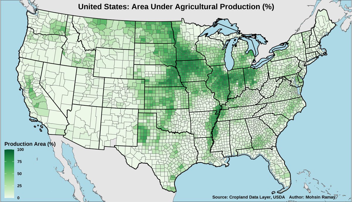
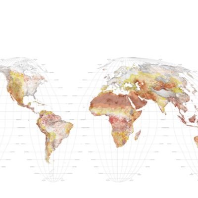
Do you know where Agriculture Thrives in the USA? I created this Agricultural Area Map using the 2022 USDA Cropland Data Layer (CDL). Tools used: - Google Earth Engine for massive data processing. - R for stunning data visualization. #GoogleEarthEngine #RStats #Ggplot2 #Maps
For more registration information, visit our website: studyhacksgeospatial.com/google-earth-e… #GoogleEarthEngine #RemoteSensing #GIS #OnlineTraining #GeospatialAnalysis #JavaScript #Python #NonCoders #LULCMapping #ChangeDetection #AirQualityMonitoring #TimeSeriesAnalysis #MachineLearning #NDVI
Tutorial about NDVI Trend Analysis with Trendline in Google Earth Engine. Tutorial Link: youtube.com/live/e7oxDDuix… registration, visit our website: studyhacksgeospatial.com/google-earth-e… #NDVI #TrendAnalysis #GoogleEarthEngine #RemoteSensing #EarthObservation #GeospatialAnalysis #DataScience


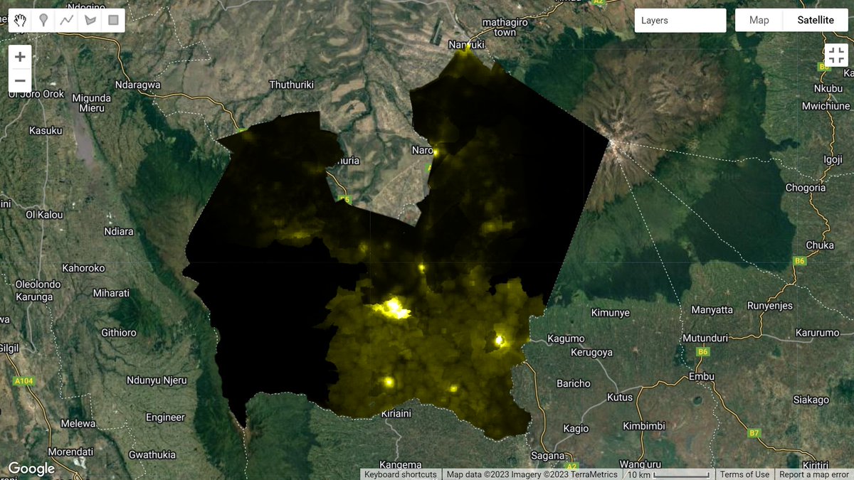
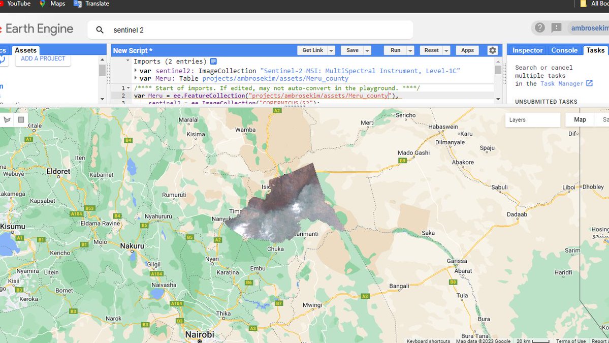
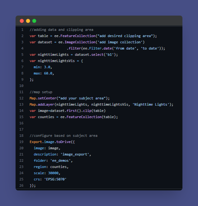
26/08/2023..#Nyeri county gridded population according to the WorldPop dataset..The dataset was downloaded in #GoogleEarthEngine . The brighter colors show the places with higher population within the county.


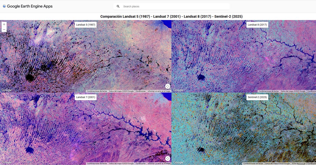
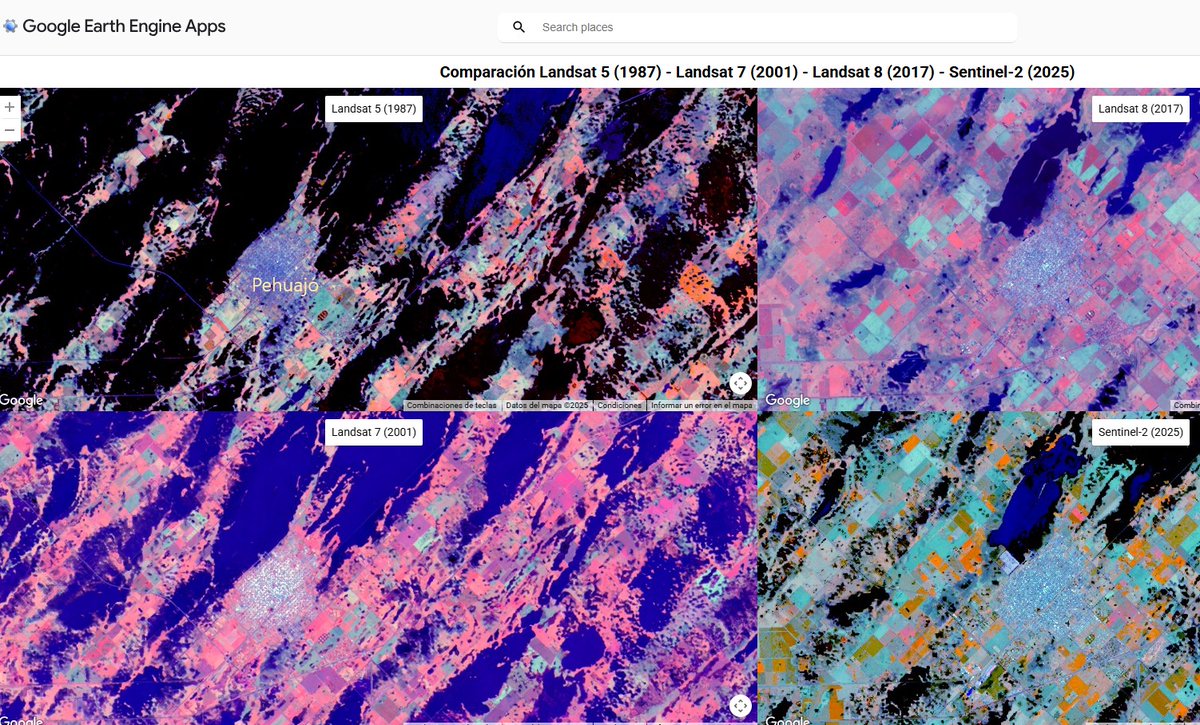
¡Impacto de las inundaciones a lo largo de las décadas! 🌊 Visor interactivo en #GoogleEarthEngine que compara imágenes de Landsat 5, 7, 8 y Sentinel-2. Los mapas están sincronizados espacialmente para que se pueda analizar los eventos de 1987, 2001, 2017 y 2025. 👇…
A tutorial about how to monitor the water demand of crops to estimate the crop coefficient using Google Earth Engine? Tutorial Link: youtube.com/live/eWpylwiqL… #WaterManagement #CropCoefficient #GoogleEarthEngine #AgricultureTech #PrecisionAgriculture #SustainableFarming

For more information about registration, visit our website: studyhacksgeospatial.com/google-earth-e… #GoogleEarthEngine #RemoteSensing #GIS #GeospatialAnalysis #OnlineTraining #CodingForBeginners #PythonAPI #JavaScriptAPI #LULCMapping #ChangeDetection #AirQualityMonitoring

Alertas de pérdida de Cobertura Forestal y monitoreo de Incendios en Coberturas Vegetales usando Google Earth Engine #googleearthengine youtube.com/live/Aj5URBRVW…

Do you like the map I created? 🌏 If you're interested in making one like it, check out my tutorial on connecting to Google Earth Engine and fetching earthquake data to create powerful maps: 🔗youtu.be/olNYYynSJfI #MapMakers #GoogleEarthEngine

🇹🇷My new map shows Turkiye's seismic activity, showcasing over 20,000 earthquakes above magnitude 2.5. It's a century of data at a glance! Spot the hotspots? 🛰️🎓 Want to map seismic data yourself? My tutorial makes it easy. 👉 Check it out: youtu.be/olNYYynSJfI

Remote Sensing training for Forest Management using Google Earth Engine Recorded class link: youtube.com/live/8tDdd2kNy… For more information about registration, visit our website: studyhacksgeospatial.com/google-earth-e… #RemoteSensing #ForestManagement #GoogleEarthEngine #GeospatialAnalysis


ميزة رائعة لمستخدمي #ArcGISPro! 🗺️ أصبح بإمكانك الآن دمج بيانات Google Earth Engine مباشرة في بيئة العمل لتحليل البيانات المكانية. مما يفتح آفاقاً جديدة للدراسات البيئية والزراعية والمناخية. جربها الآن: esri.com/arcgis-blog/pr… #GIS #GoogleEarthEngine #RemoteSensing

#InteligenciaArtificial Nunca fué más facil, en 5 segundos con Open AI #ChatGPT para #GoogleEarthEngine 😮💪💪 lo que le pidas!!


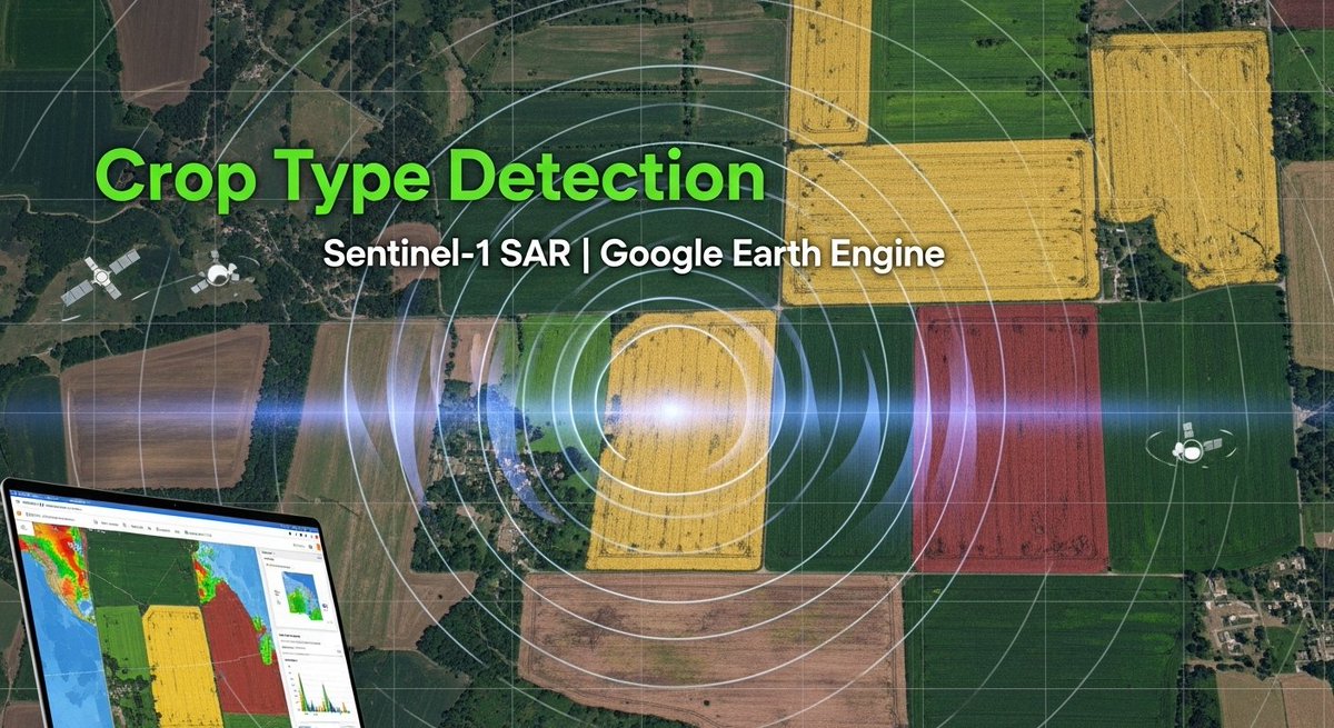
Tutorial about Crop Type Detection Using Sentinel-1 SAR Imagery in Google Earth Engine. Tutorial Link: youtu.be/b8P0d9GXsoQ?si… Registration: studyhacksgeospatial.com/google-earth-e… #GoogleEarthEngine #GEE #EarthEngine

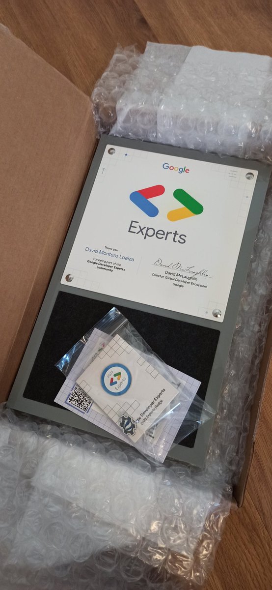
I just got this! What a beautiful piece of certificate 🥳 Thank you @GoogleDevExpert @GoogleDevEurope! #OfficialGDE #GoogleEarthEngine

Just found out that 2022 had the highest annual evapotranspiration on record for Lancaster County, PA, (20% of PA ag sales). Data compiled from #GoogleEarthEngine MODIS satellite records. Why: ⬆️water availability +⬆️evaporative demand @agsciences @psuextension @StateAbe


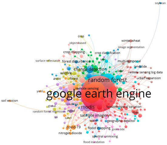
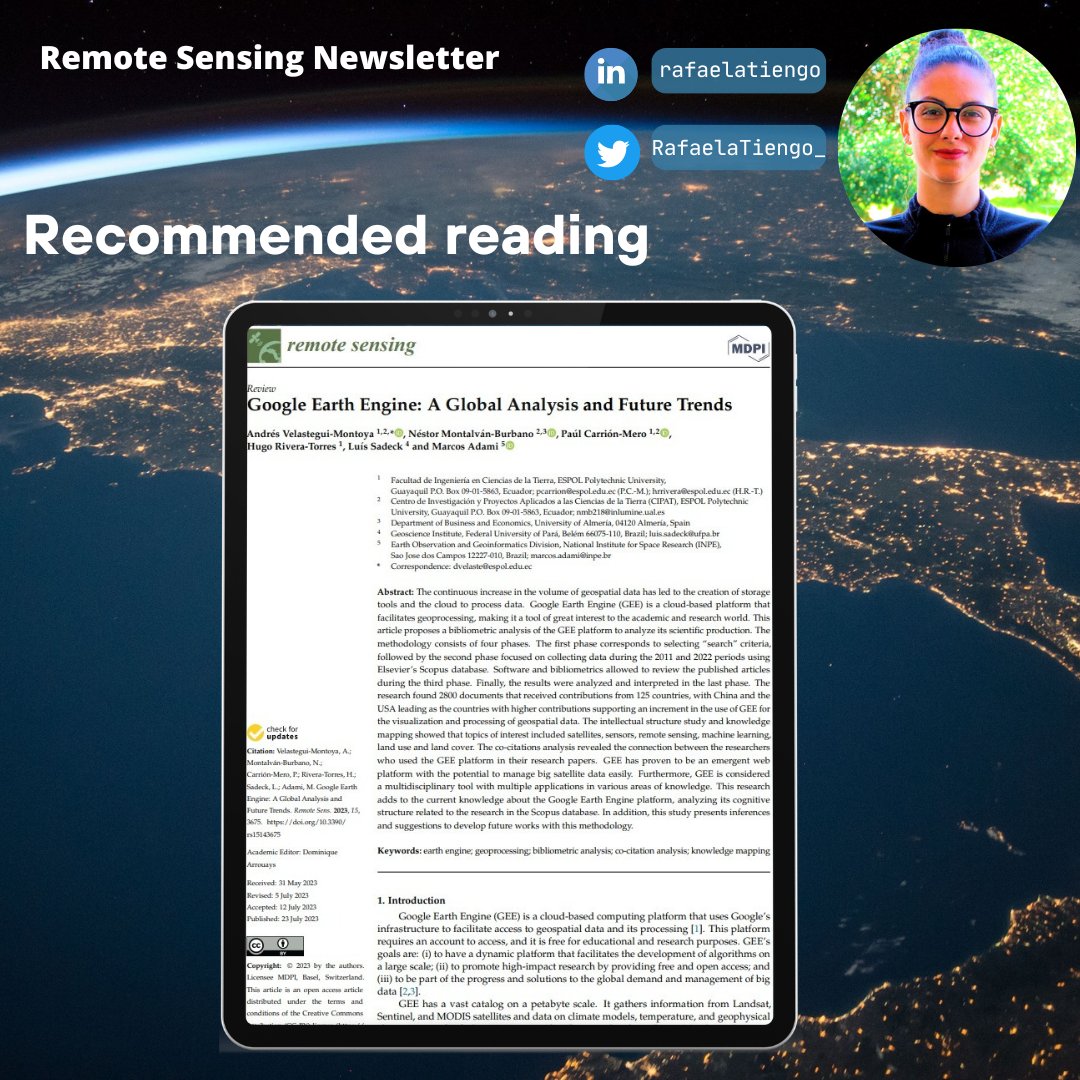
Are you interested in understanding the primary applications of the #GoogleEarthEngine and which articles are most frequently cited?👩🏾💻 📰 Check out this new paper: "Google Earth Engine: A Global Analysis and Future Trends": mdpi.com/2072-4292/15/1… 👥@andvelastegui et al. (2023)

This AI Just Fixed Google Earth’s Biggest Problem youtu.be/VWdmXlRpL84

youtube.com
YouTube
This AI Just Fixed Google Earth’s Biggest Problem
Google Earth Engine Full Course (7 Days LIVE!) Remote Sensing & GIS Masterclass Tutorial Link: youtu.be/vPkpL-qZFMc For more registration information, please visit our website: studyhacksgeospatial.com/google-earth-e… #GoogleEarthEngine #RemoteSensing #GIS #EarthObservation #StudyHacks #Geo

Last month, Google announced new upgrades to Earth AI. Gemini now helps Google Earth understand real world changes like drying rivers and other environmental patterns simply through natural questions. More access is opening up through Google Earth and Google Cloud, making it…

Esri meets Google: Integration Google Earth Engine’s imagery data for analytics with AI in ArcGIS Pro medium.com/@kanin/integra…


✅️Googleエコシステムとの連携 Google Maps、YouTubeなどのデータでトレーニングされており、地理情報、時間情報、文脈情報を理解 ✅️高精度レンダリング GPS座標と時刻を与えるだけで、歴史的に正確な街並み、正確な太陽光の角度と影を持つ場所をレンダリングできます


Hii si kama ile ya akina Wechuli per se😂 Hii ni platform specific ya Remote Sensing inaitwa Google Earth Engine.

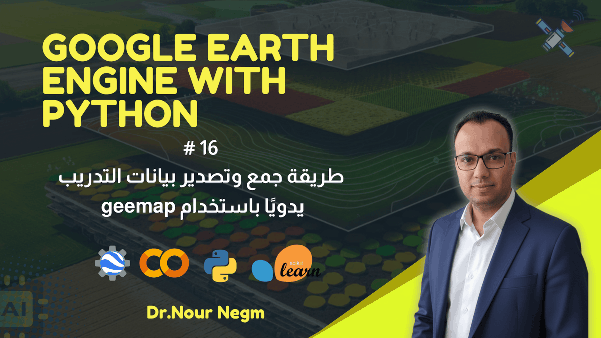
فيديو جديد على القناة 🛰️ فيديو جديد من فيديوهات تعليم Google Earth Engine باستخدام لغة البيثون مع تطبيقات عملية في مجال الزراعة والبيئة باللغة العربية لينك الفيديو علي يوتيوب : shorturl.at/dCaP1 لينك الكود على GitHub: shorturl.at/Thedd

The forecast data from WeatherNext 2 is becoming available through Google's Earth Engine and BigQuery platforms. Furthermore, the underlying technology has already been integrated to improve the weather information displayed in Google Search Central, Gemini, and Google Maps.
For more registration information, visit our website: studyhacksgeospatial.com/google-earth-e… #GoogleEarthEngine #RemoteSensing #GIS #OnlineTraining #GeospatialAnalysis #JavaScript #Python #NonCoders #LULCMapping #ChangeDetection #AirQualityMonitoring #TimeSeriesAnalysis #MachineLearning #NDVI

In this new #GeoawesomeTalk, we chat with Divya Dalapathi from @googlemaps Platform about tools like Grounding Lite and Contextual View; all built to make map development smarter. Watch here → youtu.be/jiWu4EtjXfk #GeoAI #Geoawesome #GoogleMapsPlatform #AI #Mapping


Découvrez la révolution de la cartographie avec Google Earth et Orbion ! 🌍✨ L'intelligence artificielle repousse les limites pour anticiper les catastrophes et modéliser notre planète en temps réel. Engagez-vous dans le débat sur la responsabilité collective face aux…

Excited about the future of SEO with Generative Engine Optimization (GEO)! Optimize for AI-powered search results and join the revolution: is.gd/SEOAi 🔍 #GEO #SEOrevolution

Launched our new workshop "Cloud-based Remote Sensing with QGIS and Google Earth Engine" at FOSS4G 2025 Auckland. Easily get access to vast amounts of GEE data in QGIS without coding. Check out the materials at courses.spatialthoughts.com/qgis-gee-works…


Data Source: Global mobile (cellular) network performance retrieved from GEE community using Google Earth Engine Tools used: #QGIS, #Python, #GoogleEarthEngine

【便利なAIを使いましょ!詳細は質問してくださいね】 Google Earth AIの革新:地球の未来を読み解く「意思決定エンジン」紹介 note.com/orikasa1/n/n97…

Generative Engine Optimization (GEO) is transforming how content creators and businesses can enhance their visibility in AI search engines. This new approach emphasizes the importance of optimizing content for automated technologies. bit.ly/47LSTV1 @zadroweb


We’re also upgrading weather forecasting across Gemini, Pixel Weather, Google Maps Platform, and soon Google Maps. Plus, we're making forecast data available in Earth Engine, BigQuery and an early access program on Google Cloud’s Vertex AI platform: blog.google/technology/goo…


Just created this with Gemini 3.0 / riftrunner, mind is blown! Single prompt: "create an interactive 3D Google Earth killer, something much advancer than Google Earth." thats all! Result: shenouda.nl/labs/earth/ Amazing Earth rendering Day / Night is accurate etc. check it out

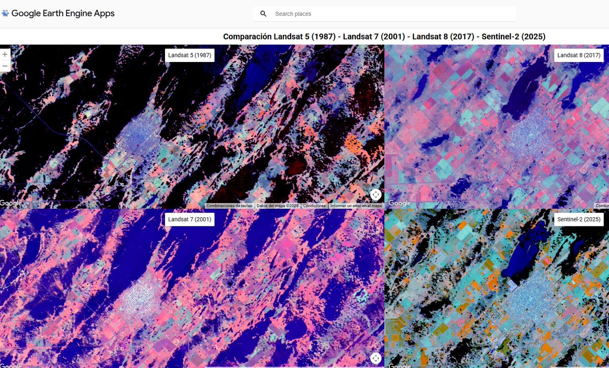
¡Impacto de las inundaciones a lo largo de las décadas! 🌊 Visor interactivo en #GoogleEarthEngine que compara imágenes de Landsat 5, 7, 8 y Sentinel-2. Los mapas están sincronizados espacialmente para que se pueda analizar los eventos de 1987, 2001, 2017 y 2025. 👇…
Tutorial about Google Earth Engine Hacks for Amazing Satellite Imagery Results Tutorial Link: youtube.com/live/e1tdT0A3C… For more information about registration, visit our website: studyhacksgeospatial.com/google-earth-e… #googleearthengine #GIS #remotesensing #training
Tutorial about Hydrological Analysis in Google Earth Engine. Flow Accumulation, Stream, and Watershed Mapping Tutorial Link: youtu.be/1dGB-ZJnYP8 #HydrologicalAnalysis #GoogleEarthEngine #FlowAccumulation #StreamMapping #WatershedMapping #GeospatialAnalysis #RemoteSensing
Tutorial about NDVI Trend Analysis with Trendline in Google Earth Engine. Tutorial Link: youtube.com/live/e7oxDDuix… registration, visit our website: studyhacksgeospatial.com/google-earth-e… #NDVI #TrendAnalysis #GoogleEarthEngine #RemoteSensing #EarthObservation #GeospatialAnalysis #DataScience
A tutorial about how to monitor the water demand of crops to estimate the crop coefficient using Google Earth Engine? Tutorial Link: youtube.com/live/eWpylwiqL… #WaterManagement #CropCoefficient #GoogleEarthEngine #AgricultureTech #PrecisionAgriculture #SustainableFarming
Google Earth Engine Full Course (7 Days LIVE!) Remote Sensing & GIS Masterclass Tutorial Link: youtu.be/vPkpL-qZFMc For more registration information, please visit our website: studyhacksgeospatial.com/google-earth-e… #GoogleEarthEngine #RemoteSensing #GIS #EarthObservation #StudyHacks #Geo
Messi in #GoogleEarthEngine by Rodrigo Principe link.medium.com/wOCZP24ddBb code.earthengine.google.com/5962016999244e…

Tutorial about Crop Type Detection Using Sentinel-1 SAR Imagery in Google Earth Engine. Tutorial Link: youtu.be/b8P0d9GXsoQ?si… Registration: studyhacksgeospatial.com/google-earth-e… #GoogleEarthEngine #GEE #EarthEngine
Remote Sensing training for Forest Management using Google Earth Engine Recorded class link: youtube.com/live/8tDdd2kNy… For more information about registration, visit our website: studyhacksgeospatial.com/google-earth-e… #RemoteSensing #ForestManagement #GoogleEarthEngine #GeospatialAnalysis
26/08/2023..#Nyeri county gridded population according to the WorldPop dataset..The dataset was downloaded in #GoogleEarthEngine . The brighter colors show the places with higher population within the county.
Do you know where Agriculture Thrives in the USA? I created this Agricultural Area Map using the 2022 USDA Cropland Data Layer (CDL). Tools used: - Google Earth Engine for massive data processing. - R for stunning data visualization. #GoogleEarthEngine #RStats #Ggplot2 #Maps
#InteligenciaArtificial Nunca fué más facil, en 5 segundos con Open AI #ChatGPT para #GoogleEarthEngine 😮💪💪 lo que le pidas!!

📃📃👉 #GoogleEarthEngine and Artificial Intelligence (#AI): A Comprehensive Review ✍️ Liping Yang et al. 🔗 mdpi.com/2072-4292/14/1…

Precision Agriculture Explained: Estimating Water Use Coefficient with Remote Sensing. Tutorial Link: youtu.be/pGf0ukESYnA?si… For more information about registration, visit our website: studyhacksgeospatial.com/google-earth-e… #googleearthengine #GIS #remotesensing


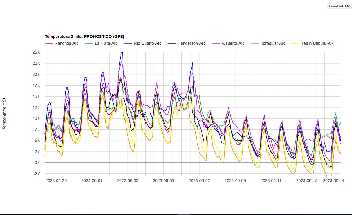
Marcado descenso en las temperaturas a partir del 7 de Junio próximo, según modelo GFS-NOAA #frost #googleearthengine #GEE #EarthEngine ❄️❄️❄️
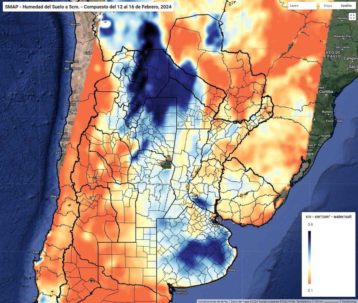
Humedad media de la capa superficial del suelo del 12 al 16 de Febrero 2024, Soil Moisture Active/Passive #SMAP #NASA en #GoogleEarthEngine #GEE
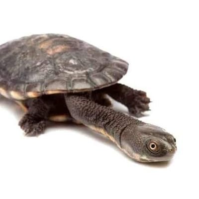
Hello Twitter #Ecologists With @EcoCommonsAus and #ChatGPT to help create #GoogleEarthEngine scripts, here is a #GEE #app that predicts potential #Turtle #hotspots throughout #Australia @donaldmcknight2 @ericjnordberg @deborah_bower @MaxRLambert @TurtleSurvival @turtletweets


Something went wrong.
Something went wrong.
United States Trends
- 1. #BaddiesUSA 58.7K posts
- 2. Rams 29.1K posts
- 3. #LAShortnSweet 20.8K posts
- 4. Scotty 9,675 posts
- 5. Cowboys 100K posts
- 6. Chip Kelly 8,542 posts
- 7. Eagles 140K posts
- 8. #TROLLBOY 1,945 posts
- 9. Raiders 67.2K posts
- 10. Stafford 14.9K posts
- 11. #ITWelcomeToDerry 15K posts
- 12. Bucs 12.2K posts
- 13. Stacey 25.5K posts
- 14. #RHOP 11.8K posts
- 15. sabrina 60.1K posts
- 16. Baker 20.8K posts
- 17. Ahna 7,013 posts
- 18. Vin Diesel 1,197 posts
- 19. billie 18.6K posts
- 20. DOGE 165K posts