#osdeveloper результаты поиска


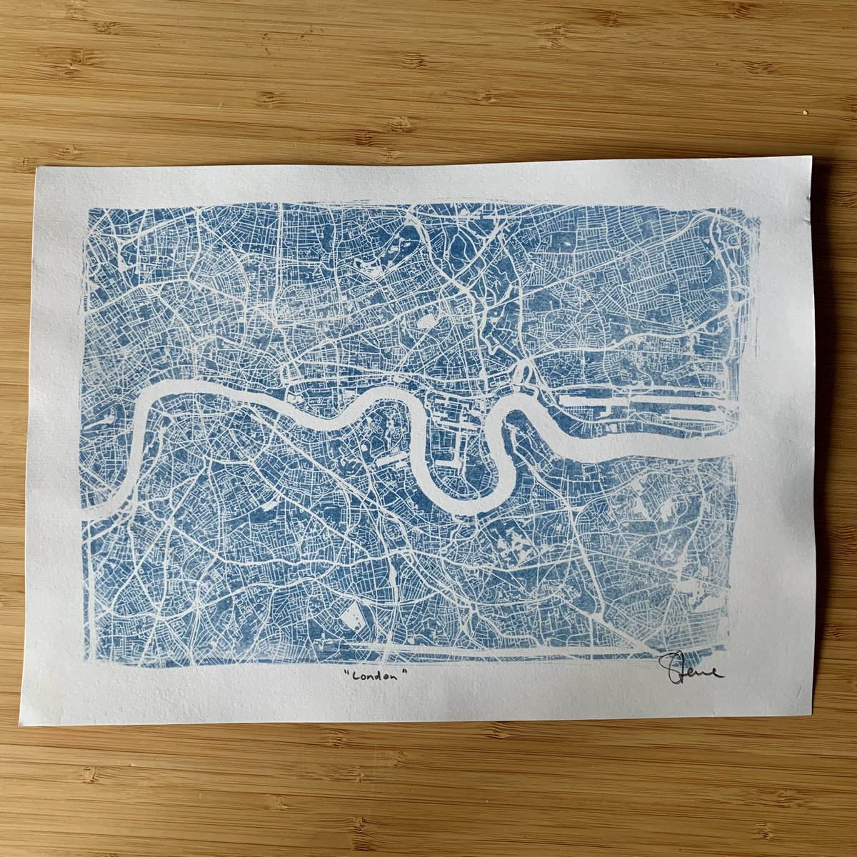
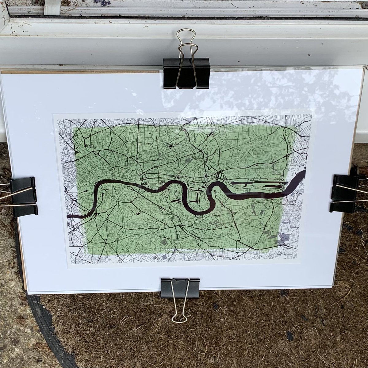
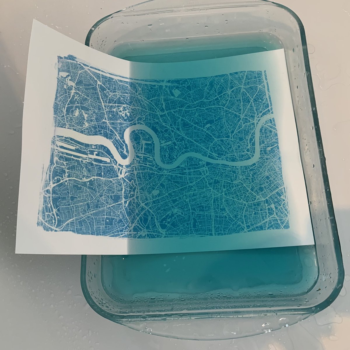
1/ Created this print today using the #cyanotype “sun print” technique. The negative was created with free @OrdnanceSurvey Open Zoomstack data. I’ve had soooo much fun mucking around with chemicals today 👍🏻 #osdeveloper

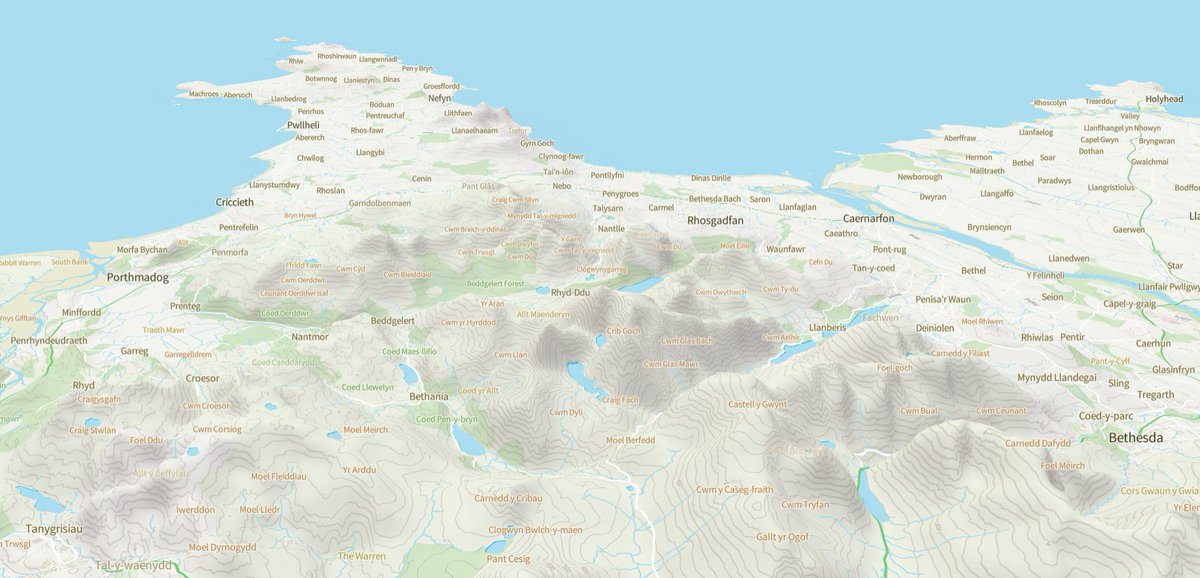
Having fun with the new 3D terrain feature in @MapLibre... using the free @OrdnanceSurvey OS Open Zoomstack and OS Terrain 50 datasets. #OSDeveloper


Today and tomorrow we are taking part in the @OrdnanceSurvey Map & Hack event - we are exploring #ev challenges around bay configuration, amenities and alerting users when new chargers are built #OSMapAndHack #OSDeveloper

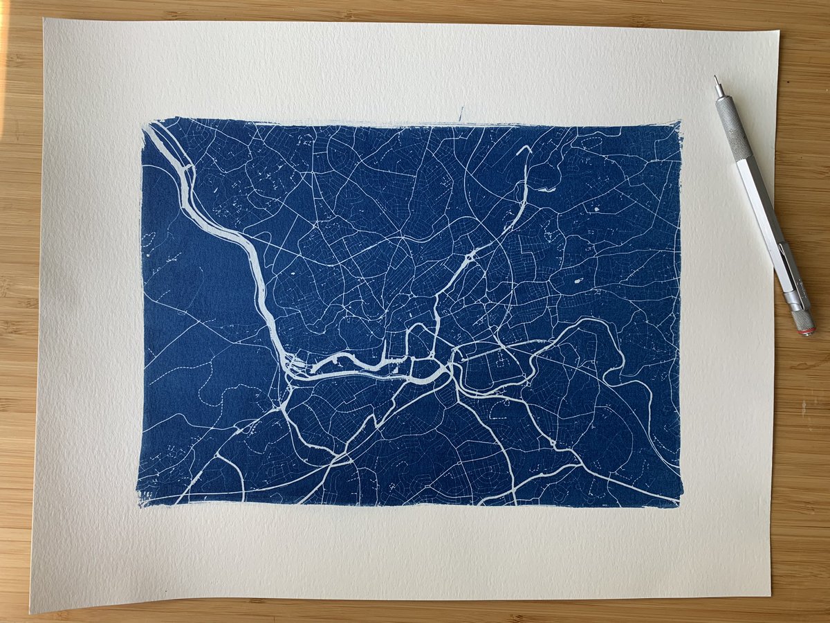
1/2 Today’s Cyanotype print map is Bristol. Again it uses Ordnance Survey free Open Zoomstack data that I’ve styled to be suitable for this type of bringing process. #osdeveloper

This is @OrdnanceSurvey Open Zoomstack in @mabox studio, but I've upped the crinklyness stakes by including both - terrain RGB and - a desaturated satellite layer that has its contrast values swapped. Quite pleasing (but processor-intensive) #OSDeveloper #WeAreOS

This is @OrdnanceSurvey OS Vector Tile API running in @mapbox on my phone that’s sitting in a Google Cardboard viewer being controlled by another map running on my laptop. The mouse movements are synced from laptop to phone with @Firebase. Phew! #osdeveloper

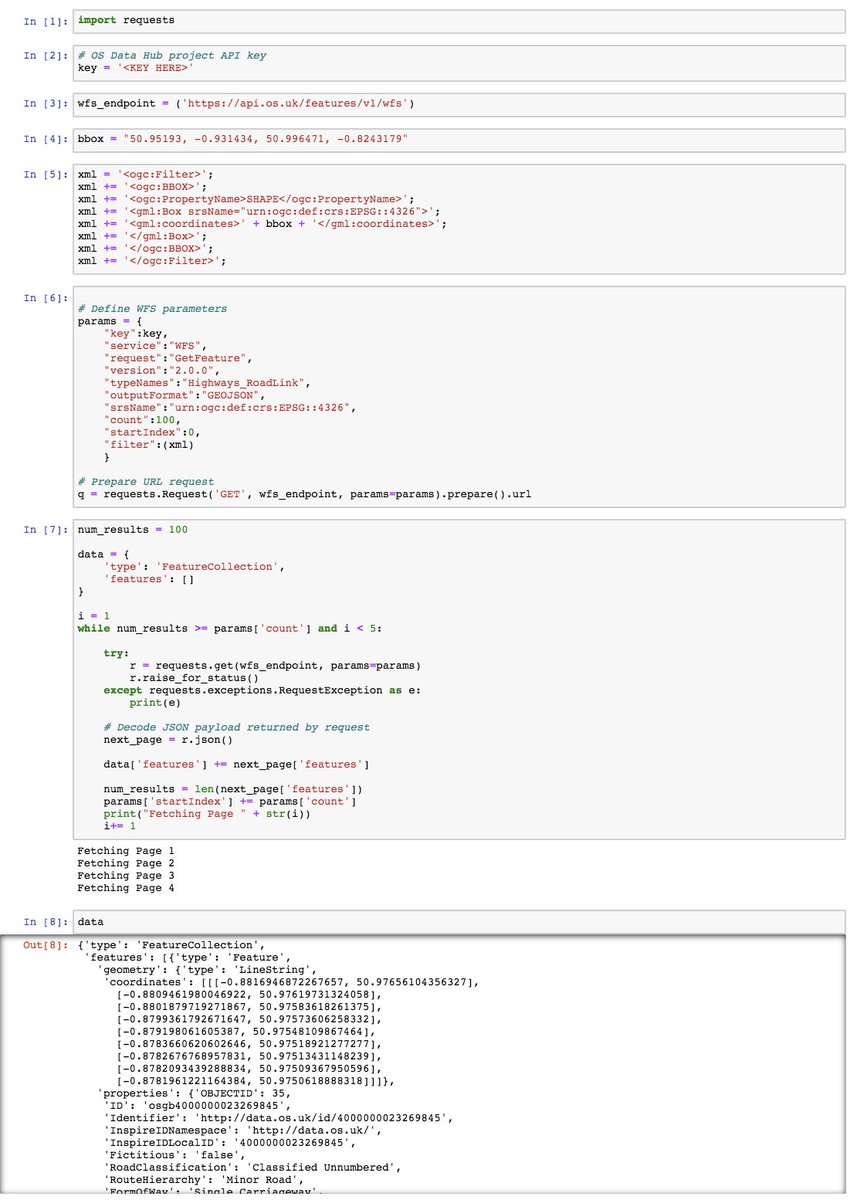
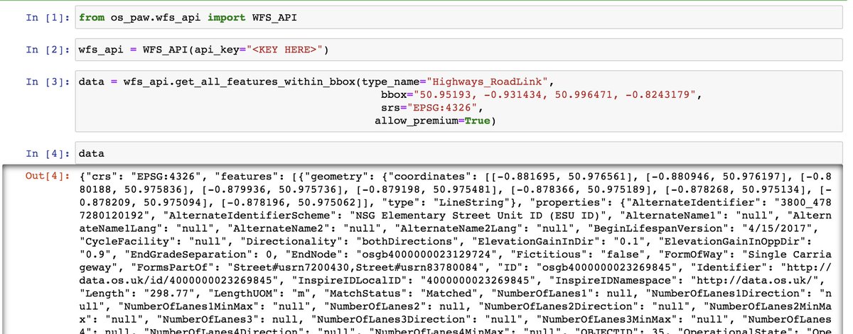
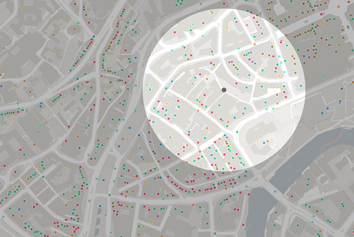
Giving the OS Python API Wrapper a whirl - it makes fetching geojson data from the OS Features API into an IPython Notebook *so* simple! Thanks OS Rapid Prototyping Folded hands See before and after ... #OSDeveloper #python #spatialdatascience #geojson pypi.org/project/os-paw/

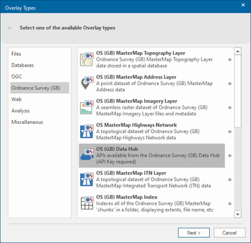
For over 30 years, @cadcorp has supported @OrdnanceSurvey data products. Read the latest #OSblog where our Technical Director discusses bringing the OS Data Hub to desktop #GIS: ow.ly/IZpf50Bkzzt #OSDeveloper #SISDesktop #SIS9
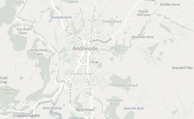
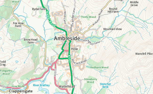
Just playing with @OrdnanceSurvey contours in the free Open Zoomstack ordnancesurvey.co.uk/business-gover… #osdeveloper


Are you a web developer, data scientist or just interested in #SpatialData? Read this guide to better understand how to build and develop applied uses of spatial data: ow.ly/HfOZ50Jef6r #OSDeveloper
The evolution of web mapping has enabled a far more integrated and collaborative ecosystem than ever before. Find out about new data standards and join a free code sprint to learn more: ow.ly/hcjj50IWOQH #OSDeveloper

One of our new startups, SearchLand, has been talking to the #OSDeveloper team about all things OS Data Hub, and how since joining our accelerator they've been able to add even more data to their platform. Amazing progress in such a short time! 🚀 ow.ly/WiUE50EO9O6
Discover how to easily display vector geospatial data in #Python: ow.ly/xgj750I68MA #OSDeveloper #GeospatialData

3D @OrdnanceSurvey Open Zoomstack demo back up and running here steveattewell.com/zoomstack3d/ It shows OS' lovely free open data backdrop map with OSM footpaths overlayed. It uses @mapbox to serve tiles and @CesiumJS for the 3d-ness #osdeveloper
Are you a #developer? Join this code sprint organised by @opengeospatial and learn more about the development of open standards and software. Find out more: ow.ly/r6KS50I6Syb #OSDeveloper #CodeSprint #OpenData


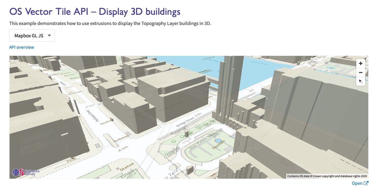
Deep dive!! Did you know that the new OS Data Hub is not just about downloads? APIs now available including a Vector Tile API that supports 3D building views, if that's your preference! Take a look here labs.os.uk/public/os-data… #OSDeveloper #SeeABetterPlace #WeAreOS

From fostering collaboration and shared knowledge, to the development of innovative and high-quality software, there are benefits of #opensource for Europe. Learn more about why open source matters and how it can benefit you as an #OSdeveloper. hubs.la/Q02dzlDQ0

youtube.com
YouTube
The strategic significance of open source in Europe
From fostering collaboration and shared knowledge, to the development of innovative and high-quality software, there are benefits of #opensource for Europe. Learn more about why open source matters and how it can benefit you as an #OSdeveloper. hubs.la/Q02tFRTn0
youtube.com
YouTube
The strategic significance of open source in Europe
From fostering collaboration and shared knowledge, to the development of innovative and high-quality software, there are benefits of #opensource for Europe. Learn more about why open source matters and how it can benefit you as an #OSdeveloper. hubs.la/Q02tG0gn0
youtube.com
YouTube
The strategic significance of open source in Europe
From fostering collaboration and shared knowledge, to the development of innovative and high-quality software, there are benefits of #opensource for Europe. Learn more about why open source matters and how it can benefit you as an #OSdeveloper. hubs.la/Q02tFPQb0
youtube.com
YouTube
The strategic significance of open source in Europe
From fostering collaboration and shared knowledge, to the development of innovative and high-quality software, there are benefits of #opensource for Europe. Learn more about why open source matters and how it can benefit you as an #OSdeveloper. hubs.la/Q01FpN_X0

youtube.com
YouTube
The strategic significance of open source in Europe
From fostering collaboration and shared knowledge, to the development of innovative and high-quality software, there are benefits of #opensource for Europe. Learn more about why open source matters and how it can benefit you as an #OSdeveloper. hubs.la/Q01FpMDc0
youtube.com
YouTube
The strategic significance of open source in Europe
From fostering collaboration and shared knowledge, to the development of innovative and high-quality software, there are benefits of #opensource for Europe. Learn more about why open source matters and how it can benefit you as an #OSdeveloper. hubs.la/Q01FpM1Q0
youtube.com
YouTube
The strategic significance of open source in Europe
From fostering collaboration and shared knowledge, to the development of innovative and high-quality software, there are benefits of #opensource for Europe. Learn more about why open source matters and how it can benefit you as an #OSdeveloper. hubs.la/Q01FpLVC0
youtube.com
YouTube
The strategic significance of open source in Europe
From fostering collaboration and shared knowledge, to the development of innovative and high-quality software, there are benefits of #opensource for Europe. Learn more about why open source matters and how it can benefit you as an #OSdeveloper. hubs.la/Q01zT9zD0
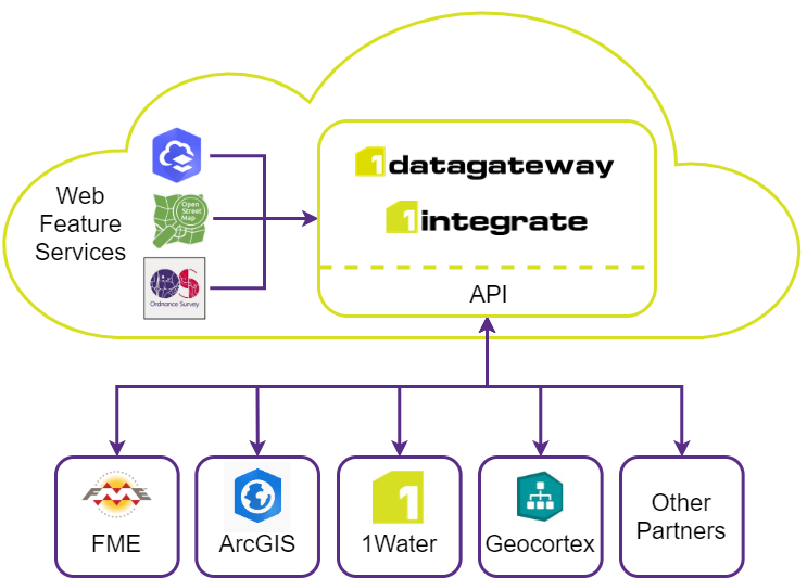
Do you use the @OrdnanceSurvey Data Hub and OS Features API (WFS)? If so, did you know that it connects directly with #1Integrate for automated data validation, cleansing and transformation: 1spatial.com/news-events/20… #OSDeveloper #1IntegrateRulesOK
Having fun with the new 3D terrain feature in @MapLibre... using the free @OrdnanceSurvey OS Open Zoomstack and OS Terrain 50 datasets. #OSDeveloper
Are you a web developer, data scientist or just interested in #SpatialData? Read this guide to better understand how to build and develop applied uses of spatial data: ow.ly/HfOZ50Jef6r #OSDeveloper
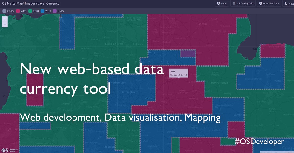
How can we determine the age of the product our customers receive for a given location? Geospatial Associate, Archie Biddiscombe shares the new currency viewer for the OS MasterMap Imagery layer, in our latest blog: ow.ly/Ow5F50J8JpM #OSDeveloper
Data is growing at a rapid pace, and so is the complexity of managing it. Learn how to retrieve, extract and understand large volumes of data through automated downloads: ow.ly/QNrs50J1Y1a #OSDeveloper
The evolution of web mapping has enabled a far more integrated and collaborative ecosystem than ever before. Find out about new data standards and join a free code sprint to learn more: ow.ly/hcjj50IWOQH #OSDeveloper
What exactly is OS Data Hub? Discover how to make the most out of its capabilities and accessible APIs: ow.ly/is8Y50IS8b0 #OSDeveloper

The metaverse combines physical and virtual worlds, creating a new parallel reality that exists in real-time. Discover how #geospatial data is used to bring this concept to the everyday: ow.ly/Qrm250IAT3E #OSDeveloper #Metaverse

This Python tutorial is perfect for those who want to make the most out of their coffee subscription. Plan the perfect @Pret coffee crawl using #Python and OS data in our latest Developer blog: ow.ly/3UGU50IvTnA #OSDeveloper #PythonTutorial
This #Python tutorial is for those wanting to discover where their favourite historical British figures once lived, worked, or were born. Learn more: ow.ly/MHsX50IiSYO #OSDeveloper #Geospatial
Discover how the evolution of innovation is moving us towards a more sustainable future: ow.ly/Y2Yt50IcPrM #OSDeveloper #Innovation #Sustainability


1/ Created this print today using the #cyanotype “sun print” technique. The negative was created with free @OrdnanceSurvey Open Zoomstack data. I’ve had soooo much fun mucking around with chemicals today 👍🏻 #osdeveloper


Having fun with the new 3D terrain feature in @MapLibre... using the free @OrdnanceSurvey OS Open Zoomstack and OS Terrain 50 datasets. #OSDeveloper
Discover how to easily display vector geospatial data in #Python: ow.ly/xgj750I68MA #OSDeveloper #GeospatialData
For over 30 years, @cadcorp has supported @OrdnanceSurvey data products. Read the latest #OSblog where our Technical Director discusses bringing the OS Data Hub to desktop #GIS: ow.ly/IZpf50Bkzzt #OSDeveloper #SISDesktop #SIS9
Today and tomorrow we are taking part in the @OrdnanceSurvey Map & Hack event - we are exploring #ev challenges around bay configuration, amenities and alerting users when new chargers are built #OSMapAndHack #OSDeveloper
Are you a #developer? Join this code sprint organised by @opengeospatial and learn more about the development of open standards and software. Find out more: ow.ly/r6KS50I6Syb #OSDeveloper #CodeSprint #OpenData
Are you a web developer, data scientist or just interested in #SpatialData? Read this guide to better understand how to build and develop applied uses of spatial data: ow.ly/HfOZ50Jef6r #OSDeveloper
From incorporating additional zoom levels to changing the map style, discover our OS Maps API examples: ow.ly/sxmk50GbIN1 #OSDeveloper
1/2 Today’s Cyanotype print map is Bristol. Again it uses Ordnance Survey free Open Zoomstack data that I’ve styled to be suitable for this type of bringing process. #osdeveloper
Have you been using the new OS Data Hub? DM us your experience and you could feature as a guest blog📢 ow.ly/bHSR50GnLud #OSDeveloper #GIS #Geospatial

This is @OrdnanceSurvey Open Zoomstack in @mabox studio, but I've upped the crinklyness stakes by including both - terrain RGB and - a desaturated satellite layer that has its contrast values swapped. Quite pleasing (but processor-intensive) #OSDeveloper #WeAreOS
This #Python tutorial is for those wanting to discover where their favourite historical British figures once lived, worked, or were born. Learn more: ow.ly/MHsX50IiSYO #OSDeveloper #Geospatial

Interested in joining the OS Data Hub trial but not worked with OS data before? We’ve added tutorials to our developer community resources to get you started: ow.ly/uKR850zk9LP #OSDeveloper #mydataday
This Python tutorial is perfect for those who want to make the most out of their coffee subscription. Plan the perfect @Pret coffee crawl using #Python and OS data in our latest Developer blog: ow.ly/3UGU50IvTnA #OSDeveloper #PythonTutorial
The evolution of web mapping has enabled a far more integrated and collaborative ecosystem than ever before. Find out about new data standards and join a free code sprint to learn more: ow.ly/hcjj50IWOQH #OSDeveloper
The Rapid Prototyping Team have taken our first step into professional open-source coding. This project is focused on user-friendliness and the importance of good documentation. Learn more: ow.ly/iN4e50HJxGy #OSDeveloper #Python

Something went wrong.
Something went wrong.
United States Trends
- 1. #เพียงเธอตอนจบ 160K posts
- 2. LINGORM ONLY YOU FINAL EP 150K posts
- 3. Good Friday 50K posts
- 4. #FanCashDropPromotion N/A
- 5. #FridayVibes 4,911 posts
- 6. Ayla 24.4K posts
- 7. Tawan 53K posts
- 8. Cuomo 107K posts
- 9. Dorado 4,188 posts
- 10. Happy Friyay 1,005 posts
- 11. Mamdani 254K posts
- 12. Justice 333K posts
- 13. Shabbat Shalom 2,102 posts
- 14. #FursuitFriday 11.9K posts
- 15. #FridayMotivation 3,348 posts
- 16. Finally Friday 2,360 posts
- 17. RED Friday 2,496 posts
- 18. Flacco 101K posts
- 19. Pence 97.5K posts
- 20. New Yorkers 45.1K posts