#pix4dcloud search results

Dive into mapping with Pix4D Cloud! Pix4D turns aerial imagery into 3D models & orthomosaics, ideal for surveying, construction, agriculture, & environmental monitoring. Unlock insights with #Pix4DCloud. Learn more at leicesterdrones.com/pix4d-cloud #DroneMapping #GIS #AgTech #3DMapping

PIX4Dcatchで撮影した、以前のデータを処理し直して、ガウススプラッティングで表示してみました。質感が良くなり滑らかになりました。 比較してみてください。 #pix4d #pix4dcatch #pix4dcloud #ガウススプラッティング #3dgs #ntgeotecs #エヴァンゲリオン #点群マニア
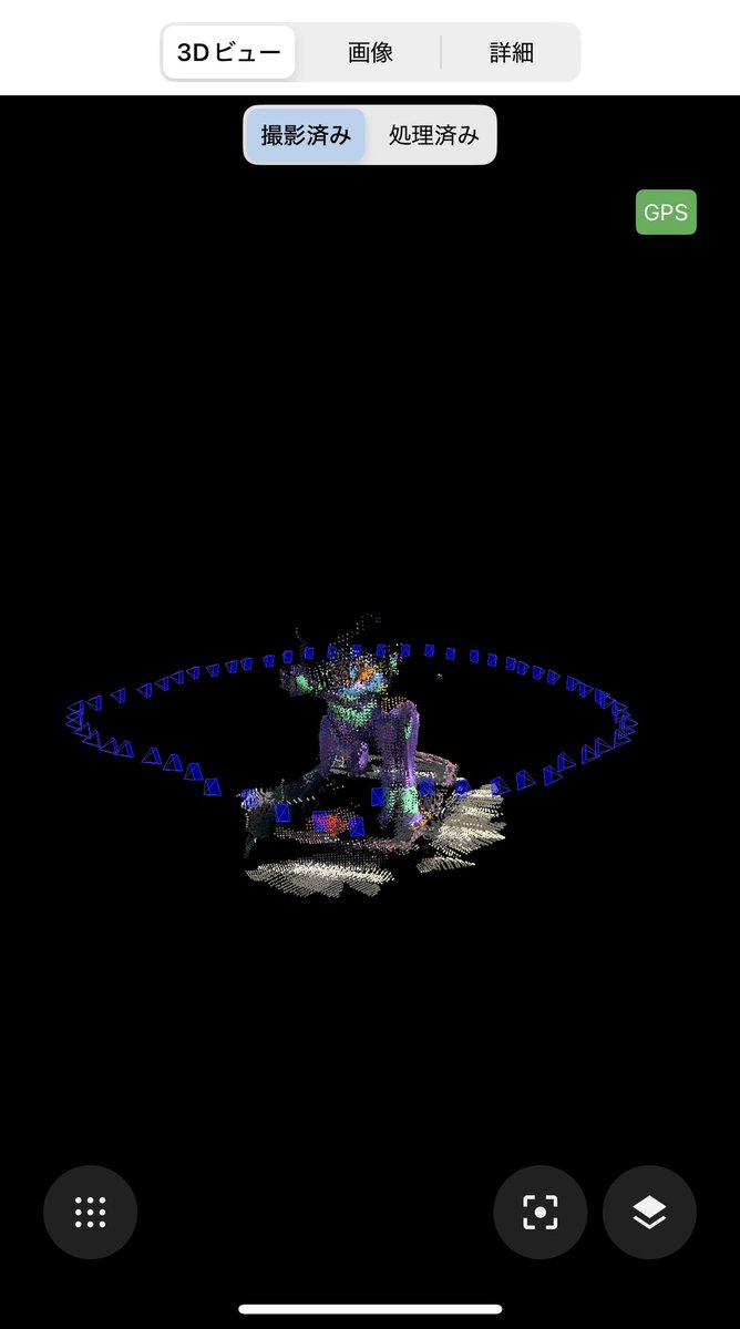
有明のSmall Worlds入口のエヴァンゲリオンを撮影してみました。オブジェをとるのが初めてで、上手くいっていない所があるのが反省的です。 #点群マニア #エヴァンゲリオン #smalkworlds

Track your document site progress with visual timeline using #Pix4DCloud Advanced. This web base software can accommodate #GCP 📌with recommended black and white targets size 50cm (20 inch). #SurveyDronesIreland #Pix4D #DroneIrealnd #DroneSurvey #DroneSoftware #3D #M300RTK

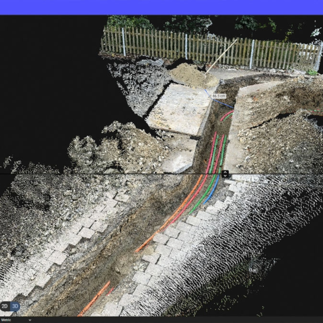
Did you know? 💡 You can now add high-resolution images directly from the field to points of interest placed by someone in the office! Enabling seamless collaboration via a mobile-to-cloud workflow. Watch our video to find out more! #PIX4Dcatch #PIX4Dcloud #construction #SUE
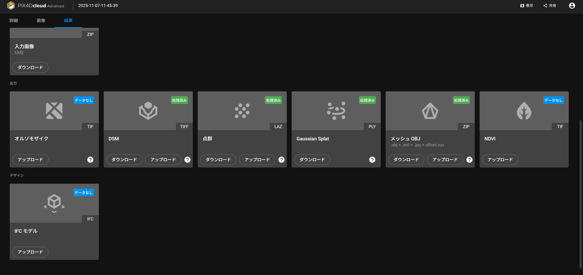
Whether you upload images for cloud processing or utilize datasets processed on your desktop license, #Pix4DCloud delivers accurate and georeferenced orthomosaics, #3D meshes, #pointclouds, and elevation models. #Pix4D #SurveyDronesIreland #dronesurvey #IAA #EASA #M300RTK

Our final #3DMonday of the year—a bronze group depicting Hercules and the Ceryneian Hind, captured with #PIX4Dcatch & processed in #PIX4Dcloud with Gaussian Splatting. 💫 Discovered in Pompeii, this piece shows off what our mobile photogrammetry can do! See you in 2026! 🥂
This #3DMonday, we're taking a closer look at the details! 🔎 Mobile scanning app #PIX4Dcatch and cloud processing on #PIX4Dcloud let you turn everyday objects like this boat into precise, shareable 3D models. 🚤 Try PIX4Dcatch for yourself: pix4d.com/product/pix4dc…
Our #PIX4Dcloud engineers have completed a complex migration of our containerized microservices to @AWS Graviton processors! ⚙️ We implemented a multi-architecture CI/CD pipeline and achieved an x86 to ARM64 transition with zero downtime. Read more here: aws.amazon.com/blogs/alps/how…

In this use case, coastal asset surveys are scanned with #PIX4Dcatch. Data goes to #PIX4Dcloud for tracking erosion & precise damage measurement from rising sea levels. This information empowers coastal authorities to make informed decisions. Read more: pix4d.com/blog/tracking-…

Disputes are a common part of construction that many professionals aim to prevent. Discover how drone mapping, specifically with #PIX4Dcloud's timeline tool, helped save €80,000 (almost $100,000)! 💰 Read more here: pix4d.com/blog/solving-c… #digitalconstruction #bim


Excited to dive into #PIX4Dcloud's new tutorials! 🎥 Comparing as-built to design, data sets, and generating reports - game changers for #construction! #DXF #IFC
#PIX4Dmatic 1.64.0 #PIX4Dmapper 4.9 #PIX4Dcloud #PIX4Dfields 2.7 #PIX4Dreact 1.5.1 #PIX4Dsurvey 1.64.0 #PIX4DcapturePro 1.4.0 #PIX4Dcatch #SurveyDronesIreland

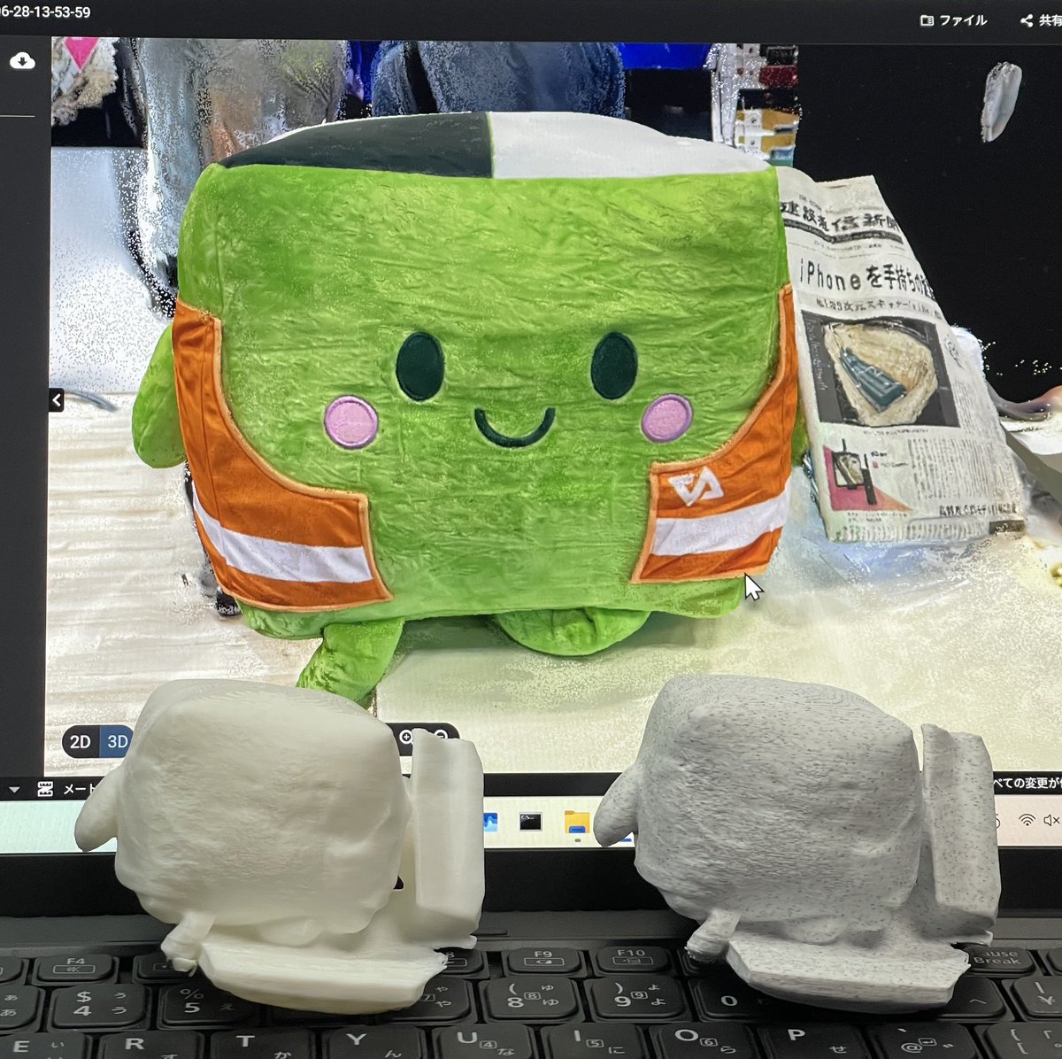
先日、お客様のご要望で小石サイズの計測をしたいとの事で、PIX4Dcatch、LiDARSLAM、地上型レーザースキャナで比較計測致しましたが、写真から点群が作成できるSfMが一番形になっていました。 ※動画はPIX4Dcatchの画面です。 #pix4d #PIX4Dcatch #pix4dcloud #sfm #点群 #ntgeotecs #NTジオテックス

The Monument to the Partygoer in Malaga is a tribute to the Verdiales culture. 🕺 🇪🇸 1085 images captured with #PIX4Dcatch, processed on #PIX4Dcloud with #GaussianSplatting output. Digitally preserving cultural heritage! 🏛️ #3DMonday Try PIX4Dcatch: pix4d.com/product/pix4dc…
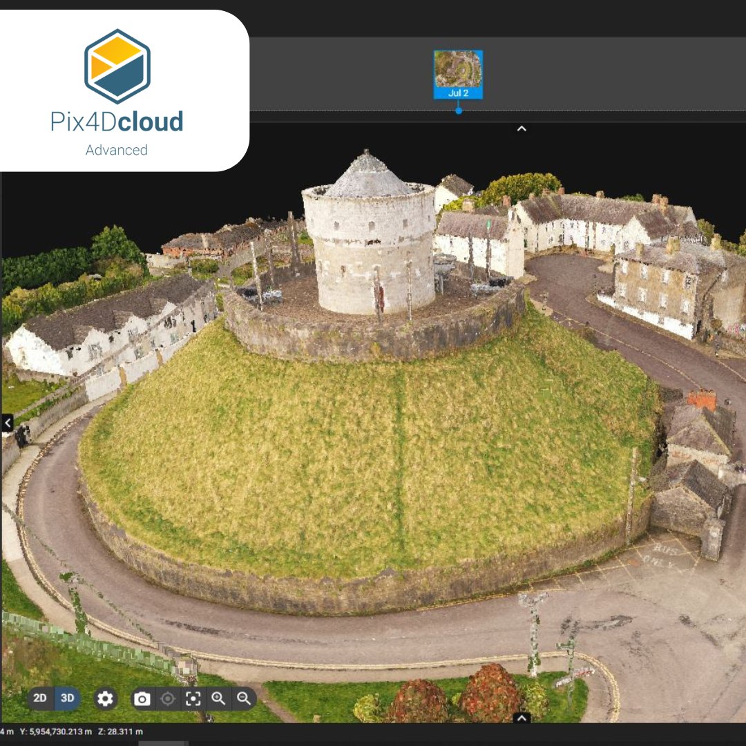
It's #3DMonday, and we're sharing a flythrough of the University of Bern captured by Pixmap. The 3D model was generated directly in #PIX4Dcloud without exchanging files, making the overall solution both lightweight and cost-effective! 💫 Try PIX4Dcloud: pix4d.com/product/pix4dc…
PIX4Dcatchでの計測を動画にしました。 ご興味がある方はご覧ください。 PIX4Dcatch 撮影編 youtu.be/I2L-AurYErs PIX4D nt-geotecs.com/products/softw… #pix4d #pix4dcatch #pix4dcloud #pix4dmatic #点群 #sfm #ntgeotecs #NTジオテックス

PIX4Dcatchで計測したデータをPIX4Dcloudで処理した点群です。手持ちのSLAMとは違いターゲット中心が認識できるレベルになっています。写真(左)、点群(右) #PIX4D #PIX4Dcatch #PIX4Dcloud #点群データ #sfm #点群マニア #ntgeotecs


#3DMonday ✨ Our latest capture is of Spanish Romantic poet and writer, Gustavo Adolfo Bécquer, using an iPhone 16 Pro and the #PIX4Dcatch app. 📱 The Gaussian Splatting output in #PIX4Dcloud handles the complex textures and lighting of the monument with high fidelity. 🏛️
This #3DMonday, our submission shows the Old Iwabuchi Sluice Gate (Tokyo, Japan) using Gaussian Splatting on #PIX4Dcloud! 📷 Drone capture and 3D modeling by: Yachiyo Engineering Co., Ltd. Property management by: Ministry of Land, Infrastructure, Transport and Tourism (MLIT)
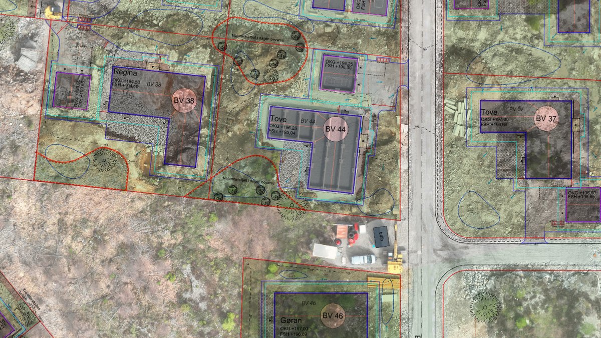
With the Design Overlay tool in #PIX4Dcloud, you can upload #DXF and #IFC files to visually compare design plans against your real-world georeferenced 3D models and orthomosaics. Check as-built vs. as-designed seamlessly. Read more here: pix4d.com/blog/as-built-…
Our final #3DMonday of the year—a bronze group depicting Hercules and the Ceryneian Hind, captured with #PIX4Dcatch & processed in #PIX4Dcloud with Gaussian Splatting. 💫 Discovered in Pompeii, this piece shows off what our mobile photogrammetry can do! See you in 2026! 🥂
A landmark year for #PIX4Dcloud! 🎊 We scaled #georeferenced #GaussianSplatting from phone to drone projects in just one year, delivering measurable photorealism. 💫 Plus, Organization Management, enhanced #BIM/#GIS exports, & more! Full highlights: pix4d.com/blog/PIX4Dclou…
It's #3DMonday again! We're featuring the iconic El Cenachero statue, one of Málaga's most beloved symbols 🇪🇸 This render uses Gaussian Splatting technology. Scan data was processed with #PIX4Dcloud and captured with #PIX4Dcatch 📸 Send us your #3Dscans to be featured next! ✨
Our #PIX4Dcloud engineers have completed a complex migration of our containerized microservices to @AWS Graviton processors! ⚙️ We implemented a multi-architecture CI/CD pipeline and achieved an x86 to ARM64 transition with zero downtime. Read more here: aws.amazon.com/blogs/alps/how…
Do you have a large surveying project with a tight deadline? @westcoastaerial used #PIX4Dmatic to process an entire city-wide dataset, achieving a full 37 sq mi #survey and collaborative delivery via #PIX4Dcloud in under 24 hours. 🗺️ ✨ The full story: pix4d.com/blog/fighting-…
High-fidelity capture in ancient Herculaneum with the #PIX4Dcatch mobile scanning app! Intricate details on this monument, incl. molding, are perfectly reproduced ✨ Viewed with the #GaussianSplatting output in #PIX4Dcloud 🏛️ #3DMonday To PIX4Dcatch: pix4d.com/product/pix4dc…

あえて極端に端的に表現すると「生成AIは芸術、SfMは計測」といっていいんじゃないかと思います。 目的が違うので手段が違う、ということかと思います。 #PIX4Dcatch #PIX4Dcloud #点群 #3Dテクスチャメッシュ #3DGaussianSplatting
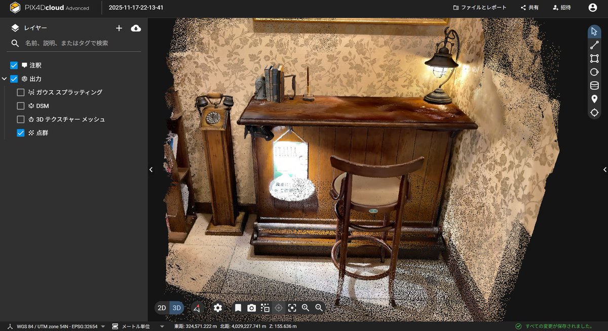
ホテルにあった、アンティークなインテリアを被写体に、生成AIとSfMで3Dモデル作成を比較してみました。 生成AIではイスだけが抽出されましたが、SfMは全体を3Dにしてくれました。 #PIX4Dcatch #PIX4Dcloud #点群 #3Dテクスチャメッシュ #3DGaussianSplatting
It's #3DMonday, and we're sharing a flythrough of the University of Bern captured by Pixmap. The 3D model was generated directly in #PIX4Dcloud without exchanging files, making the overall solution both lightweight and cost-effective! 💫 Try PIX4Dcloud: pix4d.com/product/pix4dc…
「Trend Pointの3DGS読み込み機能」、PIX4Dcloud上で生成された3DGS(.PLY形式)は、点群データを重ね合わせることができました。 読み込む際に、2点の一致点を指定する必要があるので、対空標識や明瞭にわかる地物を写しこんでおくことが重要ですね。 #TrendPoint #3DGaussianSplatting #PIX4Dcloud


📢 Online workshop alert! Master the full end-to-end Pix4D reality capture workflow! Three days of hands-on learning to guarantee accurate 2D maps and 3D models with the Pix4D ecosystem. 💫 Register now: training.pix4d.com/courses/pix4d-… #PIX4Dcatch #PIX4Dmatic #PIX4Dcloud #Pix4D

先日、お客様のご要望で小石サイズの計測をしたいとの事で、PIX4Dcatch、LiDARSLAM、地上型レーザースキャナで比較計測致しましたが、写真から点群が作成できるSfMが一番形になっていました。 ※動画はPIX4Dcatchの画面です。 #pix4d #PIX4Dcatch #pix4dcloud #sfm #点群 #ntgeotecs #NTジオテックス
PIX4Dcatchで計測したデータをPIX4Dcloudで処理した点群です。手持ちのSLAMとは違いターゲット中心が認識できるレベルになっています。写真(左)、点群(右) #PIX4D #PIX4Dcatch #PIX4Dcloud #点群データ #sfm #点群マニア #ntgeotecs
From site surveys to architectural documentation, #Pix4Dcatch puts professional-grade #3D capture in your hands. Upload images to #PIX4Dcloud or export to #PIX4Dmapper to create accurate, shareable 3D models and point clouds. [email protected] #SurveyDronesIreland

With #Pix4DMapper you can process all types of thermal (RJPG., tff., jpg.) images that have been captured. To process the images, you must create a project using Pix4DMapper and later upload to the #Pix4DCloud. #SurveyDronesIreland #Pix4D #aerialsurvey #dronesurvey #mapping

PIX4Dcatchで計測したデータをPIX4Dcloudで処理した点群です。手持ちのSLAMとは違いターゲット中心が認識できるレベルになっています。写真(左)、点群(右) #PIX4D #PIX4Dcatch #PIX4Dcloud #点群データ #sfm #点群マニア #ntgeotecs
PIX4Dcatchでの計測を動画にしました。 ご興味がある方はご覧ください。 PIX4Dcatch 撮影編 youtu.be/I2L-AurYErs PIX4D nt-geotecs.com/products/softw… #pix4d #pix4dcatch #pix4dcloud #pix4dmatic #点群 #sfm #ntgeotecs #NTジオテックス
Track your document site progress with visual timeline using #Pix4DCloud Advanced. This web base software can accommodate #GCP 📌with recommended black and white targets size 50cm (20 inch). #SurveyDronesIreland #Pix4D #DroneIrealnd #DroneSurvey #DroneSoftware #3D #M300RTK
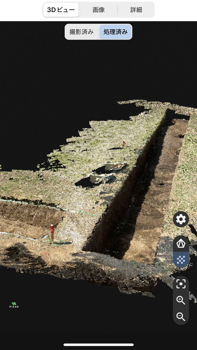
Capture data on-site with the #3DMobileScanning solution #PIX4Dcatch, and upload it to #PIX4Dcloud for processing. With PIX4Dcloud’s "compare mode," easily view before and after project images. Read more about this project here: hubs.li/Q02M3mjc0
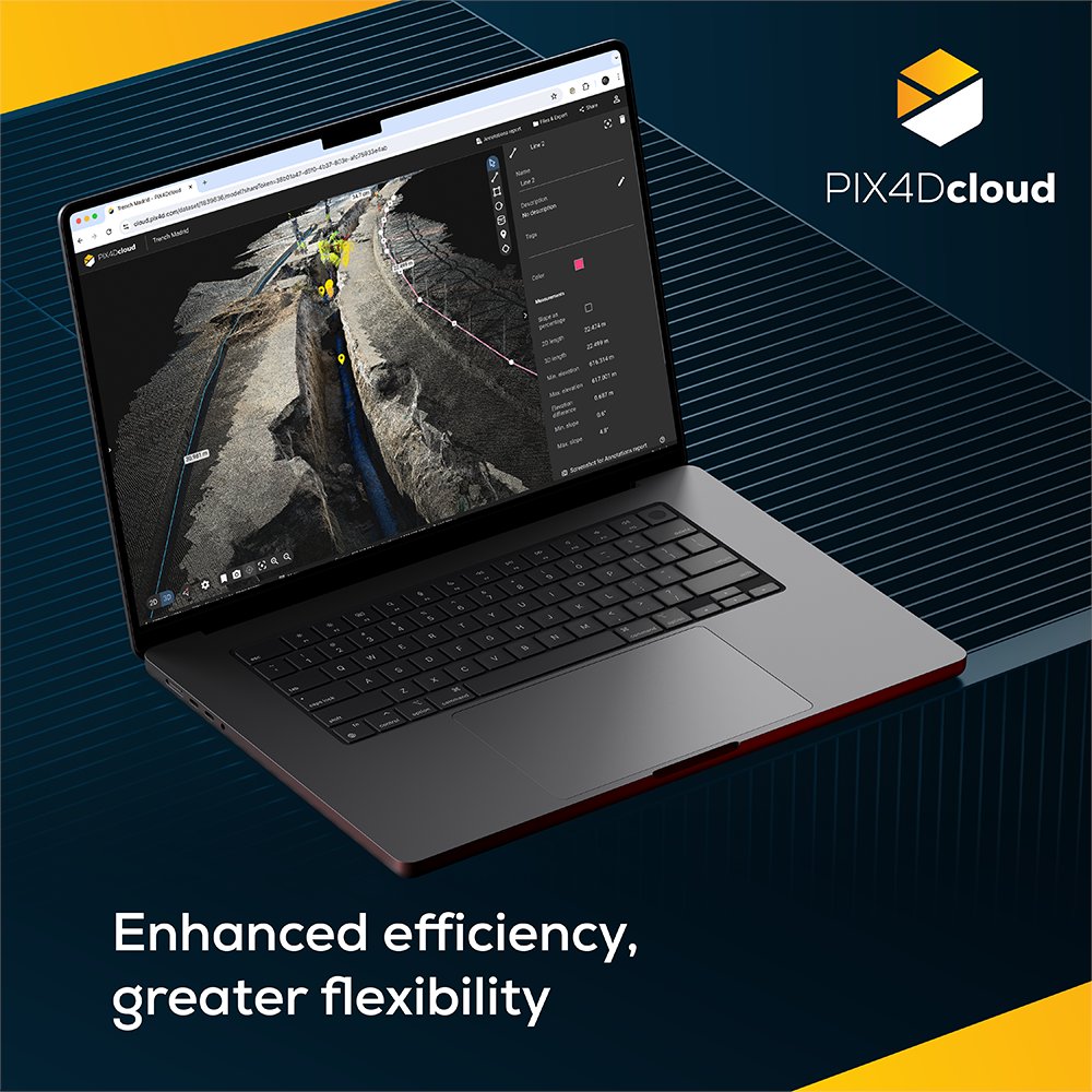
Curious about how to get the best results from #PIX4Dcloud? 🕵️♂️ Our dedicated article covers four of the latest features: 1️⃣ #DXF export 📐 2️⃣ #SHP export for #GIS integration 📁 3️⃣ DXF and #IFC overlay 🗺️ 4️⃣ Annotations report 📊 Find out here: hubs.li/Q02CqVg_0
With the Design Overlay tool in #PIX4Dcloud, you can upload #DXF and #IFC files to visually compare design plans against your real-world georeferenced 3D models and orthomosaics. Check as-built vs. as-designed seamlessly. Read more here: pix4d.com/blog/as-built-…
In this use case, coastal asset surveys are scanned with #PIX4Dcatch. Data goes to #PIX4Dcloud for tracking erosion & precise damage measurement from rising sea levels. This information empowers coastal authorities to make informed decisions. Read more: pix4d.com/blog/tracking-…

Disputes are a common part of construction that many professionals aim to prevent. Discover how drone mapping, specifically with #PIX4Dcloud's timeline tool, helped save €80,000 (almost $100,000)! 💰 Read more here: pix4d.com/blog/solving-c… #digitalconstruction #bim
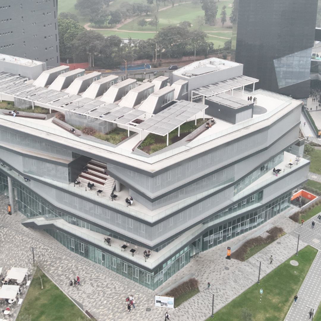
Exciting developments in Peru! 🎉 The University of Lima (@udelima) used #PIX4Dcloud for #DigitalConstruction. Using the software to monitor and accurately track the #construction of a renowned building on campus. Learn more here: hubs.li/Q02H3mcx0
📢 Online workshop alert! Master the full end-to-end Pix4D reality capture workflow! Three days of hands-on learning to guarantee accurate 2D maps and 3D models with the Pix4D ecosystem. 💫 Register now: training.pix4d.com/courses/pix4d-… #PIX4Dcatch #PIX4Dmatic #PIX4Dcloud #Pix4D
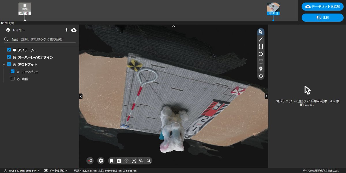
学生が自身で撮影した画像をPIX4DcloudにアップしてSfMを体験しました。 被写体の三次元形状復元はうまくいっていますが、天地がひっくりかえってしまいました。 さて、どのような修正方法があるでしょうか? 来週も頑張っていきましょう! #PIX4Dcloud
#PIX4Dmatic 1.64.0 #PIX4Dmapper 4.9 #PIX4Dcloud #PIX4Dfields 2.7 #PIX4Dreact 1.5.1 #PIX4Dsurvey 1.64.0 #PIX4DcapturePro 1.4.0 #PIX4Dcatch #SurveyDronesIreland
Our #PIX4Dcloud engineers have completed a complex migration of our containerized microservices to @AWS Graviton processors! ⚙️ We implemented a multi-architecture CI/CD pipeline and achieved an x86 to ARM64 transition with zero downtime. Read more here: aws.amazon.com/blogs/alps/how…
Identifying design issues early during #construction keeps projects on schedule and within budget! Use #PIX4Dcloud to compare #asbuilt to as-designed, catch potential problems before they escalate, and keep your project on track. Find out how: pix4d.com/blog/as-built-…

📽️ Check out our new #PIX4Dmatic video tutorials! 🌟 Learn how to: ➡️ Work with CRS ➡️ Add a region of interest ➡️ Process aerial data + terrestrial data ➡️ Merge aerial + terrestrial datasets and process with #PIX4Dcloud Watch here: hubs.li/Q02F_5jd0

A landmark year for #PIX4Dcloud! 🎊 We scaled #georeferenced #GaussianSplatting from phone to drone projects in just one year, delivering measurable photorealism. 💫 Plus, Organization Management, enhanced #BIM/#GIS exports, & more! Full highlights: pix4d.com/blog/PIX4Dclou…
Something went wrong.
Something went wrong.
United States Trends
- 1. Happy Easter N/A
- 2. He is Risen N/A
- 3. #SHIRON N/A
- 4. Resurrection Sunday N/A
- 5. 25th Amendment N/A
- 6. Muhammad Qasim N/A
- 7. Praise N/A
- 8. #KUNWorldTour2026 N/A
- 9. #aneveningwithkun_us N/A
- 10. Truth Social N/A
- 11. KUN's 2026 US Tour N/A
- 12. Power Plant Day N/A
- 13. Christ is King N/A
- 14. God Bless N/A
- 15. Kurds N/A
- 16. Because He N/A
- 17. Bridge Day N/A
- 18. Good Sunday N/A
- 19. C-130s N/A
- 20. Galilee N/A