#pysal search results


Do geospatial analysis and make it pretty with #pysal (was distracted and missed even cooler viz) - #SciPy2018


#qgis #esda #pysal Comparativa entre la distribución espacial de la población soltera, año 2010/2020. Para el año 2010, a diferencia del año 2020, es apreciable la presencia de tres grandes aglomeraciones en la ciudad; la 1° ubicada en las inmediaciones de la zona central...


Today's #PySAL Package highlight is tobler, an open-source Python package for areal interpolation, dasymetric mapping, change of support, and small area estimation. More information on tobler can be found via github.com/pysal/tobler.


Want to explore @PySAL_devs and our packages? Visit the new #PySAL website via pysal.org to learn more.

Here's the new structure of #PySAL. Let me give you a quick run down of how we've split the monolithic package (1.X model) into a federation of smaller, more focused libraries (2.X model). [Thread to follow]
![darribas's tweet image. Here's the new structure of #PySAL. Let me give you a quick run down of how we've split the monolithic package (1.X model) into a federation of smaller, more focused libraries (2.X model). [Thread to follow]](https://pbs.twimg.com/media/DyO3CYSXgAUmNG3.png)
You can now take out for a spin the all-new, best-yet, next-generation version of #PySAL, released yesterday. Completely new organisation, lots more of functionality and a new architecture to support at least the next 10 years. This is a biggie. github.com/pysal/pysal/re…


Thanks to all the new faces who participated at the #pysal sprint tutorial earlier today. @knaaptime and I had a great time working with today, and hope to see you all on tomorrow's sprint.


An open-source framework for segregation measures. urbandemographics.blogspot.com/2019/11/an-ope… A contribution by members of the #PySAL team:@renanxcortes, Rey, @knaaptime, @levijohnwolf #segregation #spatialsegregation #python

Earlier this month, the great Stef. Lumnitz released splot 1.0, the icing on the cake of an absolutely brilliant Google Summer of Code'18. This is a lightweight visualisation layer for the #PySAL family. Grab it while it's hot at github.com/pysal/splot


Join us and the Python Spatial Analysis Library team (@pysal_devs) next week from Oct. 24-25 for our CGS X PySAL Programming Sprint, with an “Introduction to Sprinting” seminar on Day 1. RSVP via tinyurl.com/pysalsprint. #PySAL #UCRCGS


Today's #PySAL Package highlight is access, which provides classical and novel measures of spatial accessibility to services. Package development was spearheaded by members of @GeodaCenter and @SpatialUCR. More information on access can be found via access.readthedocs.io/en/latest/.


Today's #PySAL Package highlight is libpysal, which provides the foundational algorithms and data structures that support the rest of the PySAL library. Learn more at pysal.org/libpysal/.

Coming to the end of year 2 for my course "Introduction to programming for the spatial sciences" @mcgillgeography. I must say that I am quite impressed with the combination of #geopandas, #rasterio, and #pysal (all through #JupyterHub) for teaching. #PandemicProof


* Understand real-world spatial interaction Mastering spatial weights is the first major step toward meaningful spatial analytics. #GIS #PySAL #GeoDa #SpatialWeights #GeospatialAnalysis
Saturday evening fun: here's a quick'n'dirty notebook to integrate @UberEng's H3 geographies with the standard geo #pydata stack (incl. @geopandas) & build #PySAL spatial weights matrices from H3's hexagons gist.github.com/darribas/c9092…


* Understand real-world spatial interaction Mastering spatial weights is the first major step toward meaningful spatial analytics. #GIS #PySAL #GeoDa #SpatialWeights #GeospatialAnalysis

Dive into spatial autocorrelation and optimization with Python and PySAL in Chapter 4 of Spatial SQL by @Matt Forrest. Explore topics like clustering, optimization by regions / territories, and location allocation. Get it here: buff.ly/3NNmWRV #spatialsql #python #pysal


I want to merge small polygons based on area with adjacent neighbor polygons. for instance,I want to merge all countries in an iterative way to have a world map in which all small countries merge with neighbors .Any idea How? #pysal #GeoPandas? gis.stackexchange.com/questions/4473…

After your initial step of converting raster to @geopandas . I use #pysal area_interpolate pysal.org/tobler/generat… with n_jobs=-1 . To scale up even more you can #rioxarray to clip individual contrives and process with #Dask

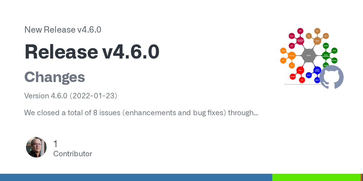
🚨 New #PySAL release alert! 🚨 v4.6.0 of the Python Spatial Analysis Library Core (#libpysal) is out now! Learn more about the changes via github.com/pysal/libpysal…
#PySAL is featured in the #UCRCGS Activity Report! You can check it out at bit.ly/3g9mX1v.

The Center for Geospatial Sciences is proud to announce the release of our 2017-2020 Activity Report, which highlights the work our center has completed since its inception as well as our ongoing initiatives and projects. The full report can be viewed at bit.ly/3g9mX1v.

Also, shoutout to @LeviJohnWolf, @JamesGaboardi, @QunshanZhao, @TaylorOshan & Jeffery Sauer for mentoring the #PySAL @GSOC students in their projects!

hey #rspatial and #pysal folk: does anyone know of commercial organisations using Geographically Weighted Regression or other GW models? ... trying to identify and perhaps contact non-academic end-users... (not asking for a friend!) #rstats #pydata #pandas #geopandas
#UCRCGS Director Sergio J. Rey (@sreyog), Associate Director Elijah Knaap (@knaaptime), & some of our affiliates: Dani Arribas-Bel (@darribas), James Gaboardi (@JamesGaboardi), Levi John Wolf (@levijohnwolf), & Stefanie Lumnitz (@stefanielumnitz), contributed to #PySAL 2.5.0!
🚨 #PYSAL UPDATE: 🚨 PySAL 2.5.0 has officially been released! This new release represents 6 months of enhancements, bug fixes, widening of test coverage, and improved documentation. Read more about the changes at github.com/pysal/pysal/re….

🚨 #PYSAL UPDATE: 🚨 PySAL 2.5.0 has officially been released! This new release represents 6 months of enhancements, bug fixes, widening of test coverage, and improved documentation. Read more about the changes at github.com/pysal/pysal/re….
Today's #PySAL Package highlight is libpysal, which provides the foundational algorithms and data structures that support the rest of the PySAL library. Learn more at pysal.org/libpysal/.


Today's #PySAL Package highlight is tobler, an open-source Python package for areal interpolation, dasymetric mapping, change of support, and small area estimation. More information on tobler can be found via github.com/pysal/tobler.
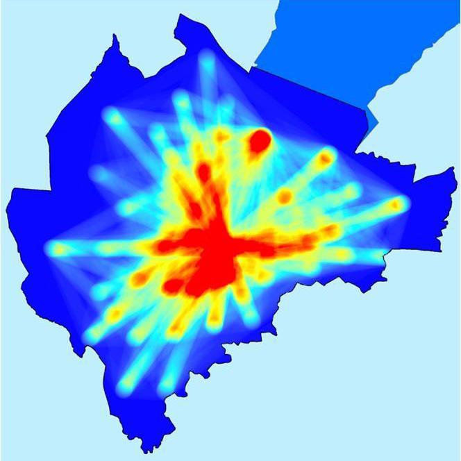

#qgis #esda #pysal Comparativa entre la distribución espacial de la población soltera, año 2010/2020. Para el año 2010, a diferencia del año 2020, es apreciable la presencia de tres grandes aglomeraciones en la ciudad; la 1° ubicada en las inmediaciones de la zona central...

Experimenting with visualizing #pysal results with #gganimate (yes, #pydata and #rstats can play nicely together!)
An open-source framework for segregation measures. urbandemographics.blogspot.com/2019/11/an-ope… A contribution by members of the #PySAL team:@renanxcortes, Rey, @knaaptime, @levijohnwolf #segregation #spatialsegregation #python

Geographic #DataScience w/ #PySAL & #pydata. Our #Scipy2016 workshop. URL: darribas.org/gds_scipy16/ Feedback welcome!


Join us and the Python Spatial Analysis Library team (@pysal_devs) next week from Oct. 24-25 for our CGS X PySAL Programming Sprint, with an “Introduction to Sprinting” seminar on Day 1. RSVP via tinyurl.com/pysalsprint. #PySAL #UCRCGS

#opensource repository of the week. Python Spatial Analysis LibraryNotes by pysal developers @pysal_devs github.com/pysal/pysal #GithubWeeklyRepo #pysal #geospatial #DataScience #MachineLearning #pandas #numpy #3D #EuroPython2019 #EuroSciPy #DeepLearning

Thanks to all the new faces who participated at the #pysal sprint tutorial earlier today. @knaaptime and I had a great time working with today, and hope to see you all on tomorrow's sprint.
Do geospatial analysis and make it pretty with #pysal (was distracted and missed even cooler viz) - #SciPy2018
Coming to the end of year 2 for my course "Introduction to programming for the spatial sciences" @mcgillgeography. I must say that I am quite impressed with the combination of #geopandas, #rasterio, and #pysal (all through #JupyterHub) for teaching. #PandemicProof
C.O.O.L.“@underdarkGIS: Working on integrating #PySAL's Local Moran's into #QGIS Processing. Pop. dens | clusters ”
Here's a LISA map of the Leave in the #EUref using #PySAL and #pydata gist.github.com/darribas/691ad…


Something went wrong.
Something went wrong.
United States Trends
- 1. Jameis 21.7K posts
- 2. Chiefs 54K posts
- 3. Giants 65.1K posts
- 4. Lions 43.3K posts
- 5. JJ McCarthy 3,072 posts
- 6. Colts 23.1K posts
- 7. Mahomes 13.4K posts
- 8. Vikings 24.2K posts
- 9. Steelers 39K posts
- 10. Gibbs 5,950 posts
- 11. Campbell 15K posts
- 12. Bears 53.1K posts
- 13. Caleb 31.1K posts
- 14. Bengals 17.5K posts
- 15. Lamar 18.4K posts
- 16. #GoPackGo 4,131 posts
- 17. #OnePride 2,777 posts
- 18. Flacco 4,082 posts
- 19. #Skol 2,443 posts
- 20. Mason Rudolph 4,730 posts