#gis search results

How do people get into #GIS? 💡 Vivian Kase shares how she discovered the field and her experience in the industry. 🌎 Read here: ow.ly/xf6A50YUvsG


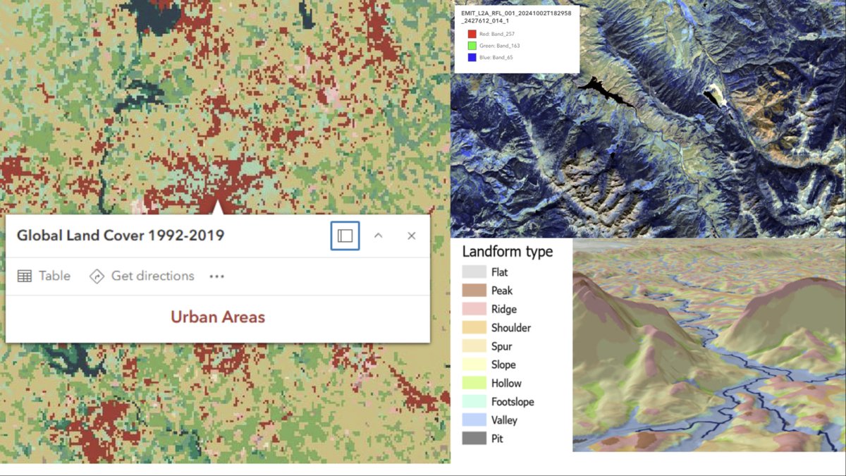
ArcGIS Online now supports AVIRIS and EMIT hyperspectral raster types — directly in the cloud. 🛰️🖥️ The February 2026 imagery update is packed with new tools for analysts and remote sensing professionals. esri.com/arcgis-blog/pr… #Geoawesome #GIS #ArcGIS #RemoteSensing #Esri

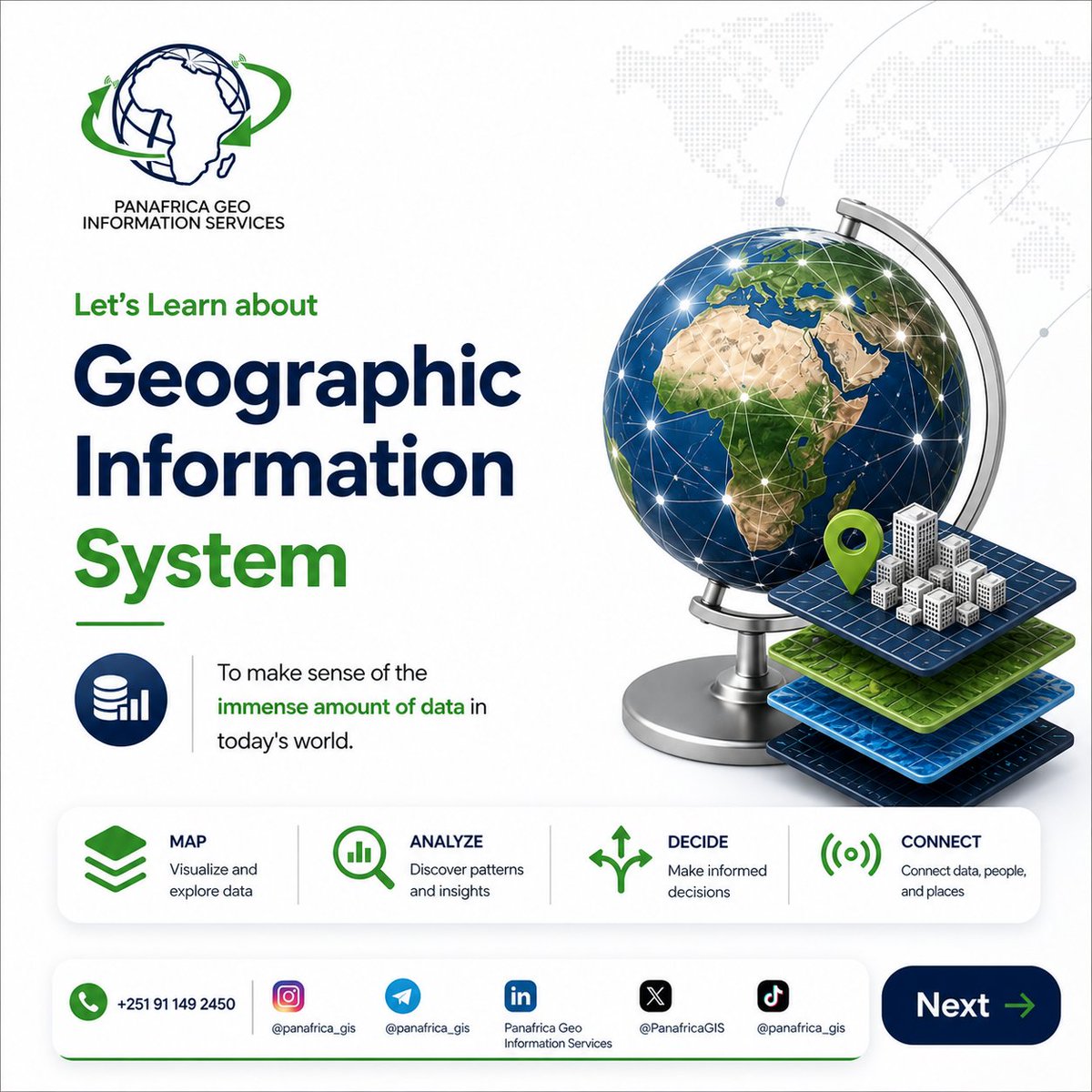
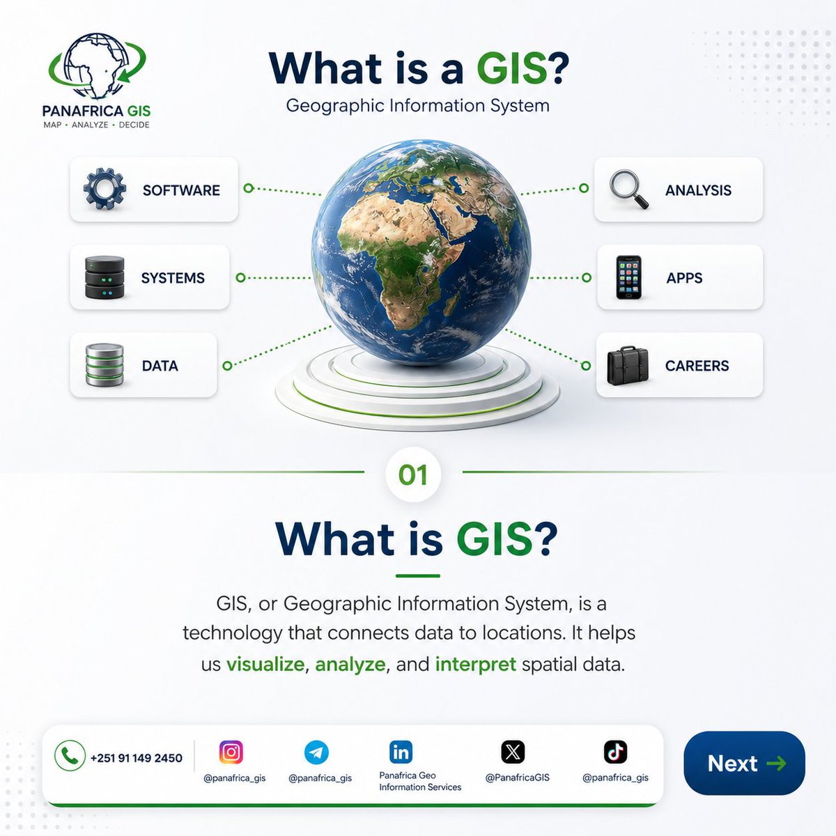
🌍 What is GIS? Geographic Information Systems connect data to locations—helping you visualize, analyze & make smarter decisions. 🚀 Powering Africa with geospatial intelligence. 📞 +251 91 149 2450 #GIS #Geospatial #DataVisualization #AfricaTech #PanafricaGIS


✨New Publication✨ Uneven Paths to Health: A Spatial Analysis of Sidewalk Conditions and #Healthcare Access for Older Adults By Nikolaos Stasinos, Kleomenis Kalogeropoulos, Andreas Tsatsari and Marianna Mantzorou 👉See the paper: mdpi.com/2220-9964/15/3… #urban #GIS


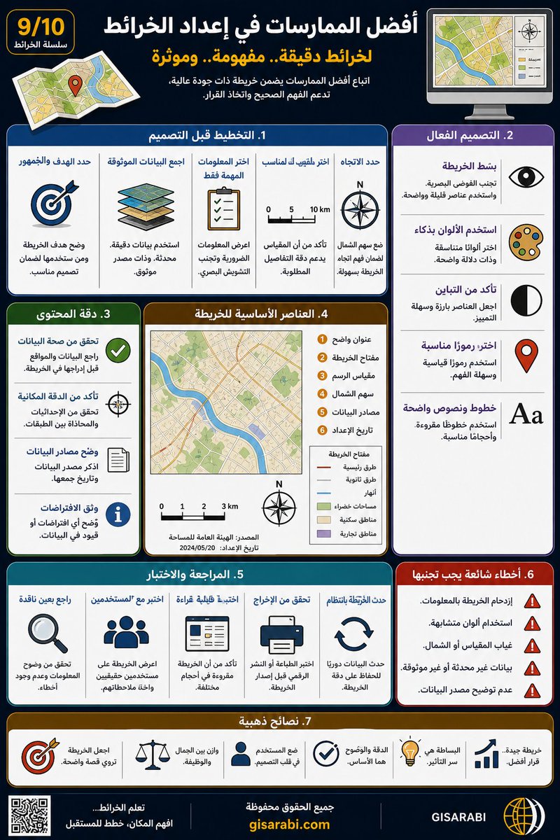
🧭 الخريطة بدون عناصرها الأساسية تفقد معناها. العنوان يحدد الفكرة، والمفتاح يفسر الرموز، ومقياس الرسم يربطك بالواقع، واتجاه الشمال يوجّهك. تفاصيل صغيرة… لكنها تصنع خريطة تُفهم لا تُشاهد فقط. gisarabi.com #جغرافيا #GIS


🗺️ إعداد خريطة ناجحة ليس خطوة واحدة… بل سلسلة قرارات. ابدأ بهدف واضح، استخدم بيانات موثوقة، صمّم بذكاء، ثم راجع واختبر قبل النشر. التفاصيل الصغيرة هي التي تصنع خريطة دقيقة ومؤثرة. gisarabi.com #جغرافيا #GIS

GIS & Geospatial Analysis with Python, Geopandas, and Folium ⏱️ 5.3 hours ⭐ 4.16 👥 3,528 🔄 May 2026 💰 $14.99 → 100% OFF comidoc.com/udemy/gis-geos… #udemy #GIS #Geospatial #Python


In #Südtirol stehen viele #Immobilien leer, zugleich herrscht Wohnungsmangel. Kann die Gemeindeimmobiliensteuer #GIS etwas ausrichten? Eine #Masterarbeit liefert interessante Erkenntnisse. #SWZ swz.it/gis-erhoehung-…


YOU’RE LOSING WATER… BUT YOU CAN’T SEE IT 💧 Every day, water systems lose huge volumes silently. With GIS, you don’t just manage infrastructure you see what’s failing in real time. 🔗 Learn more 👉 cliffordgeoconsult.com #GIS #WaterManagement #SmartUtilities #Infrastructure


The team is in full prep mode to make your Esri India Developer Summit experience truly unforgettable. Secure your spot at one of the country’s most anticipated developer event. Register now: ow.ly/JJnT50YUrjm #EsriIndia #GIS #DevSummit


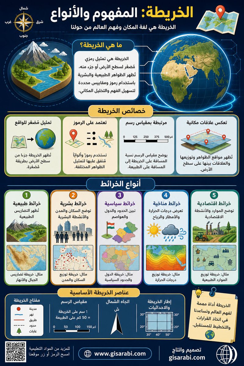
🗺️ الخريطة ليست مجرد رسم… بل لغة تشرح المكان وتكشف العلاقات الخفية بين الظواهر. من الخرائط الطبيعية إلى السياسية، كل نوع يفتح زاوية جديدة لفهم العالم وتحليله. هل تنظر للخريطة بعين قارئ… أم محلل؟ gisarabi.com #جغرافيا #GIS

📰 #ArcGIS Blog: Local or Global Scene? Which Should You Use for Your 3D Native App? esri.com/arcgis-blog/pr… _ #Esri #GIS #Geospatial #MetaMapping
esri.com
Local or Global Scene? Which Should You Use for Your 3D Native App?
Local or Global Scene? Which Should You Use for Your 3D Native App?
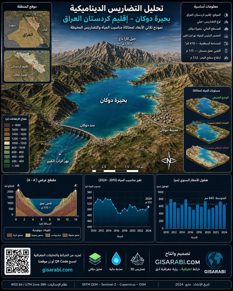
حين تتحول التضاريس من خطوط على الخريطة إلى مشهد ثلاثي الأبعاد نابض بالحياة… هنا تبدأ الجغرافيا الحقيقية. هذا النموذج يكشف كيف تتفاعل الجبال والمياه والزمن في بحيرة دوكان عبر تحليل مكاني دقيق وواقعي. طبعا التحليل بالذكاء الاصطناعي #GIS #الجغرافيا #تحليل_مكاني
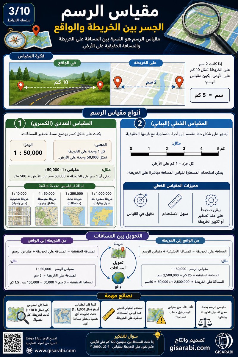
📏 مقياس الرسم هو الجسر بين الخريطة والواقع. كل 1 سم قد يساوي كيلومترات على الأرض، وهنا تبدأ الدقة: قراءة صحيحة = تحليل صحيح. افهم المقياس… وسترى المسافات كما هي، لا كما تبدو. gisarabi.com #جغرافيا #GIS

Tutorial: What is spectral resolution? How does the number of bands affect satellite image information? To get the full tutorial, comment #remotesensing #GIS #LiDAR #Radar #optical #SatelliteImagery #EarthObservation #geospatial #SpatialAnalysis #LearnGIS
اختيار القمر الصناعي ليس تفصيلاً تقنياً… بل قرار يحدد مصداقية تحليلك بالكامل. • زراعة → Sentinel-2 • غيوم/فيضانات → Sentinel-1 (SAR) • دقة فائقة → WorldView-3 • تغير يومي → PlanetScope السر الحقيقي؟ لا تعتمد على قمر واحد… اجمع بينها. #GIS #الاستشعار_عن_بعد #GeoAI


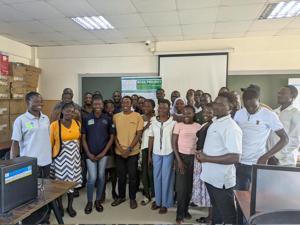
Grateful to Muni University Agriculture & Environmental Science students for the strong turnout at our GIS training—advancing data-driven climate solutions. Thanks to UNDP Rome Centre and @Youth4Climate. #ClimateAction #GIS


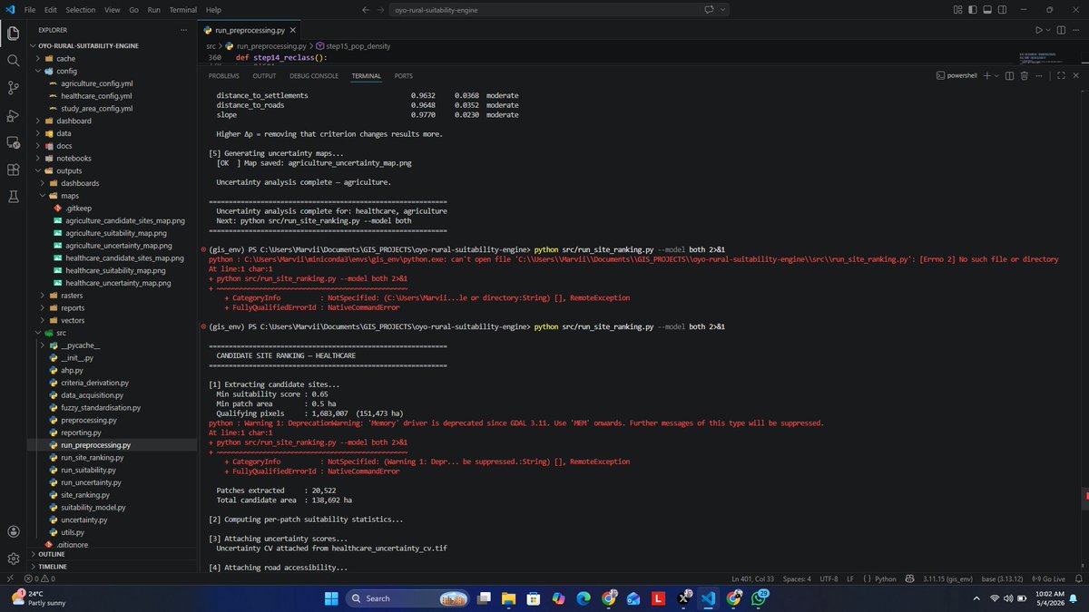
It is amazing to see the vast geospatial workflows that can be automated with python. From June 1st, I will be unveiling the numerous capstone and complex geospatial projects i have completed using Python #PythonProgramming #GIS


How do people get into #GIS? 💡 Vivian Kase shares how she discovered the field and her experience in the industry. 🌎 Read here: ow.ly/xf6A50YUvsG

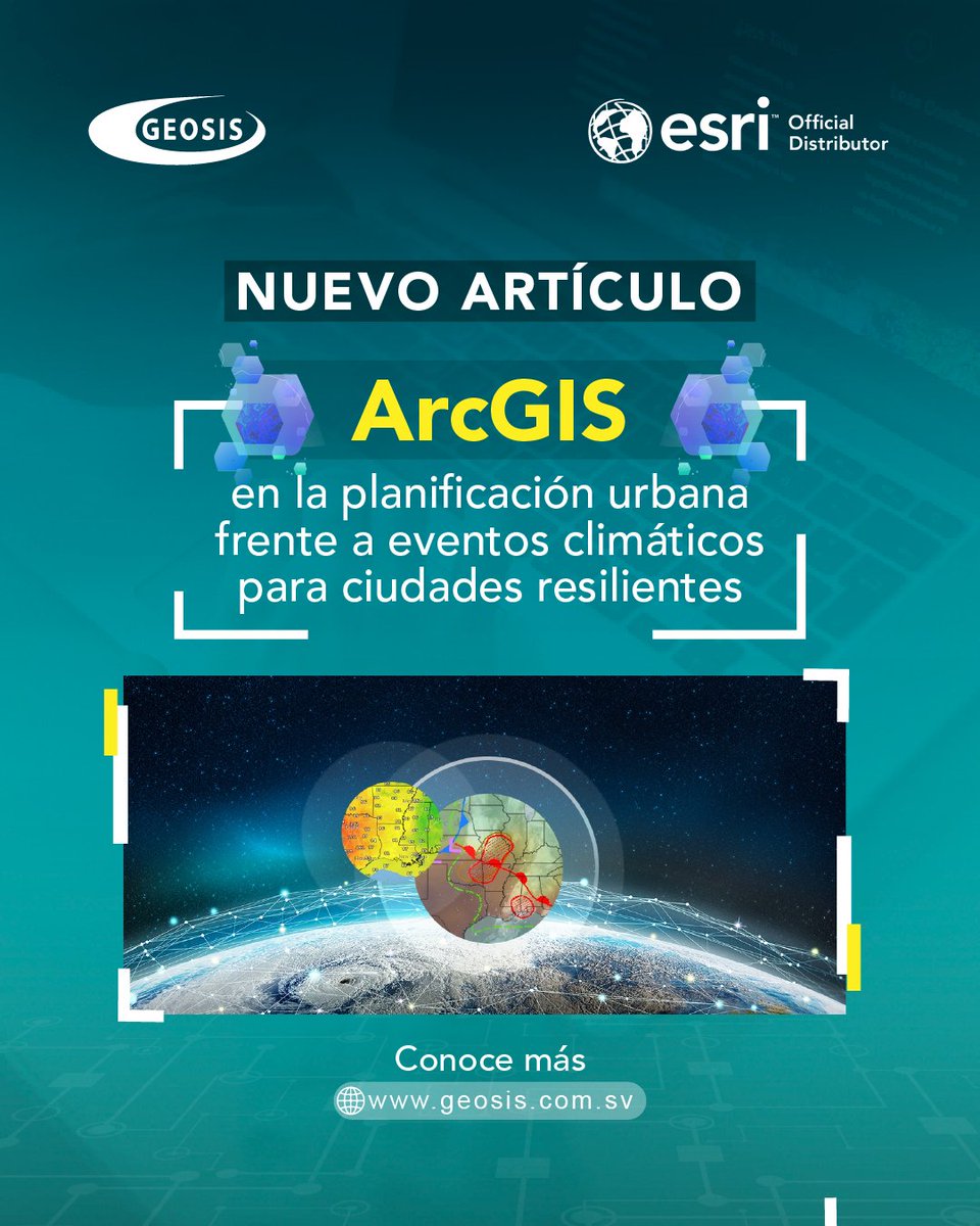
Lluvias intensas, inundaciones, deslizamientos… ¿Está su ciudad preparada? El uso de ArcGIS en la planificación urbana permite anticipar escenarios y reducir riesgos antes de que ocurran. 👉 Lea el artículo completo: geosis.com.sv/?p=2188 #ArcGIS #GIS #Geosis


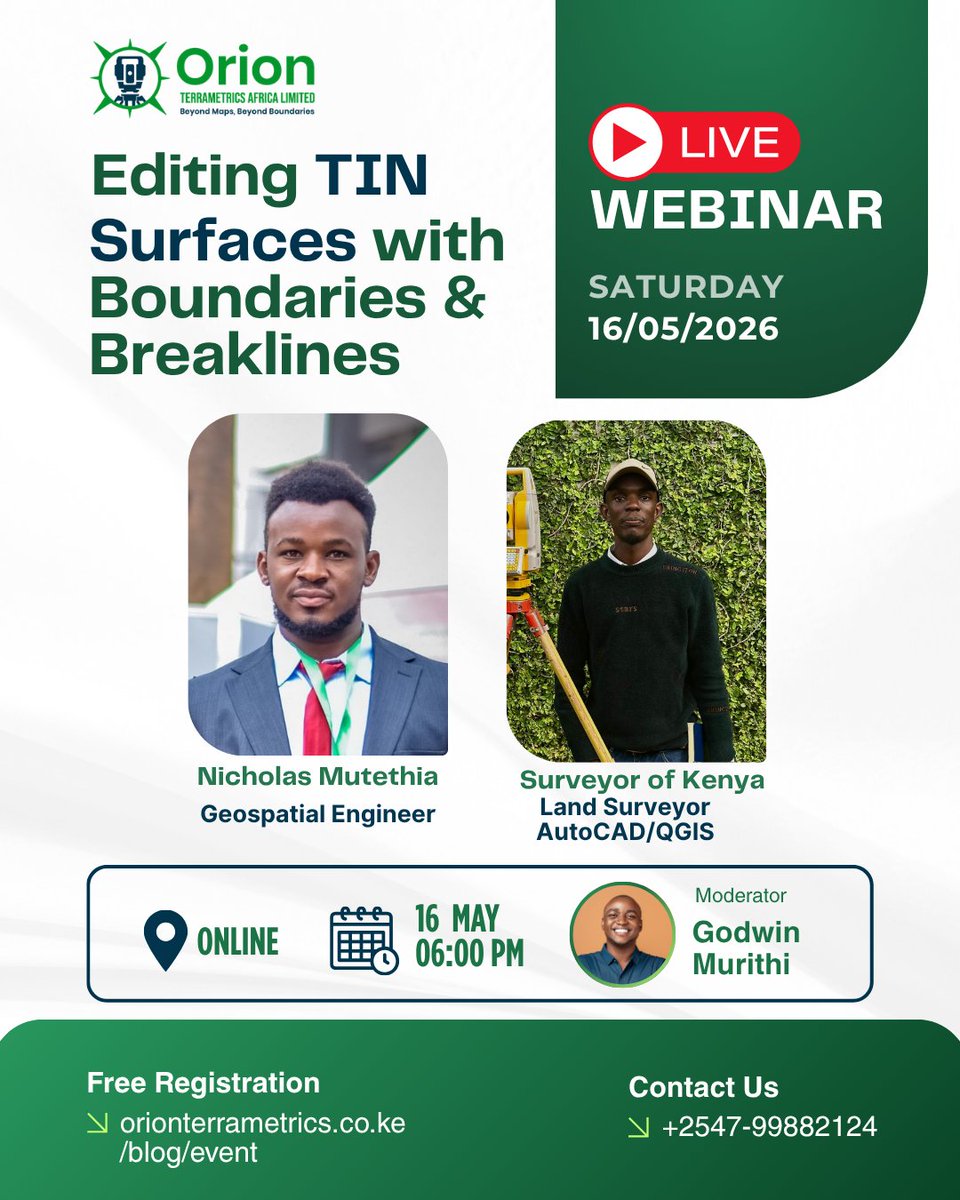
Next in the Geospatial for Africa Series Editing TIN Surfaces with Boundaries & Breaklines Learn how to refine terrain models for real-world surveying & engineering projects. 📅 Sat, 16 May 2026 ⏰ 6:00 PM (EAT) 🔗 orionterrametrics.co.ke/blog/event #GIS #Surveying #QGIS #GeoAfrica


🚀 Next in the Geospatial for Africa Series Editing TIN Surfaces with Boundaries & Breaklines Learn how to refine terrain models for real-world surveying & engineering projects. 📅 Sat, 16 May 2026 ⏰ 6:00 PM (EAT) 🔗 orionterrametrics.co.ke/blog/event #GIS #Surveying #QGIS #GeoAfrica
Land Use Land Cover Classification with Population and Settlement Dynamics Using Google Earth Engine. Tutorial Link: youtube.com/live/kdJG0ZNb1… #googleearthengine #LULC #GIS #remotesensing #UrbanGrowth #population #geospatial #SatelliteImagery #EarthObservation #SpatialAnalysis

In #Südtirol stehen viele #Immobilien leer, zugleich herrscht Wohnungsmangel. Kann die Gemeindeimmobiliensteuer #GIS etwas ausrichten? Eine #Masterarbeit liefert interessante Erkenntnisse. #SWZ swz.it/gis-erhoehung-…

standardu higieny rąk personelu wykonującego czynności w obszarze opieki nad pacjentami 👇🏻 #GIS zgorzelec.info/news/32443

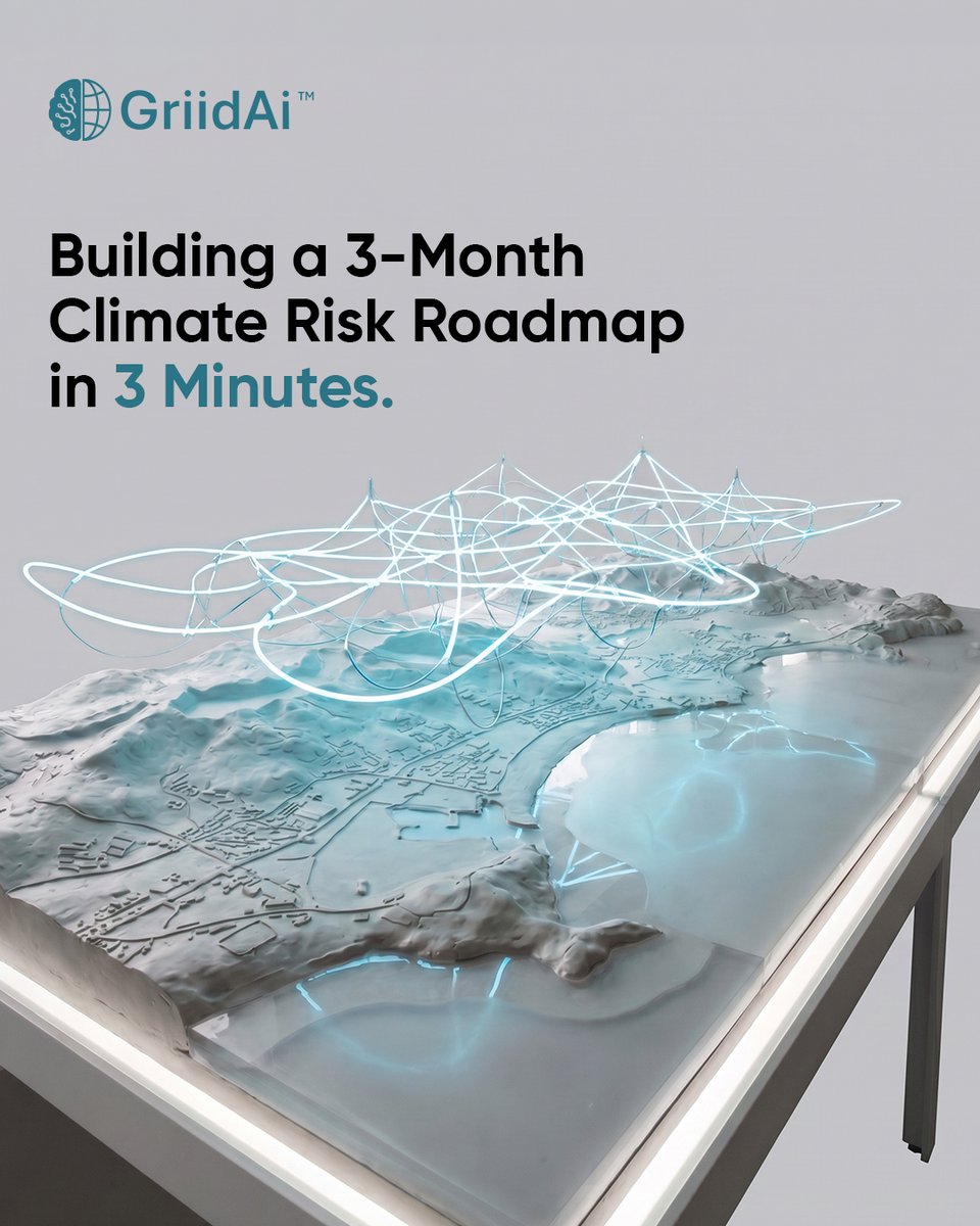
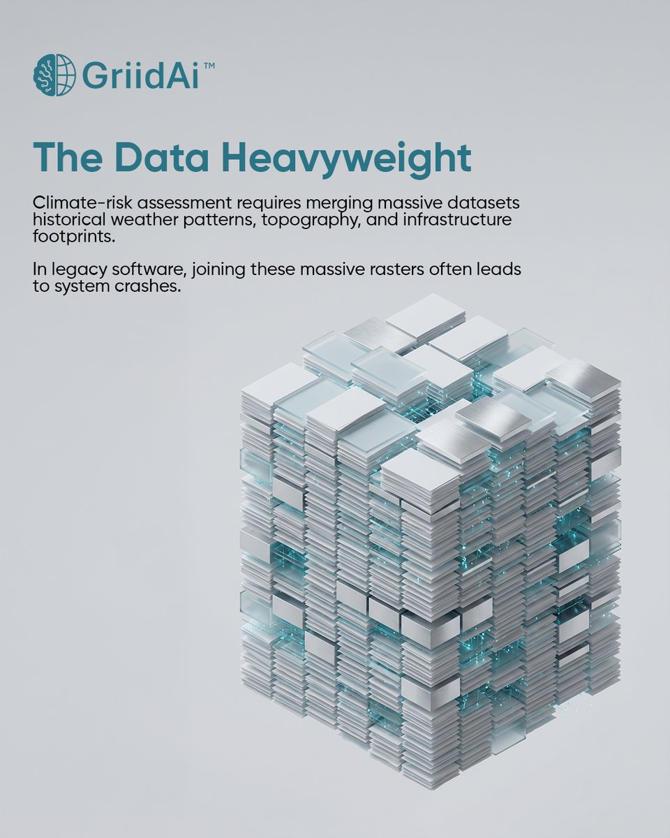
Climate-risk modeling shouldn’t crash your machine. With GriidAi, describe the model you need and let the cloud handle the heavy GIS work. No Python. No desktop limits. Just faster insight. #ClimateRisk #GIS #GeoAI #GriidAi

Grateful to Muni University Agriculture & Environmental Science students for the strong turnout at our GIS training—advancing data-driven climate solutions. Thanks to UNDP Rome Centre and @Youth4Climate. #ClimateAction #GIS

「交通の要衝」鳥栖を時間で可視化。 ORS Toolsプラグインを使用し鳥栖JCTを中心に、車で60分圏を15分ごとに描く。 Created with QGIS Isochrones: © openrouteservice. org by HeiGIT © OpenStreetMap contributors 国土地理院 基盤地図情報(DEM) #QGIS #GIS #地図
Exploring ArcGIS Pro: GIS Tutorials from Basics to Advanced ⏱️ 1.6 hours ⭐ 4.22 👥 11,178 🔄 Jul 2024 💰 $14.99 comidoc.com/udemy/explorin… #ArcGISPro #GIS #Mapping #udemy


Pusing ngerjain tugas pemetaan atau butuh analisis spasial buat skripsi dan project? 🗺️📷 Sini biar rumahpeta_co yang beresin! wa.me/6285156260748 📷 #JokiPeta #JokiGeografi #GIS #MahasiswaGeografi #Skripsi #JokiArcGIS #JokiQGIS #JokiGEE #JokiHECRAS
✨New Publication✨ Uneven Paths to Health: A Spatial Analysis of Sidewalk Conditions and #Healthcare Access for Older Adults By Nikolaos Stasinos, Kleomenis Kalogeropoulos, Andreas Tsatsari and Marianna Mantzorou 👉See the paper: mdpi.com/2220-9964/15/3… #urban #GIS


HSBC shares dropped 5% after the bank reported a $400 million fraud-related loss in Britain, highlighting risks in the $3.5 trillion private credit industry reut.rs/4doYxPB
Turkey and Saudi Arabia set to scrap visa requirements, source says reut.rs/4wb6Hme
reuters.com
Turkey and Saudi Arabia set to scrap visa requirements, source says
Turkey and Saudi Arabia plan to sign an agreement to scrap visa requirements for their citizens during talks between their foreign ministers in Ankara on Wednesday, a Turkish diplomatic source said...

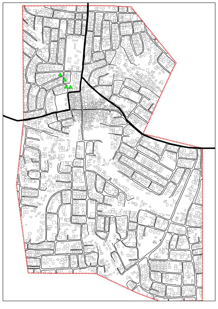
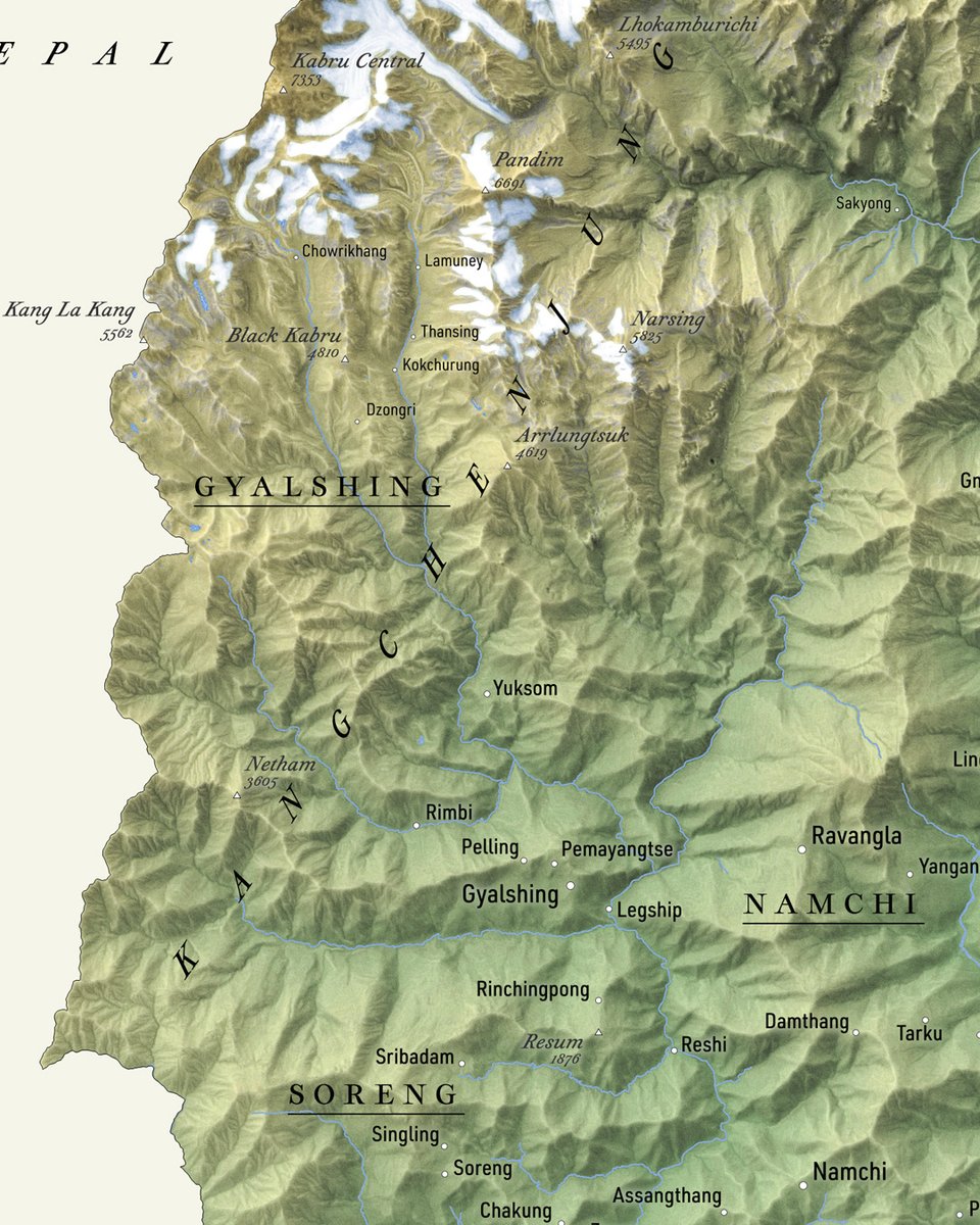
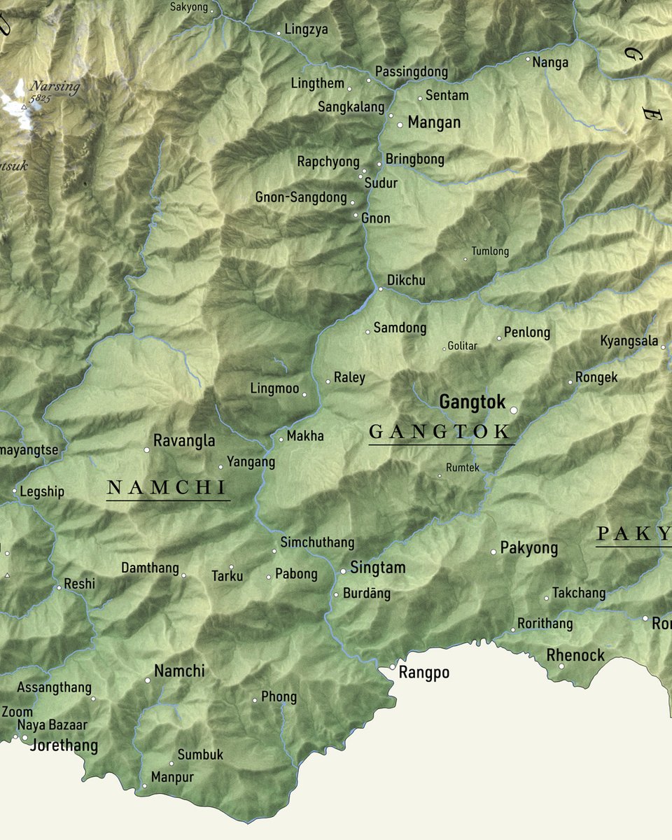
Day 05: #30DaysMapingChallenge Base Map of Kotei ( in Oforikorom Municipality) #GIS #GeographicInformationSystems


Land Use Land Cover Classification with Population and Settlement Dynamics Using Google Earth Engine. Tutorial Link: youtube.com/live/kdJG0ZNb1… #googleearthengine #LULC #GIS #remotesensing #UrbanGrowth #population #geospatial #SatelliteImagery #EarthObservation #SpatialAnalysis
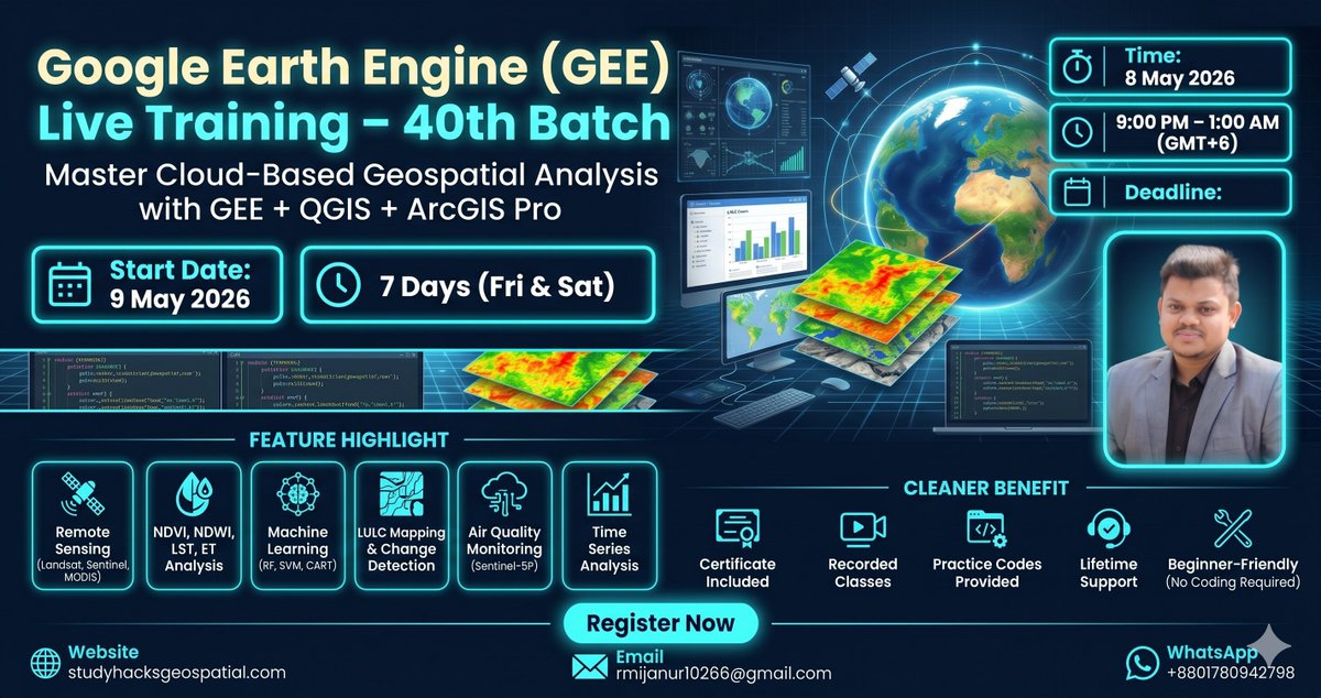
Do you want to master flood inundation mapping using Sentinel-1 SAR imagery? Join our upcoming online training program starting on 9th May and gain hands-on expertise in this powerful remote sensing technique. Registration link: studyhacksgeospatial.com/product/google… #googleearthengine #GIS


紙やExcelでは追いきれなかった災害対応。 ArcGIS Onlineによる情報一元化が、公費解体という超複雑な事業をどう変えたのか。 災害対応×GISのリアルな成功事例は必読です。 #GIS #ArcGIS #建設DX #防災 buff.ly/iEgifly

🧭 الخريطة بدون عناصرها الأساسية تفقد معناها. العنوان يحدد الفكرة، والمفتاح يفسر الرموز، ومقياس الرسم يربطك بالواقع، واتجاه الشمال يوجّهك. تفاصيل صغيرة… لكنها تصنع خريطة تُفهم لا تُشاهد فقط. gisarabi.com #جغرافيا #GIS
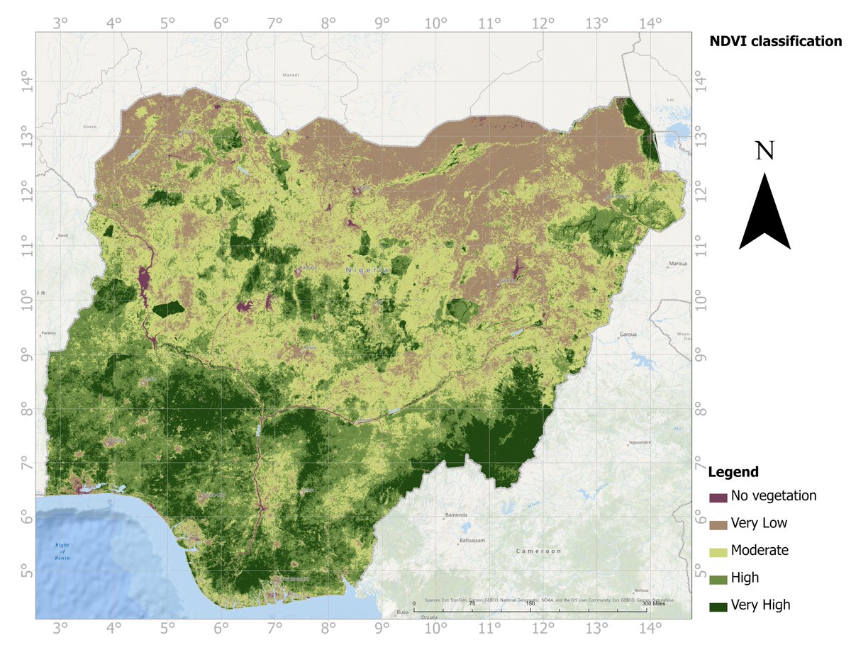
🌍 Vegetation Health Across Nigeria – NDVI Insights Registration link: studyhacksgeospatial.com/product/google… #remotesensing #NDVI #GIS #climatechange #Geospatial #nigeria #EarthObservation #EnvironmentalMonitoring

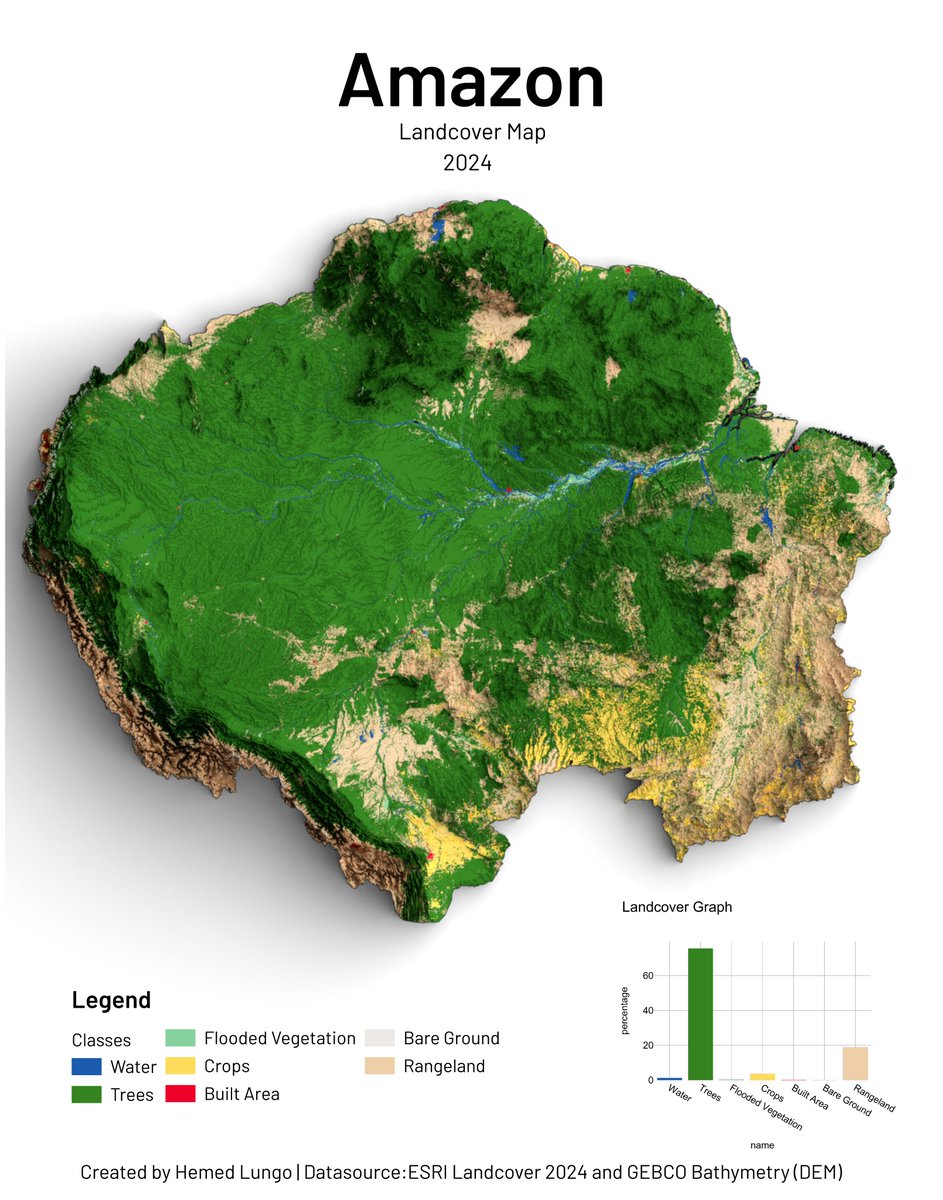
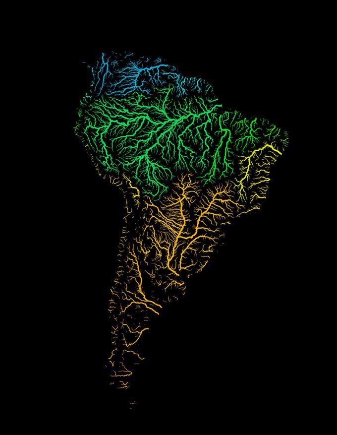
🌎 Amazon Landcover Map 2024 🗺️ Trees cover 60%+ of the Amazon — but croplands and rangeland are closing in. Mapped using ESRI Landcover 2024 by @impactobservatory & @esri and GEBCO Bathymetry DEM. 🛠️QGIS · Blender #GIS #Cartography #Amazon #Landcover
Map showing Africa's terrain— from the lowlands till on top of Mount Kilimajaro . 📊 Data: Gebco bathymetry #gischat #Africa #GIS #Cartography

ArcGIS Online now supports AVIRIS and EMIT hyperspectral raster types — directly in the cloud. 🛰️🖥️ The February 2026 imagery update is packed with new tools for analysts and remote sensing professionals. esri.com/arcgis-blog/pr… #Geoawesome #GIS #ArcGIS #RemoteSensing #Esri
🔥 Learn. Practice. Apply. Elevate your geospatial skills to the next level. Join our live online training program starting 9th May 2026 Reg Link:studyhacksgeospatial.com/product/google… #GoogleEarthEngine #GIS #RemoteSensing #DataScience #StudyHacksGeospatial #GeospatialAnalysis #QGIS #ArcGISPro
🗺️ إعداد خريطة ناجحة ليس خطوة واحدة… بل سلسلة قرارات. ابدأ بهدف واضح، استخدم بيانات موثوقة، صمّم بذكاء، ثم راجع واختبر قبل النشر. التفاصيل الصغيرة هي التي تصنع خريطة دقيقة ومؤثرة. gisarabi.com #جغرافيا #GIS

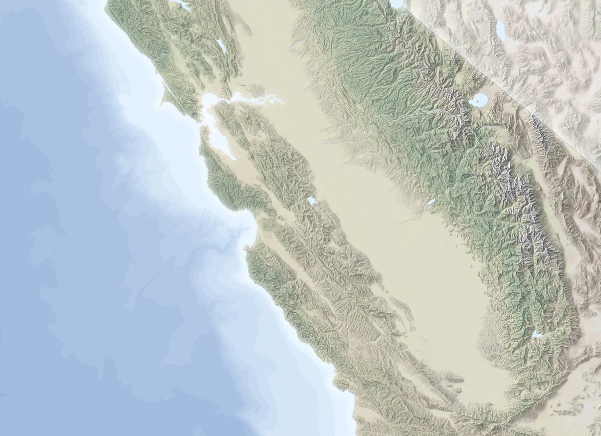
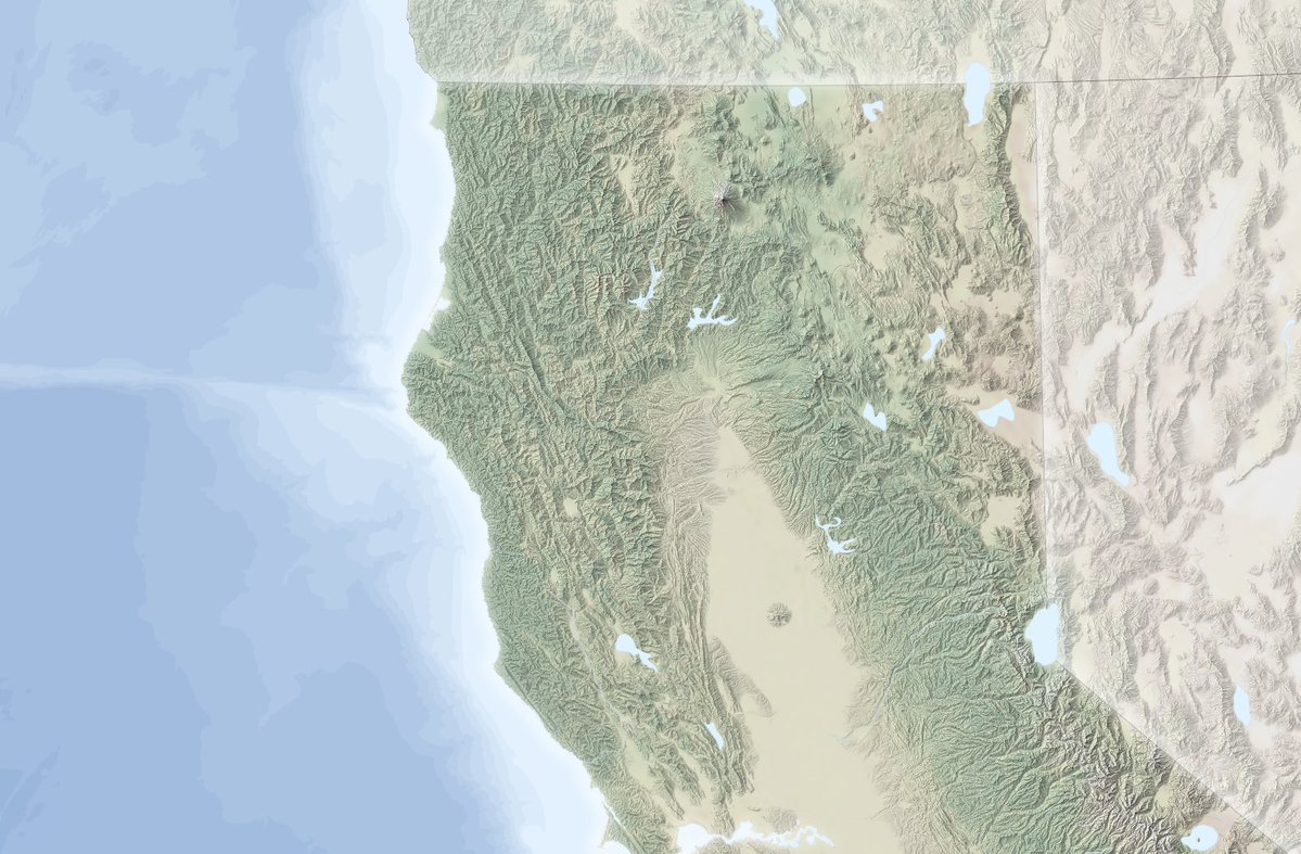
La bathymétrie et l’ombrage, ce couple parfait 🥹 (Bathy réalisée à partir de courbes de niveau extraites d’un MNT ETOPO et ensuite polygonisées, ombrage fait avec @EduardShading) #map #usa


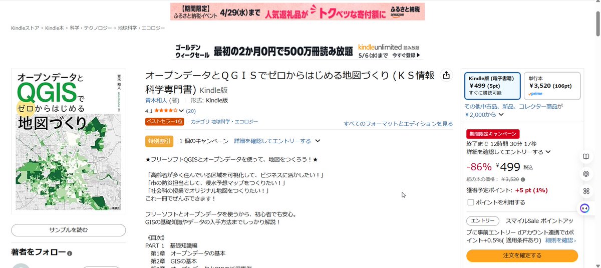
拙著 オープンデータとQGISでゼロからはじめる地図づくり が期間限定キャンペーンで、なんと499円で、お安くお求めいただけます! この機会に是非、ご購入ください! #GIS #オープンデータ #登記所備付地図 amazon.co.jp/gp/product/B0C…

👉👉 Parametric #GIS and #HBIM for #Archaeological Site Management and Historic #Reconstruction Through #3D Survey Integration ✍️ Marco Limongiello et al. 🔗 brnw.ch/21x1RGw

Next in the Geospatial for Africa Series Editing TIN Surfaces with Boundaries & Breaklines Learn how to refine terrain models for real-world surveying & engineering projects. 📅 Sat, 16 May 2026 ⏰ 6:00 PM (EAT) 🔗 orionterrametrics.co.ke/blog/event #GIS #Surveying #QGIS #GeoAfrica
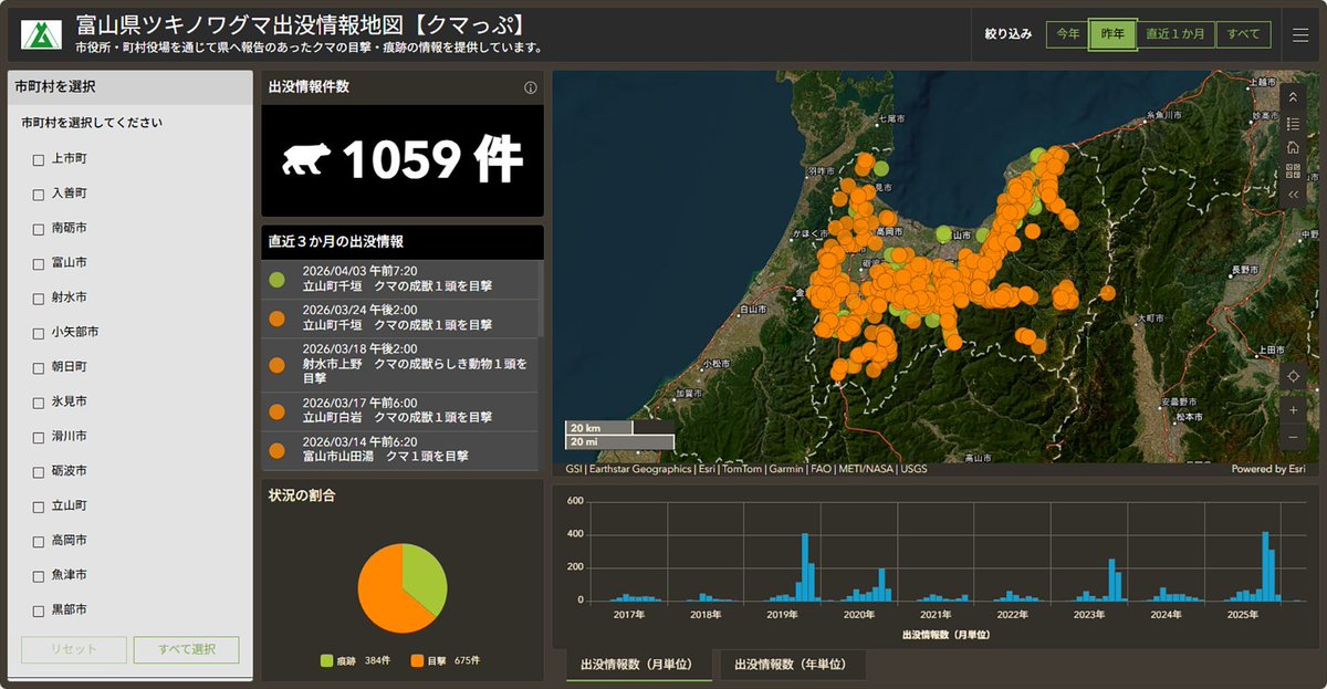
🐻🌸 先日、Esriジャパンのクマ出没情報ページに富山県の【クマっぷ】 が追加されました。 春になって暖かくなってきたから、冬眠していたクマが動き始めた…のかも?🤔 地図で最新の出没状況をチェックできます。 buff.ly/p7xHgXn #クマ出没情報 #GIS #ArcGIS #防災
#GIS ليس برنامجًا… بل عقل يفكر مكانياً. من جمع البيانات إلى تحليلها ثم دعم القرار، تتحول الخرائط إلى أدوات فهم عميق للعلاقات والأنماط. حين تدرك كيف يعمل GIS، تبدأ برؤية العالم بطريقة مختلفة تمامًا. gisarabi.com #GIS #جغرافيا #تحليل_مكاني #نظم_المعلومات_الجغرافية

Something went wrong.
Something went wrong.
United States Trends
- 1. Happy Cinco de Mayo N/A
- 2. #XDCNetwork N/A
- 3. Coinbase N/A
- 4. Presidential Fitness Test N/A
- 5. #KUNxMetgala2026 N/A
- 6. Evil Dead Burn N/A
- 7. Seger N/A
- 8. Springsteen N/A
- 9. Posey N/A
- 10. The Odyssey N/A
- 11. Gary Player N/A
- 12. Nolan N/A
- 13. Mike Alstott N/A
- 14. Vivek N/A
- 15. #We_Will_Fight_1009_Times N/A
- 16. #QuitoSinAlcalde N/A
- 17. #Heeseung_Absence_Echoes N/A
- 18. Travis Kelce N/A
- 19. Bank of America N/A
- 20. Lorenzo Neal N/A