#fedgis 搜索结果


I'll be doing three sessions about #arcpy and the ArcGIS API for Python at #esri #FedGIS this year. Hope to see you there!


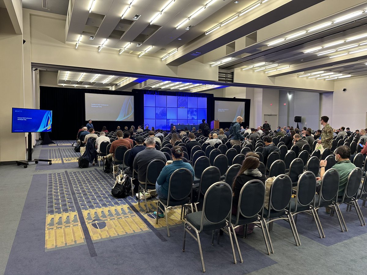
Developer Day has started at #FedGIS! Come by Salon GHI to learn more about our developer tools available in the General Session from 10am - 11:30am.

Just landed in Washington, D.C. for #FedGIS. That’s the pentagon. Looking forward to this great event #GIS #Esri #ArcGIS #FedGIS23 #URISA


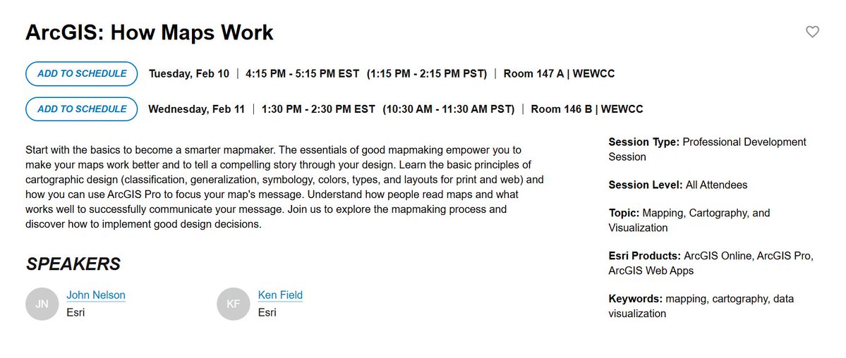
Hold on to your maps - 'Map Wizardry' is going ON TOUR! Catch @NathanCShephard @John_M_Nelson and I at #FedGIS in Washington DC next February! John and I will give 'How Maps Work' a runout too.


It's been a great past two days at the Esri Federal GIS Conference. @Esri is doing some amazing things in the Fed GIS space! Skyline is thrilled to be an Esri partner - bringing real-time streaming video into the Esri ArcGIS platform. #FedGIS #Esri
Were you able to meet with any of our team members during the Meet the Teams lunch during Developer Day at #FedGIS? Hopefully you were able to make some good connections and get your questions answered!


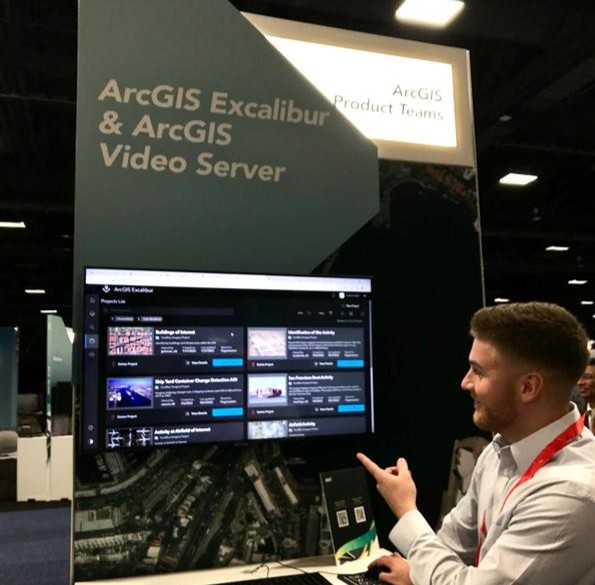
Join the #ArcGISExcalibur team at #FedGIS in today's session: "Imagery and Video Exploitation with ArcGIS Excalibur" ArcGIS Excalibur is a web-based image exploitation workflow for timely geospatial intelligence See you at 1:45 pm in Room 147A esri.social/9YyS50MMeLW


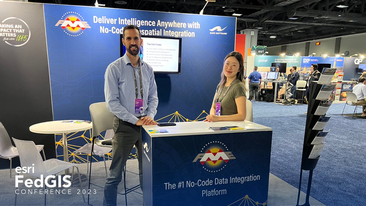
✈️🌐 We’re in Washington, DC for the @Esri Federal GIS Conference today and tomorrow (February 6-7). If you are around, come visit our team at booth #704 and discover how FME can maximize the potential of your data. #Esri #FedGIS #FedGIS2023 #arcgis #GIS #SafeSoftware
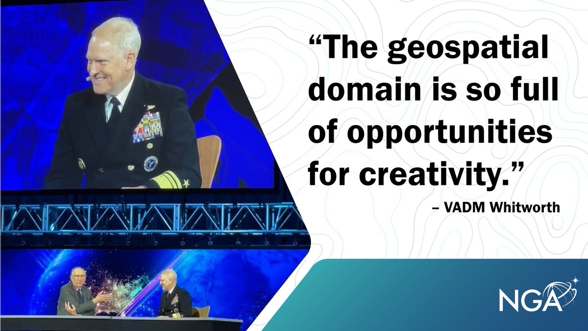
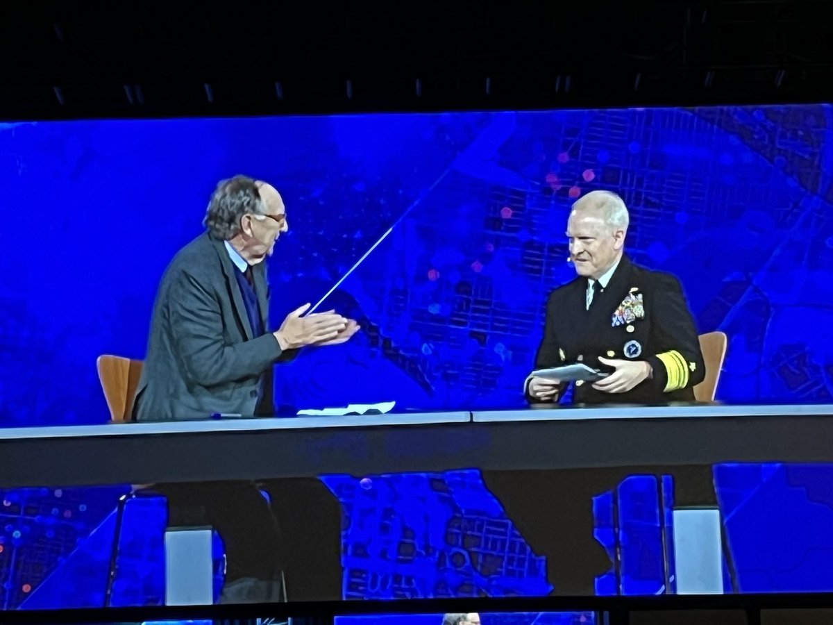
Data Deluge & Automation are key topics fr Dir of National #Geospatial Intelligence Agency Vice Adm Witworth at #EsriFedGIS23 #FedGIS
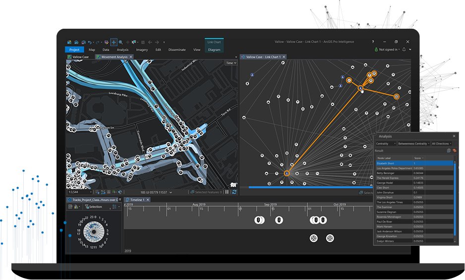
See how #ArcGIS supports law enforcement by visualizing and analyzing disparate data to produce actionable intelligence at the "ArcGIS for Law enforcement: Supporting Intelligence Investigations" session at #FedGIS See you at 8:30 am in Room 101 today. esri.social/79Oy50MMzqN
Don't miss #ArcGIS Excalibur's two sessions today at #FedGIS: Exploiting Full Motion Video for Intelligence Operations - today @ 1:30 pm in Room 102B Imagery and Video Exploitation with ArcGIS Excalibur - today @ 4pm in Room 51B esri.social/TKMZ50MMzjj
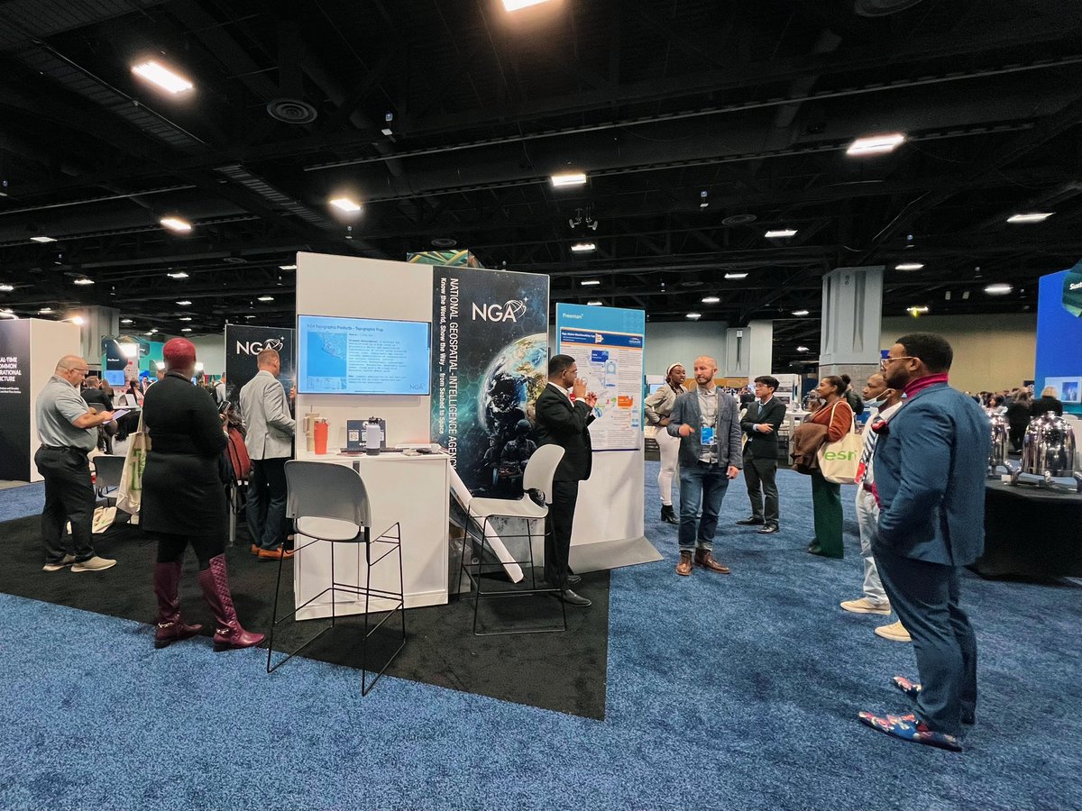
Hello D.C. we are here at @Esri #FedGIS! Stop by our booth (A2) to view demos and meet our recruiters! #JoinNGA

Will you be attending the 2023 #FedGIS Conference Feb 7-8th? GeoMarvel is honored to have our very own Jon Nordling speak to the @EsriYPN during the "Advocating for the Use of Modern #GIS in the Workplace" session (2/7 | 4:15PM). You won't want to miss it! #FedGIS2023 #Esri #YPN


Wrapping up Day 1 of #FedGIS. Thanks to the many storytellers who attended the #StoryMaps workshops & came by the booth today! Enjoy our favorite clip from the #EsriFedGIS23 plenary. Jack + YOUR stories, of course. 😉
Hold on to your maps - 'Map Wizardry' is going ON TOUR! Catch @NathanCShephard @John_M_Nelson and I at #FedGIS in Washington DC next February! John and I will give 'How Maps Work' a runout too.

Love seeing Jack Dangermond @Esri’s President & Founder amongst Esri Startup Program partners @Striveworks_US @latentai @_PHCGlobal_ @FireNeuralNet @crosswalk_labs @HydrosatI @metaspectral_ at #FedGIS2025 #FedGIS

The #FedGIS conference ended today (and was busy!), but sharing belatedly for the “We the parcel people” sticker which was a hit at the booth 🇺🇸 👨🍳 💋

Regrid is at #FedGIS! Meet CEO @WELLO & CFO Steve Stautzenbach at booth 907 and explore how our parcel data integrates with Esri. Learn more about our partnership - hubs.li/Q037YHnn0


TCarta, a provider of hydrospatial mapping services, has introduced a new line of Satellite Reconnaissance Charts to supplement official marine navigation maps in shallow waters. Look for Kyle Goodrich at #Esri #FedGIS this week. oceannews.com/news/science-t…


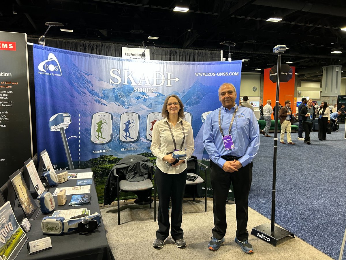
Attending the 2025 #FedGIS Conference? Visit Eos in booth 404! This is your chance to see the new Skadi Series GNSS receivers, featuring powerful Skadi Tilt Compensation, the Invisible Range Pole, & more! Learn more: ow.ly/57p250V6o0C @EsriFederalGovt #FedGIS2025 #EosGNSS
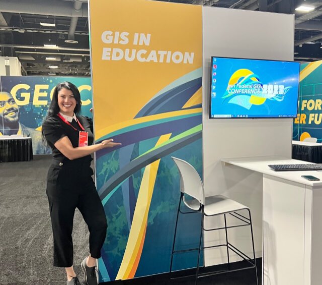
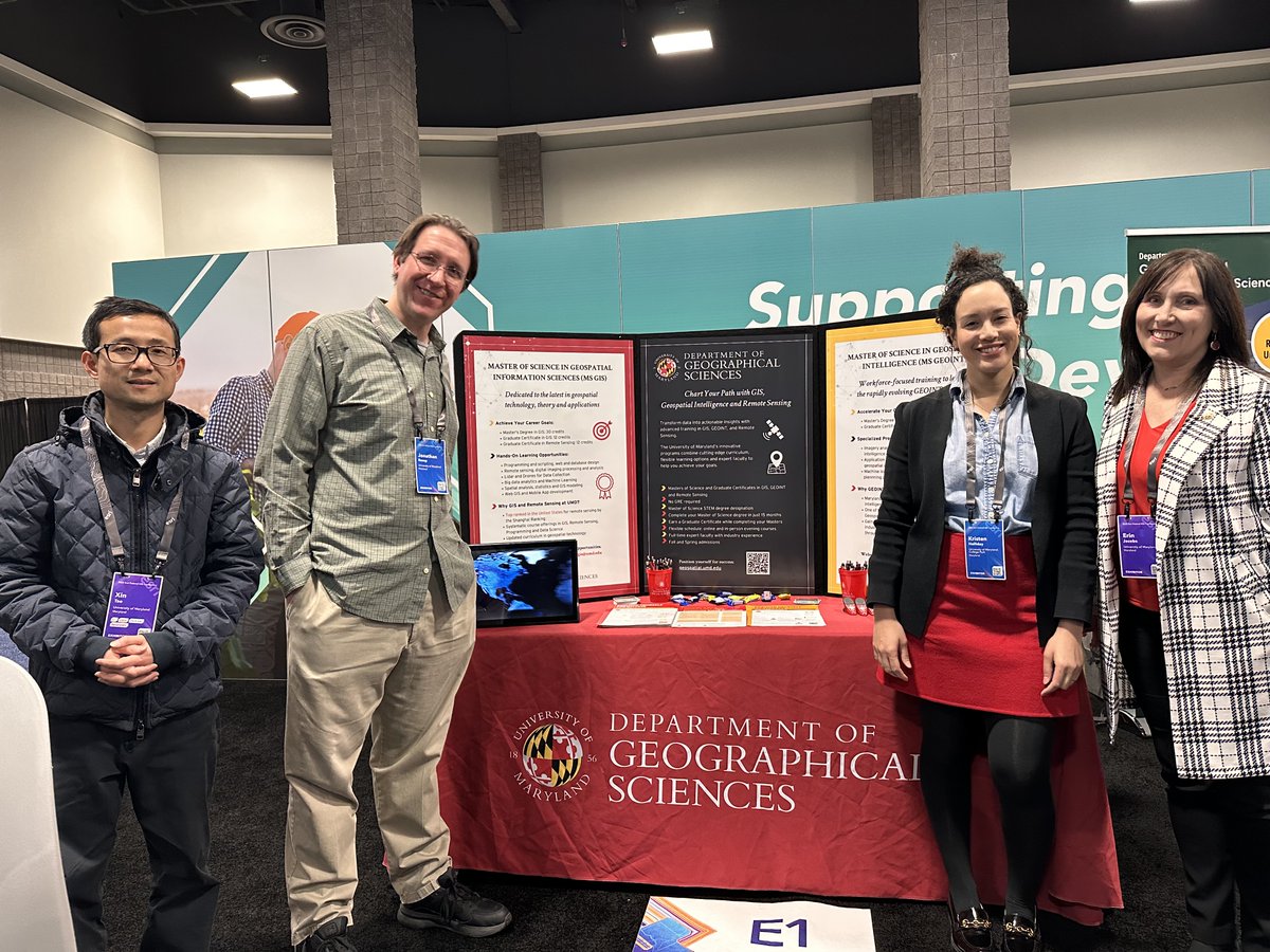
Day 2 at @Esri Federal GIS Conference: Stop by booth E1 in the GIS in Education zone. #FedGIS #FedGIS2025

#Esri #FedGIS - TCarta's Kyle Goodrich will be introducing its new Satellite Reconnaissance Chart product on Tuesday in the IC-ENC Navigational Safety session. gisuser.com/2025/02/tcarta…


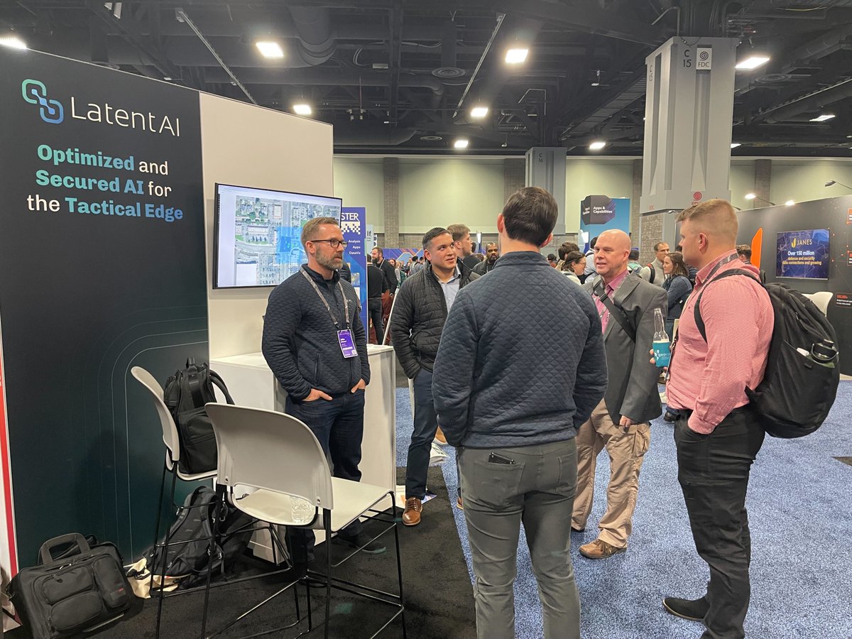
Day 2 at #FedGIS—Let’s talk AI at the edge! 🌍 From real-time situational awareness to field-updatable AI, Latent AI is redefining how agencies use AI + GIS for mission success. 📍 Find us at Startup Zone Booth S7 🔗 Learn more: ow.ly/J7sk50V50S #EdgeAI #GIS #AI
Heading to the @Esri Federal GIS Conference? Come visit us at booth E1 in the GIS in Education zone. 👋 See you at the Washington Convention Center! #FedGIS #FedGIS2025

TCarta, a provider of hydrospatial mapping services, has introduced a new line of Satellite Reconnaissance Charts to supplement official marine navigation maps in shallow waters. Look for Kyle Goodrich at #Esri #FedGIS this week. amerisurv.com/2025/02/21/tca…
amerisurv.com
TCarta Announces Satellite Derived Bathymetry Product to Supplement Official Nautical Charts in...
Denver, Colorado, 20 February 2025 – Shallow coastal zones are where most ship groundings occur, and they are also where the most inaccurate...
Regrid is at #FedGIS! Meet CEO @WELLO & CFO Steve Stautzenbach at booth 907 and explore how our parcel data integrates with Esri. Learn more about our partnership - hubs.li/Q037YHnn0
#Esri #FedGIS - TCarta will be introducing its new Satellite Reconnaissance Chart product on Tuesday in the IC-ENC Navigational Safety session. gisuser.com/2025/02/tcarta…
gisuser.com
TCarta Announces Satellite Derived Bathymetry Product to Supplement Official Nautical Charts in...
3D view of Negril, Jamaica, showing 1:4,000 scale TCarta Satellite Reconnaissance Chart with 3m resolution Satellite Derived Bathymetry.
Power smarter decisions at the edge with LEIP + ArcGIS! See it in action at FedGIS. 🎤 Tech Talk | Mon, Feb 24 @ 5:20 PM 📍 Startup Zone Theater – John Gilleland on field-updatable AI with ArcGIS ow.ly/5q2e50V50Hf Find us at Startup Zone Booth S7! #EdgeAI #GIS #FedGIS


NV5 is heading to the Esri FedGIS Conference in Washington D.C. next week! Visit us at Booth 403 to see how our geospatial solutions are helping our Federal Government clients achieve mission success. #Esri #FedGIS #Geospatial #MissionSuccess #Innovation


🚀 Sky Saber is now on the @Esri #ArcGIS Marketplace! Geospatial analysts can now run no-code AI/ML at the tactical edge—directly within ArcGIS. See a live demo at Booth S1 at #FedGIS2025! 🔗bit.ly/4hLif8e #FedGIS #AI #Geospatial #GIS #TheScienceofWhere #EsriPartner


Join us at #FedGIS to learn how ArcGIS Data Reviewer enhances data quality and cuts down on management costs. Discover how to define quality requirements and integrate Data Reviewer with your geodatabase. #DataQuality ow.ly/oU1U50UV3IC
registration.esri.com
2025 Esri Federal GIS Conference | Esri
Join us for the 2025 Esri Federal GIS Conference.

Join Kevin Mabey & Shannon Haggerty at the @Esri Federal GIS Conference Feb 24–26 in D.C. as we explore how geospatial tech is transforming infrastructure, environmental planning & CRE. Swing by our booth to connect & learn how @LightBox can support your geospatial needs. #FedGIS


Call for Images - 2025 Esri Federal GIS Conference: Your work has the power to impact your communities &industries positively! Share an example of your #ArcGIS work for potential use at #FedGIS on Feb 24-26 in DC before Jan 31 deadline: ow.ly/ByvT50UHW5N @EsriFederalGovt


Join the #ArcGISExcalibur team at #FedGIS in today's session: "Imagery and Video Exploitation with ArcGIS Excalibur" ArcGIS Excalibur is a web-based image exploitation workflow for timely geospatial intelligence See you at 1:45 pm in Room 147A esri.social/9YyS50MMeLW
Will you be attending the 2023 #FedGIS Conference Feb 7-8th? GeoMarvel is honored to have our very own Jon Nordling speak to the @EsriYPN during the "Advocating for the Use of Modern #GIS in the Workplace" session (2/7 | 4:15PM). You won't want to miss it! #FedGIS2023 #Esri #YPN

My #ThrowbackThursday pic takes us to the 2018 @esri #FedGIS conference w/ @mhp207 and @GlobalDecker repping @EsriStartups

Don't miss #ArcGIS Excalibur's two sessions today at #FedGIS: Exploiting Full Motion Video for Intelligence Operations - today @ 1:30 pm in Room 102B Imagery and Video Exploitation with ArcGIS Excalibur - today @ 4pm in Room 51B esri.social/TKMZ50MMzjj
I'll be doing three sessions about #arcpy and the ArcGIS API for Python at #esri #FedGIS this year. Hope to see you there!
It's been a great past two days at the Esri Federal GIS Conference. @Esri is doing some amazing things in the Fed GIS space! Skyline is thrilled to be an Esri partner - bringing real-time streaming video into the Esri ArcGIS platform. #FedGIS #Esri
Just landed in Washington, D.C. for #FedGIS. That’s the pentagon. Looking forward to this great event #GIS #Esri #ArcGIS #FedGIS23 #URISA
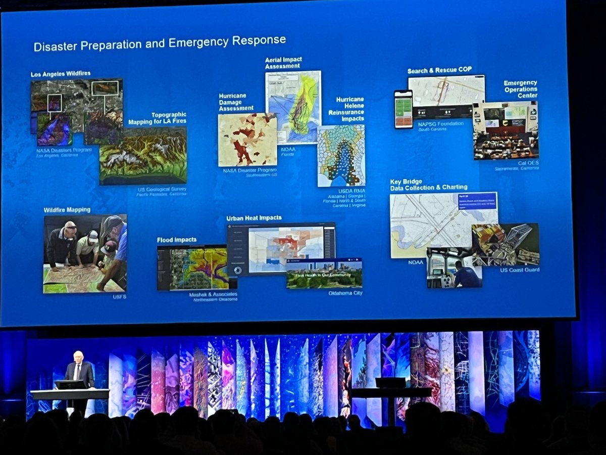
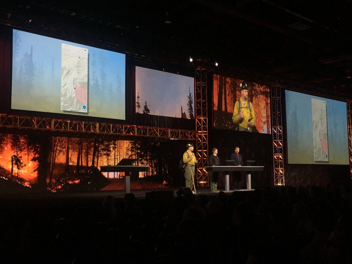
Thank you, @NIFC_fire, for sharing your #GIS success story during #FedGIS. #EsriFedGIS23 The National Interagency Fire Center includes nine agencies that support U.S. wildland firefighting. Learn a little more about NIFC. 1/3
See how #ArcGIS supports law enforcement by visualizing and analyzing disparate data to produce actionable intelligence at the "ArcGIS for Law enforcement: Supporting Intelligence Investigations" session at #FedGIS See you at 8:30 am in Room 101 today. esri.social/79Oy50MMzqN

Hi from Washington, DC! Our team had the pleasure of welcoming @Esri's @JackDangermond at our booth at the Esri #FedGIS Conference. We're especially honored because, as a Silver Partner, ICEYE's property-level flood insights just became accessible via #ArcGIS software last week.


Data Deluge & Automation are key topics fr Dir of National #Geospatial Intelligence Agency Vice Adm Witworth at #EsriFedGIS23 #FedGIS
Don't miss our ICEYE experts on stage at #FedGIS and learn how we empower rapid disaster response in a changing climate. Mark your calendars and hear more about the potential use cases of near real-time flood monitoring with the world’s largest #SAR satellite constellation.


Enjoyed hearing from @Esri Founder and President Jack Dangermond during the #FedGIS2024 plenary this morning! We love this year's #Vision theme! #FedGIS #Government

Something went wrong.
Something went wrong.
United States Trends
- 1. #AEWFullGear 68.4K posts
- 2. Klay 18.8K posts
- 3. Lando 93.6K posts
- 4. #LasVegasGP 177K posts
- 5. McLaren 37.6K posts
- 6. Samoa Joe 4,511 posts
- 7. LAFC 14.7K posts
- 8. gambino 1,957 posts
- 9. Swerve 6,215 posts
- 10. Hangman 9,496 posts
- 11. Ja Morant 8,110 posts
- 12. #Toonami 2,715 posts
- 13. Bryson Barnes N/A
- 14. #byucpl N/A
- 15. Max Verstappen 49.5K posts
- 16. LJ Martin 1,275 posts
- 17. Utah 23.8K posts
- 18. Benavidez 15.6K posts
- 19. Kimi 36.6K posts
- 20. Mark Briscoe 4,322 posts