#arcgis نتائج البحث

The November release of #ArcGIS Data Reviewer introduces new automated review workflows for identifying poor-quality features, enhancements to data quality checks, and improved support for visual review workflows. Check out the details: ow.ly/etOM50XtfOr


Bring GIS into #Civil3D workflows with #ArcGIS for #AutoCAD. Discover this tutorial series to learn how to get started adding coordinate systems, COGO points, TIN surfaces, and more. 🧠 Explore the tutorial series ➡️ ow.ly/LKcb50X6onX #AEC #Autodesk #engineering


Trippy terrain of Lielais Liepukalns and Dzierkaļu kalns (289 and 286 m a.s.l.) in Latvia, made with ArcGIS Pro. Day 5, Earth #30DayMapChallenge #dataviz #arcgis #map #esri


How to make a map layout using ArcMap? Map created using ArcGIS. Tutorial Link: youtu.be/gGdJzmyGasE For more information about registration, visit our website: studyhacksgeospatial.com/google-earth-e… #ArcMap #ArcGIS #MapLayout #GIS #Geospatial #Cartography #Mapping #DataVisualization

¿Quieres ser parte del Mapa Global de Profesionales en SIG? es totalmente gratis y lo puedes hacer desde acolita.com/directorio #QGIS #ArcGIS
Google Earth ya trae una capa de curvas de nivel y mucho más arcgeek.com #googleearth #sig #arcgis #qgis

Bring surfaces from #Civil3D into #ArcGIS #FieldMaps! This ensures you can accurately locate roads, drainage, and other features and verify that they are built according to plan. 🏗️ Learn how: ow.ly/xxnr50Xt9ZQ


✨The Life of a GIS Expert✨ If you have 3-6 months of ArcGIS experience, your next step should be to earn this technical certification! 🌎Learn more: ow.ly/qHFz50X5cY8 #GIS #ArcGIS


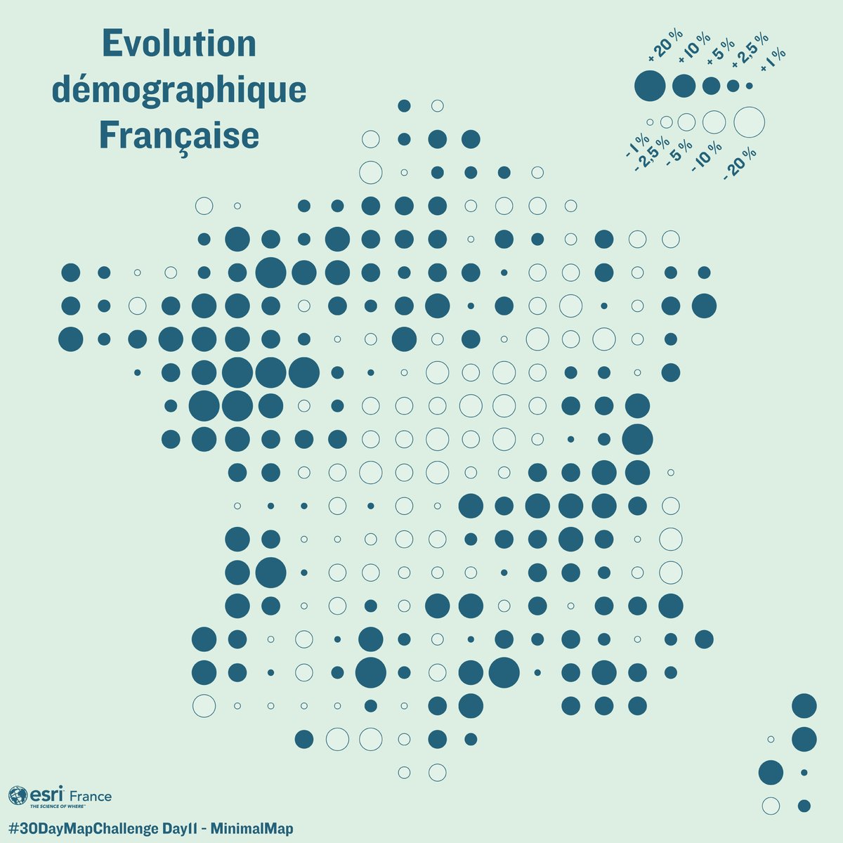
📈 Évolution démographique française entre 2011 et 2021 🌍 #30DayMapChallenge – Jour 11 : Minimal Map Découvrez la polarisation démographique française 2011-2021 : croissance au Nord-Ouest et Sud-Est, recul sur la “diagonale du vide”. #EsriFrance #ArcGIS #SIG
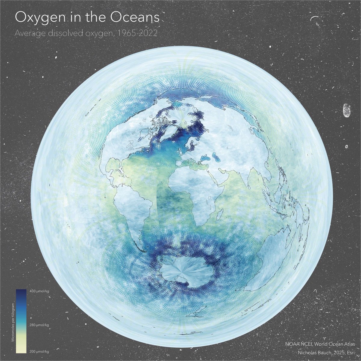
Minimal aesthetic, compelling visuals! Nick Bauch's map showcases oxygen levels 5m below the ocean's surface in #ArcGIS Pro using data from NOAA’s World Ocean Atlas, Azimuthal Equidistant projection, and Adobe Paper Texture. #30DayMapChallenge day 11: ow.ly/Vjy850XpJxj


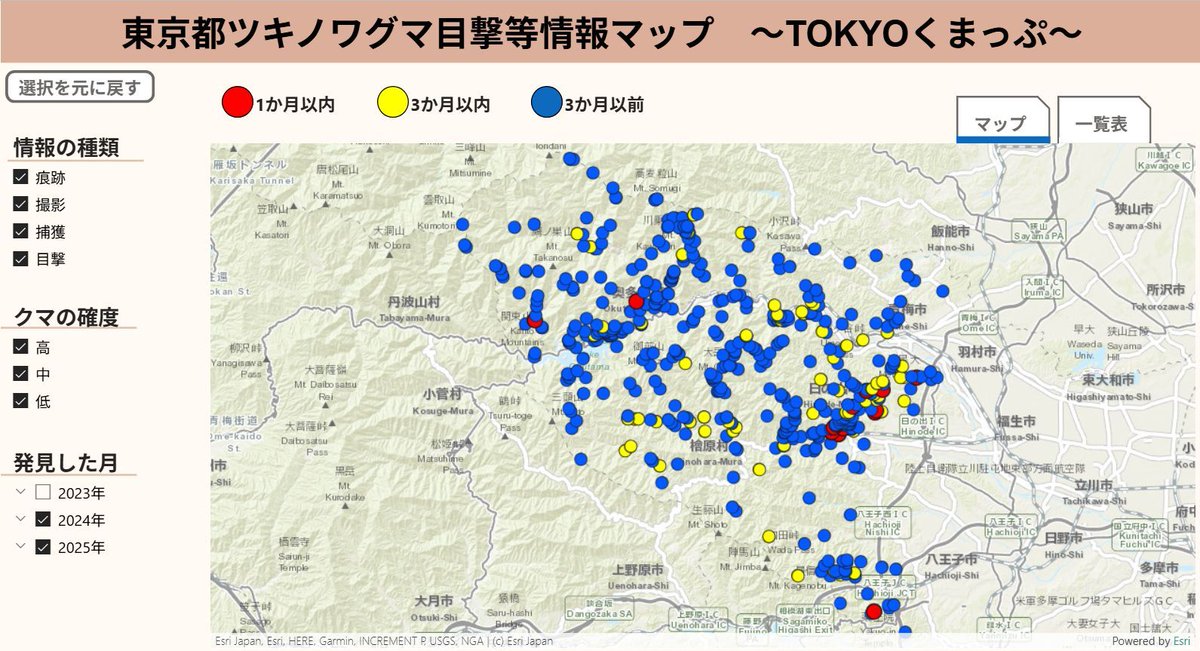
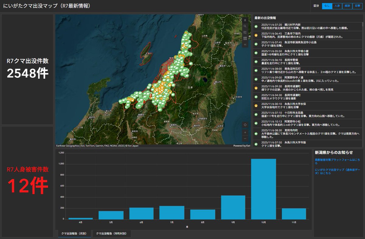
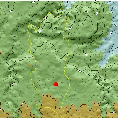
🐻 クマ出没情報をもっとわかりやすく! 自治体が公開する「クマ出没マップ」、実は ArcGIS で作られているものがあります✨ 地図で危険エリアを直感的に確認できるから、登山やお出かけ前に安心。 詳しくはこちら 👉 buff.ly/FQnOz9M #ArcGIS #GIS活用 #クマ出没 #安全対策

The November release of #ArcGIS Data Reviewer introduces new automated review workflows for identifying poor-quality features, enhancements to data quality checks, and improved support for visual review workflows. Check out the details: ow.ly/7UlJ50XuOwo
A “Draft Sketch” of a map?! Craig Williams edits a golf course map on “OpenStreetMap”, inspired by working at a course during his teenage years. He mapped The O'Donnell Golf Club in Palm Springs using #ArcGIS Pro. #30DayMapChallenge day 14: ow.ly/YxLQ50XrqVs


🚀 Version 4.34 of #ArcGIS Maps SDK for #JavaScript is here! Explore 3D flow rendering for animating directional raster data, split & merge features with Editor, slots for placing UI elements, & ground surface volume measurement in 3D! Learn more: ow.ly/RnE350XfNiX

Learn how Malaysia used #GIS for health care. A combination #ArcGIS #Survey123 and ArcGIS #Dashboards greatly reduced logistical challenges and cut the average medicine distribution timeline from 6 months to 2 months with improved reporting. 📝📊ow.ly/jXsF50XwZwg

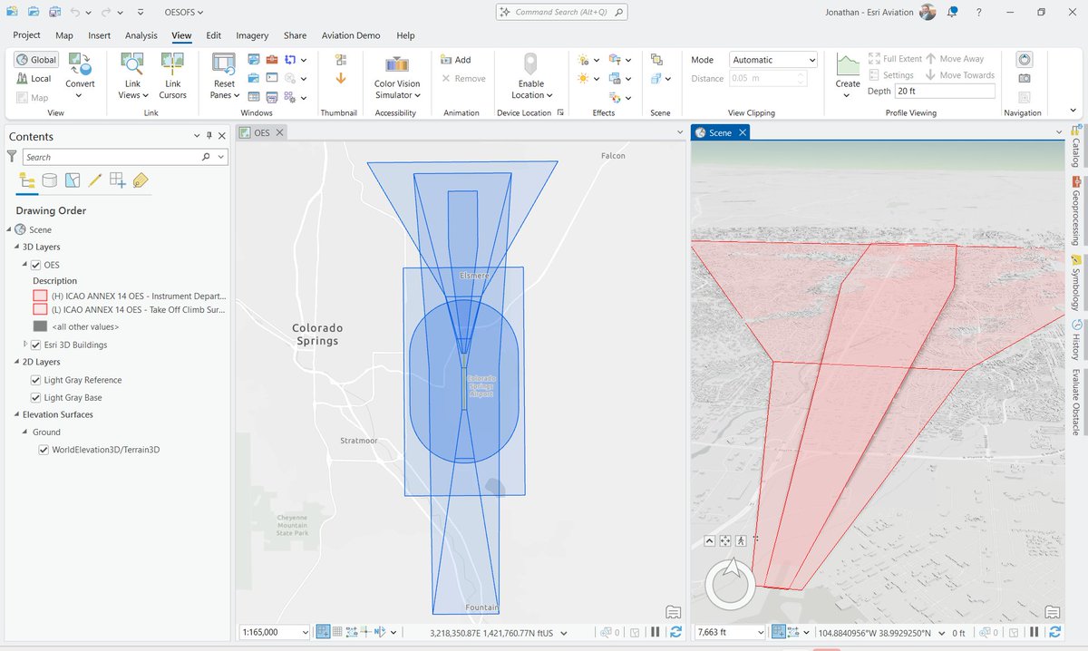
#ArcGIS Aviation Airports now supports ICAO’s updated Obstacle Limitation Surfaces (OLS) framework, improving #aviationsafety, compliance, and airport planning. Visualize and analyze airspace constraints more precisely and efficiently. Learn more: ow.ly/pn6a50XuOo6
Have you heard about the ArcGIS Well-Architected Framework? 🤔🌎It is intended to help organizations design, build, and operate #ArcGIS as a system. 💡Check out this new on-demand course to learn about the decisions made in each phase of the framework! ow.ly/ogEW50XwWi7


ICEYE and @EsriAustralia partner to deliver unprecedented hazard intelligence across Australia and Southeast Asia. #EsriAustralia #ArcGIS #EmergencyManagement hubs.li/Q03VZNVV0

Requested by #ArcGIS users and written by experts at Esri, your guide to getting up and running with #ArcGISEnterprise has arrived. Get your copy to learn the most common and vital workflows Enterprise admins need to know! Learn more ➡️ ow.ly/sjTW50Xta3a

Bring surfaces from #Civil3D into #ArcGIS #FieldMaps! This ensures you can accurately locate roads, drainage, and other features and verify that they are built according to plan. 🏗️ Learn how: ow.ly/xxnr50Xt9ZQ

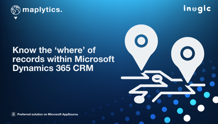
Power up Dynamics 365 with ESRI-powered Maplytics for next-level location insights. maplytics.com/integrate-esri… #CRMMaps #ArcGIS #Dynamics365CRM #LocationIntelligence
A “Draft Sketch” of a map?! Craig Williams edits a golf course map on “OpenStreetMap”, inspired by working at a course during his teenage years. He mapped The O'Donnell Golf Club in Palm Springs using #ArcGIS Pro. #30DayMapChallenge day 14: ow.ly/3hgW50Xt9Yq

The latest release of #ArcGIS #Aviation Charting and ArcGIS Aviation Airports for ArcGIS Pro release offers improved tools to streamline airport operations, charting, data management, and design. Learn more: ow.ly/446R50XuOsU


Learn about a GCS deployment of an #Esri #ArcGIS Fire Hydrant Inspection Solution and what benefits the solution provide by clicking the link below: ow.ly/X3FM50Jpa2w #GIS #ArcGISOnline #ArcGISEnterprise
Companies looking to manage forestry operations in the field, integrate with #MicrosoftDynamics365, and streamline processes can utilize the GeoBusiness Field Service Operations workflow for Forest Management. gcs.yourdatasmarter.com/forest-managem… #Esri #ArcGIS #GIS #MicrosoftD365 #D365

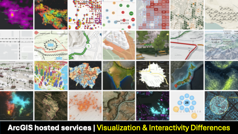
Take your ArcGIS app to the next level! Understand the visualization and interactivity differences between hosted data services to create engaging experiences. 📈💡 #ArcGIS #DevTips Learn more ➡️ ow.ly/oOVx50XhJmp

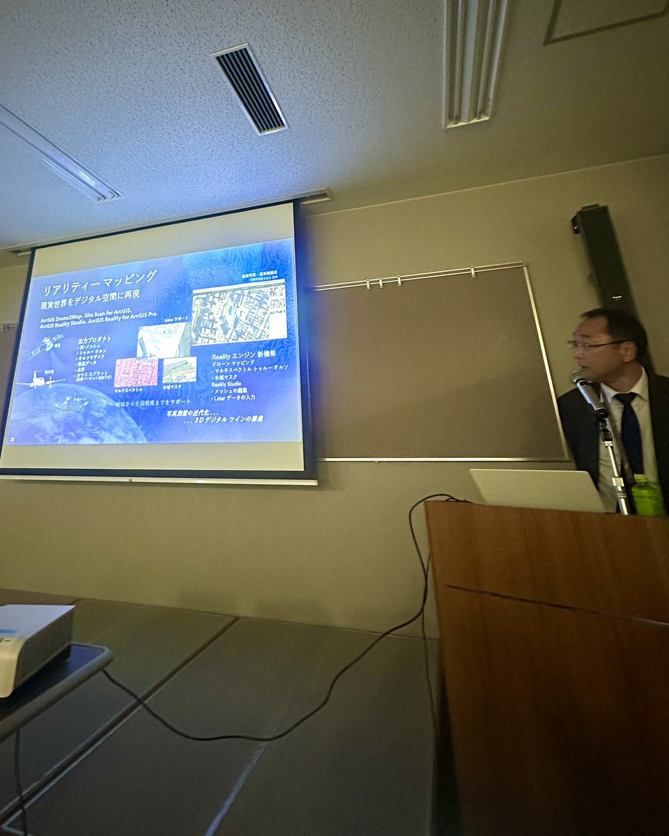
#GISDay2025 𝗚𝗲𝗼-𝗘𝗻𝗮𝗯𝗹𝗲𝗱 𝗗𝗶𝗴𝗶𝘁𝗮𝗹 𝗧𝘄𝗶𝗻𝘀 Dr. Adel Bolbol Fernández showed how #ArcGIS is turning maps into dynamic #digitaltwins using reality mapping, BIM, sensors & #GeoAI — helping cities plan smarter, predict better, & respond faster. #Esri @Esri


Delivering #ArcGIS capabilities that support key business requirements, goals, and initiatives helps you improve business outcomes integrated with #ERP, #Financials, #CRM, #Ecommerce, & more. #Esri #EsriArcGIS gcs.yourdatasmarter.com/a-business-fir…

Find out how GCS Cloud Architects can develop your organization's #ArcGIS cloud computing strategies. #Esri #Microsoft #Azure ow.ly/sgKi50Ho4S7

Throughout history, the significance of land records information within local government operations has been underestimated and underutilized. #ArcGIS offers a comprehensive suite of data management tools. #GIS #Esri #Localgovernment gcs.yourdatasmarter.com/managing-local…

Securing your organization's campus and facilities cannot be accomplished without understanding the operational environment. GeoBusiness provides indoor mapping for #publicsafety and security operations with #ArcGISIndoors #ArcGIS #GIS #ESRI gcs.yourdatasmarter.com/geobusiness-pr…


🌍 Este curso capacitará a los alumnos en el manejo de ArcGIS para la elaboración de estudios relacionados con las energías renovables. 🔗 Web: bit.ly/Curso_ArcGIS_R… 📧 [email protected] #ArcGIS #Energías #Renovables #ArcMap #Cartografía #SIG #curso


The EAPA_2025 Exam is your gateway to becoming an ArcGIS Pro expert. Ready to boost your GIS career in 2025? 🌍✨ Get structured practice + smart prep here 👇 🔗 certfun.com/esri/eapa-2025… #Esri #ArcGIS #EAPA


🗺️ PETA PROFESIONAL UNTUK ANDA Jasa pembuatan peta akurat & estetik untuk tugas, penelitian, atau kerjaan kantor. 🎯 Spasial – Tematik – Custom Analisis 💼 Software: ArcGIS 📲 Langsung WA: wa.me/+6282279228714 #GIS #ArcGIS #JokiPeta #bikinpeta #jokiarcgis #jokitugaskuliah


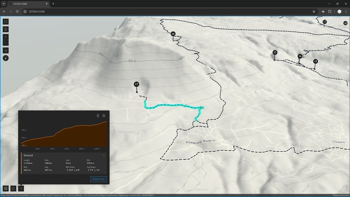
Here I leverage the #3D capabilities of the scene view in #ArcGIS #SDK for #JavaScript to create a dynamic #Elevation profile widget that adapts to each selected trail. Trail metrics calculated on-the-fly. Commissioned project, work in progress; coming online soon!
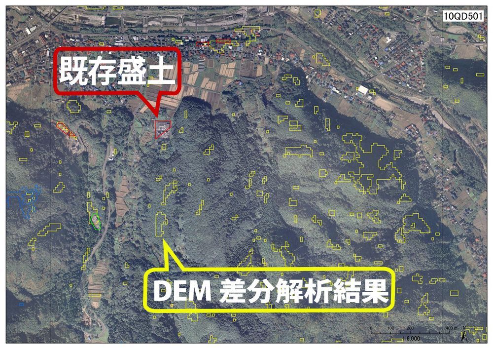
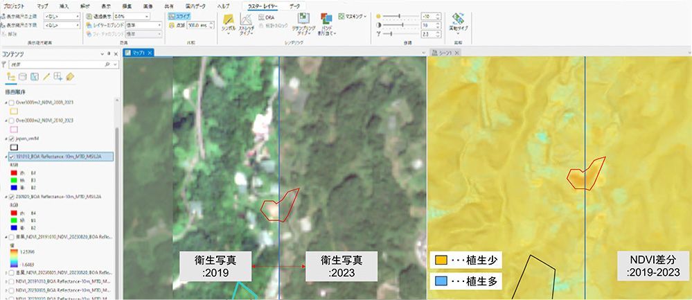
【事例】日本工営株式会社様 #ArcGIS で盛土規制法対応を実現! 🌍 ArcGISを活用し、盛土等の抽出と規制区域の指定を効率化。災害防止に向けた取り組みが進化しています。 詳細はこちら buff.ly/6AFHZvg #盛土規制法
Bring GIS into #Civil3D workflows with #ArcGIS for #AutoCAD. Discover this tutorial series to learn how to get started adding coordinate systems, COGO points, TIN surfaces, and more. 🧠 Explore the tutorial series ➡️ ow.ly/LKcb50X6onX #AEC #Autodesk #engineering
How to make a map layout using ArcMap? Map created using ArcGIS. Tutorial Link: youtu.be/gGdJzmyGasE For more information about registration, visit our website: studyhacksgeospatial.com/google-earth-e… #ArcMap #ArcGIS #MapLayout #GIS #Geospatial #Cartography #Mapping #DataVisualization
A “Draft Sketch” of a map?! Craig Williams edits a golf course map on “OpenStreetMap”, inspired by working at a course during his teenage years. He mapped The O'Donnell Golf Club in Palm Springs using #ArcGIS Pro. #30DayMapChallenge day 14: ow.ly/YxLQ50XrqVs
✨The Life of a GIS Expert✨ If you have 3-6 months of ArcGIS experience, your next step should be to earn this technical certification! 🌎Learn more: ow.ly/qHFz50X5cY8 #GIS #ArcGIS


The November release of #ArcGIS Data Reviewer introduces new automated review workflows for identifying poor-quality features, enhancements to data quality checks, and improved support for visual review workflows. Check out the details: ow.ly/etOM50XtfOr
Minimal aesthetic, compelling visuals! Nick Bauch's map showcases oxygen levels 5m below the ocean's surface in #ArcGIS Pro using data from NOAA’s World Ocean Atlas, Azimuthal Equidistant projection, and Adobe Paper Texture. #30DayMapChallenge day 11: ow.ly/Vjy850XpJxj
📈 Évolution démographique française entre 2011 et 2021 🌍 #30DayMapChallenge – Jour 11 : Minimal Map Découvrez la polarisation démographique française 2011-2021 : croissance au Nord-Ouest et Sud-Est, recul sur la “diagonale du vide”. #EsriFrance #ArcGIS #SIG

¡Brutales los avances en #GeoAI que trae #ArcGIS Pro y que nos han enseñado Celia y Libertad en la #CEsri25! 🤩🌍👏🏼 @Esri_Spain @ArcGISPro


Bring surfaces from #Civil3D into #ArcGIS #FieldMaps! This ensures you can accurately locate roads, drainage, and other features and verify that they are built according to plan. 🏗️ Learn how: ow.ly/xxnr50Xt9ZQ
Learn how Malaysia used #GIS for health care. A combination #ArcGIS #Survey123 and ArcGIS #Dashboards greatly reduced logistical challenges and cut the average medicine distribution timeline from 6 months to 2 months with improved reporting. 📝📊ow.ly/jXsF50XwZwg

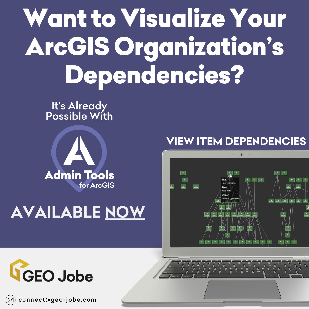
With Admin Tools for #ArcGIS you can visualize your Organization's items in a way you never could before! Reach out for a demo at [email protected] #Esri #GIS
XLSForm is a standard format for designing forms in Microsoft Excel. Learn more about creating surveys in #ArcGIS #Survey123 using XLSForm for defining questions, choices, and logic in a spreadsheet. 📝📒 ow.ly/y9A950X7hLx


石川県で開催された セミナーに参加 参加者には 企業だけでなく自治体の方もおられ 新しい使い方や事例を学べる貴重な機会となりました 当社の取組みもお話しさせて頂きました ご参加の皆さまありがとうございました 地図✖︎情報GIS maps.app.goo.gl/VwAsRuZuf4si6G… #ArcGIS #GIS #金沢セミナー…

【金沢で開催!ArcGIS活用セミナー】 ノーコードで地図アプリが作れるってご存じですか? Power BIで地図を使った分析もできるんです! ArcGISの最新情報や事例を、わかりやすくご紹介するセミナーを金沢で開催します✨ 📅 11月11日(火)14:00〜 📍 石川県地場産業振興センター 🎟️…

ICEYE and @EsriAustralia partner to deliver unprecedented hazard intelligence across Australia and Southeast Asia. #EsriAustralia #ArcGIS #EmergencyManagement hubs.li/Q03VZNVV0
ArcPyを調べるのに役立つリファレンスページの見方について解説しています。 特に入門者~初級者にお勧めの内容となっています。 |Esri Community Blog|[ community.esri.com/t5/a/a/ta-p/16… ] #ArcGIS #地図 #開発 #arcpy
![ESRIJapan's tweet image. ArcPyを調べるのに役立つリファレンスページの見方について解説しています。
特に入門者~初級者にお勧めの内容となっています。
|Esri Community Blog|[ community.esri.com/t5/a/a/ta-p/16… ]
#ArcGIS #地図 #開発 #arcpy](https://pbs.twimg.com/media/G0ns715aAAAxNkG.jpg)
![ESRIJapan's tweet image. ArcPyを調べるのに役立つリファレンスページの見方について解説しています。
特に入門者~初級者にお勧めの内容となっています。
|Esri Community Blog|[ community.esri.com/t5/a/a/ta-p/16… ]
#ArcGIS #地図 #開発 #arcpy](https://pbs.twimg.com/media/G0ntU-uaMAA4MDx.png)
![ESRIJapan's tweet image. ArcPyを調べるのに役立つリファレンスページの見方について解説しています。
特に入門者~初級者にお勧めの内容となっています。
|Esri Community Blog|[ community.esri.com/t5/a/a/ta-p/16… ]
#ArcGIS #地図 #開発 #arcpy](https://pbs.twimg.com/media/G0ntYE0aYAAZnWK.jpg)
The November release of #ArcGIS Data Reviewer introduces new automated review workflows for identifying poor-quality features, enhancements to data quality checks, and improved support for visual review workflows. Check out the details: ow.ly/7UlJ50XuOwo
#ArcGIS Aviation Airports now supports ICAO’s updated Obstacle Limitation Surfaces (OLS) framework, improving #aviationsafety, compliance, and airport planning. Visualize and analyze airspace constraints more precisely and efficiently. Learn more: ow.ly/pn6a50XuOo6
Something went wrong.
Something went wrong.
United States Trends
- 1. Broncos 30.9K posts
- 2. Treylon Burks 10.7K posts
- 3. Bo Nix 8,168 posts
- 4. Mariota 9,655 posts
- 5. #BaddiesUSA 18.9K posts
- 6. #RaiseHail 4,962 posts
- 7. Commanders 27.5K posts
- 8. Ertz 2,799 posts
- 9. #RHOP 10.3K posts
- 10. #ITWelcomeToDerry 14.6K posts
- 11. Chicharito 24.7K posts
- 12. #Married2Med 2,902 posts
- 13. Tomlin 25K posts
- 14. Bobby Wagner N/A
- 15. Sean Payton 1,209 posts
- 16. Denver 13K posts
- 17. Alex Singleton 1,072 posts
- 18. Zach Edey 2,004 posts
- 19. Riley Moss 2,072 posts
- 20. Steelers 65.1K posts