#geospatialtechnologies نتائج البحث

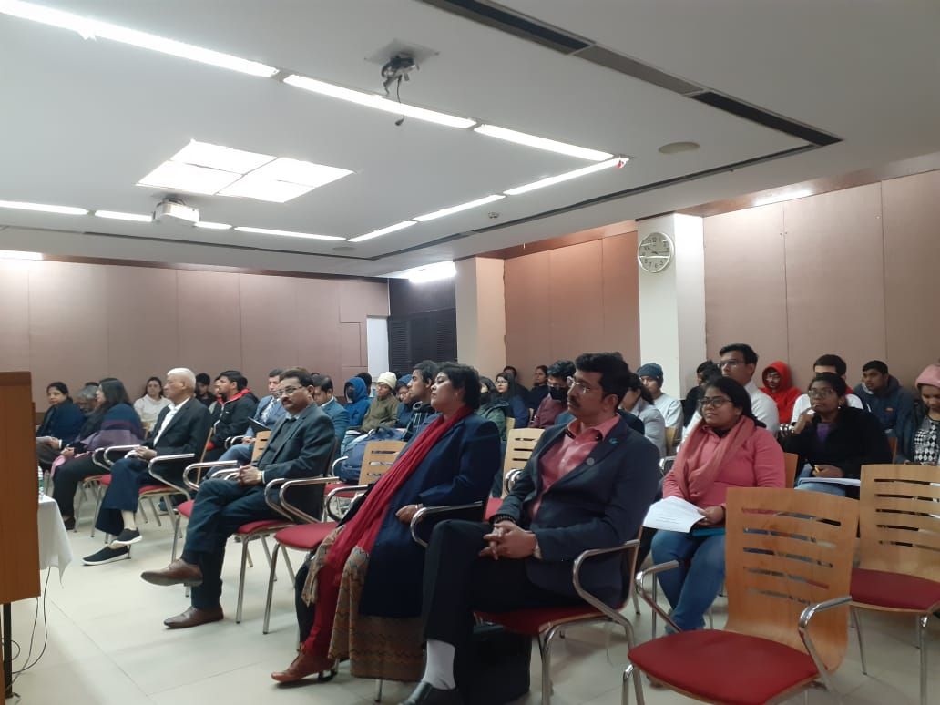
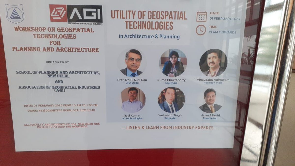
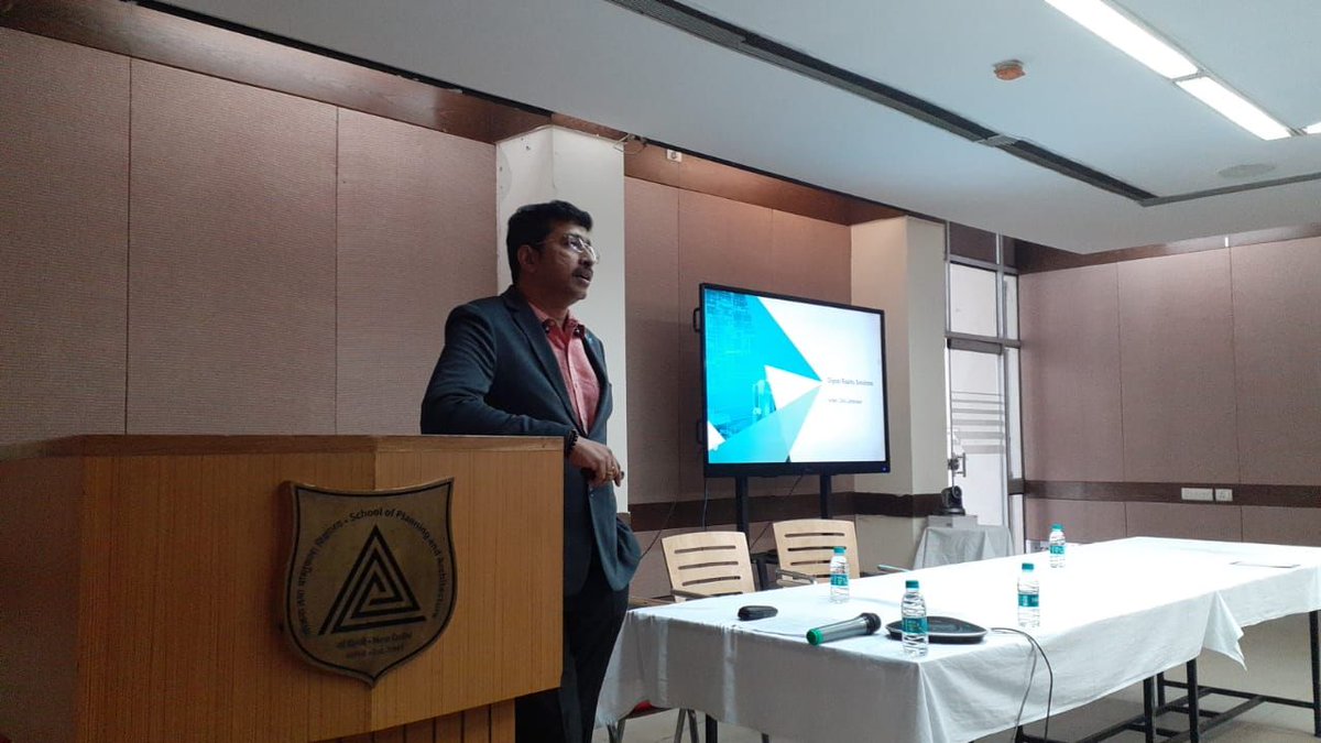
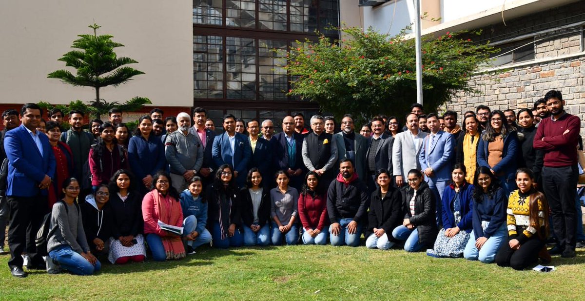
AGI conducted a #Workshop on the Utility of #GeospatialTechnologies in Architecture and Planning at the School of Planning and Architecture, New Delhi. Vinay Babu, Hexagon India, and representatives from AGI talked about the expansive potential of using Geospatial technologies.
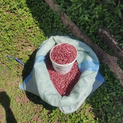
1/5 A high-level delegation from Sudan recently visited Regional Centre for Mapping of Resources for Development to explore ways to integrate geospatial technologies into the agriculture sector to ensure food security. #Agriculture #FoodSecurity #Geospatialtechnologies #RCMRD

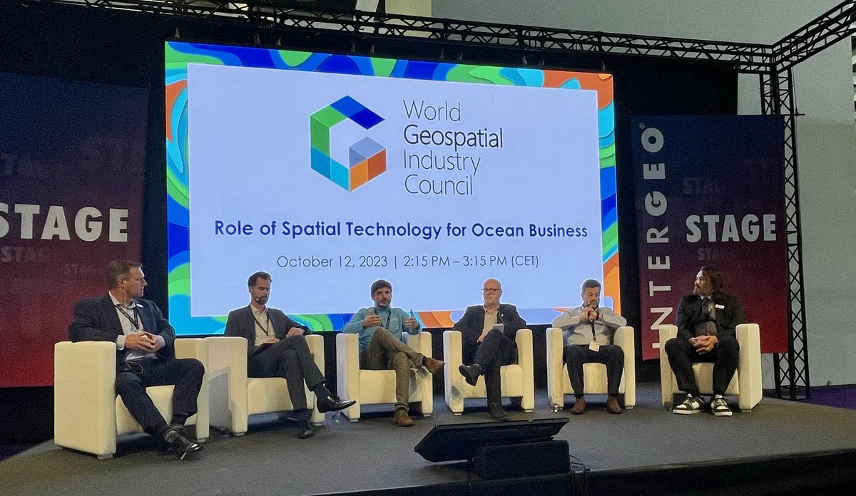
In today's panel discussion at #INTERGEO2023 on the Role of Spatial Technology for Ocean Business, moderated by @Aaron_WGIC, panelists presented insights on a diverse array of #GeospatialTechnologies & their applications in near-shore, transitional, & deep-water environments.

European Surveyor and Geoinformation Day, celebrated on March 4th, recognizes the crucial role of surveyors and geoinformation experts in shaping our world. #SurveyorDay, #Geoinformation, #GeospatialTechnologies, #SustainableDevelopment, #InfrastructurePlanning

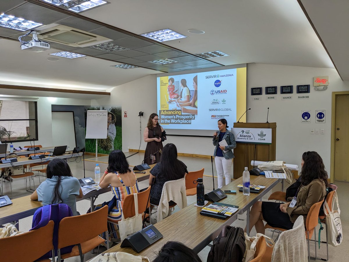
The workshop moves toward the goal of advancing women’s prosperity in the workplace through education on technical and soft skills in #EnvironmentalScience and #GeospatialTechnologies @ServirAmazonia #SERVIRAmazonia

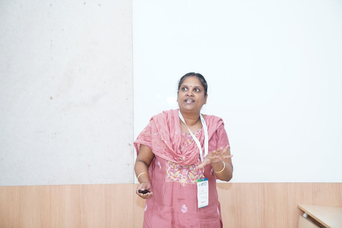
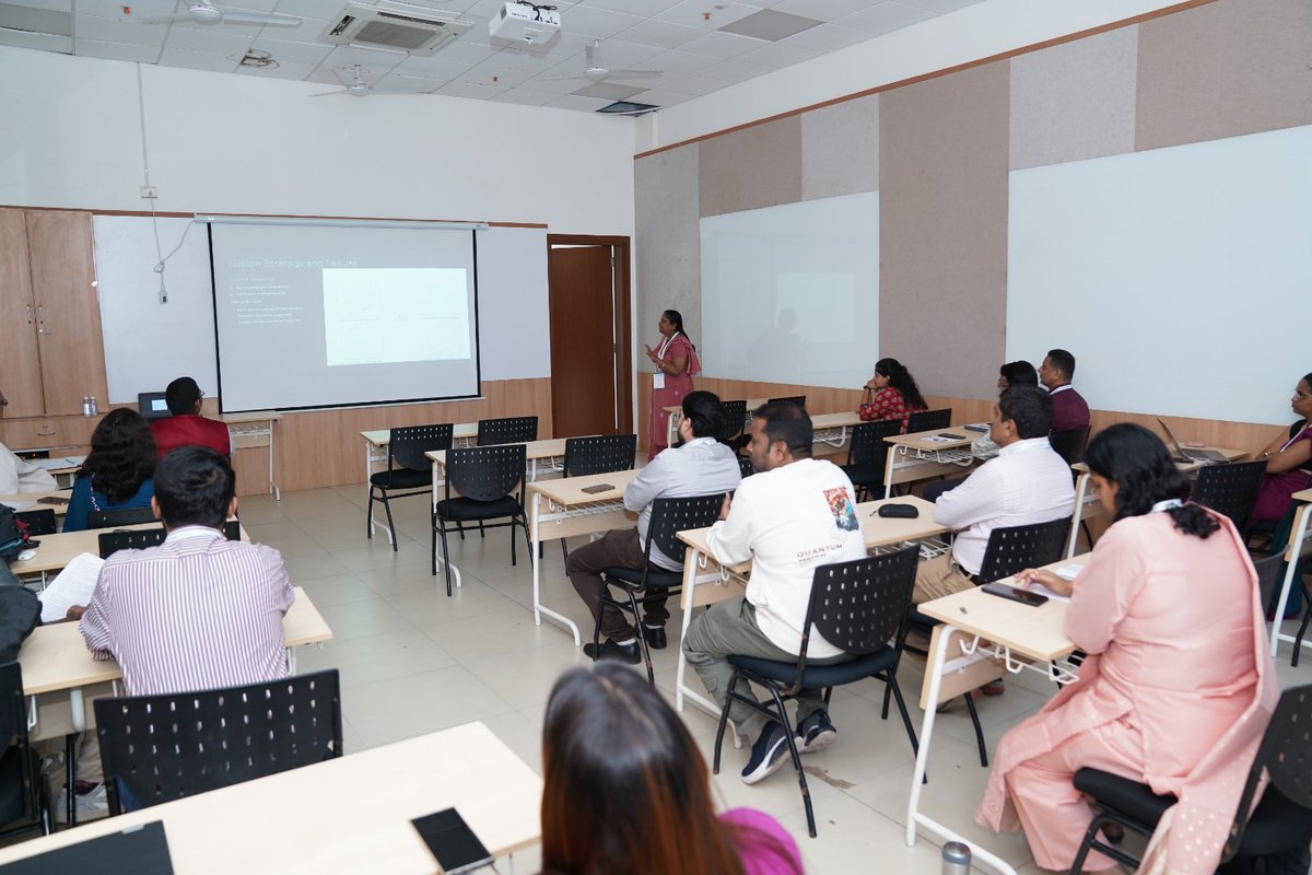
Day 3 of GIFTS Summit 2025 spotlighted Theme 1 – Emerging Trends in Remote Sensing & Geospatial Tech. Experts from IIRS, CSSTEAP, C-DAC & NRSC shared insights on innovations driving climate action, sustainability & community resilience. #RemoteSensing #GeospatialTechnologies

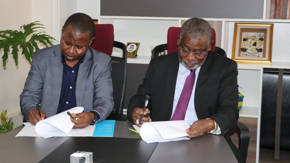
KSA strengthens its ties with Kakamega and Vihiga Counties in using #geospatialtechnologies for development. KSA signed MOUs with both counties on cooperation in county #Spatialplanning, #earthobservation data, and capacity building. Read more: linkedin.com/pulse/ksa-part…


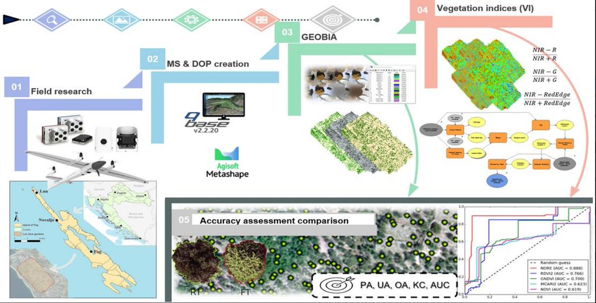
🔥 Read our Highly Cited Paper 📚 GEOBIA and Vegetation Indices in Extracting Olive Tree Canopies Based on Very High-Resolution UAV Multispectral Imagery 🔗 mdpi.com/2076-3417/13/2… 👨🔬 by Prof. Ante Šiljeg et al. #geospatialtechnologies #machinelearning

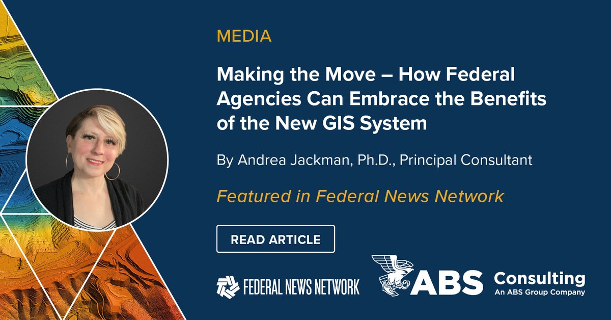
Geographic Information Systems (#GIS) play an important role in how federal organizations plan & manage real-world challenges through technology. Our expert discusses how #GeospatialTechnologies provide federal agencies digital tools in @FederalNewsNet ➡️bit.ly/3U1nZRb

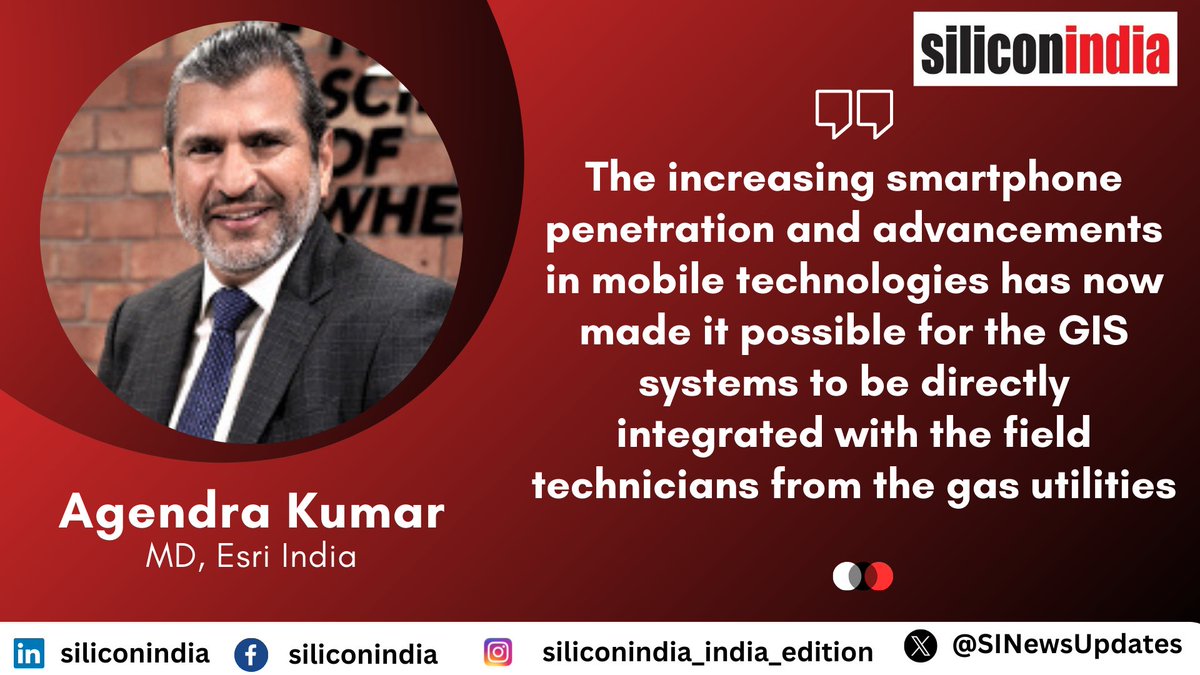
GIS Enhancing the Efficiency of Gas Distribution in Cities @agendra, MD, @EsriIndia Read more: goo.su/RWZ1F #GIStechnology #GISsystems #GeospatialTechnologies #GasDistribution #networkmanagement

Meet GeoFem participant Sabrina, agronomist & organizer of a women's coffee cooperative. She learned about #GeospatialTechnologies available for farmers & plans to share @G20_GEOGLAM & @HarvestProgram tools w/ her community in #CostaRica 🇨🇷 servirglobal.net/news/meet-four…


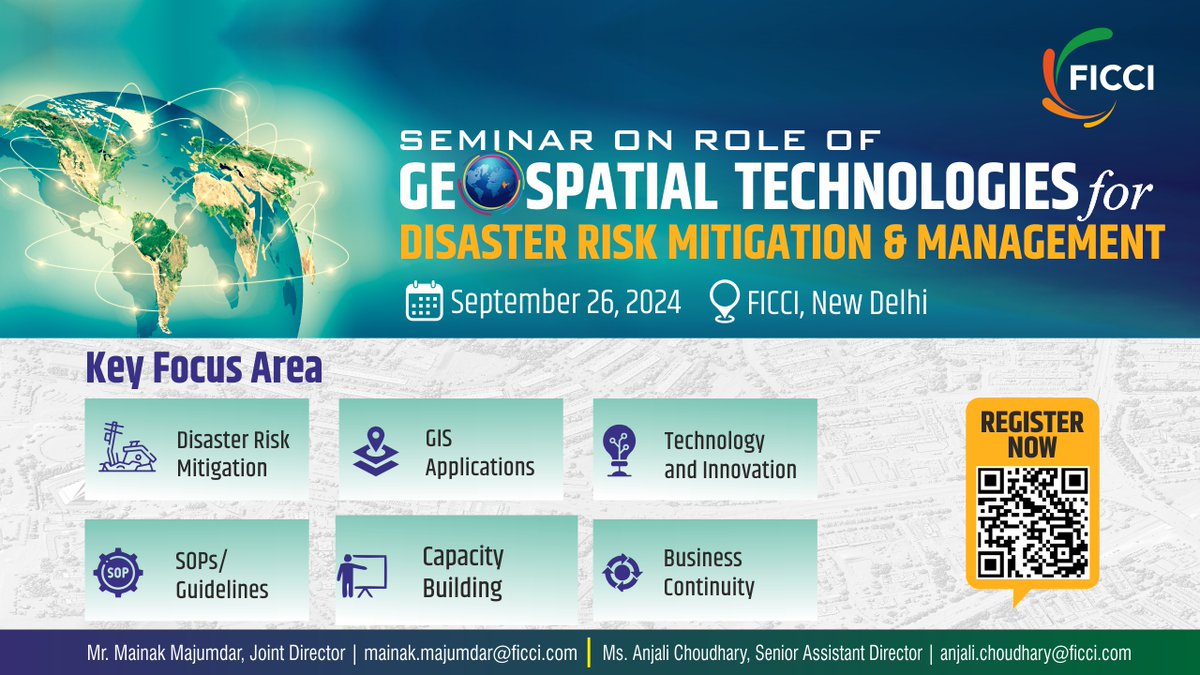
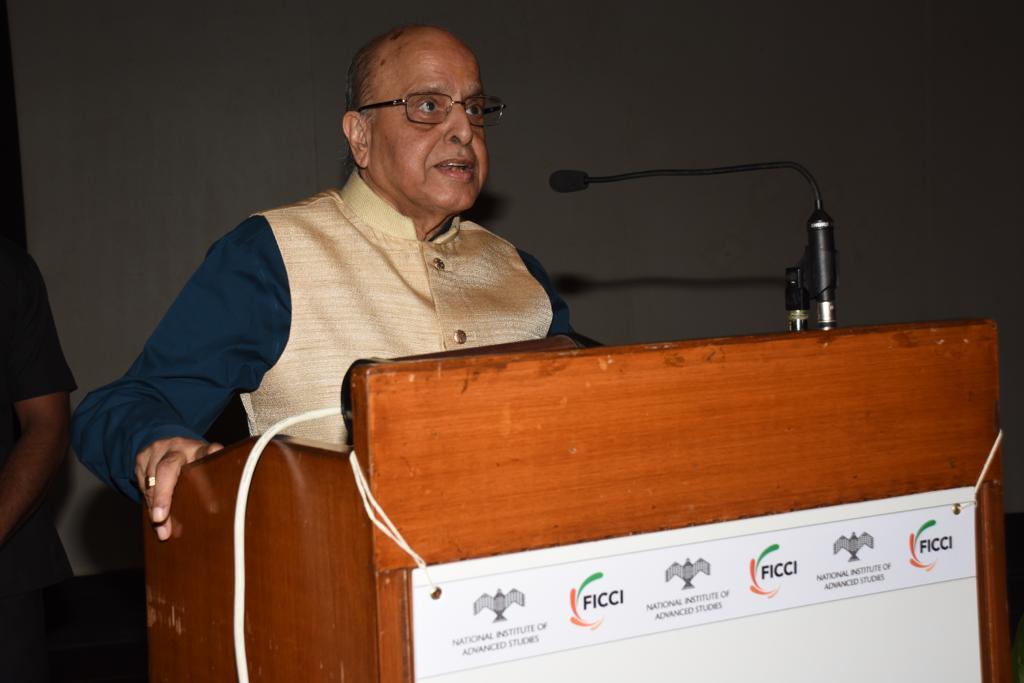
Join us for the FICCI Seminar on the Role of Geospatial Technologies in Disaster Risk Mitigation & Management on 26 September 2024 at Federation House, New Delhi. This seminar will delve into the crucial role of #GeospatialTechnologies (GIS) in mitigating Hydro-Meteorological…

Lecturer in Geospatial Technologies and Environmental Science owlindex.com/service-explor… #Owlindex #GeospatialTechnologies #EnvironmentalScience #UVM #HigherEducation #AcademicExcellence #FacultyServices #SustainableFuture #ResearchInnovation #TeachAndInspire

#SpecialIssue #GeospatialTechnologies in #Spatial and #EnvironmentalPlanning 📅 20 November 2023 👨🔬 Guest Editors: Prof. Dr. Nigel Walford from @KingstonUni 🔗 mdpi.com/journal/applsc… #keywords #landuse #landcover #landscapes #environmentalplanning #spatial #smartcities


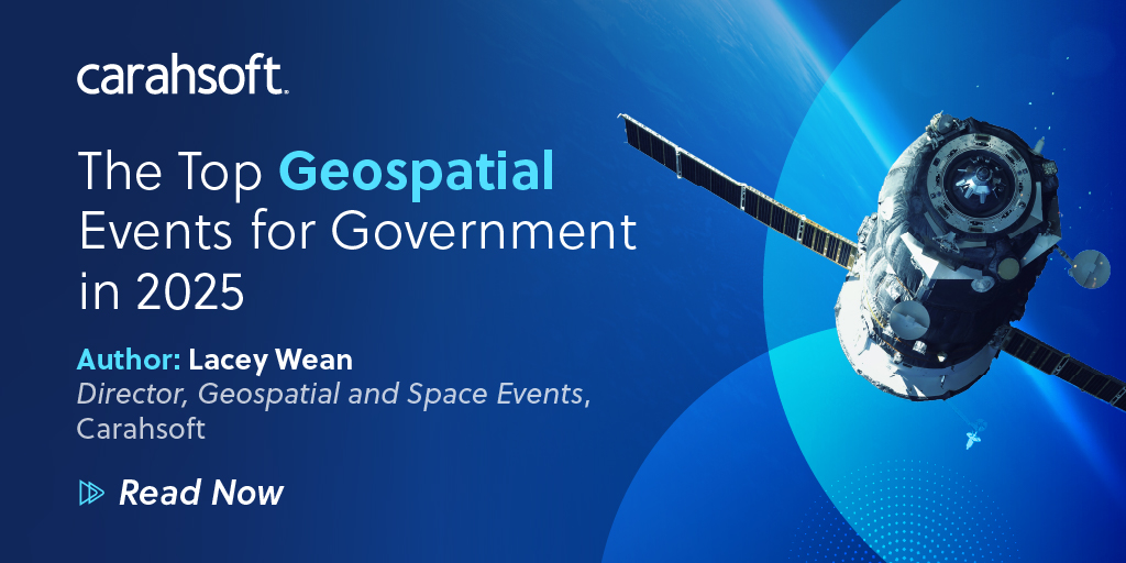
From enhancing #nationalsecurity to supporting environmental initiatives, #geospatialtechnologies are revolutionizing the Government sector. Explore the top events of 2025 & watch these innovations come to life: carah.io/2025Geospatial…

We're delighted to speak at India's leading construction conference on geospatial-BIM integration. Register for the event here geosmartinfrastructure.net/2023/registrat… #constructionchallenges #indianinfrastructure #geospatialtechnologies #infrastructureconference #innovativetechnology #VisiLean

📅 Join us on October 12, 2:15 PM at Stage 1, Hall 1.2, for the "Role of Spatial Technology for Ocean Business" panel at #INTERGEO. Get insights on diverse #GeospatialTechnologies and their applications in near-shore, transitional, and deep-water environments.

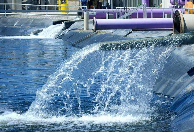
Using #geospatialtechnologies with current methodologies is an imperative step to achieving resilience and sustainability in the industrial sector due to increasing water scarcity & climate change. Read more details @orfonline 💦▶️ bit.ly/3IgKTPI #waterutility #GIS

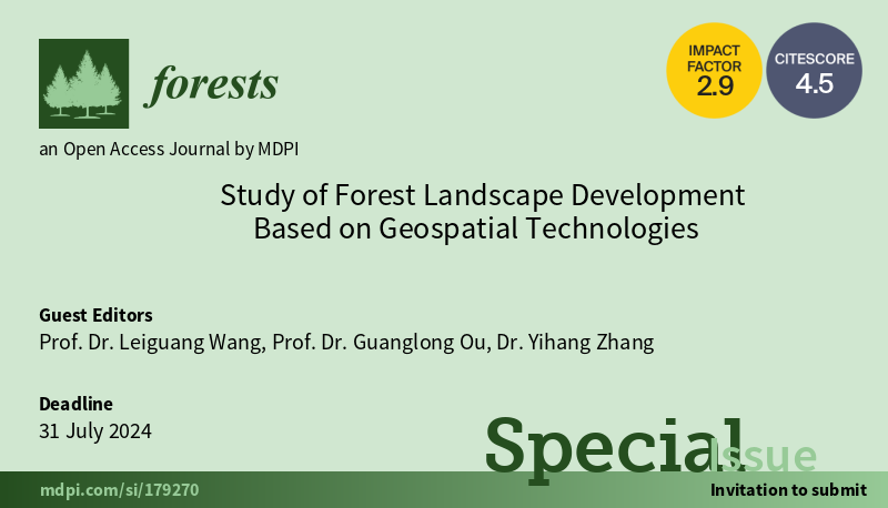
🌲#Forests🌲Open for Submissions📢 New Special Issue: Study of #ForestLandscape Development Based on #GeospatialTechnologies 👨🔬 Guest Editors: Leiguang Wang, Guanglong Ou & Yihang Zhang 🔗mdpi.com/journal/forest… 📡#remotesensing #machinelearning #forests #forestmanagement
Day 3 of GIFTS Summit 2025 spotlighted Theme 1 – Emerging Trends in Remote Sensing & Geospatial Tech. Experts from IIRS, CSSTEAP, C-DAC & NRSC shared insights on innovations driving climate action, sustainability & community resilience. #RemoteSensing #GeospatialTechnologies
From enhancing #nationalsecurity to supporting environmental initiatives, #geospatialtechnologies are revolutionizing the Government sector. Explore the top events of 2025 & watch these innovations come to life: carah.io/2025Geospatial…

GEO-Academy has been working on many new activities on #TeacherTraining for #SustainableDevelopment using innovative digital tools and #GeospatialTechnologies! 🛰️ 🌍 Subscribe to our newsletter and be the first to hear more: geoacademy.eu #ErasmusPlus
Lecturer in Geospatial Technologies and Environmental Science owlindex.com/service-explor… #Owlindex #GeospatialTechnologies #EnvironmentalScience #UVM #HigherEducation #AcademicExcellence #FacultyServices #SustainableFuture #ResearchInnovation #TeachAndInspire

Big thank you to #REACHInnovationSummit for inviting @RachelOpitz from #TGI to speak on #GeospatialTechnologies & #FoodSecurity! Excited to be part of discussion. We are all set for our second #GIFS workshop tomorrow. @mcolegeo @nadinesa Details 👉tinyurl.com/5n99vyb5
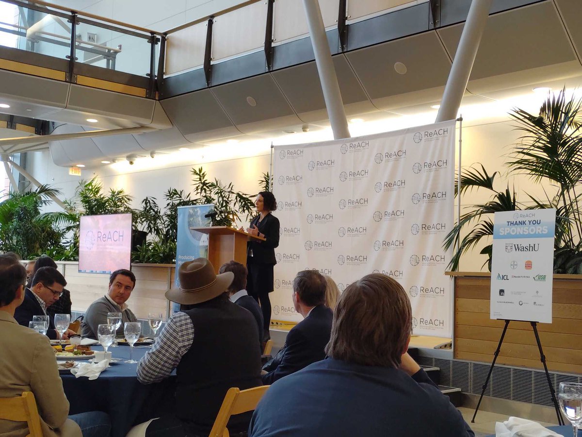
Catch up with @RachelOpitz at the #REACHInnovationSummit Feb 4-5, in St. Louis! She's excited to discuss how #geospatialtechnologies are shaping future of #foodsecurity. 🔗 Details: biostl.org/news-and-media… More about TGI's #GIFS Challenge: tinyurl.com/yc3b7au3
#TGI #GIFS Program’s Science Speed-dating Workshop happening Thursday, Feb 6 Learn how #Geospatialtechnologies promote #sustainableagriculture #landmanagement, reduces #foodwaste & improves access to #nutrition Details: tinyurl.com/yzvt9jnp @nadinesa @RachelOpitz @mcolegeo
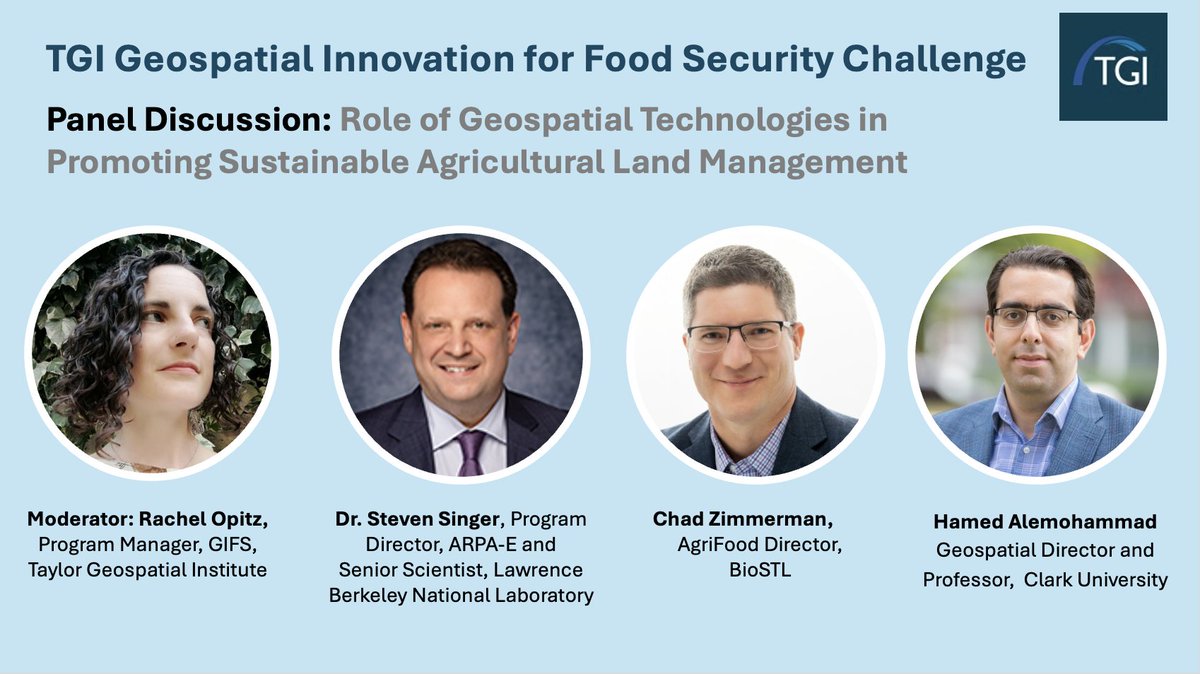
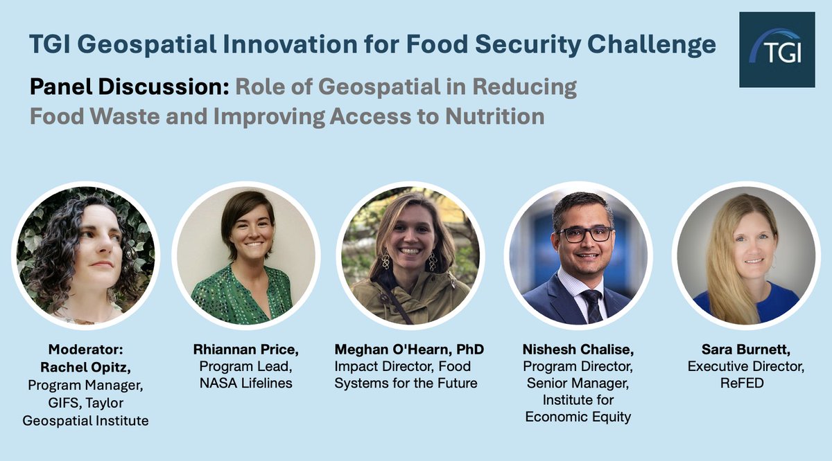
Join the TGI #GIFS Challenge to explore how #geospatialtechnologies can help reduce #foodwaste and improve #nutrition and #foodsecurity Date: Feb 6, 2025 Details: taylorgeospatial.org/foodsecuritych… #agriculture #GeospatialInnovation @RachelOpitz @nadinesa

🚀 #Geospatialtechnologies are transforming our #food systems! From improving #agriculture to optimizing #supplychains, #innovation is key to a #food-secure future. 🌍 Check out our latest article on the TGI Challenge's inaugural workshop. 👉Read here: taylorgeospatial.org/tgi-challenge-…

The future of #geospatialtechnologies is not just shaped by #data—it’s driven by the diverse voices bringing fresh perspectives to how we connect with and understand the world around us. Let’s continue to expand our horizons and empower more voices in the #GIS landscape. 🌍✨


Unlock the power of location intelligence with AAEIMAA's GIS expertise. ️ Our GIS services help you analyze data, manage assets, and make informed decisions. Visit aaeimaa-engineering.com for more details. #GIS #GeospatialTechnologies #LocationIntelligence #AAEIMAAEngineering

Geographic Information Systems (#GIS) play an important role in how federal organizations plan & manage real-world challenges through technology. Our expert discusses how #GeospatialTechnologies provide federal agencies digital tools in @FederalNewsNet ➡️bit.ly/3U1nZRb

Have you ever wondered about the impact of remote sensing on business strategy or operations? See how cutting-edge remote sensing technologies can give business leaders the upper hand. hubs.ly/Q02PKcDs0 #RemoteSensing #GeospatialTechnologies #GIS #EarthObservation
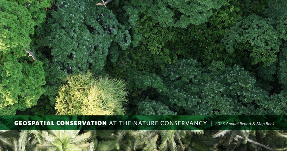
Want a good read? We suggest the recently published report from The Nature Conservancy, which highlights how advancements in #EarthObservation and #GeospatialTechnologies are revolutionizing how we understand and interact with our environment. bit.ly/4cMpiKx @nature_org
Join us for the FICCI Seminar on the Role of Geospatial Technologies in Disaster Risk Mitigation & Management on 26 September 2024 at Federation House, New Delhi. This seminar will delve into the crucial role of #GeospatialTechnologies (GIS) in mitigating Hydro-Meteorological…
🔥 Read our Highly Cited Paper 📚 GEOBIA and Vegetation Indices in Extracting Olive Tree Canopies Based on Very High-Resolution UAV Multispectral Imagery 🔗 mdpi.com/2076-3417/13/2… 👨🔬 by Prof. Ante Šiljeg et al. #geospatialtechnologies #machinelearning
GIS Enhancing the Efficiency of Gas Distribution in Cities @agendra, MD, @EsriIndia Read more: goo.su/RWZ1F #GIStechnology #GISsystems #GeospatialTechnologies #GasDistribution #networkmanagement


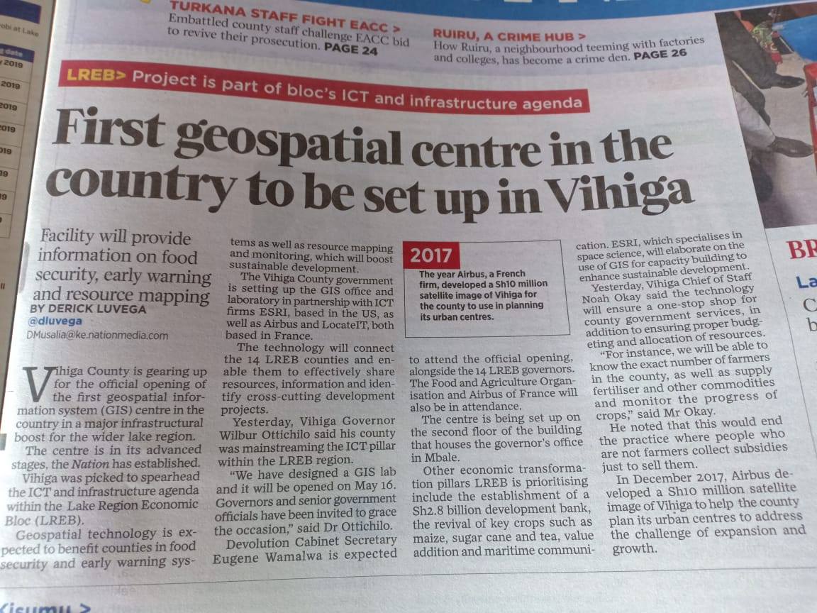
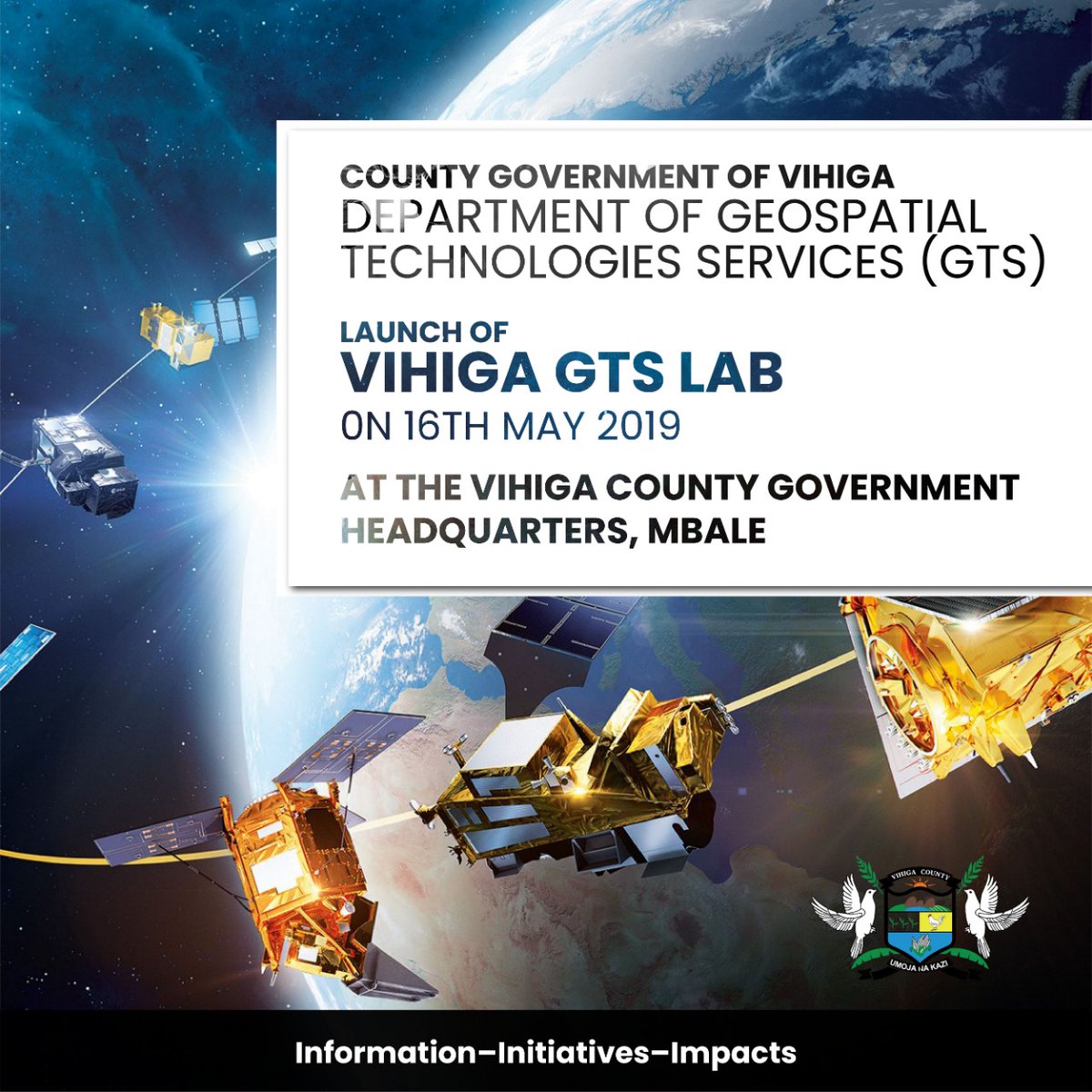
GeoSpatial Happenings, #GeospatialTechnologies - A New Frontier in Sustainable Development, @GovernorVihiga - Governor Vihiga County set to launch GeoSpatial Centre. @ITCAlumni @kenmubea

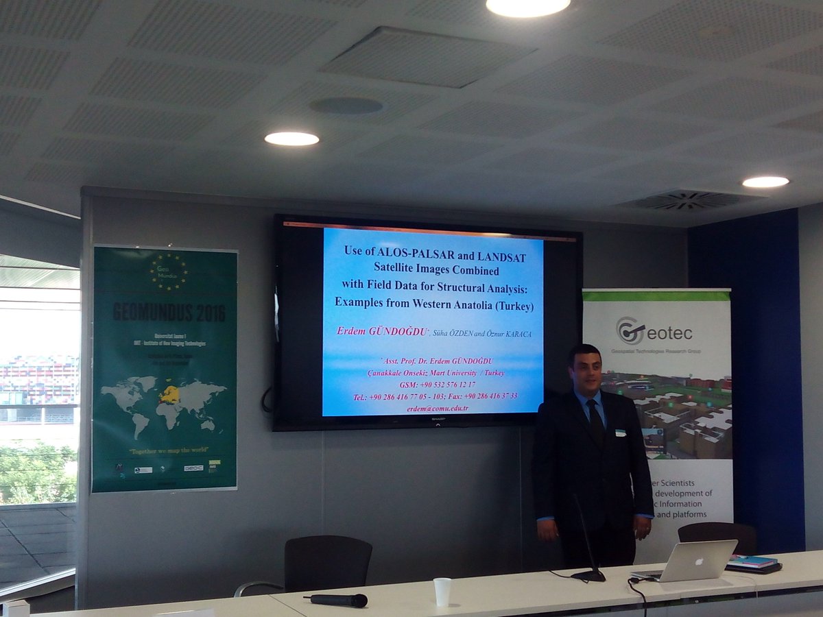
En el congreso @geomundus @Mastergeotech en la @UJI_noticies @geotecUJI #geomundus #geospatialtechnologies #geotech #2016 #UJI
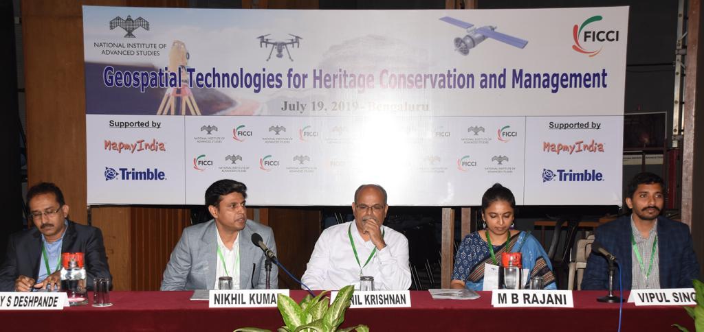
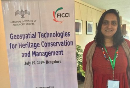
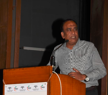
Mr Nikhil Kumar, Country Head, @HERE talks about techniques like remote sensing, satellites etc for mapping and surveying heritage sites while speaking at the conference on #GeospatialTechnologies for Heritage Conservation & Management organized by @ficci_india & @NIAS_India.

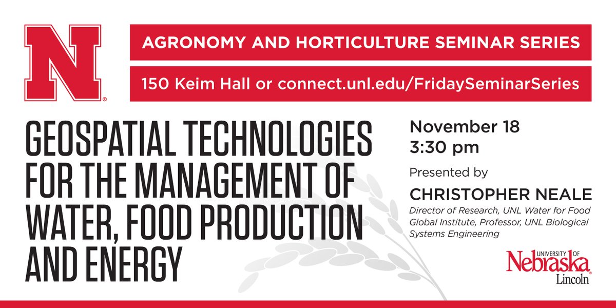
.@waterforfood's Christopher Neale to speak a/#GeospatialTechnologies for mngt of #water #foodproduction 11/18 #UNL ow.ly/2HS9304trta


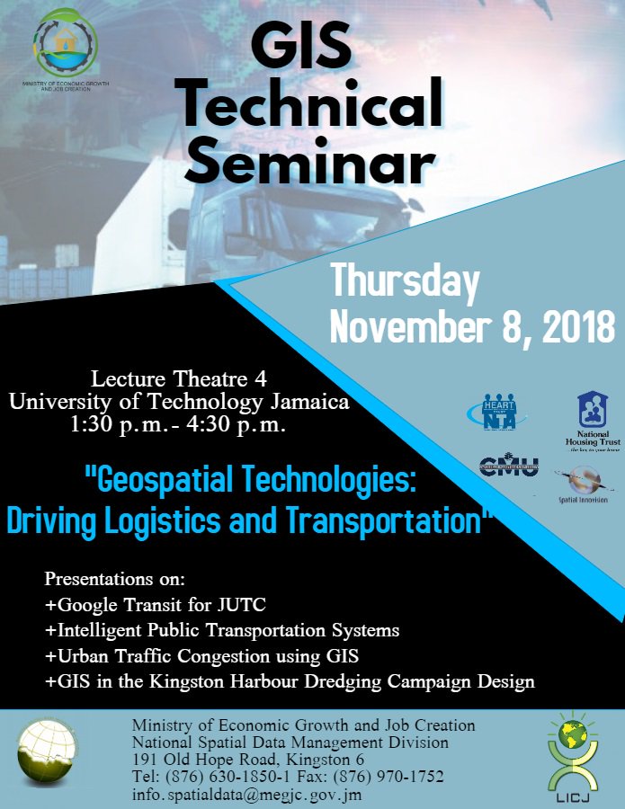
#GAW #GeographyAwarenessWeek #GeospatialTechnologies #DrivingLogisticsAndTransportation #November #GISExecutiveForum #GISTechnicalSeminar #ThanksgivingService #GISDayExpo #GISSymposium

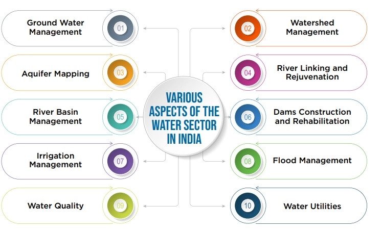
#CurrentAffairs ➦भारत में जल क्षेत्र के लिये भू-स्थानिक प्रौद्योगिकियाँ drishtiias.com/hindi/daily-up… #geospatialtechnologies #Prelims2021 #UPSC #IAS_Prelims #IASExam #CurrentNews #DrishtiIAS
Technology alone is not enough, we need technically trained people who should also have appreciation of conservation & heritage: Padma Shri awardee Prof Sharada Srinivasan at the conference on #GeospatialTechnologies for Heritage Conservation & Management by @ficci_india.

AI Changing Lives in Diverse Ways bit.ly/3y0GU1q #AI #artificialintelligence #GeospatialTechnologies #aiandml #LocationIntelligence #machinelearning #cloudcomputing #technology #healthcare #business #businesssolutions

Geospatial technologies can help in rediscovering our past and prepare for the future: Dr Shailesh Nayak, Director, NIAS at the conference on #GeospatialTechnologies for Heritage Conservation & Management organized by @ficci_india & @NIAS_India.
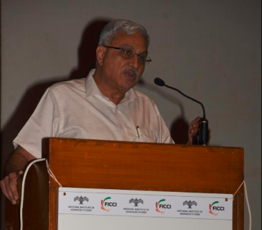
Dr Rajani, Associate Prof, NIAS shares case study on the use of Geospatial Technology for Nalanda site at the conference on #GeospatialTechnologies for Heritage Conservation & Management organized by @ficci_india & @NIAS_India.
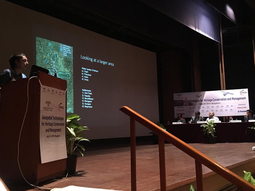
Geospatial Industry would be happy to partner Govt. in mapping all heritage sites: Mr Shishir Verma, Member, FICCI Geospatial Technology Committee at the conference on #GeospatialTechnologies for Heritage Conservation & Management organized by @ficci_india & @NIAS_India.

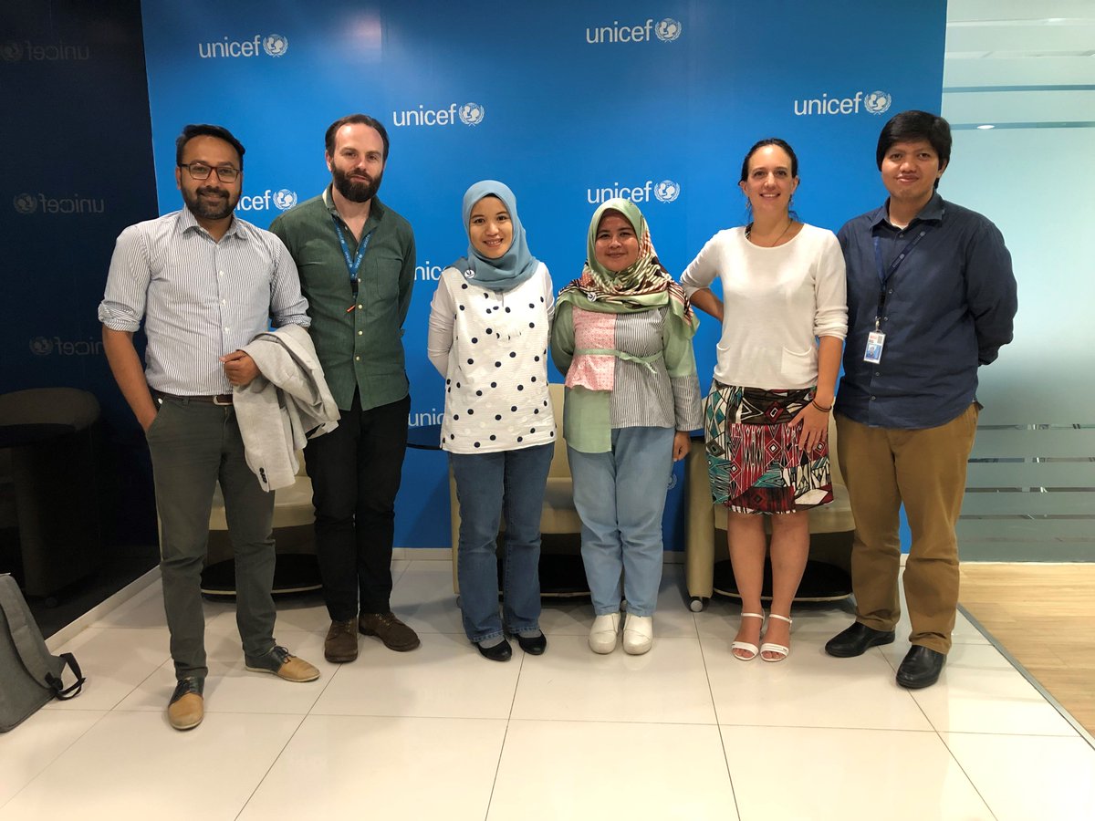
@UNOSAT and @UNICEFIndonesia in Jakarta had an engaging working session on #training content development for better #Disaster Response and Recovery using #GeospatialTechnologies. 🇺🇳🌏🗃 #UN-INSPIRE #HumanitarianDataExchange
Geospatial Technologies can play a huge role in development & mapping of Heritage Sites: Dr K Kasturirangan, Advisor & Former Chairman, @isro at the conference on #GeospatialTechnologies for Heritage Conservation & Management organized by @ficci_india & @NIAS_India.

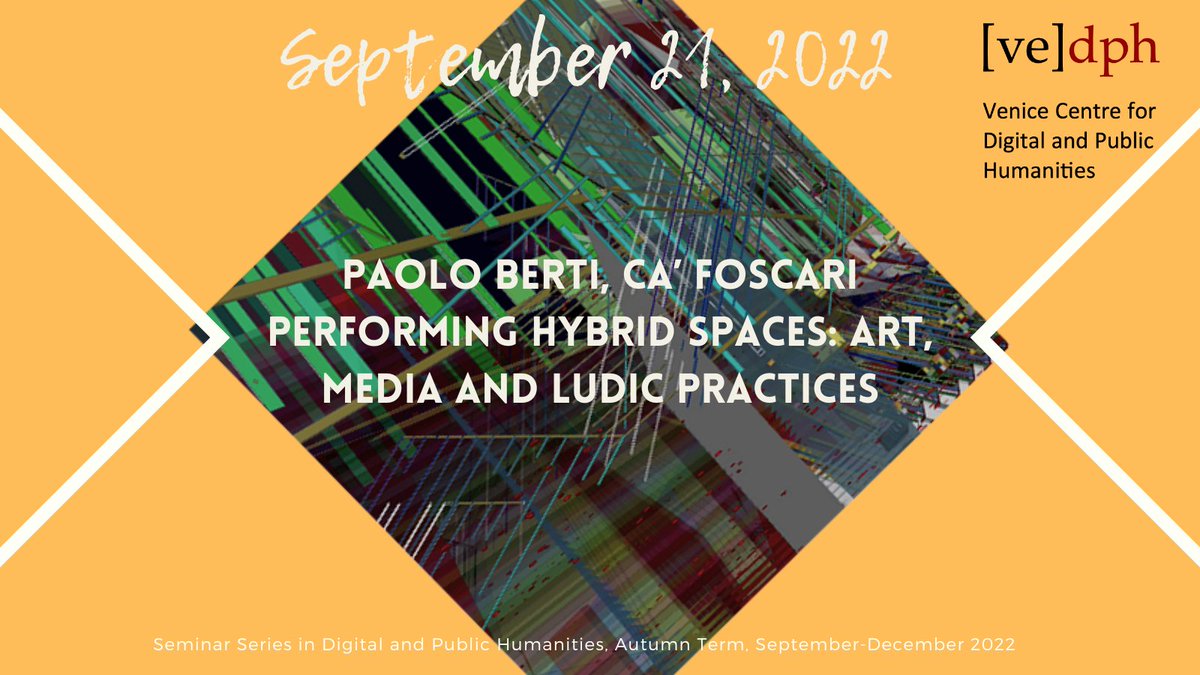
🟧🟨🟩🟦Sept 21, 5 pm CEST Paolo Berti @betrayal @CaFoscari 'Performing Hybrid Spaces: Art, Media & Ludic Practices' ℹ️ bit.ly/3xn3MKm #newmedia #digitalcultures #geospatialtechnologies #digitalarts Register➡️bit.ly/3q28uJD Series: Seminars D&PH/Autumn Cycle
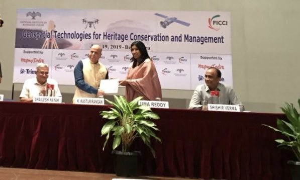
Ms @umareddyhm, Co Chair, FICCI Karnataka State Council presents 'Green Certificate' to Dr K Kasturirangan, Advisor, @isro & Chairman, @NEP during the conference on #GeospatialTechnologies for Heritage Conservation & Management organized by @ficci_india & @NIAS_India.
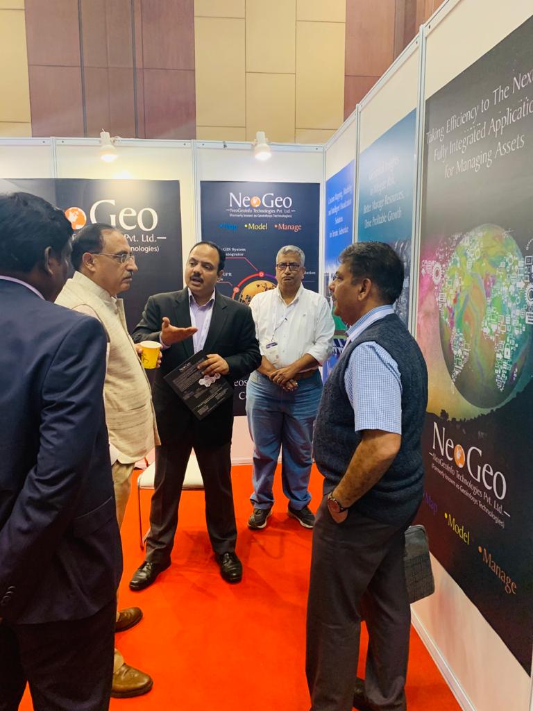
We, NeoGeo, were extremely happy to host Sir LT. General Girish Kumar, VSM at our booth and explain our entire range of Solutions and Services... #NeoGeoInfo #GeoSmartIndia #GeoSpatialTechnologies #GeoSpatialSolutions #SurveyOfIndia
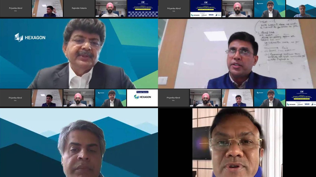
The Conference on #GeospatialTechnologies for Agriculture hosted by the @FollowCII on Oct 8, saw various government officials and industry leaders talk about the role of #Geospatial in enhancing #Agricultural #productivity.
Join us for the FICCI Seminar on the Role of Geospatial Technologies in Disaster Risk Mitigation & Management on 26 September 2024 at Federation House, New Delhi. This seminar will delve into the crucial role of #GeospatialTechnologies (GIS) in mitigating Hydro-Meteorological…
How #GeospatialTechnologies can help in the #Distribution of the #COVID19 #Vaccine? 🦠 💉 bit.ly/3afzTR5 @geoworldmedia

Something went wrong.
Something went wrong.
United States Trends
- 1. #FanCashDropPromotion 2,082 posts
- 2. Good Friday 62K posts
- 3. #FridayVibes 5,232 posts
- 4. #FursuitFriday 11.4K posts
- 5. Kenyon 1,122 posts
- 6. #FridayFeeling 2,759 posts
- 7. Happy Friyay 1,413 posts
- 8. Sedition 366K posts
- 9. LINGORM DIOR AT MACAU 629K posts
- 10. RED Friday 3,907 posts
- 11. #FridayMotivation 3,797 posts
- 12. Ja Rule 1,286 posts
- 13. Maggie 31.3K posts
- 14. Eric Swalwell 4,153 posts
- 15. ON SALE NOW 11.9K posts
- 16. Traitor 135K posts
- 17. Knox 6,449 posts
- 18. woozi 42K posts
- 19. Mark Kelly 77.3K posts
- 20. Dubai Air Show 50.8K posts