#pyrocb wyniki wyszukiwania

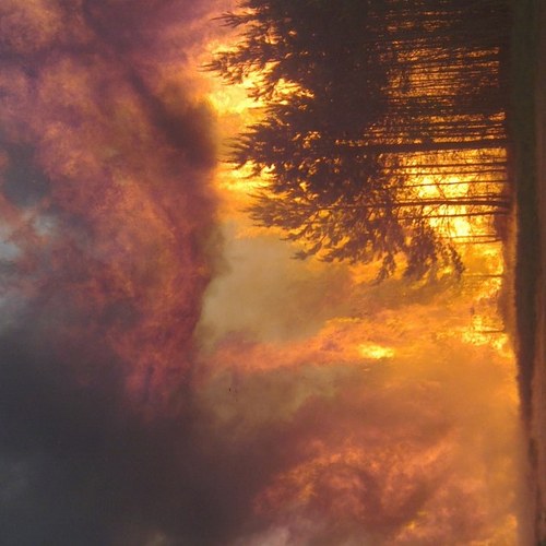
🟥 🌩 Pyrocumulonimbus (pyroCb) Clouds are towering, thunderstorm-like cumulonimbus clouds triggered by intense heat from large wildfires or volcanic eruptions. ❤️ 🔁 #PyroCb #FireStormClouds


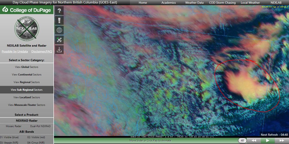
#PyroCB-looking flare up in NE BC... smoke plume with strong West to East flow gusting 57km/h, heat from wildfire (fed by wind and anomalously warm ~6C above normal) and poof, right past the atmospheric cap.

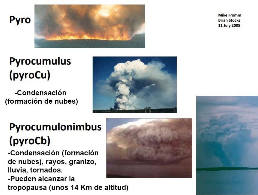
Para que entendáis la diferencia entre un pirocúmulo #PyroCu y un pirocumulonimbo #PyroCb, he traducido esta infografía de la NASA.
This is one of the most incredible fire photos I've seen to date!! Photo taken @VerimapI during a thermal scan flight over the Adams Lake fire last night shows a lenticular cloud above a #pyrocb, simply incredible!! #wow #BCwildfire #BCfire

Disponer de perfiles LIDAR (entre otros) de las formaciones de pirocúmulos y pirocumulonimbus #PyroCB en incendios forestales puede ser oro puro para analizar su comportamiento.
Un poco más al norte. Los incendios de arriba arden con mucha fuerza...demasiada. Se observan claramente pirocúmulos, incluso quizás #PyroCB

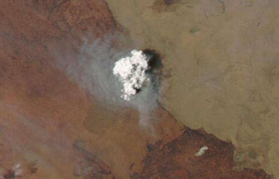
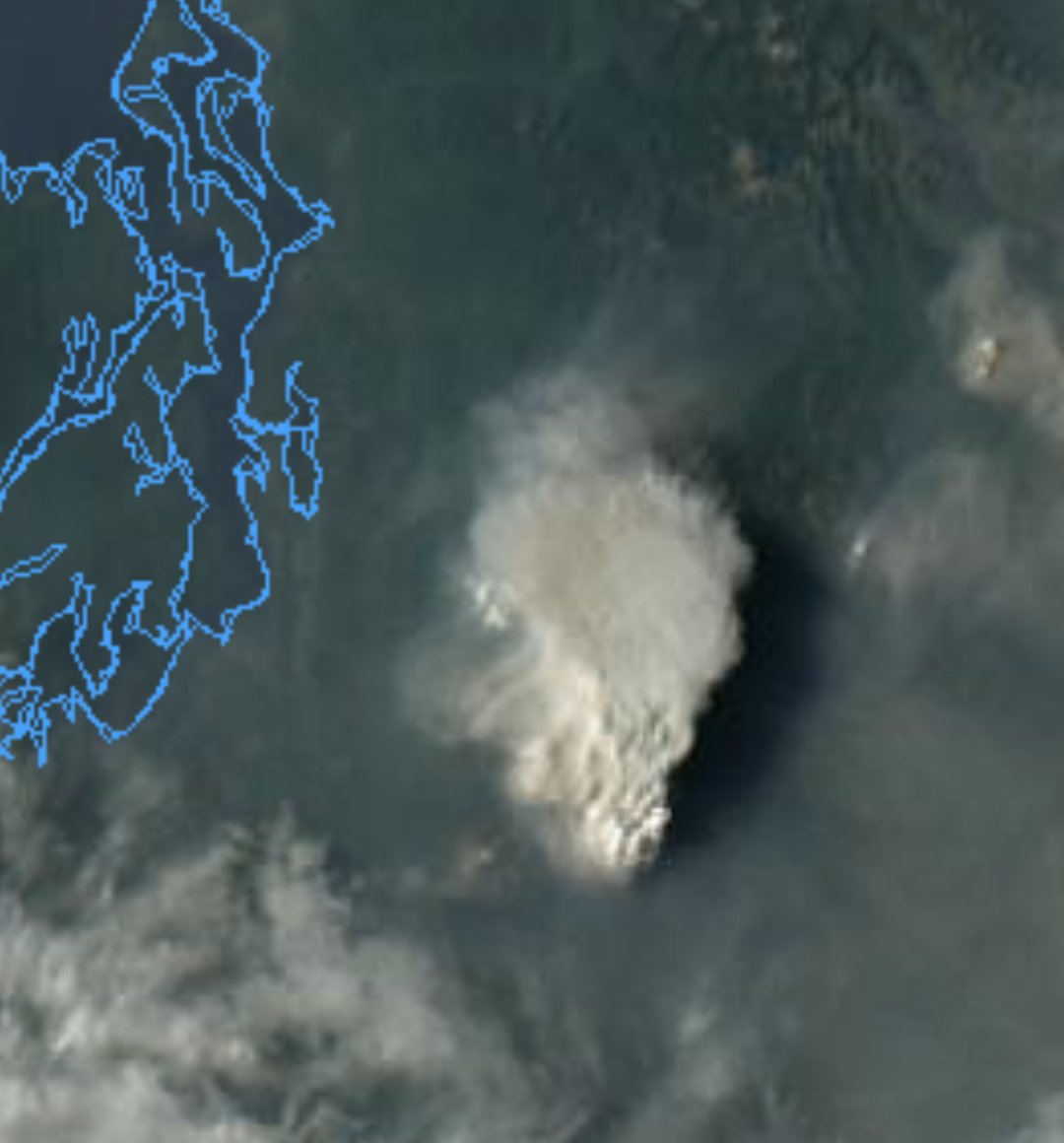
Krai de Zabaykalsky (Federación Rusa🇷🇺) Satélite Aqua hoy. Si, como creo, esa nube blanca es producto de la brutal convección de uno de los incendios, es una de las nubes convectivas más potentes que nunca haya visto en Asia. Tiene pinta de ser un bestial #PyroCB
Hay un enorme incendio justo al sureste de #Fairbanks, Alaska🇺🇸 Imagen del Aqua ayer. Se aprecia la formación de potentes pirocúmulos (¿quizá #PyroCB?).
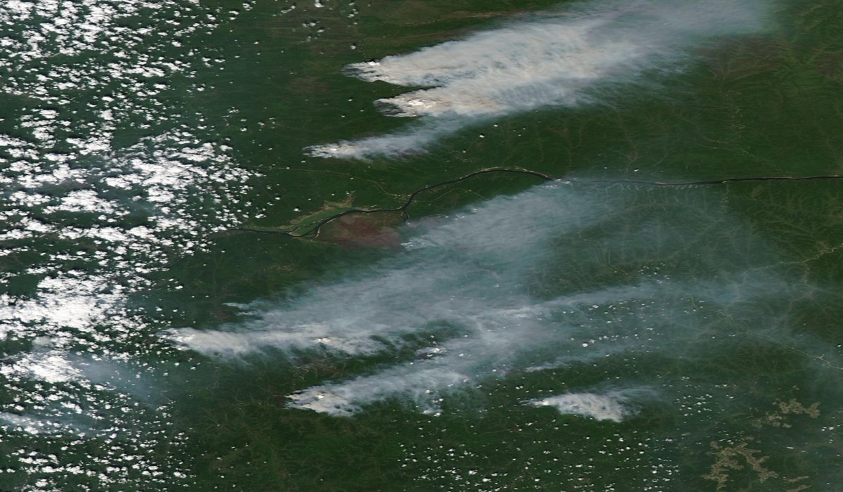
Un enorme pirocúmulo (quizá #PyroCB?) se alza sobre los cielos de Northern Australia ya cerca de la frontera con Queensland. El Niño trae otra potente época de incendios a la mitad norte de Oz donde ya han ardido más de 60 millones de hectáreas este año. (Satélite Aqua):
At 571,184 hectares and growing, the #DonnieCreek fire in NE BC is an absolute monster. Given how much landscape it has already burnt, the amount of black, charred ground is enough to enhance the local heating and lift, generating its own #PyroCB #BCWildfire #BCstorm

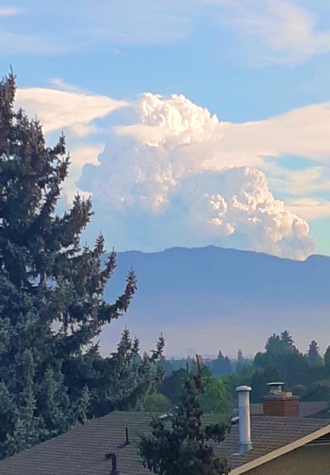
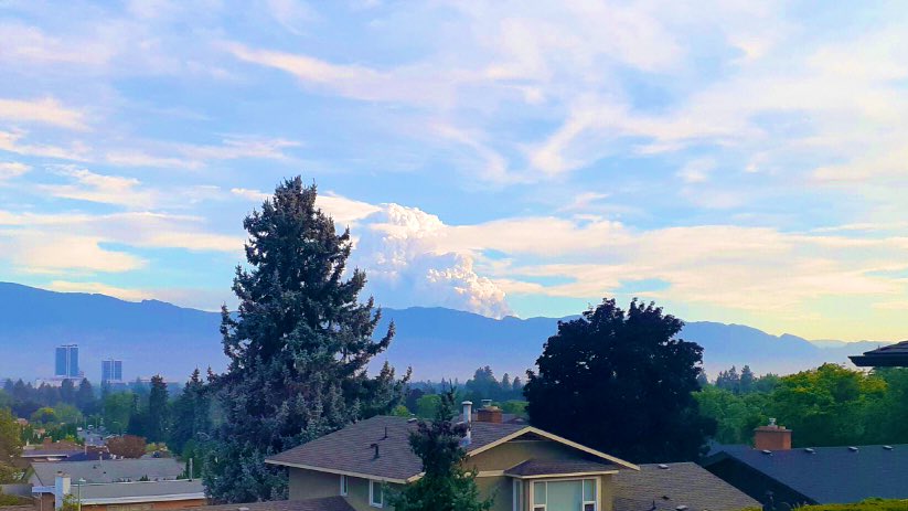
Weather friends in #Kelowna shared this photo of a #pyrocb popping up west of Little White Mountain, view is looking south from their home in Glenmore, it has been reported via *5555 #BCwildfire
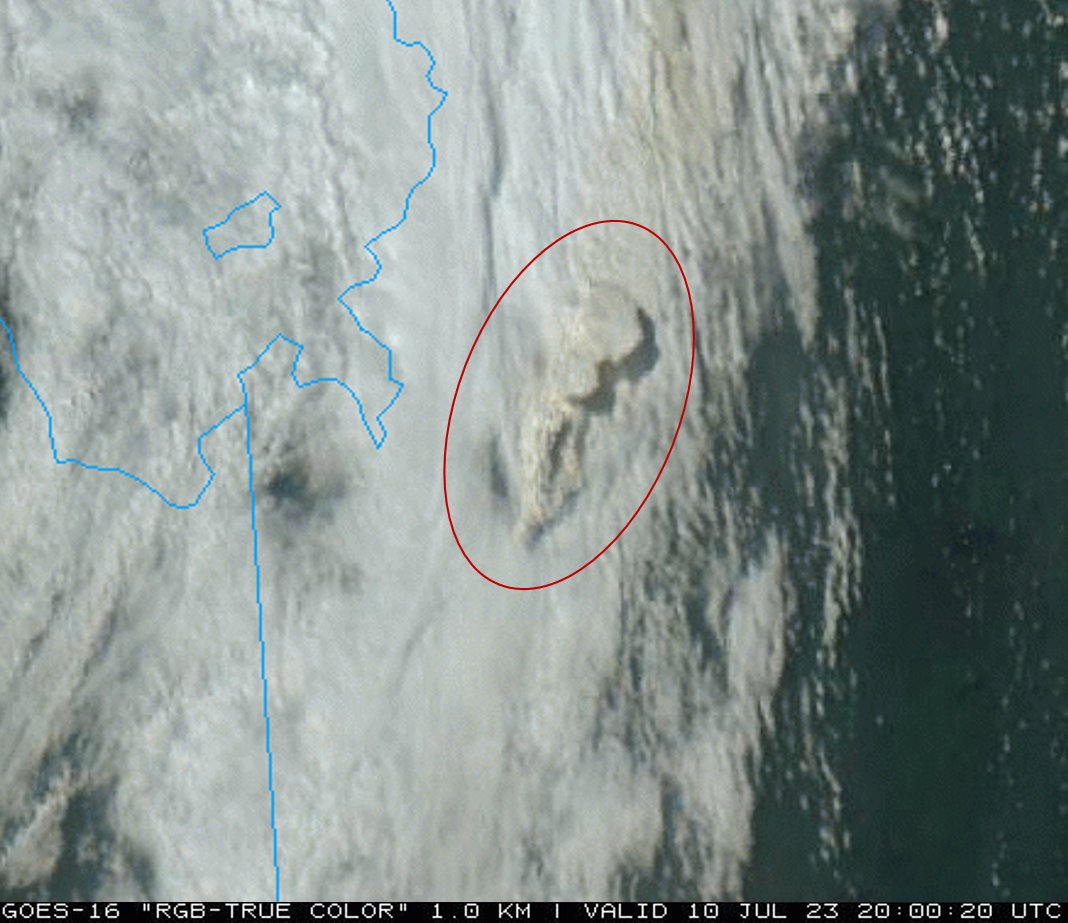
Already 85 #pyroCb events in Canada during the 2023 fire season, which exceeds the second highest total of 50 in 2021 (dataset begins in 2013). Nine pyroCbs occurred on 9-10 July alone. There have been 97 pyroCbs worldwide in 2023. Four more will make 2023 the most active year.

A fire in #Quebec produced at least four "pulses" of #pyroCb activity on Thursday (01 June). By sunset, a train of smoke-filled anvil clouds extended across much of the Gulf of St. Lawrence. This is the latest in a series of pyroCb events in Canada since early May.

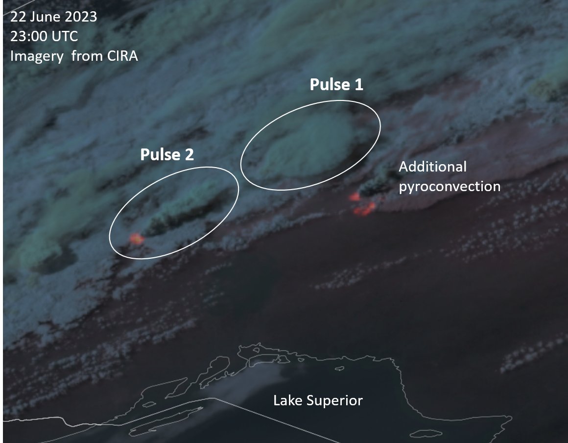
A large pyrocumulonimbus (#pyroCb) developed over a fire in #Ontario on 22 June. This brings the pyroCb total in Canada to 51, already making 2023 the most active year of the last decade. The previous benchmark was 50 pyroCbs in 2021, with only one pyroCb observed by this date.

A wildfire in British Columbia produced a #pyrocumulonimbus/#pyroCb cloud yesterday evening - more on the CIMSS Satellite Blog: cimss.ssec.wisc.edu/satellite-blog…
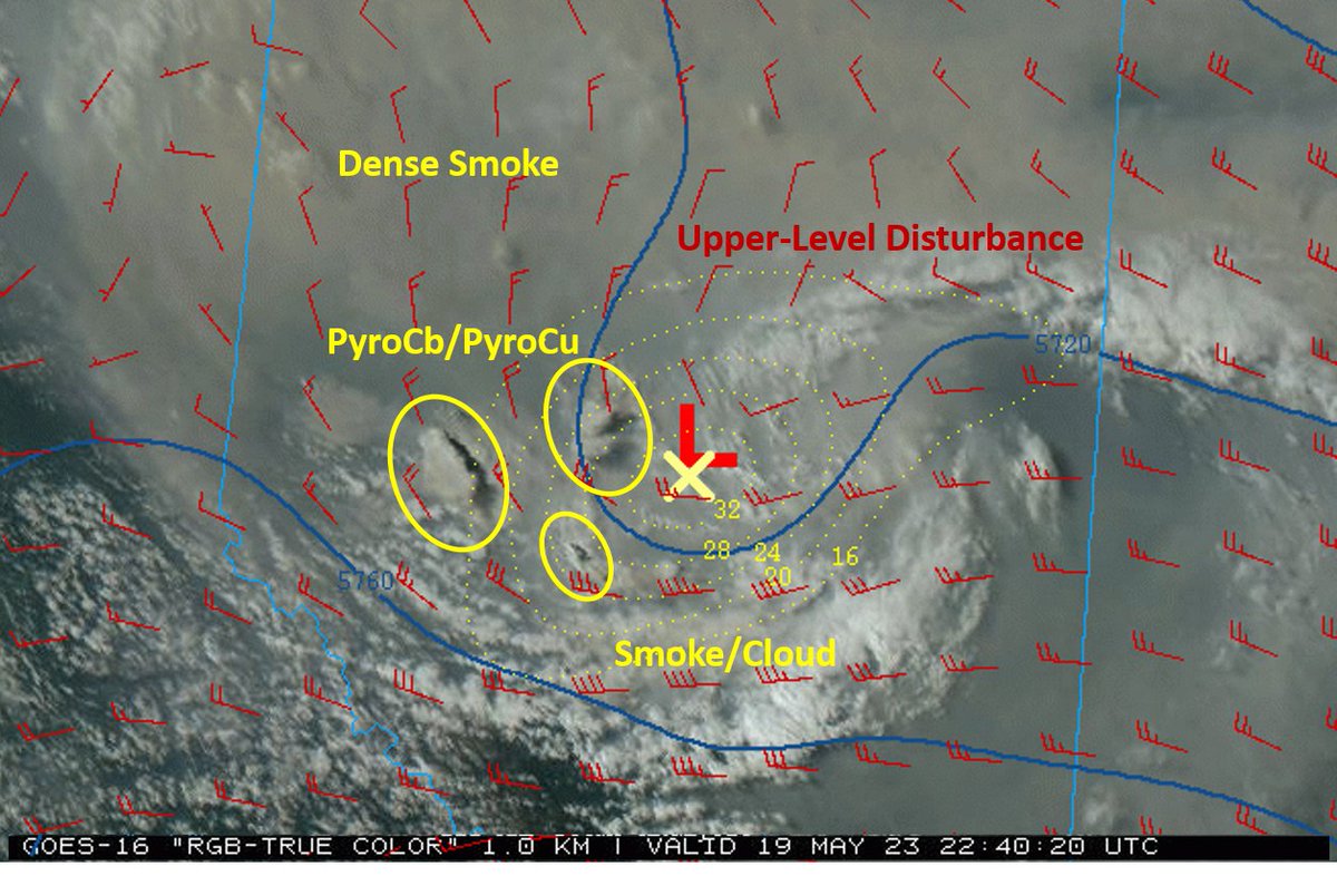
Several pyrocumulonumbus (#pyroCb) events were observed in #Alberta this evening. A small, upper-level weather disturbance is helping to destabilize the atmosphere and aid pyroCb development. Contours are 500 hPa heights and winds. Additional pyroCbs are possible this weekend.


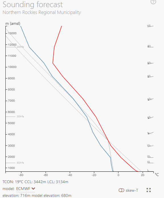
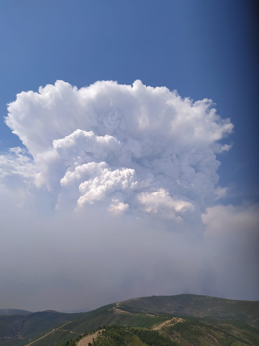
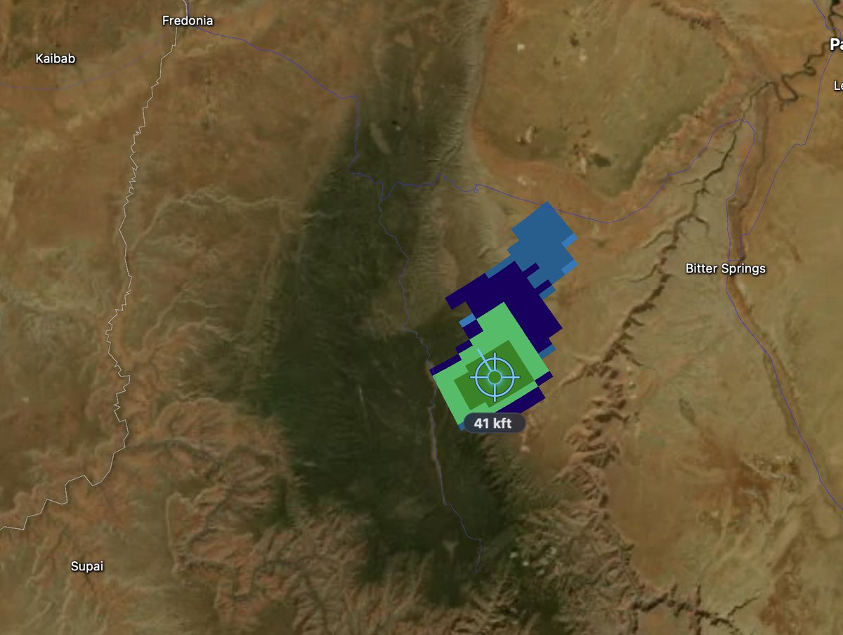
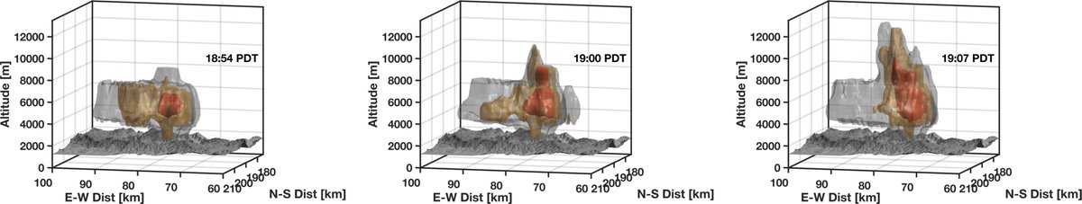
There is a decent chance the #GarnetFire will produce a #pyroCb today. The well-established fire burning in forest fuels has been active through the night, is already producing a modest plume and #pyroCu, and there is an influx of mid-level moisture. The "inverted-V" profile (
🟥 🌩 Pyrocumulonimbus (pyroCb) Clouds are towering, thunderstorm-like cumulonimbus clouds triggered by intense heat from large wildfires or volcanic eruptions. ❤️ 🔁 #PyroCb #FireStormClouds
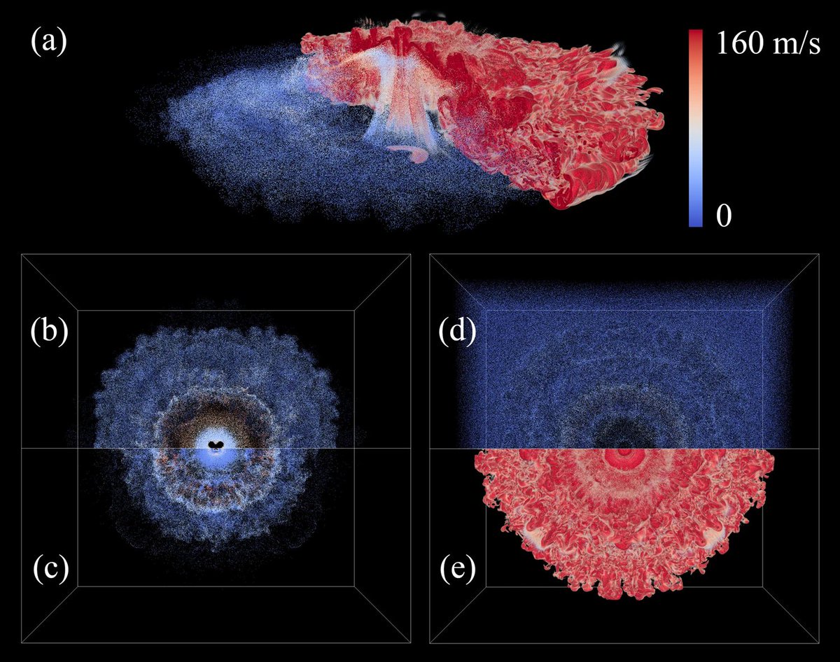
Wildfire meets thunderstorm — our E3SM simulation reproduces the 2020 Creek Fire #pyroCb for the first time in a climate model! agupubs.onlinelibrary.wiley.com/doi/full/10.10… dri.edu/scientists-suc… #Wildfire #Climate #E3SM #EarthSystemModel
🔥 We just simulated wildfire-induced thunderstorms (pyroCbs) in a global Earth system model for the first time! doi.org/10.1029/2024GL… #wildfires #pyroCb #ClimateAction #ClimateWeekNYC
Our new paper in Geophysical Research Letters presents the first simulation of pyrocumulonimbus (pyroCb) storms in a global Earth system model, a breakthrough for wildfire–climate research. doi.org/10.1029/2024GL… #Wildfires #PyroCb #WildfireSmoke #ExtremeEvents
Our new paper in Geophysical Research Letters presents the first simulation of pyrocumulonimbus (pyroCb) storms in a global Earth system model, a breakthrough for wildfire–climate research. doi.org/10.1029/2024GL… #Wildfires #PyroCb #WildfireSmoke #ExtremeEvents
Simulating Pyrocumulonimbus Clouds Using a Multiscale Wildfire Simulation Framework - Ke - 2025 - Geophysical Research Letters - Wiley Online Library agupubs.onlinelibrary.wiley.com/doi/full/10.10… #wildfires #pyroCb #pyrocumulonimbus
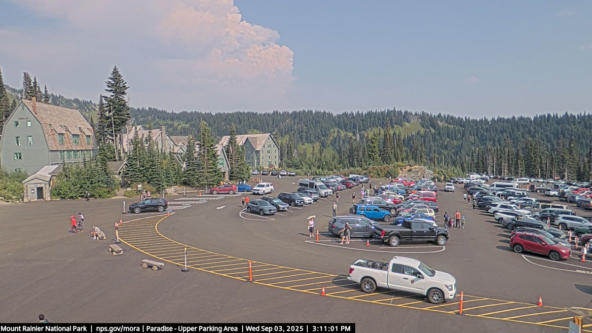
Radar rendering of yesterdays' #pyroCb from the #WildcatFire. Mt. Rainier for scale. The lowest radar sweeps are well above the surface, so we can't see the updraft core right above the fire.
The #GarnetFire's transition to #pyroCb is both meteorologically fascinating and alarming. Hoping fire crews can get ahead of these dangerous conditions.
#GarnetFire yielding deepening #pyroCu and edging toward #pyroCb. Its updraft also appears to be perturbing the upper level flow with a persistent cloud lens forming aloft, which is then perforated by the plume at the end of the loop.
There is a decent chance the #GarnetFire will produce a #pyroCb today. The well-established fire burning in forest fuels has been active through the night, is already producing a modest plume and #pyroCu, and there is an influx of mid-level moisture. The "inverted-V" profile (
There is a decent chance the #GarnetFire will produce a #pyroCb today. The well-established fire burning in forest fuels has been active through the night, is already producing a modest plume and #pyroCu, and there is an influx of mid-level moisture. The "inverted-V" profile (
Here is a rotating view of the plume structure during the period of peak depth. There are two distinct detrainment levels for the smoke, the first at a lower inversion layer that the plume punched through and the second near the top of the #pyroCb
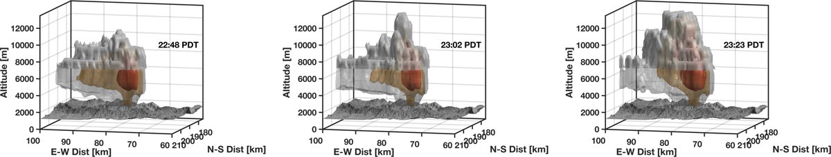
Radar summary of yesterday's deep plume and #pyroCb development from the #GarnetFire. The fire is now burning toward/into the Teakettle Experimental Forest, a location that helped me fall in love with the Sierra and my wife. (share.watchduty.org/i/61327?ts=175…)
Radar summary of yesterday's deep plume and #pyroCb development from the #GarnetFire. The fire is now burning toward/into the Teakettle Experimental Forest, a location that helped me fall in love with the Sierra and my wife. (share.watchduty.org/i/61327?ts=175…)

Here is a radar summary of the multiple distinct #pyroCb pulses from the #EmigrantFire today (times are in UTC, which is PDT+7 hrs).
Timelapse footage of the #EmigrantFire pyrocumulonimbus this evening. Note the corkscrew motion of the plume and the constant pileus clouds developing over it as it rises. #orwx
The radar correlation coefficient data clearly show the development of hydrometeors in the upper plume immediately above the fire, as opposed to displaced downwind as is often the case. #EmigrantFire #pyroCb
Impressive rapid initiation of a morning #pyroCb from the #EmigrantFire.
Impressive rapid initiation of a morning #pyroCb from the #EmigrantFire.
Quick radar summary of today's #PyroCb plume from the #DollarLakeFire burning near the head of the #GreenRiver. Hope nobody is trapped up there seeing as this is near a popular access point to the #WindRiverMountains
This is one of the most incredible fire photos I've seen to date!! Photo taken @VerimapI during a thermal scan flight over the Adams Lake fire last night shows a lenticular cloud above a #pyrocb, simply incredible!! #wow #BCwildfire #BCfire

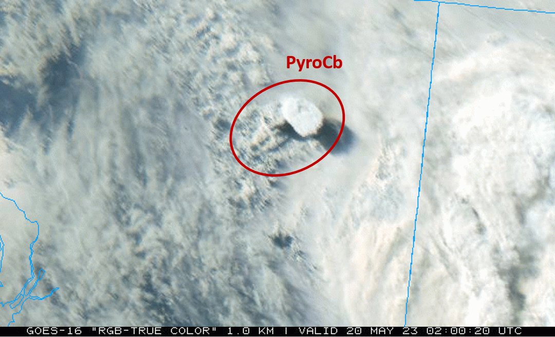
It's been a summer of fire-breathing smoke storms in North America. Scientists have tracked thunderstorms created by #wildfires for years. However, the ferocity of the pyrocumulonimbus, or #pyroCb, events that have popped up in #Canada has surprised them. earthobservatory.nasa.gov/images/148630/…


Here is a full day GOES-17 geocolor loop centered near the #CreekFire. Probably the #PyroCb event of the year in #California. PyroCb initiated around 1900 UTC w/ lightning & extreme fire behavior at 2100 UTC. Extent of the fire shows up in black at end of loop. #CAfire #CAwx
We were already in uncharted territory with the Colorado Fire activity this October, but the last 2 days of activity with the #EastTroublesomeFire goes beyond that. 2 days of #PyroCb plumes from a fire growing >100K acres in 24h. Today's synoptic annotation below.
One more radar summary: this is for the #BearFire during its downhill run to #LakeOroville, followed by a northward push in the middle of the night culminating in a deep #PyroCb pulse. I haven't dug into what caused the northward shift yet. #CAwx #CAfire
Accompanying the extreme heat in the Western US was another day of extreme #fire activity. There were at least three separate fires producing #PyroCb (fire induced thunderstorms) leading to widespread smoke across the region. #CreekFire #CastleFire #CameronPeakFire
Looking back at the #CreekFire's big run up to Mammoth Pool: Here is a radar animation of the explosive #pyroCb plume development. This plume was massive, producing multiple pushes above 12 Km. #CAwx #CAfire
Trying to catch up on radar analysis of #PyroCb. Here is a radar volume rendering of last night's #BearFire pulse at 1030 UTC, pushing up to 12 km. #CAfire #CAwx @DrDavePeterson
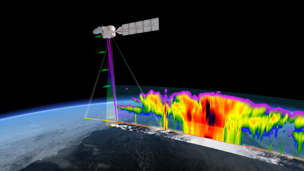
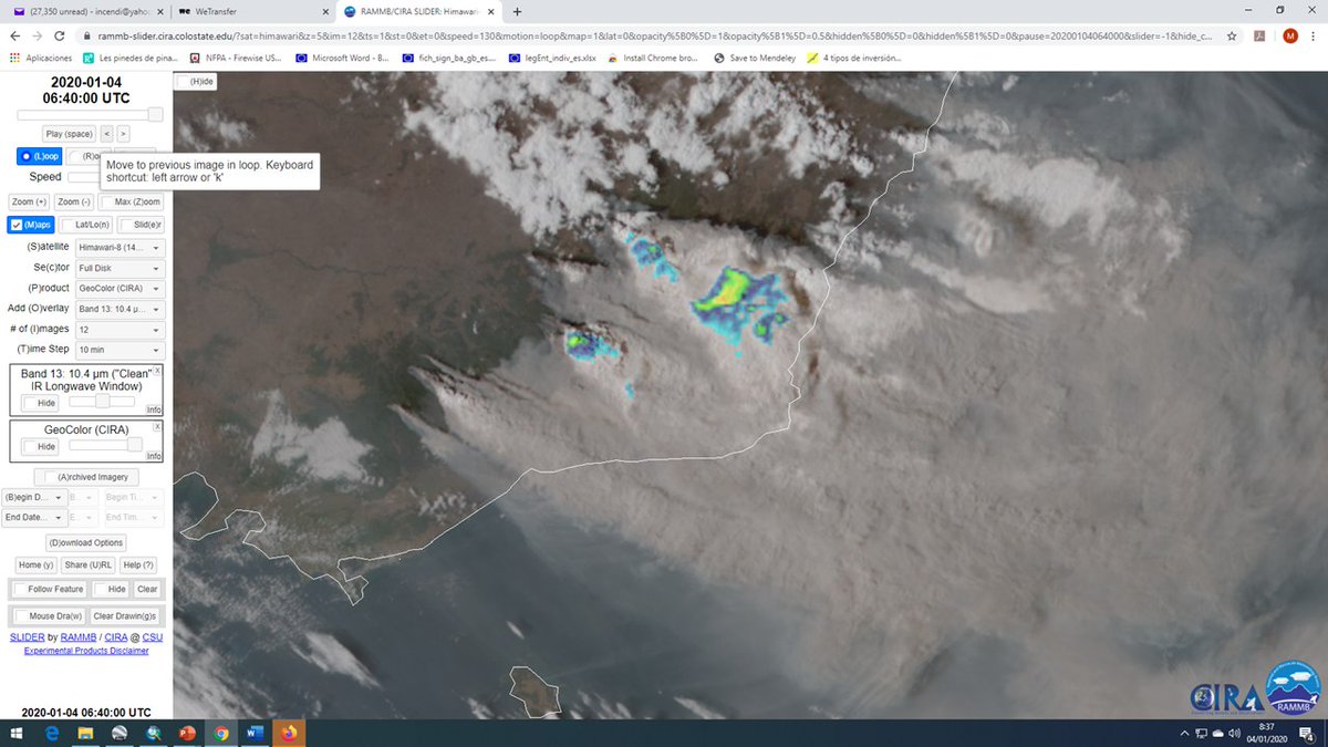
Trans-Pacific transport of smoke from the #AustralianWildFires observed by @JPSSProgram SNPP/OMPS between Dec 29, 2019 & Jan 6, 2020. Some smoke was injected to stratospheric altitudes (= highest Aerosol Index values) in #pyroCumulonimbus clouds. #pyroCb
The #CreekFire continues to generate explosive pyrocumulonimbus clouds (#PyroCB) and spread prolific smoke across #California and the western U.S. this #SundayMorning. Several other fires can also be seen in this #GOESWest loop. A truly tragic situation.

I took this today from our Southwest flight from San Jose to Las Vegas

Outbreak of at least four thunderstorms generated by wildfire (#pyroCb) in Northern #California over the #DixieFire, #AntelopeFire, and #McFarlandFire. Note the smoky anvil clouds at about 30,000 ft. Dixie Fire produced pyroCbs from two separate regions of the fire front. #CAwx

Radar volume rendering of today's explosive #pyroCb from the #DixieFire. As the @AlertWildfire videos show, rapid growth of the lookers left plume after the first #pyroCb pulse. Outflow from the former to the latter could have been a contributor. #CAwx #CAfire #FireWxIsExtremeWx
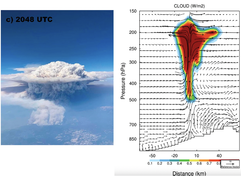
While I really like studying wildfire plumes and #pyroCb, I'm incessantly envious of volcanic plumes... this paper has only fueled my jealousy. The Hunga Tonga-Hunga Ha’apa plume really takes the cake... @COweatherman nature.com/articles/s4324…
Back up to ~45kft for the overshooting #PyroCb from the #CreekFire. I continue to be at a loss for words.
Radar volume rendering of yesterday's (7/9/2021) #pyroCb and plume growth from the #SugarFire / #BeckwourthComplexFire. Times are in UTC. #CAfire #CAwx
Unfortunately, the #CarrFire may be re-intensifying this afternoon, while initiating #pyroCb. Continued dangerous situation for those in #Redding, #California. Here is a brief truecolor #GOES16 animation showing the burst of convection from the fire (courtesy of @CODMeteorology)
Radar snapshots showing some two of the many #pyroCb/#pyropuffs last night on the #DixieFire. First sequence at ~7PM PDT, second at ~11 PM PDT. Added a white iso-surface to one of the figures to show the approx. cloud outline. #CAwx #CAfire
At 571,184 hectares and growing, the #DonnieCreek fire in NE BC is an absolute monster. Given how much landscape it has already burnt, the amount of black, charred ground is enough to enhance the local heating and lift, generating its own #PyroCB #BCWildfire #BCstorm
Dangerous fire weather conditions over northern California related to upper-level weather disturbance. Large fire-driven thunderstorm (#pyroCb) underway over the #AntelopeFire (note the smoky anvil cloud). Wind shift reaching the #DixieFire, setting the stage for erratic spread.
As predicted by @vicemergency @NSWRFS FBAN, another day of extreme fire. #PyroCb well developed over the border. All our support to firefighters in the area and eyes ooen to learn from tvose lessons and experiences
Something went wrong.
Something went wrong.
United States Trends
- 1. Britney N/A
- 2. Chabad N/A
- 3. #INDvsENG N/A
- 4. #myfirstjob N/A
- 5. Good Thursday N/A
- 6. Azerbaijan N/A
- 7. #thursdayvibes N/A
- 8. Cutch N/A
- 9. Happy Friday Eve N/A
- 10. Ming N/A
- 11. Mooney N/A
- 12. Nic Dowd N/A
- 13. Rand N/A
- 14. Six Flags N/A
- 15. #olandria N/A
- 16. #FirstJobConfessional N/A
- 17. Trent Brown N/A
- 18. Oh Michael N/A
- 19. Vote NO N/A
- 20. GF MEGA GALE X JOSSGAWIN N/A