#rafaelfire search results

#ManagedFire can help keep #firefighters safe and restore fire adapted ecosystems. The Incident Management Team for the #RafaelFire knew nearby previously managed and prescribed 🔥 would allow for a safe and effective burn out strategy @CoconinoNF @CityofFlagstaff @PrescottNF
Would you like to learn more about #ManagedFire? @SWfirescience has a new video explaining how previously managed #wildfires helped firefighters gain control of the 2021 #RafaelFire burning just outside @CityofFlagstaff in #Arizona. Watch the video here: ow.ly/ospS50Pe6T0

youtube.com
YouTube
Evolution of Fire Management and the Role of Knowledge

🔥West Wildfires 🔥 || On Thursday trees were ablaze as the #RafaelFire in Arizona grew over 78k acres, but is 91% percent contained on Friday. #AZwx #WildFire #ForestFire

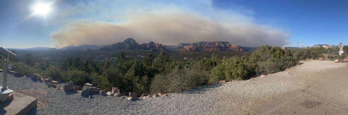
#RafaelFire burning west of Sedona... Smoke drifting across northern AZ, including Flagstaff. 1,000 acres burned so far per @PrescottNF. @abc15 #azwx


Sunday numbers on the #RafaelFire in northern Arizona. 62,376 Acres. 11% Contained. 664 Personnel #AZFire @KTAR923 @AZMorningNews
Update on #RafaelFire southwest of Flagstaff. The fire has grown to over 77,000 acres. wildfiretoday.com/2021/06/28/upd…
#RafaelFire smoke blanketing much of northern AZ...


The smoke you are smelling today is actually mostly “good” fire. It’s coming from firefighters creating controlled fire lines between the Rafael Fire and the city that’ll create a barrier to protect us. #RafaelFire

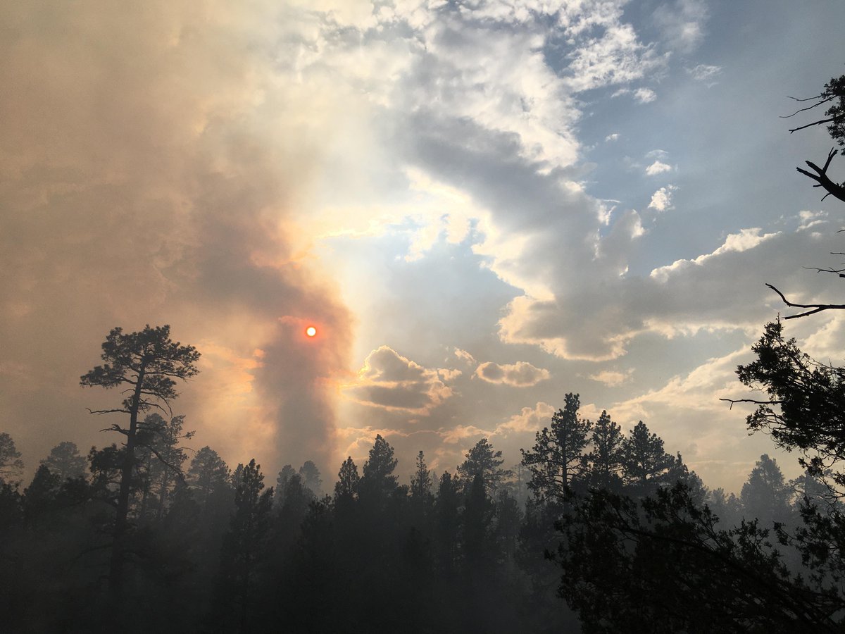
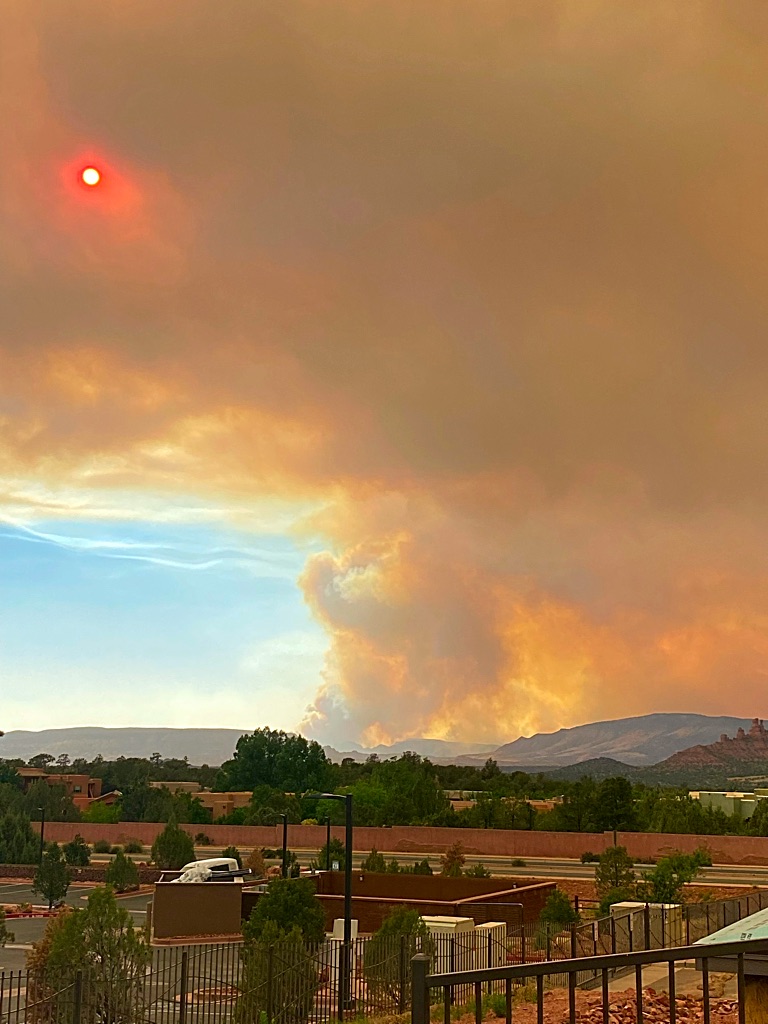
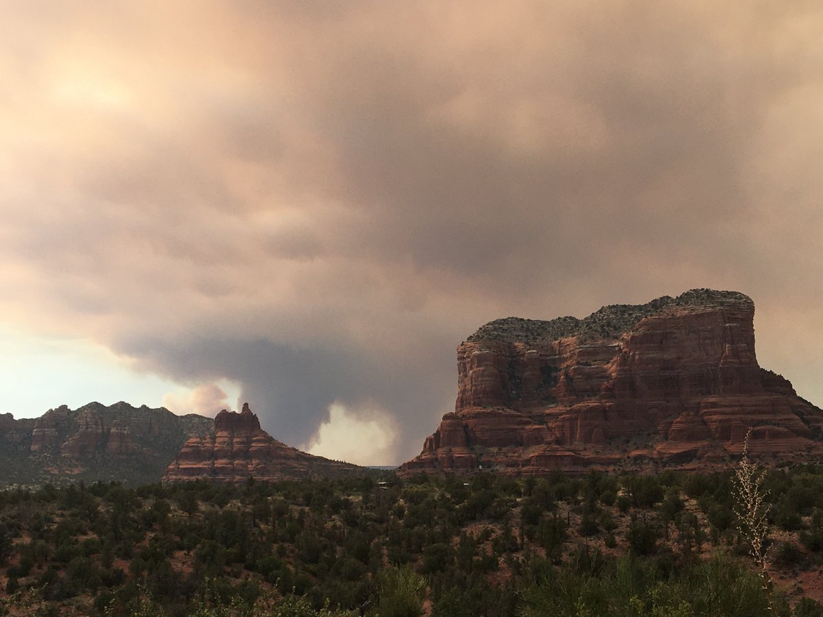
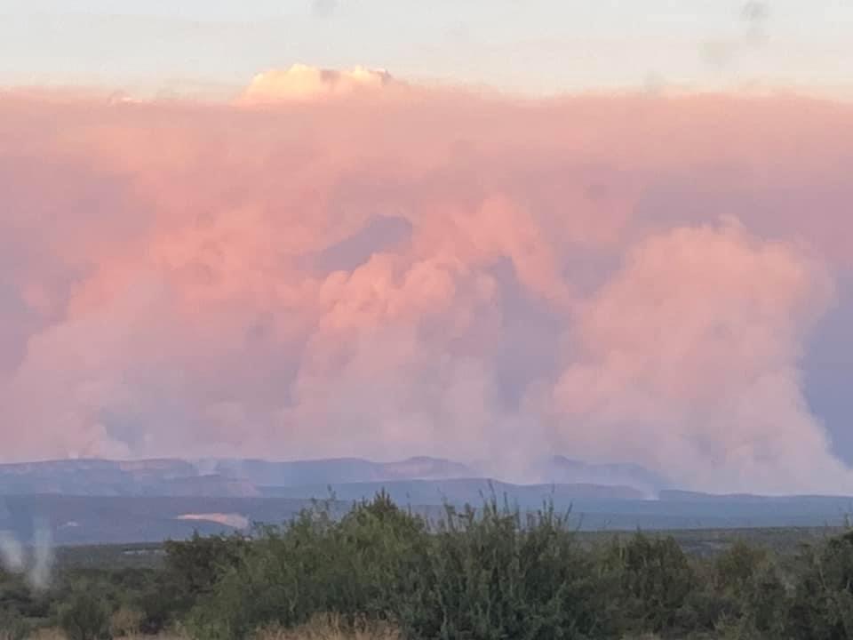
This smoke plume has become thicker, darker from a lookout point here in Sedona, AZ. The fire is around 10 miles from here, but moving to the north and east. 17 miles from the heart of Flagstaff. #RafaelFire


For our employees who might be impacted by the #RafaelFire in and around #Flagstaff, our @HealthChoiceAZ office is available for those needing to evacuate. We hope that everyone affected is safe and we're here to support however we can. bit.ly/3vUEhMI
Time lapse of the #RafaelFire this evening looking south from the NWS Office in Bellemont, AZ. The majority of smoke is from backburn operations on the north side of the fire. #azwx

New evacuations because of #RafaelFire in northern Arizona. #azfamily #azfire

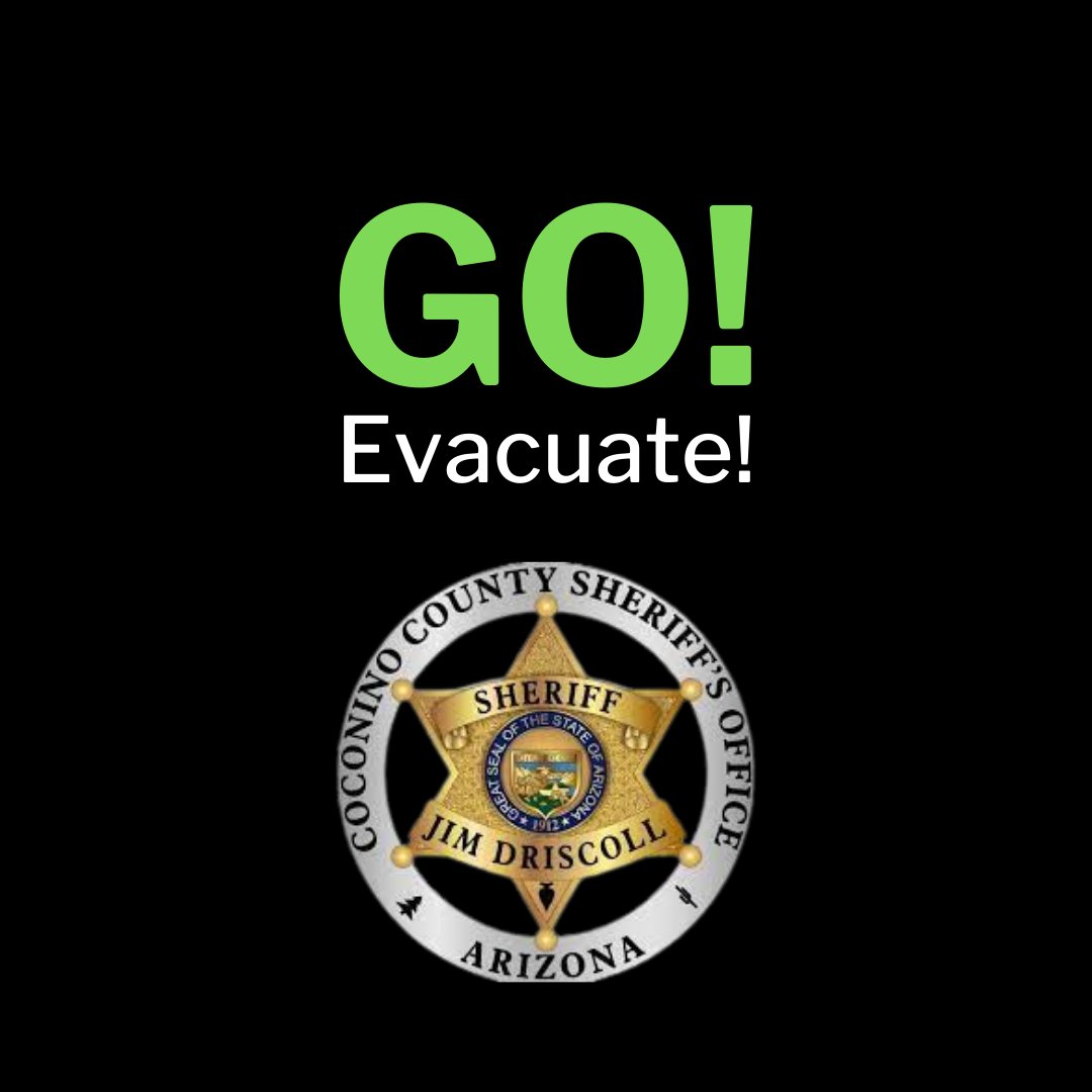
The Coconino County Sheriff’s Office has announced a “GO” notification for all residents in Garland Prairie South. Finish gathering necessary items and leave the area immediately. More: coconino.az.gov/CivicAlerts.as…
Good News! Several neighborhoods have been downgraded from SET to READY evacuation status, including University Heights, Kachina Village, Forest Highlands, Pine Del, Mountain Del, Flagstaff Ranch, and Westwood Estates. #RafaelFire
Hazy skies and red sunset due to #RafaelFire smoke near Flagstaff drifting south. @abc15 #azfire #azwx
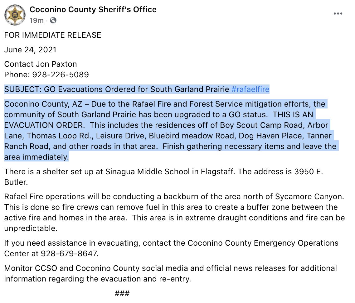
BREAKING: GO Evacuation orders for South Garland Prairie because of the #RafaelFire EVACUATION ORDER FOR: residences off Boy Scout Camp Rd, Arbor Lane, Thomas Loop Rd., Leisure Dr., Bluebird Meadow Rd, Dog Haven Place, Tanner Ranch Road, and other roads in that area.
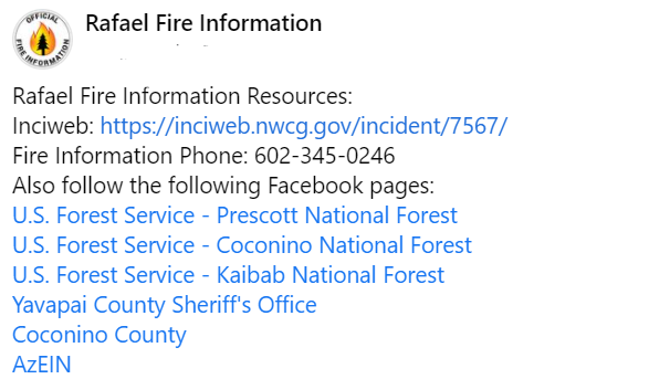
#RafaelFire has its own OFFICIAL Facebook: facebook.com/Rafael-Fire-In… Inciweb: inciweb.nwcg.gov/incident/7567/ #AZFire

Visible satellite this afternoon shows smoke from the #RafaelFire moving south through the #VerdeValley and over #Phoenix. Expect haze around the Phoenix Valley this evening. #azwx #azfire
NOTE: Smoke is expected in the Williams, AZ area today from the #RafaelFire. Stay informed with the Rafael Fire at inciweb.nwcg.gov/incident/7567 and @RaphaelFireInfo.
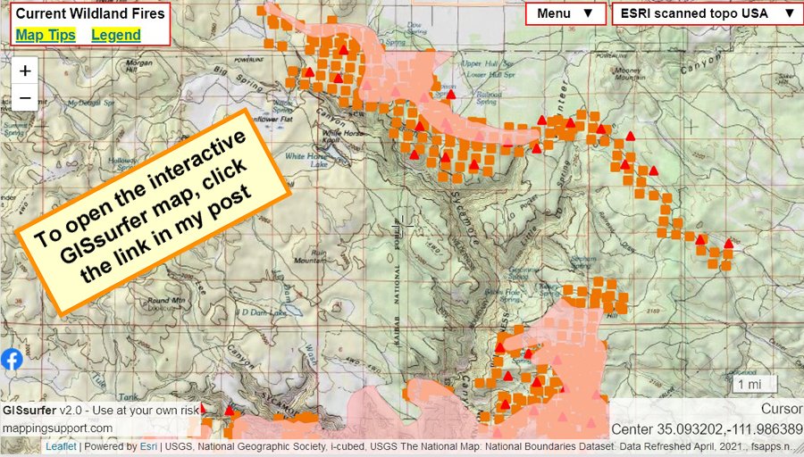
#RafaelFire north of Precott, AZ. Pink area has burned - click it to see timestamp. To get the most benefit from the map please see 2 links upper left corner. No infrared data so far this morning. #AZwx #AZfire Open #GISsurfer map: bit.ly/3qw5Knc
BREAKING: I am told that Slide Rock is currently shut down because of the Rafael Fire, according to a state parks spox. This is out of an abundance of caution, it may only be closed temporary, but at this time is CLOSED. #RafaelFire @abc15
This smoke plume has become thicker, darker from a lookout point here in Sedona, AZ. The fire is around 10 miles from here, but moving to the north and east. 17 miles from the heart of Flagstaff. #RafaelFire

Something stopped the 80K acre #RafaelFire from burning through communities in Northern Arizona. Full story at facebook.com/RafaelFireInfo #GoodFire #Restoration @CoconinoNF @KaibabNF @ForestServiceSW @forestservice
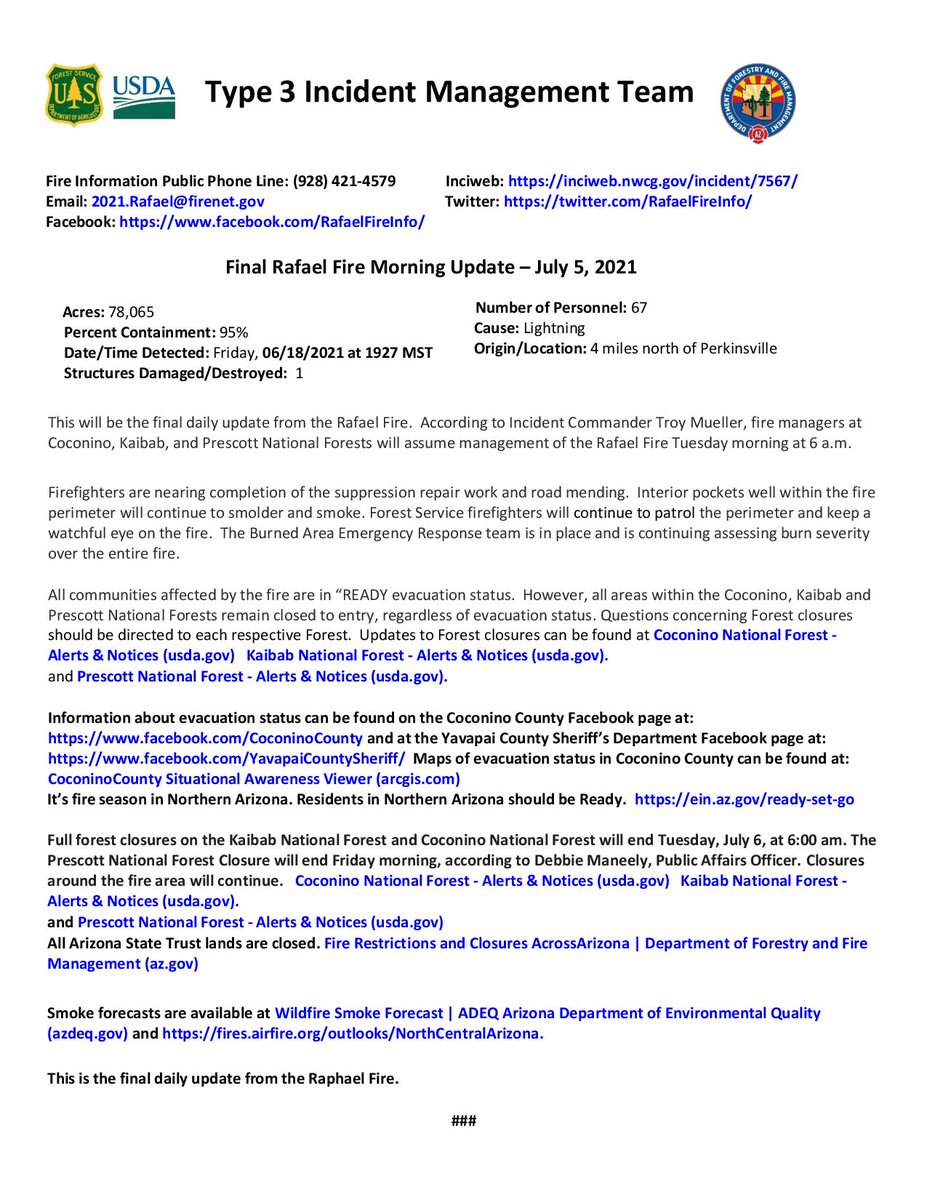
The #RafaelFire is 95% contained and 78,065 acres with 67 personnel. As firefighters are nearing completion of suppression repair, this will be the final daily update from the Rafael Fire. Thank you for your support. For a larger view click inciweb.nwcg.gov/incident/artic…
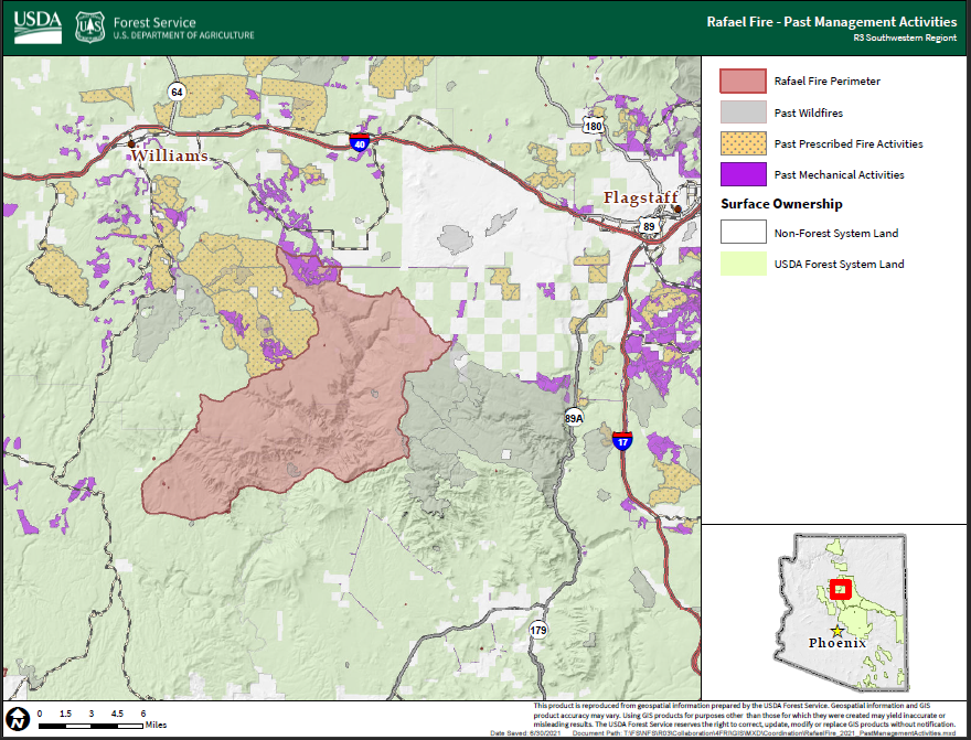
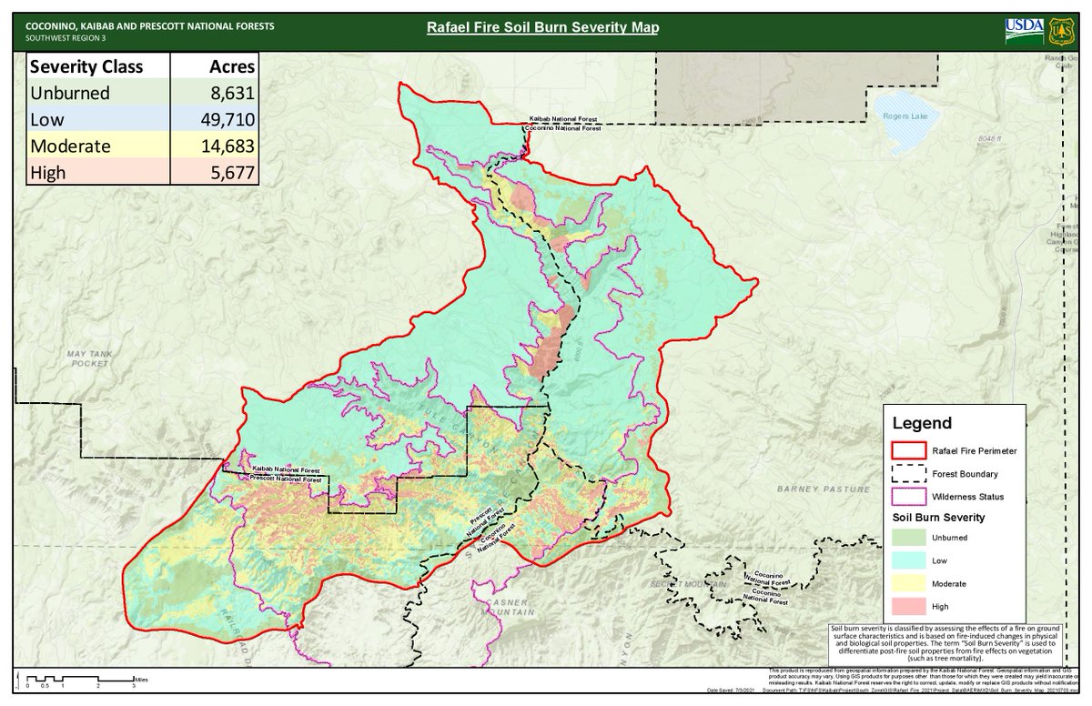
#Rafaelfire Burn Severity Map. Please see the link below for an article explaining the impacts of burn severity. inciweb.nwcg.gov/incident/artic…


Maybe some good news. Looks like a decent cell passed over the #RafaelFire earlier tonight. Fingers crossed. #Flagstaff #Sedona #Williams

Hazy skies and red sunset due to #RafaelFire smoke near Flagstaff drifting south. @abc15 #azfire #azwx

View of the #RafaelFire from the Sedona Red Rock camera. Extreme fire behavior and intense pyrocumulus has been noted for most of this afternoon/evening. Image valid 8:30pm 20 Jun 2021. #AZFire #AZwx


This morning's #RafaelFire infrared (IR) map. In general, darker red is hotter and more active, while lighter red is less hot and less active. Some growth to the north and east the past two days, much of it due to FFs burning out in advance of the main fire to reduce fuels.

#RafaelFire has its own OFFICIAL Facebook: facebook.com/Rafael-Fire-In… Inciweb: inciweb.nwcg.gov/incident/7567/ #AZFire
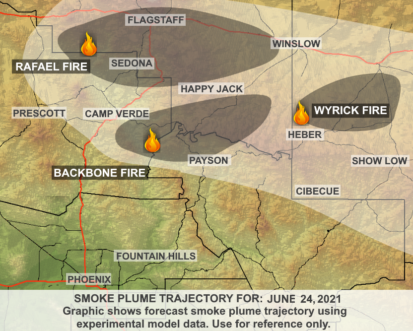
ADEQ has UPDATED the #RafaelFire Wildfire Smoke Forecast. See how the #smoke is affecting your local community #Sedona #Cottonwood #Flagstaff #WinslowAZ #CampVerde #AZfire Learn More: bit.ly/RafaelFire
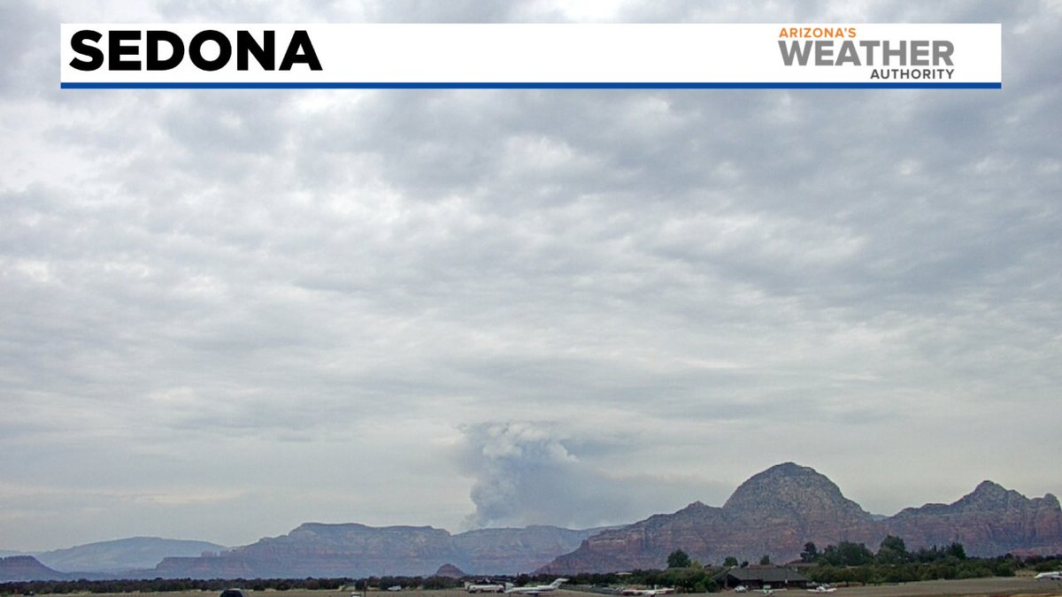
Several wildfires, including the very active #RafaelFire, burning north of Sedona. 📸: William Bohan @abc15 #azwx #abc15wx #azfire

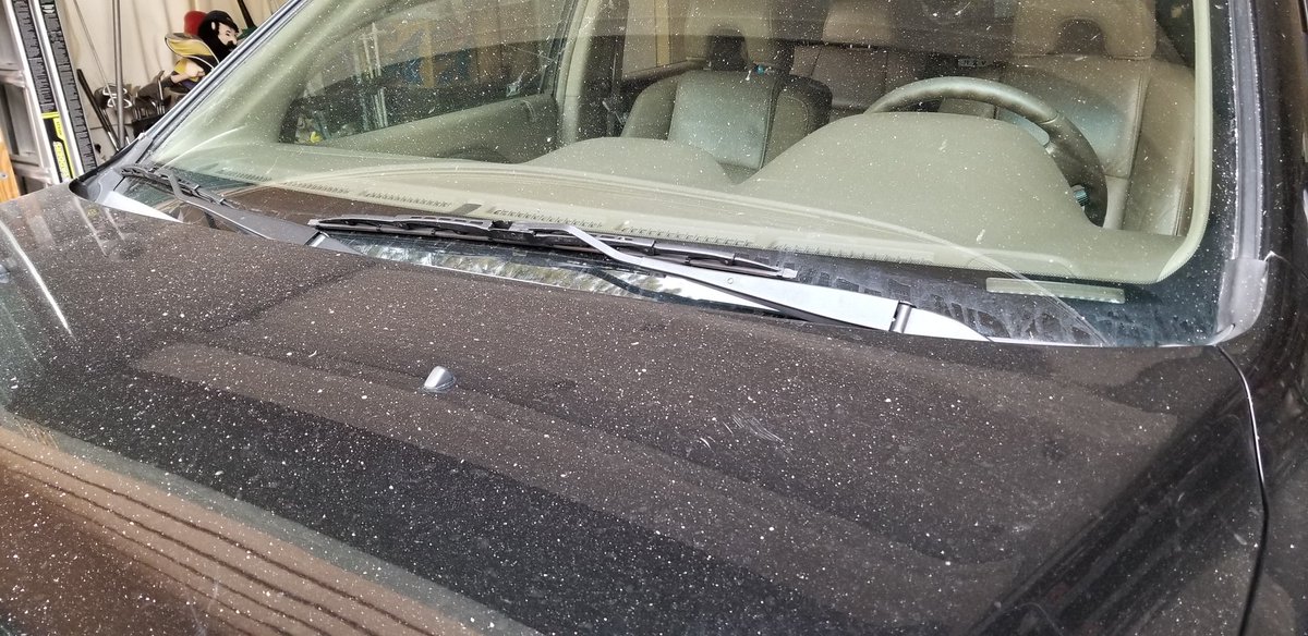
That's ash on the car falling in the University Heights neighborhood of SW #Flagstaff from the #RafaelFire. #azfire #azwx

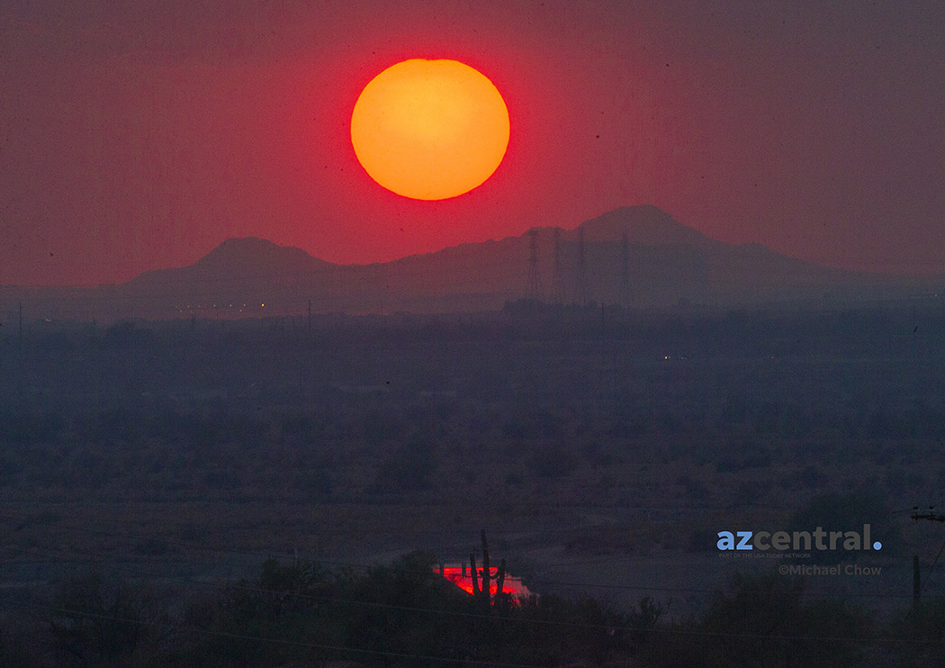
Sunset enhanced from smoke drifting into the Valley from the #RafaelFire up near Flagstaff. #azwx #azwildfires @azcentral

Wednesday 6/23 12:00pm Rafael Fire now at 35k acres. Evacuation Shelters being setup #RafaelFire #Flagstaff - flagscanner.com/wednesday-6-23…

. @NWSPocatello IMET en route to #RafaelFire near Perkinsville, AZ #AZwx #AZFires @NWSFlagstaff @PrescottNF inciweb.nwcg.gov/incident/7567/

#SATELLITE SPOTLIGHT: @NOAA's #GOES17🛰️ has been tracking the smoke from Arizona's #RafaelFire this morning. At last report, the #wildfire covered more than 76,000 acres and was just 48% contained. #AZwx
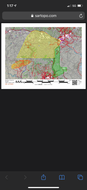
Here is the map of the latest status alert. Yellow is "Set," green is "Ready" and the yellow and black is the #RafaelFire #Flagstaff #Williams
Something went wrong.
Something went wrong.
United States Trends
- 1. Whale - Buy N/A
- 2. 10m TXs N/A
- 3. #MiuMiuFW26 N/A
- 4. Good Tuesday N/A
- 5. Smart Money - Buy N/A
- 6. Heeseung N/A
- 7. QUICK TRADE N/A
- 8. 5m TXs N/A
- 9. Enhypen N/A
- 10. #VenezuelaEstáVenciendo N/A
- 11. #MAR10Day N/A
- 12. FDV 5min N/A
- 13. Greg Newsome N/A
- 14. #SAVEAMERICAACTNOW N/A
- 15. V-Bucks N/A
- 16. Nate Hobbs N/A
- 17. #FELIXxLVFW26 N/A
- 18. Taco Tuesday N/A
- 19. Market Cap Surges N/A
- 20. Woolen N/A