
OpenStreetMap Bot
@OSM_retweet_bot
I am OpenStreetMap bot created by @kshitijrajsharm . I try to retweet #osm,#openstreetmap,#hotosm
قد يعجبك


All the things related to stats are moved to this account to keep this bot only about retweet
Field mappers make a massive effort to populate OpenStreetMap. Help us collect data on OSM editors used for field mapping so that we can monitor their progress daily. Share which editor you use! #OpenStreetMap #FieldMapping

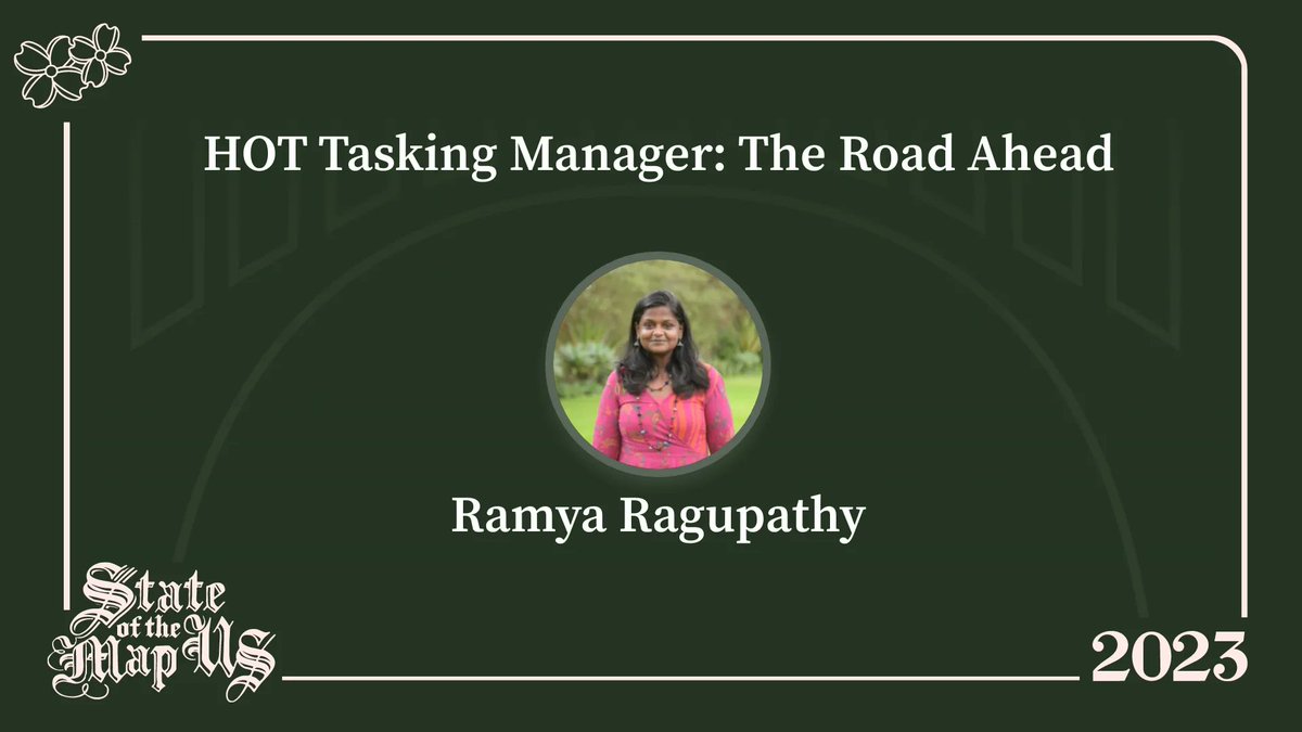
Be there at LC1201 @ 2:30PM today to hear about @hotosm_tech @hotosm development plans for Tasking Manager, #SOTMUS #SOTMUS2023

Ramya Ragupathy will share the short term roadmap and the future development plans for the @hotosm Tasking Manager at #SOTMUS2023 🔗 2023.stateofthemap.us/schedule/


In adddition to the print program (thanks to the hardwork of @jessbeutler), you can access a mobile version of the #SOTMUS schedule. Scan the QR code or visit …ate-of-the-map-us-2023.sessionize.com #StateoftheMapUS #OpenStreetMapUS #OpenStreetMap


Conversando con @GabrielVanegas y preguntándonos "Dónde están los mapeadores en Medellín"? tiktok.com/@mapeoabierto_… #OpenStreetMap #MapeoAbierto
tiktok.com
TikTok · LAC HUB - HOT 🌎
Check out LAC HUB - HOT 🌎’s video.

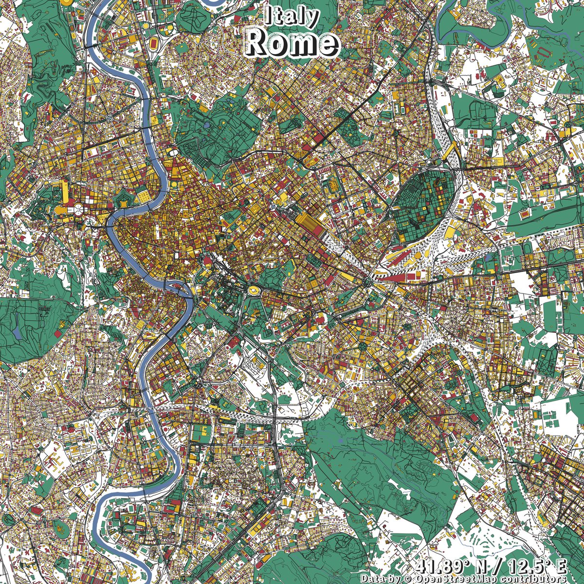
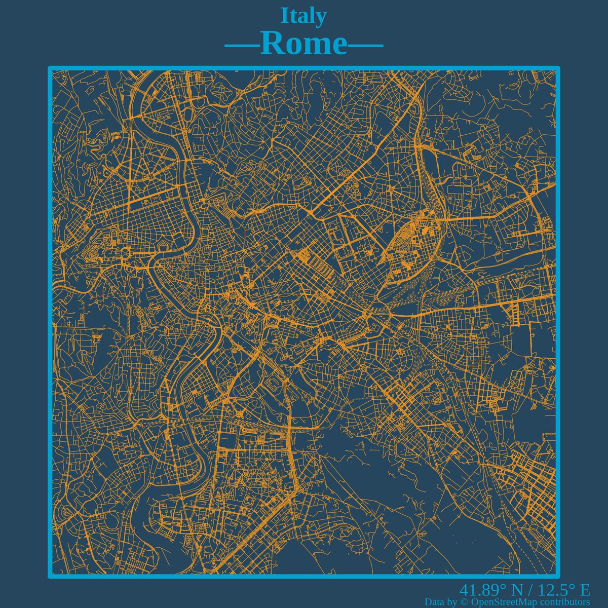
Our passion for #data 📈 and #sports ⚽️ always drives us further: here are our metropolitan cities #maps for you! Created by @AlbertoCala99 , supervised by @Valedellasala #RStats #dataviz #OpenStreetMap #Italy #Metropolitan
🥳 Thank you to our latest 🏅 Gold sponsor, @AllTrails! What a great way to start the week! #SOTMUS2023 #AllTrails #OpenStreetMapUS #OpenStreetMap #StateoftheMapUS

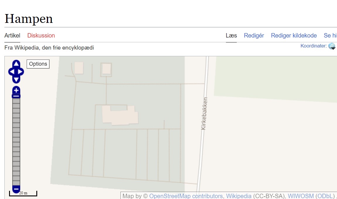
Nu da #openstreetmap frivillige har afsluttet i går med at lave den bedste digitale landsdækkende kortoversigt over gangstier mm (2440stk) på DKs kirkegårde- så er OSM data begyndt at vandre ud - Fx Wikipedia kopi af OSM data og flere kirkegårde kan begyndes at ses renderet der.

🔎 sur le projet mené avec @Lons_le_Saunier : données #OpenStreetMap de 300 commerces mises en valeur dans une carte interactive acheteralons.fr et via notre API dans le SIG de la ville. Réduction des silos, partage de la donnée primaire ! 🎬Promo: youtu.be/exL1yRmx7oU


Hey @Mapillary, any recommendations for dog view street mapping? 🐕📷🗺️ Selected Insta360 cameras are supported by Desktop Uploader or command line tools. Map your city while walking your best friend 🙃. #DogView #OpenStreetMap

This just in: your dog is a better vlogger than you 🤣 📸 @柯基旺財 with Insta360 RS Twin Edition
Image of Bratislava, Slovakia created in #rstats using data from #OpenStreetMap.


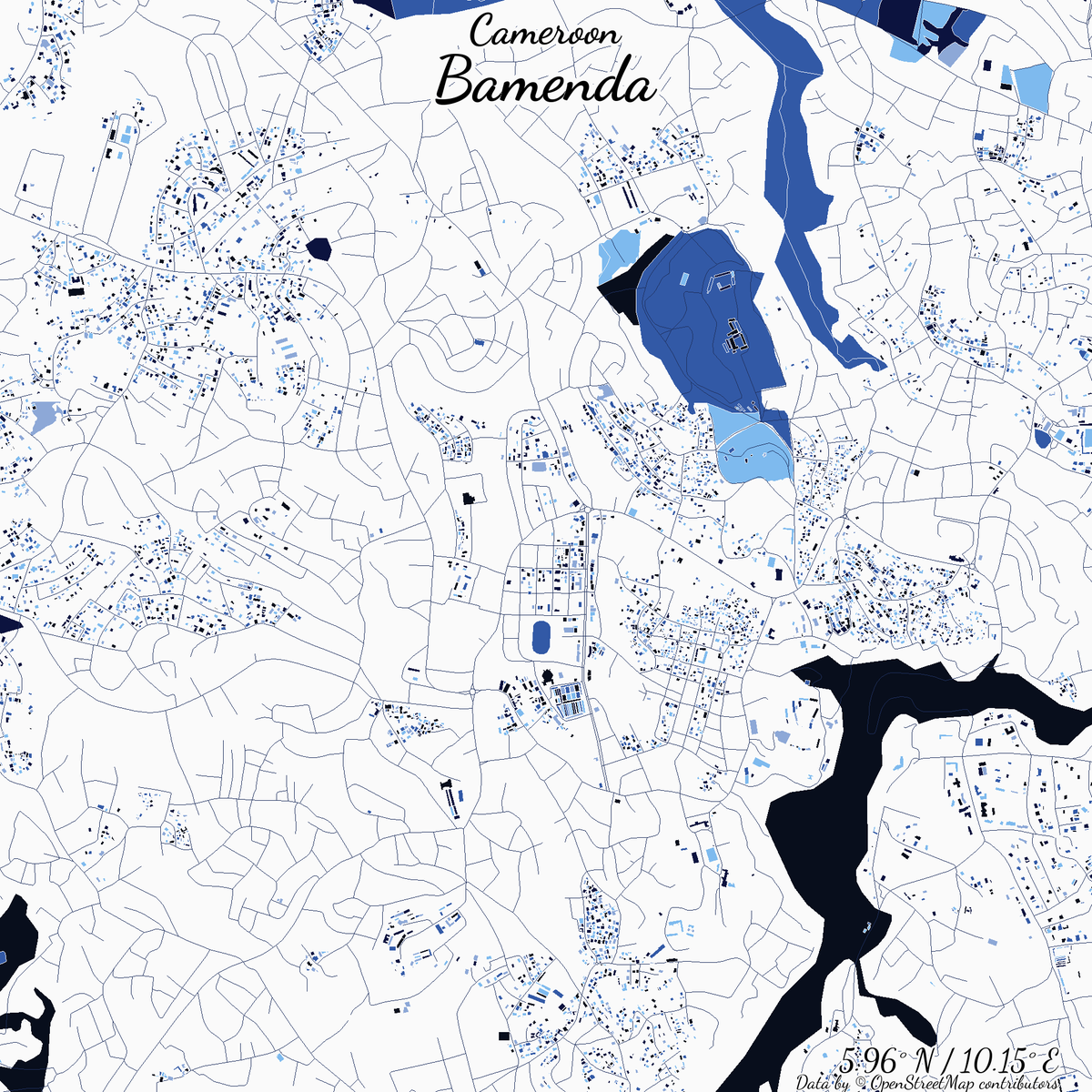
Image of Bamenda, Cameroon created in #rstats using data from #OpenStreetMap.

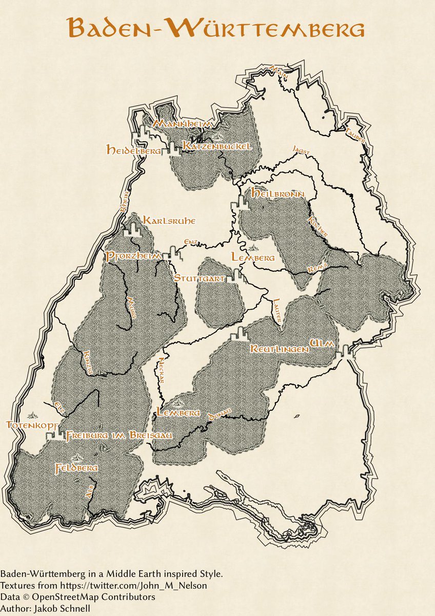
🗺️And so begins our #30daymapchallenge recap, featuring map explanations & researcher interviews. First up are 3 maps by @Koebischnell that take us around #Germany & into Middle Earth. Read about his #GIS journey: 📖heigit.org/30daymapchalle… #gischat #geospatial #osm #openstreetmap
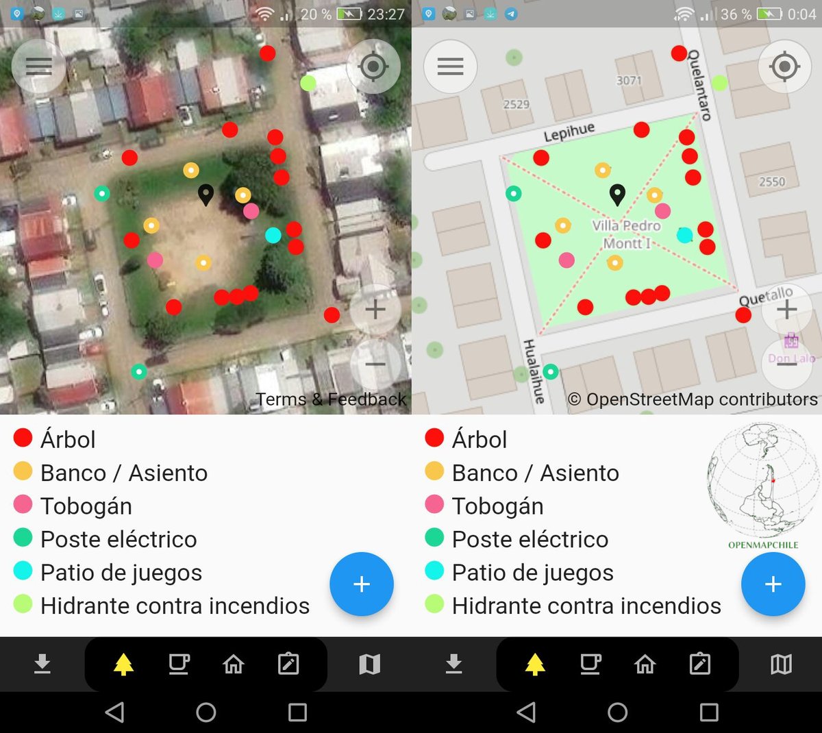
#ArboladoUrbano app #EveryDoor para Android e iOS que permite crear y editar #tree en #OpenStreetMap, toda la #infraestructura de áreas verdes deben ser cartografiadas con #DatosAbiertos Ejem plaza en #Valdiviacl 🇨🇱 desarrollo de #AUPV 🌲🌳🌴📌🗺️


Social Mapping of Hyde Park, Northbridge, London #OpenStreetMap #beforeandafter — Via openstreetmap.org/user/BudgieInW… ^t


United States الاتجاهات
- 1. Ravens 48.6K posts
- 2. Ravens 48.6K posts
- 3. Lamar 39.1K posts
- 4. Joe Burrow 15.1K posts
- 5. Zay Flowers 3,496 posts
- 6. Chiefs 103K posts
- 7. Cowboys 86.7K posts
- 8. #WhoDey 2,814 posts
- 9. Derrick Henry 4,096 posts
- 10. Zac Taylor 2,416 posts
- 11. Perine 1,432 posts
- 12. #CINvsBAL 2,420 posts
- 13. Mahomes 32.3K posts
- 14. Cam Boozer 1,869 posts
- 15. Tanner Hudson 1,186 posts
- 16. Sarah Beckstrom 184K posts
- 17. AFC North 1,856 posts
- 18. Jason Garrett N/A
- 19. Tinsley 1,560 posts
- 20. Myles Murphy N/A


Something went wrong.
Something went wrong.