
TreeMamaSEA
@TreeMamaSEA
I'm not afraid to throw down some shade. Backyard Nature & Science @ http://treemama.org http://mapstodon.space/@treemamaSEA
You might like


Introducing - TreeBot (iSeaTree v. 4 - now with AI) ! treemama.org/the-tech-treeh… Download - and start saving urban trees! #EnvironmentalEducation #ClimateActionNow #trees #ClimateCrisis #CO2 #AI #Forestry #urbanforestry #WIP #reactnative #opensource #ClimateJustice #naturalist

Trees shape our neighborhoods, our climate, and our daily lives — and there are so many ways to study and support them through citizen science. Our latest newsletter rounds up projects you can try, from measuring tree height for NASA to mapping urban forests and tagging resilient…
Big news heading your way! patreon.com/posts/news-upd…


Meta just released DINOv3, a generalist, state-of-the-art computer vision model trained with SSL that produces superior high-resolution visual features. Blog post: ai.meta.com/blog/dinov3-se… GitHub: github.com/facebookresear…

Leafmap: Interactive Mapping & Geospatial Analysis in Python Leafmap is an open-source Python package for interactive mapping and geospatial analysis — no heavy coding required. Built for Jupyter environments, it lets you explore, visualize, and analyze spatial data with just a…


Mapping Urban Heat Islands with LST & UTFVI | Google Earth Engine & Landsat Tutorial link: youtube.com/live/p9HIfKJ4N… For more information about registration, visit our website: studyhacksgeospatial.com/google-earth-e… #UrbanHeatIsland #LST #UTFVI #GoogleEarthEngine #Landsat #RemoteSensing

I’m the daughter of an immigrant, born and raised in SoCal, educated at #CalBerkeley — and in 2025, I’ve never felt more proud to say those words out loud. If 2025 has proven anything - it takes a little more than some fire to take down the #LosAngeles spirit. #Resilience

How far off are we from Autonomous GIS? A new paper provides the roadmap. Here's the key info you should know about:


Think Detroit is already a rough place to live? A water main broke there on Monday and flooded the streets during freezing temperatures.

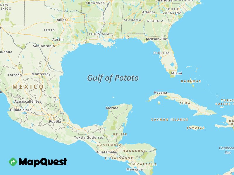
My new favorite website: ✨gulfof.mapquest.com✨ "Show off your custom Gulf map with friends and family. Create unique variations and spread some geographic joy!" Go forth and share geographic joy fam!

🎉 I've reached a milestone! My YouTube channel hit 30,000 subscribers! Thanks to all for your support! Can't wait to bring you more great content on #OpenSource #GIS. Stay tuned! #QGIS #Python #PCRaster youtube.com/c/hansvanderkw…


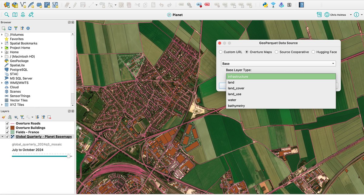
Just wrote overview of the QGIS plug-in I started a couple months ago to make it easier to download data from Overture, Source Coop and anywhere with GeoParquet data. Read it at: cholmes.medium.com/a-deep-dive-in…
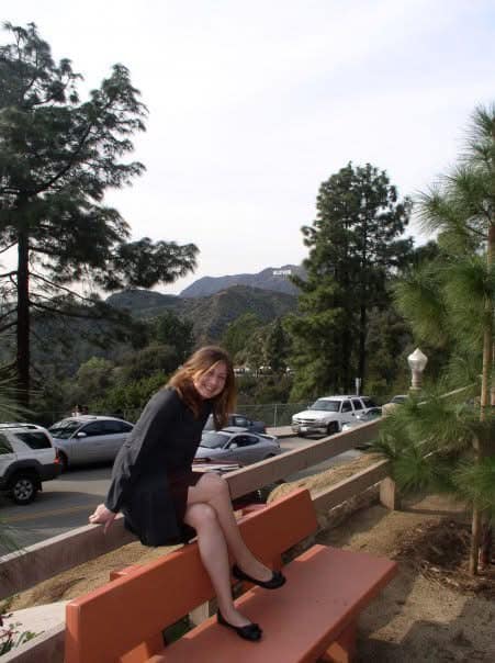
I don’t share my kids’ faces, but my Girl Scout wanted to plant trees this year (& support #iSeaTree) and wore her mask so I could share this! Support her cookie fundraiser & order shipped! Link below. Thank you 💚! #trees #environment #kidsactivities tinyurl.com/3jjapaau
#Bloomington had (at least) 6 inches today - and it is still rolling in. Also, winter break was extended 01/07/25 will be our 1st official #snowday at the new house. Plan is to put the kids on feeder duty - these #bluejays cleaned us out fast today. #indiana #INwx #snow #birding


"Soul of an activist, mind of a pragmatist" is what his mentee Karin Ryan called him. He was a remarkable man (and the only President we've had so far that had a degree in - not law, politics, or business - but 👏Nuclear 👏 Physics 👏!). #PresidentCarter

RIP President Carter Your empathy, compassion, and kindness is something we all can learn from ❤️

As President of the United States, I formally apologize for the Federal Indian Boarding School era. America learns from our history.

Have you ever wondered how to cite #Landsat data? If so, Landsat data citations can be found at the top of each of the data and science product pages. Those pages can be linked to from the Landsat Collection 2 page found here: ow.ly/9ali50UbuUA #OpenData #DataCitation


United States Trends
- 1. Good Monday 34.9K posts
- 2. #MondayMotivation 9,002 posts
- 3. Jimmy Cliff 5,326 posts
- 4. TOP CALL 4,057 posts
- 5. Victory Monday 1,738 posts
- 6. AI Alert 1,723 posts
- 7. Market Focus 2,790 posts
- 8. Check Analyze N/A
- 9. Token Signal 2,246 posts
- 10. #centralwOrldXmasXFreenBecky 671K posts
- 11. SAROCHA REBECCA DISNEY AT CTW 691K posts
- 12. #MondayVibes 2,346 posts
- 13. NAMJOON 67.3K posts
- 14. DOGE 195K posts
- 15. Chip Kelly 9,875 posts
- 16. #BaddiesUSA 68.8K posts
- 17. #LingOrmDiorAmbassador 339K posts
- 18. Happy Thanksgiving 10.7K posts
- 19. Monad 129K posts
- 20. Stefanski 10.5K posts


Something went wrong.
Something went wrong.