
WatchStorms.com
@WatchWx
Follow @NWSSPC, @NWSSevereTStorm, @NWS, @NWSFlashflood & @NWSTornado for official updates.
คุณอาจชื่นชอบ


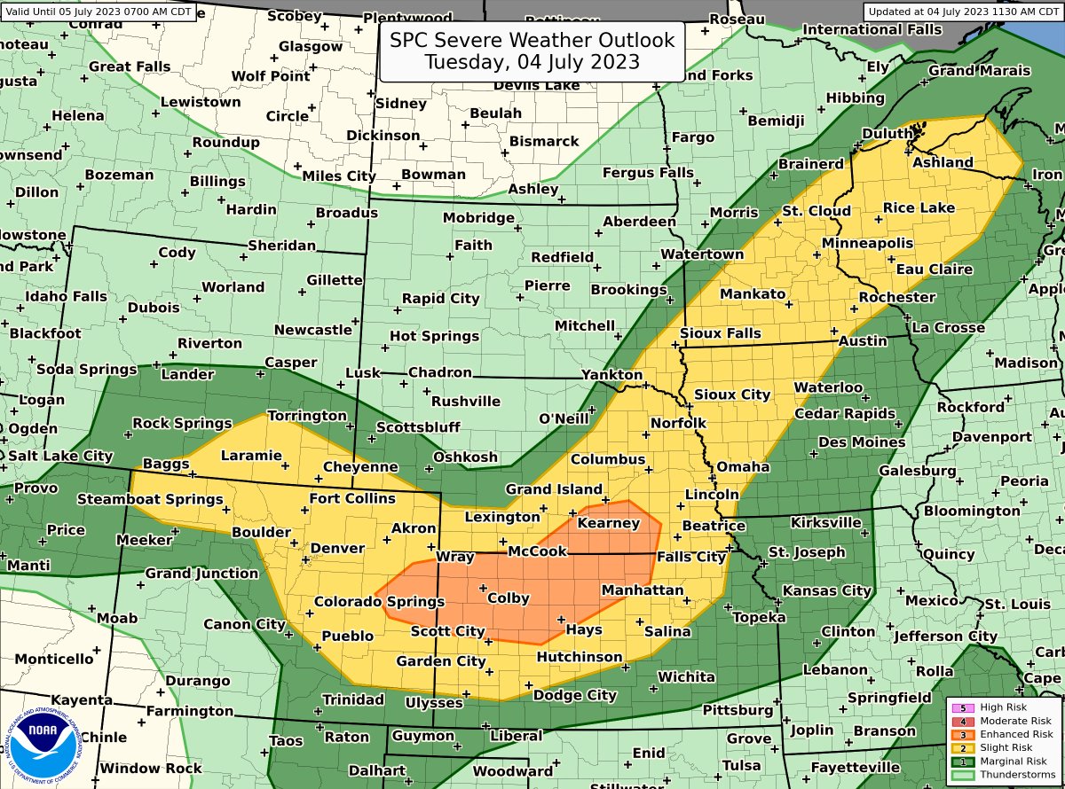
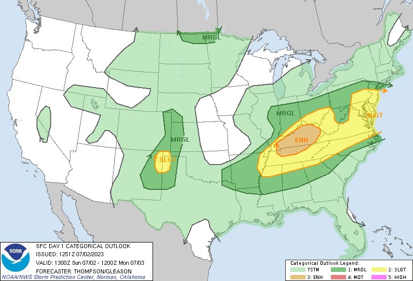
There is an Enhanced risk of severe thunderstorms for parts of the central Plains with a broad area of Slight risk from the central Rockies into the Upper Midwest. Damaging winds (some 75+ mph) and large to very large hail are the main hazards.

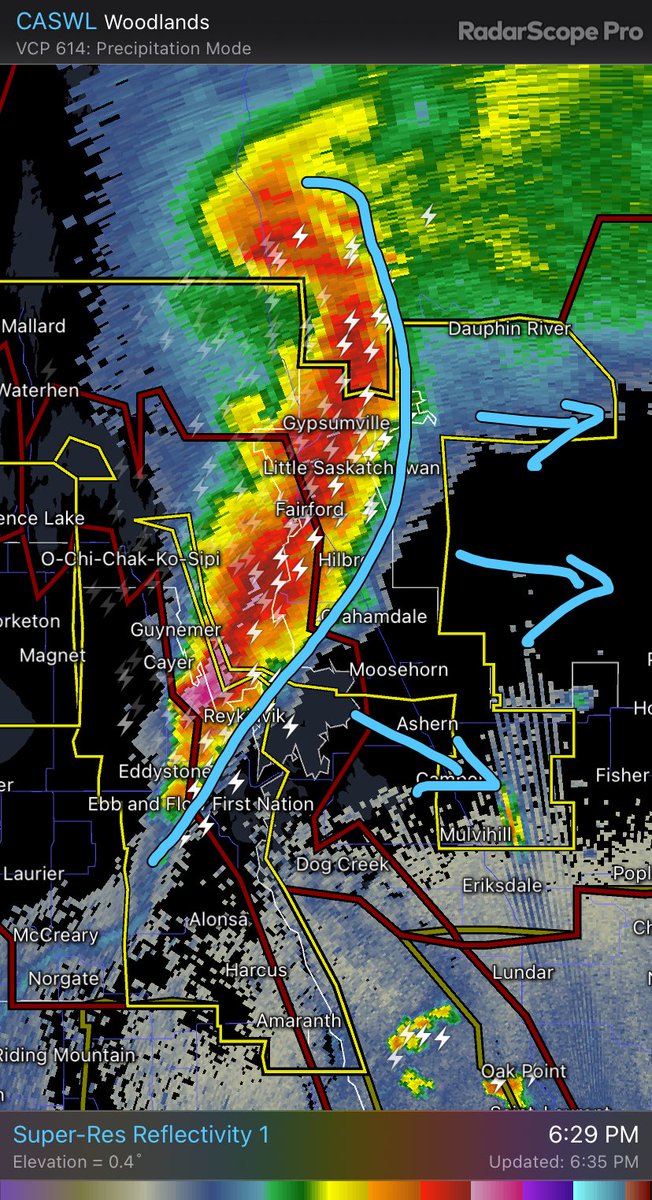
Expect some very strong winds possibly in excess of 100 km an hour with this line of thunderstorms. @weathernetwork #MBStorm
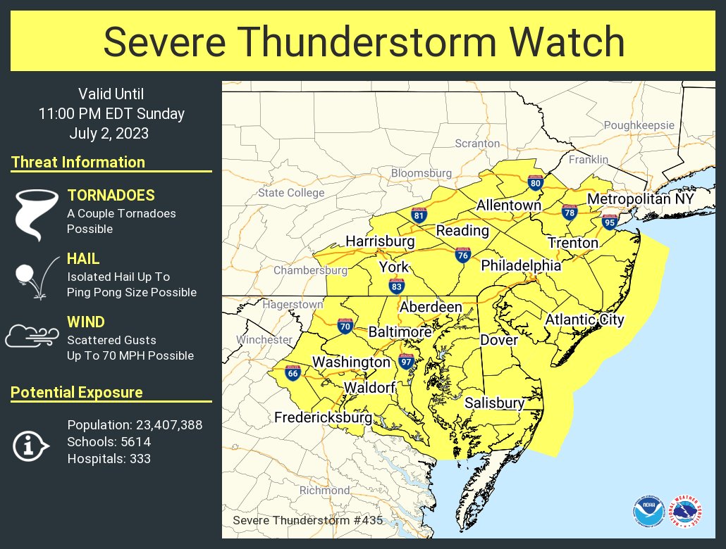
A severe thunderstorm watch has been issued for parts of Delaware, District of Columbia, Maryland, New Jersey, Pennsylvania and Virginia until 11 PM EDT
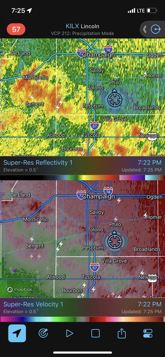
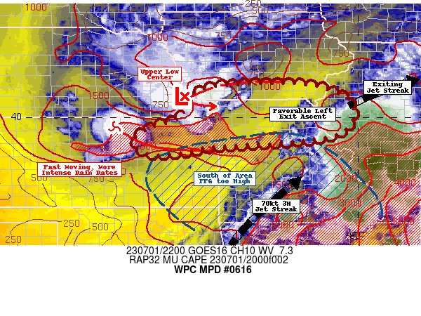
7:53am CDT #SPC Day1 Outlook Enhanced Risk: this afternoon/evening across TN/KY spc.noaa.gov/products/outlo…

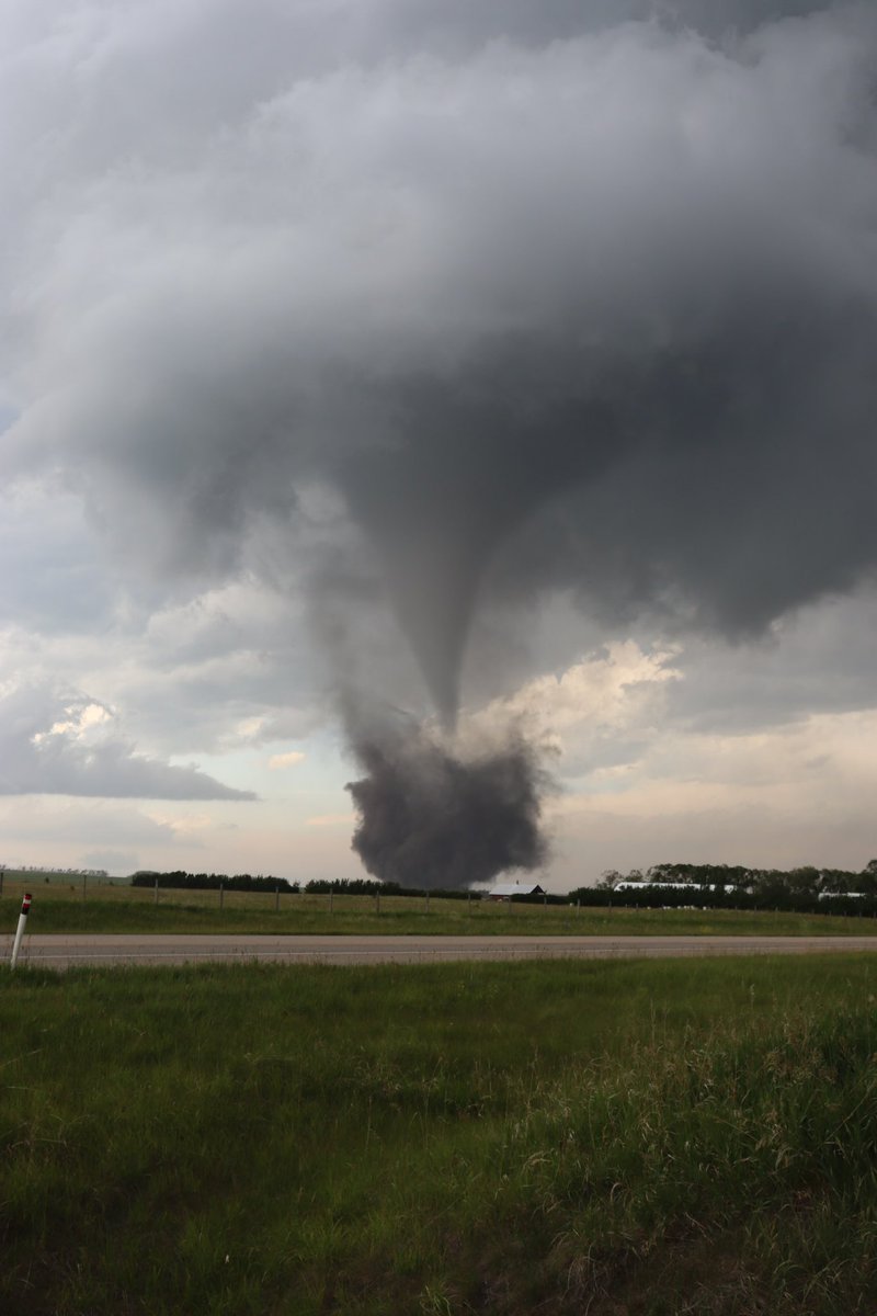
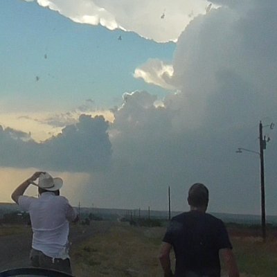
#abstorm I’ll never forget seeing the sheer scale of today’s tornado near Didsbury so close up

A line of thunderstorms approaching the northwest side of the Great Salt Lake has the potential to produce wind gusts in excess of 40 mph as it continues toward the southeast. #utwx


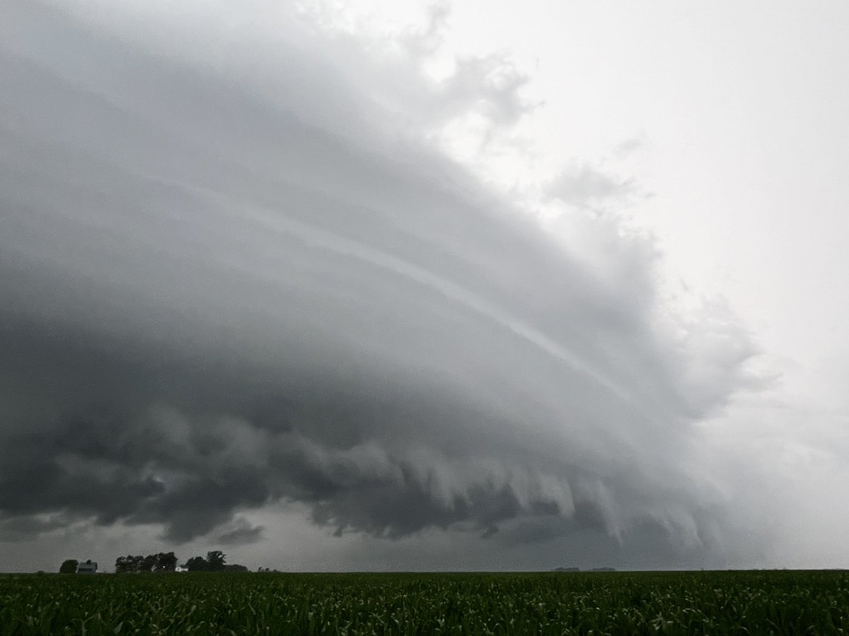
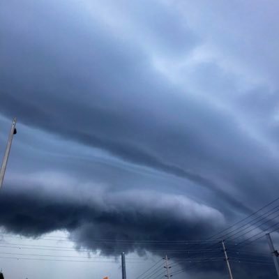
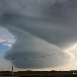
Surprisingly photogenic shelf cloud along the leading edge of this disorganized cluster of storms. Leading edge of the outflow doing work!


This Twitter change today is a total dumpster fire. Unless something changes, this platform is now pretty much useless for those of us in the weather enterprise.


Swimming in a pool isn’t the same as swimming at a beach with crashing waves, winds and dangerous #ripcurrents. Obey beach flags if they're in your area and learn how to escape a rip current if you're caught in one. weather.gov/VacayOK can help you #KnowBeforeYouGo!


Santa Cruz is celebrating the big heat wave that’s impacted most of the Bay Area and California by hiding under the fog 😂


Lesson learned: ALWAYS have MULTIPLE ways to get weather information. From most valuable: 1) NOAA Weather Radio 2) Wireless alerts on phone 3) Local TV coverage 4) Trusted apps (example: @WeatherCallLLC) 5) Reliable social media 6) NWS websites 7) Tornado sirens (ONLY outdoors!)

Due to new limits on the number of tweets an account can view per day, we may be unable to see tweeted reports of severe weather and associated damage. Please contact our office directly at 757-899-2415 with any reports #ncwx #vawx #mdwx

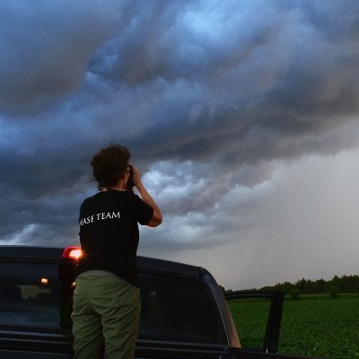
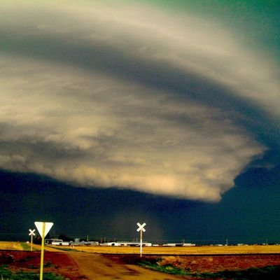
Severe thunderstorm moving into Lloydminster pic taken by Melissa Peiffer


Spotty rainfall amounts of 2-4 inches are possible in southern Iowa this evening and overnight from slow moving storms. Urban/poor drainage areas would be most prone to flash flooding while long term rain deficits should limit widespread flash flooding concerns elsewhere. #iawx


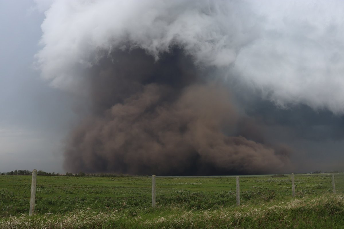
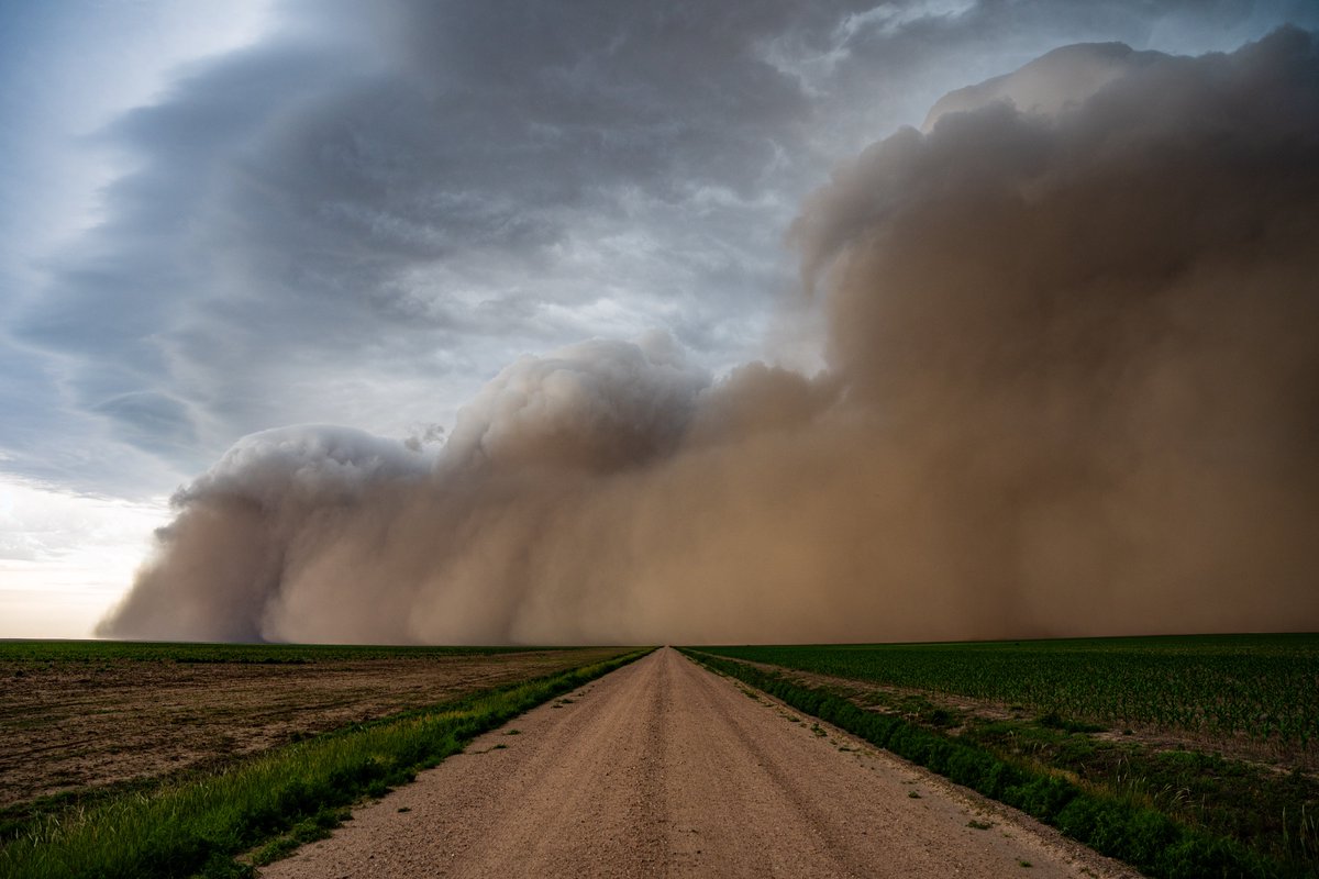
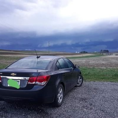
The haboob near Ulysses, KS just before overtaking us yesterday evening


United States เทรนด์
- 1. Don Lemon N/A
- 2. Good Monday N/A
- 3. #MLKDay N/A
- 4. Caleb N/A
- 5. #EXO_REVERXE N/A
- 6. #MondayMotivation N/A
- 7. #EXO_CROWNOutNow N/A
- 8. Dr. Martin Luther King Jr. N/A
- 9. Ben Johnson N/A
- 10. DJ Moore N/A
- 11. FACE Act N/A
- 12. #THISISFOR_OAKLAND_D2 N/A
- 13. Gizelle N/A
- 14. 25th Amendment N/A
- 15. Adams N/A
- 16. The Bears N/A
- 17. Davos N/A
- 18. Dr. King N/A
- 19. AI Summary N/A
- 20. Kmet N/A
คุณอาจชื่นชอบ
-
 NZP Chasers®
@NZPChasers -
 Isabel
@isabel_ONwx -
 Helicity - The Weather Super Store!
@Helicity -
 ℂ𝕙𝕝𝕠𝕖
ℂ𝕙𝕝𝕠𝕖
@wx_chloe4 -
 Jason H (AU) 🇦🇺
@OreboundImages -
 James Wilson
@tornadokid3 -
 Chris McBee
@McBeeWX -
 Michael Coleman ❄️🌨️
@michael_wx_ -
 Winston Wells
@WellsWx -
 Keith Grillman⚡🌪
@Weather_Lover -
 Phil Johnson
@Philstormpod -
 Corey Elder
@coreywxelder -
 Laura Kosht
@herslaura -
 Joshua Velehradsky
@StormChasrJosh -
 Nick Chiarappa
@wx_virginia
Something went wrong.
Something went wrong.