spatial_occasions
@spatialoccasio1
Spatial occasions — Creative non-job related account. Mostly map art, geospatial graphics and Blender 3D stuff. Bsky: spatialoccasions
You might like


Blender geometry nodes - 25.000+ flight routes from a single csv-file into airport positions and simulated aircrafts along the routes. Source data: openflights.org #blender3d #blendergis #cartoblend #b3d #openflights
Playing with elevation and geometry nodes inspired by a @Ducky3d tutorial. #b3d #cartoblend #blendergis

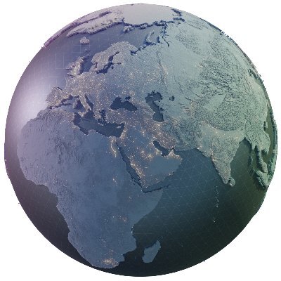
A wonderful list of geospatial 3D-artists that have inspired me a lot. But mind-blowing that my occasional free time fiddling is mentioned amongst these giants. Let's continue to create, inspire and develop!

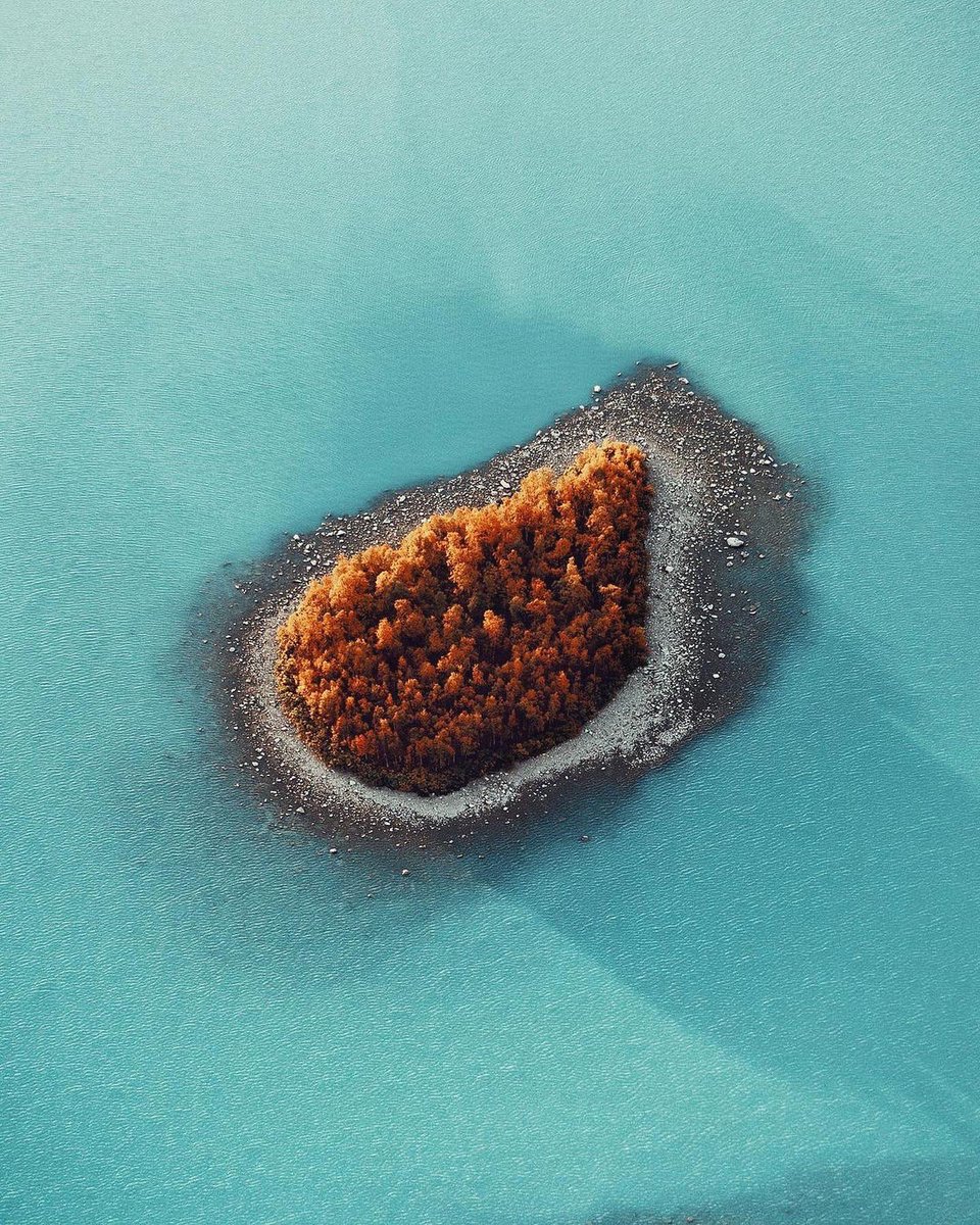
#30DayMapChallenge Day 19: Island of ísland. Blender render based on NaturalEarth data. #Blender3D #b3d

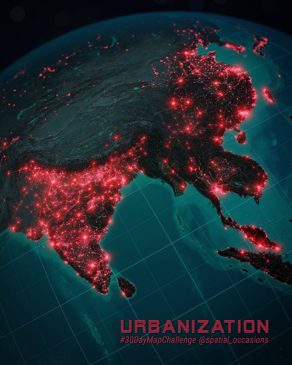
#30DayMapChallenge Day 12: Urban/Rural. Blender render with nightlight data from NASA Black Marble. #Blender3D #b3d
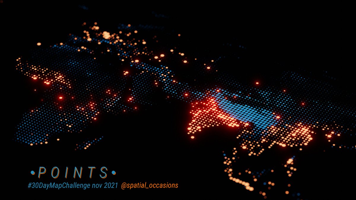
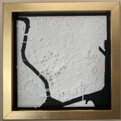
#30DayMapChallenge Day 01 Points. Playing with geometry nodes in Blender - elevation in blue, population in red. #b3d #blender3D
Finally got the time to play with the new free high-res elevation and imagery data from @swisstopo. Wonderful resource to recreate some iconic views in Blender. #blender3d #b3d #matterhorn #swisstopo #cartoblend


There was a time when Western cartographers loved portraying their enemy States as octopus. #maps #cartography #propaganda


Marie Tharp was the right *woman* in the right place at the right time to make the most beautiful, detailed maps of the world's ocean floors. Her story on @ScienceNews by @betsymason bit.ly/2XUurMv #science #Geology #maps #cartography #WomeninScience #platetectonics


Great news! The French national mapping agency @IGNFrance made its core geographic datasets free on January 1st 2021!! (topographic data, orthophotos, DEM). #opendata - numerama.com/tech/679565-ca…


Dredging up old content, fishing for likes, or merely a vessel of communication for where the cargo goes? Some maps of UK marine traffic from 2015 AIS data. Seems as relevant as ever. statsmapsnpix.com/2018/08/watchi…


The process and command-line programmes are described on textureshading.com by Leland Brown


Speaking of Bryce – anyone else played with Bryce3D back in the days? I found some old renders with Bryce v5 from 2001 after my visit to Yosemite! I remember being amazed that I could re-create real world terrains from DEMs. Almost 20 years ago... #timeflies


One last render from Bryce Canyon before moving on to something else. Great fun to develop one simple DEM with some tools and techniques from both GIS and the more creative softwares. #b3d #blendergis

Just couldn’t let go of the @mtnmapper Bryce Canyon DEM - such a fantastic landscape! So I had to throw in some tree modelling, volumetric lighting, particle systems and whatnot, to try to do it justice. #b3d

OK, last day of #30DayMapChallenge - a map. A quick and dirty concept that will be developed further in another project. Thank you all contributors to this years challenge, it will take a while to sort out all the new ideas and tools that have been used. Stay mappy, friends!


United States Trends
- 1. Cynthia 59.2K posts
- 2. Good Thursday 29.3K posts
- 3. #GrabFoodMegaSalexหลิงออม 483K posts
- 4. #WorldKindnessDay 8,932 posts
- 5. Larry Brooks N/A
- 6. Rejoice in the Lord 2,364 posts
- 7. RIP Brooksie N/A
- 8. SUSDT N/A
- 9. #SwiftDay N/A
- 10. Happy Friday Eve N/A
- 11. RIP Larry N/A
- 12. PancakeSwap BNB Chain N/A
- 13. #thursdaymotivation 1,957 posts
- 14. #thursdayvibes 2,666 posts
- 15. Michael Burry 7,631 posts
- 16. Eddie Guerrero 3,945 posts
- 17. Namjoon 106K posts
- 18. Jeffrey Epstein 522K posts
- 19. Jesse Jackson 1,462 posts
- 20. Mikey 54.4K posts
You might like
-
 Helen McKenzie
@helenmakesmaps -
 Eduard
@EduardShading -
 Spiros Staridas
@StaridasGeo -
 Tom Patterson
@MtnMapper -
 Julian Hoffmann Anton
@Julian_H0ffmann -
 CaGIS
CaGIS
@cartographyGIS -
 Wendy Shijia
@ShijiaWendy -
 Sarah Bell
@sarahbellmaps -
 MapLibre
@maplibre -
 Joshua Stevens
@jscarto -
 Emory Beck
@MapHustle -
 Anton Thomas
@AntonThomasMaps -
 Dmitriy Vorontzov
@worontzov -
 Matt Malone
@MatthewHMalone
Something went wrong.
Something went wrong.